John Speed (1552-1629)Biblio.com
134 résultats
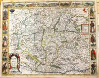
1676M11228London: Are to be sold in popshead Alley by G. Humble. 1676. Very Good . Notes: Highly decorative and detailed map of Bohemia the present-day Czech Republic.<br><br>English text on verso.<br><br>John Speed 1552 –1629 was an English cartographer and historian. He is known as England's most famous Stuart period mapmaker. His maps of English counties are often found framed in homes throughout the United Kingdom. For a series of maps Speed partnered with Dutch engraver Jodocus Hondius. <br><br> Size : 415x519 mm 16.34x20.43 Inches Coloring: Original Hand Coloring Category: Maps Europe Czech Republic Slovakia; Are to be sold in popshead Alley by G. Humble. unknown
164623423London: William Humble 1646. Other. In excellent condition. 383 by 514mm 15 by 20¼ inches. 383 by 514mm 15 by 20¼ inches. Copper engraving uncolored as published. William Humble unknown
164623401London: William Humble 1646. Other. In excellent condition. 385 by 510mm 15¼ by 20 inches. 385 by 510mm 15¼ by 20 inches. Copper engraving uncolored as published. William Humble unknown
164623402London: William Humble 1646. Other. In excellent condition. 387 by 512mm 15¼ by 20¼ inches. 387 by 512mm 15¼ by 20¼ inches. Copper engraving uncolored as published. William Humble unknown
16651789London: to be sould by Roger Rea the Elder and younger at the Golden Cross in Cornhill against the Exchange 1665. 410 by 550mm. 16.25 by 21.75 inches. Double-page engraved map fine contemporary outline hand colour upper left and right margins skilfully repaired margins reinforced with japan paper. The map bears the imprint of Roger Rea the Elder and Younger. The Reas had purchased the rights to Speed's work form William Garrett in 1659 who had previously purchased them from the widow of William Humble in the same year. Skelton suggests that the father and son intended a new edition of the atlas for the Restoration of 1660. However the atlas would appear not to have been published until 1665. This is borne out by an advertisement in the Term Catalogue by the subsequent owners of the plates Thomas Bassett and Richard Chiswell in 1675: "Mr John Speed's. Geography of the Kingdoms of England Scotland and Ireland. together with his Prospect. all in one entire Volume hath been for seven Years past out of Print the greatest part of an Impression then newly Printed being destroyed by the late dreadful Fire 1666". This is borne out by the rarity of the Rea edition of the atlas. There is evidence that they planned an edition of 1666 as there are impressions of Sussex Buckingham and Derby with Rea's imprint which bear that date. Rea would later sell the plates to Bassett and Chiswell who would publish a new edition in 1676. to be sould by Roger Rea the Elder and younger at the Golden Cross in Cornhill against the Exchange, unknown
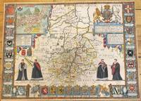
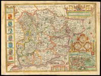
1676M9963London: Thomas Bassett & Richard Chiswell c.1676. Very Good. Notes: Map shows 25 university armorials four scholars the Royal Crest and a plan of Cambridge. English text on verso. Size : 385x525 mm 15.16x20.67 Inches Coloring: Original Hand Coloring Category: Maps Europe United Kingdom England Counties; Thomas Bassett & Richard Chiswell, unknown
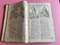
163226948London: Printed By John Dawson for George Humble and are to be Sold in Popes-head Pallace at the Figure of the White Horse 1632. Book. Good Plus. Full Leather. Third Edition. Folio. The Third Edition. Revised enlarged and newly corrected with sundry descents of the Saxon Kings Their Marriages and Armes. Pp. 10ff 1-1042 "A Catalogue of the Religious Houses Within the Realme of England and Wales with their Orders Founders Benefactors and Values ." beginning on page 1043 to p. 1086 comprising 128 pages but numbered on the rectos only 1087-1237 5 - Conclusion 80 - Index. Richly illustrated with wood engraved head and tail pieces initials coins coats of arms crests royal seals genealogies etc. text in two columns and with side-notes. Early probably early 18th-century binding in double gilt-framed light brown leather boards edges stained red. Modern leather rebacking in contrasting dark brown leather with gilt stamped dark brown leather spine label new plain endpapers. Covers scuffed else very good. Interior primarily clean and bright however does have occasional old faint tide-lines to either corners fore-edge or upper edge. Bottom quarter of 10th leaf excised possibly a contemporary handwritten note faint ink traces seen above the cut-line very occasional contemporary ink notes and corrections in margins page 11/12 wanting instead there are two page 15/16s very small and narrow wormhole from p. 663 to p. 682 still eminently readable with only loss of single letters lacks frontispiece portrait. Overall quite a good clean copy. Speed's 'History' was dedicated to James I and was first published in 1611 as a continuation of the 'Theatre of Great Britaine.' Although this book is complete in itself the first four books listed in the contents apply to The Theatre of the Empire of Great Britaine. ESTC S997. Printed By John Dawson for George Humble and are to be Sold in Popes-head Pallace at the Figure of the White Horse Hardcover
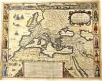
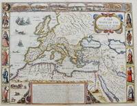
1676M10992London 1676. Very Good. Notes: English text on verso.<br>Map of the Roman Empire it is surrounded by views of the cities of Geneva Rome Jerusalem Venice and Constantinople and Alexandria and figures displaying the customary dress of Italians Egyptians Turks and Spaniards with their wives. <br><br>John Speed 1552 –1629 was an English cartographer and historian. He is known as England's most famous Stuart period mapmaker. His maps of English counties are often found framed in homes throughout the United Kingdom. For a series of maps Speed partnered with Dutch engraver Jodocus Hondius. <br><br> Size : 393x509 mm 15.47x20.04 Inches Coloring: Original Hand Coloring Category: Maps Europe Continent; Maps Asia Continent; unknown
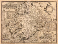
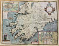
1627M10917London 1627. Good backed on acid free tissue paper for long term preservation. Notes: Map of the Province of Munster with inset maps of Cork and Limerick.<br>John Speed was a renown British cartographer 'Theatre of Great Britain' was the first atlas of the British Isles.<br>Munster Old Irish Muma the southwestern province of Ireland comprising the counties of Clare Cork Kerry Limerick Tipperary and Waterford. Size : 388x506 mm 15.28x19.92 Inches Coloring: Hand Colored Category: Maps Europe Ireland; unknown
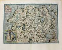
1627M10918London 1627. Good backed on acid free tissue paper for long term preservation. Notes: John Speed map of The Province Ulster in Northern Ireland with an inset showing Enis Kelling Fort Fort of Enniskillen.<br>John Speed was a renown British cartographer 'Theatre of Great Britain' was the first atlas of the British Isles. Size : 382x515 mm 15.04x20.28 Inches Coloring: Hand Colored Category: Maps Europe Ireland; unknown
167653206The Theatre of the Empire of Great Britain. T Bassett & R Chiswell. 1676. A very attractive map of Suffolk with inset of Ipswich enclosed in an elegant border. On the right of this is a pictorial reference to Bodicia Queen of the Iceni who occupied the area today known as East Anglia. On the left stands a Roman General. Numerous coats of arms of the Dukes and Earles of Suffolk and Clare adorn either side. At the bottom left a cherub holds dividers over the scale on the right a cupid holds a wind rose. Copper engraving. Fine condition good margins but some slight offsetting. Mounted size: 72 x 60 cm. Hand coloured. Size: 51 x 38 cm. 20 x 15 inches. unknown
1623LD8073London: Printed by John Beale for George Humble 1623. Second edition. Hardcover. Very Good. Folio 340 x 220mm. xx 1258pp. 74 numerous error in paging and register. Signatures: par.6 1st leaf blank A8; B-2H6; I4; 2K-4S6; 4T4; 4V-4Y6; 4Z8 4Z8 sic 4Z4; 5A-5T6; 5V1 of 4. Printers device of Humble on title head- and tail- pieces and initials throughout. Many in text engravings including 8 full page genealogies and numerous woodcuts throughout of coins and seals. Text in double column. Period full English calf rebacked and restored at corners in modern leather and stamped in gilt Historie of Great Britain Speed; lacking frontis. title somewhat browned and remargined text block lightly browned around edges lacking final 3 leaves of Table otherwise good. Sold as is. Large white on black bookplate of Dr. Otto Orren Fisher of Detroit Michigan to front pastedown. <br/><br/>Second Edition of Speeds Historie of Great Britain. Second Edition revised and enlarged and reissued in 1625 and again in 1627; Speeds Historie of Great Britain was originally published in 1612 with The Theatre of the Empire of Great Britaine as a companion volume though continuously paginated The Historie being the second work and the contents listing refers to the first four books which were part of the Theatre although this work books 5 - 10 is complete in itself. His account of the reign of Henry VIII p. 998 is followed by an appendix described in the running head as A Catalogue of the Religious Houses Colledges and Hospitals sometimes in England and Wales. These sections hold a wealth of information on early successors and founders of English Institutions. It was likely Speed an apt historian himself borrowed many of his materials from William Camden and was supplied by many Sir Robert Cotton Sir Henry Spelman and other antiquaries with whom he was acquainted. Although he probably had access to historical sources that are now lost to us he certainly used the work of Saxton and Norden his work as a historian is considered mediocre and secondary in importance to his map-making and the town plans he drew. Despite its many defects the Historie was very frequently cited by later writers. An important rich historical and artifactual book on Early English history. STC 2nd ed. 23046.3 Printed by John Beale for George Humble hardcover
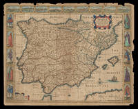
162621921<p>London: Are to be sold by Thomas Bassett in Fleet Street & Richard Chiswell in St. Pauls Churchyard 1626 but 1676. 415 by 540mm. 16.25 by 21.25 inches. Speed's map of Spain Double-page engraved map with hand-colour some wear to edges. A map of Spain from the 1676 edition of the first atlas compiled and published by an Englishman Speed's 'Prospect'. A decorative border along the top illustrates views of major cities including Granada and Barcelona and along each side there are depictions of figures in regional costume. The Balearics appear marked as the 'Pyne Ilands'. Accompanying text in English 'The Description of Spain' is printed on the reverse. John Speed 1552-1629 was the outstanding cartographer of his age. By trade a merchant tailor but by proclivity a historian it was the patronage of Sir Fulke Greville poet and statesman that allowed him to pursue this interest in earnest. His 'Theatre of Great Britain' first published in 1611 or 1612 was the first large-scale printed atlas of the British Isles. The 'Prospect of the Most Famous Parts of the World' from which the present work is drawn appeared in 1627 bound with the 'Theatre' and is the first world atlas compiled by an Englishman to be published in England. Engraved in Amsterdam many of the maps are anglicized versions of works by Dutch makers in distinctive carte-à-figure style featuring borders with figures in local costume and city views. This map is from the 1676 edition of the 'Prospect' published by Thomas Bassett and Richard Chiswell. While not as rare as the earlier publications this edition is perhaps the most important given that it is the first to include the nine new maps: among them Virginia and Maryland Barbados and Russia. It is also the last time that the 'Prospect' was printed as an atlas. Shirley Atlases T.SPE-2f.</p> Are to be sold by Thomas Bassett in Fleet Street & Richard Chiswell in St. Pauls Churchyard,
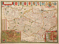
167680193The Theatre of the Empire of Great Britain. T Bassett & R Chiswell. 1676. A beautiful map of Kent based on the work of Philip Symonson. Insets of the cathedral cities of Canterbury and Rochester and seven coats of arms. Due to Kent's extensive coastline and proximity to France and the Netherlands it had unrivalled advantages for trade thus making its defence imperative. Dover Castle had long been a linchpin in the defence of the realm but most other castles in Kent were made redundant when a series of modern artillery forts like Deal and Walmer were constructed in the 1540's by Henry VIII. These were to protect the anchorage of the Downs which the Navy had recently taken to using. The adoption of other fleet-anchorages along the Thames and the Medway and the establishment of dockyards at Deptford and Woolwich by Henry VIII and at Chatham by Elizabeth I turned Kent into the best defended area in the kingdom throughout the Tudor and early Stuart periods. Copper engraving. Very good condition. Hand coloured. Sheet size: 395 x 510 mm. Mount size: 590 x 705 mm Nigel Nicolson A Tudor Atlas by John Speed unknown
1614038884London: John Sudbury & George Humble 1614. Book. Illus. by Christoph Schweitzer. Good. Hardcover. Folio. A scarce edition of this important work on British history. This is a reissue of the 1611 first edition with the date to the title page altered accordingly ESTC No. S122020. While the text starts on p. 151 this book is complete in its own right: conceived as a companion volume to Speed's grand atlas "The Theatre of the Empire of Great Britaine" and the pagination continues from that work. Fully collated includes the errata leaf to the rear often lacking the scarce "Proeme" author's preface; it is only the front and rear blanks not present. There are several errors with the pagination e.g. pp. 804 & 805 are numbered 796 & 797; Leaf 802 is misnumbered as leaf 801. Collation: frontispiece portrait later - dated July 28 1629; dedication page to the most high and most potent monarch James of Great Britaine.; The Contents 3 pages; The Proeme To the Learned and Lovers of Great Britaines Glory. pp. 151-154; main text pp. 155-894 beginning at Chap. 1. The Site and Circuit of Great Britaines Monarchie and ending with Book 10 - James of that name the first.; A Summary Conclusion of the Whole 3 pages; imprint page Imprinted at London by William Hall and John Beale for John Sudbury & George Humble; The Second index - 46 pages and finally the "Faults escaped" leaf errata. Numerous engravings in the text by Christoph Schweitzer including coins seals people head and tail-pieces. Contemporary or later half-calf binding with red title label to the spine. Binding worn and rubbed with both boards detached. Contents generally very good first few leaves detached pages generally clean title page laid-down with several chips as shown in photographs this and the later frontispiece plate dust marked. Provenance: with the Baptist College Library Bristol bookplate and that of "A. Gifford of the Museum" Dr Andrew Gifford 1700 -1784. A Baptist minister and the first assistant librarian in the British Museum's Department of Manuscripts. He was also the museum's first numismatist in 1756 Early inconspicuous manuscript shelf marks to the first few pages. A good complete copy though ideally requiring rebinding. A particularly scarce edition. A large heavy book a small postal surcharge may apply. John Sudbury & George Humble Hardcover
16651761London: to be solde by Roger Rea ye elder & younger at ye Golden Crosse in Cornhill agt. ye Exchang 1665. 410 by 550mm. 16.25 by 21.75 inches. Double-page engraved map fine contemporary outline hand colour upper left and right margins skilfully repaired margins reinforced with japan paper. The map bears the imprint of Roger Rea the Elder and Younger. The Reas had purchased the rights to Speed's work from William Garrett in 1659 who had previously purchased them from the widow of William Humble in the same year. Skelton suggests that the father and son intended a new edition of the atlas for the Restoration of 1660. However the atlas would appear not to have been published until 1665. This is borne out by an advertisement in the Term Catalogue by the subsequent owners of the plates Thomas Bassett and Richard Chiswell in 1675: "Mr John Speed's. Geography of the Kingdoms of England Scotland and Ireland. together with his Prospect. all in one entire Volume hath been for seven Years past out of Print the greatest part of an Impression then newly Printed being destroyed by the late dreadful Fire 1666". This is borne out by the rarity of the Rea edition of the atlas. There is evidence that they planned an edition of 1666 as there are impressions of Sussex Buckingham and Derby with Rea's imprint which bear that date. Rea would later sell the plates to Bassett and Chiswell who would publish a new edition in 1676. to be solde by Roger Rea ye elder & younger at ye Golden Crosse in Cornhill agt. ye Exchang, unknown
16270020055London: George Humble. Sumptuously rebound in quarter calf by Period Binders of Bath with bright gilt titles to spine and five raised bands new cream endpapers with complementing brown buckram boards preserving Armorial Bookplate of Arthur Levin Josephs to fixed front endpaper. First page is professionally relaid title page followed by Dedication page Contents Page and Index of Chapters 12 155/924pp Second Index of Principal Events A to Z46pp. Numerous engarvings throughout as called for. Two pages in unpaginated second index at end have three inch horizontal tears with no loss. Otherwise all VG. . Very Good. Hardcover. Second Edition. 1627. George Humble hardcover
1676LTH20-A-5London: Thomas Bassett; Richard Chiswell 1676. Leather. Good. 17.5" by 13". None. A collection of leaves from the highly sought after geographical work; The Theatre of the Empire of Great Britain. Complete with the maps this is around £100000. Containing; the original title page in both red and black printing two dedication pages "To the Right Honourable Sir Joseph Sheldon" and "To the Most High and Most Potent Monarch James" three leaves of the preface three leaves of poetical works the "Contents of the Chorographical Part The First Book" through to the contents of "The King's Dominions Abroad" the title page to "The Second Book: Containing the Principality of Wales" page 97 and 98 of this work five leaves of road branch diagrams the title page to "The Third Book: Containing a General View of the Kingdom of Scotland" page 129 of this work the title page to "The Fourth Book: Containing the Kingdom of Ireland" page 135 of this work the title page to "A Prospect of the Most Famous Parts of the World" and the complete Index. Rebacked in a full contemporary calf binding with the original calf boards. Externally a trifle rubbed with wear to the extremities and minor cocking to the spine. Both hinges are tender. Internally binding is a little strained in places with some leaves working loose. Work is seriously incomplete with what is present listed above. Some scattered spotting and handling marks. Good Thomas Bassett; Richard Chiswell hardcover
16651785London: to be solde by Roger Rea ye Elder and younger at ye Golden Crosse in Cornhill against the Exchange 1665. 410 by 550mm. 16.25 by 21.75 inches. Double-page engraved map upper left and right margins skilfully repaired margins reinforced with japan paper. The map bears the imprint of Roger Rea the Elder and Younger. The Reas had purchased the rights to Speed's work from William Garrett in 1659 who had previously purchased them from the widow of William Humble in the same year. Skelton suggests that the father and son intended a new edition of the atlas for the Restoration of 1660. However the atlas would appear not to have been published until 1665. This is borne out by an advertisement in the Term Catalogue by the subsequent owners of the plates Thomas Bassett and Richard Chiswell in 1675: "Mr John Speed's. Geography of the Kingdoms of England Scotland and Ireland. together with his Prospect. all in one entire Volume hath been for seven Years past out of Print the greatest part of an Impression then newly Printed being destroyed by the late dreadful Fire 1666". This is borne out by the rarity of the Rea edition of the atlas. There is evidence that they planned an edition of 1666 as there are impressions of Sussex Buckingham and Derby with Rea's imprint which bear that date. Rea would later sell the plates to Bassett and Chiswell who would publish a new edition in 1676. to be solde by Roger Rea ye Elder and younger at ye Golden Crosse in Cornhill against the Exchange, unknown
1651M8291London: Tho: Basset; Richard Chiswell c. 1651. Very Good. Notes: StolenHighly decorative map of the Roman Empire. Includes illustrations of ships and sea monsters as well as various animals placed in their native lands. <br>Includes a decorative cartouche on the upper right side and a brief historical description of the history of the Roman Empire at the bottom of the map. Illustrations of Rome Geneva Jerusalem Venice Constantinople and Alexandria as well as various native people in costumes are placed around the map. Size : 391x509 mm 15.40x20.05 Inches Coloring: Original Hand Coloring Category: Maps Mediterranean Sea; Maps Asia Near East Turkey; Maps Europe Continent; Maps Africa Continent; Tho: Basset; Richard Chiswell unknown
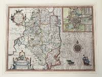
1610M9855London c.1610. Very Good. Notes: John Speed's map of Leinster county; also with an <br>early plan of Dublin. Size : 382x511 mm 15.04x20.12 Inches Coloring: Original Hand Coloring Category: Maps Europe Ireland; unknown
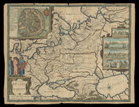
167621930<p>London: Sold by Tho: Basset in Fleet Street and Richard Chiswell in St. Pauls Church yard 1676. 405 by 515mm. 16 by 20.25 inches. Speed's map of Russia Double-page engraved map with hand-colour. A map of Russia one of the nine new maps added to the 1676 edition of Speed's 'Prospect' the first atlas compiled and published by an Englishman. Unusually this map is not in the carte-à-figure style that characterizes the 'Prospect'. Instead set in the top left-hand corner of the map is a detailed plan of Moscow with points of particular interest such as 'The Emperours Palace' and 'The Horse market' labelled. On the right-hand side is an elaborate cartouche containing views including 'Archangel' Arkhangelsk and 'A Hott House'. Accompanying text in English 'The Description of Russia' is printed on the reverse. John Speed 1552-1629 was the outstanding cartographer of his age. By trade a merchant tailor but by proclivity a historian it was the patronage of Sir Fulke Greville poet and statesman that allowed him to pursue this interest in earnest. His 'Theatre of Great Britain' first published in 1611 or 1612 was the first large-scale printed atlas of the British Isles. The 'Prospect of the Most Famous Parts of the World' from which the present work is drawn appeared in 1627 bound with the 'Theatre' and is the first world atlas compiled by an Englishman to be published in England. Engraved in Amsterdam many of the maps are anglicized versions of works by Dutch makers in distinctive carte-à-figure style featuring borders with figures in local costume and city views. This map is from the 1676 edition of the 'Prospect' published by Thomas Bassett and Richard Chiswell. While not as rare as the earlier publications this edition is perhaps the most important given that it is the first to include the nine new maps: among them Virginia and Maryland Barbados and the present example Russia. It is also the last time that the 'Prospect' was printed as an atlas. Shirley Atlases T.SPE-2f.</p> Sold by Tho: Basset in Fleet Street and Richard Chiswell in St. Pauls Church yard,
16769731London Thomas Bassett and Richard Chiswell 1676. Copper engraving 38.5 x 51.5 cm modern hand-colour closed tear in the sea beside the vignette of a naval engagement trivial spotting English text to verso. Speeds 'carte à figure' map of Italy with eight costume vignettes and six city views around the edges with the coats of arms of Corsica and Sardinia. John Speed 1552-1629 is unquestionably the most significant English map-maker of the seventeenth-century. The first edition of Speed's Theatre was published in 1612. It was the first atlas of the British Isles and the first attempt made by an Englishman to match the achievements of the great continental publishing houses - although much of the engraving of the copper plates was performed in Amsterdam by Jodocus Hondius. Our map of Italy appeared in Speeds Prospect of the Most Famous Parts of the World the first world atlas attributed to an Englishman first published in 1627; again many of the plates were engraved in Amsterdam mostly by Abraham Goos. Map unknown