SPEED, JOHN:Biblio.com
1 203 résultats
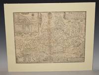
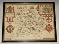
92126Sudbury & George Humbell 1610-1612. Engraved surface 20 x 15.50 inches. Frame Size 26.5 x 21.50 inches Attractive hand-colouring. A nice example of this decorative County map by John Speed. Includes inset of Breknoke with the coat of arms for James Butler Earle of Breknoke and three other coasts of arms plus and early battle scene. FRAMED in Glazed Hogarth Frame. Strong impression with the detail in the engraving clear and black. Frame has a few small chips. Overall in very good condition. Imprint on left- hand corner giving publishers: “Performed by John Speede. And are to be solde by Sudbury & George Humbell”. The maps by J.Speed are "the best known and most popular of all English county maps" Tooley. Despite competition from maps of the English counties by Blaeu and Jansson Speed’ maps were “bestsellers”. A beautifully coloured map of the historic county of Brecknockshire with an inset map of the city of Brecon. Sudbury & George Humbell 1610-1612 unknown
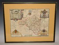
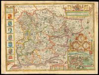
92117Sudbury & George Humbell 1610/11 1st Edition. Engraved surface 20 x 15.50 inches. With later light hand colouring. Frame Size 26.5 x 21.50 inches Attractive hand-colouring. Double glazed with English text on verso. An attractive and decorative map with inset town plan of Radnor scales of English Miles within large decorative cartouche and 3 elaborate coat of arms. Title cartouche and large compass rose. Strong impression with the detail in the engraving clear and black. Nice wide mustard margins. A few weak creases near centrefold. Overall in very good condition. A scarce edition. Imprint in the centre lower bottom giving publishers: “Described by Christopher Saxton Augmented and published by John Speede servant of his Majesty. And are to be solde in Popes head alley by John Sudbury & George Humbell The maps by J.Speed are "the best known and most popular of all English county maps" Tooley. Despite competition from maps of the English counties by Blaeu and Jansson Speed’ maps were “bestsellers”. Sudbury & George Humbell 1610/11 1st Edition unknown
1258162229.Gpaperback. Good. Access codes and supplements are not guaranteed with used items. May be an ex-library book. paperback
1962DC 167NY: Vantage Press 1962. SIGNED by Speed & Has DJ DJ has price & 1st stated Pages are browning -- John Orville Speed the Pennyrile Poet & from Madisonville KY -- EMAIL for Pictures. Signed by Author. First Edition. Hard Cover. Good/Good. Vantage Press Hardcover
1610247261Sudbury & Humble 1610. Map. Engraving with hand coloring. Image measures 15 x 20".<br/> <br/> This wonderfully decorated map depicts the island of Anglesey off the northwest coast of Wales. The island is centered on the map and labeled with towns rovers as well pictorial mountains and trees. A strapwork title cartouche features the coat of arms of England flanked by a lion and a unicorn. Below two elegant ships sail the beautifully patterned ocean surrounding an elaborate and colorful compass rose. In the lower left corner of the map showing part of Wales is an ornamental scale topped with strapwork cherubs a peacock and the country's coat of arms. A similar border frames the inset of Beaumaris in the upper right of the map which shows a plan of the port city labeled according to a key including its famous castle. The map appeared in Speed's atlas "The Theatre of the Empire of Great Britaine." It is in good condition with but margins are cropped. Expert repair to right corners. <br> <br> John Speed 1552-1629 is widely considered to be the most famous English cartographer of the 17th century. His atlas "The Theatre of the Empire of Great Britaine" contained the first set of individual county maps of England and Wales as well as significant town plans that are in many cases the first visual records of their subjects. This map of Anglesey is a beautiful example of his work.<br/> <br/> Sudbury & Humble unknown
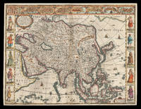
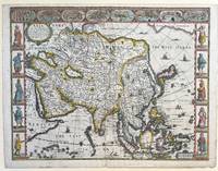
162621912<p>London: Are to be sold in pops-head alley against the Exchange by G. Humble 1626 but 1627-1632. 400 by 510mm. 15.75 by 20 inches. The first English printed map of Asia Double-page engraved map with hand-colour. The first English printed map of the continent of Asia from the first atlas compiled and published by an Englishman Speed's 'Prospect'. The map is heavily influenced by Hondius' 1623 map and inherits the gaps in his geographical understanding of Asia: Korea is presented as a peninsula and an anonymous stretch of water separates Asia from America identified only as a blending of 'The Tartarian Sea' and 'The West Ocean'. In India one finds the mythical 'Lake Ciamay' a common feature of European maps of Asia from the 16th to the 18th c. the imagined source of the major rivers of south-east Asia. The map is not without topographical accuracy however. In China the Great Wall of China is depicted described as 'a bulwarke against the suddaine infall of ye Tartars on this side'. Vignettes in the border at the top of the map depict bird's-eye views of important towns among them 'Goa' and 'Aden'. Illustrated in the borders along the sides of the map are costumed figures. Accompanying text in English 'The Description of Asia' is printed on the reverse. John Speed 1552-1629 was the outstanding cartographer of his age. By trade a merchant tailor but by proclivity a historian it was the patronage of Sir Fulke Greville poet and statesman that allowed him to pursue this interest in earnest. His 'Theatre of Great Britain' first published in 1611 or 1612 was the first large-scale printed atlas of the British Isles. The 'Prospect of the Most Famous Parts of the World' from which the present work is drawn appeared in 1627 bound with the 'Theatre' and is the first world atlas compiled by an Englishman to be published in England. Engraved in Amsterdam many of the maps are anglicized versions of works by Dutch makers in distinctive carte-à-figure style featuring borders with figures in local costume and city views. Chubb XXV; 'Mapping the Continent of Asia' 30; Shirley Atlases T.SPE-2a; Suárez 200.</p> Are to be sold in pops-head alley against the Exchange by G. Humble,
1627337000London: George Humble 1627. unbound. Map. Engraving with hand coloring. Image measures 15 3/8" x 20".<br/> <br/> This fascinating 1626 map of Asia by John Speed is the first British map of Asia. The map presents the entire continent from the Mediterranean east to include Japan and the East Indies. The map presents many speculations and common conventions found at a time when parts of Asia were largely unexplored by Europeans.<br> <br> Korea is presented as an elongated peninsula while the Kamchatka Peninsula is entirely absent. The map shows Japan and a fairly detailed depiction of the East Indies. Further west the Caspian Sea is presented along its East-West axis as per the practice at the time. The Great Wall of China is depicted in a grand style. Throughout several kingdoms important cities rivers lakes islands mountains and other topographical features are noted.<br> <br> One of the most interesting cartographic feature on this map is the appearance of Lake Ciamay or Lake Chiamay near northeast India. This mythical lake appeared on maps from the 16th to late 18th century and was believed to be the source of the great rivers of Southeast Asia.<br> <br> Illustrations of ships and sea monsters are included. The map is surrounded on the left and right with illustrations of the costumes and people from various parts of the continent. Along the top border eight city views are included detailing Candy Goa Damascus Jerusalem Ormus Bantam Aden and Macao.<br> <br> Engraved by Abraham Goos 1590 - 1643 a master engraver was the son of Pieter Goos and Margareta van den Keere which were both from map families. Appears in Speed's important "Prospect of the Most Famous Parts of the World". The map is in good condition. Archival repair to closed tear at lower margin near centerfold. Minor staining at edges not affecting the image. English text on verso.<br> <br> John Speed 1552-1629 is widely considered to be the most famous English cartographer of the 17th century. His atlas "The Theatre of the Empire of Great Britaine" contained the first set of individual county maps of England and Wales as well as significant town plans that are in many cases the first visual records of their subjects. This important map of Asia is a wonderful example of his work.<br/> <br/> George Humble unknown
164623419London: William Humble 1646. Other. In excellent condition. 384 by 509mm 15 by 20 inches. Copper engraving uncolored as published. William Humble unknown
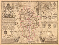
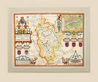
162757319Theatre of the Empire of Great Britain published by Bassett and Chiswell. c.1627. Speed's map of Bedfordshire embelished with four strapwork cartouches surrounding the town plan of Bedford the coats of arms of the Earls and Dukes of Bedford the title commentary and the scale. First published in 1611 today the work of John Speed is regarded highly by map collectors historians and artists due to the intricate nature and artistic beauty of the maps. Copper engraving. Fine condition. Mounted size: 71.5 x 60 cm Hand coloured. Size: 50 x 38.5 cm. 19½ x 15 inches unknown
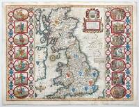
1676141841London: Basset and Chiswell 1676. Highly decorative map of the Saxon Heptarchy is from the 1676 edition of John Speed's famous atlas of 1610-12 "The Theatre of the Empire of Great Britain" published in London by Bassett and Chiswell. The most striking features of the map are the borders that flank the main body of the map. On one side they graphically portray and illustrate the seven ancient Saxon kingdoms together with their kings at the time of their own respective conversions to Christianity. The opposite side depicts the seven Saxon kingdoms with their respective kings when first established. Shields of the kingdoms a compass rose and a delightful title cartouche further enhance and embellish this most wonderful and interesting map. Copperplate engraving with hand colour. Plate mark size: 38.5 x 51. cm. Very good condition. Nicolson; The Counties of Great Britain A Tudor Atlas by John Speed p29. unknown
201687869London: Batsford 2016. Pages clean and bright. Biniding firm. Previous owner inscription to fly title page. Light shelf wear. Hard. Very Good. Elephant Folio Landscape. Batsford Hardcover
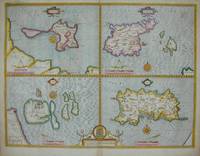
16765122London: Basset & Chiswell 1676. Copper engraving 38.5 x 51 cms modern hand-colour four maps on one sheet English text to verso. Islands around the British coast were often grouped in various cominations by early mapmakers. John Speed 1552-1629 is unquestionably the most significant English map-maker of the seventeenth-century. A brief note from Grangers Bibliographical History of England 1779 contains most of the information we have about Speeds life: John Speed who was bred a Tailor was by the generosity of Sir Fulk Grevil his patron set free from a manual employment and enabled to pursue his studies to which he was strongly inclined by the bent of his genius. The fruits of them were his Theatre of Great Britain containing an entire set of maps of the counties drawn by himself his History of Great Britain richly adorned with seals coins & medals from the Cotton collection; and his Genealogies of Scripture first bound up with the Bible in 1611 which was the first edition of the present English translation. His maps were very justly esteemed & his History of Great Britain was in its kind incomparably more complete than all the histories of his predecessors put together The first edition of Speeds Theatre was published in 1612. It was the first atlas of the British Isles and the first attempt made by an Englishman to match the achievements of the great continental publishing houses although much of the engraving of the copper plates was performed in Amsterdam by Jodocus Hondius. Speed was an antiquary and intended that his atlas should be read in conjunction with his history of Britain. He managed to include a great deal of historical detail on his modern county maps and the inset town plans some surveyed by himself together comprise the first collection of town plans of the British Isles all in all making the Theatre a highly decorative as well as a useful volume. It was a great success and there were editions printed throughout the seventeenth-century. Map Basset & Chiswell unknown
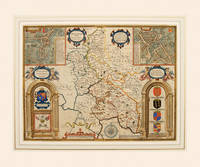
166254995Theatre of the Empire of Great Britain. Roger Rea. 1662-65. A beautiful map of Buckinghamshire from Speed's Theatre. Inset plans of the market towns of Buckingham and Redding the latter being a strange choice given that it lies in the county of Berkshire - an indication that the other market towns in Buckinghamshire were not large or prosperous. Embellished with cartouches cherubs and coats of arms belonging to the titled families of the county. Decorated scale at bottom with dividers above and compass rose to the right. Copper engraving. Good condition. Cut close at left and right hand sides but enough added margin for mounting and framing. Top margin strengthened. A closed tear 3 inches runs from the bottom up to the shield of Thomas of Wodstoke on the right. This has an old repair and is scarcely noticeable. Later colour. Size: 50 x 38 cm. 19½ x 15 inches unknown
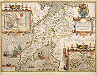
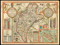
162764225London. c.1627. John Speed 1552-1629 is arguably the most famous name in early English cartography. In 1610 he published his wonderful and historic atlas 'The Theatre of Great Britain'. In 1627 he published another edition entitled 'A Prospect of The Most Famous Parts of The World' published in London by John Sudbury and George Humble. Speed based his maps on the earlier works done by Christopher Saxton and John Norden. His maps have always been keenly sought after as include many decorative features. Examples include: compass roses cherubs coats of arms mannerist style decoration prominent town plans stylish calligraphy and well defined regional physical features. John Speed's maps proved so popular that they were issued for many years after his death. This decorative and attractive example is of the Welsh county of Caernarvonshire. Size: 420 x 525 mm. Copperplate engraving with later hand colour. Fair to good condition. Repair to lower centrefold. Margins slim and 'chipped'. unknown
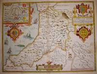
16765645London: Basset & Chiswell 1676. Copper engraving 39 x 51.5 cms recent hand-colour inset of Cardigan very minor staining on the right-hand side of the map English text on verso. John Speed 1552-1629 is unquestionably the most significant English map-maker of the seventeenth-century. A brief note from Granger's Bibliographical History of England 1779 contains most of the information we have about Speed's life: "John Speed who was bred a Tailor was by the generosity of Sir Fulk Grevil his patron set free from a manual employment and enabled to pursue his studies to which he was strongly inclined by the bent of his genius. The fruits of them were his Theatre of Great Britain containing an entire set of maps of the counties drawn by himself his History of Great Britain richly adorned with seals coins & medals from the Cotton collection; and his Genealogies of Scripture first bound up with the Bible in 1611 which was the first edition of the present English translation. His maps were very justly esteemed & his History of Great Britain was in its kind incomparably more complete than all the histories of his predecessors put together ." The first edition of Speed's "Theatre" was published in 1612. It was the first atlas of the British Isles and the first attempt made by an Englishman to match the achievements of the great continental publishing houses - although much of the engraving of the copper plates was performed in Amsterdam by Jodocus Hondius. Speed was an antiquary and intended that his atlas should be read in conjunction with his history of Britain. He managed to include a great deal of historical detail on his 'modern' county maps and the inset town plans some surveyed by himself together comprise the first collection of town plans of the British Isles all in all making the Theatre a highly decorative as well as a useful volume. It was a great success and there were editions printed throughout the seventeenth-century. Map Basset & Chiswell unknown
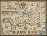
171021976<p>London: And Now Sold by Henry Overton at the White Horse without Newgate London 1710-1743. 385 by 510mm. 15.25 by 20 inches. Speed's map of Cornwall Double-page engraved map with hand colour. A map of Cornwall from one of the Overton editions of the first large-scale atlas of the British Isles Speed's 'Theatre'. In the top left-hand corner is a prospect of 'Launceston or Ancient Dunhevet'. Along the right-hand side of the map four antiquities are illustrated including the Hurlers Stones which according to legend are men petrified for playing hurling on a Sunday. The sea around the peninsula is filled with sea-monsters and ships. John Speed 1552-1629 was the outstanding cartographer of his age. By trade a merchant tailor but by proclivity a historian it was the patronage of Sir Fulke Greville poet and statesman that allowed him to pursue this interest in earnest. His 'Theatre of Great Britain' from which the present work is drawn was first published in 1611 or 1612 and is 'the earliest English attempt at atlas-production on a grand scale' Skelton. Drawing heavily on the work of Saxton and Norden little of Speed's cartography is original he acknowledges 'I have put my sickle into other mens corne' instead it is his blend of cartography and history incorporating town-plans vignettes and genealogy that makes Speed an innovator. This map is from one of the editions of the 'Prospect' published by Henry Overton between ca. 1710 and 1743. Unlike in earlier editions the verso of the maps tend to be blank.</p> And Now Sold by Henry Overton at the White Horse without Newgate London,
164623396London: William Humble 1646. Other. In excellent condition. 384 by 508mm 15 by 20 inches. 384 by 508mm 15 by 20 inches. Copper engraving uncolored as published. William Humble unknown
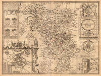
16651789London: to be sould by Roger Rea the Elder and younger at the Golden Cross in Cornhill against the Exchange 1665. 410 by 550mm. 16.25 by 21.75 inches. Double-page engraved map fine contemporary outline hand colour upper left and right margins skilfully repaired margins reinforced with japan paper. The map bears the imprint of Roger Rea the Elder and Younger. The Reas had purchased the rights to Speed's work form William Garrett in 1659 who had previously purchased them from the widow of William Humble in the same year. Skelton suggests that the father and son intended a new edition of the atlas for the Restoration of 1660. However the atlas would appear not to have been published until 1665. This is borne out by an advertisement in the Term Catalogue by the subsequent owners of the plates Thomas Bassett and Richard Chiswell in 1675: "Mr John Speed's. Geography of the Kingdoms of England Scotland and Ireland. together with his Prospect. all in one entire Volume hath been for seven Years past out of Print the greatest part of an Impression then newly Printed being destroyed by the late dreadful Fire 1666". This is borne out by the rarity of the Rea edition of the atlas. There is evidence that they planned an edition of 1666 as there are impressions of Sussex Buckingham and Derby with Rea's imprint which bear that date. Rea would later sell the plates to Bassett and Chiswell who would publish a new edition in 1676. to be sould by Roger Rea the Elder and younger at the Golden Cross in Cornhill against the Exchange, unknown
171312789London: Henry Overton Bassett & Chiswell 1713. Copper-engraved map with full modern colour very large marings in very good condition except for a stain at the bottom edge well away from the image. A highly decorative map of Denbighshire by one of the greatest English cartographers<br/> <br/> Denbighshire in Wales clearly a mountainous region was surveyed by Christopher Saxton which was Speed's source for this map. William Smith Pursuivant at the College of Arms was the apparent source for the coats of arms: one of which is that of Robert Dudley Earl of Leicester Queen Elizabeth's favorite. In the town plan of Denbigh in the upper right corner is a circular inset displaying what appears to be a castle. It is actually an unfinished and indeed never finished church that Leicester had tried to have built in Denbigh. Apparently his unpopularity was part of the reason the church was never completed. The map is decorated with a sea monster a classical god on horseback and a ship. Henry Overton's edition of this map includes the few roads that snaked their way through the county.<br/> <br/> cf. Hawkyard and Nicolson The Counties of Britain A Tudor Atlas by John Speed p. 73-76; Skelton The County Atlases of the British Isles 1579-1850 Map Collector's Circle part 1 #7 Speed and part 4 #92 & 121. Henry Overton, Bassett & Chiswell unknown
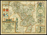
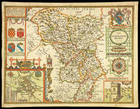
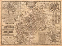
162711763London: Performed by John Speede and are to be sold in popes head Alley by Iohn Sudbury and G. Humble 1627. 380 by 510mm. 15 by 20 inches. Engraved map with hand colouring. A beautifully coloured map of Derbyshire with insets of the city of Derby and the springs at Buxton. John Speed 1552-1629 was the outstanding cartographer of his age. His 'Theatre of Great Britain' was the first atlas of the British Isles: Speed prepared the maps himself about two years before they were published. His maps and books dominated the seventeenth-century English market. The present map is taken from the 1627 English edition published by George Humble. Chubb XXV. Performed by John Speede, and are to be sold in popes head Alley by Iohn Sudbury and G. Humble, unknown
16651781London: to be sold by Roger Rea the Elder and younger at ye Golden Crosse in Cornhill against ye Exchange 1665. 410 by 550mm. 16.25 by 21.75 inches. Hand-coloured double-page engraved map upper left and right margins skilfully repaired margins reinforced with japanned paper. The map bears the imprint of Roger Rea the Elder and Younger. The Reas had purchased the rights to Speed's work form William Garrett in 1659 who had previously purchased them from the widow of William Humble in the same year. Skelton suggests that the father and son intended a new edition of the atlas for the Restoration of 1660. However the atlas would appear not to have been published until 1665. This is borne out by an advertisement in the Term Catalogue by the subsequent owners of the plates Thomas Bassett and Richard Chiswell in 1675: "Mr John Speed's. Geography of the Kingdoms of England Scotland and Ireland. together with his Prospect. all in one entire Volume hath been for seven Years past out of Print the greatest part of an Impression then newly Printed being destroyed by the late dreadful Fire 1666". This is borne out by the rarity of the Rea edition of the atlas. There is evidence that they planned an edition of 1666 as there are impressions of Sussex Buckingham and Derby with Rea's imprint which bear that date. Rea would later sell the plates to Bassett and Chiswell who would publish a new edition in 1676. to be sold by Roger Rea the Elder and younger at ye Golden Crosse in Cornhill against ye Exchange, unknown
164623403London: William Humble 1646. Other. In excellent condition. 384 by 514mm 15 by 20¼ inches. 384 by 514mm 15 by 20¼ inches. Copper engraving uncolored as published. William Humble unknown
88321Published Bassett & Chiswell. Ca 1676. Engraved map Uncoloured. With printed description of the County of Dorset on back. Ivory Mount Size 64cm x 52cm. Map size 52cm x 39cm In very good condition. Neat Centre fold. -- Map of Dorset from 1662 with town plan of Dorchester and coats of arms. From John Speed’s ‘Theatre of the Empire of Britain’ originally engraved by Jodocus Hondius with a brief description and history of Dorset with list of Divisions and Hundreds on the back. Published Bassett & Chiswell. Ca 1676 unknown
16651761London: to be solde by Roger Rea ye elder & younger at ye Golden Crosse in Cornhill agt. ye Exchang 1665. 410 by 550mm. 16.25 by 21.75 inches. Double-page engraved map fine contemporary outline hand colour upper left and right margins skilfully repaired margins reinforced with japan paper. The map bears the imprint of Roger Rea the Elder and Younger. The Reas had purchased the rights to Speed's work from William Garrett in 1659 who had previously purchased them from the widow of William Humble in the same year. Skelton suggests that the father and son intended a new edition of the atlas for the Restoration of 1660. However the atlas would appear not to have been published until 1665. This is borne out by an advertisement in the Term Catalogue by the subsequent owners of the plates Thomas Bassett and Richard Chiswell in 1675: "Mr John Speed's. Geography of the Kingdoms of England Scotland and Ireland. together with his Prospect. all in one entire Volume hath been for seven Years past out of Print the greatest part of an Impression then newly Printed being destroyed by the late dreadful Fire 1666". This is borne out by the rarity of the Rea edition of the atlas. There is evidence that they planned an edition of 1666 as there are impressions of Sussex Buckingham and Derby with Rea's imprint which bear that date. Rea would later sell the plates to Bassett and Chiswell who would publish a new edition in 1676. to be solde by Roger Rea ye elder & younger at ye Golden Crosse in Cornhill agt. ye Exchang, unknown
164623423London: William Humble 1646. Other. In excellent condition. 383 by 514mm 15 by 20¼ inches. 383 by 514mm 15 by 20¼ inches. Copper engraving uncolored as published. William Humble unknown