Speed, John JosephBiblio.com
1 203 résultats
1258660997.Ghardcover. Good. Access codes and supplements are not guaranteed with used items. May be an ex-library book. hardcover
78599London Fleet Street Thomas Bassett 1676. Framed size approx 28 x 23 inches. Engraved surfaces approx 20 x 15 ins. Double-glazed in gold wood frame with ivory mount behind glass. Front and Back. In very good condition. Some darkening/tanning to paper vertical centre crease. Some slight fading to print in some areas. Lovely bright crisp colouring. Very small tear to top l/h corner. Centre fold and edges darkened on rear side. Else a beautiful clean example. Original engraved map with hand colouring. Coloured letterpiece on rear side. London, Fleet Street, Thomas Bassett, 1676 unknown
164623421London: William Humble 1646. Other. In excellent condition. 383 by 512mm 15 by 20¼ inches. 383 by 512mm 15 by 20¼ inches. Copper engraving uncolored as published. William Humble unknown
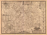
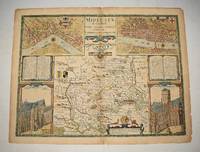
167621984<p>London: are to be sold by Thomas Basset in Fleet Street and Richard Chiswell in St Pauls Churchyard 1676. 390 by 515mm. 15.25 by 20.25 inches. Speed's map of Hertfordshire Double-page engraved map with hand colour slight discolouration to centre fold. A map of Hertfordshire from the 1676 edition of the first large-scale atlas of the British Isles Speed's 'Theatre'. In the top left-hand corner is an inset town-plan of Hertford with points of interest including 'Hony lane' and 'Back stret' marked using an alphabetical key. In the top right-hand corner is an inset showing 'Verolanium' presumably a mis-spelling of 'Verulamium' modern-day St. Albans one of the most significant cities in Roman Britain. In the bottom right-hand corner is a cartouche in which are described the 'three mortall and bloody Battells of Englands civill disections' fought in Hertfordshire: the first battle of St. Albans 1451 the second battle of St. Albans 1461 and the battle of Barnet 1471. Accompanying text in English 'Hundreds in Hertford-shire' and 'Hertford-shire' is printed on the verso. John Speed 1552-1629 was the outstanding cartographer of his age. By trade a merchant tailor but by proclivity a historian it was the patronage of Sir Fulke Greville poet and statesman that allowed him to pursue this interest in earnest. His 'Theatre of Great Britain' from which the present work is drawn was first published in 1611 or 1612 and is 'the earliest English attempt at atlas-production on a grand scale' Skelton. Drawing heavily on the work of Saxton and Norden little of Speed's cartography is original he acknowledges 'I have put my sickle into other mens corne' instead it is his blend of cartography and history incorporating town-plans vignettes and genealogy that makes Speed an innovator. This map is from the 1676 edition of the 'Theatre' published by Thomas Bassett and Richard Chiswell. Chubb CIV; Shirley Atlases T.Spe-1j; Skelton 92.</p> are to be sold by Thomas Basset in Fleet Street, and Richard Chiswell in St Pauls Churchyard,
164623410London: William Humble 1646. Other. In excellent condition. 383 by 508mm 15 by 20 inches. 383 by 508mm 15 by 20 inches. Copper engraving uncolored as published. William Humble unknown
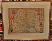
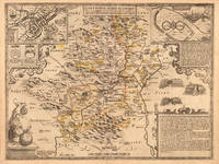
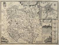
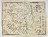
1610330332John Sudbury & George Humble 1610. unbound. Map. Original engraving. Image measures 15" x 20".<br/> <br/> Beautiful early map of Herefordshire with inset plan of the city of Hereford.The region central England is known for cider and beer production. Topography castles and churches are represented pictorially. Insets include an image and explanation of a famous 1461 battle during the War of the Roses a group of coats of arms and two images of a mapmaker at work. Verso has information and history on the county and a census of towns and "hundreds" smaller municipalities within the county. Map is in good condition despite a few scattered stains. Chips to margins not affecting the image. There is a small repari near the original fold line. <br> <br> John Speed 1552-1629 born in Cheshire and a tailor by profession until he was 50 is widely considered to be the most famous English cartographer of the 17th century. He is noted for placing England in the mainstream of map publishing an industry which was at the time dominated by the Dutch. His atlas "The Theatre of the Empire of Great Britaine" contained the first set of individual county maps of England and Wales as well as significant town plans that are in many cases the first visual records of their subjects.<br/> <br/> John Sudbury & George Humble unknown
52742London: Performed by John Speed and are to be Sold by Henry Overton at the White Horse without Newgate. c.1720. 41x 51 cm. Uncoloured double-page map. Insets of a plan of the town of Hereford arms of the nobility and battle of Mortimer's Cross. Some creases Additional light fold creases mid right and mid lower half. London: Performed by John Speed and are to be Sold by Henry Overton at the White Horse without Newgate. [c.1720] unknown
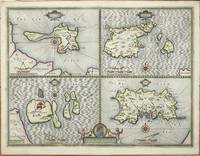
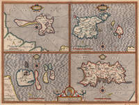
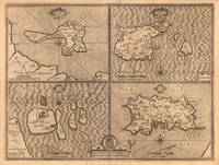
161011341London: John Sudbury and George Humble 1610. No binding. Good. THE FIRST REASONABLY ACCURATE MAP OF JERSEY. 385 x 510 mm. with recent outline and wash colour in good condition. The first published state of a quartered map by John Speed displaying the tidal Holy Island Lindisfarne reachable on foot at low tide and the Farne Islands both off the coast of Northumberland. On the right side are the two main Channel Islands of Guernsey and Jersey. This is the first reasonably accurate map of Jersey to be printed. The parish boundaries are marked along with the various waterways each indicating housing along their courses. In addition three windmills are displayed. Guernsey displays no real improvement over that of Gerard Mercator published in 1595 but it does now display its proximity to Jersey. Sark now displays buildings and one windmill which had only recently been built by Hellier de Carteret in 1571. He was the first Seigneur of the island. It was famously decapitated by the Nazis in the Second World War. John Speed 1552-1629 is the best known and among collectors the most popular British cartographer. He was like his father a tailor by trade with a passion for history. On joining the Society of Antiquaries he took his first steps towards the compilation of the atlas that has placed him among the cartographic immortals.In 1611 he produced the 'History of Great Britain' and his atlas the 'Theatre of the Empire of Great Britain' was published to accompany it. The 'Theatre .' was the first atlas of the British Isles ever produced containing sixty-seven maps which in addition to the counties of England and Wales also included general maps of the Heptarchy England in Anglo-Saxon times Great Britain and Ireland England Wales Scotland and the Provinces of Ireland together with maps of the Isles of Wight and Man and the Channel Islands. Preparation for the atlas took several years and the maps are all engraved by Jodocus Hondius in Amsterdam. This example was printed in 1627 the last edition to be published before the death of Speed. Provenance: private Jersey collection. Shirley T.SPE-1e; Skelton 1966; Skelton 1970 7 & 16. John Sudbury and George Humble unknown
162623758London: G. Humble 1626. Other. In excellent condition. 382 by 508mm 15 by 20 inches. 382 by 508mm 15 by 20 inches. Copper engraving hand colored in outline and wash. Original antique copper engraving hand colored in outline and wash. John Speed 1551 or 1552 28 July 1629 was an English cartographer and historian. He is alongside Christopher Saxton one of the best known English mapmakers of the early modern period.Speed was born in the Cheshire village of Farndon and went into his father Samuel Speed's tailoring later in life.While working in London Speed was a tailor and member of a corresponding guild and came to the attention of "learned" individuals. These individuals included Sir Fulke Greville who subsequently made him an allowance to enable him to devote his whole attention to research. By 1598 he had enough patronage to leave his manual labour job and "engage in full-time scholarship". As a reward for his earlier efforts Queen Elizabeth granted Speed the use of a room in the Custom House. Speed was by this point as "tailor turned scholar" who had a highly developed "pictorial sense".In 1575 Speed married a woman named Susanna Draper in London later having children with her. These children definitely included a son named John Speed later a "learned" man with a doctorate and an unknown number of others since chroniclers and historians cannot agree on how many children they raised. Regardless there is no doubt that the Speed family was relatively well-off.By 1595 Speed published a map of biblical Canaan in 1598 he presented his maps to Queen Elizabeth and in 16111612 he published maps of Great Britain with his son perhaps assisting Speed in surveys of English towns.At age 77 or 78 in August 1629 Speed died. He was buried alongside his wife in London's St Giles-without-Cripplegate church on Fore Street. Later on a memorial to John Speed was also erected behind the altar of the church. According to the church's website "His was one of the few memorials in the church that survived the bombing" of London during The Blitz of 19401941 . The website also notes that "the cast for the niche in which the bust is placed was provided by the Merchant Taylors' Company of which John Speed was a member". His memorial brass has ended up on display in the Burrell Collection near Glasgow. Wikipedia G. Humble unknown
164623415London: William Humble 1646. Other. In excellent condition. 386 by 510mm 15¼ by 20 inches. 386 by 510mm 15¼ by 20 inches. Copper engraving uncolored as published. William Humble unknown
16239847London George Humble 1623. Copper engraving image 38 x 50.5 cm sheet size 41.5 x 53 cm fine original hand colour blank verso. An unusual example: the map was coloured trimmed to the edge of the printed image and mounted on thick paper in the 17th century perhaps as part of a special commission from a wealthy patron. Typically surviving Speed maps have been extracted from atlases and have descriptive text on the verso. However some examples were sold as loose sheets without any text on the back sometimes the text was supplied as side panels on either side of the map and occasionally these were bound into atlases when supplies of a particular map had run out and these broadsheets were the only copies to hand. It is also possible that an entire atlas was created in this fashion. John Speed 1552-1629 is unquestionably the most significant English map-maker of the seventeenth-century. A brief note from Granger's Bibliographical History of England 1779 contains most of the information we have about Speed's life: "John Speed who was bred a Tailor was by the generosity of Sir Fulk Grevil his patron set free from a manual employment and enabled to pursue his studies to which he was strongly inclined by the bent of his genius. The fruits of them were his Theatre of Great Britain containing an entire set of maps of the counties drawn by himself his History of Great Britain richly adorned with seals coins & medals from the Cotton collection; and his Genealogies of Scripture first bound up with the Bible in 1611 which was the first edition of the present English translation. His maps were very justly esteemed & his History of Great Britain was in its kind incomparably more complete than all the histories of his predecessors put together ." The first edition of Speed's "Theatre" was published in 1612. It was the first atlas of the British Isles and the first attempt made by an Englishman to match the achievements of the great continental publishing houses - although much of the engraving of the copper plates was performed in Amsterdam by Jodocus Hondius. Speed was an antiquary and intended that his atlas should be read in conjunction with his history of Britain. He managed to include a great deal of historical detail on his 'modern' county maps and the inset town plans some surveyed by himself together comprise the first collection of town plans of the British Isles all in all making the Theatre a highly decorative as well as a useful volume. It was a great success and there were editions printed throughout the seventeenth-century. Map unknown
164623420London: William Humble 1646. Other. In excellent condition. 386 by 510mm 15¼ by 20 inches. 386 by 510mm 15¼ by 20 inches. Copper engraving uncolored as published. William Humble unknown
16769731London Thomas Bassett and Richard Chiswell 1676. Copper engraving 38.5 x 51.5 cm modern hand-colour closed tear in the sea beside the vignette of a naval engagement trivial spotting English text to verso. Speeds 'carte à figure' map of Italy with eight costume vignettes and six city views around the edges with the coats of arms of Corsica and Sardinia. John Speed 1552-1629 is unquestionably the most significant English map-maker of the seventeenth-century. The first edition of Speed's Theatre was published in 1612. It was the first atlas of the British Isles and the first attempt made by an Englishman to match the achievements of the great continental publishing houses - although much of the engraving of the copper plates was performed in Amsterdam by Jodocus Hondius. Our map of Italy appeared in Speeds Prospect of the Most Famous Parts of the World the first world atlas attributed to an Englishman first published in 1627; again many of the plates were engraved in Amsterdam mostly by Abraham Goos. Map unknown
195349146London Phoenix House Limited 1953-54. Folio. 4 orig. hcloth all in orig. slicase. Fine and clean. Text and fine facsimile-maps in colour. hardcover
1954223986London: Phoenix House Limited 1954. First edition. Illustrated. 3 vols. Folio. Three-quarter cloth patterned boards paper labels. Near Fine 3 in slipcases. First edition. Illustrated. 3 vols. Folio. Phoenix House Limited unknown
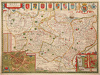
167680193The Theatre of the Empire of Great Britain. T Bassett & R Chiswell. 1676. A beautiful map of Kent based on the work of Philip Symonson. Insets of the cathedral cities of Canterbury and Rochester and seven coats of arms. Due to Kent's extensive coastline and proximity to France and the Netherlands it had unrivalled advantages for trade thus making its defence imperative. Dover Castle had long been a linchpin in the defence of the realm but most other castles in Kent were made redundant when a series of modern artillery forts like Deal and Walmer were constructed in the 1540's by Henry VIII. These were to protect the anchorage of the Downs which the Navy had recently taken to using. The adoption of other fleet-anchorages along the Thames and the Medway and the establishment of dockyards at Deptford and Woolwich by Henry VIII and at Chatham by Elizabeth I turned Kent into the best defended area in the kingdom throughout the Tudor and early Stuart periods. Copper engraving. Very good condition. Hand coloured. Sheet size: 395 x 510 mm. Mount size: 590 x 705 mm Nigel Nicolson A Tudor Atlas by John Speed unknown
16651785London: to be solde by Roger Rea ye Elder and younger at ye Golden Crosse in Cornhill against the Exchange 1665. 410 by 550mm. 16.25 by 21.75 inches. Double-page engraved map upper left and right margins skilfully repaired margins reinforced with japan paper. The map bears the imprint of Roger Rea the Elder and Younger. The Reas had purchased the rights to Speed's work from William Garrett in 1659 who had previously purchased them from the widow of William Humble in the same year. Skelton suggests that the father and son intended a new edition of the atlas for the Restoration of 1660. However the atlas would appear not to have been published until 1665. This is borne out by an advertisement in the Term Catalogue by the subsequent owners of the plates Thomas Bassett and Richard Chiswell in 1675: "Mr John Speed's. Geography of the Kingdoms of England Scotland and Ireland. together with his Prospect. all in one entire Volume hath been for seven Years past out of Print the greatest part of an Impression then newly Printed being destroyed by the late dreadful Fire 1666". This is borne out by the rarity of the Rea edition of the atlas. There is evidence that they planned an edition of 1666 as there are impressions of Sussex Buckingham and Derby with Rea's imprint which bear that date. Rea would later sell the plates to Bassett and Chiswell who would publish a new edition in 1676. to be solde by Roger Rea ye Elder and younger at ye Golden Crosse in Cornhill against the Exchange, unknown
164623408London: William Humble 1646. Other. In excellent condition. 381 by 505mm 15 by 20 inches. 381 by 505mm 15 by 20 inches. Copper engraving uncolored as published. William Humble unknown
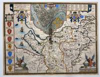
16162535London: John Speed and William Smyth 1616. Map Countye Palatine of Chester with that Most Ancient Citie Described; Hand-colored. circa 1616<br /> <br /> Hand colored map extracted from Countye Palatine of Chester Book one page 73 and 74 Chapter 37. Several modern archival repairs to verso plus an older repair at fold which has left 3 1/4-inch acid-burned strip which is obvious on verso but lesser so on recto but still evident. About 16 x 20.5 inches. Text to verso. Vibrant colors. Currently mounted to mat board. Good condition.<br /> <br /> County map of Cheshire with a large inset plan of the city of Chester at top center. The inset map is flanked by pairs of putti supporting strapwork armorial medallions. 'Arms of the Earles of Chester' along the left side of the map. Angels turning a large globe and holding an armorial shield in each of the lower corners. Includes several galleons and sea monsters. Medallion of Caesar near inset of Chester.<br /> <br /> Striking map. John Speed and William Smyth unknown
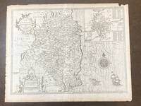
1676100280To be sold by Robert Chiswell in St. Paul's Churchyard and Thomas Basset in Fleetstreet 1676. Map. Very Good. Uncolored map of County Leinster 15 in. x 20.25 in. sheet is 17 in. x 22 in. with inset map 6 in. x 7 in. of Dublin with a 69-point key. The map is backed by pages 141/142 of an atlas presentation. Title and legend are decorated with two ornate cartouches a decorative compass rose and a full-masted sailing ship and sea-monster that cruise the Irish Sea. <br /> <br /> Map is dated 1610. The English text on the verso and the 3-line imprint Chiswell and Bassett below the distance scale indicate it is from the 1676 publication of Speed's "Theatre of the Empire of Great Britaine." On the map's backside page 141 describes the geography people and history of the County. Page 142 provides an alphabetized list all the towns and villages included on the map. <br /> <br /> Light tanning; rubbing and short closed tears along right and edges. Faint vertical fold line at center and faint horizontal fold line eight inches above bottom. One inch chip in margin at upper right corner. John Speed 1552-1629 began his career as a tailor with deep interests in history theology and cartography. The patronage of Sir Fulke Greville Lord Brooke 1554-1628 allowed him to give up his trade and dedicate himself to these interests. In terms of cartography he is especially known for an ambitious project to publish a series of maps of English counties called Theatre of the Empire of Great Britaine first published in 1611. Designed along the lines of Ortelius' Theatrum orbis terrarum Speed's Theatre was groundbreaking: it provided some of the first detailed maps of the Irish provinces as well as town plans for seventy-three English towns. Univ of Missouri Special Collections. To be sold by Robert Chiswell in St. Paul's Churchyard and Thomas Basset in Fleetstreet unknown
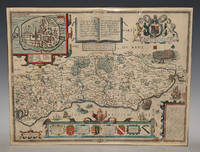
86954<p>Described by Iohn Norden. Augmented by I. Speede And are to be solde by G. Humble. Cum Privilegio 1627. Nice later hand-colouring. An attractive and decorative map with inset town plan of Chichester crests and elaborate coat of arms vignettes of galleons and sea-monsters there is a Civil War battle probably a skirmish at Haywards Heath and a representation of William the Conqueror's fleet arriving at Pevensey. In very good condition. Some slight darkening around edges and centre fold. Professional repair lower margin. Unframed. Large double sided map engraved surface 20.5 x 16 inches. The maps by John Speed are "the best known and most popular of all English county maps" Tooley. This is a very famous map engraved by Jodocus Hondius in 1610 and first published the following year in Speed's atlas 'The Theatre of the Empire of Great Britain'.</p> Described by Iohn Norden. Augmented by I. Speede, And are to be solde by G. Humble. Cum Privilegio 1627
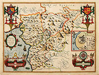
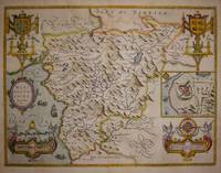
162764226London. c.1627. John Speed 1552-1629 is arguably the most famous name in early English cartography. In 1610 he published his wonderful and historic atlas 'The Theatre of Great Britain'. In 1627 he published another edition entitled 'A Prospect of The Most Famous Parts of The World' published in London by John Sudbury and George Humble. Speed based his maps on the earlier works done by Christopher Saxton and John Norden. His maps have always been keenly sought after as include many decorative features. Examples include: compass roses cherubs coats of arms mannerist style decoration prominent town plans calligraphy and well defined regional physical features. John Speed's maps proved so popular that they were issued for many years after his death. This example is of the Welsh county of Merionethshire. Size:420 x 545 mm. Copperplate engraving with later hand colour. Fair condition. Map has had repairs to lower centrefold and margin. General toning. unknown
16765646London: Basset & Chiswell 1676. Copper engraving 39 x 51.5 cms recent hand-colour inset town-plan of Harlech light waterstaining to the upper part of the map English text on verso. John Speed 1552-1629 is unquestionably the most significant English map-maker of the seventeenth-century. A brief note from Granger's Bibliographical History of England 1779 contains most of the information we have about Speed's life: "John Speed who was bred a Tailor was by the generosity of Sir Fulk Grevil his patron set free from a manual employment and enabled to pursue his studies to which he was strongly inclined by the bent of his genius. The fruits of them were his Theatre of Great Britain containing an entire set of maps of the counties drawn by himself his History of Great Britain richly adorned with seals coins & medals from the Cotton collection; and his Genealogies of Scripture first bound up with the Bible in 1611 which was the first edition of the present English translation. His maps were very justly esteemed & his History of Great Britain was in its kind incomparably more complete than all the histories of his predecessors put together ." The first edition of Speed's "Theatre" was published in 1612. It was the first atlas of the British Isles and the first attempt made by an Englishman to match the achievements of the great continental publishing houses - although much of the engraving of the copper plates was performed in Amsterdam by Jodocus Hondius. Speed was an antiquary and intended that his atlas should be read in conjunction with his history of Britain. He managed to include a great deal of historical detail on his 'modern' county maps and the inset town plans some surveyed by himself together comprise the first collection of town plans of the British Isles all in all making the Theatre a highly decorative as well as a useful volume. It was a great success and there were editions printed throughout the seventeenth-century. Map Basset & Chiswell unknown
87964Published by Bassett and Chiswell -The Theatre of the Empire of Great Britaine described by John Norden. 1676. Nice later hand-colouring. Considered to be the most decorative map of the county it includes views of St. Peter’s Westminster Abbey and St. Paul’s cathedrals In good condition. Some slight darkening around edges and centre fold. Professional repair ends of folds. Unframed. Large double sided map engraved surface 20.5 x 16 inches. Published by Bassett and Chiswell -The Theatre of the Empire of Great Britaine, described by John Norden. 1676 unknown
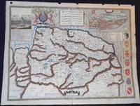
1627006728London: George Humble 1627. Map. Very Good. Are to be sold in popes head Alley by J. S. & G. H." "R. Elstrack sculpsit." 1 hand-colored copperplate engraving 41 x 55 cm. from Book One of John Speed's Theatre of the Empire of Great Britaine London: George Humble 1627. See: STC 2nd ed. 23042. A detailed map of Norfolk County with inset illustrations of a battle in the Peasant's Revolt in 1381 and of the town of Norwich. The town plan of Norwich includes a guide to 24 locations in the town. Above the map is the royal coat of arms of the United Kingdom; along one side are seven coats of arms of Norfolk families. text on the reverse describes Norfolk and lists the hundreds. In Very Good Condition: minor loss along upper edge not impacting image; just starting to separate at lower end of center fold; colors are bright; a clean and crisp map. George Humble unknown