John SpeedBiblio.com
136 résultats
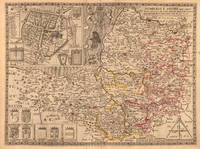
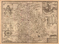
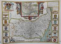
1625M8563London: John Speed c. 1625. Backed on acid free tissue paper for long term preservation central fold reinforced otherwise very good. Notes: A beautifully decorated and coloured map of Suffolk by historian and cartographer John Speed. This map of Suffolk is taken from “Theatre of the Empire of Great Britain†and shows the town plan of Ipswich in an inset at the top of the map. The Inset has the images of the Roman general Petillius Cerealis on the left and Boadicea on the right. The arms of the noble families of the county are also depicted on either side of this artistic map. <br><br>A description of the county of Suffolk is written on verso. Size : 400x545 mm 15.75x21.46 Inches Coloring: Hand Colored Category: Maps Europe United Kingdom England Counties; John Speed unknown
167653206The Theatre of the Empire of Great Britain. T Bassett & R Chiswell. 1676. A very attractive map of Suffolk with inset of Ipswich enclosed in an elegant border. On the right of this is a pictorial reference to Bodicia Queen of the Iceni who occupied the area today known as East Anglia. On the left stands a Roman General. Numerous coats of arms of the Dukes and Earles of Suffolk and Clare adorn either side. At the bottom left a cherub holds dividers over the scale on the right a cupid holds a wind rose. Copper engraving. Fine condition good margins but some slight offsetting. Mounted size: 72 x 60 cm. Hand coloured. Size: 51 x 38 cm. 20 x 15 inches. unknown
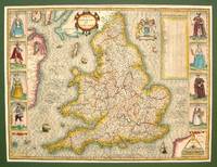
1614M7656London: Sudbury & Humble c.1614. Very Good some skillful reinforcement of the folds. Notes: StolenRare first state of the map. This handsome map from Speed's "Theatre of the Empire of Great Britaine" after Jodocus Hondius 1610 engraving was described by Christopher Saxton and augmented by John Speed in 1612. This striking map of England has along its side decorative costume figures and a detailed table of all the Shires and other important location of England. Size : 385x515 mm 15.16x20.28 Inches Coloring: Hand Colored Category: Maps Europe United Kingdom; Sudbury & Humble unknown
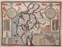
1616M8779London: John Sudbury & George Humble 1616. Good a few marginal tears upper left corner replaced not affecting the image. Reinforced with acid free tissue paper on the back of the margins. . Notes: StolenBeautiful map of Cumberland northern England showing mountains rivers and major towns with an inset of Carlisle armorials and a vignette of a battle scene.<br><br>John Speed 1552 –1629 was an English cartographer and historian. He is known as England's most famous Stuart period mapmaker. His maps of English counties are often found framed in homes throughout the United Kingdom.For a series of maps Speed partnered with Dutch engraver Jodocus Hondius. <br><br> Size : 384x507 mm 15.12x19.96 Inches Coloring: Original Hand Coloring Category: Maps Europe United Kingdom England; John Sudbury & George Humble unknown
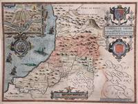
1616M8778London: John Sudbury & George Humble 1616. Good a few marginal tears restored margins reinforced with acid free tissue. . Notes: StolenBeautiful map of Cardigan Shyre in Wales drawn by John Speed and engraved by Jodocus Hondius showing its mountains major rivers forests and towns. Decorative inset shows plan of town of Cardigan. <br><br><br>John Speed 1552 –1629 was an English cartographer and historian. He is known as England's most famous Stuart period mapmaker. His maps of English counties are often found framed in homes throughout the United Kingdom.For a series of maps Speed partnered with Dutch engraver Jodocus Hondius. <br><br> Size : 383x510 mm 15.08x20.08 Inches Coloring: Original Hand Coloring Category: Maps Europe United Kingdom Wales; John Sudbury & George Humble unknown
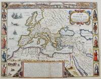
1651M8291London: Tho: Basset; Richard Chiswell c. 1651. Very Good. Notes: StolenHighly decorative map of the Roman Empire. Includes illustrations of ships and sea monsters as well as various animals placed in their native lands. <br>Includes a decorative cartouche on the upper right side and a brief historical description of the history of the Roman Empire at the bottom of the map. Illustrations of Rome Geneva Jerusalem Venice Constantinople and Alexandria as well as various native people in costumes are placed around the map. Size : 391x509 mm 15.40x20.05 Inches Coloring: Original Hand Coloring Category: Maps Mediterranean Sea; Maps Asia Near East Turkey; Maps Europe Continent; Maps Africa Continent; Tho: Basset; Richard Chiswell unknown
164623400London: William Humble 1646. Other. In excellent condition. 386 by 512mm 15¼ by 20¼ inches. 386 by 512mm 15¼ by 20¼ inches. Copper engraving uncolored as published. William Humble unknown
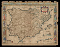
162621921<p>London: Are to be sold by Thomas Bassett in Fleet Street & Richard Chiswell in St. Pauls Churchyard 1626 but 1676. 415 by 540mm. 16.25 by 21.25 inches. Speed's map of Spain Double-page engraved map with hand-colour some wear to edges. A map of Spain from the 1676 edition of the first atlas compiled and published by an Englishman Speed's 'Prospect'. A decorative border along the top illustrates views of major cities including Granada and Barcelona and along each side there are depictions of figures in regional costume. The Balearics appear marked as the 'Pyne Ilands'. Accompanying text in English 'The Description of Spain' is printed on the reverse. John Speed 1552-1629 was the outstanding cartographer of his age. By trade a merchant tailor but by proclivity a historian it was the patronage of Sir Fulke Greville poet and statesman that allowed him to pursue this interest in earnest. His 'Theatre of Great Britain' first published in 1611 or 1612 was the first large-scale printed atlas of the British Isles. The 'Prospect of the Most Famous Parts of the World' from which the present work is drawn appeared in 1627 bound with the 'Theatre' and is the first world atlas compiled by an Englishman to be published in England. Engraved in Amsterdam many of the maps are anglicized versions of works by Dutch makers in distinctive carte-à-figure style featuring borders with figures in local costume and city views. This map is from the 1676 edition of the 'Prospect' published by Thomas Bassett and Richard Chiswell. While not as rare as the earlier publications this edition is perhaps the most important given that it is the first to include the nine new maps: among them Virginia and Maryland Barbados and Russia. It is also the last time that the 'Prospect' was printed as an atlas. Shirley Atlases T.SPE-2f.</p> Are to be sold by Thomas Bassett in Fleet Street & Richard Chiswell in St. Pauls Churchyard,
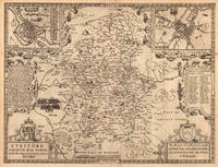
1610012725London 1610. No Binding. Good/No Jacket. Attractive hand coloring. Good. Creasing to middle Japanese paper repair to various tears yellowing to paper. Includes inset view of Bath Bathe and coats-of-arms in lower corners and sea colored blue with ships. From John Speed's Theatre of the Empire of Great Britaine. Anno 1610 in lower corner but a scarce reprint circa 1690 - 1695 by "Christopher Browne at the Globe near the West End of St. Paul's Church London <br/> <br/> unknown
164623404London: William Humble 1646. Other. In excellent condition. 378 by 507mm 15 by 20 inches. 378 by 507mm 15 by 20 inches. Copper engraving uncolored as published. William Humble unknown
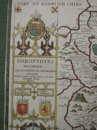
16767838Published by Thomas Bassett and Richard Chiswell Theatre of the Empire of Great Britain atlas 1676. no binding. copper engraved and hand coloured map from 'The Theatre of the Empire of Great Britaine' 386 x 516 mmelaborate cartouche with compass rose below inset bird's eye plan of Shrewsbury smaller inset with description of 'a great and bloody battaill was fought . Anno 1403 Battle of Shrewsbury .' with a small pictorial rendering of same; showing forests hills rivers including River Severne churches parkland; includes Part of Denbigh Shire Montgomery Shire Staffordshire etc; verso shows Hundreds in Shropshire and The Description of Shropshire Chapter XXXVII tight margins an attractive antique map suitable for mounting/framing. This is an original antique map. We do not sell reproductions or facsimiles Published by Thomas Bassett and Richard Chiswell, Theatre of the Empire of Great Britain atlas unknown
164623413London: William Humble 1646. Other. In excellent condition. 386 by 513mm 15¼ by 20¼ inches. 386 by 513mm 15¼ by 20¼ inches. Copper engraving uncolored as published. William Humble unknown
16275156London George Humble 1627. Copper engraving 8.7 x 12.3 cms recent hand-colour. Some light marginal soiling. English text on verso. From the first edition of the so-called minature Speed which used maps by van den Keere to illustrate a pocket edition of Speeds text and which Humble appears to have printed to coincide with editions of the larger atlas. Map unknown
1664GEN85841664. Howell James; Speed Samuel. First edition leather bound hardback; 16 219 1 pages. It is lacking the four plates but is otherwise ESTC R21017 complete the first leaf is a blank. The full calf binding has some wear and some marks and light staining it is sound. The endp apers are browning in the margins. The blank preliminary leaf and the title leaf have an owner's inscriptions. There are some marginal fingermarks and staining in places and some marginal pencil annotations. hardcover
16643551London: Rowland Reynolds. Very Good. 1664. First Edition. Rebacked with new endpapers; early twentieth century blind & gilt embossed spine over contemporary full ruled sheep. Fore edge corners renewed. Four full page engravings: incl. frontis of James Howell standing in a wood; his coat of arms to the left which seems to be borrowed form his 'Dendrologie' Paris1641; Charles II of Britain Louis XIV of France & Philip IV of Spain with chapters corresponding to each monarch.; Folio; Additional images and further information provided upon request. ; All shipments through USPS insured Priority Mail. . Rowland Reynolds
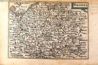
1646M11174London c.1646. Very Good. Notes: Miniature map of Poland with English text on verso.<br>Pieter van den Keere Latin: Petrus Kaerius 1571 – c.1646 was a Flemish engraver publisher and globe maker who worked for the most part of his career in England and the Dutch Republic. Size : 86x122 mm 3.39x4.80 Inches Coloring: Original Hand Coloring Category: Maps Europe Poland Lithuania; unknown
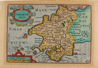
1627M9234London: George Humble c.1627. Very Good. Notes: A charming map of Pembrokeshire county in Wales during the early 17th century. English text on verso. Size : 85x121 mm 3.35x4.76 Inches Coloring: Hand Colored Category: Maps Europe United Kingdom Wales; George Humble unknown
16275154London George Humble 1627. Copper engraving 8.7 x 12.3 cms recent hand-colour. Trivial soiling. English text on verso. From the first edition of the so-called minature Speed which used maps by van den Keere to illustrate a pocket edition of Speeds text and which Humble appears to have printed to coincide with editions of the larger atlas. Map unknown
162764885London. 1627. A handsome early Sudbury and Humble edition of John Speed's map of Oxfordshire in colour. Towns and cities are highlighted in red decorative college arms and the supposed years of their foundation are found on either side of the map. A detailed inset map of the city of Oxford is in the upper right corner with a separate key with 28 listed city landmarks. The arms of the earl of Oxford to the right. Two academic university figures are seen standing with a pair of compass dividers either side of a striking globe representing the scale of miles. A strapwork border design and the royal coat of arms complete this map wonderfully well. Size: 395 x 535 mm. Copperplate engraving with later hand colouring. Fair condition. Some old repairs to lower central fold. Slight discolouration to the central fold. unknown
164623409London: William Humble 1646. Other. In excellent condition. 383 by 507mm 15 by 20 inches. Copper engraving uncolored as published. William Humble unknown
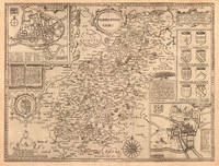
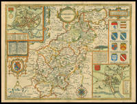
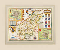
162711770London: Performed by Iohn Speede and are to be sold by George Humble in ye Popes head alley 1627. 380 by 510mm. 15 by 20 inches. Engraved map with hand colouring. A beautifully coloured map of Northamptonshire with inset maps of Northampton and Peterborough and a vignette with text of the Battle of Edgecote Moor where Richard Neville Duke of Warwick defeated Edward IV during the Wars of the Roses. John Speed 1552-1629 was the outstanding cartographer of his age. His 'Theatre of Great Britain' was the first atlas of the British Isles: Speed prepared the maps himself about two years before they were published. His maps and books dominated the seventeenth-century English market. The present map is taken from the 1627 English edition published by George Humble. Chubb XXV. Performed by Iohn Speede and are to be sold by George Humble in ye Popes head alley, unknown
162757317Theatre of the Empire of Great Britain published by Bassett and Chiswell. c.1627. A highly decorative Speed's map with coats of arms of all the families that were made earls of Northampton following the Norman conquest. Insets showing a townplan of Northampton with related text and plan of Peterborough and a vignette of the Battle of Egdecot in 1469 together with a section of text First published in 1611 today the work of John Speed is regarded highly by map collectors historians and artists due to the intricate nature and artistic beauty of the maps. Copper engraving. Fine condition; wide margins. Mounted size: 71.5 x 60 cm Hand coloured. Size: 51 x 38.5 cm. 20 x 15 inches unknown
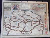
1627006728London: George Humble 1627. Map. Very Good. Are to be sold in popes head Alley by J. S. & G. H." "R. Elstrack sculpsit." 1 hand-colored copperplate engraving 41 x 55 cm. from Book One of John Speed's Theatre of the Empire of Great Britaine London: George Humble 1627. See: STC 2nd ed. 23042. A detailed map of Norfolk County with inset illustrations of a battle in the Peasant's Revolt in 1381 and of the town of Norwich. The town plan of Norwich includes a guide to 24 locations in the town. Above the map is the royal coat of arms of the United Kingdom; along one side are seven coats of arms of Norfolk families. text on the reverse describes Norfolk and lists the hundreds. In Very Good Condition: minor loss along upper edge not impacting image; just starting to separate at lower end of center fold; colors are bright; a clean and crisp map. George Humble unknown
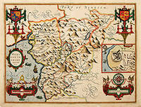
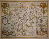
162764226London. c.1627. John Speed 1552-1629 is arguably the most famous name in early English cartography. In 1610 he published his wonderful and historic atlas 'The Theatre of Great Britain'. In 1627 he published another edition entitled 'A Prospect of The Most Famous Parts of The World' published in London by John Sudbury and George Humble. Speed based his maps on the earlier works done by Christopher Saxton and John Norden. His maps have always been keenly sought after as include many decorative features. Examples include: compass roses cherubs coats of arms mannerist style decoration prominent town plans calligraphy and well defined regional physical features. John Speed's maps proved so popular that they were issued for many years after his death. This example is of the Welsh county of Merionethshire. Size:420 x 545 mm. Copperplate engraving with later hand colour. Fair condition. Map has had repairs to lower centrefold and margin. General toning. unknown
16765646London: Basset & Chiswell 1676. Copper engraving 39 x 51.5 cms recent hand-colour inset town-plan of Harlech light waterstaining to the upper part of the map English text on verso. John Speed 1552-1629 is unquestionably the most significant English map-maker of the seventeenth-century. A brief note from Granger's Bibliographical History of England 1779 contains most of the information we have about Speed's life: "John Speed who was bred a Tailor was by the generosity of Sir Fulk Grevil his patron set free from a manual employment and enabled to pursue his studies to which he was strongly inclined by the bent of his genius. The fruits of them were his Theatre of Great Britain containing an entire set of maps of the counties drawn by himself his History of Great Britain richly adorned with seals coins & medals from the Cotton collection; and his Genealogies of Scripture first bound up with the Bible in 1611 which was the first edition of the present English translation. His maps were very justly esteemed & his History of Great Britain was in its kind incomparably more complete than all the histories of his predecessors put together ." The first edition of Speed's "Theatre" was published in 1612. It was the first atlas of the British Isles and the first attempt made by an Englishman to match the achievements of the great continental publishing houses - although much of the engraving of the copper plates was performed in Amsterdam by Jodocus Hondius. Speed was an antiquary and intended that his atlas should be read in conjunction with his history of Britain. He managed to include a great deal of historical detail on his 'modern' county maps and the inset town plans some surveyed by himself together comprise the first collection of town plans of the British Isles all in all making the Theatre a highly decorative as well as a useful volume. It was a great success and there were editions printed throughout the seventeenth-century. Map Basset & Chiswell unknown