Allgemeine GeologieBiblio.com

288 résultats
0366661515.Gpaperback. Good. Access codes and supplements are not guaranteed with used items. May be an ex-library book. paperback
ria9781138138292_inpHardcover. New. New Book; Fast Shipping from UK; Not signed; Not First Edition; A text which aims to help undergraduate students in geology to recognize and interpret metamorphic textures and microstructures in thin-section. For lecturers and postgraduates in geology and petrology the book provides reference for t hardcover
183759116Paris Bachelier 1837. 4to. Without wrappers. In "Comptes rendus hebdomadaires des séances de l’Académie des sciences" Vol. 5 No 14. Pp. 491- 514. Entire issue offered. Agassiz's paper: pp. 506-508. <br/><br/><em>First printing in France of Agassiz' founding paper - starting the the study of ancient glaciation - in glaciology in which he outlines his thesis that there was an earlier geological period with widespread ice-age conditions extending from the North Pole to the Mediterranean and Caspian Seas. he concluded that the Alpine ice now restricted to the higher valleys once extended into the central plain crossed it and even mounted to the southern summits of the Jura chain. Agassiz here adopts the term "ice age" coined in 1836 by Karl Schimper as 'Eiszeit'. Agassiz submitted the offered paper to the French Academy after he in his opening address as President of the Swiss Society of Natural History in 1837 its Séance July 1837 in his famous "Discourse at Neuchatel" gave an exposition of the evidence of glaciation. The paper offered is his own but briefer exposition of the famous address to the Swiss Society.Parkinson "Breakthroughs" 1837 G. </em> unknown
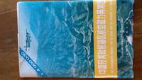
19894724Beijing: China Cartographic Publishing House 1989. Book. Very Good. Soft cover. One very large folding sheet plus softcover book: "Technical description for the 1 : 400 000 The Aeromagnetic Anomaly Map of China and the Adjacent Sea Areas." In coloured paper envelope. China Cartographic Publishing House Paperback
1527767833.Gpaperback. Good. Access codes and supplements are not guaranteed with used items. May be an ex-library book. paperback
1527811832.Gpaperback. Good. Access codes and supplements are not guaranteed with used items. May be an ex-library book. paperback
1330366336.Gpaperback. Good. Access codes and supplements are not guaranteed with used items. May be an ex-library book. paperback
1330287363.Gpaperback. Good. Access codes and supplements are not guaranteed with used items. May be an ex-library book. paperback
1334478279.Gpaperback. Good. Access codes and supplements are not guaranteed with used items. May be an ex-library book. paperback
1330096592.Gpaperback. Good. Access codes and supplements are not guaranteed with used items. May be an ex-library book. paperback
1334477353.Gpaperback. Good. Access codes and supplements are not guaranteed with used items. May be an ex-library book. paperback
1527872793.Gpaperback. Good. Access codes and supplements are not guaranteed with used items. May be an ex-library book. paperback
1330235479.Gpaperback. Good. Access codes and supplements are not guaranteed with used items. May be an ex-library book. paperback
24521Mostly relating to the San Francisco Bay Area of California but also to other parts of the state. Between 1912 and 1950. The two volumes contain a total of 239pp. 12mo in ink and pencil with entries dating from between 29 November 1912 and 28 March 1950. In fair overall condition with light signs of age and wear. In two Keuffel & Esser notebooks each in remains of brown calf binding the first with 'MINING TRANSIT BOOK 363' stamped on front cover and the second with 'Cross Section Book 375 S'. In manuscript on cover of first volume: '19<.> Dec. The Psilomelane D<eposits> of the Francis<can> <.> by Don <.> Under Prof. A. C. L<awson> <.>'. The two volumes mainly consist of rough notes statistics and diagrams - on samples deposits assay returns extracts surface workings stadia shots - relating to geological and mineralogical surveys mostly in California. The first volume dates from between 29 November 1912 Fort Baker and 23 January 1917 Latouche and contains doctoral work by the author while a geology student under Professor A. C. Lawson the identifier and namer of the San Andreas Fault at the University of California Berkeley. Named colleagues in some of these surveys are A. R. Whitman and E. F. Davis the latter at the time engaged in what was still considered in 1984 as 'some of the most cogently argued evenly balanced and thoroughly researched work' on Franciscan geology M. C. Blake ed. 'Franciscan Geology of Northern California'. The second volume contains entries written between 5 September 1917 Hayden Hill and 28 March 1950 Yuba Gravel Range Nevada County. Towards the end of the second volume is a page dated 15 March 1950 and headed 'Work in Court House until 10 AM' perhaps suggesting that the author was by that time employed as a California state geologist a section of the same volume relating to the Decanso Mine seems to indicate that he was also working as a consultant. The first volume relates exclusively to California and mostly to the San Francisco Bay Area with entries on Fort Baker Marin County; the Robert Friggel Ranch in Livermore Alameda County; the Lucky Star Mine in Hayden Hill Lassen County; and Red Rock Island. Other places surveyed in the first volume are: 'Tesla-Carnegie' in San Joaquin County the Hess Mine in Imperial County and 'Latouche'. The second volume contains more information relating to the Lucky Star and Hess mines but mostly concerns: the Descanso Mine San Diego County; 'Laceiba' La Ceiba Honduras; Little Colorado; 'Cameron Mine' Deer Lodge Montana; Donner Mine 'North Star Consolidated quartz mine' in Placer County; Arctic Mine in Canyon Creek Nevada County; 'Sheba' Queen of Sheba Mine Inyo County; 'Gray Eagle Vein' Arizona; and Yuba Gravel Range Nevada County. VOLUME ONE: 93pp. The first page carries an index with the following entries: 'Ft Baker'; 'Livermore' in text: 'Friggels Ranch Livermore Calif'; 'Red Rock' 'Red Rock Island'; 'Conn Valley' 'Conn Valley deposit'; 'Conn Valley. October 18-19 1913. With Davis; E. F.'; 'Challenger report abstract'; 'Davis' Abstract' 'E. F. Davis's Report'; 'Assay Returns'; 'Tesla-Carnegie'; 'Extracts' and 'Lucky Star Mine' 'January 8th '15 Hayden Hill Lucky Star Mine Sampling'. Headings in text relate to 'Hess Mine' and 'Latouche'. One of the pages relating to Red Rock Island is headed: 'March 22 1913 with Davis & Whitman Same voyage. windy & cold'. And one of those on Fort Baker dated 12 October 1913 has: 'with "<Corey Cosey>". K. Campbell.' Another page is headed: 'Conn Valley. October 18-19 1913. With Davis; E. F.' VOLUME TWO: 146pp. First page headed: 'Hayden Hill Sept 5 1917'. Eleven pages on the Descanso Mine California dated 19 September 1931 include sections headed 'Water' 'Assays' 'Terms' 'Crosby's Terms' and 'History'. There are four pages of diagrams of Donner as 'Doner' Mine Place County and thirteen pages of diagrams of the survey area of Yuba Gravel Range Nevada County. An entry dated 25 March 1950 on 'Yuba Gravel Range Stadia Shots' is followed by one three days later on 'East Rim Survey Stadia'. The volume also contains: a seven-page account dated 9 and 10 August 1929 regarding a journey through San Lorenzo and Lagunillas Venezula to La Ceiba Honduras; several pages in small black print the first headed 'Arrival at Eucalyptus'; three pages of 'Notes on Coca: Authority: History of Coca by W. Golden Mortimer'. His "Challenger Report Abstract" HMS Challenger sprawls over twelve pages. Mostly relating to the San Francisco Bay Area of California, but also to other parts of the state. Between 1912 and 1950. unknown
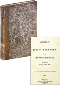
182346664Baltimore: N.G. Maxwell 1823. First Edition. 12mo 18.5cm.; calf-backed marbled boards gilt-lettered spine; xv214-211pp. Boards a bit scuffed with brief exposure at corners leather somewhat dried and mottled endpapers toned faint dampstaining to first half of textblock else a Very Good sound copy. Theory on the formation of the earth dedicated to Andrew Jackson. Early chapters cover general natural phenomena such as "strata" and "The various colours of Marble" while the latter half of the text focuses on the North American continent describing "A Flood that was produced by the rise of northeast rise of North America" the formation of the Delaware Schuylkill and Susquehanna Rivers; the formation of the North American prairies; and the "Insects Vegetation &c. of America." The author later published another work titled "Antiquities of America Explained" 1831 arguing that a group of Tyrians and Jews crossed the Atlantic 3000 years ago creating a colony in Nova Scotia that eventually spread across the entire continent. This title missed by Sabin. SHOEMAKER 12827. N.G. Maxwell unknown
184254245Albany: W. & A. White & J. Visscher 1842. First Edition. First printing. Quarto 30cm. In original publisher's cloth signed binding by Warner & Boynton of New York stamped in gold and blind with crinoid and trilobite ornaments in gilt to front board and base of spine; yellow coated endpapers; errata at rear; 2 1-5 6-306 2 pp; engraved series title page and 80 in-text wood engravings. One volume from a longer series. A sound and fresh copy with some gentle wear to joints head and tail; boards bumped and rubbed; heavy foxing to engraved series title and occasional light foxing throughout: Very Good. <br /> <br /> Vanuxem initiated certain practices adopted by other geological surveys including "anchoring rock units to specific type localities" and dating strata "on the basis of fossils" ANB. This volume was part of a larger geological survey which in turn was part of a series on the Natural History of New York. The Third Geological District here included the counties of Montgomery Fulton Otsego Herkimer Oneida Lewis Oswego Madison Onondaga Cayuga Cortland Chenango Broome Tioga and eastern Tompkins County. HAZEN & HAZEN 10589. SABIN 53782. W. & A. White & J. Visscher unknown
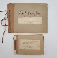
1898693921898. Two odd volumes of Geological Society of America photo books. Small oblong quarto 20 cm x 27 cm; Oblong duodecimo 13 cm x 18 cm. <br /> <br /> First book: Cover title and seven photographs on 1/4 brown cloth with gray card boards held together with a string tie binding. In calligraphy on the front board: "G. S. A. Photographs." The photographs measure 16.5 cm wide x 11.5 cm tall. Caption titles on paper strips mounted below the photographs. Numbers on small strips mounted in top fore-edge corners. With the following photographs present: 495- "28. Terraces of Tertiary Lake Beds near Salmon City Idaho on the Lemhi River."; 496- "29. Terraces of Tertiary Lake Beds on Lemhi River near Salmon City Idaho."; 497- "30. Old Gold diggings - work 1859-65. Leesburg Idaho on Napias Creek."; 498- "32. Rocky cut for sluice California Bar Idaho."; 499- "33. Discharge sluice California Bar Idaho."; 500- "31. Hydraulic Mining at California Bar Idaho."; 501- "No. Basal Cambrian sandstones of section at mouth of Two-mile Canyon 2 miles south of Malad City Idaho 562 C.D.W. 1898." Condition: Very good. Light wear and waviness to boards. Numerical notations crossed out in top fore-edge corners.<br /> <br /> Second book: Thirty-seven linen-backed photographs mounted between gray card boards with 1/4 brown cloth. Front board completely detached but present. The photographs measure 16.5 cm wide x 11.5 cm tall. With typed titles and some notations in pencil/pen on the reverse. Numbers mounted in the top fore-edge corners of the photographs. With the following photographs present: 747- "Shore of lake Ontario Niagara county New York. Illustrated mode of origin of beach shingle by showing rock in place and rocks recently detached."; 748- "Beach of flat shingle. Shore of lake Ontario at Golden Hill Creek New York." 749- "Beach of well rounded shingle. Shore of lake Ontario at Golden Hill Creek New York."; 750- "Cemented shingle in spit of glacial lake Iroquois at Lewiston New York."; 751- "Section of spit of glacial lake Iroquois at Lewiston N.Y. The dip is landward indicating growth on the inside of the spit."; 752- "Section of spit of glacial lake Iroquois at Lewiston. The dip is landward indicating growth on inside of spit." 753- "Cut terrace of the Iroquois shore line 2 miles west of Dickensonville N.Y. Lacustrine plain bed of lake Iroquois near Jeddo N.Y. The water edge was at base of cliff. The cliff is carved from Medina shale."; 754- "Till plain 1/2 mile south of Jedoo Niagara county N.Y."; 755- "Cross bedding and unconformity in sand kame 3 miles east of Lockport N.Y."; 756- "Till Shore of lake Ontario Wilson N.Y."; 757- "Deposit by torrent of Erian water on the withdrawal of the ice sheet from the escarpment at Lewiston N.Y. Unassorted and unworn alluvi."; 758- "Section of talus Niagara gorge."; 759- "Angular gravel in kame south of Royalton Niagara county N. Y."; 760- "Solitary gravel kame 3 miles south of Middleport N. Y."; 761- Escarpment of the Niagara limestone; looking west from a point on the talus near Lewiston N.Y."; 762- "Niagara escarpment capped by niagara limestone; looking east from a point 5 miles west of Lockport N.Y."; 763- "Niagara escerpment sic without capping of Niagara limestone; looking west from a point near Middleport New York."; 764- "Drowned valley of Twelve-mile creek Niagara county N.Y. near Wilson. Water lilies grow on submerged alluvial plain."; 765- "Head of estuary of Twelve-mile creek Niagara county N.Y. Submerged alluvial plain supports rushes."; 766- "Estuary of Eighteen-mile creek near Olcott Niagara county N.Y. Channel deep current slow. Submerged alluvial plain supports rushes."; 767- "Valley of Eighteen-mile creek Niagara county N.Y. above head of estuary. Channel shallow current rapid; alluvial plain supports rushes."; 768- "Post-Glacial anticline Hopkins creek Niagara county N.Y. The displacement of the rocks is accompanied by a superficial ridge traversing an alluvial terrace." 769- "Section of Niagara limestone Cooks quarry near La Salle Niagara county N.Y. Shows structure described by James Hall Geology of 4th district N.Y. pages 93 and 94."; 770- "Section in cut of Erie Railroad Niagara falls N.Y. Shows structure described by James Hall Geology of the 4th district N.Y. pages 93 and 94."; 771- "Weathering of Niagara limestone by solution. A joint face exposed in quarrying southwest of Middleport N.Y."; 772- "Weathering of Niagara limestone by solution; old quarry southwest of Middleport N.Y."; 773- "Unconformity by erosion. Sandstones and shales of the Medina format Niagara gorge."; 774- "Isolated limestone mass at base of Niagara shale containing 'transition fauna' of Ringueberg."; 775- Section of ripplemark on Medina sandstone Lockport N.Y. From crest to crest 23 feet; depth of trough 29 inches.";776- "Flagstone in court-house yard Elyria Ohio. Shows reticulated ripplemarks."; 777- "Trough of large ripplemark in Medina sandstone Niagara gorge N.Y."; 778- "Crest of large ripplemark in Medina sandstone quarry near Lewiston N.Y."; 779- "Crest of large ripple-mark in Medina sandstone. Quarry in Lockport N.Y."; 780- "Diverse cross-bedding associated with large ripplemarks in Medina sandstone. Quarry near Lewiston N.Y."; 781- "Quarry dace in Medina sandstone Lockport N.Y."; 782- "Quarry face in Niagara limestone Lockport N.Y. The joint face shows weather fracture."; 783- Shore of lake Ontario at Wilson N.Y. Train of shore drift from right being arrested by bew-pin begins to accumulate and partly protects bluff from wave attack. Dearth of shore drift under lee of pier fevors wave attack; bluff eaten back 45 feet. Bluff contains two tills and cover of laminated clay a deposit from lake Iroquois. Boulder pavement at top of lower till indicated by arrow." Condition: Good only due to the detached cover. The photographs are in very good condition. Two photo books with forty-four photographs extremely well identified with detailed captions containing the geological characteristics of the wide variety of locations and with the numbers of Gilbert's negatives clearly listed. It could be that these images appeared or were intended to appear in USGS publications.<br /> <br /> The Geological Society of America GSA was founded in 1888. It is a global scientific society with members from academia government and industry in over one hundred countries. The aim of the GSA is to support the professional growth of geoscientists and encourage cooperative research among earth life planetary and social scientists foster public dialogue on geoscience issues and promote the geosciences in the service of humankind.<br /> <br /> James Furman Kemp 1859-1926 was mostly known for his work in igneous petrology and on the origin of ore deposits. He served as the President of the Geological Society of America in 1921. Charles Doolittle Walcott 1850-1927 was the third director of the U.S. Geological Survey the fourth Secretary of the Smithsonian Institution and a contributor to the "Bulletin of the Geological Society of America."<br /> <br /> The lion's share of the photographs are reproduced from the negatives of U.S. explorer geographer and geologist Grove Karl Gilbert 1843-1918 whose life spanned an age of heroic geology and who was one of the founders of modern geomorphology the study of landforms. He helped launch the U.S. Geological Survey USGS and was its chief geologist under the famed explorer and second USGS director John Wesley Powell. In addition Gilbert was a founding member of the National Geographic Society as well as president twice of the Geological Society of America. Gilbert was first exposed to the American West when he participated in the Wheeler Survey one of the four great surveys of the American West headed by George Wheeler Clarence King Ferdinand Vandeveer Hayden and Powell. Gilbert's monumental works were "Report on the Geology of the Henry Mountains" 1877 and "Lake Bonneville - Department of the Interior Monographs of the United States Geological Survey Volume 1" 1890. He is credited with naming ancient Lake Bonneville whose raised shorelines he used to demonstrate crustal isostasy.<br /> <br /> "Gilbert had a knack for harnessing the geography of the land in the cause of something greater: extraction of knowledge about the processes at work." - R. S. Anderson https://eos.org/features/reflections-on-the-legacy-of-grove-karl-gilbert-1843-1918.<br /> <br /> A collection featuring the investigative research of three prominent U.S. geologists who were the top field geologists of their time. A spectacular portrait of late nineteenth century / early twentieth century field geology. unknown
1937347621937. Hardcover. Very good. Quartos. 5 volumes of 134 collected writings with typed table of content pages half title pages and occasional additional type script. Volume one is bound in drab green cloth with leather title label on the spine. Volumes II III IV and V are bound in three quarter Moroccan leather with marbled paper covered boards. Raised bands and gilt lettered title labels on the spines. Top edges gilt. Marbled end papers for volumes 2-5. Leather is rubbed and scuffed on the edges spines and raised bands. <br /> <br /> A variety of the pamphlets are illustrated. In volume 1 is an inscription from father to son - "To my son Wallace Jr. with my most sincere good wishes and affection signed Wallace W Atwood June 7 1928." This collection is one of a kind and possibly compiled by Wallace Atwood himself. Atwood's writings are taken from government publications and articles from scientific journals and magazines. Most of the works are bound in the volumes with their original covers. Some articles were taken in part from magazines. Other articles are pasted down on the pages. Occasional hand written information in the volumes. A very nice display of the Professor's works. <br /> <br /> A list of the works are recorded in the typed table of contents for each volume. A complete list for volumes 1 and 2 are provided in this description for examples of the Professor's works in the variety of publications. The entire list of papers for the remaining 3 volumes is not provided. <br /> <br /> Volume I 1900-1910<br /> <br /> Contains 6 of 11 pamphlets listed in the contents the 5 missing pamphlets are noted as "missing" in the typed contents thus these dated writings were never bound in the volume:<br /> <br /> 1. The Geography of the Region About Devil's Lake and the Dalles of the Wisconsin. Wisconsin Geological and Natural History Survey Bulletin 5. No. 1 1900. 151 pages. Illustrated with 38 plates 47 figures. Original printed covers included;<br /> 2. Glaciation of San Francisco Mountain Arizona. Reprinted from the Journal of Geology April-May 1905. Printed by University of Chicago Press. Pages 276-279;<br /> 3. Red Mountain Arizona. Journal of Geology Vol. 14 1906 Missing;<br /> 4. Glaciation of the Unita Mountains. Journal of Geology Vol. 15 1907 Missing;<br /> 5. Lakes of the Unita Mountains. Reprinted from Bulletin of the American Geographical Society January 1908. 6 pages. Illustrated. Original covers present;<br /> 6. Geologic Studies in the Alaska Peninsula Abstract. Bulletin of the Geological Society of America Vol. 20 1908. 1 page;<br /> 7. Alaska and its Wealth Missing "The World Today" June 1908;<br /> 8. Physical Geography of the Evanston-Waukegan Region Missing. Illinois State Geological Survey Bulletin No. 7 University of Illinois 1908;<br /> 9. Mineral Resources of Alaska. Report on Progress of Investigations in 1908. C--Prince William Sound Kenzai Peninsula Southwestern Alaska. United States Geological Survey Bulletin 379-C 1909. Pages 87-152. Illustrated. Original covers present;<br /> 10. Physical Geography and Geology. Educational Department Keystone View Company 1910. 28 pages plus extra catalogs pages;<br /> 11. Prospecting in Alaska Missing. University of Chicago Magazine December 1910;<br /> Additional typed manuscript inside a pocket folder on the rear paste down includes biographical material concerning Dr. Wallace W. Atwood President of Clark University; published papers to January 1 1924. <br /> <br /> Volume II 1911-1920<br /> <br /> Contains 17 of 19 listed papers. The two "missing" papers in the table of contents have a hand corrected mark through with a written note "See Supp. Vol. 1". Note: Supplement for Volume I is NOT PRESENT. <br /> 1. Geology and Mineral Resources of Parts of the Alaskan Peninsula. USGS Survey Bulletin 467 1911. 137 pages. Illustrated fold-outs. Original covers present with an inscription by Atwood written top of the front cover. <br /> 2. The First Year Science Course in High School. The School Review February 1911. Pages 119-123.<br /> 3. Physiographic Studies on the South Slope of the San Juan Mountains Colorado. Journal of the Washington Academy of Sciences July 1911. 1 page;<br /> 4. Physiographic Studies in the San Juan District of Colorado Missing. Journal of Geology July 1911;<br /> 5. The Evidence of Three Distinct Glacial Epochs in the Pleistocene History of the San Juan Mountains Colorado. The Journal of Geology July-August 1912. Pages 385-409. Illustrated. Original covers present;<br /> 6. Some Triassic Fossils from Southeastern Alaska Missing. Journal of Geology Oct-Nov. 1912;<br /> 7. The Atwood Celestial Sphere. Bulletin of the Chicago Academy of Sciences May 1913. 38 pages. Illustrated. Original covers present;<br /> 8. A New Way of Studying Astronomy - The Atwood Celestial Sphere. Scientific American June 1913. Clipped article placed inside pocket folder;<br /> 9. Bringing the Stars to Earth. Technical World Mag. July 1913. A clipped section of the magazine. Article by Richard Morrison who writes of Atwoods Sphere with illustrations of Atwood and others;<br /> 10. Geographic History of the San Juan Mountains since the Close of the Mesozoic Era. Proceedings National Academy of Sciences March. 1916. Pages 177-181;<br /> 11. Saving the Silts of the Mississippi River. Bulletin of the Geological Society of America 1916. Pages 149-50;<br /> 12. The Physiographic Conditions at Butte Montana and Bingham Canyon Uta when Copper Ores in These Districts were Enriched. A Shaler Memorial Investigation reprinted from Economic Geology December 1916. Pages 697-740. Numerous photographs illustrations. Folding panorama view. Original covers present;<br /> 13. Another Locality of Eocene Glaciation in Southern Colorado. The Journal of Geology Oct-Nov. 1917. Pages 783-686. Original covers present;<br /> 14. Relation of landslides and Glacial Deposits to Reservoir Sites in the San Juan Mountains Colorado. USGS Survey 685 1918. 38 pages. Illustrated. Original covers present;<br /> 15. Geography in America. Reprinted from the Geographical Review January 1919. 8 pages;<br /> 16. First Steps in the Study of Geography. Visual Education Magazine Vol. 1 No. 1 January 1920. Pages 17-24. Not all pages bound in but the original covers were;<br /> 17. The New Meaning of Geography in American Education. Also appeared in School and Society February 1921. Address before the meeting of the Rochester City Teachers' Association February 6 1920. 16 pages;<br /> 18. Habitat Groups in the Teaching of Geography. Visual Education Magazine May 1920. Pages 29-36. Illustrated. Not a complete issue but both covers bound in;<br /> 19. The Regional Treatment of Geography. Also appeared in School Century December 1920. Visual Education Magazine June 1920. Pages 15-17. Not a complete issue but both covers bound in.<br /> <br /> Volume III 1921-1930<br /> <br /> Contains 34 papers all present. The first paper is titled "The Inauguration of Wallace Walter Atwood As President of Clark University February 1 1921. Worcester Mass. Mr. Atwoods inaugural has 71 pages. Both covers present. Contents also include articles on teaching geography to children elements of Social Studies more San Juan scientific papers and an article titled "In the Background of the Turmoil in China."<br /> <br /> Volume IV 1931-1933<br /> <br /> Contains 33 papers all present. Subjects include Nominations of Officers. Association of American Universities; The New Ph.D. Degrees in Great Britain and France; The High Sierra and the Redwood Highway Sierra Club Bulletin 1933; How the specialized Motion Picture is Developed; Dr. Attwood addresses; National Parks; an article on Ellen Chuchill Semple 1863-1932; and more. Some of the articles are cut out and pasted down on paper. <br /> <br /> Volume V 1934-1937<br /> <br /> Contains 43 numbers all present. Contents include 3 titles covering the Ancient Mayan Civilization; Guides versus Teachers; Humanity Among the Faculty; the Pan American Institute of Geography and History; the Students of Clark; association and meeting presentations; some scientific articles and more. William Walter Atwood 1872-1949 studied geology at the University of Chicago and graduated there in 1897. He earned is Pd.D. in 1903 and was Associate Professor of Geology until 1913. Atwood later became Professor of Physiography at Harvard 1913-1920. In 1921 Atwood was elected President of Clark University in Worceser in 1920 and began his term in February 1921. Clark University currently has a large collection of Wallace Walter Atwood papers. hardcover
19257766Charlottesville: University of Virginia 1925. First Edition. Original printed wrappers softcover as issued; 322pp; 27 illustrations from photographs; 30 text figures. Ownership markings; moderate wear/soil to covers; internally clean and unmarked; Very Good. A publication of the Virginia Geological Survey prepared in Co-Operation with the United States Geological Survey and the Virginia Office of State Forests. University of Virginia unknown
18839696Staunton VA: Printed by S. M. Yost & Son for Jed Hotchkiss 1883. Hard Cover. Good binding. Quarto. xi 1 196 192; 6 196; 1 iii 196 pp. maps illus. First edition. Volume 1 & 2 bound together in library buckram; Volume 3 in marbled boards with modern bonded leather spine and corners; Volume 4 in library buckram. Volume II is lacking volume title page and index. All volumes trimmed some closer than others. Ex-library with typical markings; bindings are a trifle worn but sturdy; contents are a bit brittle with some closed tears to the folds of the maps a couple of maps have cleanly separated along those tears; occasional early tape repairs to a few leaves and a few maps. Rogers’s geological map is quite crisp and bright. Relatively well-preserved volumes from this landmark publication. <br /> <br /> An important periodical that ran from 1880 through Volume VI 1885 before being merged into the Industrial South. Jedediah Hotchkiss the editor and publisher is perhaps most remembered as the staff officer of Stonewall Jackson and employed his topographical and cartographical skills to the great benefit of Jackson during the Civil War. After the war Hotchkiss established himself in Staunton VA as a consulting engineer and geologist among other endeavors eventually editing and publishing this present periodical. Given the wealth of information related to natural resources it's easy to imagine that these efforts brought significant funding into the commonwealth at a time it was greatly needed. <br /> <br /> While there are contributions by most significant geologists of the day as well as maps and sections by Hotchkiss J. Peter Lesley James P. Kimball R. O. Currey John L. Campell and others. But certainly the most notable inclusions is William Barton Rogers’s 1841 geological map of Virginia. This first systematic geological survey of Virginia began in 1835 when Rogers a recognized expert was engaged by the Virginia General Assembly to undertake the task. The manuscript of the map was largely complete when funding for the project was cut off in 1841. This map languished for decades until a version of it Marcou 592 was published in Virginia: A Geographical and Political Summary. Hotchkiss a friend and colleague of Rogers further added to the map and issued it in Vol. I No. 6 of The Virginias 1880. Of this map E. M. Sanchez-Saavedra writes: "The geological map of Virginia is modest in appearance but it contains more information than first meets the eye. Its topography was based on the 1827 Boye nine-sheet map altered to emphasize natural drainage and erosion patterns. The large patches of color representing different formations were the result of Rogers's years in the field—digging climbing and analyzing rock strata." Finally noting that this color coding seems to have been of Roger's invention it would be employed to some degree in subsequent years by John Wesley Powell as he embarked on his ambitious undertaking to map the entirety of the country. This map remains an important piece of Virginia geologic and cartographic history. Sanchez-Saavedra A Description of the Country: Virginia's Cartographers and Their Maps 1607-1881. pp. 103-118. Marcou 612. Printed by S. M. Yost & Son for Jed Hotchkiss unknown
151920343Wellington: Government Printer. Very Good- with No dust jacket as issued. 1915-1931. First Edition. Hardcover. Original wrappers present for Suter - Mollusca but absent for the 6 other reports. ; Bound volume of 7 reports and 2 maps. Brown cloth boards with red leather lettering piece on spine. Spine titled in gilt: "N. Z. SCIENTIFIC PAPERS." Dimensions of boards: 330 x 245mm. Ex-library General Assembly Library New Zealand New Zealand Collection. Some library stamps and markings including gilt library stamp on spine and front board. Handwritten contents on front free endpaper. The contents are: 1. "The Geology of the Malvern Hills. New Zealand Department of Scientific and Industrial Research. Geological Memoirs. Memoir No. 1" by R. Speight. Wellington: Government Printer 1928. 4 72 pages 1 folding panorama 1 plate leaf 1 large folding colour geological map of the Malvern Hills erratum slip facing page 51. Bibliographical reference: Bagnall S1377. 2. "Alphabetical Hand-List of New Zealand Tertiary Mollusca" by Henry Suter. Wellington: Government Printer 1915. 3. 2 large folding maps showing faults faultlines. Maps produced by the New Zealand Geological Survey J. Henderson Director. One map of the South Island and one map of the North Island. The South Island map has a 4" tear. 4. "Average Annual Rainfall in New Zealand for the period 1891 to 1925. New Zealand Department of Scientific and Industrial Research. Meteorological Branch." prepared by E. Kidson. Wellington: Government Printer 1930. 8 pages 5 maps 3 with colour. 28 pages. 1 map within the pagination. 5. "Meteorological Observations for 1928. Prepared in The Meteorological Office. Wellington. New Zealand. Department of Scientific and Industrial Research." by E. Kidson. Wellington: Government Printer 1930. 6. "Meteorological Observations for 1929. Prepared in The Meteorological Office. Wellington. New Zealand. Department of Scientific and Industrial Research." by E. Kidson. Wellington: Government Printer 1931. 23 pages. Page dimensions: 305 x 243mm. Chip to blank margin of final leaf. 7. "Geological Survey Branch Twenty-Fourth Annual Report New Series of the. Extract from the Annual Report of the Department of Scientific and Industrial Research 1929-30." Wellington: Government Printer 1930. 23 1 blank pages 2 folding maps. Page dimensions: 323 x 209mm. 8. "Geological Survey Branch Twenty-Fifth Annual Report New Series. Extract from the Annual Report of the Department of Scientific and Industrial Research 1930-31." Wellington: Government Printer 1931. 12 pages. . Government Printer hardcover
19561218Washington D. C.: United States Government Printing Office 1956. Very Good. 9-1/4" x 6-1/4". viii 1-164 vi 165-280 iv 281-354 vi 355-489 1 blank plates pp. In four parts 965A - 965D. 51 b/w plates total of which 13 are fold-out and stored in a large pocket at rear. Red cloth gilt lettering to spine. Light wear. Internally clean and tight plates fine. United States Government Printing Office hardcover
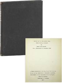
86012Boulder: 1955. Original typescript 36pp. Illustrated with nine original mounted photographs reproduced line drawings and two large original folding plates: "Geologic Map and Cross-Sections of the Red Canyon Area 37" x 36" hand-colored and "Structure Contour Map of the Southern End of Glen Anticline" approx. 27" x 24". Mild toning to text and plates; four of the photographs have become slightly darkened with age; Very Good overall. <br /> <br /> Original manuscript of the author's Master's Thesis noteworthy primarily for its handsome large hand-colored geologic map of the region. We can find no record of a Robert Lea Beckett as a practicing geologist after this date nor indeed any professional record; he appears to have died in Shepherdstown West Virginia around 1999. unknown
192860740Indianpolis: Bobbs-Merrill Co. 1928. 8vo. 328 pp. Frontisp. numerous plates photo plates diagrams. Blue-ribbed publisher’s cloth gilt lettering front cover & spine minor shelfwear dustsoiling w/ d.j. cover art of geological strata minor closed tears old scotch tape repairs still VG/G copy. First edition stated of this popularized geology which followed up the author’s 1927 “Creation. A History of Non-Evolutionary Theories†detailing here the “Flood theory of fossils†“Earthquake Wave†theories and more. Bobbs-Merrill Co., hardcover
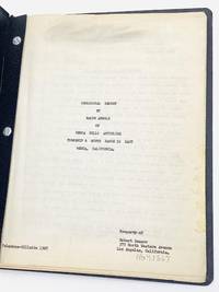
195179273Los Angeles 1951. The 24-page original typescript includes 16 tipped-in original black-and-white photographs two elevation charts and a map.<br /> <br /> Arnold was hired by Jack Leland to study reports and maps of the Mecca Hills Anticline and conduct a field inspection providing his opinion of the oil and gas possibilities of the rock formations. On page three of the report underlined in red is his comment: “This structure is ideal for oil and gas accumulation.†He further states: “from the evidence it is clear that oil exists in the general area of the north end of the Imperial Valley.â€<br /> <br /> The Mecca Hills Anticline is now in a protected reserve. Established in 1994 the U.S. Bureau of Land Management manages the 26356-acre Mecca Hills Wilderness. The area includes narrow steep-walled canyons that create a natural maze within the badlands. Uniquely faulted and folded geologic formations are the result of activity on the local sections of the San Andreas Fault making the Mecca Hills one of the more unusual geological sites of this kind. Located in Riverside County Mecca is a desert community on the north shore of the Salton Sea in the Eastern Coachella Valley and is surrounded by agricultural land with a population of approximately 8000 residents.<br /> <br /> Bound with brads in black leatherette wrappers. The contents are a little toned and the photographs once affixed with glue are now loose but all present. unknown