[British Geology]Biblio.com
288 résultats
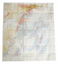
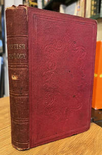
185071486London: The Society for Promoting Christian Knowledge 1850. Small 8vo. xii 305 pp. Hand coloured folding map frontis and chart at rear with wood engravings throughout. Cloth with blind stamped decoration to boards and gilt lettering to spine. Wear and bumping to extremities particularly at spine which has darkened. Light marking to binding. Folding pages have wear to fore-edges. Pencil ownership mark to ffep otherwise quite clean internally. . Good. Publisher's Cloth. 1850. The Society for Promoting Christian Knowledge 1850 hardcover
193862369London: George Allen & Unwin Ltd. 1938. 8vo. viii 9-303 1 pp. Photo frontisp. numerous photo plates text illusts. Blue cloth gilt lettering on spine minor edgewear scuffing w/ d.j. minor chipping head of spine minor creasing dustsoiling & slight sunning to spine still VG/VG- copy w/ former ownership markings on endpapers. First British edition of this fascinating memoir of the noted American geologist-naturalist’s trek prospecting for gold iron ore and other metals in Sierra Leone and considered one of the earliest women geologists. She is perhaps best remembered for her fundamental geological descriptions of large areas in Sierra Leone Wyoming and New Hampshire later becoming a passionate environmental activist. Very scarce in dustjacket. See: Carol Frost Katharine Fowler-Billings: Pioneering Woman Field Geologist Trained in the Rocky Mountains Rocky Mountain Geology Vol. 37 No. 1 Spring 2002. George Allen & Unwin Ltd., hardcover
196264136Houston TX: Gulf Publishing Co. 1962. 4to. 9.5 x 11.5 in. xii 350 pp. With 100’s of photos diagrams maps. Blue publisher’s cloth comb binding silver lettering w/ d.j. stereoscopic aerial photos front cover minor tear & chipping to foot spine NF/VG- copy from the library of Dr. Clive F. “Rick†Kienle 1942-2025 geologist and specialist in aerial photo mapping . First edition of this pioneering work on aerial photography with an emphasis on tectonic and lithologic interpretation of geomorphics units and landforms with detailed methodology on how to construct photogeologic maps drawn from the author’s 120000 photos. Bandat 1895-1982 first developed his photogeologic methods while working for Shell in New Guinea from 1936-1938 and later in Cuba and Java before becoming a specialist with Gulf Oil following World War II across the Middle East and Central America. Gulf Publishing Co., hardcover
a88864Mexico 1924. In Spanish. Sm.folio. 159pp. photo illustrations numerous large foldout maps and plans wraps. VG original front printed cover remounted on later wraps. Binding secure; no ownership marks. Scarce . paperback
a41078Mexico 1924. In Spanish. Sm.folio. 159pp. photo illustrations numerous very large foldout maps and plans later wraps. Fairly Good title page and next two pages lack lower corner not affecting any text and have a few short closed tears. Backstrip reinforced. Scarce. . paperback
183742877New Haven A.H. Maltby and Herrick & Noyes 1837. Contemp. hcalf. Gilt spine. Light wear to titlelabel with gilt lettering. Slightly rubbed. In: "The Amrican Jounal of Science and Arts. Conducted by Benjamin Silliman" Vol. 31.- January 1837. Engraved portrait Dr. Prince. VIII428 pp. and 1 folded map 4 engraved plates partly folded. The entire volume offered. Hildreth's paper: pp. 1- 84 a. 20 woodengraved textillustrations maps fossils startigraphy. Apart from a brownspots in upper margin of the first 7 leaves a fine clean copy. <br/><br/><em>First appearance of this classic travel account from Ohio mainly describing the geology and teh fossils of the area. - Sabin: 31796. </em> unknown
198176728Socorro NM: New Mexico Institute of Mining and Technology 1981. A thesis presented by the author "in Partial Fulfillment of the Requirements for the Degree of Master of Science in Geology.†Quarto 8 3/4 x 11 inches. 10 i–xxiv 202 5 pp. plus two plates in rear pocket; four tables; illustrated with 40 figures including 24 tipped-in original color photographs. Rectos only. Original black cloth with gilt spine lettering. The original photographs are still bright and clear. An excellent copy.Plate 1 in the pocket measures 30 42 inches and is titled: Geological Map and Sections of the Western Gallinas Mountains Socorro County. It has been hand-colored and bears an explanatory legend.Plate 2 in the pocket measures 30 25.5 inches and is titled: Correlation of Major Ash-Flow Sheets Along the Northern Margin of the San Augustin Plains.In the Introduction Coffin lays out the Purpose of the Investigation: “The objectives of this thesis are to determine the stratigraphic relationships structural trends economic potential and the distribution of various rock units in the eastern half of the Dog Springs 7.5-minute quadrangle Socorro County New Mexico. This thesis was undertaken as part of the New Mexico Bureau of Mines and Mineral Resources extensive mapping project of the northeastern portion of the Datil-Mogollon volcanic province.†New Mexico Institute of Mining and Technology hardcover
a44555Hannover 1860 Klindworth's. Catalogue of mining library. In German. 8vo. 124pp. original brown cloth with two tools in gilt mallet and pick on front. VG light fading of cover. . hardcover
a16818Mexico 1900 1901. Boletin de Instituto Geologico de Mexico No. 15. Parte 1: 4to. 75pp. photo illustrations map wraps; Parte 2: 4to. 76pp. plates. Good. . paperback
SA02F-00544See Description. Used - Acceptable. Acceptable condition. Published by The Johns Hopkins Press. geology maryland MD US history A readable intact copy that may have noticeable tears and wear to the spine. All pages of text are present but they may include extensive notes and highlighting or be heavily stained. Includes reading copy only books. NOT AVAILABLE FOR SHIPMENT OUTSIDE OF THE UNITED STATES. See Description unknown
a47949Prague 1967 Geological Survey of Czechoslovakia. Sm.4to. 8pp. of text in English plus 7 large foldout maps in folding case. VG in VG case light soiling. unknown
526001940. 3 original colour maps each c. 110 x 110 cm 40 x 45 inches folding to 20 x 12.5 cm. Natural fold creases generally very fresh and clean. Shows anchorage Big delta Blying Sound Circle fairbanks Gulkana Healy Kantishna River Kenai Livengood Mount Hayes Mount McKinley Seldovia Seward Talkeetna Talketna Mountains Tanan Tyonek Valdez etc. 1940 unknown
a109249Minneapolis 1914 - 1932 first edition. University of MInnesota. Five octavo volumes all grey printed wraps. Reports are 75-245 pages each. Maps some foldout some are large foldouts held in rear pockets. No missing maps. Photo illustrations on glossy stock in some volumes. Titles in collection: The Clays and Shales of Minnesota by Frank Grout; Surface Formations and Agricultural Conditons of NW Minn 2 parts by Frank Leverett; Surface Formations and Agricultural Conditions of the South Half of Minn by Leverett; Geology and Water Resources of Northwestern Minn by Ira Allison. All Good to VG. no owner marks. 5 volumes: . paperback