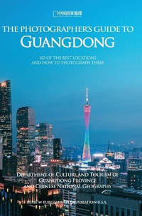
Chinese National GeographyBiblio.com
1 748 résultats
B9781683721734Hardback. New. hardcover
168372173X.Ghardcover. Good. Access codes and supplements are not guaranteed with used items. May be an ex-library book. hardcover
2003SBS-9780754632870ASHGATE 2003. Hardcover. New. ASHGATE hardcover
2003SBS-9780754632870ASHGATE 2003. Hardcover. New. ASHGATE hardcover
1994OVS394Oxford University Press 1994-10-13. Hardcover. Very Good. Huge book complete with all 4 note books. Blue boards with gilt lettering. Book is in very nice condition text is unmarked and pages are tight. Oxford University Press hardcover
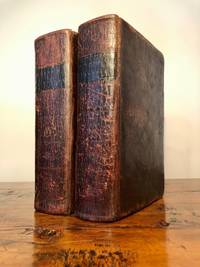
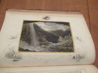
18107540Edinburgh: William Anderson of Stirling 1810. Revised edition. Leatherbound. Good. J. Menzies; T. Clerk engraved maps. 8vo. Pp. xii 952; 830. Frontis. fold-out map each volume. Illustrated with 30 additional engraved fold-out maps. Volumes uniformly bound in contemporary full polished calf gilt titles stamped in black morocco lettering pieces on the spine with gilt rules decorations and volume numbers. Previous owner ink signature "D. B. McNab" on each front free endpaper and ink manuscript index to plates tipped in. T. Kitchin engraving of armillary sphere mounted to front pastedown of vol. 1 and 1841 data table of Scotland's railways and canals to Vol. 2 FFEP. Corners bumped spines with crackling light scuffs and scars to covers leaf edges toned and light foxing throughout top edges soiled all maps intact albeit some with small chips and creases bindings tight. "A compilation where those who read the Newspapers might at once find some account of any particular town or fortress." The casual armchair traveler is also well-served with vivid descriptions. This revision of the 1807 edition has better maps. The Chronological Table leaves off in November 1809 with events of the Napoleonic Wars. <p>Sample of a brief entry: "Oregan or River of the West a river of North America which falls into the ocean in lon. 122.30.W and lat. 43.17.30.N." Though the mythical river had yet to be supplanted by the real Columbia in the listings it appears on the updated map of North America. William Anderson of Stirling unknown
1120905362.Gpaperback. Good. Access codes and supplements are not guaranteed with used items. May be an ex-library book. paperback
1142098303.Gpaperback. Good. Access codes and supplements are not guaranteed with used items. May be an ex-library book. paperback
1142523055.Gpaperback. Good. Access codes and supplements are not guaranteed with used items. May be an ex-library book. paperback
1167238435.Gpaperback. Good. Access codes and supplements are not guaranteed with used items. May be an ex-library book. paperback
1466957778.Ghardcover. Good. Access codes and supplements are not guaranteed with used items. May be an ex-library book. hardcover
A9781346277615Hardback. New. hardcover
1346277613.Ghardcover. Good. Access codes and supplements are not guaranteed with used items. May be an ex-library book. hardcover
026572824X.Gpaperback. Good. Access codes and supplements are not guaranteed with used items. May be an ex-library book. paperback
0260849731.Ghardcover. Good. Access codes and supplements are not guaranteed with used items. May be an ex-library book. hardcover
1447445422.Gpaperback. Good. Access codes and supplements are not guaranteed with used items. May be an ex-library book. paperback
19762083002115700034Japan Map Center 1976. Soft Cover. Fine. Number of pages: 644p 32 plates Size: 22cm Number of books: 1 Japan Map Center paperback
1850019528London and New York: The London Printing and Publishing Company - Limited 1850. First Edition Thus . Half Leather. Good. 11 1/8" Tall. 3 Colored Maps 22 Colored Plates 30 Uncolored Plates. Two Volumes Three Quarter Leather. Volume 1: 944 Pp With 30 Uncolored Plates And One Colored Map "Mexico California And Texas: The Newly Discovered Gold Districts". Volume Ii: 784 Pp With Two Colored Maps Of Canada And 22 Colored Plates All With Yellow Borders And Nice Original Color Throughout. The Map Of Mexico And California Tipped In But Neatly Loosened And Detached Without Intention And Usually Not Present Has Nicely Detailed Illustrations Of The Ruins At Uxmal Yucatan Mexican Peasantry And Gold Washing And Outlines The Gold Districts Of The U S And Mexico In Yellow. No Date Of Publication Indicated But Presumably 1850. Bindings Poor Three Of Four Boards Detached Spines Perished Boards Very Worn And Frayed Deserving Of An Expensive Rebind. Contents Near Fine Clean Maps Perfectly Preserved. Volume I With Additional Illustrated Title Page Showing Penn's Treaty Painted By Benjamin West And Here Engraved By J. Rogers. This Greatly Enlarged Fourth Edition With The Colored California Gold Map Is Uncommon About 7 Holdings Shown In Worldcat; It Is Not Listed In Carl Wheat's "The Maps Of The California Gold Region 1848 - 1857" Nor In The Addendum To The 1997 Martino Reprint Of That Book. <br/> <br/> The London Printing and Publishing Company - Limited hardcover
19722090202123001940Rekishi tosho-sha 1972. Soft Cover. Fine. The book is in fine condition. Rekishi tosho-sha paperback
19722091202132700883Rekishi tosho-sha 1972. Soft Cover. Fine. The book is in fine condition. Rekishi tosho-sha paperback
19722092902139200648Rekishi tosho-sha 1972. Soft Cover. Fine. The book is in fine condition. Rekishi tosho-sha paperback
19192080502106502611Jin yusha 1919. Soft Cover. Fine. Volume: 1 Jin yusha paperback
19192090502128301064Jin yusha 1919. Soft Cover. Fine. The book is in fine condition. Jin yusha paperback
19722091202133104071Rekishi tosho-sha 1972. Soft Cover. Fine. Volume: 1 Rekishi tosho-sha paperback
19192091502135400094Jinyusha Publishing Department 1919. Soft Cover. Fine. Number of books: 1 Jinyusha Publishing Department paperback