4 242 résultats
20182-6139047935Editorial Académica Española 2018. Paperback. New. 252 pages. Spanish language. 8.66x5.91x0.57 inches. Editorial Académica Española paperback
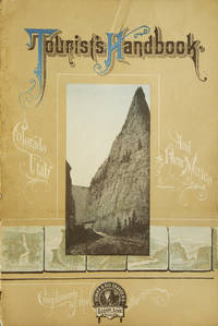
1895250835Chicago: Poole Brothers 1895. Denoted the "thirteenth edition two hundredth thousand" on title page. With illustrations. Plus folding map. 56 pp. 8vo. Original pictorial wrappers. Wrappers worn along spine. Some neat early pencil marginalia. Very good. In a half morocco and cloth folding case spine gilt. Denoted the "thirteenth edition two hundredth thousand" on title page. With illustrations. Plus folding map. 56 pp. 8vo. A useful turn of the century tourists' guide for places along the railroad's routes. This copy has pencil marginalia beside entries for five cities including Salt Lake City giving the impressions of a traveller in 1898. <br/><br/> Poole Brothers] hardcover
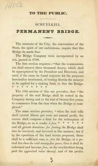
1835222028Harrisburg: Welsh; Welsh & Patterson 1835. 9; 36; 6 pp. 3 vols. 8vo. Removed. Toned. 9; 36; 6 pp. 3 vols. 8vo. <br/><br/> Welsh; Welsh & Patterson unknown
1834212846Philadelphia: np 1834. 16 pp. 1 vols. 8vo. Removed. Very good. 16 pp. 1 vols. 8vo. Make the Bridge free for God's Sake! Not in American Imprints. Not in American Imprints <br/><br/> np unknown
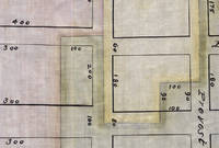
3725149<p>Likely Jersey City Hudson County New Jersey c. 1880s–1890s. Indenture. 12½ x 8 inches. 17 pages i.e. Five loose bifoliums; watermarked “Platner & Porter Superfine†WITH: Plat Map. Approx. 21 x 11½ inches. Cloth with ink manuscript and watercolor highlights. All near fine.</p> <p>In 1854 parts of Jersey City New Jersey were under water. In the city’s Hudson River front district called Harsimus Bay or Cove three land owners wanted to reclaim some of these submerged lands.</p> <p>In order to do so however the bounds of their properties needed to be properly set forth and clarified. They did so by means of a new indenture and the creation of a plat map “to illustrate the boundary and partition†of their respective tracts.</p> <p>This indenture and accompanying plat map were originally prepared and surveyed in 1854. Watermarks in the paper upon which the present indenture is written suggest it was copied in the late nineteenth century. Thus we date these two items to c. 1880s–1890s.</p> <p>It is not clear who caused the copy to be made. The arduous work of reclaiming submerged lands may have led to ongoing difficulties and the need to clarify potentially conflicting claims between neighbors:</p> <p>And whereas the said Dudley S. Gregory party of the first part under the authority contained in the said Deeds has commenced to fill in and reclaim lands under water in the waters of Hudsons sic River or her Harsimus Cove and put down and caused to be placed in and upon said lands under water certain cribs Bulkheads and Structures — And whereas the said Parties of the first second and third part hereto are desirous of filling in and reclaiming lands under water in front of or near to their respective lands bounded upon the water as aforesaid —</p> <p>A map was needed too:</p> <p>And whereas the Parties hereto are desirous of fixing settleing sic and establishing a boundary and partition of the lands under water and water rights between them…and to this end have caused a map showing such partition to be made — which is hereunto attached… pp.7–8</p> <p>The indenture aggregates together the various deeds held by the three land owners and their wives to make each land owners’ property claims clear. This information is rendered graphically on a plat map copied here from the original 1854 survey drawn by Clerk & Bacst City Surveyors of Jersey City.</p> <p>Each tract is shown on the grid of the city’s streets or what may have been proposed streets. Each is outlined in red yellow or green watercolor and infilled with a wash of the respective color.</p> <p>The area shown is bounded by Hudson Street on the east Steuben Street on the south Prospect Street on the west and South Seventh Street on the north.</p> unknown
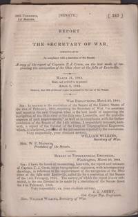
184434812Washington DC: n.p. 1844. Wraps. Incomplete. Disbound loose wraps. 34 pages. Illustrated with 16 numbered folding plans and sections with an additional 5 folding maps and plans not numbered. Stitching has been removed and contents and plans are loose and separated. One plan has a closed tear at the fold intersection. No loss of content. Maps and plans are in good condition. Text ends on page 34 with no back cover. Contents lightly toned and clean. <br /> <br /> Issued in 1844 this copy has 21 folding plans and maps of which 16 are numbered. It does not have all the 27 folding plates and maps compared to the 1845 copy currently held by the Cincinnati Public Library their copy states "Part 2". Does not appear maps or plans were removed at the back. Possible that this copy is incomplete but difficult to verify if the 34 page text came with 21 drawings or 27 drawings initially. n.p. unknown
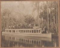
188035288n.p.: n.p. 1880. Photograph. Good. Photograph. Approx. 10" x 8". Light wear to the photograph card. Written on the back side of the picture - "Steamer Cherokee Chattahoochee River Georgia 1880. n.p. unknown
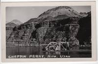
195069762N.p.: n.p. 1950. Postcard. Near Fine. Real photo postcard 3.5 x 5.5 inches with divided back. Nice and bright with just a hint of toning/foxing around the edges which is only noticeable on the rear side. Black and white photograph shows vehicles and people on the river ferry at Hite Utah. Now a ghost town flooded by Lake Powell Hite UT named after the prospector/settler Cass Hite was a small settlement along the Colorado River that was established in 1881. The Chaffin Ferry operated at Dandy Crossing at Hite UT from 1946 until its drowning by Lake Powell in the early Sixties. n.p. unknown
1956RDEACUE00crSecretaria de Educacion Publica 1956. Very Good. de Anda Luis Aveleyra Arroyo. Cueva de la Candelaria. Volumen I. Maldonado-Koerdell Manuel; del Rio Pablo Martinez. Mexico: Secretaria de Educacion Publica 1956. 216pp. Indexed. Illustrated. 4to. Hardcover. Book condition: Very good with gently bumped spine ends and former owner's name in ink on front free endsheet. Small pen mark on top edge of textblock. Dust Jacket Condition: Very good. Rubbed and bumped overall with a short closed tear where front panel meets spine. Lightly soiled rear panel. Scarce. Secretaria de Educacion Publica hardcover
1723043074Paris: Andre Morin 1723. Full Calf. Very Good. Mild general wear to calf light rubbing to hinges slight cracking to leather of spine endpapers a little worn and rumpled. 5 raised bands gilt to spine and lettering. 288pp plus a charming index and postscript. Previous owner's name penned to endpaper and author's name which does not appear on title page penciled to endpaper. Size: 8vo - over 7¾" - 9¾" tall. Quantity Available: 1. Shipped Weight: Under 1 kilo. Category: Literature & Literary; Humour; Inventory No: 043074. Andre Morin unknown
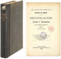
1888644221888. 1888 Digest of Chilean Law Echeverria y Reyes Anibel Compiler. Rio Soto Aguilar Abraham Compiler. Recopilacion de Leyes y Decretos de Interes General Vigentes en 21 de Mayo de 1888. Santiago: Imprenta Nacional 1888. xxv 806 pp. Octavo 9-1/2" x 6-1/2". Later quarter cloth over paper-covered boards gilt title to spine. Some shelfwear light fading to front board chip to fore-edge of front free endpaper light toning to text internally clean. Ex-library. Location label to spine small inkstamps to title page. $150. Only edition. A well-organized and indexed digest of Chilean law with an emphasis on administrative law. Contents: Acta de la Independencia Constitucion Politica Congreso Nacional Poder Ejecutivo Elecciones Garantias Individuales Municipalidades Correos Telegrafos y Telefonos Policia de Seguridad y Orden Publico Policia Sanitaria Beneficencia Publica Estadistica y Censo Subvenciones a Empresas de Ferrocarriles Vapores y Telegrafos Disposiciones Varias. OCLC locates 8 copies in North America 6 in law libraries Columbia Harvard LA County Library of Congress Tulane Yale. unknown
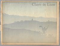
189724464Paris: Enoch & Co.; E. Flammarion 1897. First Edition. Hardcover. Good. 9.5" x 12.5" oblong 42 pp in original illustrated paper-covered boards with 9 full-page lithographed plates by Rivière and with additional art nouveau ornaments and decorative endpapers by George Auriol. Boards rubbed and edgeworn with loss of much of the paper over the spine front board loose but holding binding also a bit delicate. Clairs de Lune was first performed at the Theatre du Chat Noir on 14 December 1896. Illustrator Henri Rivière was by then famous for his creation of a form of shadow theatre performed regularly at the cafe and cabaret Chat Noir. Riviere produced more than 40 shadow plays on a variety of mythical historical and biblical themes in collaboration many different artists writers and musicians. He worked with Fragerolle on several occasions and Enoch published colored albums of several of them. The "text" of this volume consists entirely of musical notation and lyrics. Enoch & Co.; E. Flammarion hardcover
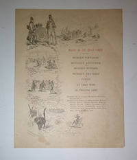
16-5224Paris: Le Chat Noir 1888. Folio. 25 cx 32cm. 4pp .Partial run from no. 52 to no. 98 . Printed on rag paper. Paris: Le Chat Noir, 1888 unknown
2019341056Spirit Studios Inc 2019. paperback. very good/no dustjacket. 8vo. pp.437. Spirit Studios Inc paperback
1989219779Lethbridge: Milk River Historical Society 1989. First edition. Hardcover. Very good/No Dustjacket. 4to. pp 1692. 2 volume set heavy set additional postage will apply Milk River Historical Society hardcover
2013204715Paris / Arras: Somogy / Conseil General du Pas de Calasis 2013. Softcover. VG. Quarto. Softcover. Illustrated wraps. 79 pages : illustrations chiefly color ; 26 cm. Somogy / Conseil General du Pas de Calasis paperback
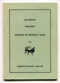
1993526597Los Angeles: Residents of Beverly Glen Inc./ Les River Community Center 1993. Softcover. Fine. First edition. Edited by Jane Curry. Foreword by Dorothy River. 12mo. 46pp. Frontispiece drawing of 'The Glen Club House 1909'. Green wrappers printed in black. Fine with slightest fading along spine text is fresh and clean. Prints a two-page foreword by Dorothy River dated 1993 a resident of Beverly Glen discussing the circumstances of her husband's writing of this publication an anecdotal history of the area beginning with a discussion of events in the 19th century that led to development of Beverly Glen in 1909 followed by Les River's observations about the Beverly Glen area of Los Angeles near Sunset Boulevard and Mulholland Drive in the following decades. OCLC lists a single holding Santa Monica Public Library. Residents of Beverly Glen, Inc./ (Les River Community Center) unknown
19806080Texas Western Press TX 1980. Fine in fine dust jackets with volume one dj having slight closed nick to top edge . First edition two volumes hardcovers volume one fourth printing volume two first printing VOLUME ONE SIGNED BY SONNICHSEN ON THE HALF TITLE PAGE AND JOSE CISNEROS AND CARL HERTZOG ON THE COLOPHON PAGE Texas Western Press, TX hardcover
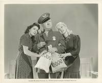
1940164648Universal City: Universal Pictures 1940. Vintage publicity photograph of W.C. Fields with Una Merkel and Evelyn Del Rio from the 1940 film. <br /> <br /> From the archive of noted Hollywood still photographer Ray Jones. Born in Wisconsin on January 1 1901 Jones worked for Paramount Pictures in the early 1930s and went on to be the head of the still photography department at Universal Pictures in 1935 where he worked well into the 1950s.<br /> <br /> An American comedy classic wherein W.C. Fields stars as a drunk who accidentally thwarts a bank robbery and becomes the bank security as the result. <br /> <br /> Shot on location in Lompoc California. <br /> <br /> 10 x 8 inches. Near Fine. <br /> <br /> National Film Registry. Criterion Collection 78. Ebert II. Universal Pictures unknown
008732Connecticut: Mystic River Historical Society Very Good condition. Cover soil. NO owner's name or bookplate. NO ink stamps. NO underlining. NO highlighting. NO margin notes. This undated portfolio has reproductions of 16 historic maps of Connecticut and vicinity. Most are single sheets although five measure 20" wide by 16" tall when unfolded. The maps are laid-in loose except for one which is printed on the front cover of the portfolio. Also included are 3 loose sheets of text that give background information on each map. Subtitle: A Bicentennial Project of the Mystic River Historical Society. The maps included are: Captain John Smith's Map of New England 1614; Map of Connecticut circa 1625; A Map of New England 1677; Connecticut and Parts Adjacent 1777; Old Homes and Homesites of Groton Connecticut; Benedict Arnold at New London 1781; Our Corner of Connecticut in 1833; Borough of Stonington in 1851; Our Corner of Connecticut in 1854; The Present-day Mystic Area in 1854; Groton Bank in 1868; Noank Poquonoc and Old Mystic in 1868; The Town of Stonington in 1868; Our Corner of Connecticut in 1868. Oversize Softcover. 10.5" wide by 14.5" tall This large book will require extra postage for Priority and International shipments but only the standard charge for media mail. . First Edition Thus presumed. Softcover portfolio. Very Good condition. Illus. by NOT a library discard. Oversize Softcover. Great Packaging Fast Shipping. Mystic River Historical Society Paperback
1906301417.Ghardcover. Good. Access codes and supplements are not guaranteed with used items. May be an ex-library book. hardcover
1972Q-0671781138Pocket Books: New York 1972-01-01. Mass Market Paperback. New. In shrink wrap. Looks like an interesting title! Pocket Books: New York paperback
3838175751.Gpaperback. Good. Access codes and supplements are not guaranteed with used items. May be an ex-library book. paperback
2006Q-1857592123Scala Publishers 2006-07-06. Paperback. New. In shrink wrap. Looks like an interesting title! Scala Publishers paperback
1988Q-0060158646HarperCollins 1988-02-01. Hardcover. New. In shrink wrap. Looks like an interesting title! HarperCollins hardcover