4 242 résultats
190962142New York: G.P. Putnam’s Sons 1909. Tall 8vo. xxxvii 1 401 1 pp. plus 6 pp. publisher’s catalogue. Title in red & black colour frontisp. over 200 text illustrations plates photo illustrations drawings maps 5 large folding. Pictorial tan-coloured publisher’s cloth cover art of Powell Expedition in the Grand Canyon brown & black ruling & lettering t.e.g. slightly shaken still a VG bright copy from the library of former California State Librarian Gary Kurutz. Fifth printing of this excellent first-hand account by Dellenbaugh who explored with Powell’s second United States River Expedition of 1871 & 1872 down the Grand Canyon and were accompanied by noted landscape photographer E.O. Beaman. G.P. Putnam’s Sons, hardcover
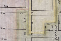
3725149<p>Likely Jersey City Hudson County New Jersey c. 1880s–1890s. Indenture. 12½ x 8 inches. 17 pages i.e. Five loose bifoliums; watermarked “Platner & Porter Superfine†WITH: Plat Map. Approx. 21 x 11½ inches. Cloth with ink manuscript and watercolor highlights. All near fine.</p> <p>In 1854 parts of Jersey City New Jersey were under water. In the city’s Hudson River front district called Harsimus Bay or Cove three land owners wanted to reclaim some of these submerged lands.</p> <p>In order to do so however the bounds of their properties needed to be properly set forth and clarified. They did so by means of a new indenture and the creation of a plat map “to illustrate the boundary and partition†of their respective tracts.</p> <p>This indenture and accompanying plat map were originally prepared and surveyed in 1854. Watermarks in the paper upon which the present indenture is written suggest it was copied in the late nineteenth century. Thus we date these two items to c. 1880s–1890s.</p> <p>It is not clear who caused the copy to be made. The arduous work of reclaiming submerged lands may have led to ongoing difficulties and the need to clarify potentially conflicting claims between neighbors:</p> <p>And whereas the said Dudley S. Gregory party of the first part under the authority contained in the said Deeds has commenced to fill in and reclaim lands under water in the waters of Hudsons sic River or her Harsimus Cove and put down and caused to be placed in and upon said lands under water certain cribs Bulkheads and Structures — And whereas the said Parties of the first second and third part hereto are desirous of filling in and reclaiming lands under water in front of or near to their respective lands bounded upon the water as aforesaid —</p> <p>A map was needed too:</p> <p>And whereas the Parties hereto are desirous of fixing settleing sic and establishing a boundary and partition of the lands under water and water rights between them…and to this end have caused a map showing such partition to be made — which is hereunto attached… pp.7–8</p> <p>The indenture aggregates together the various deeds held by the three land owners and their wives to make each land owners’ property claims clear. This information is rendered graphically on a plat map copied here from the original 1854 survey drawn by Clerk & Bacst City Surveyors of Jersey City.</p> <p>Each tract is shown on the grid of the city’s streets or what may have been proposed streets. Each is outlined in red yellow or green watercolor and infilled with a wash of the respective color.</p> <p>The area shown is bounded by Hudson Street on the east Steuben Street on the south Prospect Street on the west and South Seventh Street on the north.</p> unknown
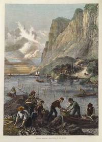
187520995London: Illustrated London News 1875. Very good overall. Striking full page wood engraving with later hand color of the abundant Hudson River shad harvest from the Illustrated London News. In 1870 New York began a program of seed the Hudson with over 2 million shad fry. The program was very successful with the river yielding astonishing quantities of shad in subsequent years. In the foreground fishermen unload baskets of shad while in the middle ground shad boats work the river. In the distance are a cottage at the water's edge a winding mountain road and the towering cliffs of the Hudson River with a dramatic sky. With handsome later hand coloring. Approximately 10 3/4 x 16" Illustrated London News unknown
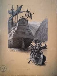
1895163631895. Painting. Very good overall. Shute was a well known illustrator from Brookline Mass. who worked for Stratemeyer until his death in 1906. <br /> This is a gouache on stiff board illustration in shades of black and white depicting Native Americans in canoes approaching Henry Hudson's Half Moon. Signed at the left A. B. S. and with two spaces at the lower left and upper right and marked mortise in pencil. <br /> Image size 10 1/4 x 16". Paperboard size: 15 x 20 unknown
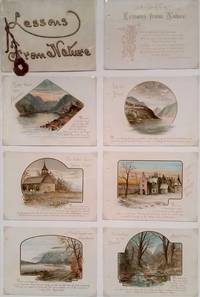
16181Paperback. Very good overall. Attractive color lithographic views highlighted in gold & text related to the Hudson River & Adirondacks including 'North West from Peekskill'; 'West Point'; 'Old Dutch Church Sleepy Hollow'; Sunnyside Home of Washington Irving'; 'Mount Taurus and Breakneck' Cold Spring NY; and 'Headwaters of the Hudson'. Attractive cream card covers with title in gilt relief tied with silk cord. The title on the front cover reads "Lessons From Nature" and is accompanied with text of poem by Percy Bysshe Shelley. With "Merry Xmas 1890 G. C. Meckham" in pencil inside cover. Nicely mounted to display board suitable for framing. paperback
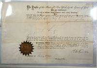
184728447New York 1847. A certificate complete with seal signed by R. E. Fenton and Chauncey DePew.<br /> <br /> Hell Gate is a narrow part of the East River in New York City the phrase taken from the Dutch 'Hellegat.' The name refers to the whirlpool that results from the currents rocks and narrow channel and dangers to merchant travel through the area. Hell Gate Pilots were experienced and authorized by the state to navigate vessels through the channel. <br /> <br /> Reuben E. Fenton was a merchant and politician and governor of New York from 1865-1868. Chauncey Depew was an attorney businessman and politician as well as US Senator from New York. <br /> <br /> 16 3/8 x 10 3/4" cream paper original folds gold seal with manuscript additions and signatures with signed and stamped swearing in page for the County Clerk's Office in New York County 8 1/2 x 7" cream paper manuscript additions. Some folds are split with slt loss. Otherwise very good and an interesting piece of nautical history. unknown
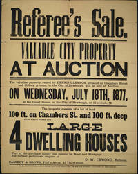
187724402Newburgh NY: E. M. Ruttenber & Son 1877. Good condition. Large impressive broadside printed in a variety of type fonts for Hudson River property that is currently on the southern edge of the campus of Mount Saint Mary College and Bishop Dunn School. The broadside lists the owner as Dennis Glennon located at Chambers Street and Gidney Avenue Newburgh NY. <br /> <br /> Referee's Sale with Auction date Wednesday July 18th 1877 at the Court House in the city of Newburgh. The property is a lot measuring 100 X 100ft with 4 large dwelling houses D. W. Esmond Referee. <br /> <br /> Printed in black on yellow paper. Period folds some slt. holes at intersection of some folds a couple of crease separations short tear upper left corner repaired. 19 x 24". Not recorded in OCLC. E. M. Ruttenber & Son unknown
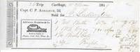
16637The Steamboat William Young was a Hudson River boat out of Newburgh NY. Receipt for butter eggs oats & freight charge $14.77; with a small woodcut illustration of the steamship with the slogan "Keep a supply of plaster coal salt flour & c". Sold for G. Ludington. 7 x 2 1/2". Very good. unknown
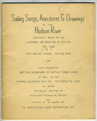
196728547Albany: Three City Press 1967. Otherwise very good condition. . and also Presenting the True Adventure of Captain Thomas Adams as well as his Strange Encounter with the Tin Peddler's Ghost all being edited or written by Professor Richard W. Wilkie who Offers it in Behalf of The Hudson River Sloop Restoration Inc."<br /> <br /> 8vo 35pp staplebound tan card covers with color ills hand drawn maps. Cover dusty otherwise clean. Three City Press unknown
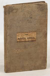
1838000015095New York: Wm. H. Colyer 1838. First edition. Hardcover. Near Very Good. 12mo. 16 cm x 10 cm. 5 6-119 1 pp. Grey cloth with a paper label printed in black on the front board. Illustrated with a fold-out map of the region done in black and white. Evans 52888. A brief and informative guide to the Hudson River and its environs. Soiling to the cloth. Foxing to the leaves and a piece torn off the free front endpaper. Wm. H. Colyer hardcover
189064162Philadelphia PA: Wolf & Company 1890. Oblong 12mo. 6 x 4.25 in. 13 leaves unnumbered. Printed title. With 12 colour chromolithograph plates. Raised-embossed decorated & illustrated softcovers cover art on front cover of Native American paddling canoe and Hudson sidewheeler steamship in raised embossed gilt lettering advertisement for Kimball’s Straight Cut tobacco and High Grade Cigarettes on back cover punch-sewn w/ white silk braid minor age toning to fore-edges dustsoiling & minor crease on back cover interior NF bright chromos. First edition of this very rare tourist’s colour chromolithograph souvenir viewbook including images of the “Entrance to the Highlands The Dunderberg†“Adirondacks Highlands†“Mount Taurus and Breakneck†“West Point†“Washington’s Headquarters at Newburgh†and the “Sunnyside Home of Washington Irving.†Of particular interest is the view of the original barrel vault of the tomb of Ulysses Grant erected within 10 days of his entombment and later replaced with the 8000 ton granite tomb erected from 1892-1897. No copies in Worldcat. Wolf & Company, paperback
1869100268<p>Pamphlet 8vo original wrappers illustrated including large folding map 50 pp. Wrapper on spine mostly missing top cover torn near spine making it partially detached a couple of minor chips and folds to the back cover and some edge folds normal aging map in very nice shape. A decent copy. This work includes all kinds of facts and figures about the Hudson River.There are several wood engravings several ads and a large long folding map. The map of the river shows some of the highlights and places you can visit.</p> Gaylord Watson,
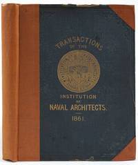
186124677London: Institution of Naval Architects Secretary's Office 1861. Hardcover. Very good condition. Much material on Hudson River steamers and the construction of iron clad war vessels relevant to the US Civil War. The Hudson River steamers are included in the section "Eastern River Boats" with information including: general description mechanical structure masts & guys hull frame engines condenser walking beam boilers paddle wheels and management and appliances for the economical navigation "everything is managed from the wheel-house" p119.<br /> <br /> With three large folding plates titled "Eastern River Boat "Commonwealth" plates 9 10 & 11 and three large folding plates "Western River Boat "Memphis" plates 12 13 & 14.<br /> <br /> This volume contains 22 engraved plates plate 5 missing but never present likely the H. M. iron clad ship 'Warrior'. The second volume of a series still in print in 1992 which includes an article by Norman S. Russell titled "On American River Steamers" pp 105 -127.<br /> <br /> Tall 4to. Original green gilt cloth covers rebacked and recornered with tan buckram gilt title only on front cover. Slight chipping to top and bottom cloth edges of front board; internally bright and clean. OCLC: 606595780. Institution of Naval Architects Secretary's Office hardcover
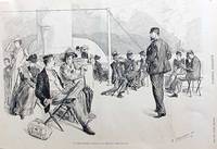
189016185Harper's Weekly 1890. A charming woodblock depicting a Hudson River scene on the deck of a steam boat with ladies and gentlemen taking in the view of the majestic river. The ladies are dressed in long gowns and wear large elegantly decorated hats and the gentlemen sport top hats and boaters. From Harper's Weekly Volume XXXIV No. 1760. Signed and dated in the lower right "C. S. Reinhart - N.Y. '90". Very good. 14 1/2 x 9 1/2" Harper's Weekly unknown
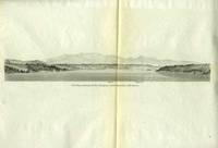
186818662Washington DC 1868. A Hudson River view centered on Kingston NY with Catskill Mountains looming behind it. Steel engraving. Original vertical fold very good. Image size: 11 w 2". Paper size: 13 1/2 x11 1/2" unknown
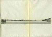
186818660Washington DC 1868. View on the upper Hudson Tivoli on the left Red Hook Island and Saugerties light house and point central and Koone's Island to the right. Steel engraving. Original vertical fold very good. Image size: 12 w 1 1/2 ". Paper size: 13 1/2 x11 1/2" unknown
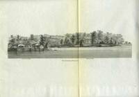
186818663Washington DC 1868. Attractive close up of the shoreline just below Red Hook NY. Barrytown Landing buildings and dock to the left the Edgewater House a colonnaded grand home to the right with a gazebo near the water. Steel engraving. Original vertical fold very good. Image size: 10 1/2 w 3". Paper size: 13 1/2 x11 1/2" unknown
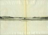
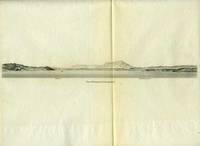
186818661Washington DC 1868. Coastal profile of the Hudson with the Lime Kilns to the left Red Hook in the central far distance and Verplanck's Point to the right with several buildings. Steel engraving. Original vertical fold very good. Image size: 9 1/2 w 1 1/2". Paper size: 13 1/2 x11 1/2" unknown
186818664Washington DC 1868. View of the upper-mid Hudson River Clifton Point to the left and Knickerbocker Pier to the right. Steel engraving. Original vertical fold very good. Image size: 11 1/2 w 1 1/2 ". Paper size: 13 1/2 x11 1/2" unknown
16893Very good condition with some cancellation holes. An early Junk bond with an attractive bank-note engraving of the Hudson Highlands - a fictitious Garrison's Landing looking west across the Hudson towards the plains of West Point; with an eagle on the verso. Issued at 4 percent dated 12th March 1918. Chauncey Depew 1834 - 1928 whose ancestors settled in 1685 at the present location of Peekskill NY was president of the New York Central Railroad System and president of the West Shore Railroad Company. This line extended from Weehawken NJ north along the west shore of the Hudson River to Albany NY and then west to Buffalo; it is no longer a passenger line & now serves as CSX Transportation's main freight route from the west to the New York City area. Approx. 13 5/8 x 9 1/4". Printed in orange and black. With a stamp duty affixed to the top right corner. unknown
16896Very good condition with some cancellation holes. An early Junk bond with an attractive bank-note engraving of the Hudson Highlands - a fictitious Garrison's Landing looking west across the Hudson towards the plains of West Point; with an eagle on the verso. Issued at 4 percent dated 24th November 1936. Chauncey Depew 1834 - 1928 whose ancestors settled in 1685 at the present location of Peekskill NY was president of the New York Central Railroad System and president of the West Shore Railroad Company. This line extended from Weehawken NJ north along the west shore of the Hudson River to Albany NY and then west to Buffalo; it is no longer a passenger line & now serves as CSX Transportation's main freight route from the west to the New York City area. Approx. 13 5/8 x 9 1/4". Printed in brown and black. unknown
16900An early Junk bond with an attractive bank-note engraving of the Hudson Highlands - a fictitious Garrison's Landing looking west across the Hudson towards the plains of West Point; with a train on the verso. Printed in green & black 9 1/2 x 15" with half of the coupons attached and an orange Tax stamp in the top right corner. Issued at 4 percent principal due in 2361. Signed by Chauncey Depew 1834 - 1928 whose ancestors settled in 1685 at the present location of Peekskill NY was president of the New York Central Railroad System and president of the West Shore Railroad Company. This line extended from Weehawken NJ north along the west shore of the Hudson River to Albany NY and then west to Buffalo; it is no longer a passenger line & now serves as CSX Transportation's main freight route from the west to the New York City area. unknown
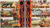
21656Very Good. A Quintessential Artifact of the Interwar Florida Tourism Boom.<br /> A vibrant and structurally ambitious artifact of Depression-era boosterism capturing the Indian River region's pivot from a rural citrus hub to a premier 'New Deal' tourism destination. <br /> <br /> While many Florida guides of this period focused on the 'Gilded Age' glamour of the Gold Coast this 1936 booklet emphasizes the varied 'Working Man's Paradise'-blending sport fishing marsh hunting and high-yield citrus farming with the newly accessible culture of automobile travel. The multi-panel cover art is a standout specimen of mid-1930s commercial design utilizing the stylized simplified forms and saturated palettes of the interwar travel-poster movement. It provides a rare town-by-town survey of fifteen coastal localities during a period of significant regional identity formation.<br /> <br /> KEY FEATURES<br /> Design: Multi-panel color-litho cover in classic 1930s travel-poster style.<br /> Local Profiles: Granular coverage of 15 towns including Eau Gallie Grant Indialantic and Sebastian.<br /> Branding: Heavy focus on the 'Indian River Orange' as both a commodity and a cultural symbol.<br /> Visuals: 28 pages of photographs and stylized graphic panels typical of 1930s regional marketing.<br /> Rarity: Scarce; OCLC/WorldCat records only 6 institutional holdings.<br /> <br /> CONDITION: Very Good. The bold poster-style cover remains bright and highly presentable. There is a localized stain to the lower corner of the inside cover and first page though it does not affect the exterior graphics or the structural integrity. Otherwise a carefully handled clean example with only minor wrapper corner wear. HISTORICAL SIGNIFICANCE --<br /> The 1936 Indian River booklet marks the precise moment Florida transitioned from an agricultural frontier into a motorized tourist playground. Produced during the height of the Great Depression it uses "booster optimism" to sell a lifestyle of self-sufficiency citrus and cattle alongside modern leisure tarpon fishing and beach-going. It is a vital record of the 15 included towns-many of which were then merely small fishing villages or groves-capturing their landscape before the post-WWII development boom.<br /> <br /> Subjects: Indian River Florida Brevard County History Florida Citrus Industry 1930s Tourism WPA-Era Graphic Design Sport Fishing History Vero Beach Fort Pierce New Smyrna Florida Ephemera Travel Promotion Americana Regional History Trade Catalogues. unknown
187030576Richmond: Geo. W. Gray 1870. First Edition. Wraps. Good. Light brown stitched wraps with title on outer wrap. 23 pages. A few spots to front wrap. Light creases to wraps. Interior contents clean. Geo. W. Gray unknown
184434812Washington DC: n.p. 1844. Wraps. Incomplete. Disbound loose wraps. 34 pages. Illustrated with 16 numbered folding plans and sections with an additional 5 folding maps and plans not numbered. Stitching has been removed and contents and plans are loose and separated. One plan has a closed tear at the fold intersection. No loss of content. Maps and plans are in good condition. Text ends on page 34 with no back cover. Contents lightly toned and clean. <br /> <br /> Issued in 1844 this copy has 21 folding plans and maps of which 16 are numbered. It does not have all the 27 folding plates and maps compared to the 1845 copy currently held by the Cincinnati Public Library their copy states "Part 2". Does not appear maps or plans were removed at the back. Possible that this copy is incomplete but difficult to verify if the 34 page text came with 21 drawings or 27 drawings initially. n.p. unknown