4 242 résultats
187262362London: Effingham Wilson Royal Exchange 1872. 8vo. 4 147 1 pp. 3 woodcut-engraved plates 4 collotype sepia-tinted photo plates w/ tissue guards present 5 plates 3 large folding. Brick-red publisher’s cloth gilt lettering front cover & spine scuffing & wear head & foot of spine minor wear to corners shaken still a VG- copy from the library of former Confederate officer Colonel and later Colonel Richard L. Maury 1840-1907 served in the Army of Northern Virginia for the Confederacy was Superintendent of Immigration under Emperor Maximilian and by 1868 became a respected lawyer in Virginia and was son of the noted scientist and inventor Matthew Fontaine Maury 1806-1873 best remembered for developing the electrically controlled naval mine as well as efforts to persuade European powers to support the Confederacy. First edition of this promotional work for the Fairlie articulated steam locomotive with driving wheels on bogies and at the time one named the “Mountaineer†had been ordered by the newly constructed Denver & Rio Grande Railroad and was the only Double Fairlie to operate on an American narrow gauge railway. After his initial trials for his invention Fairlie received many orders the newly developed locomotive and by 1876 43 different railways operated his patent locomotives which by 1870 were being produced by the Fairlie Engine & Steam Carriage Co. but ceased production after the death of his partner England. His locomotives proved especially popular in Mexico and 49 of his massive 0-6-00-6-0 were to remain in operation until the end of the 1920’s. See: Robin Jones Looking Both Ways: When Robert Fairlie ‘Double Up’ Steam The Railway Hub March 17 2022. Effingham Wilson, Royal Exchange, hardcover
3003Boston: The Company; Alfred Mudge & Son Printers 1878. . 8vo dusty pink wrappers front printed; some chips; slightly soiled One holding library in OCLC Boston: [The Company]; Alfred Mudge & Son, Printers, 1878. unknown
2472Boston: The Company Alfred Mudge & son Printers 1878. . 8vo buff wrappers front printed some minor fragments missing from the bottom margin of the first few leaves not affecting text One holding library only in OCLC. Lists all capital expenditures for the year bridge building and other repairs; a breakdown of all shipments sent and the usual financial disclosures Boston: [The Company] Alfred Mudge & son Printers, 1878. unknown
2687Chicago: The Company Poole Bros. Printers and Engravers 1896. . Large 8vo buff printed wrappers back pictorial; some chipping and soiling to wrappers. First published in 1887. Many of the illustrations are engraved after the photographs Jackson took on his trip with Ernest Ingersoll and which were published in Ingersoll's "Crest of the Continent". The copyright for Ingersoll's book and the present one were both give to S. K. Hooper the Passenger Agent for the railroaD. Chicago: [The Company] Poole Bros., Printers and Engravers, 1896. unknown
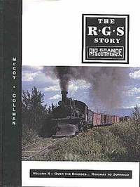
200159996Denver CO: Sundance Publications Inc. 2001. 4to. 416 pp. Frontisp. 100s of colour and black & white photo illustrations maps diagrams. Half-purple over colour-illustrated boards minor shelfwear very slight dustsoiling w/ glassine cover minor shelfwear minor bumping lower corners VG/VG copy signed by three authors on half-title numbered. First edition signed & No. 1285 “Display Copy†of this lavishly illustrated history and installment in the Rio Grande Southern saga against the backdrop of the rich gold mining district previously occupied by the Ute Indigenous Peoples. Sundance Publications, Inc., hardcover
19531111Winnipeg Manitoba: Department of Resources and Development Engineering and Water Resources Branch; Water Resources Division 1 October 1953. First printing. Card Covers. pp. ix 66. 4to. Card covers in duo-tang style binding. Replete with 21 plates of maps in addition to many tables charts aerial photographs etc. Light rubbing to the covers light occasional pencil marginalia otherwise bright and clean with tight sound binding; very good. At time of cataloguing not in Peel University of Manitoba Archives & Special Collections. A thorough investigation on the feasibility of diversion of river flows in excess of the channel capacity for the Greater Winnipeg region. Thorough consideration is given to all possible flood-control measures including channel improvement dyking storage and diversion. Initial cost estimates for the project ranged from 12 million dollars for protection against a flood of the 1950 magnitude to 82 million dollars for protection against a flood of the 1826 magnitude. <br/><br/> Department of Resources and Development, Engineering and Water Resources Branch; Water Resources Division unknown
1995129221Hanoi: Red River Gallery 1995. 1st edition. As New. quarto. softback with stiff wrappers 70pp. col. pls. 5 Hanoi painters go up against the wall Red River Gallery unknown
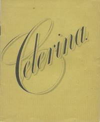
19009703London: Rio Chemical Co 1900. Booklet stapled in wrappers 10.5 x 13.5 cm. 31 1 pages. Text in black and with red borders throughout. An attractively designed booklet advertising the Rio Chemical Company's Celerina a "nerve tonic stimulant and spasmodic" containing "celery coca kola viburnum and aromatics. "It is recommended in cases of "impotency spermatorrhea loss of nerve power nervous headache neuralgia paralysis dysmenorrhea hysteria opium habit inebriety prostatitis dyspepsia and all languid and debilitated conditions of the system." With slight oxidation to the staples and some light wear to the wrapper's crease; near fine. OCLC locates no copies of this but one each of three other Celerina promotional publications. Rio Chemical Co unknown
AQ12886Brigg: Ball Printer s.d. c.1800 2pp. Single sheet printed on both sides. Numerous old folds two short tears early manuscript land tax notes to verso. An apparently unrecorded circular issued for the benefit of local landowners regarding proposed improvements to the drainage infrastructure on the level of Ancholme River Lincolnshire. The issue of effective drainage of the Ancholme Level had worsened in the latter years of the eighteenth-century to redress this commissioners appointed Isaac Leatham of Barton near Malton to produce a comprehensive report. He addressed issues regarding both drainage and navigation and submitted his proposal in late 1800 though the projected cost for improvements of £22975 was thought excessive. The commissioners subsequently approached civil engineer John Rennie 1761-1821 who produced a report in 1801. His proposals included constructing catchwater drains on either side of the main channel enlarging the width and depth of the channel building two new locks and rebuilding the road bridge at Brigg. An Act of Parliament required to proceed with the works was obtained on 26th June 1802. . Dimensions 200 x 340 mm. Ball, Printer, [s.d., c.1800] unknown
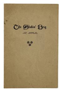
AQ31250Aberdeen: William Smith & Sons The Bon-Accord Press s.d. 1920 4pp. Original publisher's printed buff wrappers. A trifle creased. The second located copy of an anonymous Scots dialect verse lamenting the collapse of a suspension footbridge spanning the River Dee Aberdeenshire and pleading for philanthropic intervention for its restoration. St Devenick's Bridge colloquially known of the 'Shakkin' Briggie' for its propensity to sway when crossed was constructed in 1836/37 funded by Church of Scotland clergyman George Morison 1758-1845 for the benefit of his parishioners. The bridge was severely damaged by floodwaters in October 1920. Public funds were raised and repairs carried out resulting in the crossing reopening in September 1922. However since that time erosion of the banks of the Dee has swept away portions of the structure and it now stands derelict. OCLC and COPAC together record a single copy NLS. . First edition. 8vo. William Smith & Sons, The Bon-Accord Press, [s.d., 1920?] unknown
98784An attractive calligraphic testimonial visible image size 390 × 260 mm in blue ink on a two-tone blue background within a decorative gilt border was signed by nine senior members of the congregation and presented to the outgoing Honorary Secretary. It is surmounted by a large ornamental scroll a mass of wattle blossom and a large vignette illustration of a paddle steamer towing a heavily-laden barge on the River Murray. The copious amounts of dirty smoke belching forth are starkly realistic - an unexpected bonus on an otherwise routine production. The work is signed 'Niehuus & Lucy Adelaide'; we are unsure when they commenced work together but the partnership was dissolved four months after this commission was completed. Minimal foxing and light surface blemishes do not detract from this charming period piece recently mounted and matted ready for framing. unknown
191280313Adelaide: R.E.E. Rogers Government Printer 1912. First Edition. Hardcover. Very Good. Adelaide R.E.E. Rogers Government Printer 1912 and 1913. Foolscap folio 66 pages plus a folding chart 3 large folding plans or charts describing a typical plan of a lock and weir and charting the effects of certain reservoirs on navigation and a large folding map of the Murray 555 × 910 mm the 'section between Swan Reach and Wentworth . showing locations of lock-sites' with a very large inset map of the entire length of the river and 32 pages plus a folding map 'Proposed improvements in the vicinity of the mouth of the River Murray' 537 × 518 mm. Contemporary full morocco lettered in gilt on the front cover 'Captain Johnston's River Murray Reports'; the original spine is missing and has been replaced with a fairly pedestrian piece of cloth giving it a quarter cloth look; extremities rubbed bumped and a little worn; title pages a little marked with the second one a little foxed along the top margin; neat repairs to a few trifling tears to the folding plans with a tape-stain to an old repair along one fold of the last map; slight nicks to the bottom edge of some leaves in the first paper; overall in very good condition. The ownership signature of Arthur Searcy 1913 is written in pencil on each title page. Arthur Searcy 1852-1935 was Controller of Harbors from July 1911 and Chairman of the Harbors Board Committee until his retirement at the age of 65 information from the Searcy scrapbooks in the State Library of South Australia. He was the older brother of the more well-known Alfred 1854-1925. <p>Loosely inserted are retained duplicate typescripts of two letters in all four pages foolscap from Searcy as Chairman of the Board to the Minister of Marine regarding proposed works at Victor Harbor one page and Goolwa three pages. The letters are signed and dated at the head by Searcy August and September 1922 respectively; the one on Goolwa raises numerous objections to Johnston's scheme. Three related contemporary newspaper cuttings one printing a lengthy letter from Simpson Newland are also present. The September 1928 ownership signature of E.H. Bakewell is written in pencil on the recto of the front free endpaper. Bakewell was managing director of the South Australian Reinforced Concrete Company which makes sense in this context. R.E.E. Rogers, Government Printer hardcover
1853100379Adelaide: W.C. Cox Printer 1853. First Edition. Hardcover. Very Good. Adelaide W.C. Cox Printer 1853. Octavo 46 pages. Relatively recent quarter morocco and buckram by the Law Bindery Melbourne; title leaf a little foxed with minimal light scattered foxing to a few other leaves; an excellent copy with most interesting provenance see below. The author Clerk of the Executive Council of South Australia was on board the vessel; this is his account of the first successful navigation of the Murray as far as Swan Hill by Captain Francis Cadell. Fellow-passenger James Allen also published his version of events. Captain William Randell and his paddle-steamer 'Mary Ann' left Goolwa at the Murray mouth ahead of Cadell and travelled much farther up the Murray but Cadell overtook him en route and reached Swan Hill first. However both men deservedly earned the bonus of 2000 pounds offered by the South Australian Government 'for each of the first two steamers to travel up the Murray as far as the Darling junction' 'Australian Dictionary of Biography'. We have noted previously the manuscript correction page 5 line 4 'largest' to 'longest' river and presume it is in Kinloch's hand. At the head of the title page of this copy is the pencilled ownership name possibly his signature of Robert Wadsworth over-written in red ink by the subsequent owner 'John Shillinglaw from Robert Wadsworth 1854'. Shillingworth has annotated the text in both pencil and red ink three and seven pages respectively. The pencilling identifies the 'gentleman's son' working as a shepherd as 'old "Bigodd Macdonald"' and asks elsewhere of a sentence nine lines long 'what does this wretched twaddler mean' he's got a point too!. Robert Wadsworth was eventually Clerk of the Victorian Executive Council from 1875 to 1889; of passing interest to bibliophiles his son Arthur 1864-1931 was the first Commonwealth Parliamentary Librarian having 'charge of the Commonwealth library for over twenty-six years while also being titular head of the Victorian State parliamentary library' ADB. <p>John Joseph Shillinglaw 1831-1905 public servant and historian was the eldest son of the librarian of the Royal Geographical Society. 'He was to study under Captain John Washington eminent maritime surveyor and in 1852 he migrated with his father and brothers to Victoria arriving in October. From November he was chief clerk of petty sessions at Williamstown and in 1854 was appointed inspector and sometime acting superintendent of the Water Police. He was also secretary to the Steam Navigation Board until December 1857. In 1856-69 he was shipping-master for the Port of Melbourne and registrar of seamen; he helped to found the first Sailors' Home and did much to improve the working conditions of seamen'. It is hardly surprising that he should be given a copy of this book soon after its publication. He held various public service positions over the years; from 1885-94 he 'was secretary to the royal commission on vegetable products. He was also secretary to the Board of Viticulture. Shillinglaw was an enthusiast in whatever department he worked; however he is remembered for his association with colonial literature and history'. He was the author of numerous books and on his death his estate 'included a vast collection of papers and rare books' presumably including this item ADB. Ferguson 11196. W.C. Cox, Printer hardcover
185378787Adelaide: W.C. Cox Printer 1853. First Edition. Hardcover. Very Good. Adelaide W.C. Cox Printer 1853. Octavo 46 pages. Antique-style quarter calf and marbled papered boards; title page slightly dusty and a trifle marked with two tiny closed tears to the top edge; a few pencilled emphases to the margins; light vertical crease down the centre of the last six leaves; an excellent copy. The author Clerk of the Executive Council of South Australia was on board the vessel; this is his account of the first successful navigation of the Murray as far as Swan Hill by Captain Francis Cadell. Fellow-passenger James Allen also published his version of events. Captain William Randell and his paddle-steamer 'Mary Ann' left Goolwa at the Murray mouth ahead of Cadell and travelled much farther up the Murray but Cadell overtook him en route and reached Swan Hill first. However both men deservedly earned the bonus of 2000 pounds offered by the South Australian Government 'for each of the first two steamers to travel up the Murray as far as the Darling junction' 'Australian Dictionary of Biography'. W.C. Cox, Printer hardcover
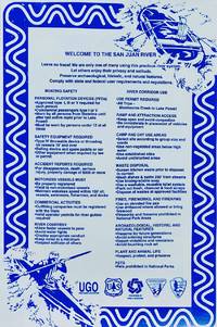
198584001985. White vinyl sign printed in blue ink 91 cm x 61 cm / 36" x 24" Pin holes at corners otherwise better than very good. Sign from the put-in near Bluff at Sand Island for boaters floating the San Juan River. Includes Safety tips required gear and rules of the river. The San Juan Upper and Lower sections are from Sand Island to Clay Hills. From Oscar's garage to yours. unknown
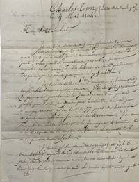
18042937Charlestown: From Mr. Riviére to “Monsieur Rimert Employé dans les bureaux du Préfet Maritime à Brestâ€. Text in French. Arrived through Bordeaux with the town’s backstamp on the delivery address 32 Bordeaux 1804. Handwritten pre-postal letter in ink. Torn at the wax seal and at a folding with no effect on the text. Paper tanned at the foldings. Otherwise in fine condition. Handwritten pre-postal letter in ink. 3 pages on bifolium. Scarce pre-postal letter from Charlestown USA to Brest France by a Saint-Domingue-refugee dated in 1804.<p><br /> Written to Mr. Rimbert in Brest at the “bureaux du Préfet Maritime†by Mr. Riviére in Charlestown South Caroline who - according to his account - was taken from Saint-Domingue as a prisoner on parole to Jamaica after Rochambeau’s surrender to Dessalines in November 1803. Shortly he could leave Jamaica via Havana to Charlestown; the journey took him almost 80 days. Riviére informs Rimbert about meeting his uncle Mr. Verrier and his children in Jamaica and Havana reminds him of their old friendship and ask his help to forward his carrier in the marine administration in case he decides to go back to France.<p><br /> During the French Revolutionary uprisings thousands of French refugees from the West Indies arrived in the United States. Due to the conflicts of the Haitian Revolution 1790–1804 nearly 20000 mostly white planters gens de couleur and slaves fled the French colony of Saint Domingue to seek asylum mainly in American port cities such as New York Philadelphia Baltimore New Orleans and Charleston. The present letter adds a personal touch to this episode of history. From Mr. Riviére to “Monsieur Rimert, Employé dans les bureaux du Préfet Maritime à Brestâ€. Text in French. Arrived thro unknown
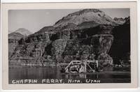
195069762N.p.: n.p. 1950. Postcard. Near Fine. Real photo postcard 3.5 x 5.5 inches with divided back. Nice and bright with just a hint of toning/foxing around the edges which is only noticeable on the rear side. Black and white photograph shows vehicles and people on the river ferry at Hite Utah. Now a ghost town flooded by Lake Powell Hite UT named after the prospector/settler Cass Hite was a small settlement along the Colorado River that was established in 1881. The Chaffin Ferry operated at Dandy Crossing at Hite UT from 1946 until its drowning by Lake Powell in the early Sixties. n.p. unknown
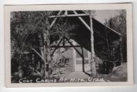
195069763N.p.: n.p. 1950. Postcard. Near Fine. Real photo postcard 3.5 x 5.5 inches with divided back. Nice and bright with just a hint of toning/foxing around the edges which is only noticeable on the rear side. Black and white photograph shows a close view of the front side of a small cabin at Hite Utah. Now a ghost town flooded and drowned by Lake Powell in the early 1960s Hite UT named after the prospector/settler Cass Hite was a small settlement along the Colorado River that was established in 1881. n.p. unknown
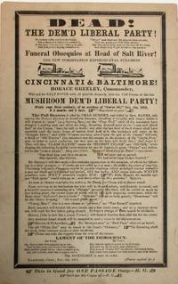
187238915Hartford 1872. Broadside 6" x 9-1/2" text surrounded by mourning border. A few spots Very Good. Illustrations of two steamers. At the bottom: "This is Good for ONE PASSAGE Only. - H.G." Dated at Hartford November 5 1872.<br /> <br /> "Salt River" is 19th century American slang: a losing candidate for office was taking a trip "up Salt River." Tickets for passage "up Salt River" were frequently printed to mock supporters of losing candidates. <br /> This humorous scarce broadside taunts Horace Greeley and other defectors from the Republican Party for their support of Greeley in 1872. "On the overwhelming defeat of the Liberal Republican Party and its candidate Horace Greeley in the presidential election of 1872. Greeley had been nominated at a Liberal Republican convention at Cincinnati in May and at the Democratic National Convention at Baltimore in July 1872" AAS description.<br /> Pall bearers include Charles Sumner and General Banks prominent Republican supporters of Greeley.<br /> OCLC 191231113 2- AAS Middlebury 47090036 1- CT Hist. Soc. as of August 2025. unknown
18997339Raton NM 1899. 36 silver prints 9.5 cm x 12 cm / 3.75" x 4.75" on curved gray Kodak decorative mounts 14 cm x 17 cm / 5.5" x 6.75". All 36 have manuscript identifications and descriptions on the back in black ink. A few mounts show minor rubbing and discoloring at extremities one mount chipped at the head. Some images have gentle spotting and fading.<br /> <br /> - Our Home Raton New Mexico<br /> - New Store built for us in Raton 1898<br /> - Out for a Drive By reservoir on Chico Rico New Mex. 1898<br /> - Out for a Drive. Sugarite Canon 1898.<br /> - A pretty camp on mouth of South Fork Conejos River Colo. 1898 <br /> - Scene on Conejos River on mouth of South Fork Colorado. 1898<br /> - Camp above Falls on Conejos River Colorado 1898<br /> - Conejos River above Falls Colorado 1898<br /> - Conejos River above Antonito from Bridge 1897 <br /> - Our camp on shore of Lake on Lake Fork of Conejos River. Colorado 1898.<br /> - Lake on Lake Fork Conejos River Colo 1897.<br /> - Boat riding on Conejos Lakes. 1898 <br /> - A bit of tough road on Conejos River men holding wagon on road by Poles. 1898 <br /> - Camp scene on Elk Creek Colo. 1898<br /> - Mr. Davies and our Camp on Elk Creek. 1898<br /> - Dinner on Elk Creek 1898 <br /> - Head of San Juan River Continental Divide Colorado 1897<br /> - Scene on West Fork San Juan River Colorado 1898<br /> - Hours Lake. West Fork San Juan River Colorado 1897 <br /> - Engine Rock on East Fork San Juan River 1898<br /> - Our camping outfit on East Fork of San Juan River. Colorado 1897<br /> - A grand wild spot above Hot Springs on San Juan River Colorado 1897<br /> - San Juan River as it flows through Park in Pagosa Springs Colo 1898<br /> - Our Partner Whistler's camp in Park Pagosa Springs Colo. 1898.<br /> - Harvey mounted on a Rocky Mountain Canary. Pagosa Camp in Park Colorado 1898<br /> - Our friend Jon Blake's House Pagosa Springs Colo.<br /> - Up in Brazos Gorge Showing Side Walls 1898<br /> - Whistler fishing in Mouth of Gorge on Brazos. 1898<br /> - Harry Sallin Shep packed Brazos River Camp 1897<br /> - Sallin her friend at Lake Camp Colorado 1897<br /> - Our beauty in morning. Camp on Brazos. 1897<br /> - Your humble servant with a nice trout in tow. Mouth of Brazos Canon 1898<br /> - A few Rabbits Ducks on Crow Creek 1898<br /> - Palisades in Cimarron Canon on Cimarron River New Mex. 1898<br /> - Our camp on Sulphur Spring Cimarron Canon 1898.<br /> - Flume on a draw on top of Sanga De Christo Range. Colfax Co. Part of a ditch 54 miles long. Used for Hydraulic mining. Nice collection of late 19th century images showing intentional camping and recreating in southern Colorado and northern New Mexico created by a family in Raton New Mexico. Images of camping riding hunting fishing boating etc. All views are nicely identified. unknown
185036728Washington DC: United States Congress 1850. Wraps. Good. Disbound wraps with large folding map approx. 32" x 23". 10 pages. Approximate 3" closed edge tear in the margin not affecting the map. Small pin holes at some of the map fold intersections. Light edge wear to the map. Separate text in good condition. United States Congress unknown
186027984New York: E. & H.T. Anthony Co. 1860. Photography. Good overall. A stereoview image of the ice flow in Garrison New York with two men standing on uneven ice and the West Point Ferry docked in the center. This image shows the Landing well before the park area was filled in with the ice flows butting up against the buildings at the Garrison Landing. A very underdeveloped West Point is viewed across the Hudson. From the 'Beauties of the Hudson River" series No. 6686. Albumen images on front text label laid on on verso. Image & verso are dusty and card corners are rubbed. E. & H.T. Anthony Co. unknown
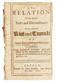
171234981London 1712. 16pp. Trimmed close minor toning. Good. Disbound.<br/> <br/> An anonymous political work that has been attributed over the centuries to both Jonathan Swift and Mary de la Rivière Manley. Most sources identify Manley as the author; she was an English author and pamphleteer who was famous for presenting political screeds disguised as romances or satire. A rare pamphlet either in institutions or the market.<br/> <br/> ESTC N45508. unknown
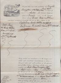
184836021Triana Alabama: n.p. 1848. Paper. Very good. Paper. Approximately 12.5" x 8." Folded. Front side is printed and hand written. Back side is a written receipt and written bill of lading for the cotton belonging to the Caleb Toney estate. Illustrated shipping letterhead from the Brewer Rowe & McKee that 85 bales of Cotton formerly owned by Caleb Toney were being shipped on "flat bottomed boats now lying on the Tennessee River whereof "Brewer Rowe & McKee owners and masters and bound for the port of New Orleans." At this time the best cotton land in the country was located along the Tennessee River from Whitesburg then known as Ditto’s Landing extending to a point three miles west of Triana. Madison County as we all know has led all counties in the State in cotton production practically without interruption since its creation in 1808. In 1816 it<br /> produced ten thousand bales for the market which according to The National Intelligencer was twice the production of any county of its size in the U.S. The big problem now facing the cotton merchants was transportation. With no railroads the only means of transportation was by navigation. As early as 1815 the leading businessmen of the county were making plans to meet the situation. Cotton had to reach the Tennessee River to be loaded on steamboats and transported to New Orleans via Paducah Kentucky down the Ohio River to Cairo and thence into the Mississippi for its ultimate destination.<br /> <br /> There is one family in particular that Judge Taylor refers to in his history the Toney Family. There were three brothers Harris Caleb and Edmund. They came into Madison County in 1818 and were among the first to buy land in the Triana vicinity. These three brothers were men of considerable means as judged by the standards of<br /> that time and quickly identified themselves with the development of Triana. Harris Toney was the eldest and the leader. He first engaged in the merchandising and cotton business later investing his ample means in farm lands and Negroes. He was far in advance of his time in his methods of farm development and was laying plans so extensive they would have overshadowed all other agricultural enterprises of his time but unfortunately he did not live long enough to see the fruition of his undertaking. He died according to Judge Taylor’s history in the prime of his manhood. Don’t know just when that was. He evidently was never married as his lands and properties were inherited by a Mrs. Coons and Mrs. Barclay. The next oldest brother Caleb died at an early age. <br /> <br /> The youngest of the three Col. Edmund Toney was one of the best businessmen of his day possessing excellent judgment and sound business sense. It was said of him that in his whole life he never was known to make a financial blunder. While the war stripped him of slaves and his land ran to waste yet at the close of the war he<br /> was out of debt and able to embark in the General Merchandising business in Triana. He died in 1877 at age 77 and is buried in Maple Hill Cemetery.<br /> <br /> Excerpts taken from Highlights in the History of Triana by Charles Dillard Lyle printed in The Huntsville Historic Quarterly June 21 1997. n.p. unknown
197962332Carmel CA: The Friends of Photography Inc. 1979. Oblong 4to. 31 1; 104 pp unpaginated. Second title in red & black 8 text photo illustrations 51 sepia-tinted photo plates. Oatmeal-coloured publisher’s cloth gilt lettering on spine w/ d.j. cover art photo of Columbia River gorge by Watkins slight dustsoiling very slight shelfwear NF/NF copy w/ original Friends of Photography membership application laid-in from the library of Charles H. “Brig†Belvin IV b. 1937 w/ ownership markings on ffep. First edition thus of this exceptional photographic work which reproduces all 51 of Watkins’ mammoth plate prints from the Photographs of the Columbia River and Oregon presenting a unique opportunity to fully appreciate the noted photographer’s brief six month period in 1867 documenting the Gorge in his exacting 18 x 22 in. wet plate glass negative process. The Friends of Photography, Inc., hardcover