8 621 résultats
1003 pages. Name index. Many dozens of black and white reproductions of wonderful archival photos. Provides a history of the Alberta districts of Blindman River, Bluff Centre, Harmonier, Iola, Lavesta, Montgreenar, Pineville, Riverview, Western Sunset and Willesden Green. Documents the history of the land sections and the families who occupied them. Includes sections on cattle and horse brands, sawmills, and cowboys. Covers the years 1900-1973. Gift greetings upon first blank leaf otherwise unmarked with moderate wear. Binding intact. A sound copy of this excellent local history and genealogical reference. Krotki (2) 544. Strathern 3089. Book
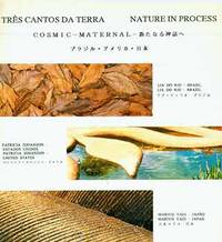
18-4185Rio de Janeiro: Museu Nacional de Belas Artes 1993. 4to. 34 pp. Very Good. Soft Cover. Stiff printed paper wraps. Staple binding. Color plates throughout. Text in Portuguese English and Japanese. Scarce.From the Collection of the Art Historian Peter Selz. [Rio de Janeiro?]: [Museu Nacional de Belas Artes?], 1993. paperback
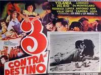
55-2037Mexico 1980. Mexican movie poster. 32 x 42 cm. Folded with signs of use mainly on the edges. Se trata de un cartel de mostrar real de la película. Se doble con signos de uso principalmente en los bordes. Mexico, 1980. unknown
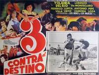
55-2042Mexico 1980. Mexican movie poster. 32 x 42 cm. Folded with signs of use mainly on the edges. Se trata de un cartel de mostrar real de la película. Se doble con signos de uso principalmente en los bordes. Mexico, 1980. unknown
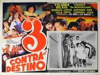
55-2040Mexico 1980. Mexican movie poster. 32 x 42 cm. Folded with signs of use mainly on the edges. Se trata de un cartel de mostrar real de la película. Se doble con signos de uso principalmente en los bordes. Mexico, 1980. unknown
55-2039Mexico 1980. Mexican movie poster. 32 x 42 cm. Folded with signs of use mainly on the edges. Se trata de un cartel de mostrar real de la película. Se doble con signos de uso principalmente en los bordes. Mexico, 1980. unknown
55-2043Mexico 1980. Mexican movie poster. 32 x 42 cm. Folded with signs of use mainly on the edges. Se trata de un cartel de mostrar real de la película. Se doble con signos de uso principalmente en los bordes. Mexico, 1980. unknown
55-1320Mexico 1980. Mexican movie poster. 32 cm. x 42 cm. Folded with signs of use mainly on the edges. Se trata de un cartel de mostrar real de la película. Se doble con signos de uso principalmente en los bordes. Mexico, 1980. unknown
55-2036Mexico 1980. Mexican movie poster. 32 x 42 cm. Folded with signs of use mainly on the edges. Se trata de un cartel de mostrar real de la película. Se doble con signos de uso principalmente en los bordes. Mexico, 1980. unknown
55-2028Mexico 1980. Mexican movie poster. 44 x 35 cm. Folded with signs of use mainly on the edges. Se trata de un cartel de mostrar real de la película. Se doble con signos de uso principalmente en los bordes. Mexico, 1980. unknown
55-1343Mexico 1980. Mexican movie poster. 94 cm. x 69 cm. Folded with signs of use mainly on the edges. Se trata de un cartel de mostrar real de la película. Se doble con signos de uso principalmente en los bordes. Mexico, 1980. unknown
55-2041Mexico 1980. Mexican movie poster. 32 x 42 cm. Folded with signs of use mainly on the edges. Se trata de un cartel de mostrar real de la película. Se doble con signos de uso principalmente en los bordes. Mexico, 1980. unknown
55-1319Mexico 1980. Mexican movie poster. 32 cm. x 42 cm. Folded with signs of use mainly on the edges. Se trata de un cartel de mostrar real de la película. Se doble con signos de uso principalmente en los bordes. Mexico, 1980. unknown
55-2038Mexico 1980. Mexican movie poster. 32 x 42 cm. Folded with signs of use mainly on the edges. Se trata de un cartel de mostrar real de la película. Se doble con signos de uso principalmente en los bordes. Mexico, 1980. unknown
156 pages. Index. Excellent black and white photos. Nice colour map entitled "Forest Distribution in Trent River Watershed" (34"x36") stored in pocket inside back board. Also present is a colour map entitled "Crown Timber Lands 1912" which covers the same geography and measures 21"x20". Final item in pocket is a chart showing "Classification of Land, Trent Watershed, Ont. 1912". Gilt lettering upon backstrip and front board. Initials upon front free endpaper else unmarked. Binding sound. Average wear. Sound copy. Book
19992111902153102181Bunkasha 1999. Soft Cover. Fine. Volume: 1 Bunkasha paperback
0666956006.Gpaperback. Good. Access codes and supplements are not guaranteed with used items. May be an ex-library book. paperback
187742208St. Louis: A. Gast & Co. Lith. 1877. 1877. IOWA NEBRASKA. First edition. 8vo. 21.6 cm x 13.3 cm. Original printed yellow wrappers 31 1 pp. illustrated from two full-page pictorial plates three maps on verso of front cover and recto and verso of rear cover. Front map is of the great South Platte region. Map on inside rear cover is a map of Southern Iowa showing lands of the Chicago Burlington & Quincy Railroad Company that are available for sale Map on outside of rear cover is a map showing the leading through routes to the West and the land grants in Iowa & Nebraska of the Chicago Burlington and Quincy R. R. and Burlington & Missouri River Railroad in Nebraska. A scarce and interesting promotional for the sale of 1000000 acres of land owned along the routes of the Burlington and Missouri River Railroad. The Burlington and Missouri put out some of the most interesting and compelling railroad land promotionals in the genre nicely illustrated with maps and plates and this example is no exception. The maps show the lands for sale along the line of the railroad from Monroe Iowa to Omaha; lands in Nebraska from Omaha to Kearney along the South Platte; and a map showing railroad routes from Chicago. The plates are entitled "Looking Southwest from Lincoln Neb." and "Valley of the Big Blue South of Seward Neb." The text is devoted to detailed descriptions of the land including natural resources soil climate stock raising and homesteading opportunities and prices for land and for goods. This publication enjoyed some success; another promotional issued the next year advertised only 750000 acres of land left for sale indicating that the Burlington and Missouri had sold off a quarter million acres of land the previous year. Laid into this copy is a four-page "Circular of Rates on Tickets and Freight" for several railroads including the Burlington & Missouri. Not in Railway Economics nor in the Eberstadt or Decker catalogues. OCLC locates three copies at the American Antiquarian Society Harvard Business School Library and the DeGolyer Library. There is also a copy at Yale. This scarce promotional booklet has covers lightly soiled small chips to the covers covers holding but loose internally quite serviceable. Overall a very good copy. A. Gast & Co. Lith., [1877]. unknown
22 pages. Clean and unmarked with moderate wear. Faint label removal patch on first page. A sound copy. Book
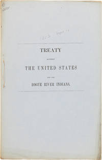
1855WRCAM50640Washington 1855. 7pp. Printed on blue paper. Folio stitched as issued. Gatherings loose. Edges toned internally clean. Very good. Concluded September 10 1853 proclaimed February 5 1855. Concluded by Joel Palmer at Table Rock in Oregon Territory. The Rogue River tribe agrees to sell their lands between Rogue River and Siskiyou Mountains in return for $60000. EBERSTADT 109. unknown books
2021__178906063XIwa Pub 2021. Paperback. New. 9.00x6.00x0.50 inches. Iwa Pub paperback
19532090202120403958Iwa Koku shoten 1953. Soft Cover. Fine. Number of books: 1 Iwa Koku shoten paperback
36" x 25.5". Indicates 25 foot contours, water bodies, roads, rail lines, structures, etc. Light wear. Book
1331551137.Gpaperback. Good. Access codes and supplements are not guaranteed with used items. May be an ex-library book. paperback
065600617X.Ghardcover. Good. Access codes and supplements are not guaranteed with used items. May be an ex-library book. hardcover