Fer, de NicolaasBiblio.com
2 067 résultats
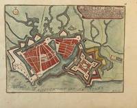
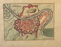
PR121919-036Original map of Grenoble France. Later colored with the river Iser les Recolets Tour de Natot Porte de Beaune.Engraving with later hand coloring on laid paper in good condition. Total size 270 x 390 mm. Numbered with 46 in the right top.NL Decoratieve historische kaart van Grenoble in Frankrijk. unknown
PR121919-035Original map of Le Havre in North of France. Later colored with citadelle la Corderie Fontaine Bassin des Capucins and compass.Engraving with later hand coloring on laid paper in good condition. Total size 280 x 380 mm. Numbered with 26 in the right top.NL Decoratieve historische kaart van Havre de Grâce de vroegere naam van het huidige Le Havre gelegen aan de monding van de Seine in Normandië Frankrijk. Komt waarschijnlijk uit de atlas Les Forces de L'Europe van Nicolas de Fer een bekende Franse cartograaf. Le Havre werd in 1517 gesticht door Frans I als strategische haven. De kaart toont een versterkt Le Havre zoals het eruitzag tijdens de 17e18e eeuw toen de stad een belangrijk militair en handelscentrum was. De citadel werd aangelegd om de monding van de Seine te verdedigen tegen Engelse invallen. unknown
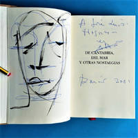
200123.576Santander: Estudio 2001. 1ª ed. Cartoné editorial. 14x21. Fotos. Estudio unknown
0947912460.Ghardcover. Good. Access codes and supplements are not guaranteed with used items. May be an ex-library book. hardcover
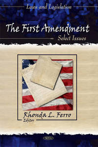
A9781617289873Hardback. New. Provides an overview of the major exceptions to the First Amendment of the ways that the Supreme Court has interpreted the guarantee of freedom of speech and press to provide no protection or only limited protection for some types of speech. hardcover
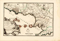
170015700Paris: N. de Fer 1700-05. Other. Full margins as published. In excellent condition. 233 by 343mm 9 by 13 inches. 233 by 343mm 9 by 13 inches. Original antique hand-colored copper engraving published 1700. Depicting Kingdom of Naples this map is a fine example of 0s European cartography. Image: 233 by 343mm 9 by 13 inches. An attractive and historically significant 18th-century map for the discerning collector. Nicolas de Fer 16461720 was a prominent French cartographer engraver and publisher based in Paris. After inheriting his father's mapmaking business de Fer built it into one of the most productive cartographic firms in France eventually becoming Geographer to King Louis XIV of France and King Philip V of Spain. His output was prolificmore than 600 sheet maps town plans and atlasescovering Europe the Americas and beyond. De Fer's maps are known for their decorative cartouches attractive hand coloring and commercial appeal though they were sometimes criticized for prioritizing artistry over accuracy. His maps are particularly associated with the campaigns of the War of the Spanish Succession and are sought by collectors for their decorative quality.This hand-colored copper engraving map of Kingdom of Naples published 1700 exemplifies the cartographic tradition of 1700s Europe. The map is engraved with careful attention to topographic detail depicting towns rivers mountain ranges and political boundaries with the precision expected of the finest cartographic productions of the period. The hand coloring highlights the geographic features and political divisions of Kingdom of Naples making this an attractive piece for both the collector and the scholar.A fine example from Introduction à la Géographie Paris sought after by collectors of antique maps of Italy antique maps of Kingdom of Naples and antique hand-colored copper engravings for sale. In very good condition. Light age-toning to the sheet as expected for a 18th-century map. N. de Fer unknown
658588847Springer pp. 506 . Hardback. Used. Springer hardcover
200580763La Esfera de los Libros S.L. 2005. Tapa blanda. 2ª Mano. . . Ex biblioteca marca tejuelo sello y expurgo. . . 1056 p. ; 24x16 cm. tapa blanda La Esfera de los Libros S.L. unknown
1975750843PN. New. 1975. Soft Cover. Date is original print. This is a reprint edition. . PN paperback
1975750994PN. New. 1975. Soft Cover. Date is original print. This is a reprint edition. . PN paperback
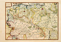
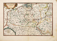
170566130Paris. c.1705. An attractive and quite detailed map of the northern regions of Brabant in Belgium and south western Holland by the French cartographer Nicolas de Fer. A number of larger regional towns are highlighted as are local rivers woodlands hills and marshes. Published in the 'Atlas Curieux ou Le Monde'. Size: 275 x 405 mm. Copperplate engraving with later hand colour. Good condition. Some general age toning. unknown
12269803like new. unknown
1952ZB628447London 1952. 83 pp. hardcover ex library page with plates detached but present else text clean good working copy. - If you are reading this this item is actually physically in our stock and ready for shipment once ordered. We are not bookjackers. Buyer is responsible for any additional duties taxes or fees required by recipient's country. Photos available upon request. London hardcover
2012DADAX3848457091Eae Editorial Academia Espanola 2012-04-05. paperback. New. 5.91x0.96x8.66. Buy with confidence. Excellent Customer Service & Return policy. Eae Editorial Academia Espanola paperback
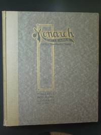
1911x1245Beaver Dam WI: Malleable Iron Range Company 1911. Handsome trade catalog of these popular coal/wood/corn cob-fired cooking appliances a few with gas attachments not much changed in design since 1899. Undated but circa 1911 - catalog 20 was issued in 1919. Light wear some bumping to the corners fraying to the edges. Text clean; 64 pages; b/w illustrations parts lists comments on quality. First Edition. Hard Cover. Very Good. 10¼" by 12". Malleable Iron Range Company Hardcover
DADAX0415813441Routledge 2015-02-19. 1. paperback. New. 6.00x0.60x8.90. Buy with confidence. Excellent Customer Service & Return policy. Routledge paperback
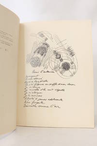
196258331Paris & Bruxelles Brussels & Liège: Editions de l'Essai 1962. Fine. Editions de l'Essai Paris & Bruxelles Brussels & Liège 1962 24 x 32 cm broché First edition one of 470 numbered copies on coated paper the only deluxe copies after 30 Coronado ""Lys de Gand"". Work illustrated with 21 drawings by Ferro. Light and minor foxing without significance on the title page. Editions de l'Essai unknown
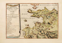
170070272Paris 1700-05. Pozzoli is a province of Naples and the main city of the Phlegrean Peninsula. It lies some two miles from the once fashionable resort of Baia. The map is well executed and detailed. Nicolas de Fer was the son of Antoine de Fer a Parisian map and print seller. This map from the Atlas Curieux. At the time of publication de Fer was the official cartographer to the French Dauphin but he later became cartographer to both the French and Spanish kings. Size: 270 x 405 mm. Copperplate engraving with later hand colour. Good condition. Slightly toned. unknown
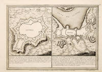
170565686Paris. 1705. An interesting and unusual map depicting the basic fortifications of two Portuguese towns. Published in the 'Atlas Curieux ou Le Monde'. Size: 275 x 395 mm. Copperplate engraving. Fine condition. unknown
1702523961702. Copper engraving. Later colouring. Size: 33 x 22 cm. 13 x 8½ inches unknown
SONG1505876311CREATESPACE 2015-01-01. First Edition. paperback. Used: Good. 8.50x0.53x11.00. Buy with confidence. Excellent Customer Service & Return policy. CREATESPACE paperback
196897.49491986Like new! American Iron and Steel Institute
169532945Paris ca. 1695. 23x295 cm. Kobberstukket kort i fugleperspektiv over Göteborg og den nordlige del af sundet med byplan og fortifikationer. Med stor kartouche. Håndkoloreret. <br/><br/><em>Fra Nicholas de Fer: "Les Forces d l'Europe". </em> unknown
1507650418.Gpaperback. Good. Access codes and supplements are not guaranteed with used items. May be an ex-library book. paperback