2 067 résultats
200672470Museum; University of Washington Press Distribution. New. 2006. Paperback. 0937108383 . FREE UPGRADE to Courier/Priority Shipping Upon Request - IN STOCK AND IMMEDIATELY AVAILABLE FOR SHIPMENT - Flawless copy brand new pristine never opened -- 112 pp. With 108 ills. 73 col. . 30 x 25 cm. -- with a bonus offer-- . Museum; University of Washington Press (Distribution) paperback
DADAX0937108383Brand: San Diego Museum of Art 0000-00-00. paperback. New. 9.75x0.50x11.50. Buy with confidence. Excellent Customer Service & Return policy. Brand: San Diego Museum of Art paperback
GOR008106634Paperback. Very Good. paperback
20131391879NASA. New. 2013. Soft Cover. Reprint Edition . NASA paperback
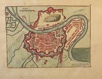
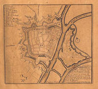
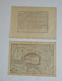
PR121919-036Original map of Grenoble France. Later colored with the river Iser les Recolets Tour de Natot Porte de Beaune.Engraving with later hand coloring on laid paper in good condition. Total size 270 x 390 mm. Numbered with 46 in the right top.NL Decoratieve historische kaart van Grenoble in Frankrijk. unknown
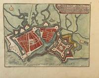
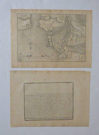
PR121919-035Original map of Le Havre in North of France. Later colored with citadelle la Corderie Fontaine Bassin des Capucins and compass.Engraving with later hand coloring on laid paper in good condition. Total size 280 x 380 mm. Numbered with 26 in the right top.NL Decoratieve historische kaart van Havre de Grâce de vroegere naam van het huidige Le Havre gelegen aan de monding van de Seine in Normandië Frankrijk. Komt waarschijnlijk uit de atlas Les Forces de L'Europe van Nicolas de Fer een bekende Franse cartograaf. Le Havre werd in 1517 gesticht door Frans I als strategische haven. De kaart toont een versterkt Le Havre zoals het eruitzag tijdens de 17e18e eeuw toen de stad een belangrijk militair en handelscentrum was. De citadel werd aangelegd om de monding van de Seine te verdedigen tegen Engelse invallen. unknown
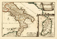
170515703Paris: N. de Fer 1705. Other. In excellent condition. 223 by 335mm 8 by 13 inches. 223 by 335mm 8 by 13 inches. Original antique hand-colored copper engraving published 1705. Depicting Kingdom of Naples this map is a fine example of 0s European cartography. Image: 223 by 335mm 8 by 13 inches. An attractive and historically significant 18th-century map for the discerning collector. Nicolas de Fer 16461720 was a prominent French cartographer engraver and publisher based in Paris. After inheriting his father's mapmaking business de Fer built it into one of the most productive cartographic firms in France eventually becoming Geographer to King Louis XIV of France and King Philip V of Spain. His output was prolificmore than 600 sheet maps town plans and atlasescovering Europe the Americas and beyond. De Fer's maps are known for their decorative cartouches attractive hand coloring and commercial appeal though they were sometimes criticized for prioritizing artistry over accuracy. His maps are particularly associated with the campaigns of the War of the Spanish Succession and are sought by collectors for their decorative quality.This decorative map show the Southern part of Italy with Sicily. Inside the map are many place names rivers mountains etc. engraved. In the upper right corner we see the title cartouche. In the lower right corner we see an inset map which shows the island Sardinia. At the bottom are two mileage scales.A fine example from Introduction à la Géographie Paris sought after by collectors of antique maps of Italy antique maps of Kingdom of Naples and antique hand-colored copper engravings for sale. In very good condition. Light age-toning to the sheet as expected for a 18th-century map. N. de Fer unknown
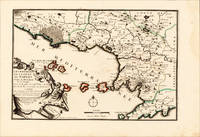
170015700Paris: N. de Fer 1700-05. Other. Full margins as published. In excellent condition. 233 by 343mm 9 by 13 inches. 233 by 343mm 9 by 13 inches. Original antique hand-colored copper engraving published 1700. Depicting Kingdom of Naples this map is a fine example of 0s European cartography. Image: 233 by 343mm 9 by 13 inches. An attractive and historically significant 18th-century map for the discerning collector. Nicolas de Fer 16461720 was a prominent French cartographer engraver and publisher based in Paris. After inheriting his father's mapmaking business de Fer built it into one of the most productive cartographic firms in France eventually becoming Geographer to King Louis XIV of France and King Philip V of Spain. His output was prolificmore than 600 sheet maps town plans and atlasescovering Europe the Americas and beyond. De Fer's maps are known for their decorative cartouches attractive hand coloring and commercial appeal though they were sometimes criticized for prioritizing artistry over accuracy. His maps are particularly associated with the campaigns of the War of the Spanish Succession and are sought by collectors for their decorative quality.This hand-colored copper engraving map of Kingdom of Naples published 1700 exemplifies the cartographic tradition of 1700s Europe. The map is engraved with careful attention to topographic detail depicting towns rivers mountain ranges and political boundaries with the precision expected of the finest cartographic productions of the period. The hand coloring highlights the geographic features and political divisions of Kingdom of Naples making this an attractive piece for both the collector and the scholar.A fine example from Introduction à la Géographie Paris sought after by collectors of antique maps of Italy antique maps of Kingdom of Naples and antique hand-colored copper engravings for sale. In very good condition. Light age-toning to the sheet as expected for a 18th-century map. N. de Fer unknown
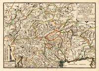
170515715Paris: N. de Fer 1705. Other. Full margins as published. 252 by 352mm 10 by 13 inches. 252 by 352mm 10 by 13 inches. Original antique hand-colored copper engraving published 1705. Depicting Tyrol & Trentino this map is a fine example of 0s European cartography. Image: 252 by 352mm 10 by 13 inches. An attractive and historically significant 18th-century map for the discerning collector. Nicolas de Fer 16461720 was a prominent French cartographer engraver and publisher based in Paris. After inheriting his father's mapmaking business de Fer built it into one of the most productive cartographic firms in France eventually becoming Geographer to King Louis XIV of France and King Philip V of Spain. His output was prolificmore than 600 sheet maps town plans and atlasescovering Europe the Americas and beyond. De Fer's maps are known for their decorative cartouches attractive hand coloring and commercial appeal though they were sometimes criticized for prioritizing artistry over accuracy. His maps are particularly associated with the campaigns of the War of the Spanish Succession and are sought by collectors for their decorative quality.Ornated in the lower left corner with a small milage scale.A fine example from Introduction à la Géographie Paris sought after by collectors of antique maps of Italy antique maps of Tyrol and antique hand-colored copper engravings for sale. In very good condition. Light age-toning to the sheet as expected for a 18th-century map. N. de Fer unknown
592351705. Rahmengrösse: 39 x 48 24 x 33 cm Goldrahmen u. Passepartout tadell. Nicolas de Fer 1646 -1720 in Paris einer der führenden französischen Kartographen und Kartenverleger schuf zahlreiche Atlanten und spezialisierte sich auf die Veröffentlichung von Drucken zu aktuellen Ereignissen: Karten von Grenzverläufen oder neueroberten Gebieten sowie Karten von Städten die vom französischen Festungsbaumeister Vauban ausgebaut wurden. 600 1705 unknown
KART0070Paris 1705. Wien - Plangröße: 50 x 165 cm rechter weißer Rand schmal beschnitten ob. Rand etwas ausgefranst mittl. Bugfalte schwach gebr. Ansicht des Donaulaufs von Krems bis Pressburg Wien und Pressburg ringbefestigt. Paris 1705. unknown
51-3483Paris: Nicolas de Fer circa 1693. 4to. 23 x 29cm. 18th Century rose cardboard covers. 33 engraved views and plans and 2 hand-drawn plans of Versoi and the col of Grand-Saint-Bernard showing Saint-Rhémy et San Leonardo. Old manuscript table of contents. Most of the plates are 17th Century but 2 are 18th Century. Small losses and browning to most plates.Nicholas de Fer 1646 – 1720 was the son of cartographer Antoine de Fer. Nicholas was established as an engraver cartographer and map publisher in Paris with over 600 maps and atlases to his credit. His work earned a large following because of its considerable decorative appeal. In the late 17th century de Fer’s career culminated in his appointment as Geographer to the King of France. Upon his death in 1720 Nicolas was succeeded by two of his sons-in-law Guillaume Danet and Jacques-François Danet and their heirs who continued the de Fer publishing firm until c. 1760. Recueil de 35 cartes plans et vues de villes fortifiées gravées sur cuivre 33 et manuscrites 2. S.l.n.d. Paris 1693 e.a. In-4 oblong cartonnage rose pièce de titre manuscrite Reliure vers 1800.Le présent ensemble contient :– 27 cartes et plans de villes fortifiées extraites pour la plupart de l'atlas de Nicolas de Fer 1693 montrant Turin Endingen Mont Royal Mayence Ath Pignerol Mont-Melian Landau Casal Verceil Genève Maestricht Huningue Nice Charle-Roy Bonn Calais Coblentz Stetin Juliers Wismar Mons Verüe Berg S. Winox Kamieniec Podolski Donquerque Coni ;– 4 vues gravées de Montmélian Miolans Verue Verrua Savoia et du siège de Genève ;– 2 planches manuscrites : un plan de Versoi et une carte du col du Grand-Saint-Bernard montrant Saint-Rhémy et San Leonardo ;– 2 petites planches gravées postérieures.Exemplaire défraîchi : cartes jaunies présentant parfois des restaurations ; petits manques marginaux à quelques cartes quelques rousseurs et taches d'encre. Paris: Nicolas de Fer, circa 1693. unknown
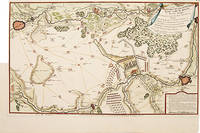
171752957Paris. 1717. Detailed map of a battle in the July of 1712 with troop placementsand positions on the map. An explanation of the battle at lower right. Accompanying text on reverse. Published in de Fer's Atlas Curieux ou Le Monde. Copper engraving. Very good condition. Upper left top and right hand margin have been trimmed close to edge of plate Later colouring. Size: 52.5 x 31 cm. unknown
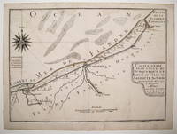
239457Map. Engraving with original hand coloring. Image measures 8.75" x 12".<br/> <br/> This charming map of Dunkirk shows the city as it sits on the coast of the southernmost part of the North Sea here labeled as the Sea of Flanders. Working circa 1705 De Fer has represented the city with a schematized drawing of its exterior walls. Canals connecting the city to nearby towns and churches are also depicted and labeled. Sand bars are drawn and mountains are represented pictorically and a decorative compass rose at the upper left points due north. The map is in very good condition with no chips or tears and minor staining. Nicolas de Fer 1646-1720 was a French cartographer engraver and publisher. He became official geographer to the French Dauphin 1691 and to the Spanish King 1702 and was renowned particularly for his maps of the French coast of which this is a fine example.<br/> <br/> unknown
1841aaum 1700. Maße: ca. 327 x 25 cm mehrfach gefaltet gering fleckig/Blatt mit kleinen Randläsuren. unknown
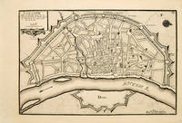
171753083Atlas Curieux ou le Monde. Paris 1717. Plan of Cologne with north to the right showing fortifications and old town. Title at top left. Includes accompanying text Copper engraving. Excellent condition good margins. Uncoloured. Size: 34.8 x 24 cm. 13½ x 9½ inches unknown
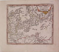
1725204942Paris: de Fer Nicolas 1725. unbound. very good. Map. Engraving with modern hand coloring. Image measures 5.25" x 6.25".<br/> <br/> Charming miniature map of Denmark with the Coat of Arms incorporated in the cartouche. Map includes both Schleswig and Holstein while today part of the former and all of the latter are northern Germany. Nicolas de Fer 1646-1720 was a French cartographer engraver and publisher. He became official geographer to the French Dauphin 1691 and to the Spanish King 1702.<br/> <br/> de Fer, Nicolas unknown
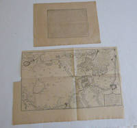
51-6443Paris: chez l'auteur dans l'Isle du Palais sur le quay de l'orloge a la Sphére Royale avec privilége du Roy 1715. Engraved text broadside 27.3 x 38cm. and engraved map 38 x 57cm. Top left trimmed to borderline. Contemporary laid paper uniformly time aged.Published in "L'atlas curieux ou Le monde reÌpreseÌnteÌ dans des cartes geÌneÌrales et particulieres du ciel et de la terre : diviseÌ tant en ses quatre principales parties que par eÌtats et provinces et orneÌ par des plans et descriptions des villes capitales et principales et des plus superbes edifices qui les embelissent comme sont les eglises les palais les maisons de plaisance les iardins les fontaines &c. ". OCLC Number / Unique Identifier:79022119.LThe Atlas Curieux is geographic encyclopedia of images and maps of France with detailed views of the grand waterworks at Marly views of the great palaces and chateaux views and plans of the Paris Observatory and samples of military architecture. Issued in six annual parts from 1700-1705 the maps are based on the new observations of the Académie des Sciences and drawn up with the assistance of Philipe de La Hire.Library of Congress:The French cartographer and engraver Nicolas de Fer was a master at creating maps that were works of art. The maps that he published were printed during the Baroque period when the decorative arts were characterized by ornate detail. De Fer’s detailed maps and atlases were valued more for their decorative content than their geographical accuracy.Nicolas de Fer was born in 1646. His father Antoine de Fer owned a mapmaking firm. At the age of twelve Nicolas was apprenticed to a Parisian engraver named Louis Spirinx. The family business was starting to decline when his father died in 1673. Nicolas de Fer’s mother Genevieve took over the business after the death of her husband. In 1687 the business was passed on to Nicolas and the profits increased after he took over the firm. Nicolas de Fer was a prolific cartographer who produced atlases and hundreds of single maps. He eventually became the official geographer to King Louis XIV of France and King Philip V of Spain.One of de Fer’s major works is an atlas titled L’atlas curieux The curious atlas. Paris: chez l'auteur dans l'Isle du Palais sur le quay de l'orloge a la Sphére Royale avec privilége du Roy, 1715 unknown
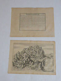
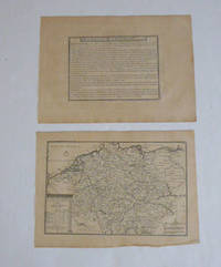
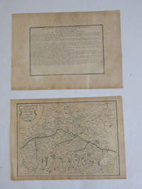
51-6469Paris: chez l'auteur dans l'Isle du Palais sur le quay de l'orloge a la Sphére Royale avec privilége du Roy 1705-1717. Engraved text broadside and engraved map.Each 27.3 x 38cm. Contemporary laid paper uniformly time aged.Published in "L'atlas curieux ou le monde reÌpreseÌnteÌ dans des cartes geÌneÌrales et particulieres du ciel et de la terre : diviseÌ tant en ses quatre principales parties que par eÌtats et provinces et orneÌ par des plans et descriptions des villes capitales et principales et des plus superbes edifices qui les embelissent comme sont les eglises les palais les maisons de plaisance les iardins les fontaines &c. ". OCLC Number / Unique Identifier:79022119.LThe Atlas Curieux is geographic encyclopedia of images and maps of France with detailed views of the grand waterworks at Marly views of the great palaces and chateaux views and plans of the Paris Observatory and samples of military architecture. Issued in six annual parts from 1700-1705 the maps are based on the new observations of the Académie des Sciences and drawn up with the assistance of Philipe de La Hire.Library of Congress:The French cartographer and engraver Nicolas de Fer was a master at creating maps that were works of art. The maps that he published were printed during the Baroque period when the decorative arts were characterized by ornate detail. De Fer’s detailed maps and atlases were valued more for their decorative content than their geographical accuracy.Nicolas de Fer was born in 1646. His father Antoine de Fer owned a mapmaking firm. At the age of twelve Nicolas was apprenticed to a Parisian engraver named Louis Spirinx. The family business was starting to decline when his father died in 1673. Nicolas de Fer’s mother Genevieve took over the business after the death of her husband. In 1687 the business was passed on to Nicolas and the profits increased after he took over the firm. Nicolas de Fer was a prolific cartographer who produced atlases and hundreds of single maps. He eventually became the official geographer to King Louis XIV of France and King Philip V of Spain.One of de Fer’s major works is an atlas titled L’atlas curieux The curious atlas. Paris: chez l'auteur dans l'Isle du Palais sur le quay de l'orloge a la Sphére Royale avec privilége du Roy, 1705-1717 unknown
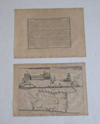
51-6472Paris: chez l'auteur dans l'Isle du Palais sur le quay de l'orloge a la Sphére Royale avec privilége du Roy 1705-1717. Engraved text broadside and engraved map.Each 27.3 x 38cm. Contemporary laid paper uniformly time aged.Map of the fortifications of Lisbon with the city divided into its Old and New Towns. The citadel of the city is prominently marked. Features two views of the Royal Palace and Belem Tower respectively.This map was published during the War of the Spanish Succession a conflict in which Portugal and Lisbon featured prominent hence the depiction of the fortifications of the city.Published in "L'atlas curieux ou le monde reÌpreseÌnteÌ dans des cartes geÌneÌrales et particulieres du ciel et de la terre : diviseÌ tant en ses quatre principales parties que par eÌtats et provinces et orneÌ par des plans et descriptions des villes capitales et principales et des plus superbes edifices qui les embelissent comme sont les eglises les palais les maisons de plaisance les iardins les fontaines &c. ". OCLC Number / Unique Identifier:79022119.LThe Atlas Curieux is geographic encyclopedia of images and maps of France with detailed views of the grand waterworks at Marly views of the great palaces and chateaux views and plans of the Paris Observatory and samples of military architecture. Issued in six annual parts from 1700-1705 the maps are based on the new observations of the Académie des Sciences and drawn up with the assistance of Philipe de La Hire.Library of Congress:The French cartographer and engraver Nicolas de Fer was a master at creating maps that were works of art. The maps that he published were printed during the Baroque period when the decorative arts were characterized by ornate detail. De Fer’s detailed maps and atlases were valued more for their decorative content than their geographical accuracy.Nicolas de Fer was born in 1646. His father Antoine de Fer owned a mapmaking firm. At the age of twelve Nicolas was apprenticed to a Parisian engraver named Louis Spirinx. The family business was starting to decline when his father died in 1673. Nicolas de Fer’s mother Genevieve took over the business after the death of her husband. In 1687 the business was passed on to Nicolas and the profits increased after he took over the firm. Nicolas de Fer was a prolific cartographer who produced atlases and hundreds of single maps. He eventually became the official geographer to King Louis XIV of France and King Philip V of Spain.One of de Fer’s major works is an atlas titled L’atlas curieux The curious atlas. Paris: chez l'auteur dans l'Isle du Palais sur le quay de l'orloge a la Sphére Royale avec privilége du Roy, 1705-1717 unknown
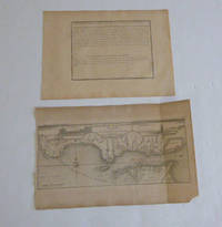
51-6470Paris: chez l'auteur dans l'Isle du Palais sur le quay de l'orloge a la Sphére Royale avec privilége du Roy 1705-1717. Engraved text broadside and engraved map.27.3 x 38cm. and 27.3 x 43cm. Missing piece in lower right corner. Fold mark on right side. Contemporary laid paper uniformly time aged.The Tagus is the longest river in the Iberian Peninsula. The river rises in the Montes Universales between Cuenca and Teruel in mid-eastern Spain flows 1007 km generally westward and empties into the Atlantic Ocean in Lisbon.Published in "L'atlas curieux ou le monde reÌpreseÌnteÌ dans des cartes geÌneÌrales et particulieres du ciel et de la terre : diviseÌ tant en ses quatre principales parties que par eÌtats et provinces et orneÌ par des plans et descriptions des villes capitales et principales et des plus superbes edifices qui les embelissent comme sont les eglises les palais les maisons de plaisance les iardins les fontaines &c. ". OCLC Number / Unique Identifier:79022119.LThe Atlas Curieux is geographic encyclopedia of images and maps of France with detailed views of the grand waterworks at Marly views of the great palaces and chateaux views and plans of the Paris Observatory and samples of military architecture. Issued in six annual parts from 1700-1705 the maps are based on the new observations of the Académie des Sciences and drawn up with the assistance of Philipe de La Hire.Library of Congress:The French cartographer and engraver Nicolas de Fer was a master at creating maps that were works of art. The maps that he published were printed during the Baroque period when the decorative arts were characterized by ornate detail. De Fer’s detailed maps and atlases were valued more for their decorative content than their geographical accuracy.Nicolas de Fer was born in 1646. His father Antoine de Fer owned a mapmaking firm. At the age of twelve Nicolas was apprenticed to a Parisian engraver named Louis Spirinx. The family business was starting to decline when his father died in 1673. Nicolas de Fer’s mother Genevieve took over the business after the death of her husband. In 1687 the business was passed on to Nicolas and the profits increased after he took over the firm. Nicolas de Fer was a prolific cartographer who produced atlases and hundreds of single maps. He eventually became the official geographer to King Louis XIV of France and King Philip V of Spain.One of de Fer’s major works is an atlas titled L’atlas curieux The curious atlas. Paris: chez l'auteur dans l'Isle du Palais sur le quay de l'orloge a la Sphére Royale avec privilége du Roy, 1705-1717 unknown
51-6477Paris: chez l'auteur dans l'Isle du Palais sur le quay de l'orloge a la Sphére Royale avec privilége du Roy 1705-1717. Engraved text broadside and map. Each 27.3 x 38cm. Contemporary laid paper uniformly time aged.This detailed map shows the vicinity of Milan and the important network of canals. The Naviglio Canal shown here connecting Lake Maggiore with Milan was the first artificial canal in Europe probably originating as a defensive ditch dug in the 12th century. It was one of the largest post-medieval engineering projects allowing development of commerce transport and agriculture in the region. Prominently depicted within a large area north of Pavia is the Enclos des Chartreux Certosa di Pavia monastery located within a large hunting park that belonged to the Visconti family of Milan.Evora is the capital of the province of Alentejo east of Lisbon It was captured by the Romans in 80 BC and has a Roman aqueduct and temple of Diana the goddess of hunting. There is also a 13th-century Gothic cathedral. From the 14th to the 16th centuries Evora was the residence of the Kings of Portugal.This map was published during the War of the Spanish Succession a conflict in which Portugal and Lisbon featured prominent hence the depiction of the fortifications of the city.Published in "L'atlas curieux ou le monde reÌpreseÌnteÌ dans des cartes geÌneÌrales et particulieres du ciel et de la terre : diviseÌ tant en ses quatre principales parties que par eÌtats et provinces et orneÌ par des plans et descriptions des villes capitales et principales et des plus superbes edifices qui les embelissent comme sont les eglises les palais les maisons de plaisance les iardins les fontaines &c. ". OCLC Number / Unique Identifier:79022119.LThe Atlas Curieux is geographic encyclopedia of images and maps of France with detailed views of the grand waterworks at Marly views of the great palaces and chateaux views and plans of the Paris Observatory and samples of military architecture. Issued in six annual parts from 1700-1705 the maps are based on the new observations of the Académie des Sciences and drawn up with the assistance of Philipe de La Hire.Library of Congress:The French cartographer and engraver Nicolas de Fer was a master at creating maps that were works of art. The maps that he published were printed during the Baroque period when the decorative arts were characterized by ornate detail. De Fer’s detailed maps and atlases were valued more for their decorative content than their geographical accuracy.Nicolas de Fer was born in 1646. His father Antoine de Fer owned a mapmaking firm. At the age of twelve Nicolas was apprenticed to a Parisian engraver named Louis Spirinx. The family business was starting to decline when his father died in 1673. Nicolas de Fer’s mother Genevieve took over the business after the death of her husband. In 1687 the business was passed on to Nicolas and the profits increased after he took over the firm. Nicolas de Fer was a prolific cartographer who produced atlases and hundreds of single maps. He eventually became the official geographer to King Louis XIV of France and King Philip V of Spain.One of de Fer’s major works is an atlas titled L’atlas curieux The curious atlas. Paris: chez l'auteur dans l'Isle du Palais sur le quay de l'orloge a la Sphére Royale avec privilége du Roy, 1705-1717 unknown
51-6466Paris: chez l'auteur dans l'Isle du Palais sur le quay de l'orloge a la Sphére Royale avec privilége du Roy 1705-1717. Engraved text broadside and engraved map.Each 27.3 x 38cm. Contemporary laid paper uniformly time aged.Published in "L'atlas curieux ou le monde reÌpreseÌnteÌ dans des cartes geÌneÌrales et particulieres du ciel et de la terre : diviseÌ tant en ses quatre principales parties que par eÌtats et provinces et orneÌ par des plans et descriptions des villes capitales et principales et des plus superbes edifices qui les embelissent comme sont les eglises les palais les maisons de plaisance les iardins les fontaines &c. ". OCLC Number / Unique Identifier:79022119.LThe Atlas Curieux is geographic encyclopedia of images and maps of France with detailed views of the grand waterworks at Marly views of the great palaces and chateaux views and plans of the Paris Observatory and samples of military architecture. Issued in six annual parts from 1700-1705 the maps are based on the new observations of the Académie des Sciences and drawn up with the assistance of Philipe de La Hire.Library of Congress:The French cartographer and engraver Nicolas de Fer was a master at creating maps that were works of art. The maps that he published were printed during the Baroque period when the decorative arts were characterized by ornate detail. De Fer’s detailed maps and atlases were valued more for their decorative content than their geographical accuracy.Nicolas de Fer was born in 1646. His father Antoine de Fer owned a mapmaking firm. At the age of twelve Nicolas was apprenticed to a Parisian engraver named Louis Spirinx. The family business was starting to decline when his father died in 1673. Nicolas de Fer’s mother Genevieve took over the business after the death of her husband. In 1687 the business was passed on to Nicolas and the profits increased after he took over the firm. Nicolas de Fer was a prolific cartographer who produced atlases and hundreds of single maps. He eventually became the official geographer to King Louis XIV of France and King Philip V of Spain.One of de Fer’s major works is an atlas titled L’atlas curieux The curious atlas. Paris: chez l'auteur dans l'Isle du Palais sur le quay de l'orloge a la Sphére Royale avec privilége du Roy, 1705-1717 unknown
51-6450Paris: chez l'auteur dans l'Isle du Palais sur le quay de l'orloge a la Sphére Royale avec privilége du Roy 1705-1717. Engraved text broadside and engraved map.Each 27.3 x 38cm. Contemporary laid paper uniformly time aged.Published in "L'atlas curieux ou Le monde reÌpreseÌnteÌ dans des cartes geÌneÌrales et particulieres du ciel et de la terre : diviseÌ tant en ses quatre principales parties que par eÌtats et provinces et orneÌ par des plans et descriptions des villes capitales et principales et des plus superbes edifices qui les embelissent comme sont les eglises les palais les maisons de plaisance les iardins les fontaines &c. ". OCLC Number / Unique Identifier:79022119.LThe Atlas Curieux is geographic encyclopedia of images and maps of France with detailed views of the grand waterworks at Marly views of the great palaces and chateaux views and plans of the Paris Observatory and samples of military architecture. Issued in six annual parts from 1700-1705 the maps are based on the new observations of the Académie des Sciences and drawn up with the assistance of Philipe de La Hire.ibrary of Congress:The French cartographer and engraver Nicolas de Fer was a master at creating maps that were works of art. The maps that he published were printed during the Baroque period when the decorative arts were characterized by ornate detail. De Fer’s detailed maps and atlases were valued more for their decorative content than their geographical accuracy.Nicolas de Fer was born in 1646. His father Antoine de Fer owned a mapmaking firm. At the age of twelve Nicolas was apprenticed to a Parisian engraver named Louis Spirinx. The family business was starting to decline when his father died in 1673. Nicolas de Fer’s mother Genevieve took over the business after the death of her husband. In 1687 the business was passed on to Nicolas and the profits increased after he took over the firm. Nicolas de Fer was a prolific cartographer who produced atlases and hundreds of single maps. He eventually became the official geographer to King Louis XIV of France and King Philip V of Spain.One of de Fer’s major works is an atlas titled L’atlas curieux The curious atlas. Paris: chez l'auteur dans l'Isle du Palais sur le quay de l'orloge a la Sphére Royale avec privilége du Roy, 1705-1717 unknown
51-6464Paris: chez l'auteur dans l'Isle du Palais sur le quay de l'orloge a la Sphére Royale avec privilége du Roy 1705-1717. Engraved text broadside and engraved map.Each 27.3 x 38cm. Contemporary laid paper uniformly time aged.Published in "L'atlas curieux ou le monde reÌpreseÌnteÌ dans des cartes geÌneÌrales et particulieres du ciel et de la terre : diviseÌ tant en ses quatre principales parties que par eÌtats et provinces et orneÌ par des plans et descriptions des villes capitales et principales et des plus superbes edifices qui les embelissent comme sont les eglises les palais les maisons de plaisance les iardins les fontaines &c. ". OCLC Number / Unique Identifier:79022119.LThe Atlas Curieux is geographic encyclopedia of images and maps of France with detailed views of the grand waterworks at Marly views of the great palaces and chateaux views and plans of the Paris Observatory and samples of military architecture. Issued in six annual parts from 1700-1705 the maps are based on the new observations of the Académie des Sciences and drawn up with the assistance of Philipe de La Hire.ibrary of Congress:The French cartographer and engraver Nicolas de Fer was a master at creating maps that were works of art. The maps that he published were printed during the Baroque period when the decorative arts were characterized by ornate detail. De Fer’s detailed maps and atlases were valued more for their decorative content than their geographical accuracy.Nicolas de Fer was born in 1646. His father Antoine de Fer owned a mapmaking firm. At the age of twelve Nicolas was apprenticed to a Parisian engraver named Louis Spirinx. The family business was starting to decline when his father died in 1673. Nicolas de Fer’s mother Genevieve took over the business after the death of her husband. In 1687 the business was passed on to Nicolas and the profits increased after he took over the firm. Nicolas de Fer was a prolific cartographer who produced atlases and hundreds of single maps. He eventually became the official geographer to King Louis XIV of France and King Philip V of Spain.One of de Fer’s major works is an atlas titled L’atlas curieux The curious atlas. Paris: chez l'auteur dans l'Isle du Palais sur le quay de l'orloge a la Sphére Royale avec privilége du Roy, 1705-1717 unknown