2 067 résultats
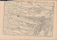
51-6468Paris: chez l'auteur dans l'Isle du Palais sur le quay de l'orloge a la Sphére Royale avec privilége du Roy 1714-1717. Engraved map. 27.3 x 38cm and 27.3 x 39.5cm. Fold on right side.lContemporary laid paper uniformly time aged.Published in "L'atlas curieux ou Le monde reÌpreseÌnteÌ dans des cartes geÌneÌrales et particulieres du ciel et de la terre : diviseÌ tant en ses quatre principales parties que par eÌtats et provinces et orneÌ par des plans et descriptions des villes capitales et principales et des plus superbes edifices qui les embelissent comme sont les eglises les palais les maisons de plaisance les iardins les fontaines &c. ". OCLC Number / Unique Identifier:79022119.LThe Atlas Curieux is geographic encyclopedia of images and maps of France with detailed views of the grand waterworks at Marly views of the great palaces and chateaux views and plans of the Paris Observatory and samples of military architecture. Issued in six annual parts from 1700-1705 the maps are based on the new observations of the Académie des Sciences and drawn up with the assistance of Philipe de La Hire.ibrary of Congress:The French cartographer and engraver Nicolas de Fer was a master at creating maps that were works of art. The maps that he published were printed during the Baroque period when the decorative arts were characterized by ornate detail. De Fer’s detailed maps and atlases were valued more for their decorative content than their geographical accuracy.Nicolas de Fer was born in 1646. His father Antoine de Fer owned a mapmaking firm. At the age of twelve Nicolas was apprenticed to a Parisian engraver named Louis Spirinx. The family business was starting to decline when his father died in 1673. Nicolas de Fer’s mother Genevieve took over the business after the death of her husband. In 1687 the business was passed on to Nicolas and the profits increased after he took over the firm. Nicolas de Fer was a prolific cartographer who produced atlases and hundreds of single maps. He eventually became the official geographer to King Louis XIV of France and King Philip V of Spain.One of de Fer’s major works is an atlas titled L’atlas curieux The curious atlas. Paris: chez l'auteur dans l'Isle du Palais sur le quay de l'orloge a la Sphére Royale avec privilége du Roy, 1714-1717 unknown
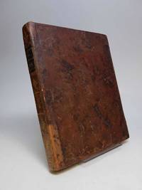
156417hardcover. Dediees a Monseigneur le Dauphin par Sontres Humble et tres Obeissant Serviteur et Geographe De Fer. Beautiful double-page engraved title page 4 38 2 60 28pp. This splendid atlas is illustrated with 32 engraved coastal charts including a folding wind chart and a general index chart of France. The double page maps have delicate outline hand coloring. An engraved divisional title page number 26 entitled "Les Costes de la Mer Mediterranee" is the 33rd plate. Short 4to 9.5 x 7.75 inches 17th Century calf well-worn; neatly rebacked; marbled endpapers red edges. Inscription in ink first fly leaf. Paris: Chez le Sr. de Fer dans l'Isle du Palais sur Quay de l'Orloge a la Sphere Royale. Avec Pri. du Roy 1690.<br/> <br/> Nicolas de Fer 1646-1720 was a prolific cartographer engraver and publisher who took over the family map business from his mother when she retired in 1687. The business flourished and he gained a great reputation in his lifetime and was appointed 'Geographer to the King' in 1690. This original edition the first atlas to bear his name was published in 1690 on the basis of an atlas published in 1634 by order of Cardinal Richelieu by the publisher Tassin who sold his plates in 1644 to Antoine de Fer Nicolas's father. Scarce.<br/> <br/> unknown
51-6454Paris: chez l'auteur dans l'Isle du Palais sur le quay de l'orloge a la Sphére Royale avec privilége du Roy 1705-1717. Engraved map. 27.3 x 38 cm. Contemporary laid paper uniformly time aged.Loss fof paper and borderline upper left.Published in "L'atlas curieux ou Le monde reÌpreseÌnteÌ dans des cartes geÌneÌrales et particulieres du ciel et de la terre : diviseÌ tant en ses quatre principales parties que par eÌtats et provinces et orneÌ par des plans et descriptions des villes capitales et principales et des plus superbes edifices qui les embelissent comme sont les eglises les palais les maisons de plaisance les iardins les fontaines &c. ". OCLC Number / Unique Identifier:79022119.LThe Atlas Curieux is geographic encyclopedia of images and maps of France with detailed views of the grand waterworks at Marly views of the great palaces and chateaux views and plans of the Paris Observatory and samples of military architecture. Issued in six annual parts from 1700-1705 the maps are based on the new observations of the Académie des Sciences and drawn up with the assistance of Philipe de La Hire.ibrary of Congress:The French cartographer and engraver Nicolas de Fer was a master at creating maps that were works of art. The maps that he published were printed during the Baroque period when the decorative arts were characterized by ornate detail. De Fer’s detailed maps and atlases were valued more for their decorative content than their geographical accuracy.Nicolas de Fer was born in 1646. His father Antoine de Fer owned a mapmaking firm. At the age of twelve Nicolas was apprenticed to a Parisian engraver named Louis Spirinx. The family business was starting to decline when his father died in 1673. Nicolas de Fer’s mother Genevieve took over the business after the death of her husband. In 1687 the business was passed on to Nicolas and the profits increased after he took over the firm. Nicolas de Fer was a prolific cartographer who produced atlases and hundreds of single maps. He eventually became the official geographer to King Louis XIV of France and King Philip V of Spain.One of de Fer’s major works is an atlas titled L’atlas curieux The curious atlas. Paris: chez l'auteur dans l'Isle du Palais sur le quay de l'orloge a la Sphére Royale avec privilége du Roy, 1705-1717 unknown
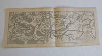
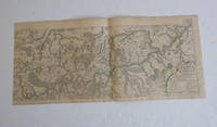
51-6447Paris: chez l'auteur dans l'Isle du Palais sur le quay de l'orloge a la Sphére Royale avec privilége du Roy 1705-1717. Engraved map. One fold. Worm holes in lower marginEach 27.3 x 64.2 cm. Contemporary laid paper uniformly time aged.Published in "L'atlas curieux ou Le monde reÌpreseÌnteÌ dans des cartes geÌneÌrales et particulieres du ciel et de la terre : diviseÌ tant en ses quatre principales parties que par eÌtats et provinces et orneÌ par des plans et descriptions des villes capitales et principales et des plus superbes edifices qui les embelissent comme sont les eglises les palais les maisons de plaisance les iardins les fontaines &c. ". OCLC Number / Unique Identifier:79022119.LThe Atlas Curieux is geographic encyclopedia of images and maps of France with detailed views of the grand waterworks at Marly views of the great palaces and chateaux views and plans of the Paris Observatory and samples of military architecture. Issued in six annual parts from 1700-1705 the maps are based on the new observations of the Académie des Sciences and drawn up with the assistance of Philipe de La Hire.ibrary of Congress:The French cartographer and engraver Nicolas de Fer was a master at creating maps that were works of art. The maps that he published were printed during the Baroque period when the decorative arts were characterized by ornate detail. De Fer’s detailed maps and atlases were valued more for their decorative content than their geographical accuracy.Nicolas de Fer was born in 1646. His father Antoine de Fer owned a mapmaking firm. At the age of twelve Nicolas was apprenticed to a Parisian engraver named Louis Spirinx. The family business was starting to decline when his father died in 1673. Nicolas de Fer’s mother Genevieve took over the business after the death of her husband. In 1687 the business was passed on to Nicolas and the profits increased after he took over the firm. Nicolas de Fer was a prolific cartographer who produced atlases and hundreds of single maps. He eventually became the official geographer to King Louis XIV of France and King Philip V of Spain.One of de Fer’s major works is an atlas titled L’atlas curieux The curious atlas. Paris: chez l'auteur dans l'Isle du Palais sur le quay de l'orloge a la Sphére Royale avec privilége du Roy, 1705-1717 unknown
51-6446Paris: chez l'auteur dans l'Isle du Palais sur le quay de l'orloge a la Sphére Royale avec privilége du Roy 1714-1717. Engraved map. One fold. 27.3 x 51cm. Contemporary laid paper uniformly time aged.Published in "L'atlas curieux ou Le monde reÌpreseÌnteÌ dans des cartes geÌneÌrales et particulieres du ciel et de la terre : diviseÌ tant en ses quatre principales parties que par eÌtats et provinces et orneÌ par des plans et descriptions des villes capitales et principales et des plus superbes edifices qui les embelissent comme sont les eglises les palais les maisons de plaisance les iardins les fontaines &c. ". OCLC Number / Unique Identifier:79022119.LThe Atlas Curieux is geographic encyclopedia of images and maps of France with detailed views of the grand waterworks at Marly views of the great palaces and chateaux views and plans of the Paris Observatory and samples of military architecture. Issued in six annual parts from 1700-1705 the maps are based on the new observations of the Académie des Sciences and drawn up with the assistance of Philipe de La Hire.ibrary of Congress:The French cartographer and engraver Nicolas de Fer was a master at creating maps that were works of art. The maps that he published were printed during the Baroque period when the decorative arts were characterized by ornate detail. De Fer’s detailed maps and atlases were valued more for their decorative content than their geographical accuracy.Nicolas de Fer was born in 1646. His father Antoine de Fer owned a mapmaking firm. At the age of twelve Nicolas was apprenticed to a Parisian engraver named Louis Spirinx. The family business was starting to decline when his father died in 1673. Nicolas de Fer’s mother Genevieve took over the business after the death of her husband. In 1687 the business was passed on to Nicolas and the profits increased after he took over the firm. Nicolas de Fer was a prolific cartographer who produced atlases and hundreds of single maps. He eventually became the official geographer to King Louis XIV of France and King Philip V of Spain.One of de Fer’s major works is an atlas titled L’atlas curieux The curious atlas. Paris: chez l'auteur dans l'Isle du Palais sur le quay de l'orloge a la Sphére Royale avec privilége du Roy, 1714-1717 unknown
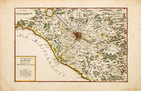
170070256Paris c.1700-05. Nicolas de Fer was the son of Antoine de Fer a Parisian map and print seller. This map from the Atlas Curieux shows the environs of Rome. At the time of publication de Fer was the official cartographer to the French Dauphin but he later became cartographer to both the French and Spanish kings. Size: 290 x 440 mm. Copperplate engraving with later hand colour. Good condition some slight toning and creasing. unknown
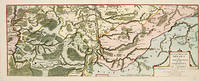
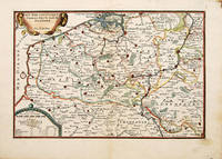
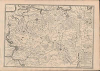
170552950Paris. 1705. An attractive map of part of Belgium showing forests and river valleys. 'de Fer's maps are popular despite or maybe because of their rather flamboyant decoration' Moreland & Bannister p130. Title at lower right. Atlas Curieux ou Le Monde. Copper engraving. Fine condition Later colouring. Size: 59 x 22 cm. Moreland and Bannister unknown
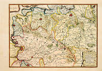
171752951Paris. 1717. An attractive map of part of Belgium showing forests and river valleys. 'de Fer's maps are popular despite or maybe because of their rather flamboyant decoration' Moreland & Bannister p130. Title at lower right. Atlas Curieux ou Le Monde. Copper engraving. Fine condition Original colour. Size: 59 x 23 cm. unknown
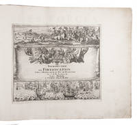
170223526Paris 1702. Oblong 1mo 30 x 37 cm. chez l'auteur" = Nicolas de Fer a false imprint Contemporary tanned sheepskin sewn on 5 cords gold-tooled spine with the title in the 2nd of 6 compartments. Ad 1 with 10 letterpress title pages in red and black for the 10 parts; 5 engraved titles for parts 1-5 that for part 5 repeating that for part 2; plus 234 beautifully engraved plates a few folding with 366 maps and views of fortified cities. Ad 2 with an engraved title page 2 letterpress title pages in red and black and 40 engraved plates including 2 folding labelled A-S in part 1 and T-Oo in part 2. 2 works in 12 parts or volumes bound as 1. Splendid atlas of fortifications of the cities of Europe plus Malta and some other Mediterranean sites combined with a maritime atlas of the French coasts published by Pieter Mortier 1661-1711. Both are based on the similar publications of Nicolas de Fer 1646-1720 and falsely indicate that they were published by him.Ad 1: The atlas of fortified cities of Europe. Many of the plans show the work of the greatest 17th-century masters of the art and science of fortification including Samuel Marolois Simon Stevin and Sébastien Le Prestre de Vauban. The last two parts contain primarily smaller maps printed 4 to the page. Ad 2: The maritime atlas of the coasts of France. It also shows the fortifications along the coasts so it complements the fortifications atlas and was clearly designed to match it in format and style. With the caption of one plate cut off and 2 plates and 1 letterpress title-page somewhat browned. Further in good condition. A couple plates are bound in the wrong volume. A splendid fortifications atlas.l Ad 1: Muller Historieplaten 3034a; cf. Pastoureau Atlas français IX A & H pp. 203-209 213: Paris Fer ed. 1690-1695 & Amsterdam Mortier ed. 1702 with different title; Phillips pp. 256-7 other ed.; Ad 2: Muller Historieplaten 3034a; Pastoureau Les atlas français XVIe-XVIIe siècles Fer VIII B p. 203 cf. pp. 201-203; for Mortier see: Koeman III pp. 4-10 and IV p. 423. unknown
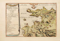
170070272Paris 1700-05. Pozzoli is a province of Naples and the main city of the Phlegrean Peninsula. It lies some two miles from the once fashionable resort of Baia. The map is well executed and detailed. Nicolas de Fer was the son of Antoine de Fer a Parisian map and print seller. This map from the Atlas Curieux. At the time of publication de Fer was the official cartographer to the French Dauphin but he later became cartographer to both the French and Spanish kings. Size: 270 x 405 mm. Copperplate engraving with later hand colour. Good condition. Slightly toned. unknown
51-6453Paris: chez l'auteur dans l'Isle du Palais sur le quay de l'orloge a la Sphére Royale avec privilége du Roy 1705-1717. Engraved map. 27.3 x 38 cm. Contemporary laid paper uniformly time aged.Published in "L'atlas curieux ou Le monde reÌpreseÌnteÌ dans des cartes geÌneÌrales et particulieres du ciel et de la terre : diviseÌ tant en ses quatre principales parties que par eÌtats et provinces et orneÌ par des plans et descriptions des villes capitales et principales et des plus superbes edifices qui les embelissent comme sont les eglises les palais les maisons de plaisance les iardins les fontaines &c. ". OCLC Number / Unique Identifier:79022119.LThe Atlas Curieux is geographic encyclopedia of images and maps of France with detailed views of the grand waterworks at Marly views of the great palaces and chateaux views and plans of the Paris Observatory and samples of military architecture. Issued in six annual parts from 1700-1705 the maps are based on the new observations of the Académie des Sciences and drawn up with the assistance of Philipe de La Hire.ibrary of Congress:The French cartographer and engraver Nicolas de Fer was a master at creating maps that were works of art. The maps that he published were printed during the Baroque period when the decorative arts were characterized by ornate detail. De Fer’s detailed maps and atlases were valued more for their decorative content than their geographical accuracy.Nicolas de Fer was born in 1646. His father Antoine de Fer owned a mapmaking firm. At the age of twelve Nicolas was apprenticed to a Parisian engraver named Louis Spirinx. The family business was starting to decline when his father died in 1673. Nicolas de Fer’s mother Genevieve took over the business after the death of her husband. In 1687 the business was passed on to Nicolas and the profits increased after he took over the firm. Nicolas de Fer was a prolific cartographer who produced atlases and hundreds of single maps. He eventually became the official geographer to King Louis XIV of France and King Philip V of Spain.One of de Fer’s major works is an atlas titled L’atlas curieux The curious atlas. Paris: chez l'auteur dans l'Isle du Palais sur le quay de l'orloge a la Sphére Royale avec privilége du Roy, 1705-1717 unknown
51-6451Paris: chez l'auteur dans l'Isle du Palais sur le quay de l'orloge a la Sphére Royale avec privilége du Roy 1705-1717. 2 Engraved maps and coats of arms on two leaves.Each 27.3 x 38cm. Contemporary laid paper uniformly time aged.Published in "L'atlas curieux ou Le monde reÌpreseÌnteÌ dans des cartes geÌneÌrales et particulieres du ciel et de la terre : diviseÌ tant en ses quatre principales parties que par eÌtats et provinces et orneÌ par des plans et descriptions des villes capitales et principales et des plus superbes edifices qui les embelissent comme sont les eglises les palais les maisons de plaisance les iardins les fontaines &c. ". OCLC Number / Unique Identifier:79022119.LThe Atlas Curieux is geographic encyclopedia of images and maps of France with detailed views of the grand waterworks at Marly views of the great palaces and chateaux views and plans of the Paris Observatory and samples of military architecture. Issued in six annual parts from 1700-1705 the maps are based on the new observations of the Académie des Sciences and drawn up with the assistance of Philipe de La Hire.ibrary of Congress:The French cartographer and engraver Nicolas de Fer was a master at creating maps that were works of art. The maps that he published were printed during the Baroque period when the decorative arts were characterized by ornate detail. De Fer’s detailed maps and atlases were valued more for their decorative content than their geographical accuracy.Nicolas de Fer was born in 1646. His father Antoine de Fer owned a mapmaking firm. At the age of twelve Nicolas was apprenticed to a Parisian engraver named Louis Spirinx. The family business was starting to decline when his father died in 1673. Nicolas de Fer’s mother Genevieve took over the business after the death of her husband. In 1687 the business was passed on to Nicolas and the profits increased after he took over the firm. Nicolas de Fer was a prolific cartographer who produced atlases and hundreds of single maps. He eventually became the official geographer to King Louis XIV of France and King Philip V of Spain.One of de Fer’s major works is an atlas titled L’atlas curieux The curious atlas. Paris: chez l'auteur dans l'Isle du Palais sur le quay de l'orloge a la Sphére Royale avec privilége du Roy, 1705-1717 unknown
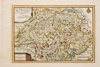
171753085Atlas Curieux ou le Monde. Paris 1717. Map of Switzerland with title at top left dedication and scales in lower corners Copper engraving. Fine condition Later colour. Size: 348 x 240 mm. 13½ x 9½ iinches unknown
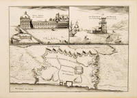
171053827Atlas Curieux ou le Monde. c.1710. The lower half of this attractive engraving shows a map of the fortifications of Lisbon. The upper half has two views- To the left the 'Palais Royal de Lisbonne' and to the right 'Le Chateau de Belem'. Copper engraving. Fine condition. Uncoloured. Size: 330 x 240 mm. 13 x 9½ inches. unknown
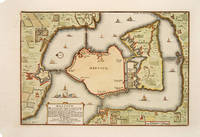
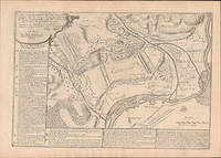
1705527391705. A plan of the town fortifications and surrounding area Copper engraving. Fine condition Later colouring. Size: 34 x 23 cm. 13½ x 9 inches unknown
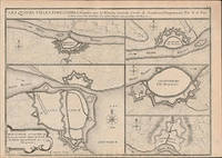
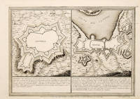
170565686Paris. 1705. An interesting and unusual map depicting the basic fortifications of two Portuguese towns. Published in the 'Atlas Curieux ou Le Monde'. Size: 275 x 395 mm. Copperplate engraving. Fine condition. unknown
1702523961702. Copper engraving. Later colouring. Size: 33 x 22 cm. 13 x 8½ inches unknown
51-6445Paris: chez l'auteur dans l'Isle du Palais sur le quay de l'orloge a la Sphére Royale avec privilége du Roy 1714-1717. Engraved map. 27.3 x 38cm. Contemporary laid paper uniformly time aged.Published in "L'atlas curieux ou Le monde reÌpreseÌnteÌ dans des cartes geÌneÌrales et particulieres du ciel et de la terre : diviseÌ tant en ses quatre principales parties que par eÌtats et provinces et orneÌ par des plans et descriptions des villes capitales et principales et des plus superbes edifices qui les embelissent comme sont les eglises les palais les maisons de plaisance les iardins les fontaines &c. ". OCLC Number / Unique Identifier:79022119.LThe Atlas Curieux is geographic encyclopedia of images and maps of France with detailed views of the grand waterworks at Marly views of the great palaces and chateaux views and plans of the Paris Observatory and samples of military architecture. Issued in six annual parts from 1700-1705 the maps are based on the new observations of the Académie des Sciences and drawn up with the assistance of Philipe de La Hire.ibrary of Congress:The French cartographer and engraver Nicolas de Fer was a master at creating maps that were works of art. The maps that he published were printed during the Baroque period when the decorative arts were characterized by ornate detail. De Fer’s detailed maps and atlases were valued more for their decorative content than their geographical accuracy.Nicolas de Fer was born in 1646. His father Antoine de Fer owned a mapmaking firm. At the age of twelve Nicolas was apprenticed to a Parisian engraver named Louis Spirinx. The family business was starting to decline when his father died in 1673. Nicolas de Fer’s mother Genevieve took over the business after the death of her husband. In 1687 the business was passed on to Nicolas and the profits increased after he took over the firm. Nicolas de Fer was a prolific cartographer who produced atlases and hundreds of single maps. He eventually became the official geographer to King Louis XIV of France and King Philip V of Spain.One of de Fer’s major works is an atlas titled L’atlas curieux The curious atlas. Paris: chez l'auteur dans l'Isle du Palais sur le quay de l'orloge a la Sphére Royale avec privilége du Roy, 1714-1717 unknown
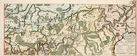
170566130Paris. c.1705. An attractive and quite detailed map of the northern regions of Brabant in Belgium and south western Holland by the French cartographer Nicolas de Fer. A number of larger regional towns are highlighted as are local rivers woodlands hills and marshes. Published in the 'Atlas Curieux ou Le Monde'. Size: 275 x 405 mm. Copperplate engraving with later hand colour. Good condition. Some general age toning. unknown
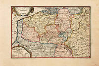
171778864Paris: 1717. Map of the Catholic Low Countries or current day Belgium. Published in "Atlas Curieux ou le Monde". Copper engraving. Hand coloured. Sheet size: 274 x 405 mm Plate size: 216 x 326 mm Very good condition. unknown
51-6452Paris: chez l'auteur dans l'Isle du Palais sur le quay de l'orloge a la Sphére Royale avec privilége du Roy 1705-1717. Engraved map. 27.3 x 38 cm. Contemporary laid paper uniformly time aged.Published in "L'atlas curieux ou Le monde reÌpreseÌnteÌ dans des cartes geÌneÌrales et particulieres du ciel et de la terre : diviseÌ tant en ses quatre principales parties que par eÌtats et provinces et orneÌ par des plans et descriptions des villes capitales et principales et des plus superbes edifices qui les embelissent comme sont les eglises les palais les maisons de plaisance les iardins les fontaines &c. ". OCLC Number / Unique Identifier:79022119.LThe Atlas Curieux is geographic encyclopedia of images and maps of France with detailed views of the grand waterworks at Marly views of the great palaces and chateaux views and plans of the Paris Observatory and samples of military architecture. Issued in six annual parts from 1700-1705 the maps are based on the new observations of the Académie des Sciences and drawn up with the assistance of Philipe de La Hire.ibrary of Congress:The French cartographer and engraver Nicolas de Fer was a master at creating maps that were works of art. The maps that he published were printed during the Baroque period when the decorative arts were characterized by ornate detail. De Fer’s detailed maps and atlases were valued more for their decorative content than their geographical accuracy.Nicolas de Fer was born in 1646. His father Antoine de Fer owned a mapmaking firm. At the age of twelve Nicolas was apprenticed to a Parisian engraver named Louis Spirinx. The family business was starting to decline when his father died in 1673. Nicolas de Fer’s mother Genevieve took over the business after the death of her husband. In 1687 the business was passed on to Nicolas and the profits increased after he took over the firm. Nicolas de Fer was a prolific cartographer who produced atlases and hundreds of single maps. He eventually became the official geographer to King Louis XIV of France and King Philip V of Spain.One of de Fer’s major works is an atlas titled L’atlas curieux The curious atlas. Paris: chez l'auteur dans l'Isle du Palais sur le quay de l'orloge a la Sphére Royale avec privilége du Roy, 1705-1717 unknown
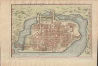
1715019811Paris. Very Good. 1715. Map. Lovely engraved map depicting Mexico City in the early 18th century. Map is on a 10 ¾" x 15 ¾" sheet that was taken from Nicolas de Fer's "L'Atlas Curieux" of 1715; no content on verso. Date of map was printed in upper margin along with the sheet number "125" and title; content in French. Hand-coloring is still bright. Map has very light toning to edges but is otherwise clean. This detailed map depicts Mexico City when it was surrounded by water and was linked to the mainland by the famous causeways originally designed by the Aztecs. Also pictured are aqueducts and farms and about 50 locations have been numbered on the map but the key is not present likely printed on another page in the Atlas. A beautiful map. . unknown
170578550Paris: 1705. A beautiful city plan of Ulm in the federal German state of Baden-Württemberg. Copper engraving. Hand coloured. Size: 277 x 403 mm Good condition. unknown
171678549Paris: 1716. A beautiful city plan of Stralsund in Germany just off the island of Rugen in the Baltic Sea. Copper engraving. Hand coloured. Sheet size: 275 x 404 mm Plate size: 230 x 332 mm Good condition. unknown
51-6444Paris: chez l'auteur dans l'Isle du Palais sur le quay de l'orloge a la Sphére Royale avec privilége du Roy 1714-1717. Engraved map. 27.3 x 38cm. Contemporary laid paper uniformly time aged.Published in "L'atlas curieux ou Le monde reÌpreseÌnteÌ dans des cartes geÌneÌrales et particulieres du ciel et de la terre : diviseÌ tant en ses quatre principales parties que par eÌtats et provinces et orneÌ par des plans et descriptions des villes capitales et principales et des plus superbes edifices qui les embelissent comme sont les eglises les palais les maisons de plaisance les iardins les fontaines &c. ". OCLC Number / Unique Identifier:79022119.LThe Atlas Curieux is geographic encyclopedia of images and maps of France with detailed views of the grand waterworks at Marly views of the great palaces and chateaux views and plans of the Paris Observatory and samples of military architecture. Issued in six annual parts from 1700-1705 the maps are based on the new observations of the Académie des Sciences and drawn up with the assistance of Philipe de La Hire.ibrary of Congress:The French cartographer and engraver Nicolas de Fer was a master at creating maps that were works of art. The maps that he published were printed during the Baroque period when the decorative arts were characterized by ornate detail. De Fer’s detailed maps and atlases were valued more for their decorative content than their geographical accuracy.Nicolas de Fer was born in 1646. His father Antoine de Fer owned a mapmaking firm. At the age of twelve Nicolas was apprenticed to a Parisian engraver named Louis Spirinx. The family business was starting to decline when his father died in 1673. Nicolas de Fer’s mother Genevieve took over the business after the death of her husband. In 1687 the business was passed on to Nicolas and the profits increased after he took over the firm. Nicolas de Fer was a prolific cartographer who produced atlases and hundreds of single maps. He eventually became the official geographer to King Louis XIV of France and King Philip V of Spain.One of de Fer’s major works is an atlas titled L’atlas curieux The curious atlas. Paris: chez l'auteur dans l'Isle du Palais sur le quay de l'orloge a la Sphére Royale avec privilége du Roy, 1714-1717 unknown