FER, Nicolas deBiblio.com
2 067 résultats
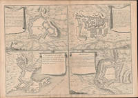
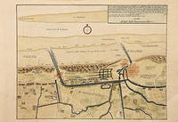
171778680Paris: c.1717. Map of the towns of Dunkirk and Mardick showing the new canal. Published in "Atlas Curieux ou le Monde". Copper engraving. Hand coloured. Size: 275 x 398 mm Very good condition. unknown
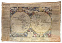
1695ABC_49413Paris: chez lauteur / van Loon 1695. Approximately 114 x 165 cm each. Copperplate engravings in original outline colour tissue-backed for stability laid down to modern cartographic linen. All with title banner dated 1698 with the Royal Privilege and text panels dated 1703. Each map printed on four joined sheets with title surmounted and engraved text panels at sides and bottom. A magnificent set of five Enlightenment wall maps of the continents & world all in early states: the only known set of all five unknown in any public or private collection. In the late 17th century mapmaking was emerging from an equal focus on the decorative and descriptive to a more analytic sensibility. Nicolas de Fer 1646-1720 successfully navigated the early Enlightenment era with these monumental wall maps created with the patronage of the Dauphin of France. The dramatic cartouches and vignettes in the maps are masterpieces of baroque imagery capturing the people wonders resources and cultures of faraway lands eagerly sought by Europeans during this dynamic period. A very limited number of large wall maps were produced by the major cartographic houses for the nobility and for wealthy merchants to satisfy curiosity about the world beyond Europe. Grand wall maps such as these were usually mounted for display and their exposure led to the great majority of examples from this period having been lost; the incidence of this type of map passing down to our era is astonishingly small. 1 America: LAmerique divisee selon letendue de ses principales parties et dont les points principaux sont placez sur les observations de messieurs de lAcademie Royale des Sciences 1698. Second state of 1698 first edition adding the dedication to the Dauphin within an ornamental cartouche. One of the most glorious cartographic expressions of the spirit of 17th century French expansionism in North America. The geography is of the type in fashion at Paris during the short interval between La Salles descent of the Mississippi in 1682 and the founding of Louisiana in 1699. De Fer properly aligned Hudson Bay above the Great Lakes which are portrayed with exceptional accuracy and the southern reaches to the Great Lakes are better aligned with the east coast. The map shows advanced knowledge of the Mississippi River drainage although still emptying in the Gulf of Mexico in Texas too far to the west following the school of Coronelli. Two of the most iconic 18th century images of America those of beavers at work and of a cod-fishery were introduced on this map before being made famous by the English cartographer Herman Moll. The beaver scene shows dozens of the industrious creatures against a backdrop of Niagara Falls which is most likely based on Hennepins first printed view of the falls published a year earlier in 1697. 2 Africa: LAfrique divisée selon letendue de ses principales parties et dont les points principaux sont placez sur les observations de messieurs de lAcadémie Royale des Sciences 1698. The African continent on a fantastic scale with extensive annotations and panelled legends throughout; dedicatory cartouche in the southern Indian Ocean. The side panels have extensive text entries for the division of the continent cities islands capes rivers mountains and a lengthy description of the source of the Nile. Richly decorated with more than 20 elaborate scenes showing art industry clothing customs farming hunting trade battle and landscapes. Numerous animals include ostrich monkey crocodile lion elephant and camel. With a plan of the Dutch fort at the Cape of Good Hope in a draped paneled inset. The Arabian Peninsula is shown in its entirety. Based in part on the work of de lIsle it shows an early conception of the Middle East: in particular it omits the Sinai Peninsula included in several of de Fers earlier efforts. Among the toponyms along the coast of the Gulf are Abadan Sur Ahsa Janama Bahr El Catif Bischa Borou Godo Vodana Calba Dadana and Pinder. Although the coastlines are well mapped there is a notable lack of understanding of the interior: the Niger delta is shown divulging on the west coast instead of the Gulf of Benin while the massive extent of the Congo rivers drainage basin is here only hinted at. The Nile is finally freed from the twin Ptolemaic lakes and begins to take on its more accurate course.3 Asia: LAsie divisée selon letendue de ses principales parties et dont les points principaux sont placez sur les observations de messieurs de lAcadémie Royale des Sciences 1696. The earliest known state dated 1696 in the dedication. Includes the rare letterpress historical text panels dated 1703. Much of the continent is well-charted based largely on Dutch for the Philippines Malaysia Southeast Asia and Jesuit sources for areas such as China. The coastlines north of Korea correctly shown as a peninsula curving west and northward begin and end in ambiguity. Inset map of Arctic Asia; two inset maps of Northeast China based on the writings of the Jesuits Martino Martini and Ferdinand Verbiest. The richly decorated borders depict the people art religion commerce and cultures of Asia. Vignettes show Chinese Japanese Turks Indians Tartars Philippines inhabitants of the Molucca and Sunda islands Ceylonese Arabs peoples from Goa and Mongolia Armenians Georgians people from Golconda Malaysia Siam Cochin and Tonkin. Among the images are those of the faithful during the Hajj visiting the Kaaba at Mecca. The rare letterpress panels provide extensive text references; rivers towns capes lakes and straights including more detailed descriptions of Turkey Arabia China Persia India Russia and Arabic islands in the Indian Ocean. 4 Europe: LEurope divisée selon letendue de ses principales parties et dont les points principaux sont placez sur les observations de messieurs de lAcadémie Royale des Sciences 1695. The earliest known state dated 1695 within the dedication. With 16 legends in elaborate Baroque vignettes describing the French Polish Germans Austrians English and other peoples the vignettes interspersed with views of cities hunting coats of arms pageantry and other fascinating glimpses of a dynamic continent with culture flowering everywhere. The side panels have extensive text entries for the division of the continent countries principalities nobility cities principal islands capes rivers mountains etc. Widely acknowledged as one of the foremost French cartographers of the late 17th century Nicolas de Fer published more than 600 maps and many atlases documenting French fortified towns strongholds and the explorations and discoveries of new territories. Unlike most Dutch cartographers who mainly made maps for navigational purposes he worked in the French decorative style creating a total of 26 large wall maps to adorn walls in the palaces and castles of European royalty clergy and wealthy merchants.A superb set previously unobtainable: no other set of the de Fer wall maps of the continents in their earliest incarnation with or without the side panels other than the present example are known to have survived. Examples of individual continental maps in the earliest states as here rarely appear on the market. Later states of the map often appear without the surmounted title and text panels. No comparable set traced in auction records; an example of the first-state America map alone sold by Cohen & Taliaferro in 2010 commanded $185000.Provenance: Long in an aristocratic collection based near Novara. Acquired in the U.S. trade. Absolutely untouched by facsimile only some reinstatement of paper in text panels and much less so to very minor loss in maps. Old outline colour retouched; cartouches and vignettes with recent colour. Stabilised cracks occasional scuffing overall age toning.l Burden P. The Mapping of North America II no. 744; Dahl E. The Original Beaver Map: De Fers 1698 Wall Map of America in: The Map Collector 29 Dec. 1984 pp. 22-26; Suarez T. Shedding the Veil Singapore 1992 no. 48; not in WorldCat. chez lauteur / van Loon, hardcover
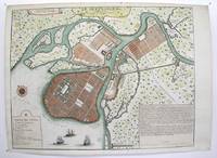
1717M3039Paris 1717. margins trimmed and laid down on 18th century paper otherwise very good. Notes: StolenRare map of the Imperial capital city during the reign of Alexander I with its traditional regular street layout and eleven districts. The map provides excellent detail of the public buildings docks and shipyards fortifications palaces churches hospitals universities etc Size : 365x473 mm 14.375x18.625 Inches Coloring: Hand Colored Category: ; Maps Russia; Maps City Maps unknown
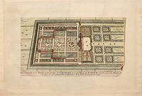
170578538Paris: 1705. Nicolas de Fer's excellent plan of the Nieuburg House where the treaty of Ryswick in the Netherlands was signed in 1697 and not 1705 as stated in the print. From the "Atlas Curieux ou Le Monde". Copper engraving. Hand colouring. Size: 275 x 400 mm Good condition. unknown
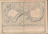
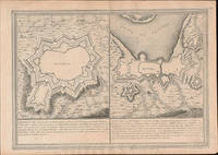
51-6473Paris: chez l'auteur dans l'Isle du Palais sur le quay de l'orloge a la Sphére Royale avec privilége du Roy 1705-1717. Engraved map. 27.3 x 38cm. Contemporary laid paper uniformly time aged.Elvas is a fortified hilltop town on the Spanish border east of Lisbon. The Portuguese too the city fromthe Moors in 1226 and it was captured by Spain in 1580. The fortifications date mostly from the 17th century and there is a 16th-century aqueduct.Evora is the capital of the province of Alentejo east of Lisbon It was captured by the Romans in 80 BC and has a Roman aqueduct and temple of Diana the goddess of hunting. There is also a 13th-century Gothic cathedral. From the 14th to the 16th centuries Evora was the residence of the Kings of Portugal.This map was published during the War of the Spanish Succession a conflict in which Portugal and Lisbon featured prominent hence the depiction of the fortifications of the city.Published in "L'atlas curieux ou le monde reÌpreseÌnteÌ dans des cartes geÌneÌrales et particulieres du ciel et de la terre : diviseÌ tant en ses quatre principales parties que par eÌtats et provinces et orneÌ par des plans et descriptions des villes capitales et principales et des plus superbes edifices qui les embelissent comme sont les eglises les palais les maisons de plaisance les iardins les fontaines &c. ". OCLC Number / Unique Identifier:79022119.LThe Atlas Curieux is geographic encyclopedia of images and maps of France with detailed views of the grand waterworks at Marly views of the great palaces and chateaux views and plans of the Paris Observatory and samples of military architecture. Issued in six annual parts from 1700-1705 the maps are based on the new observations of the Académie des Sciences and drawn up with the assistance of Philipe de La Hire.Library of Congress:The French cartographer and engraver Nicolas de Fer was a master at creating maps that were works of art. The maps that he published were printed during the Baroque period when the decorative arts were characterized by ornate detail. De Fer’s detailed maps and atlases were valued more for their decorative content than their geographical accuracy.Nicolas de Fer was born in 1646. His father Antoine de Fer owned a mapmaking firm. At the age of twelve Nicolas was apprenticed to a Parisian engraver named Louis Spirinx. The family business was starting to decline when his father died in 1673. Nicolas de Fer’s mother Genevieve took over the business after the death of her husband. In 1687 the business was passed on to Nicolas and the profits increased after he took over the firm. Nicolas de Fer was a prolific cartographer who produced atlases and hundreds of single maps. He eventually became the official geographer to King Louis XIV of France and King Philip V of Spain.One of de Fer’s major works is an atlas titled L’atlas curieux The curious atlas. Paris: chez l'auteur dans l'Isle du Palais sur le quay de l'orloge a la Sphére Royale avec privilége du Roy, 1705-1717 unknown
51-6475Paris: chez l'auteur dans l'Isle du Palais sur le quay de l'orloge a la Sphére Royale avec privilége du Roy 1705-1717. Engraved map. 27.3 x 38cm. Contemporary laid paper uniformly time aged.Elvas is a fortified hilltop town on the Spanish border east of Lisbon. The Portuguese too the city fromthe Moors in 1226 and it was captured by Spain in 1580. The fortifications date mostly from the 17th century and there is a 16th-century aqueduct.Published in "L'atlas curieux ou le monde reÌpreseÌnteÌ dans des cartes geÌneÌrales et particulieres du ciel et de la terre : diviseÌ tant en ses quatre principales parties que par eÌtats et provinces et orneÌ par des plans et descriptions des villes capitales et principales et des plus superbes edifices qui les embelissent comme sont les eglises les palais les maisons de plaisance les iardins les fontaines &c. ". OCLC Number / Unique Identifier:79022119.LThe Atlas Curieux is geographic encyclopedia of images and maps of France with detailed views of the grand waterworks at Marly views of the great palaces and chateaux views and plans of the Paris Observatory and samples of military architecture. Issued in six annual parts from 1700-1705 the maps are based on the new observations of the Académie des Sciences and drawn up with the assistance of Philipe de La Hire.Library of Congress:The French cartographer and engraver Nicolas de Fer was a master at creating maps that were works of art. The maps that he published were printed during the Baroque period when the decorative arts were characterized by ornate detail. De Fer’s detailed maps and atlases were valued more for their decorative content than their geographical accuracy.Nicolas de Fer was born in 1646. His father Antoine de Fer owned a mapmaking firm. At the age of twelve Nicolas was apprenticed to a Parisian engraver named Louis Spirinx. The family business was starting to decline when his father died in 1673. Nicolas de Fer’s mother Genevieve took over the business after the death of her husband. In 1687 the business was passed on to Nicolas and the profits increased after he took over the firm. Nicolas de Fer was a prolific cartographer who produced atlases and hundreds of single maps. He eventually became the official geographer to King Louis XIV of France and King Philip V of Spain.One of de Fer’s major works is an atlas titled L’atlas curieux The curious atlas. Paris: chez l'auteur dans l'Isle du Palais sur le quay de l'orloge a la Sphére Royale avec privilége du Roy, 1705-1717 unknown
51-6474Paris: chez l'auteur dans l'Isle du Palais sur le quay de l'orloge a la Sphére Royale avec privilége du Roy 1705-1717. Engraved map. 27.3 x 38cm. Contemporary laid paper uniformly time aged.Elvas is a fortified hilltop town on the Spanish border east of Lisbon. The Portuguese too the city fromthe Moors in 1226 and it was captured by Spain in 1580. The fortifications date mostly from the 17th century and there is a 16th-century aqueduct.Published in "L'atlas curieux ou le monde reÌpreseÌnteÌ dans des cartes geÌneÌrales et particulieres du ciel et de la terre : diviseÌ tant en ses quatre principales parties que par eÌtats et provinces et orneÌ par des plans et descriptions des villes capitales et principales et des plus superbes edifices qui les embelissent comme sont les eglises les palais les maisons de plaisance les iardins les fontaines &c. ". OCLC Number / Unique Identifier:79022119.LThe Atlas Curieux is geographic encyclopedia of images and maps of France with detailed views of the grand waterworks at Marly views of the great palaces and chateaux views and plans of the Paris Observatory and samples of military architecture. Issued in six annual parts from 1700-1705 the maps are based on the new observations of the Académie des Sciences and drawn up with the assistance of Philipe de La Hire.Library of Congress:The French cartographer and engraver Nicolas de Fer was a master at creating maps that were works of art. The maps that he published were printed during the Baroque period when the decorative arts were characterized by ornate detail. De Fer’s detailed maps and atlases were valued more for their decorative content than their geographical accuracy.Nicolas de Fer was born in 1646. His father Antoine de Fer owned a mapmaking firm. At the age of twelve Nicolas was apprenticed to a Parisian engraver named Louis Spirinx. The family business was starting to decline when his father died in 1673. Nicolas de Fer’s mother Genevieve took over the business after the death of her husband. In 1687 the business was passed on to Nicolas and the profits increased after he took over the firm. Nicolas de Fer was a prolific cartographer who produced atlases and hundreds of single maps. He eventually became the official geographer to King Louis XIV of France and King Philip V of Spain.One of de Fer’s major works is an atlas titled L’atlas curieux The curious atlas. Paris: chez l'auteur dans l'Isle du Palais sur le quay de l'orloge a la Sphére Royale avec privilége du Roy, 1705-1717 unknown
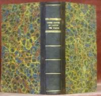
182345312Lausanne : Lacombe 1823. 170x105mm. XXII - 266Êpages reliure demi-basane. Plats papier marbr. Titre dor au dos. 350 Lacombe unknown
283091578X.Gpaperback. Good. Access codes and supplements are not guaranteed with used items. May be an ex-library book. paperback
2830913817.Gpaperback. Good. Access codes and supplements are not guaranteed with used items. May be an ex-library book. paperback
2026x-9048567815Routledge 2026. Hardcover. New. 136 pages. 9.18x6.12x9.45 inches. Routledge hardcover
1312523476.Gpaperback. Good. Access codes and supplements are not guaranteed with used items. May be an ex-library book. paperback
1300743441.Gpaperback. Good. Access codes and supplements are not guaranteed with used items. May be an ex-library book. paperback
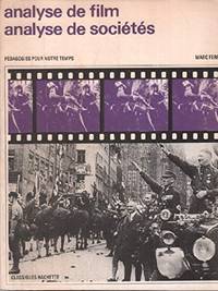
1990BN232796Hachette Littérature 1990. 1990. Softcover. Analyse de film analyse de societes : une source nouvelle pour l'histoire <br/><br/>Analyse de film analyse de societes : une source nouvelle pour l'histoire Ferro Hachette Littérature paperback
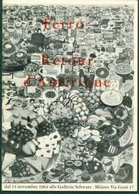
59-3406Milano: Galleria Schwarz 1964. Stapled in pictorial wraps. 8vo. Exhibition catalogue for an exhibit that opened Nov. 14 1964 at the Galleria Schwarz. With an introduction by Alain Jouffroy and statements by the artist. With 33 black and white photos and one in color. Milano: Galleria Schwarz, 1964. paperback
9788521211761-11-128023Blucher. New. Blucher unknown
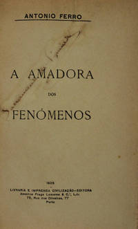
1910PG044<p>Livraria e Imprensa Civilização Editora. Porto. 1925.</p>_x000d_<p>De 20x13 cm. Com 202 vi págs. Encadernação inteira de pele com ferros a ouro na lombada com motivos vegatalistas e nas pastas onde formam uma cercadura com um filete simples. Preseva as capas de brochura </p>_x000d_<p>Exemplar com assinatura de posse desvanecida de Sacramento de Figueiredo na folha de rosto. </p> I-58-D-21 unknown
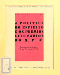
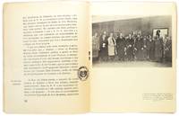
1307PM048<p>Discurso de António Ferro em 21 de Fevereiro de 1935. Acção do Secretariado da Propaganda Nacional. Edições SPN. Lisboa. S./D. 1935</p>_x000d_<p>De 20x16cm. Com 39 i págs. Brochado.</p>_x000d_<p>Ilustrado em extratexto sobre papel couché reproduzindo várias obras premiadas no concurso literário do S.P.N. de 1933-1934 entre as quais a «MENSAGEM» de Fernando Pessoa.</p>_x000d_<p>Exemplar com vestígios de cota bibliográfica sobre a capa de brochura anterior.</p>_x000d_<p>Com carimbos oleográficos «Biblioteca Popular de Lisboa» sobre as páginas de rosto: n.º 10 e n.º 39.</p>_x000d_<p>Discurso plenário em que o autor define «Política do Espírito» esclarecendo a audiência a respeito das suas relações com a sociedade com a cultura e com a política.</p> I-53-C-1 unknown
1307PM203<p>Acção do Secretariado da Propaganda Nacional. Edições S.P.N. Lisboa. 1935.</p>_x000d_<p>De 20x16 cm. Com 20 págs. Brochado. Ilustrado em extratexto com uma fotografia a preto e branco.</p>_x000d_<p>Exemplar com carimbo oleográfico da Legião Portuguesa e cota de biblioteca sobre a capa de brochura anterior com carimbo da Biblioteca Popular de Lisboa sobre a folha de rosto e a página 20 e cota bibliográfica manuscrita sobre a folha de rosto.</p>_x000d_<p>Opúsculo contendo o texto do discurso proferido pelo Director do S.P.N. em 23 de Março de 1935 no banquete comemorativo da I Exposição da Arte Moderna realizada na Sociedade Nacional de Belas Artes.</p> I-6-D-48 unknown
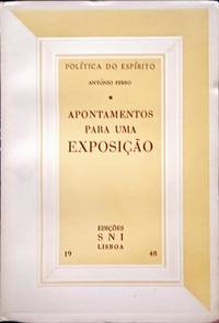
2208JS076<p>Discurso do Secretário Nacional da Informação no Acto Inaugural da Exposição «14 anos de política do Espírito» no Palácio Foz aos 29 de Janeiro de 1948. Política do Espírito. Edições S. N. I. Lisboa. 1948.</p>_x000d_<p>De 195x13 cm. Com 25 ii págs. Brochado. Exemplar com manchas de oxidação no corte das folhas.</p> I-241-F-181 unknown
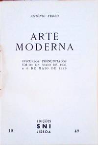
3003MF935<p>Discursos pronunciados em 23 de Maio de 1935 e 6 de Maio de 1949. Política do Espírito. Edições SNI Secretariado Nacional de Informação. Lisboa. 1949.</p>_x000d_<p>De 19x13 cm. Com 44 ii págs. Brochado. Ilustrado em extratexto com fotografia a preto e branco.</p> I-222-B-59 unknown
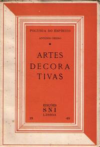
1303JG003<p>Palestra ao microfone da E.N. em Agosto de 1940 e discurso inaugural da 1.ª exposição de artes decorativas no S. N. I. em Maio de 1949. Edições SNI. Lisboa. 1949.</p>_x000d_<p>De 19x13 cm. Com 31 iv págs. Brochado. Ilustrado em extratexto a preto e branco e sobre papel couché.</p>_x000d_<p>Exemplar com picos de humidade no corte lateral das folhas.</p> I-241-F-116 unknown
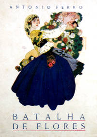
1702JR068<p>Capa de António Soares H. Antunes & C.ª - Editores. Rio de Janeiro. 1923.</p>_x000d_<p>De 18x13 cm. Com 162 vi págs. Brochado.</p>_x000d_<p>Colectânea de crónicas em que o autor faz uso do seu espírito crítico e criatividade literária no comentário de figuras e temas do seu tempo colocando o foco no paradigma cultural da época.</p>_x000d_<p> </p> I-43-F-36 unknown
2501RS101<p>Capa de Antonio Soares. Conferencia realizada na Société Amicale Franco-Portugaise em 6 de Novembro de 1920. H. Antunes-Editor. Lisboa. Rio de Janeiro. 1921.</p>_x000d_<p>De 17x135 cm. Com 56 págs. Brochado. Ilustrado em extratexto com dois retratos a preto e branco sobre papel couché e um fac-simile manuscrito. Capa de António Soares. Exemplar com dedicatória do autor na folha de guarda. </p>_x000d_<p> </p> SACO RS622-08 unknown
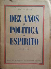
2402JS045<p>Edições SPN Secretaria da Propaganda Nacional. Lisboa. 1943</p>_x000d_<p>De 225x165 cm. Com 29 págs. Brochado.</p>_x000d_<p>«Discurso pronunciado por Antonio Ferro em 26 de Outubro de 1943 na Sede do S.P.N por ocasião da homenagem que lhe foi prestada a propósito da comemoração do X aniversário do Secretariado da Propaganda Nacional». </p> SACO JS650-8 unknown