Fer, Nicolas de;Biblio.com
198 résultats
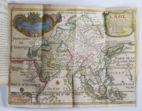
171750277Paris: Guillaume Danet Son-in law of the author 1717. Second edition. Hardcover. Good- to very good condition. Octavo. 197 9pp. 5 folding maps. Original calf with gilt lettering tooling and ruling on spine; raised bands. Decorative endpapers. Title page with copperplate engravings of two hand-colored printed globes and black double-framing California depicted as an island in this and two other maps. Second edition augmented with longitudes and latitudes of major cities. Illustrated headpiece decorative initials and endpieces. All pages with double frames; marginalia. <br /> <br /> Introduction to geography by the French cartographer and engraver Nicolas de Fer 1646–1720 containing five folding copperplate engraved maps four of them hand-colored. The first showing a general map of the globe with America in one Europe Africa and Australia in the second globe both with North and South Poles. The margins are adorned with hand-colored portraits of significant explorers; Columbus Vespuci Shouten etc. The second map is the only one in black and white. It depicts "La Sphere Artificielle." The third map shows Europe the fourth Asia the Middle-East and Oceania with parts of Europe and Africa and finally North and South America depicted on the fifth. Contains list of cities and catalog of Fer publications at rear.<br /> <br /> At the age of twelve Fer became an apprentice of the Parisian engraver Louis Spirinx. After the death of Fer's father in 1673 he also was a cartographer Nicolas took over the business specializing in the production atlases geography and cartography-oriented publications. Well connected to the Royal Court Fer advanced to become the official geographer of the Philip V of Spain and Louis XIV of France. His numerous publications are considered artistic rather than accurate.<br /> <br /> Text in French. Binding rubbed along edges and boards with front joint mostly cracked but holding together. Small plate of previous owner glued to upper inside front cover. Inked and penciled notes on verso of decorative front endpaper. Starting at title page. Some creasing and small closed tears of maps. B/w map with two inch tear reinforced with tape on verso. Map of Europe with four inch closed tear. Map of America also reinforced with three and a half inch paper strip on verso. Page ninety-three with remnants of black glossy paper glued to gutter and part of text some loss of text. Binding in overall good- interior in good to very good condition. Guillaume Danet (Son-in law of the author) hardcover
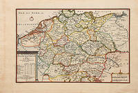
170578548Paris: 1705. Nicolas de Fer's excellent map of the German states. From the "Atlas Curieux ou Le Monde". Copper engraving. Hand colouring. Size: 274 x 405 mm Good condition. unknown
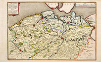
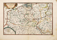
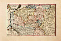
170566131Paris. c.1705. A charming map of Spanish and Dutch Flanders in the early eighteenth century. A number of the larger cities and towns are highlighted together with local physical features in the form of rivers canals woodlands and marshland. Published in de Fer's 'Atlas Curieux ou Le Monde'. Size: 275 x 400 mm. Copperplate engraving with later hand colour. Fine condition. unknown
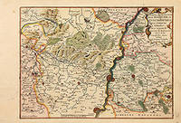
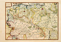
170578854Paris: 1705. Map of the Bishopric of Liege and the surrounding areas of Maastricht. Published in "Atlas Curieux ou le Monde". Copper engraving. Hand coloured. Size: 273 x 402 mm Very good condition. unknown
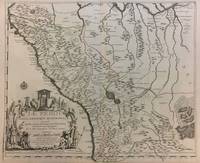
1719291534Paris 1719. Map. Engraving with original hand outline color. Image measures 19 x 23". Sheet measures 20 x 28".<br/> <br/> Unusual map of Peru from the early 18th century. Includes part of Ecuador Bolivia and Brazil based on Jesuit activity in the area. Amazon rain forest is visualized with a dynamic design. Cartouche describes the mining industry. Nicolas de Fer 1646-1720 was a prolific cartographer engraver and publisher who took over the family map business from his mother when she retired in 1687. The business flourished and he gained a great reputation in his lifetime and was appointed 'Geographer to the King' in 1690. This map demonstrates his skill and provides a curious yet alluring mixture of history and geography.<br/> <br/> unknown
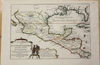
1705M772Paris 1705. Excellent. Notes: This map covers the Gulf of Mexico through Central America and includes parts of Cuba and Jamaica. It extends through Mexico to show the southern tip of Baja California. This is an early map to show the correct location of the Mississippi River delta gleaned from the expeditions of La Salle and Iberville. Two French forts are located: LaSalle's Fort St. Louis in Texas Fortbati en 1685 and another near present-day New Orleans. One of the prominent features in northern Mexico is Les Fameuses Mines de Ste. Barbe the legendary Santa Barbara mines of the Chihuahua-Durango region. Size : 230x335 mm 9x13.125 Inches Coloring: Original Outline Coloring Category: Maps Central America Mexico unknown
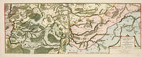
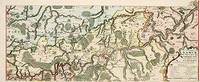
170552950Paris. 1705. An attractive map of part of Belgium showing forests and river valleys. 'de Fer's maps are popular despite or maybe because of their rather flamboyant decoration' Moreland & Bannister p130. Title at lower right. Atlas Curieux ou Le Monde. Copper engraving. Fine condition Later colouring. Size: 59 x 22 cm. Moreland and Bannister unknown
171752951Paris. 1717. An attractive map of part of Belgium showing forests and river valleys. 'de Fer's maps are popular despite or maybe because of their rather flamboyant decoration' Moreland & Bannister p130. Title at lower right. Atlas Curieux ou Le Monde. Copper engraving. Fine condition Original colour. Size: 59 x 23 cm. unknown
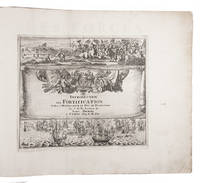
170223526Paris 1702. Oblong 1mo 30 x 37 cm. chez l'auteur" = Nicolas de Fer a false imprint Contemporary tanned sheepskin sewn on 5 cords gold-tooled spine with the title in the 2nd of 6 compartments. Ad 1 with 10 letterpress title pages in red and black for the 10 parts; 5 engraved titles for parts 1-5 that for part 5 repeating that for part 2; plus 234 beautifully engraved plates a few folding with 366 maps and views of fortified cities. Ad 2 with an engraved title page 2 letterpress title pages in red and black and 40 engraved plates including 2 folding labelled A-S in part 1 and T-Oo in part 2. 2 works in 12 parts or volumes bound as 1. Splendid atlas of fortifications of the cities of Europe plus Malta and some other Mediterranean sites combined with a maritime atlas of the French coasts published by Pieter Mortier 1661-1711. Both are based on the similar publications of Nicolas de Fer 1646-1720 and falsely indicate that they were published by him.Ad 1: The atlas of fortified cities of Europe. Many of the plans show the work of the greatest 17th-century masters of the art and science of fortification including Samuel Marolois Simon Stevin and Sébastien Le Prestre de Vauban. The last two parts contain primarily smaller maps printed 4 to the page. Ad 2: The maritime atlas of the coasts of France. It also shows the fortifications along the coasts so it complements the fortifications atlas and was clearly designed to match it in format and style. With the caption of one plate cut off and 2 plates and 1 letterpress title-page somewhat browned. Further in good condition. A couple plates are bound in the wrong volume. A splendid fortifications atlas.l Ad 1: Muller Historieplaten 3034a; cf. Pastoureau Atlas français IX A & H pp. 203-209 213: Paris Fer ed. 1690-1695 & Amsterdam Mortier ed. 1702 with different title; Phillips pp. 256-7 other ed.; Ad 2: Muller Historieplaten 3034a; Pastoureau Les atlas français XVIe-XVIIe siècles Fer VIII B p. 203 cf. pp. 201-203; for Mortier see: Koeman III pp. 4-10 and IV p. 423. unknown
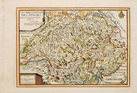
171753085Atlas Curieux ou le Monde. Paris 1717. Map of Switzerland with title at top left dedication and scales in lower corners Copper engraving. Fine condition Later colour. Size: 348 x 240 mm. 13½ x 9½ iinches unknown
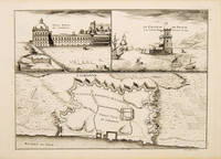
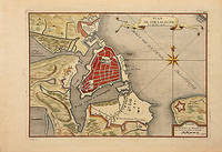
171053827Atlas Curieux ou le Monde. c.1710. The lower half of this attractive engraving shows a map of the fortifications of Lisbon. The upper half has two views- To the left the 'Palais Royal de Lisbonne' and to the right 'Le Chateau de Belem'. Copper engraving. Fine condition. Uncoloured. Size: 330 x 240 mm. 13 x 9½ inches. unknown
1705527391705. A plan of the town fortifications and surrounding area Copper engraving. Fine condition Later colouring. Size: 34 x 23 cm. 13½ x 9 inches unknown
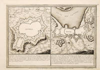
170565686Paris. 1705. An interesting and unusual map depicting the basic fortifications of two Portuguese towns. Published in the 'Atlas Curieux ou Le Monde'. Size: 275 x 395 mm. Copperplate engraving. Fine condition. unknown
1702523961702. Copper engraving. Later colouring. Size: 33 x 22 cm. 13 x 8½ inches unknown
170566130Paris. c.1705. An attractive and quite detailed map of the northern regions of Brabant in Belgium and south western Holland by the French cartographer Nicolas de Fer. A number of larger regional towns are highlighted as are local rivers woodlands hills and marshes. Published in the 'Atlas Curieux ou Le Monde'. Size: 275 x 405 mm. Copperplate engraving with later hand colour. Good condition. Some general age toning. unknown
171778864Paris: 1717. Map of the Catholic Low Countries or current day Belgium. Published in "Atlas Curieux ou le Monde". Copper engraving. Hand coloured. Sheet size: 274 x 405 mm Plate size: 216 x 326 mm Very good condition. unknown
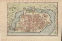
1715019811Paris. Very Good. 1715. Map. Lovely engraved map depicting Mexico City in the early 18th century. Map is on a 10 ¾" x 15 ¾" sheet that was taken from Nicolas de Fer's "L'Atlas Curieux" of 1715; no content on verso. Date of map was printed in upper margin along with the sheet number "125" and title; content in French. Hand-coloring is still bright. Map has very light toning to edges but is otherwise clean. This detailed map depicts Mexico City when it was surrounded by water and was linked to the mainland by the famous causeways originally designed by the Aztecs. Also pictured are aqueducts and farms and about 50 locations have been numbered on the map but the key is not present likely printed on another page in the Atlas. A beautiful map. . unknown
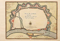
170578550Paris: 1705. A beautiful city plan of Ulm in the federal German state of Baden-Württemberg. Copper engraving. Hand coloured. Size: 277 x 403 mm Good condition. unknown
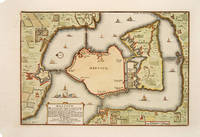
171678549Paris: 1716. A beautiful city plan of Stralsund in Germany just off the island of Rugen in the Baltic Sea. Copper engraving. Hand coloured. Sheet size: 275 x 404 mm Plate size: 230 x 332 mm Good condition. unknown
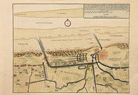
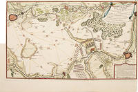
171778680Paris: c.1717. Map of the towns of Dunkirk and Mardick showing the new canal. Published in "Atlas Curieux ou le Monde". Copper engraving. Hand coloured. Size: 275 x 398 mm Very good condition. unknown
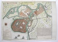
1717M3039Paris 1717. margins trimmed and laid down on 18th century paper otherwise very good. Notes: StolenRare map of the Imperial capital city during the reign of Alexander I with its traditional regular street layout and eleven districts. The map provides excellent detail of the public buildings docks and shipyards fortifications palaces churches hospitals universities etc Size : 365x473 mm 14.375x18.625 Inches Coloring: Hand Colored Category: ; Maps Russia; Maps City Maps unknown
170578538Paris: 1705. Nicolas de Fer's excellent plan of the Nieuburg House where the treaty of Ryswick in the Netherlands was signed in 1697 and not 1705 as stated in the print. From the "Atlas Curieux ou Le Monde". Copper engraving. Hand colouring. Size: 275 x 400 mm Good condition. unknown
171752957Paris. 1717. Detailed map of a battle in the July of 1712 with troop placementsand positions on the map. An explanation of the battle at lower right. Accompanying text on reverse. Published in de Fer's Atlas Curieux ou Le Monde. Copper engraving. Very good condition. Upper left top and right hand margin have been trimmed close to edge of plate Later colouring. Size: 52.5 x 31 cm. unknown
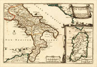
170515703Paris: N. de Fer 1705. Other. In excellent condition. 223 by 335mm 8 by 13 inches. 223 by 335mm 8 by 13 inches. Original antique hand-colored copper engraving published 1705. Depicting Kingdom of Naples this map is a fine example of 0s European cartography. Image: 223 by 335mm 8 by 13 inches. An attractive and historically significant 18th-century map for the discerning collector. Nicolas de Fer 16461720 was a prominent French cartographer engraver and publisher based in Paris. After inheriting his father's mapmaking business de Fer built it into one of the most productive cartographic firms in France eventually becoming Geographer to King Louis XIV of France and King Philip V of Spain. His output was prolificmore than 600 sheet maps town plans and atlasescovering Europe the Americas and beyond. De Fer's maps are known for their decorative cartouches attractive hand coloring and commercial appeal though they were sometimes criticized for prioritizing artistry over accuracy. His maps are particularly associated with the campaigns of the War of the Spanish Succession and are sought by collectors for their decorative quality.This decorative map show the Southern part of Italy with Sicily. Inside the map are many place names rivers mountains etc. engraved. In the upper right corner we see the title cartouche. In the lower right corner we see an inset map which shows the island Sardinia. At the bottom are two mileage scales.A fine example from Introduction à la Géographie Paris sought after by collectors of antique maps of Italy antique maps of Kingdom of Naples and antique hand-colored copper engravings for sale. In very good condition. Light age-toning to the sheet as expected for a 18th-century map. N. de Fer unknown
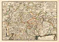
170515715Paris: N. de Fer 1705. Other. Full margins as published. 252 by 352mm 10 by 13 inches. 252 by 352mm 10 by 13 inches. Original antique hand-colored copper engraving published 1705. Depicting Tyrol & Trentino this map is a fine example of 0s European cartography. Image: 252 by 352mm 10 by 13 inches. An attractive and historically significant 18th-century map for the discerning collector. Nicolas de Fer 16461720 was a prominent French cartographer engraver and publisher based in Paris. After inheriting his father's mapmaking business de Fer built it into one of the most productive cartographic firms in France eventually becoming Geographer to King Louis XIV of France and King Philip V of Spain. His output was prolificmore than 600 sheet maps town plans and atlasescovering Europe the Americas and beyond. De Fer's maps are known for their decorative cartouches attractive hand coloring and commercial appeal though they were sometimes criticized for prioritizing artistry over accuracy. His maps are particularly associated with the campaigns of the War of the Spanish Succession and are sought by collectors for their decorative quality.Ornated in the lower left corner with a small milage scale.A fine example from Introduction à la Géographie Paris sought after by collectors of antique maps of Italy antique maps of Tyrol and antique hand-colored copper engravings for sale. In very good condition. Light age-toning to the sheet as expected for a 18th-century map. N. de Fer unknown