FER (Nicolas de);Livre Rare Book
197 résultats
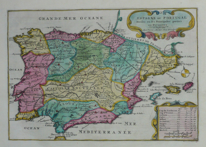
1702LBW-1338Amsterdam Pierre Mortier 1702 211 x 268 mm.
1705M5239Paris 1705. excellent. Notes: With a decorative water mark Size : 255x355 mm 10x14 Inches Coloring: Hand Colored Category: Maps City Maps; Maps Europe Portugal unknown
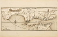
171053828Atlas Curieux ou le Monde. c.1710. The lower half of this attractive engraving shows the mouth of the Tagus from the sea to Lisbon showing the coastline settlement and fortification in detail. Title at top centre flanked by two views- To the left the 'Palais Royal de Lisbonne' and to the right 'Le Chateau de Belem'. Copper engraving. Fine condition. Uncoloured. Size: 405 x 175 mm. 16 x 7 inches. unknown
1702LBW-1306Amsterdam Pierre Mortier 1702 217 x 312 mm.
1706M6388Paris 1706. Very Good margins extended. Size : 130x180 mm 5.125x7.125 Inches Coloring: Hand Colored Category: ; Maps Europe Portugal unknown
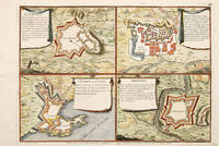
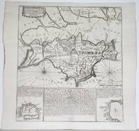
170565687Paris 1705. An unusual and interesting plan of the fortifications of four villages in Portugal. Published in the 'Atlas Curieux ou Le Monde'. Size: 275 x 410 mm. Copperplate engraving with later hand colour. Good condition. unknown
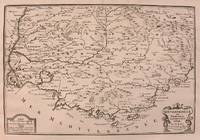
1705M5140Paris 1705. Excellent. Size : 230x345 mm 9x13.625 Inches Coloring: Black & White Category: ; Maps Europe France unknown
1705M5133Paris 1705. Excellent. Size : 236x345 mm 9.25x13.625 Inches Coloring: Black & White Category: Maps Europe France unknown
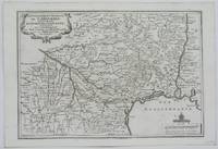
1705M1429A detailed map of Normandy also showing the islands of Guernsey Jersey and part of Brittany.<br /> From "L'Atlas Curieux ou le Monde Represente ans des Cartes Generales et Particulieres du Ciel et de la Terre..."
1702LBW-1337Amsterdam Pierre Mortier 1702 196 x 274 mm.
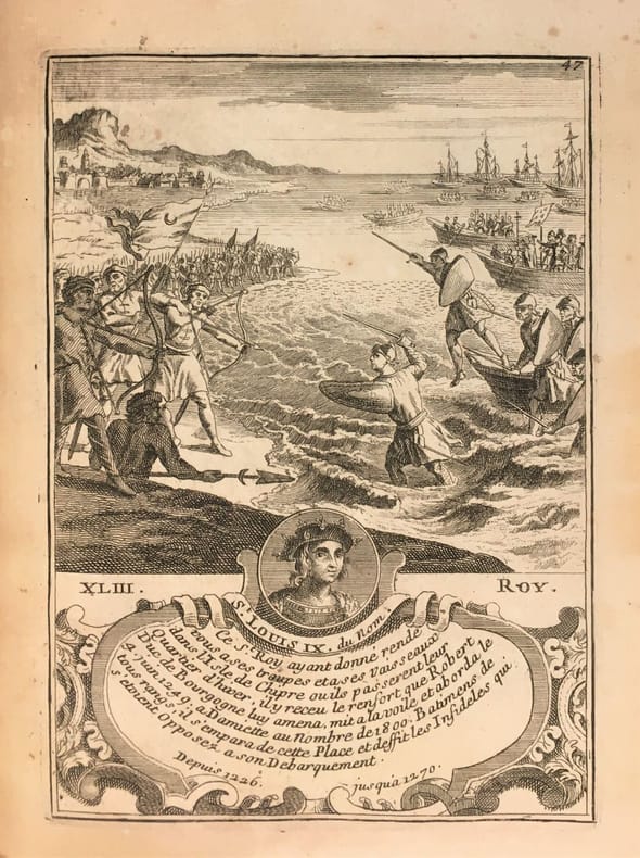
172226591722 1722 J.F. Bernard, Paris, 1722.1 volume in-4 plein veau d'époque, dos à nerfs orné de fleurons en encadrement de filets, pièce de titre, [2ff.] blancs, [141ff.] non chiffrés et [1f.] blanc. Bien complet des 65 gravures en taille-douce (chiffrées de 4 à 69, la page de titre, l'épître et la table comptant pour les gravures 1 à 3). Chaque notice royale et accompagnée d'une gravure présentant un portrait et une figure allégorique. Ex-libris. Bel exemplaire malgré quelques épidermures.
17221070Paris, Benard, 1722 ; in-4 de 132 pl., veau granité de l'époque, dos à nerfs orné, pièce vieux rouge, tranches mouchetées.
1722LBW-6646[Paris, 1722]. 445 x 555 mm.
175412504Notes de Charles Rollin.Texte en latin. Plein veau moucheté d'époque, dos longs très ornés avec un fer à l'oiseau. Très bon Paris Estienne 1754 2 volumes in-12°
171750277Paris: Guillaume Danet Son-in law of the author 1717. Second edition. Hardcover. Good- to very good condition. Octavo. 197 9pp. 5 folding maps. Original calf with gilt lettering tooling and ruling on spine; raised bands. Decorative endpapers. Title page with copperplate engravings of two hand-colored printed globes and black double-framing California depicted as an island in this and two other maps. Second edition augmented with longitudes and latitudes of major cities. Illustrated headpiece decorative initials and endpieces. All pages with double frames; marginalia. <br /> <br /> Introduction to geography by the French cartographer and engraver Nicolas de Fer 1646–1720 containing five folding copperplate engraved maps four of them hand-colored. The first showing a general map of the globe with America in one Europe Africa and Australia in the second globe both with North and South Poles. The margins are adorned with hand-colored portraits of significant explorers; Columbus Vespuci Shouten etc. The second map is the only one in black and white. It depicts "La Sphere Artificielle." The third map shows Europe the fourth Asia the Middle-East and Oceania with parts of Europe and Africa and finally North and South America depicted on the fifth. Contains list of cities and catalog of Fer publications at rear.<br /> <br /> At the age of twelve Fer became an apprentice of the Parisian engraver Louis Spirinx. After the death of Fer's father in 1673 he also was a cartographer Nicolas took over the business specializing in the production atlases geography and cartography-oriented publications. Well connected to the Royal Court Fer advanced to become the official geographer of the Philip V of Spain and Louis XIV of France. His numerous publications are considered artistic rather than accurate.<br /> <br /> Text in French. Binding rubbed along edges and boards with front joint mostly cracked but holding together. Small plate of previous owner glued to upper inside front cover. Inked and penciled notes on verso of decorative front endpaper. Starting at title page. Some creasing and small closed tears of maps. B/w map with two inch tear reinforced with tape on verso. Map of Europe with four inch closed tear. Map of America also reinforced with three and a half inch paper strip on verso. Page ninety-three with remnants of black glossy paper glued to gutter and part of text some loss of text. Binding in overall good- interior in good to very good condition. Guillaume Danet (Son-in law of the author) hardcover
1705B2350Paris: Nicolas de Fer c. 1705. Upper fore-corner of the Toulon Grenoble St. Esprit Verceil and Veue de Verue plates all repaired professionally; otherwise a very good copy text and maps are clean and crisp. Binding: Recent ½ calf with contemporary marbled boards spine in five compartments of raised bands gilt title on two endpapers renewed. With 172 engraved plates by Nicolas de Fer and 8 in-text plates including the title. Notes: Introduction a la Fortification was a famous atlas at its timefirst published in 1690-1695. <br>The author Nicolas de Fer inherited his father’s cartography business. Being a prolific cartographer his reputation grew such that he became the official geographer of King Louis XIV of France and King Philip V of Spain. He made maps of both North America and Europe notably including maps of the War of Spanish Succession. <br> Size: Oblong folio Illustration: With 172 engraved plates by Nicolas de Fer and 8 in-text plates including the title. Lacks 9 plates St. Malo Environs de St. Malo Gravelines Nieuport Combat de Leuse Liege Camp de Weil and Civita Vecchia; but has 5 extras not called for in the plate list Aire Hesdin Menin Batavia and Quebec. Pages: P. plate index title engraved maps and text plates. Category: Book Atlas & Cartography; Book Military Nicolas de Fer hardcover
1701685P7Ferrara: Appresso Bernardino Pomatelli 1701. Vellum. Very Good. 9" by 6.5". Not Stated. A very scarce early Italian history on the city of Comacchio in Ferrara illustrated here with a beautiful folding plate of the town and more plates and in-text engravings. In the original Italian. A very scarce work. Illustrated with an engraved title page a folding plate two plates and ten in-text engravings. Collated complete.Collated from Jisc from a copy held at the University of Oxford Libraries. Register runs as 1 8 6 A-Kk8 Ll6. In a vellum binding. An early history on Comacchio. An extensive history of the town of Comacchio a commune of Emilia Romagna in Italy in the province of Ferrara. The town was founded about two thousand years ago. Comacchio was governed first by the Exarchate of 'Ravenna' then by the Duchy of Ferrara' eventually being returned as part of the territories of there Papal States. It was the seat of a Lombard duchy being prosperous under the Goths and Lombards. It owed its fortune to the salt pans and its important location. Comacchio has some beautiful examples of both religious and civil architecture including the Comacchio Cathedral. Written by Giovanni Francesco Ferro though the work is sometimes to his uncle Bartolomeo Ferro. The work is dedicated to Pope Clement XI. In a full vellum binding. Externally with discolouration and marking to the boards and spine. Bumping to the head and tail of the spine and to the extremities. Small amount of loss to the spine label. Internally firmly bound. Pages are lightly age-toned and generally clean with the odd spot. Very small hole to the folding plate. Small amount of loss to leaf C1 to the head affecting two words of text very lightly to leaf D1 affecting six words lightly to leaf D3 affecting ten words E1 affecting nine words E3 affecting eight words F1 affecting seven words F3 affecting six words. Printing error to leaf Q5 affecting roughly nine words. Very Good Appresso Bernardino Pomatelli hardcover
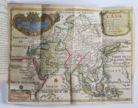
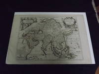
1722biblio10<p>Engraved double page map 28" x 20" wide margins hand colored in outline two uncolored pictorial cartouches. Expert and nearly invisible repairs along centerfold normal aging; about near fine. Impression is bright and clean. Nicholas De Fer 1646-1720 was a highly respected and prolific French cartographer whose maps were valued for their decorative appeal. Around 1690 he was made the geographer to the Dauphin and published his first atlas. He would become geographer to other high-ranking individuals in French and Spanish society. The present map is detailed and attractive map of Asia with a cartouche showing Chinese at the upper left and Indians in the upper right. The map covers a lot of territory showing Arabia and the Persian Empire in the West and Japan in the east but goes as far south as the Isle of Borneo and Java. Part of Eastern Europe is also visible. Library missouri website.</p>
1722biblio10<p>Engraved double page map 28" x 20" wide margins hand colored in outline two uncolored pictorial cartouches. Expert and nearly invisible repairs along centerfold normal aging; about near fine. Impression is bright and clean. Nicholas De Fer 1646-1720 was a highly respected and prolific French cartographer whose maps were valued for their decorative appeal. Around 1690 he was made the geographer to the Dauphin and published his first atlas. He would become geographer to other high-ranking individuals in French and Spanish society. The present map is detailed and attractive map of Asia with a cartouche showing Chinese at the upper left and Indians in the upper right. The map covers a lot of territory showing Arabia and the Persian Empire in the West and Japan in the east but goes as far south as the Isle of Borneo and Java. Part of Eastern Europe is also visible. Library missouri website.</p> books
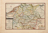
170578548Paris: 1705. Nicolas de Fer's excellent map of the German states. From the "Atlas Curieux ou Le Monde". Copper engraving. Hand colouring. Size: 274 x 405 mm Good condition. unknown
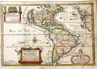
1717M11008Paris: Chez l'autheur dans l'Isle du Palais sur le Quay de l'Orloge a la Sphere Royale 1717. Very Good. Notes: Beautiful example of the map of the Americas by renowned 17th century French cartographer Nicolas De Fer.<br><br> Size : 225x337 mm 8.86x13.27 Inches Coloring: Hand Colored Category: Maps North America; Maps South America Countries; Chez l'autheur dans l'Isle du Palais sur le Quay de l'Orloge a la Sphere Royale unknown
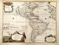
1705M11362Paris c.1705. Very Good. Notes: Detailed French map of the Americas with decorative cartouches.<br>Nicolas de Fer 1646–1720 was a French cartographer and geographer. He also was an engraver and publisher. His work was most often praised for being beautiful and artistic. Size : 464x600 mm 18.27x23.62 Inches Coloring: Hand Colored Category: Maps North America; Maps South America Continent; unknown
1722152321722 reliure plein veau havane in-quarto carré (binding full calfskin in-quarto), dos 5 nerfs (spine with 5 raised bands) - entre-nerfs à double filets or à fleuron au fer évidé et rinceaux aux angles avec des petits fers en remplissage (between the raised bands double gilt lines - floweret with hollowed out blocking stamp - with foliages executed in the curved lines in angles - with small blocking stamp in filling) - pièce de titre comportant le titre abrégé de l'ouvrage sur fond havane clair (label of the title with the title abbreviated by the work) - rinceaux en tête et en pied (top and at the foot of spine with foliages carried out with the curved line), petits manques de cuir sur le dos (missing pieces of leather on the spine), coiffe supérieure légèrement accidentée (head of the spine damaged), coiffe inférieure manquante (is missing tail of the spine), charnière du quatrième plat fortement épidermée jusqu'au carton (joint of the back cover with strongly scratches up to the cardboard), coins de queue fortement écornés (corners of the bottom strongly dog-eared), roulettes à froid sur les coupes (fillets with blind-stamping decoration on the cuts), toutes tranches peignées (all painting edges), pages de garde peignées (painting endpapers), texte à manchette (marginal note), illustrations : orné de bandeaux - lettrines et de culs-de-lampe et gravures hors-texte (illustrations : illuminated of headpieces and dropped initials and of tailpieces and illustrations full page engravings), cicatrices de mouillures (scars of waterstains), galeries de vers en particulier en fin d'ouvrage atteignant le texte mais sans conséquence sur sa compréhension (worm's gallery in particular at the end of work on the text but without consequence on its understanding), 9 feuillets de pièces liminaires (9 leaves of introductory pieces) + 566 pages + 1 feuillet (1 leaf), 1722 à Paris Chez Michel Brunet - Grand'Salle du Palais au Mercure Galant,
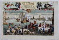
1725M4694Paris 1725. Excellent. Notes: A decorative and beautifully hand coloured title page of the important atlas L'Atlas Curieux ou Le Monde" by Nicholas de Fer. Size : 220x335 mm 8.625x13.125 Inches Coloring: Hand Colored Category: Maps Misc Curiosities Title Pages Games etc. unknown
1715M4751Paris 1715. Very Good slight wear at the center of the fold. Size : 350x320 mm 13.75x12.625 Inches Coloring: Black & White Category: ; Maps Europe United Kingdom unknown