J Sch FerBiblio.com

2 067 résultats
ria9783867413015_inpPaperback. New. New Book; Fast Shipping from UK; Not signed; Not First Edition; N/A paperback
ria9783867413008_inpPaperback. New. New Book; Fast Shipping from UK; Not signed; Not First Edition; N/A paperback
3867413010.Gpaperback. Good. Access codes and supplements are not guaranteed with used items. May be an ex-library book. paperback
3867413002.Gpaperback. Good. Access codes and supplements are not guaranteed with used items. May be an ex-library book. paperback
1999Q-0425168565Berkley 1999-05-01. Mass Market Paperback. New. In shrink wrap. Looks like an interesting title! Berkley paperback
19782082402113802665Kodansha-kan 1978. Soft Cover. Fine. Number of books: 1 Kodansha-kan paperback
2016119940DZ Books. New. 2016. Hardcover. 1941701256 . FREE UPGRADE to Courier/Priority Shipping Upon Request - IN STOCK AND IMMEDIATELY AVAILABLE FOR SHIPMENT - Flawless copy brand new pristine never opened -- with a bonus offer-- . DZ Books hardcover
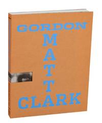
2007211508New York & New Haven CT: Whitney Museum of American Art and Yale University Press 2007. First edition. Softcover. 239 pages. Exhibition catalog for a show that ran February 22 through June 3 2007. Features a foreword by Adam D. Weinberg along with essays by Elisabeth Sussman Tina Kukielski Gwendolyn Owens Spyros Papapetros Christian Schneidemann Briony Fer and Joan Simon. Includes numerous color and black and white illustrations a chronology and list of previous exhibitions compiled by Tina Kukielski and a selected bibliography. A clean very near fine copy in wrappers in a very near fine die cut dust jacket made of cardstock. A very attractive catalog that is one of the better references on Gordon Matta-Clark who sadly died at the age of only 35 from pancreatic cancer. Whitney Museum of American Art and Yale University Press unknown
169532945Paris ca. 1695. 23x295 cm. Kobberstukket kort i fugleperspektiv over Göteborg og den nordlige del af sundet med byplan og fortifikationer. Med stor kartouche. Håndkoloreret. <br/><br/><em>Fra Nicholas de Fer: "Les Forces d l'Europe". </em> unknown
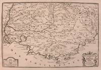
1705M5140Paris 1705. Excellent. Size : 230x345 mm 9x13.625 Inches Coloring: Black & White Category: ; Maps Europe France unknown
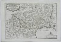
1705M5133Paris 1705. Excellent. Size : 236x345 mm 9.25x13.625 Inches Coloring: Black & White Category: Maps Europe France unknown
1705M1429A detailed map of Normandy also showing the islands of Guernsey Jersey and part of Brittany.<br /> From "L'Atlas Curieux ou le Monde Represente ans des Cartes Generales et Particulieres du Ciel et de la Terre..."
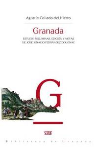
SAL8433870278España: UNIVERSIDAD DE GRANADA. Rústica. Nuevo/Nuevo. ZONUNIV UNIVERSIDAD DE GRANADA paperback
2005Q-8471690853Ediciones Miguel Sánchez 2005-12-28. Paperback. New. New. In shrink wrap. Looks like an interesting title! Ediciones Miguel Sánchez paperback
8471690888.Gpaperback. Good. Access codes and supplements are not guaranteed with used items. May be an ex-library book. paperback
2004DADAX1860111440Brand: Cadogan Guides 2004-03-01. 3rd. paperback. New. 5.50x0.75x8.25. Buy with confidence. Excellent Customer Service & Return policy. Brand: Cadogan Guides paperback
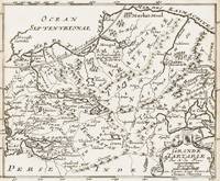
1700398AG1700. Paris c. 1700. Original copper engraved map. 16 cm wide x 13.2 cm high. Mounted on paper. Very good condition. From a wonderful collection of Maps from an old english library South Shields - with a tiny library stamp to the mounting paper The stamp is NOT on the Map. Nicolas de Fer 164625 October 1720 was a French cartographer and geographer. De Fer was the youngest of three sons of Antoine de Fer who was also a cartographer. When he was 12 he became the apprentice of Parisian engraver Louis Spirinx and made his first map of the Canal du Midi at the age of 23. After the death of his father in June 1673 his mother Geneviève initially took over the map making company which had begun to decline. She passed it and the atelier called Quai de L'Horloge on to Nicolas in 1687 because of her old age. De Fer was so successful at improving the firm that in 1690 he became the official geographer to Louis Dauphin of France. With support from the Spanish and French Royal Families de Fer also became official geographer for Philip V and Louis XIV the kings of Spain and France respectively. Because of this his maps became Bourbon propaganda endorsing French King Louis XIV. His business flourished producing town plans atlases wall maps and more than 600 sheet maps. He made maps of places in Europe and North America including New Spain places fortified by Vauban the Low Countries and the War of the Spanish Succession. In 1698 de Fer published a map of North America which included a depiction of beavers building dams near Niagara Falls. Seventeen years later Herman Moll published a map which plagiarized elements of de Fer's work particularly the beaver scene. It became known as the "Beaver map". De Fer became the official geographer for His Catholic Majesty in 1720. Two of his sons-in-law Guillaume Danet and Jaques-François Bénard continued the company after de Fer's death on 25 October of that year until around 1760. Wikipedia unknown
1801209618.Gpaperback. Good. Access codes and supplements are not guaranteed with used items. May be an ex-library book. paperback
1334579954.Gpaperback. Good. Access codes and supplements are not guaranteed with used items. May be an ex-library book. paperback
8471690861.Gpaperback. Good. Access codes and supplements are not guaranteed with used items. May be an ex-library book. paperback
2n1779De Fer Paris um 1700. Maße: 26 cm x 19 cm. - Nicolas de Fer war einer der führenden französischen Kartographen und Kartenverleger - unknown
192485112Hakubunkan 1924. Fine. Hakubunkan 1924 19.50 x 11 cm broché Work published by the Japanese Ministry of Railways admirably illustrated with 130 double-page color illustrations by Hatsusaburo Yoshida: 2 decorating the pastedowns traditional Japanese animated scenes 26 views and 104 bird's-eye view landscape maps. Numerous black maps including a large one at the end of the Japanese railways which is detached. Pale green cloth covers. Smooth spine with title. Boards printed in black with a sample of Japanese fabric a cartouche for the title. Cardboard slipcase repeating the board motifs in black. Small lacks to slipcase rubbing and corners bumped. Fine condition of the collection with occasional light foxing. A paper lack to the pastedowns at the end of the volume. Some pages with fine manuscript notes in ink. Celebrated as the Hiroshige of the Taisho era Yoshida 1884-1955 was a painter and cartographer. His bird's-eye view maps and views are enhanced by multiple colors and changes of season and weather. A major retrospective of his works took place in Japan at the Sakai Museum in 1999. Hakubunkan hardcover
1260462927.Ghardcover. Good. Access codes and supplements are not guaranteed with used items. May be an ex-library book. hardcover
20192-0464190487Blurb 2019. Hardcover. New. 162 pages. Spanish language. 8.23x5.24x0.67 inches. Blurb hardcover
20192-0464224594Blurb 2019. Hardcover. New. 196 pages. Spanish language. 8.27x5.28x0.75 inches. Blurb hardcover