Ferro, Knopp (Artist)Biblio.com

2 067 résultats
2025x-3735610390Kerber Christof Verlag 2025. Paperback. New. 290 pages. German language. 9.13x1.14x11.02 inches. Kerber Christof Verlag paperback
50593452like new. unknown
19742091202133211565Rippushobo 1974. Soft Cover. Fine. Number of books: 10 Rippushobo paperback
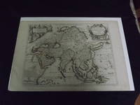
1722biblio10<p>Engraved double page map 28" x 20" wide margins hand colored in outline two uncolored pictorial cartouches. Expert and nearly invisible repairs along centerfold normal aging; about near fine. Impression is bright and clean. Nicholas De Fer 1646-1720 was a highly respected and prolific French cartographer whose maps were valued for their decorative appeal. Around 1690 he was made the geographer to the Dauphin and published his first atlas. He would become geographer to other high-ranking individuals in French and Spanish society. The present map is detailed and attractive map of Asia with a cartouche showing Chinese at the upper left and Indians in the upper right. The map covers a lot of territory showing Arabia and the Persian Empire in the West and Japan in the east but goes as far south as the Isle of Borneo and Java. Part of Eastern Europe is also visible. Library missouri website.</p>
ria9786207659463_inpPaperback. New. New Book; Fast Shipping from UK; Not signed; Not First Edition; N/A paperback
6207659465.Gpaperback. Good. Access codes and supplements are not guaranteed with used items. May be an ex-library book. paperback
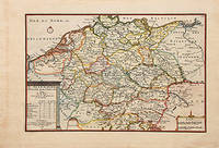
170578548Paris: 1705. Nicolas de Fer's excellent map of the German states. From the "Atlas Curieux ou Le Monde". Copper engraving. Hand colouring. Size: 274 x 405 mm Good condition. unknown
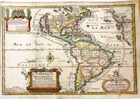
1717M11008Paris: Chez l'autheur dans l'Isle du Palais sur le Quay de l'Orloge a la Sphere Royale 1717. Very Good. Notes: Beautiful example of the map of the Americas by renowned 17th century French cartographer Nicolas De Fer.<br><br> Size : 225x337 mm 8.86x13.27 Inches Coloring: Hand Colored Category: Maps North America; Maps South America Countries; Chez l'autheur dans l'Isle du Palais sur le Quay de l'Orloge a la Sphere Royale unknown
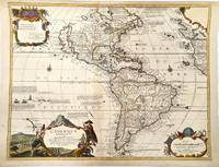
1705M11362Paris c.1705. Very Good. Notes: Detailed French map of the Americas with decorative cartouches.<br>Nicolas de Fer 1646–1720 was a French cartographer and geographer. He also was an engraver and publisher. His work was most often praised for being beautiful and artistic. Size : 464x600 mm 18.27x23.62 Inches Coloring: Hand Colored Category: Maps North America; Maps South America Continent; unknown
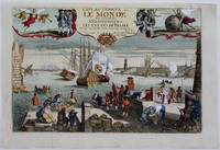
1725M4694Paris 1725. Excellent. Notes: A decorative and beautifully hand coloured title page of the important atlas L'Atlas Curieux ou Le Monde" by Nicholas de Fer. Size : 220x335 mm 8.625x13.125 Inches Coloring: Hand Colored Category: Maps Misc Curiosities Title Pages Games etc. unknown
2070323803.Gmass_market. Good. Access codes and supplements are not guaranteed with used items. May be an ex-library book. unknown
6205855747.Gpaperback. Good. Access codes and supplements are not guaranteed with used items. May be an ex-library book. paperback
6207786858.Gpaperback. Good. Access codes and supplements are not guaranteed with used items. May be an ex-library book. paperback
6207786874.Gpaperback. Good. Access codes and supplements are not guaranteed with used items. May be an ex-library book. paperback
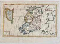
1689322292Paris: Nicolas De Fer 1689. unbound. Map. Engraving with original hand outline color. Sheet measures 13" x 9.5". Image measures 12.75" x 7.25".<br/> <br/> This is a lovely 1689 map of Ireland by Nicolas De Fer. Depicts the Emerald Isle in its entirety color coded and subdivided into its four provinces of Ulster Connacht Leinster and Munster. Parts of Scotland the Isle of Man and England and Wales are also visible. Major towns lakes rivers and islands are noted in Ireland and mountains beautifully rendered in profile. The title cartouche represents the Celtic Harp. The map is in good condition with minor toning along the original fold. Original platemark visible.<br> <br> Nicolas de Fer 1646-1720 was a prolific cartographer engraver and publisher who took over the family map business from his mother when she retired in 1687. The business flourished and he gained a great reputation in his lifetime and was appointed 'Geographer to the King' in 1690. This map demonstrates his skill and provides a curious yet alluring mixture of history and geography.<br/> <br/> Nicolas De Fer unknown
1715M4751Paris 1715. Very Good slight wear at the center of the fold. Size : 350x320 mm 13.75x12.625 Inches Coloring: Black & White Category: ; Maps Europe United Kingdom unknown
2830913817.Gpaperback. Good. Access codes and supplements are not guaranteed with used items. May be an ex-library book. paperback
1993BN233405Editions La Découverte 1993. 1993. Hardcover. L'état de toutes les Russies: Les états et les nations de l'ex-URSS <br/><br/>L'état de toutes les Russies: Les états et les nations de l'ex-URSS Collectif; Ferro Marc Editions La Découverte hardcover
198859544Madrid: Ministerio de Defensa - Armada Española - Eds. Turner 1988. 35x24 XCIIp 578p fotos firma. Tapa dura editorial con sobrecubiertas. Buen estado. Ministerio de Defensa - Armada Española - Eds. Turner hardcover
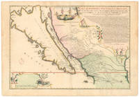
1720NL-01644<p>This exquisite and scarce map was published in Paris in 1720. The maker Nicolas de Fer was one of the most prolific and influential French cartographers of the late 17th and early 18th centuries who worked for the French King and <em>dauphin </em>crown prince.</p><p>The map depicts the most iconic cartographic myth in the European exploration of the Americas: California as a large island. This notable misconception impacted the accuracy of mapmaking for centuries and full acceptance that California was part of the continental mainland was not achieved until the mid-18th century.</p><p><strong>But why '<em>Nouvelle Caroline</em>'</strong></p><p>We can actually start at the eastern edge of the map where we see the great Mississippi River emptying into the Gulf. At first its position seems somewhat anachronistic as it follows an antiquated 17th-century notion of the Mississippi Delta located far to the west. Cartographers began rejecting this configuration after French explorer Sieur de la Salle navigated the entire lower river in 1682. Yet De Fer's choice to position the delta further west was in fact a keen political move executed in service to his patron the <em>dauphin</em>. By positioning the Mississippi so far west as to include it in this map he automatically implies a significantly enlarged French Louisiana even if it remains unseen.</p><p>The French were gradually beginning to encroach on the silver-rich regions in Upper Mexico which at that time belonged firmly to New Spain. But a great upheaval had recently taken place in Spain altering the entire political landscape of Europe. When the Spanish King Charles II died in 1700 this closed the chapter on the powerful dynasty of the Spanish Habsburgs following a long period of decline. When power subsequently transferred to Charles' nephew Phillipe of Anjou who became Philip V of Spain it passed from the Habsburgs to the Bourbons to which the French kings belonged. It was almost a personal victory for De Fer as Philip was the son of the French <em>dauphin</em> who in turn was De Fer's main patron.</p><p>A political element of cartographic land grabbing is echoed in the map's title which refers to the island as 'California or New Carolina' <em>Nouvelle Caroline</em>. This bold new proposal for an alternate name was loaded with political meaning. Following the Spanish succession some still challenged Philip's claim just as some feared an amalgamation of French and Spanish interests and power in the New World. De Fer's maps were part of the counter-propaganda touting the ambitions of his patrons as fact to exaggerate their global influence. While the term 'California' was very much tied to the envisioned island renaming the entire region <em>Nouvelle Caroline</em> New Carolina would make borders more fluid and national ownership less defined.</p><p>Beneath the title De Fer has included extensive text that constitutes an invaluable record of late 17th century missions and Indian villages in this remote part of the New World. The inclusion of this text helped cement De Fer's map as a seminal contribution to West Coast cartography. The mapmaker seems to have been well aware of the importance of this annotation as he surrounded it with fascinating vignettes depicting scenes of Native American life and the abundance of the land. He further compliments these scenes with depictions of fauna in the lower-left corner including an aardvark a sloth and a pelican or spoonbill set around the scale bar.</p><p><strong>Census and details</strong></p><p><em>La Californie ou Nouvelle Caroline </em>was published in the <em>Atlas ou recueil de cartes gegraphiques</em>. It is not only one of the most significant depictions of the California island theory but also its largest separate <em>i.e.</em> regional representation on a printed map. It is essentially an enlarged and far more focused version of his <em>Californie et Nouveau Mexique</em> published twenty years prior in <em>L'Atlas Curieux ou le Monde</em>.</p><p>De Fer's California maps drew on information provided by the Jesuit missionary Father Eusebio Kino who traveled throughout the region in the 1680s and 90s and made extensive observations including the compilation of his own maps. We know that Kino was a significant source because the map's title is taken directly from his original expedition notes and important discoveries made by Kino – such as the mouth of the St. Thomas River discovered in 1684 – have been copied directly onto De Fer's map from his original. The source is hardly a secret: De Fer uses the inset text in the upper right corner to note how his work was drawn from a map that came via the Viceroy of New Spain to the <em>Academie de Sciences in France</em>. The text also provides a history of California's exploration and subjugation up until 1695 – including the initial discovery of Baja California by Hernan Cortes – further underscoring the original author.</p><p>De Fer made several significant changes for the present map. He plots more than 300 towns and villages including many locations on the mainland and in what today is known as New Mexico and southern Arizona. The toponyms generally confirm the influence of Father Kino. Among the many places listed we find the ruins of Casa Grande identified by Kino in 1694 and appeared on this map for the first time. Important towns like San Diego Santa Fe and Mexico City are noted clearly if not prominently. We even see the first inkling of the settlements that soon would grow into Tucson and Phoenix. The spelling of many of the place names also changed on this new map just as De Fer incorporated the first Indian toponyms along the Gila River.</p><p>While the southern coastline is relatively accurately documented there are almost no place names present along the northern mainland or on the eastern side of the island reflecting how little was known about this region at the time. Along California's exterior coast we do find some toponyms in many cases related to the coves and inlets that ships would have frequented. Yet even at this early stage we are already seeing multiple toponymic references to Saint Francis San Francisco in Spanish in the island's northern part.</p><p>Turning to the toponyms of the northern interior we find <em>Gran Quivira</em> which refers to the legend of Cibola or the Seven Cities of Gold supposedly discovered by the Spanish explorer Francisco Vasquez de Coronado in 1539. While we know this terminology from many iconic early West Coast charts like Cornelis de Jode's famous map of the Northwest Pacific 1593 the myth had such pervasive power that the notion persisted well into the 18th century. In this case it has even been complimented by a second quasi-mythological eldorado reference in the toponym <em>Gran Teguaio Coqui</em>. This term originates from the <em>Benevides Memorial </em>1630 which describes it as rivaling Quivira in wealth.</p><p><strong>Context</strong></p><p>Between 1500 and 1747 confusion ensued over whether or not California previously documented in medieval folklore as a mysterious island filled with an abundance of gold was considered part of a series of various mythical islands in an unknown ocean. The "island theory" was perpetuated by Spanish explorers including Juan de la Fuca who suggested in reports published in 1592 that the large opening identifying the mouth of Mexico's Baja peninsula joined a grand bay in the northern part of the continent.</p><p>In 1622 Henry Briggs produced a map based on these reports and the travels of Samuel Purchas. Published in London Briggs' map was accompanied by an article that referred to California as a large island off the coast of <em>Newe Spaine</em>. This "island" appeared to have a rough and rocky coastline complete with smaller islands offshore. Brigg's map became the standard outline for depicting California's insularity and was copied and incorporated onto the maps of influential publishers and geographers throughout Europe.</p><p>Father Kino would eventually dispel the Island of California myth when he discovered Baja California was indeed landbound. Father Kino published this insight in Paris in 1705 some fifteen years before our map was issued quickly becoming the authoritative source for rejecting the island hypothesis. The notion stubbornly persisted despite Kino's publication of his latest observations and map. In addition to influential French cartographers like Nicolas de Fer and Philippe Buache one of the great English mapmakers of the period Herman Moll remained convinced of California's insularity. He even went so far as to claim that he had met sailors who had circumnavigated it. Soon however even the most ardent defenders would have to yield when Ferdinand VII of Spain decreed California to be a peninsula in 1747.</p><p>Cartographers:</p><p><strong>Nicolas De Fer 1646–1720</strong> was a French cartographer and geographer who also worked as an engraver and publisher. He was renowned for his massive output and his pleasant visual designs. He was the son of a Parisian cartographer and began apprenticing at an early age. By twelve however he shifted his apprenticeship to the closely associated field of engraving – a move his father no doubt encouraged as it might enhance his competitive position on the market with his son as a trained engraver.</p><p>De Fer's father died in 1673 but Nicolas did not take over the company until 1687 at which point it had been virtually run into the ground. Nevertheless Nicolas had a knack for business and soon turned things around. By 1690 he was so successful that he won employment as the official geographer to Louis <em>Le Grand Dauphin</em> of France and son of the reigning French king Louis XIV. Soon after with support from the Spanish and French courts De Fer was appointed the official geographer for King Louis XIV. In 1720 shortly before his death he was even appointed royal geographer to Philip V king of Spain.</p><p>De Fer's popularity in the Bourbon royal circles was primarily due to his appreciation of the propagandistic effects of strategic cartography. But no doubt his keen sense of aesthetics helped as well. Whatever the case his maps were hugely popular well-funded and widely distributed. He was impressively productive publishing over 600 sheets from his atelier and covering everything from town plans to world maps. Many of his maps rode the political conjunctures of the age. Hardly would a territory have been won or surrendered before De Fer's atelier was working on a map delineating the new realities.</p>
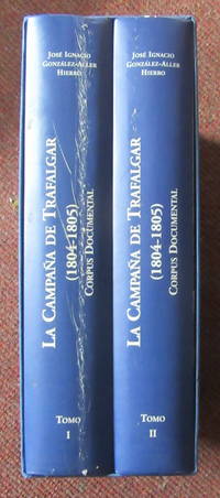
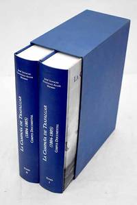
2004093324United Kingdom: Ministerio de Defensa Armada Espa~nola. 2 Volumes. Spanish text. 1814 pages Large size 30 cm x 22 cm. The spine of volume one has a superficial but noticeable scratch rubbing type mark from base to head see image from Winghale Books. Apart from this defect the books are very clean and sound. 2 Volume hardback set in a slip case. La campana de Trafalgar 1804-1805: corpus documental: 1 and 2. THIS SET WEIGHS OVER 7 KGS PLEASE ASK ABOUT INTERNATIONAL POSTAGE outside the UK . read description. Hardcover. 2004. Ministerio de Defensa Armada Espa~nola hardcover
20043686678Madrid.: Ministerio de Defensa SecretarÃa General Técnica. 2004. Hardcover. Good. 30 cm. 2 v. 1814 p. il. col. y n. Encuadernación en tapa dura de editorial. Ãndice. En la port. : Armada Española. Guardados en estuche. Batalla de Trafalgar 1805. Fuentes . ISBN: 8497811364 Arte militar en general 355.494"1805"093 Historia de Europa 944"1805"093 Ministerio de Defensa, Secretaría General Técnica. hardcover
W01OS-00438Centro Andaluz del Libro. Used - Very Good. Very Good condition. 4th edition. Spanish edition. Andalusia Spanish Cooking Cookbook Books in Spanish Centro Andaluz del Libro unknown
2012DADAX3848457091Eae Editorial Academia Espanola 2012-04-05. paperback. New. 5.91x0.96x8.66. Buy with confidence. Excellent Customer Service & Return policy. Eae Editorial Academia Espanola paperback
20043551124Madrid.: Fundación Iberdrola. 2004. Hardcover. Good. 31 x 41 cm. 282 p. il. col. y n. Encuadernación en tapa dura de editorial ilustrada. Borbón Casa de. Retratos. España. Marina de guerra. En el arte. Aledo Guillermo G. de. 1923-2000 . Pintura 75 Aledo Guillermo G. de Ingeniería militar 623.824600:75 Ingeniería militar 623.82460"17/19" Fundación Iberdrola. hardcover