FER (Nicolas de);Livre Rare Book
197 résultats
1702LBW-1353Amsterdam Pierre Mortier 1702 230 x 340 mm.
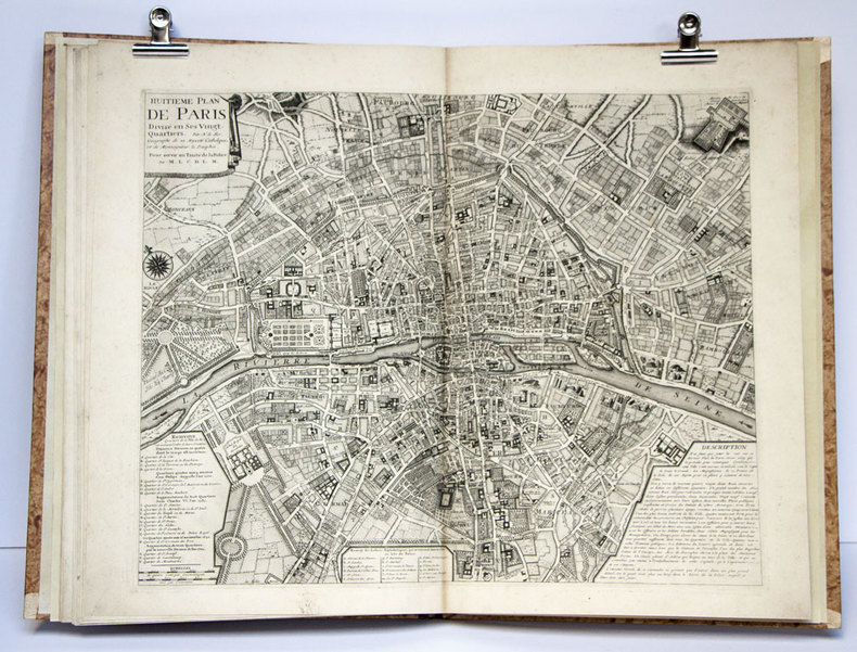
1750S376681750. paperback. gebraucht gut Bon état. Ein Einriss 3 cm verso fachmännisch geschlossen Papier altersbedingt leicht fleckig und geknickt sonst GUTES EXEMPLAR. 235 x 345 cm. In französischer Sprache. 112. Par N. de Fer Geog. de Sa Majeste' Catolique et de Monseigneur le Dauphin. Für Ihre Zufriedenheit versenden wir mit DHL und ausschließlich mit Trackingcode für eine sichere Sendungsverfolgung! Weitere Angebote unter antiquariat-kastanienhof paperback
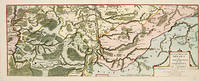
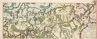
170552950Paris. 1705. An attractive map of part of Belgium showing forests and river valleys. 'de Fer's maps are popular despite or maybe because of their rather flamboyant decoration' Moreland & Bannister p130. Title at lower right. Atlas Curieux ou Le Monde. Copper engraving. Fine condition Later colouring. Size: 59 x 22 cm. Moreland and Bannister unknown
171752951Paris. 1717. An attractive map of part of Belgium showing forests and river valleys. 'de Fer's maps are popular despite or maybe because of their rather flamboyant decoration' Moreland & Bannister p130. Title at lower right. Atlas Curieux ou Le Monde. Copper engraving. Fine condition Original colour. Size: 59 x 23 cm. unknown
1708M5770Paris 1708. Very Good. Size : 240x345 mm 9.5x13.625 Inches Coloring: Hand Colored Category: ; Maps Europe France unknown
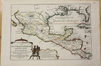
1705M772Paris 1705. Excellent. Notes: This map covers the Gulf of Mexico through Central America and includes parts of Cuba and Jamaica. It extends through Mexico to show the southern tip of Baja California. This is an early map to show the correct location of the Mississippi River delta gleaned from the expeditions of La Salle and Iberville. Two French forts are located: LaSalle's Fort St. Louis in Texas Fortbati en 1685 and another near present-day New Orleans. One of the prominent features in northern Mexico is Les Fameuses Mines de Ste. Barbe the legendary Santa Barbara mines of the Chihuahua-Durango region. Size : 230x335 mm 9x13.125 Inches Coloring: Original Outline Coloring Category: Maps Central America Mexico unknown
175553444Amsterdam et Leipzig, Arkstée & Merkus 1755 In-folio, atlas demi-veau havane, dos à nerfs richement orné, pièce de titre de maroquin rouge, grande vignette de maroquin rouge avec titre frappé or posé sur le premier plat reliure à l'imitation. Titre et 8 plans gravés à double page et montés sur onglet par Nicolas De Fer. Mouillure au titre, lég. brunissures.
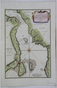
1705M5485Paris 1705. Very Good. Notes: Map of strait between Sweden and Denmark. Size : 335x225 mm 13.125x8.875 Inches Coloring: Hand Colored Category: Maps Europe Scandinavia Countries; unknown
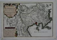
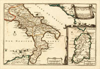
170515703Paris: N. de Fer 1705. Other. In excellent condition. 223 by 335mm 8 by 13 inches. 223 by 335mm 8 by 13 inches. Original antique hand-colored copper engraving published 1705. Depicting Kingdom of Naples this map is a fine example of 0s European cartography. Image: 223 by 335mm 8 by 13 inches. An attractive and historically significant 18th-century map for the discerning collector. Nicolas de Fer 16461720 was a prominent French cartographer engraver and publisher based in Paris. After inheriting his father's mapmaking business de Fer built it into one of the most productive cartographic firms in France eventually becoming Geographer to King Louis XIV of France and King Philip V of Spain. His output was prolificmore than 600 sheet maps town plans and atlasescovering Europe the Americas and beyond. De Fer's maps are known for their decorative cartouches attractive hand coloring and commercial appeal though they were sometimes criticized for prioritizing artistry over accuracy. His maps are particularly associated with the campaigns of the War of the Spanish Succession and are sought by collectors for their decorative quality.This decorative map show the Southern part of Italy with Sicily. Inside the map are many place names rivers mountains etc. engraved. In the upper right corner we see the title cartouche. In the lower right corner we see an inset map which shows the island Sardinia. At the bottom are two mileage scales.A fine example from Introduction à la Géographie Paris sought after by collectors of antique maps of Italy antique maps of Kingdom of Naples and antique hand-colored copper engravings for sale. In very good condition. Light age-toning to the sheet as expected for a 18th-century map. N. de Fer unknown
1702LBW-1330Amsterdam Pierre Mortier 1702 216 x 289 mm.
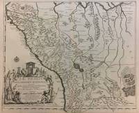
1719291534Paris 1719. Map. Engraving with original hand outline color. Image measures 19 x 23". Sheet measures 20 x 28".<br/><br/> Unusual map of Peru from the early 18th century. Includes part of Ecuador Bolivia and Brazil based on Jesuit activity in the area. Amazon rain forest is visualized with a dynamic design. Cartouche describes the mining industry. Nicolas de Fer 1646-1720 was a prolific cartographer engraver and publisher who took over the family map business from his mother when she retired in 1687. The business flourished and he gained a great reputation in his lifetime and was appointed 'Geographer to the King' in 1690. This map demonstrates his skill and provides a curious yet alluring mixture of history and geography.<br/><br/> unknown books
1719291534Paris 1719. Map. Engraving with original hand outline color. Image measures 19 x 23". Sheet measures 20 x 28".<br/> <br/> Unusual map of Peru from the early 18th century. Includes part of Ecuador Bolivia and Brazil based on Jesuit activity in the area. Amazon rain forest is visualized with a dynamic design. Cartouche describes the mining industry. Nicolas de Fer 1646-1720 was a prolific cartographer engraver and publisher who took over the family map business from his mother when she retired in 1687. The business flourished and he gained a great reputation in his lifetime and was appointed 'Geographer to the King' in 1690. This map demonstrates his skill and provides a curious yet alluring mixture of history and geography.<br/> <br/> unknown
1705M5141Paris 1705. Excellent. Size : 245x345 mm 9.625x13.625 Inches Coloring: Black & White Category: ; Maps Europe Benelux unknown
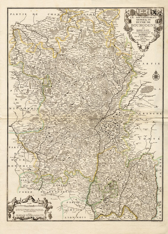
171216203Paris, chez l'Auteur, 1712 ; grande carte (cuvette du cuivre : 67,5 x 49 cm), coloris d'époque.
1705279321705 Date: 1705 ) de Nicolas de Fer "L'Atlas curieux ou le Monde réprésente dans des cartes. "- 356 x 240 mm - plis en marge du haut.
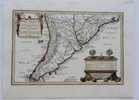
1704M5174Paris 1704. Excellent. Notes: French Map of Chile by renowned French cartographer. Size : 235x340 mm 9.25x13.375 Inches Coloring: Original Outline Coloring Category: Maps South America Countries; unknown
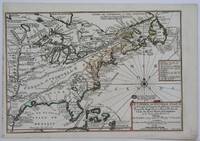
1705M4344Paris 1705. Excellent. Notes: This decorative map focuses on the French possessions in North America. The treatment of French Florida is intriguing. The map shows the United States of America and parts of Southern Canada East of the Mississippi river.<br>"Territorial expansion of New France had reached the Mississipi River with the establishment of the first European settlement at Fort Maurepas by Pierre Le Moyne d'Iberville in 1699 sixteen years after La Salle had reached the mouth of the river. This attractive map from 'L'Atlas Curieux ou le Monde' paris 1705 although containing geographical errors has many interesting historical notes" -The Macdonald Stewart Foundation Size : 232x342 mm 9.125x13.5 Inches Coloring: Hand Colored in Outline Reference: The Macdonald Stewart Foundation "La Decouverte du Monde Cartographes et Cosmographes" Map # 44; McCorkle 702.2 Category: ; Maps North America Great Lakes; Maps Canada; Maps Canada East; Maps United States East; Maps United States South unknown
1703M5179Paris 1703. Excellent. Size : 230x310 mm 9x12.25 Inches Coloring: Original Outline Coloring Category: ; Maps Asia Middle East Holy Land & Palestine unknown
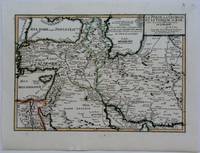
1703M5176Paris 1703. Excellent. Size : 230x335 mm 9x13.125 Inches Coloring: Original Outline Coloring Category: Maps Asia Near East Turkey; Maps Asia Middle East Iran Iraq; Maps Asia Middle East Caucasus.; unknown
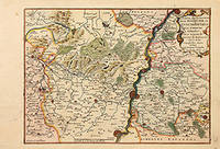
170578854Paris: 1705. Map of the Bishopric of Liege and the surrounding areas of Maastricht. Published in "Atlas Curieux ou le Monde". Copper engraving. Hand coloured. Size: 273 x 402 mm Very good condition. unknown
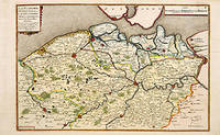
170566131Paris. c.1705. A charming map of Spanish and Dutch Flanders in the early eighteenth century. A number of the larger cities and towns are highlighted together with local physical features in the form of rivers canals woodlands and marshland. Published in de Fer's 'Atlas Curieux ou Le Monde'. Size: 275 x 400 mm. Copperplate engraving with later hand colour. Fine condition. unknown
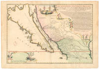
1720NL-01644<p>This exquisite and scarce map was published in Paris in 1720. The maker Nicolas de Fer was one of the most prolific and influential French cartographers of the late 17th and early 18th centuries who worked for the French King and <em>dauphin </em>crown prince.</p><p>The map depicts the most iconic cartographic myth in the European exploration of the Americas: California as a large island. This notable misconception impacted the accuracy of mapmaking for centuries and full acceptance that California was part of the continental mainland was not achieved until the mid-18th century.</p><p><strong>But why '<em>Nouvelle Caroline</em>'</strong></p><p>We can actually start at the eastern edge of the map where we see the great Mississippi River emptying into the Gulf. At first its position seems somewhat anachronistic as it follows an antiquated 17th-century notion of the Mississippi Delta located far to the west. Cartographers began rejecting this configuration after French explorer Sieur de la Salle navigated the entire lower river in 1682. Yet De Fer's choice to position the delta further west was in fact a keen political move executed in service to his patron the <em>dauphin</em>. By positioning the Mississippi so far west as to include it in this map he automatically implies a significantly enlarged French Louisiana even if it remains unseen.</p><p>The French were gradually beginning to encroach on the silver-rich regions in Upper Mexico which at that time belonged firmly to New Spain. But a great upheaval had recently taken place in Spain altering the entire political landscape of Europe. When the Spanish King Charles II died in 1700 this closed the chapter on the powerful dynasty of the Spanish Habsburgs following a long period of decline. When power subsequently transferred to Charles' nephew Phillipe of Anjou who became Philip V of Spain it passed from the Habsburgs to the Bourbons to which the French kings belonged. It was almost a personal victory for De Fer as Philip was the son of the French <em>dauphin</em> who in turn was De Fer's main patron.</p><p>A political element of cartographic land grabbing is echoed in the map's title which refers to the island as 'California or New Carolina' <em>Nouvelle Caroline</em>. This bold new proposal for an alternate name was loaded with political meaning. Following the Spanish succession some still challenged Philip's claim just as some feared an amalgamation of French and Spanish interests and power in the New World. De Fer's maps were part of the counter-propaganda touting the ambitions of his patrons as fact to exaggerate their global influence. While the term 'California' was very much tied to the envisioned island renaming the entire region <em>Nouvelle Caroline</em> New Carolina would make borders more fluid and national ownership less defined.</p><p>Beneath the title De Fer has included extensive text that constitutes an invaluable record of late 17th century missions and Indian villages in this remote part of the New World. The inclusion of this text helped cement De Fer's map as a seminal contribution to West Coast cartography. The mapmaker seems to have been well aware of the importance of this annotation as he surrounded it with fascinating vignettes depicting scenes of Native American life and the abundance of the land. He further compliments these scenes with depictions of fauna in the lower-left corner including an aardvark a sloth and a pelican or spoonbill set around the scale bar.</p><p><strong>Census and details</strong></p><p><em>La Californie ou Nouvelle Caroline </em>was published in the <em>Atlas ou recueil de cartes gegraphiques</em>. It is not only one of the most significant depictions of the California island theory but also its largest separate <em>i.e.</em> regional representation on a printed map. It is essentially an enlarged and far more focused version of his <em>Californie et Nouveau Mexique</em> published twenty years prior in <em>L'Atlas Curieux ou le Monde</em>.</p><p>De Fer's California maps drew on information provided by the Jesuit missionary Father Eusebio Kino who traveled throughout the region in the 1680s and 90s and made extensive observations including the compilation of his own maps. We know that Kino was a significant source because the map's title is taken directly from his original expedition notes and important discoveries made by Kino – such as the mouth of the St. Thomas River discovered in 1684 – have been copied directly onto De Fer's map from his original. The source is hardly a secret: De Fer uses the inset text in the upper right corner to note how his work was drawn from a map that came via the Viceroy of New Spain to the <em>Academie de Sciences in France</em>. The text also provides a history of California's exploration and subjugation up until 1695 – including the initial discovery of Baja California by Hernan Cortes – further underscoring the original author.</p><p>De Fer made several significant changes for the present map. He plots more than 300 towns and villages including many locations on the mainland and in what today is known as New Mexico and southern Arizona. The toponyms generally confirm the influence of Father Kino. Among the many places listed we find the ruins of Casa Grande identified by Kino in 1694 and appeared on this map for the first time. Important towns like San Diego Santa Fe and Mexico City are noted clearly if not prominently. We even see the first inkling of the settlements that soon would grow into Tucson and Phoenix. The spelling of many of the place names also changed on this new map just as De Fer incorporated the first Indian toponyms along the Gila River.</p><p>While the southern coastline is relatively accurately documented there are almost no place names present along the northern mainland or on the eastern side of the island reflecting how little was known about this region at the time. Along California's exterior coast we do find some toponyms in many cases related to the coves and inlets that ships would have frequented. Yet even at this early stage we are already seeing multiple toponymic references to Saint Francis San Francisco in Spanish in the island's northern part.</p><p>Turning to the toponyms of the northern interior we find <em>Gran Quivira</em> which refers to the legend of Cibola or the Seven Cities of Gold supposedly discovered by the Spanish explorer Francisco Vasquez de Coronado in 1539. While we know this terminology from many iconic early West Coast charts like Cornelis de Jode's famous map of the Northwest Pacific 1593 the myth had such pervasive power that the notion persisted well into the 18th century. In this case it has even been complimented by a second quasi-mythological eldorado reference in the toponym <em>Gran Teguaio Coqui</em>. This term originates from the <em>Benevides Memorial </em>1630 which describes it as rivaling Quivira in wealth.</p><p><strong>Context</strong></p><p>Between 1500 and 1747 confusion ensued over whether or not California previously documented in medieval folklore as a mysterious island filled with an abundance of gold was considered part of a series of various mythical islands in an unknown ocean. The "island theory" was perpetuated by Spanish explorers including Juan de la Fuca who suggested in reports published in 1592 that the large opening identifying the mouth of Mexico's Baja peninsula joined a grand bay in the northern part of the continent.</p><p>In 1622 Henry Briggs produced a map based on these reports and the travels of Samuel Purchas. Published in London Briggs' map was accompanied by an article that referred to California as a large island off the coast of <em>Newe Spaine</em>. This "island" appeared to have a rough and rocky coastline complete with smaller islands offshore. Brigg's map became the standard outline for depicting California's insularity and was copied and incorporated onto the maps of influential publishers and geographers throughout Europe.</p><p>Father Kino would eventually dispel the Island of California myth when he discovered Baja California was indeed landbound. Father Kino published this insight in Paris in 1705 some fifteen years before our map was issued quickly becoming the authoritative source for rejecting the island hypothesis. The notion stubbornly persisted despite Kino's publication of his latest observations and map. In addition to influential French cartographers like Nicolas de Fer and Philippe Buache one of the great English mapmakers of the period Herman Moll remained convinced of California's insularity. He even went so far as to claim that he had met sailors who had circumnavigated it. Soon however even the most ardent defenders would have to yield when Ferdinand VII of Spain decreed California to be a peninsula in 1747.</p><p>Cartographers:</p><p><strong>Nicolas De Fer 1646–1720</strong> was a French cartographer and geographer who also worked as an engraver and publisher. He was renowned for his massive output and his pleasant visual designs. He was the son of a Parisian cartographer and began apprenticing at an early age. By twelve however he shifted his apprenticeship to the closely associated field of engraving – a move his father no doubt encouraged as it might enhance his competitive position on the market with his son as a trained engraver.</p><p>De Fer's father died in 1673 but Nicolas did not take over the company until 1687 at which point it had been virtually run into the ground. Nevertheless Nicolas had a knack for business and soon turned things around. By 1690 he was so successful that he won employment as the official geographer to Louis <em>Le Grand Dauphin</em> of France and son of the reigning French king Louis XIV. Soon after with support from the Spanish and French courts De Fer was appointed the official geographer for King Louis XIV. In 1720 shortly before his death he was even appointed royal geographer to Philip V king of Spain.</p><p>De Fer's popularity in the Bourbon royal circles was primarily due to his appreciation of the propagandistic effects of strategic cartography. But no doubt his keen sense of aesthetics helped as well. Whatever the case his maps were hugely popular well-funded and widely distributed. He was impressively productive publishing over 600 sheets from his atelier and covering everything from town plans to world maps. Many of his maps rode the political conjunctures of the age. Hardly would a territory have been won or surrendered before De Fer's atelier was working on a map delineating the new realities.</p>
1715M4751Paris 1715. Very Good slight wear at the center of the fold. Size : 350x320 mm 13.75x12.625 Inches Coloring: Black & White Category: ; Maps Europe United Kingdom unknown
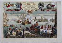
1725M4694Paris 1725. Excellent. Notes: A decorative and beautifully hand coloured title page of the important atlas L'Atlas Curieux ou Le Monde" by Nicholas de Fer. Size : 220x335 mm 8.625x13.125 Inches Coloring: Hand Colored Category: Maps Misc Curiosities Title Pages Games etc. unknown
1722152321722 reliure plein veau havane in-quarto carré (binding full calfskin in-quarto), dos 5 nerfs (spine with 5 raised bands) - entre-nerfs à double filets or à fleuron au fer évidé et rinceaux aux angles avec des petits fers en remplissage (between the raised bands double gilt lines - floweret with hollowed out blocking stamp - with foliages executed in the curved lines in angles - with small blocking stamp in filling) - pièce de titre comportant le titre abrégé de l'ouvrage sur fond havane clair (label of the title with the title abbreviated by the work) - rinceaux en tête et en pied (top and at the foot of spine with foliages carried out with the curved line), petits manques de cuir sur le dos (missing pieces of leather on the spine), coiffe supérieure légèrement accidentée (head of the spine damaged), coiffe inférieure manquante (is missing tail of the spine), charnière du quatrième plat fortement épidermée jusqu'au carton (joint of the back cover with strongly scratches up to the cardboard), coins de queue fortement écornés (corners of the bottom strongly dog-eared), roulettes à froid sur les coupes (fillets with blind-stamping decoration on the cuts), toutes tranches peignées (all painting edges), pages de garde peignées (painting endpapers), texte à manchette (marginal note), illustrations : orné de bandeaux - lettrines et de culs-de-lampe et gravures hors-texte (illustrations : illuminated of headpieces and dropped initials and of tailpieces and illustrations full page engravings), cicatrices de mouillures (scars of waterstains), galeries de vers en particulier en fin d'ouvrage atteignant le texte mais sans conséquence sur sa compréhension (worm's gallery in particular at the end of work on the text but without consequence on its understanding), 9 feuillets de pièces liminaires (9 leaves of introductory pieces) + 566 pages + 1 feuillet (1 leaf), 1722 à Paris Chez Michel Brunet - Grand'Salle du Palais au Mercure Galant,