FER (Nicolas de);Livre Rare Book
199 résultats
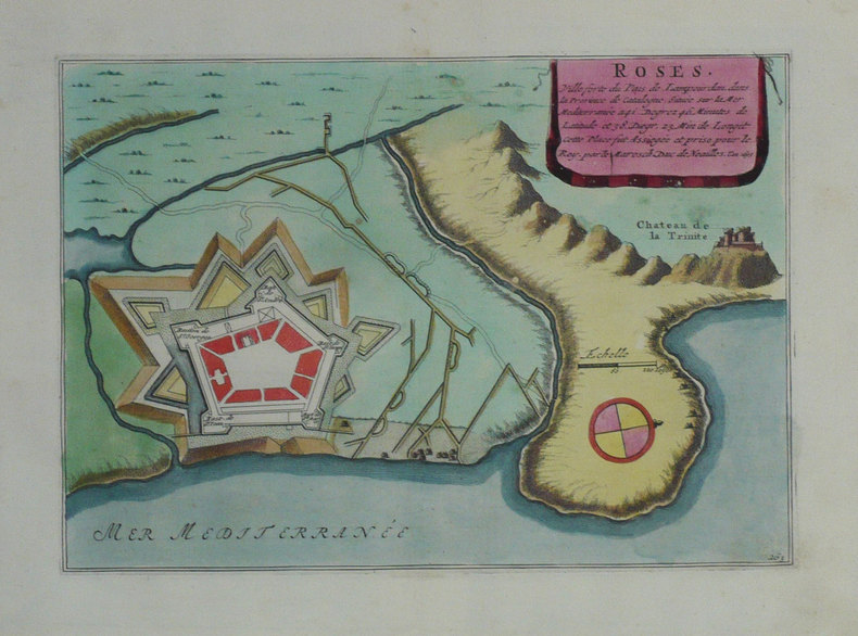
1702LBW-1339Amsterdam Pierre Mortier 1702 217 x 288 mm.
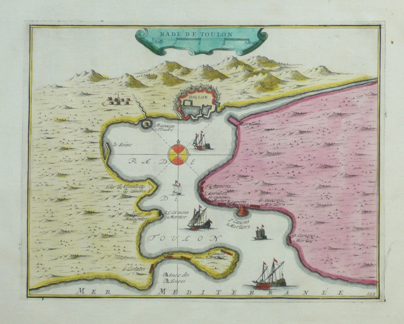
1702LBW-1303Amsterdam Pierre Mortier 1702 194 x 274 mm.
1702LBW-1332[Amsterdam, Pierre Mortier, 1702]. 210 x 267 mm.
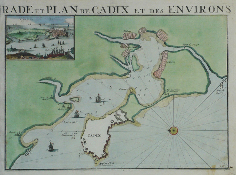
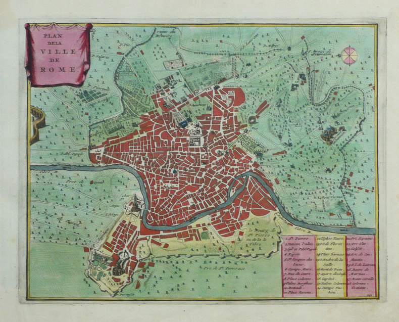
1702LBW-1289Amsterdam P. Mortier 1702 260 x 355 mm.
1702LBW-1318Amsterdam Pierre Mortier 1702 207 x 267 mm.
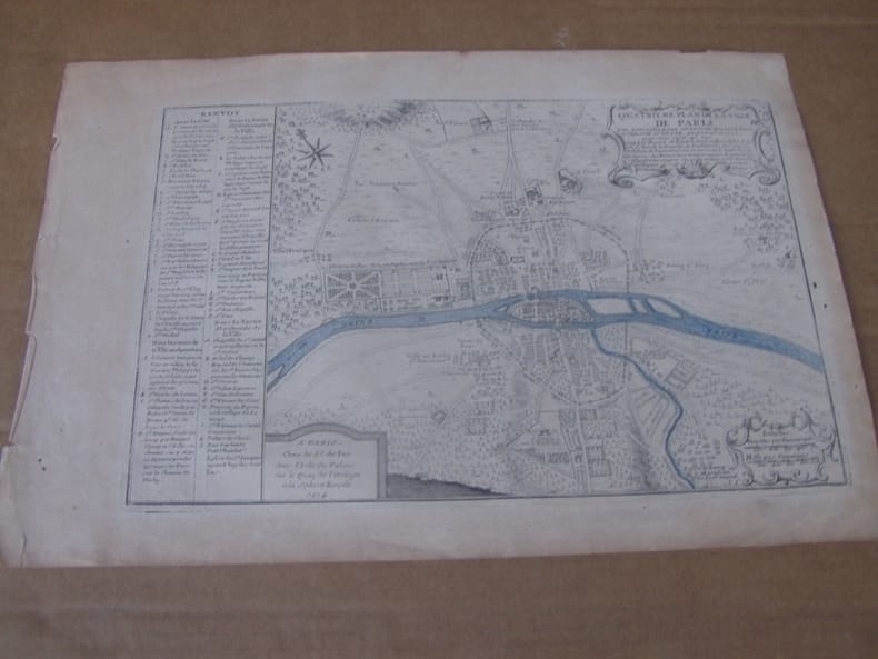
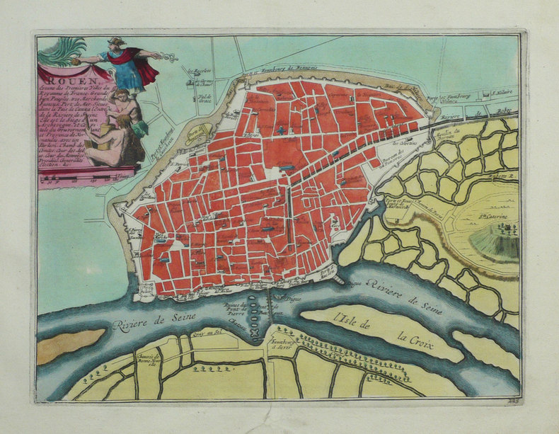
1720LBW-3721[Paris, circa 1720]. 434 x 533 mm.
1714279211714 Paris, 1714 - Blatt-Maße: ca. 27 x 38 cm. -- gut erhalten. || Original copper engraved map from 1714.
1702M5130Paris 1702. Excellent. Size : 250x355 mm 9.875x14 Inches Coloring: Black & White Category: ; Maps Europe Spain unknown
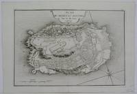
1760M7182Paris: Desnos c. 1760. Very Good. Notes: These maps was originally designed by de la Hire 1640-1718 in 1705. Size : 461x461 mm 18.15x18.15 Inches Coloring: Hand Colored Reference: Tooley III:72 Category: Maps Celestial; Desnos unknown
1705M5145Paris 1705. Excellent. Size : 230x330 mm 9x13 Inches Coloring: Black & White Category: ; Maps Europe France unknown
1705LBW-710Paris 1705 223 x 335 mm.
1705M4627Paris 1705. Very Good. Size : 230x340 mm 9x13.375 Inches Coloring: Hand Colored Category: Maps City Maps; Maps Europe United Kingdom England London unknown
171752957Paris. 1717. Detailed map of a battle in the July of 1712 with troop placementsand positions on the map. An explanation of the battle at lower right. Accompanying text on reverse. Published in de Fer's Atlas Curieux ou Le Monde. Copper engraving. Very good condition. Upper left top and right hand margin have been trimmed close to edge of plate Later colouring. Size: 52.5 x 31 cm. unknown
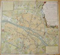
1735M7483Paris c.1735. Very Good;. Notes: Large scale decorative 18th century map of Paris. Top right title in a cartouche adorns a fountain spewing water referring to the establishment of the network of fountains in the capital. Size : 565x590 mm 22.24x23.23 Inches Coloring: Hand Colored Reference: Jean Boutier #212A Category: Maps Europe France Paris;Maps City Maps; unknown
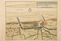
171778680Paris: c.1717. Map of the towns of Dunkirk and Mardick showing the new canal. Published in "Atlas Curieux ou le Monde". Copper engraving. Hand coloured. Size: 275 x 398 mm Very good condition. unknown
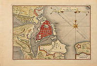
171678549Paris: 1716. A beautiful city plan of Stralsund in Germany just off the island of Rugen in the Baltic Sea. Copper engraving. Hand coloured. Sheet size: 275 x 404 mm Plate size: 230 x 332 mm Good condition. unknown
1716M5138Paris 1716. Excellent. Size : 235x325 mm 9.25x12.75 Inches Coloring: Black & White Category: ; Maps Europe Germany unknown
1702LBW-1301Amsterdam Pierre Mortier 1702 226 x 331 mm.
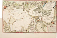
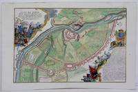
1705M6202Paris 1705. Excellent. Notes: An attractive map of the city of Narva besieged by a military encampment.<br><br>The Battle of Narva was an early battle in the Great Northern War fought in November of 1700. The Swedish army under Charles XII of Sweden defeated a Russian force four times its size commanded by Peter the Great. Narva marked the peak of Swedish power on the continent with Russia eventually gaining decisive victories that were able to end the conflict. Size : 230x325 mm 9x12.75 Inches Coloring: Hand Colored Category: ; Maps Europe Estonia Latvia; Maps City Maps; Maps Military unknown
1705M5280Paris 1705. Excellent. Size : 225x340 mm 8.875x13.375 Inches Coloring: Hand Colored Category: ; Maps Europe Estonia Latvia unknown
1702LBW-1354Amsterdam Pierre Mortier 1702 232 x 295 mm.
1702LBW-1302Amsterdam Pierre Mortier 1702 229 x 334 mm.
1705279621705 Paris, 1705 - Blatt-Maße: ca. 27 x 38 cm. -- gut erhalten. || Original copper engraved map from 1714.
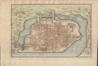
1715019811Paris. Very Good. 1715. Map. Lovely engraved map depicting Mexico City in the early 18th century. Map is on a 10 ¾" x 15 ¾" sheet that was taken from Nicolas de Fer's "L'Atlas Curieux" of 1715; no content on verso. Date of map was printed in upper margin along with the sheet number "125" and title; content in French. Hand-coloring is still bright. Map has very light toning to edges but is otherwise clean. This detailed map depicts Mexico City when it was surrounded by water and was linked to the mainland by the famous causeways originally designed by the Aztecs. Also pictured are aqueducts and farms and about 50 locations have been numbered on the map but the key is not present likely printed on another page in the Atlas. A beautiful map. . unknown books
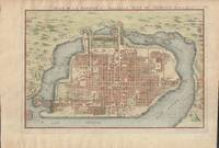
1715019811Paris. Very Good. 1715. Map. Lovely engraved map depicting Mexico City in the early 18th century. Map is on a 10 ¾" x 15 ¾" sheet that was taken from Nicolas de Fer's "L'Atlas Curieux" of 1715; no content on verso. Date of map was printed in upper margin along with the sheet number "125" and title; content in French. Hand-coloring is still bright. Map has very light toning to edges but is otherwise clean. This detailed map depicts Mexico City when it was surrounded by water and was linked to the mainland by the famous causeways originally designed by the Aztecs. Also pictured are aqueducts and farms and about 50 locations have been numbered on the map but the key is not present likely printed on another page in the Atlas. A beautiful map. . unknown