2 067 résultats
24714374like new. unknown
47774791-nnew. unknown
B9783725809387Hardback. New. hardcover
2026x-9048567815Routledge 2026. Hardcover. New. 136 pages. 9.18x6.12x9.45 inches. Routledge hardcover
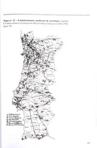
2208AC052<p>Discurso Pronunciado em 29 de Novembro de 1949. Colecção Política de Espírito. Edições SNI. Lisboa. 1950.</p>_x000d_<p>De 19x13 cm. Com 21 iii págs. Brochado. Ilustrado. Exemplar com pequenos sinais de manuseamento.</p> I-241-F-57 unknown
1912RL037<p>Manuais 4 e 24. Coord. . Universidade Aberta. Lisboa. 1997 1990.</p>_x000d_<p>2 Volumes de 30x20 cm. Com 375; 321 págs. Brochado. Ilustrado no 1.º volume no texto e em extratexto com mapas e quadros genealógicos em folhas desdobráveis. </p>_x000d_<p>Contém notas biográficas dos autores nas badanas das capas de brochura de cada volume. </p>_x000d_<p>Maria José Ferro Tavares é autora do 1º volume e coordena o 2º volume que conta com a colaboração de António Camões Gouveia Renascimento a meados do século XVIII Manuel Filipe Cruz Canaveira de Pombal à República A. de Oliveira Marques 1ª República e Fernando Rosas Estado Novo. </p> I-62-F-21 unknown
2205PA103<p>Volume I N.º 20 Volume II N.º 26. Coordenação de. Universidade Aberta. Lisboa. 1990.</p>_x000d_<p>2 Volumes de 30x21 cm. Com 536 ii; 584 págs. Brochados. Exemplar com miolo solto lombada partida e sublinhados e anotações no volume I.</p> I-154-G-3 unknown
0061360155.Ghardcover. Good. Access codes and supplements are not guaranteed with used items. May be an ex-library book. hardcover
16197Denver CO: The F. M. Davis Iron Works Co. Fine. N.D. First Edition. Softcover. 8vo 8" - 9" tall; 105 pages . The F. M. Davis Iron Works Co. paperback
0260367494.Gpaperback. Good. Access codes and supplements are not guaranteed with used items. May be an ex-library book. paperback
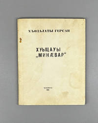
196943963033780497<p>Хъодалаты ГерÑан. Хуыцауы "Минæвар" : уацау.<br />Цхинвал : Рауагъдад "ИрыÑтон" 1969. <br /><br />Кодалаев ГерÑан Зурабович. "ПоÑланец" Бога : повеÑÑ‚ÑŒ на оÑетинÑком Ñзыке / ред. Ð. С. Пухаев ; худож. Г. З. Кодалаев ; худред. Ð. Д. Ванеев ; техред. Ш. Г. Елбакиев ; корр. Ð. И. Техов. <br />Цхинвали : ИрыÑтон 1969. <br />88 Ñ. ; 17 Ñм. — 1000 Ñкз. <br /><br />Khodalaev Gersan Zurabovich in Iron Ossetian: Khodzalaty Gersan. Xuycauÿ "Minaévar" God's "Messenger" : uatsau prose tale / parallel Russian title in colophon: "Poslanets" Boga; parallel Georgian title: Lmertis "Gharmomagdeneli."<br />Tskhinval : Iryston Publishing House 1969. 88 pp. ; 17 cm.<br />Paper wrappers. Print run of 1000 copies.<br />Signed by the author on the front free endpaper.<br />Condition good: wrappers heavily age-toned and browned; small stain at lower right corner of front wrapper; text block uniformly toned; pages complete and legible.</p><p>Gersan Zurabovich Khodalaev Хъодалаты ГерÑан 1938-2022 was one of the leading figures of South Ossetian literature and culture of the later twentieth century: poet publicist translator laureate of the State Prize named after Kosta Khetagurov - the highest literary honor in Ossetian culture named after the nineteenth-century founder of Ossetian literary tradition - laureate of the "Apple of Narts" prize and long-serving chief editor of "Fidwag" Фидиуаг the only Ossetian-language literary journal in South Ossetia. Born in the Leningori district of South Ossetia his first collection of poetry "The Traveler" appeared in 1964; the present work written in 1963 and published in 1969 is a rare example of his prose: a уацау uatsau a traditional form of Ossetian narrative drawing on both the ancient oral storytelling tradition and modern literary conventions. Published by the Iryston ИрыÑтон = "Ossetia" publishing house established in Tskhinval in 1967 as the primary vehicle for South Ossetian literary publication the book appeared within the characteristic trilingual context of the South Ossetian Autonomous Oblast of the Georgian SSR: the colophon provides parallel titles in Russian "ПоÑланец Бога" and Georgian ლმეირთის "ღáƒáƒ მáƒáƒ›áƒáƒ“გენელი". With a print run of only 1000 copies aimed at local Ossetian readers and regional libraries and no international distribution Tskhinval publications of this period are extraordinarily rare outside the Caucasus; the subsequent armed conflicts of 1991-1992 and the 2008 Russo-Georgian War have further disrupted the survival and dispersal of South Ossetian cultural materials.</p> Iryston Publishing House paperback
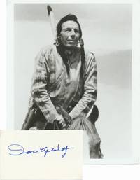
51749It took an environmental "Keep America Beautiful" commercial in the 1970s featuring a closeup of Cody with a tear rolling down his cheek to bring this supposed Cherokee Indian actor actually he was Italian-American born Espera DeCortito to the public's attention; he played ethnic roles in numerous films from the late 1920s through the late 1990s notably "Chief Iron Eyes" in the 1948 Bob Hope film "The Paleface." Large and bold signature in blue fineline on a heavy stock 5" X 3" card. Fine. Accompanied by an unsigned glossy 8" X 10" photograph a candid closeup later-life image of Cody in full Native American garb astride a horse. unknown
0817924043.Ghardcover. Good. Access codes and supplements are not guaranteed with used items. May be an ex-library book. hardcover
19812082702114908781Rippushobo 1981. Soft Cover. Fine. Number of books: 1 Rippushobo paperback
1987779675PN. New. 1987. Soft Cover. Date is original print. This is a reprint edition. . PN paperback
1975750843PN. New. 1975. Soft Cover. Date is original print. This is a reprint edition. . PN paperback
1975750994PN. New. 1975. Soft Cover. Date is original print. This is a reprint edition. . PN paperback
1975750370PN. New. 1975. Soft Cover. Date is original print. This is a reprint edition. . PN paperback
199968301New York: Cast Iron Gallery 1999. First Edition; First Printing. Softcover. Very Good in wrappers. ; 4to - over 9¾" - 12" tall. Cast Iron Gallery unknown
0816054940.Ghardcover. Good. Access codes and supplements are not guaranteed with used items. May be an ex-library book. hardcover
9786556924588TODAVIA EDITORA. new. O protagonista de O seu terr�vel abra��o Ǹ um escritor e intelectual paulistano branco de classe mǸdia e sujeito ��s conting�ncias de sua origem. Sua inf�ncia foi como todas as outras para as pessoas de seu mesmo estrato social: escola e clube condom�nio e praia. As primeiras experi�ncias com sexo drogas e a consci�ncia do abismo entre classes em um pa�s como o Brasil tudo isso fez parte de sua forma��o juntamente com os livros o cinema e a m�sica popular. Aos quarenta anos porǸm ele descobre ter uma doen��a terminal. E o Brasil tambǸm parece estar muito pouco saudǭvel pol�tica e socialmente: mergulhado num regime autoritǭrio em que livros s�o banidos e as liberdades individuais est�o constantemente amea��adas num momento em que as diferen��as entre classes s�� aumentam. Neste romance agudo sobre escolhas fatalidades e falta de dire��o Tiago Ferro exercita uma veia ficcional que mistura em doses iguais de inconformismo e despudor o romance e o ensaio a fabula��o e o comentǭrio pol�tico a medita��o pessoal e a escatologia. O resultado explosivo a cada parǭgrafo dialoga com o melhor da literatura latino-americana contempor�nea. Este Ǹ o retrato de uma gera��o que cresceu com muitas op����es mas que chegou �� maturidade encontrando um beco sem sa�da em suas vidas pessoais e no pr��prio pa�s em que nasceu. TODAVIA EDITORA unknown
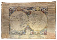
1695ABC_49413Paris: chez lauteur / van Loon 1695. Approximately 114 x 165 cm each. Copperplate engravings in original outline colour tissue-backed for stability laid down to modern cartographic linen. All with title banner dated 1698 with the Royal Privilege and text panels dated 1703. Each map printed on four joined sheets with title surmounted and engraved text panels at sides and bottom. A magnificent set of five Enlightenment wall maps of the continents & world all in early states: the only known set of all five unknown in any public or private collection. In the late 17th century mapmaking was emerging from an equal focus on the decorative and descriptive to a more analytic sensibility. Nicolas de Fer 1646-1720 successfully navigated the early Enlightenment era with these monumental wall maps created with the patronage of the Dauphin of France. The dramatic cartouches and vignettes in the maps are masterpieces of baroque imagery capturing the people wonders resources and cultures of faraway lands eagerly sought by Europeans during this dynamic period. A very limited number of large wall maps were produced by the major cartographic houses for the nobility and for wealthy merchants to satisfy curiosity about the world beyond Europe. Grand wall maps such as these were usually mounted for display and their exposure led to the great majority of examples from this period having been lost; the incidence of this type of map passing down to our era is astonishingly small. 1 America: LAmerique divisee selon letendue de ses principales parties et dont les points principaux sont placez sur les observations de messieurs de lAcademie Royale des Sciences 1698. Second state of 1698 first edition adding the dedication to the Dauphin within an ornamental cartouche. One of the most glorious cartographic expressions of the spirit of 17th century French expansionism in North America. The geography is of the type in fashion at Paris during the short interval between La Salles descent of the Mississippi in 1682 and the founding of Louisiana in 1699. De Fer properly aligned Hudson Bay above the Great Lakes which are portrayed with exceptional accuracy and the southern reaches to the Great Lakes are better aligned with the east coast. The map shows advanced knowledge of the Mississippi River drainage although still emptying in the Gulf of Mexico in Texas too far to the west following the school of Coronelli. Two of the most iconic 18th century images of America those of beavers at work and of a cod-fishery were introduced on this map before being made famous by the English cartographer Herman Moll. The beaver scene shows dozens of the industrious creatures against a backdrop of Niagara Falls which is most likely based on Hennepins first printed view of the falls published a year earlier in 1697. 2 Africa: LAfrique divisée selon letendue de ses principales parties et dont les points principaux sont placez sur les observations de messieurs de lAcadémie Royale des Sciences 1698. The African continent on a fantastic scale with extensive annotations and panelled legends throughout; dedicatory cartouche in the southern Indian Ocean. The side panels have extensive text entries for the division of the continent cities islands capes rivers mountains and a lengthy description of the source of the Nile. Richly decorated with more than 20 elaborate scenes showing art industry clothing customs farming hunting trade battle and landscapes. Numerous animals include ostrich monkey crocodile lion elephant and camel. With a plan of the Dutch fort at the Cape of Good Hope in a draped paneled inset. The Arabian Peninsula is shown in its entirety. Based in part on the work of de lIsle it shows an early conception of the Middle East: in particular it omits the Sinai Peninsula included in several of de Fers earlier efforts. Among the toponyms along the coast of the Gulf are Abadan Sur Ahsa Janama Bahr El Catif Bischa Borou Godo Vodana Calba Dadana and Pinder. Although the coastlines are well mapped there is a notable lack of understanding of the interior: the Niger delta is shown divulging on the west coast instead of the Gulf of Benin while the massive extent of the Congo rivers drainage basin is here only hinted at. The Nile is finally freed from the twin Ptolemaic lakes and begins to take on its more accurate course.3 Asia: LAsie divisée selon letendue de ses principales parties et dont les points principaux sont placez sur les observations de messieurs de lAcadémie Royale des Sciences 1696. The earliest known state dated 1696 in the dedication. Includes the rare letterpress historical text panels dated 1703. Much of the continent is well-charted based largely on Dutch for the Philippines Malaysia Southeast Asia and Jesuit sources for areas such as China. The coastlines north of Korea correctly shown as a peninsula curving west and northward begin and end in ambiguity. Inset map of Arctic Asia; two inset maps of Northeast China based on the writings of the Jesuits Martino Martini and Ferdinand Verbiest. The richly decorated borders depict the people art religion commerce and cultures of Asia. Vignettes show Chinese Japanese Turks Indians Tartars Philippines inhabitants of the Molucca and Sunda islands Ceylonese Arabs peoples from Goa and Mongolia Armenians Georgians people from Golconda Malaysia Siam Cochin and Tonkin. Among the images are those of the faithful during the Hajj visiting the Kaaba at Mecca. The rare letterpress panels provide extensive text references; rivers towns capes lakes and straights including more detailed descriptions of Turkey Arabia China Persia India Russia and Arabic islands in the Indian Ocean. 4 Europe: LEurope divisée selon letendue de ses principales parties et dont les points principaux sont placez sur les observations de messieurs de lAcadémie Royale des Sciences 1695. The earliest known state dated 1695 within the dedication. With 16 legends in elaborate Baroque vignettes describing the French Polish Germans Austrians English and other peoples the vignettes interspersed with views of cities hunting coats of arms pageantry and other fascinating glimpses of a dynamic continent with culture flowering everywhere. The side panels have extensive text entries for the division of the continent countries principalities nobility cities principal islands capes rivers mountains etc. Widely acknowledged as one of the foremost French cartographers of the late 17th century Nicolas de Fer published more than 600 maps and many atlases documenting French fortified towns strongholds and the explorations and discoveries of new territories. Unlike most Dutch cartographers who mainly made maps for navigational purposes he worked in the French decorative style creating a total of 26 large wall maps to adorn walls in the palaces and castles of European royalty clergy and wealthy merchants.A superb set previously unobtainable: no other set of the de Fer wall maps of the continents in their earliest incarnation with or without the side panels other than the present example are known to have survived. Examples of individual continental maps in the earliest states as here rarely appear on the market. Later states of the map often appear without the surmounted title and text panels. No comparable set traced in auction records; an example of the first-state America map alone sold by Cohen & Taliaferro in 2010 commanded $185000.Provenance: Long in an aristocratic collection based near Novara. Acquired in the U.S. trade. Absolutely untouched by facsimile only some reinstatement of paper in text panels and much less so to very minor loss in maps. Old outline colour retouched; cartouches and vignettes with recent colour. Stabilised cracks occasional scuffing overall age toning.l Burden P. The Mapping of North America II no. 744; Dahl E. The Original Beaver Map: De Fers 1698 Wall Map of America in: The Map Collector 29 Dec. 1984 pp. 22-26; Suarez T. Shedding the Veil Singapore 1992 no. 48; not in WorldCat. chez lauteur / van Loon, hardcover
2002__0471486698John Wiley & Sons Inc 2002. Hardcover. New. 1st edition. 272 pages. 10.25x7.00x0.75 inches. John Wiley & Sons Inc hardcover
2012870635.Gpaperback. Good. Access codes and supplements are not guaranteed with used items. May be an ex-library book. paperback
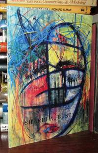
65960Editions l'Entrée des artistes In-8-carré 25 cm 48pp. illustr. couverture blanche bon etat Ats28 unknown