2 067 résultats
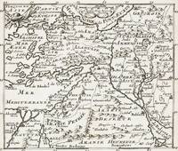
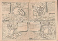
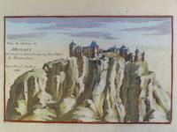
1700399AG1700. Paris c. 1700. Original copper engraved maps. 16 cm wide x 13.2 cm high. Mounted on paper. Very good condition. From a wonderful collection of Maps from an old english library South Shields - with a tiny library stamp to the mounting paper The stamp is NOT on the Map. Nicolas de Fer 164625 October 1720 was a French cartographer and geographer. De Fer was the youngest of three sons of Antoine de Fer who was also a cartographer. When he was 12 he became the apprentice of Parisian engraver Louis Spirinx and made his first map of the Canal du Midi at the age of 23. After the death of his father in June 1673 his mother Geneviève initially took over the map making company which had begun to decline. She passed it and the atelier called Quai de L'Horloge on to Nicolas in 1687 because of her old age. De Fer was so successful at improving the firm that in 1690 he became the official geographer to Louis Dauphin of France. With support from the Spanish and French Royal Families de Fer also became official geographer for Philip V and Louis XIV the kings of Spain and France respectively. Because of this his maps became Bourbon propaganda endorsing French King Louis XIV. His business flourished producing town plans atlases wall maps and more than 600 sheet maps. He made maps of places in Europe and North America including New Spain places fortified by Vauban the Low Countries and the War of the Spanish Succession. In 1698 de Fer published a map of North America which included a depiction of beavers building dams near Niagara Falls. Seventeen years later Herman Moll published a map which plagiarized elements of de Fer's work particularly the beaver scene. It became known as the "Beaver map". De Fer became the official geographer for His Catholic Majesty in 1720. Two of his sons-in-law Guillaume Danet and Jaques-François Bénard continued the company after de Fer's death on 25 October of that year until around 1760. Wikipedia unknown
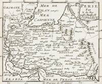
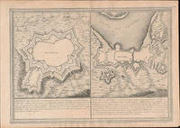
1700402AG1700. Paris c. 1700. Original copper engraved maps. 15.5 cm wide x 13 cm high. Mounted on paper. Very good condition. From a wonderful collection of Maps from an old english library South Shields - with a tiny library stamp to the mounting paper The stamp is NOT on the Map. Nicolas de Fer 164625 October 1720 was a French cartographer and geographer. De Fer was the youngest of three sons of Antoine de Fer who was also a cartographer. When he was 12 he became the apprentice of Parisian engraver Louis Spirinx and made his first map of the Canal du Midi at the age of 23. After the death of his father in June 1673 his mother Geneviève initially took over the map making company which had begun to decline. She passed it and the atelier called Quai de L'Horloge on to Nicolas in 1687 because of her old age. De Fer was so successful at improving the firm that in 1690 he became the official geographer to Louis Dauphin of France. With support from the Spanish and French Royal Families de Fer also became official geographer for Philip V and Louis XIV the kings of Spain and France respectively. Because of this his maps became Bourbon propaganda endorsing French King Louis XIV. His business flourished producing town plans atlases wall maps and more than 600 sheet maps. He made maps of places in Europe and North America including New Spain places fortified by Vauban the Low Countries and the War of the Spanish Succession. In 1698 de Fer published a map of North America which included a depiction of beavers building dams near Niagara Falls. Seventeen years later Herman Moll published a map which plagiarized elements of de Fer's work particularly the beaver scene. It became known as the "Beaver map". De Fer became the official geographer for His Catholic Majesty in 1720. Two of his sons-in-law Guillaume Danet and Jaques-François Bénard continued the company after de Fer's death on 25 October of that year until around 1760. Wikipedia unknown
1700403AG1700. Paris c. 1700. Original copper engraved maps. 15.5 cm wide x 13 cm high. Mounted on paper. Very good condition. From a wonderful collection of Maps from an old english library South Shields - with a tiny library stamp to the mounting paper The stamp is NOT on the Map. Nicolas de Fer 164625 October 1720 was a French cartographer and geographer. De Fer was the youngest of three sons of Antoine de Fer who was also a cartographer. When he was 12 he became the apprentice of Parisian engraver Louis Spirinx and made his first map of the Canal du Midi at the age of 23. After the death of his father in June 1673 his mother Geneviève initially took over the map making company which had begun to decline. She passed it and the atelier called Quai de L'Horloge on to Nicolas in 1687 because of her old age. De Fer was so successful at improving the firm that in 1690 he became the official geographer to Louis Dauphin of France. With support from the Spanish and French Royal Families de Fer also became official geographer for Philip V and Louis XIV the kings of Spain and France respectively. Because of this his maps became Bourbon propaganda endorsing French King Louis XIV. His business flourished producing town plans atlases wall maps and more than 600 sheet maps. He made maps of places in Europe and North America including New Spain places fortified by Vauban the Low Countries and the War of the Spanish Succession. In 1698 de Fer published a map of North America which included a depiction of beavers building dams near Niagara Falls. Seventeen years later Herman Moll published a map which plagiarized elements of de Fer's work particularly the beaver scene. It became known as the "Beaver map". De Fer became the official geographer for His Catholic Majesty in 1720. Two of his sons-in-law Guillaume Danet and Jaques-François Bénard continued the company after de Fer's death on 25 October of that year until around 1760. Wikipedia unknown
1706M6387Paris 1706. Very Good margins extended. Size : 130x175 mm 5.125x6.875 Inches Coloring: Hand Colored Category: ; Maps Europe Portugal unknown
2004Alibris.0017380London England: Phaidon Press. 2004. Trade paperback. Very good. Trade paperback US. 160 p. Contains: Illustrations. Phaidon Contemporary Artist. Audience: General/trade. . Phaidon Press paperback
2004Q-0714842648Phaidon Press 2004-12-01. Paperback. New. In shrink wrap. Looks like an interesting title! Phaidon Press paperback
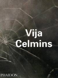
2004203716London: Phaidon 2004. Softcover. VG: Exlibary book. Sticker at the base of the spine. Stamp on the first page. Stamp on the last page. A softcover book with French flaps. The title is in white down a gray spine. Pages: 7 8-160. Profusely illustrated with a majority black-and-white images. Phaidon paperback
2004208584London: Phaidon 2004. Softcover. VG. Clean and unmarked. Close to new. Quarto. Softcover with French flaps. The title is in white down a gray spine. Pages: 7 8-160. Profusely illustrated with a majority black-and-white images. Phaidon paperback
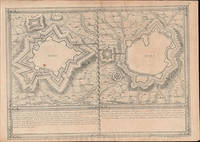
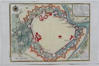
51-6473Paris: chez l'auteur dans l'Isle du Palais sur le quay de l'orloge a la Sphére Royale avec privilége du Roy 1705-1717. Engraved map. 27.3 x 38cm. Contemporary laid paper uniformly time aged.Elvas is a fortified hilltop town on the Spanish border east of Lisbon. The Portuguese too the city fromthe Moors in 1226 and it was captured by Spain in 1580. The fortifications date mostly from the 17th century and there is a 16th-century aqueduct.Evora is the capital of the province of Alentejo east of Lisbon It was captured by the Romans in 80 BC and has a Roman aqueduct and temple of Diana the goddess of hunting. There is also a 13th-century Gothic cathedral. From the 14th to the 16th centuries Evora was the residence of the Kings of Portugal.This map was published during the War of the Spanish Succession a conflict in which Portugal and Lisbon featured prominent hence the depiction of the fortifications of the city.Published in "L'atlas curieux ou le monde reÌpreseÌnteÌ dans des cartes geÌneÌrales et particulieres du ciel et de la terre : diviseÌ tant en ses quatre principales parties que par eÌtats et provinces et orneÌ par des plans et descriptions des villes capitales et principales et des plus superbes edifices qui les embelissent comme sont les eglises les palais les maisons de plaisance les iardins les fontaines &c. ". OCLC Number / Unique Identifier:79022119.LThe Atlas Curieux is geographic encyclopedia of images and maps of France with detailed views of the grand waterworks at Marly views of the great palaces and chateaux views and plans of the Paris Observatory and samples of military architecture. Issued in six annual parts from 1700-1705 the maps are based on the new observations of the Académie des Sciences and drawn up with the assistance of Philipe de La Hire.Library of Congress:The French cartographer and engraver Nicolas de Fer was a master at creating maps that were works of art. The maps that he published were printed during the Baroque period when the decorative arts were characterized by ornate detail. De Fer’s detailed maps and atlases were valued more for their decorative content than their geographical accuracy.Nicolas de Fer was born in 1646. His father Antoine de Fer owned a mapmaking firm. At the age of twelve Nicolas was apprenticed to a Parisian engraver named Louis Spirinx. The family business was starting to decline when his father died in 1673. Nicolas de Fer’s mother Genevieve took over the business after the death of her husband. In 1687 the business was passed on to Nicolas and the profits increased after he took over the firm. Nicolas de Fer was a prolific cartographer who produced atlases and hundreds of single maps. He eventually became the official geographer to King Louis XIV of France and King Philip V of Spain.One of de Fer’s major works is an atlas titled L’atlas curieux The curious atlas. Paris: chez l'auteur dans l'Isle du Palais sur le quay de l'orloge a la Sphére Royale avec privilége du Roy, 1705-1717 unknown
51-6475Paris: chez l'auteur dans l'Isle du Palais sur le quay de l'orloge a la Sphére Royale avec privilége du Roy 1705-1717. Engraved map. 27.3 x 38cm. Contemporary laid paper uniformly time aged.Elvas is a fortified hilltop town on the Spanish border east of Lisbon. The Portuguese too the city fromthe Moors in 1226 and it was captured by Spain in 1580. The fortifications date mostly from the 17th century and there is a 16th-century aqueduct.Published in "L'atlas curieux ou le monde reÌpreseÌnteÌ dans des cartes geÌneÌrales et particulieres du ciel et de la terre : diviseÌ tant en ses quatre principales parties que par eÌtats et provinces et orneÌ par des plans et descriptions des villes capitales et principales et des plus superbes edifices qui les embelissent comme sont les eglises les palais les maisons de plaisance les iardins les fontaines &c. ". OCLC Number / Unique Identifier:79022119.LThe Atlas Curieux is geographic encyclopedia of images and maps of France with detailed views of the grand waterworks at Marly views of the great palaces and chateaux views and plans of the Paris Observatory and samples of military architecture. Issued in six annual parts from 1700-1705 the maps are based on the new observations of the Académie des Sciences and drawn up with the assistance of Philipe de La Hire.Library of Congress:The French cartographer and engraver Nicolas de Fer was a master at creating maps that were works of art. The maps that he published were printed during the Baroque period when the decorative arts were characterized by ornate detail. De Fer’s detailed maps and atlases were valued more for their decorative content than their geographical accuracy.Nicolas de Fer was born in 1646. His father Antoine de Fer owned a mapmaking firm. At the age of twelve Nicolas was apprenticed to a Parisian engraver named Louis Spirinx. The family business was starting to decline when his father died in 1673. Nicolas de Fer’s mother Genevieve took over the business after the death of her husband. In 1687 the business was passed on to Nicolas and the profits increased after he took over the firm. Nicolas de Fer was a prolific cartographer who produced atlases and hundreds of single maps. He eventually became the official geographer to King Louis XIV of France and King Philip V of Spain.One of de Fer’s major works is an atlas titled L’atlas curieux The curious atlas. Paris: chez l'auteur dans l'Isle du Palais sur le quay de l'orloge a la Sphére Royale avec privilége du Roy, 1705-1717 unknown
51-6474Paris: chez l'auteur dans l'Isle du Palais sur le quay de l'orloge a la Sphére Royale avec privilége du Roy 1705-1717. Engraved map. 27.3 x 38cm. Contemporary laid paper uniformly time aged.Elvas is a fortified hilltop town on the Spanish border east of Lisbon. The Portuguese too the city fromthe Moors in 1226 and it was captured by Spain in 1580. The fortifications date mostly from the 17th century and there is a 16th-century aqueduct.Published in "L'atlas curieux ou le monde reÌpreseÌnteÌ dans des cartes geÌneÌrales et particulieres du ciel et de la terre : diviseÌ tant en ses quatre principales parties que par eÌtats et provinces et orneÌ par des plans et descriptions des villes capitales et principales et des plus superbes edifices qui les embelissent comme sont les eglises les palais les maisons de plaisance les iardins les fontaines &c. ". OCLC Number / Unique Identifier:79022119.LThe Atlas Curieux is geographic encyclopedia of images and maps of France with detailed views of the grand waterworks at Marly views of the great palaces and chateaux views and plans of the Paris Observatory and samples of military architecture. Issued in six annual parts from 1700-1705 the maps are based on the new observations of the Académie des Sciences and drawn up with the assistance of Philipe de La Hire.Library of Congress:The French cartographer and engraver Nicolas de Fer was a master at creating maps that were works of art. The maps that he published were printed during the Baroque period when the decorative arts were characterized by ornate detail. De Fer’s detailed maps and atlases were valued more for their decorative content than their geographical accuracy.Nicolas de Fer was born in 1646. His father Antoine de Fer owned a mapmaking firm. At the age of twelve Nicolas was apprenticed to a Parisian engraver named Louis Spirinx. The family business was starting to decline when his father died in 1673. Nicolas de Fer’s mother Genevieve took over the business after the death of her husband. In 1687 the business was passed on to Nicolas and the profits increased after he took over the firm. Nicolas de Fer was a prolific cartographer who produced atlases and hundreds of single maps. He eventually became the official geographer to King Louis XIV of France and King Philip V of Spain.One of de Fer’s major works is an atlas titled L’atlas curieux The curious atlas. Paris: chez l'auteur dans l'Isle du Palais sur le quay de l'orloge a la Sphére Royale avec privilége du Roy, 1705-1717 unknown
1705M4699Paris 1705. Excellent. Size : 245x340 mm 9.625x13.375 Inches Coloring: Hand Colored Category: Maps City Maps; Maps Europe Austria unknown
20192-0464287111Blurb 2019. Hardcover. New. 480 pages. Spanish language. 8.23x5.32x1.50 inches. Blurb hardcover
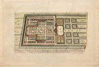
170578538Paris: 1705. Nicolas de Fer's excellent plan of the Nieuburg House where the treaty of Ryswick in the Netherlands was signed in 1697 and not 1705 as stated in the print. From the "Atlas Curieux ou Le Monde". Copper engraving. Hand colouring. Size: 275 x 400 mm Good condition. unknown
2n1788De Fer Paris 1705. Maße: 19 cm x 122 cm. - Nicolas de Fer war einer der führenden französischen Kartographen und Kartenverleger - unknown
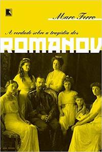
9788501402738RECORD. new. Em um relato emocionante Marc Ferro refuta um verdadeiro tabu da hist�ria e lana luz sobre um dos maiores mistrios do sculo XX. Na noite de 16 para 17 de julho de 1918 na regio dos Urais o tsar Nicolau II sua esposa e seus filhos Olga Tatiana Maria Anastsia e Alexei o tsarvitche foram executados pelos bolcheviques. Marc Ferro porm jamais acreditou nessa verso oficial. Com base em documentos e com o rigor dos grandes historiadores ele questiona o assassinato dos Romanov. Ju�zes e testemunhas subitamente mortos ou executados documentos truncados peas do dossi de instruo subutilizadas e testes de DNA controversos o colocam diante de uma hip�tese inconfessvel e sacr�lega: a tsarina e suas filhas teriam sido salvas graas a um acordo secreto entre bolcheviques e alemes a partir do qual e para sempre elas deveriam se calar sobre terem sobrevivido. Somente o destino do tsarvitche Alexei permaneceria desconhecido por falta de fontes. RECORD unknown
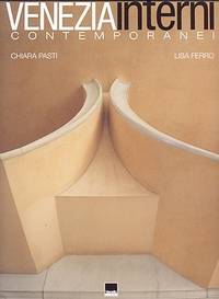
200992784Grafiche Vianello Srl. New. 2009. Hardcover. 8872002869 . FREE UPGRADE to Courier/Priority Shipping Upon Request - IN STOCK AND IMMEDIATELY AVAILABLE FOR SHIPMENT - Flawless copy brand new pristine never opened -- Text in English and Italian. 176 pages; 250 color illustrations. Description: "Living in Venice can mean a lot of things. Each of the different kinds of houses relates to the city in its own way. Living in a 'palazzo' is hardly the same as living in a loft or in a Byzantine building. Then the fact that one's home overlooks a lane a square a private garden or even the lagoon means having a different relationship with the outside. There are many different ways of living in this unique city. Twenty five splendid houses including Casa Balboni designed by the great architect Carlo Scarpa are described and illustrated in detail in the 184 pages of this book and its 250 photographs all in color." -- with a bonus offer-- . Grafiche Vianello Srl hardcover
20092-8872002869Vianello Libri 2009. Hardcover. New. bilingual edition. 176 pages. Italian language. 13.00x10.00x1.00 inches. Vianello Libri hardcover
1396750444.Ghardcover. Good. Access codes and supplements are not guaranteed with used items. May be an ex-library book. hardcover
1390311406.Gpaperback. Good. Access codes and supplements are not guaranteed with used items. May be an ex-library book. paperback
1391347811.Ghardcover. Good. Access codes and supplements are not guaranteed with used items. May be an ex-library book. hardcover
6139633281.Gpaperback. Good. Access codes and supplements are not guaranteed with used items. May be an ex-library book. paperback
1347908366.Ghardcover. Good. Access codes and supplements are not guaranteed with used items. May be an ex-library book. hardcover
0265774918.Ghardcover. Good. Access codes and supplements are not guaranteed with used items. May be an ex-library book. hardcover