4 134 résultats
Broch?. 209 pages.
Folio (533 x 364 mm). (3), 79 pp., engraved, illustrated title-page and 25 engraved maps after William Faden, in contemporary hand colour. Contemporary black morocco, richly stamped in silver and blind. Bright yellow pastedowns. In custom-made half morocco solander box. The first European-style atlas printed in the Islamic world: an exceedingly rare, handsome, and entirely complete example in its original first binding. "[T]he first world atlas printed by Muslims [...], of which only fifty copies were printed" (Library of Congress, Near East Collections: an illustrated guide, online). Several copies were reserved for high-ranking officials and important institutions; most of the remainder were destroyed in a warehouse fire during the Janissary Revolt of 1808. "Based on several estimates and accounting for the single maps (torn-out from bound volumes of the atlas) sold or being offered worldwide, it is believed that a maximum of 20 complete examples could be present in libraries or in private collections, whereas some sources suggest that there exist only 10 complete and intact copies in the world. As such, it is one of the rarest printed atlases of historical value" (Wikipedia). - A prestigious project for the Ottoman Palace with the seal of approval of the Sultan Selim III, this work was one of the avantgardistic enterprises promoted by Mahmoud Ra'if to introduce Western technical and scientific knowledge to the Ottoman state. Composed of 25 maps based on William Faden's "General Atlas", it is the first Muslim-published world atlas to make use of European geographic knowledge. On each of the maps the place-names are transliterated in Arabic. The Atlas includes Raif's 79-page geographical treatise "Ucalet ül-Cografiye" and the frequently missing folding celestial map on blue paper. - Maps very clean, showing only a few minor stains and repaired tears to folds; a creasemark to the map of Africa; an internal tear to pre-Revolutionary map of France. Binding professionally repaired at extremeties and upper hinge with a few scuffmarks and insignificant traces of worming. An excellent copy, one of the very few surviving specimens in the beautiful original oriental leather binding (the only other known example was sold through us in 2019). A severely defective copy recently commanded an auction price of USD 118,750 (Swann Galleries NY, 26 May 2016, lot 199). OCLC 54966656. Not in Philipps/Le Gear. Not in Atabey or Blackmer collections.
2004026553Hanover and London: University Press of New England 2004. SIGNED by the AUTHOR directly on the title page his signature only NOT personalized to anyone. HARDCOVER First Edition Very scarce SIGNED. Fine condition in a bright and shiny Near Fine dust jacket only lightly rubbed. NO chips or tears. Gold "Signed by the Author" seal on the front. Square and tight. NO owner's name or bookplate. NOT a remainder. Pages are crisp clean and unmarked. 2004. First Printing of the First Edition with full number line 54321 on the copyright page. From the publisher's Hardscrabble Crime series. Bound in the original green boards with blue cloth spine. Stamped in bright gold. From the dust jacket: "'Imagine a wise-cracking Tiger Woods as Sherlock Holmes' says bestselling novelist Tess Gerritsen. 'That's the sort of lovable hero John Corrigan has created in this new mystery series.' Corrigan once again captures life--and death--on the PGA Tour in his new mystery featuring Jack Austin native of Maine and professional golfer. After narrowly missing his first tournament win at the conclusion of SNAP HOOK Jack has begun a new season in the worst slump of his career. Since he now has a family to support the slump couldn't come at a worse time. But as Jack battles back to his usual level of play his friend Grant Ashley faces a more serious problem. Grant's new wife the young and beautiful Lynne is also abrasive unpleasant . . . and missing. Her husband is clearly more concerned than he wants to admit but he refuses to call the police. Jack and his friend Perkins security consultant to the Tour are determined to look for the missing woman but it is an investigation destined to lead to secrets betrayals lies and ultimately murder. 'Corrigan commands a wealth of technical detail to make Jack's every round vivid and exciting' said Kirkus Reviews of SNAP HOOK. 'Highly recommended for golfers golf widows and widowers and everybody who's ever wondered what the fuss is about.'". SIGNED by the AUTHOR. First Printing of the First Edition. Hardcover. Fine condition/Fine dust jacket. Illus. by NOT a library discard. 8vo. xii 281pp. Great Packaging Fast Shipping. University Press of New England Hardcover

1025 x 700 mm. Chart of Costa Rica, Panama, the Mosquito Gulf and the Pacific Ocean. Engraved chart, including tidal information, compass roses, soundings, seabed notations, currents, sandbanks, shoals, inland elevations, detailing and buildings. First published in 1889, revised in 1926. Signs of contemporary use, with several pencil markings. Folded.
1994007659Herndon Virginia U.S.A.: Potomac Books Inc 1994. 435pp/illus/maps. The official Army history of Desert Shield/Desert Storm. Clean like new. First Edition. Hard Cover. Fine/Fine. 8vo - over 7¾" - 9¾" tall. Potomac Books Inc Hardcover
Ink and watercolours on paper, backed with cloth. Calligraphic and armorial headpiece; historiated initials; two coloured illustrations (a hunter loading his gun; a hawk devouring a goose). Four red wax seals. 77 x 55 cms, rolled and stored in a contemporary marbled tube. A certificate of apprenticeship for the hunter Anton Spiallek (Spialleck) of Wiegstädtel near Opava in Silesia, signed by Franz Spialeck (possibly a relation) and four other district hunting officials of Dombrau and Mittel-Suchau (Prostrední Suchá), owned by Richard Baron Mattencloit. The art of hunting had long included falconry also in Silesia, and it was among the favourite pastimes of the nobility.
8vo. (16), 121, (3) pp. With engr. frontispiece and 5 engr. plates by Giovanni Giuseppe Cosattini. Contemp. Italian vellum. First edition of Lotto Lotti's (1667-1714) poem celebrating the liberation of Vienna from the 1683 Turkish siege, written in the Bologna dialect. "Divided in 5 cantos of 30 to 40 eight-line verses each" (Kábdebo). Among the pretty engravings are scenes of the siege and battle. - Somewhat browned and (finger-)stained throughout; worming to blank margin near beginning; vellum on lower board and spine-end restored professionally. Sturminger 1971. Kábdebo II, 290. British Library (17th c. Italian books) I, 503. ICCU VEAE\001923. Graesse IV, 264.
8vo. (4), 440 pp. With a folding map (215 x 265 mm) and 30 steel engravings. Contemporary green half morocco with giltstamped spine. First edition, published as vol. 51 in the series "L'Univers. Histoire et description de tous les peuples": a geographical and topographical account of the Middle East, focusing on the ancient cultural regions of Chaldea, Assyria, Media, Babylonia, Mesopotamia, Phoenicia, and Palmyra, now largely covered by Iraq and Iran and reaching from Asia Minor to the western shores of the Arabian Gulf. The plates show monuments and landmarks, specimens of cuneiform writing, engraved stones, etc. - Some foxing, but a tight, well-preserved copy. OCLC 370244338.
211 pages. Documents a 50 day Father and son flying and sightseeing saga of a lifetime. The richly detailed account of a "Round the World" adventure. Records with dramatic realism such anecdotes as the lonesome 15 hour trans-Pacific flights, and the tense moments when intercepting an Iranian pilot's transmissions after he had been hit by gunfire over the Persian Gulf. Takes you behind the scenes to such tantalizing and remote places of the world as Bali, Burma and Bangladesh. Includes fascinating pictures. Clean, bright and unmarked with very light wear. Excellent copy. Book
54 x 90 mm. Black-and-white photographic print on cardboard backing (62 x 104 mm). Captioned in French. Rare photograph of two mounted camel couriers in a desert landscape, by the celebrated French photographer Claude-Joseph Portier (d. 1910), active in Algeria in the 1860s. The picture shows one camel resting on the ground, the other standing. Featuring a bedouin tent in the background, as well as 2 bedouins sitting on the ground near the left side of the image. - Small scratch mark near the centre.
194344692New York: Charles Scribner’s Sons 1943. 4to. 4 131 1 pp. Illust. title numerous illusts. & plates some double-page. Illust. green cloth w/ d.j. cover art by John Fulton vry mnr shlfwr slght rubbng NF/VG copy. First edition of this golf title in the Renick Sports Stories series. Charles Scribner’s Sons, hardcover
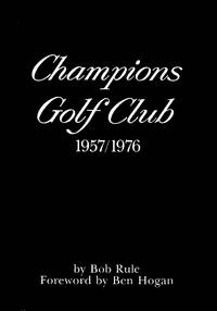
1976012810<p>Houston Texas: Graphics Unlimited Inc. 1976. Book. Near Fine. Hardcover. 1st Edition. 4to - over 9¾ - 12" tall. Black leatherette with gilt lettering on the spine. About Fine. The black dust jacket with white lettering has a few small edge tears and nicks and a minor bit of wear at the spine ends. The front flap shows faint toning. Protected now in an archival Mylar sleeve. 152 pages chronicling the history of the first two decades of the famous Houston golf club founded by Jack Burke Jr. and Jimmy Demaret. Illustrated with numerous black-and-white and color photos documenting early club history including hosting the Ryder Cup 1967 and U.S. Open 1969. Includes a Foreword by Ben Hogan. Stated First Edition in collectible condition. .</p> Graphics Unlimited, Inc. hardcover
194863234New York: A.S. Barnes & Co. 1948. 8vo. 125 1 pp. Photo frontisp. photo illustrations throughout. Light green publisher’s cloth green lettering front cover & spine slight shelfwear w/ d.j. cover art of Babe Didrikson golf swings minor chipping & small tear head of spine creasing & edgewear still VG/G- copy w/ former ownership markings of Pacific Northwest golfer Lena Hillsman on ffep. First edition of this compact and detailed work by the 1948 US Women’s Open champion in 1948 detailing the fundamentals of the game and her stroke-by-stroke techniques. Didrikson 1911-1956 was considered one of the best women athletes in the first half of the 20th-Century who excelled at a myriad of sports qualified for five Olympic events in Los Angeles even though women were allowed to compete in only three setting a world record and winning the first Olympic 80-meter hurdels broke the world record with Jean Smiley in the high jump and dominated Women’s golf during the 1940’s. A.S. Barnes & Co., hardcover
Colour lithograph, 790 x 625 mm. Mounted on original cloth with maps series key printed on verso. Folded. The finest contemporary map of the Çanakkale sector of the Gallipoli Campaign, the site of the dreaded "Narrows" of the Dardanelles where Allied naval forces made their ill-fated attempt to "force the straits" towards taking Istanbul. Drafted in Cairo under the direction of T. E. Lawrence at the Arab Bureau's Intelligence Office, based on a recently captured Ottoman map. - In the early days of World War I, the Entente sought to knock the Ottoman Empire out of the conflict by taking Constantinople, by way of the Dardanelles. The Gallipoli Campaign (17 February 1915 to 9 January 1916) involved a force of 490,000 British, Indian, Australian, New Zealander and French troops making various landings upon the Gallipoli Peninsula that strategically guarded the mouth of the Dardanelles. The 325,000 Ottoman defenders, backed by German forces, successfully repelled these raids in what was one of the most bloody military contests in world history. - From the outset, the Allies were hampered by a lack of accurate maps of the Gallipoli Peninsula and the adjacent Asian shore of the Dardanelles. They eventually succeeded in capturing a complete six-part set of excellent, newly published Ottoman surveys showing the battle theatre in its entirety. These maps were rushed to the map department of the Intelligence Office (later the famed "Arab Bureau") in Cairo, where they were translated, enlarged and improved by a team headed by Lieutenant T. E. Lawrence, later known as "Lawrence of Arabia". These maps were printed by the Survey Department, Egypt, as a series of six interconnecting maps, although each map was designed to act as a stand-alone work complete in and of itself (a geographic key to all six maps is present on the verso of the present map). - Overall clean and bright, with some very light staining to upper-left quadrant and some light wear at some fold vertices.
8vo. 200, (2) pp. (front flyleaves included in pagination). Printed in red and black throughout. With 12 watercolour plates. Original printed wrappers. First edition of this French translation of the classics of Islamic poetry. Prepared by the French writer and orientalist Toussaint (1879-1955), this anthology features some prominent examples of love and war poetry, including the Mu'allaqat, and the Rubáiyát of Omar Khayyám, as well as excerpts from the Quran, al-Burda, the Arabian Nights, and the work of Ibn al-Farid. With decorative watercolour plates by Antoine de Roux. - Extremities slightly rubbed. Small tear to lower margin of pp. 33f., not touching text, otherwise in excellent condition. A lovely Laffont production. OCLC 492849402.
Simpatica e ammiccante illustrazione a colori (dimensioni mm 275 x 211) montata in passepartout, su disegno di Vald'Es con soggetto il golf rivisitato in chiave maliziosa. Tratta dalla rivista "La vie Parisienne", fondata nel 1863 e rilevata da Charles Saglio nel 1906, che la modernizzò e le fece assumere quel taglio erotico che contribuì a decretarne il suo grande successo.. .
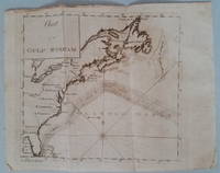
17893818<p>Appearing in the March 1789 issue of the American Museum magazine this engraving is the second American version of Franklin's famous chart of the Gulf Stream printed in America. Both American versions were preceded by English and French printings. The <strong>Chart of the Gulf Stream</strong> accompanies Franklin's "Remarks upon the navigation from Newfoundland to New York." p. 213 in the magazine. Franklin prepared the chart in 1768 while serving in London as a deputy postmaster general for mail service to and from the American colonies. It was Franklin's cousin Timothy Folger of Nantucket who provided him with a practical seafarer's knowledge of the Gulf Stream and its importance in trans-Atlantic crossings.</p><p>The previous American publication of the chart was in 1786 in <em>The Transactions of the American Philosophical Society</em>. This updated version provides a more accurate depiction of the North American coast. State boundary lines are partially indicated. One curious boundary delineation in the chart has a portion of the District of Maine extending over the northern boundaries of New Hampshire and part of Vermont.</p><p><strong>References:</strong> Wheat & Brun <em>Maps & Charts Published in America before 1800</em>: 723.</p><p><strong>Condition:</strong> Folded as issued with misfolding along one fold line. Light to occasionally moderate soiling. Edge roughness primarily at upper left edge.</p><p>ICN 7794.1</p> Mathew Carey
1140 x 710 mm. Chart of the East Coast of Arabia from Ras Sukra to Palinurus Shoal with inset maps of Bander Reisut, Merbat Bay and Kishin Bay. Engraved chart, including tidal information, compass roses, soundings, seabed notations, currents, sandbanks, shoals, lighthouses and beacons picked out in yellow and red, inland elevations, detailing and buildings. Published by John Walker, Geographer to the East India Company in 1850, new editions in 1865, 1888, 1921 and 1924. Signs of contemporary use. Folded.
Aquatint print (image size: 485 x 390 mm, not including title and imprint; paper size: 55 x 45 cm), engraved by Jean Pierre Jazet after Vernet. Striking aquatint of a Mamluk leader by the acclaimed French artist Carle Vernet (1758-1836), best known for his depiction of horses and war scenes. The Mamluk leader is depicted in traditional garb with a scimitar dangling from a robe in his hand, on a horse, with a fighting scene in the background in front of a Middle Eastern town. The engraver, Jean Pierre Jazet (1788-1871), must have been a skilled artist himself. - A lithographed copy, retaining some of the original splendour, was published in Vienna by Joseph Trentsensky a few years later. - A fine copy in a crisp impression. Dayot, Carle Vernet (1925), no. 102. Nagler XXII, p. 440. Cf. Mennessier de la Lance II, p. 617.
4o. 294, (1) pp., final blank page. With a full-page map of Palestine not included in pagination, 2 full-page plans of Jerusalem included in pagination, and several small print illustrations in the text. Contemporary half calf over marbled boards with giltstamped spine and spine-title. Marbled endpapers. Fourth edition of this description of a journey through Palestine by the French painter and writer Bazelaire (1857-1926), first published in 1889. In April 1888 she boarded a ship with a group of pilgrims, which, after a stop in Civitavecchia, from where she visited Rome, dropped anchor in Haifa. Accompanied by her brother Maurice (1840-1909) and her sister Isabelle (1847-89) she departed on horseback to tour the country for a month. Her emotional account describes the places they visited, including Mount Carmel, Nazareth, Tibériade, Jerusalem ("Am I really in Jerusalem, or is it but a dream about to fade away?", p. 129), Mount Olivet, Jericho, the Dead Sea, Bethlehem, Hebron, and the Valley of Josaphat. Among other adventures, a night spent locked in the Church of the Holy Sepulchre near Jesus's empty tomb inspired a particular sense of awe: "It is a night as long as a century, and as short as all joys in the world! [...] All those who have seen Jerusalem know and understand these things, I invoke all pilgrims!" (pp. 253f.). - The initials and illustrations accompanying the text were created by Bazelaire herself. The plans show the old and new towns of Jerusalem. - Extremities insignificantly rubbed; small flaw to spine. Paper somewhat browned and brownstained throughout. A pressed palm leaf is inserted between pp. 124 and 125. Hage Chahine, Guide du livre orientaliste 359. OCLC 1083265900. Cf. Ueckmann, Frauen und Orientalismus 359 (1899 ed.). Kuhn, Orientalische Bibliographie VI, 4225 (1892 ed.). Not in Weber, Cox, Graesse.
2009Q-1935096338Chicken Soup for the Soul 2009-04-21. Paperback. New. New. In shrink wrap. Looks like an interesting title! Chicken Soup for the Soul paperback
Appears to be a 1970s or 1980s replica of the pre-WWII original. Features two charming young ladies in elegant long silk dresses playing mini-golf. Approximately 30" x 20". Crimped metal strips protect top and bottom edges. Clean and unmarked with light wear. A charming memento of 1930s Shanghai. Will be shipped in a sturdy mailing tube. Poster
Pubblicitario, di cm. 6,5 x 5,0 a colori, tedesco, anni '30 circa.
Small 8vo. 2 vols. VIII, 320 pp. 406, (2) pp. With 2 engraved frontispieces. Somewhat later brown cloth with giltstamped spine titles. Edges sprinkled. First edition; very rare. This is the earliest "édition pour la jeunesse" cited by Chauvin, containing such popular episodes as "Haroun al Raschid" and "Ali Baba". The editor chose not to tamper with Galland's century-old text, since modernisations would have compromised the "naïveté de narration". Contemporary reviewers, however, were quick to point out that any parts unfit for juvenile consumption had been omitted, while difficult passages referring to oriental customs were elucidated by editor's notes. A second edition (enlarged by a glossary) was published in 1825; a German translation would appear in 1828. - Bindings slightly rubbed. Interior evenly browned with light spotting. From the library of the Bohmian lawyer and amateur naturalist Ludwig Grasse of Reichenbach, with his repeated ownership stamps (ca. 1900). Rare; OCLC lists only three copies in libraries internationally (Cleveland; Weimar; Erlangen-Nuremberg). Chauvin IV, 76. OCLC 4433944.