948 résultats
1894R320089933IMPRIMERIE VEUVE LAMY. 1894. In-4. Broché. Etat d'usage, Plats abîmés, Dos abîmé, Intérieur frais. 23 pages - salissures sur el 1er plat - Ouvrage legerement plié en tranches - Dos fendu.. . . . Classification Dewey : 920-Biographie générale et généalogie
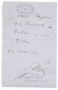
1855348431855. Paris 12.V.1855. 1 Seite. gr.-8°. Mit geprägten Initialen in Kartusche am Kopf. Kleiner Randeinriss am Unterrand ein alter Sammlervermerk Bleistift. Philippe Ricord 1800-1889 französischer Chirurg und Syphilodologe; Leibarzt des Prinzen Napoleon und konsult. Chirurg Kaiser Napoleons III - Rezept: "tous les jours 24 Capsules de Cubèbe ." - Mit dem Stempel der Apotheke von C. Favrot in Paris. Cubeben "wirken kräftig erregend und werden . besonders gegen Schleimflüsse der Geschlechtsorgane angewandt" Brockhaus 14.Aufl. 1908. unknown
1892RO30364350Librairie polytechnique, Baudry et cie. 1892. In-12. Relié. Etat passable, Couv. légèrement passée, Dos frotté, Papier jauni. 1188 pages. Tranches rouges. Coins frottés. Accrocs en coiffe en tête. Nombreuses rousseurs. Nombreux schémas en noir et blanc. Titre et filets en doré au dos.. . . . Classification Dewey : 620-Art de l'ingénieur et activités connexes
18722696Paris, Imp. Lemercier et Cie, 1872. In-folio oblong (57 x 40 cm) d'(1) f. de table, 1 titre-frontispice et 20 planches numérotées, demi-chagrin rouge, dos à nerfs, titre doré en capitales sur le premier plat (reliure de l'époque).
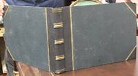
1890B7270No publisher info. circa 1890s to early 1900s. Some spotting mostly to early leaves some prints with imperfections in the plates else crisp and clean most with strong tonal range. . Binding: Half black morocco over navy pebbled boards. Spine with 3 pairs of raised bands. All edges gilt. Notes: Philip Adolphe Klier c.1845 – 1911 also known as Philip Klier was a German photographer who arrived in Burma as a young man around 1865 and spent the rest of his life there. Mainly working as self-trained photographer and businessman Klier took hundreds of photographs at the end of the 19th century during the British colonial period in Burma. His photographs taken both in his studio as well as on location were mainly sold as picture postcards for foreign visitors. They have also been published in several books and collected in public archives. Among a small number of other photographers Klier is considered as one of the earliest professional photographers in the history of today's Myanmar.<br>Jean Philippe Vogel 1871 in The Hague – 1958 popularly known by his initials J. Ph. Vogel was a Dutch Sanskritist and epigraphist who worked with the Archaeological Survey of India from 1901 to 1914 and later as Professor in the University of Leiden where some of his fonds are currently located.<br>George Craddock 1859-1934 was an Anglo-Indian photographer from Punjab. He worked in various cities throughout India eventually settling on his studio in Lahore where he died. <br>G.W. Lawrie was a Scottish photographer active from 1883 to 1921. He had a number of studios in India including in Lucknow. <br>CAPTIONS<br>1.Victoria Terminus G.I.P.R. Bombay<br>2.Public Works Dept. Bombay<br>3.Girgaum Road Bombay<br>4.Jama Musjid Delhi<br>5.Humayon’s Tomb Delhi<br>6.Peacock Throne Delhi<br>7.Dewan-i-Khas Delhi<br>8.Pearl Mosque Delhi<br>9.Justice Palace Delhi<br>10.Kutab Minar Delhi<br>11.Elephant Tower Fattehpore Sikri<br>12.The Great Gate Fattehpore Sikri <br>13.Marble Mausoleum or Sheik Selim Christi Futtehpore Sikri<br>14.General View of Futtehpore Sikri<br>15.Mausoleum of Prince Etmad Dowlat Agra<br>16.Khas Mahal Agra<br>17.Delhi Gate Agra Fort <br>18.Pearl Mosque Agra<br>19.Dewan-i-am Agra Fort<br>20.Taj Mahal<br>21.Tomb Taj Mahal<br>22.Zenana Agra Fort<br>23.Runjiet Singh’s Tomb Lahore<br>24.The Badshak Mosque Lahore<br>25.High Court Lahore<br>26.Museum Lahore<br>27.Shalimar Gardens Lahore <br>28.Public Works Dept. Lahore<br>29.Shadera <br>30.Dhal Canal entrance to Chenar Bagh Srinagar <br>31.Murrec <br>32.On the Canal to Chenar Bagh Srinagar <br>33.Old Mosque Srinagar<br>34.On the Jhelum Srinagar<br>35.Banyian Tree Botanical Gardens Calcutta <br>36.General View of Calcutta Showing Government House and High Court <br>37.Nath Temple at Manicktolla Calcutta <br>38.Mullicks Ghat Hooghly River <br>39.Bhotans <br>40.Darjeeling form Woodlands Hotel <br>41.Himalaya Range<br>42.Loop No. 3 Do. H. Ry. Chumbatti <br>43.Mussoorri<br>44.Naini Tal<br>45.Bhim Tal<br>46.Vishun Pud Benares <br>47.Golden Temple Benares <br>48.Hosainabad and City Lucknow<br>49.General view Hossainabad Lucknow <br>50.Roumi Darwara Lucknow<br>51.Chulunki Kaiserbagh Lucknow<br>52.Mosque of the Great Emambara Lucknow<br>53.The Mosque and Great Emambara Lucknow<br>54.The Residency Lucknow<br>55.The Bailey Guard Gate Lucknow<br>56.Sikandra Bagh Lucknow<br>57.Alum Bagh Lucknow <br>58.La Martiniere College Lucknow<br>59.Memorial Wall Cawnpore <br>60.Meenakshi Amman Temple no. 2216<br>61.Burma <br>62.Dilwana Jain Temple Mt. Nobu <br>63.Scene on the Shwe Dagon Pagoda Rangoon<br>64.Shwe Dagone Pagoda Rangoon<br>65.Scene on the Shwe Dagon Pagoda Rangoon<br>66.Ellora Caves<br>67.Prome Pagoda<br>68.Gaudmas Pagoda Rangoon<br>69.Large Image at Pegu<br>70.Royal Lakes Rangoon<br>71.Shayetmy <br>72.Mandalay the Palace<br>73.Burmese Hpongyees Collecting Alms<br>74.Mandalay Maha Lawka Maya Zain Pagoda <br>75.Jeppalamam Madma Kapaleeshwarar Temple<br>76.Seven Pagodas Madras<br>77.Seven Pagodas<br>78.High Court Madras<br>79.Temple and Tank Little Conjeevaram<br>80.Temple<br>81.Temple Johore<br>82.Temple<br>83.Temple Great Conjeevaram<br><br><br><br> Size: Oblong folio Illustration: Comprising of 83 fine albumen prints silver prints and/or printing-out-paper prints 5 loose mostly of India measuring 185 x 230 – 205 x 285 mm. Most captioned either in manuscript on the sheet mount some captioned on the plate. Some plates have the photographer’s stamp either embossed or printed within the plate. Last 9 sheets trimmed. A few plates mounted upside down. <br>Oblong folio 280 x 380 mm. Category: Book Asia Central India & Ceylon / Sri Lanka; Book Photographic Album; No publisher info. hardcover
1837042238Paris: Delloye 1837. 1st Edition . Hardcover. Very Good. Color And B/W Lithographic Plates Maps. Lvi 208 Ii Pp. With Errata At End. Quarter Calf Gilt Marbled Boards Speckled Edges.First Edition. Complete. Two Stamps In Russian On Title PageTwo Detached Partial Labels In Russian Two Small Pieces Of Paper Attached To Front Pastedown With Partial But Illegible Text In Russian. Binding Solid. Small And Very Faint Dampstain In Lower Tip Of Some Pages Well Outside Printed Area Plates Clean Except A Couple Of Color Plates On Poor Quality Paper Have Browned. <br/> <br/> Delloye hardcover
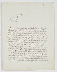
1892679981892. Paris 13.V.1802 2 Seiten auf 4° Doppelblatt. Philippe Petit-Radel 1749-1815 French surgeon and literary scholar brother of Louis Charles François Petit-Radel and Louis François Petit-Radel; editor of the two volumes devoted to Surgery by the Encyclopédie méthodique; in 1798 he was elected to the chair of surgical clinic at the Paris School of Medicine where he distinguished himself by his severity and his zeal to re-establish the ancient practice of speaking Latin. One of the rare letters written by him in Englsih: "Sir The circumstances of your being overcharged under the load of public and private affaires which disturb you from receiving every one who are addressed to you is more the cause that has impeded me to cultivate your kindness than the carelessness i should be faulty of towards such a respectable person as you are. Mr Banket a friend of mine having assured me of the remembrance you keep of the very little titles littler i can have to your estimation and on my part desirous of putting those in a more proper light i venture this letter to let you know the satisfaction i should have if your acquaintance that was formed under the auspicies of the officious M.r Graff would take its former force to be not afterwards disclaimed. After a great many works in physic i have published to make known to the learned men my ability in the theoretical and practical part of my profession i ventured to write in the elegiae linguages of Ovidium a train of sentiments that the pure heart of every one can avow/wow. drawn in the scientific style as i have exposed them. But notwithanding the lucubration was accepted with indulgence and i dare say with distinction by the judicious readers as it appears from the flattering account the news papers have given of it the antiquity of the language proving me happy to its fates i resolved to translate it into French; desirous as i was of saving the original from the claws of oblivion. The work i send you is this i am speaking of: i should require of your benevolence to read the preface in which every circumstances relating to my person are exposed in a shorter way than in the first work. If the matter and the marrow itself of the book can deserve your attention i will sure seek for a new admission to you for supplying to the brevity that imposes me this present letter. It is in the hope you will kindly answer to my wishes that i dare intrude me in your time; mean while i remain you the most respectful of yours. Your very humble and obedient servant Petit-Radet rüe Chirong/Chiroux 897 Paris 23 Prairial an 10" unknown
187122250Paris 1871. unknown
187122250Paris 1871. unknown books
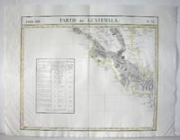
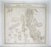
1827M2904Bruselles 1827. Excellent. Size : 464x557 mm 18.25x21.875 Inches Coloring: Original Outline Coloring Category: ; Maps Central America unknown
1827M2726Bruxelles 1827. Good; some worming on the upper and lower parts of the fold. Notes: From Vandermaelen's "Atlas Universel de Geographie Physique Politique Statistique et Mineralogique" Brusseles 1827.<br><br>"The map trade in the 1820s had taekn notice of the enormous interest in Texas and had begun to supply maps catering to it. In 1827 Phillipe van der Maelen's 'Atlas Universel' the most lavish and detailed cartographic production of the decade and the first major lithographed atlas included five maps depicting parts of Texas. These maps were based primarily on the outmoded models of Humboldt and Pike and contributed no new knowledge." Martin & Martin 32 Size : 470x515 mm 18.5x20.25 Inches Coloring: Original Outline Coloring Reference: Martin & Martin 32 Category: ; Maps United States South Texas unknown
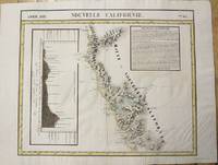
1827M2722Bruxelles 1827. Very Good; several wormholes on the upper and lower parts of the fold. Notes: From Vandermaelen's "Atlas Universel de Geographie Physique Politique Statistique et Mineralogique" Brusseles 1827. Size : 472x572 mm 18.625x22.5 Inches Coloring: Original Outline Coloring Category: Maps United States West California unknown
1827M2724Bruxelles 1827. Good; some worming on the upper and lower parts of the fold wormholes professionally filled. Notes: From Vandermaelen's "Atlas Universel de Geographie Physique Politique Statistique et Mineralogique" Brusseles 1827. Size : 468x490 mm 18.375x19.25 Inches Coloring: Original Outline Coloring Category: Maps United States West States; unknown
1827M2720Bruxelles 1827. Very Good; several wormholes on the upper and lower parts of the fold. Notes: From Vandermaelen's "Atlas Universel de Geographie Physique Politique Statistique et Mineralogique" Brusseles 1827. Size : 460x554 mm 18.125x21.75 Inches Coloring: Original Outline Coloring Category: Maps United States West States; unknown
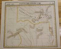
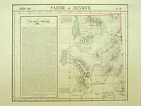
182740379Bruxelles: Ph. Vandermaelen 1827. First edition. A very good sharp copy. 1 sheet. Hand-colored lithographic map. 47 x 57 cm. Shows the ranges of eight Indian tribes. Covers parts of Utah Colorado and northern Arizona and New Mexico. Includes text: Note sur le Mexique. At a time when American map publishers were virtually ignoring the western United States Vandermaelen's large scale work -which includes sections of Utah Wyoming Arizona and Nevada then still considered part of Mexico along with the location of Indian tribes and shows Lake Timpanagos- was a landmark in the history the cartography of the Transmississippi West. Large text box on the left entitled: Note sur le Mexique by A. Delavault. From Phillipe Vandermaelen Atlas universel de geographie physique politique statistique et mineralogique. a magnificent and ground breaking six volume atlas of the entire world which was the first atlas to use lithography to show the entire world using such a large uniform scale approximately 26 miles to the inch and which was designed to be joined together into a three-dimensional globe with a diameter of approximately 25 feet. Wheat Transmississippi 378. Sabin 43762. Phillips 749. [Ph. Vandermaelen] unknown
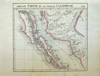
182740378Bruxelles: Ph. Vandermaelen 1827. First edition. Very good bright copies a few minor spots or marginal finger soiling. 2 sheets. Hand-colored lithographic maps. 46 x 51 cm and 46 x 54 cm. Large scale map of Baja. Map 58 includes parts of Baja California Sonora Sinaloa and Chihuahua. Map 65 includes the tip of Baja California and the "Iles Revillagigedo" and a text box: Note sur le Mexique . de Humboldt. Sheets from Phillipe Vandermaelen Atlas universel de geographie physique politique statistique et mineralogique. a magnificent and ground breaking six volume atlas of the entire world which was the first Atlas to use lithography to show the entire world using such a large uniform scale approcimately 26 miles to the inch and which was designed to be joined together into a three-dimensional globe with a diameter of approximately 25 feet. Phillips 749. Sabin 43762. [Ph. Vandermaelen] unknown
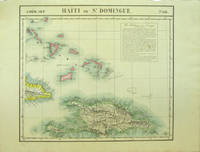
182740377Bruxelles: Ph. Vandermaelen 1827. First edition. Very good bright copies a few minor spots or marginal finger soiling. 2 sheets. Hand-colored lithographic maps. 46 x 53 cm and 50 x 56 cm. Large scale map of Haiti; map 68 also includes parts of Cuba and the Bahamas and has a text box entitled: Iles Bahamas ou Lucayes; map 74 includes the southern and remaining portion of Haiti plus Aruba Bonaire and small parts of Puerto Rico and Venezuela. Text box entitled: Republique d'Haiti. Redigee par A. Delavault. Sheets from Phillipe Vandermaelen Atlas universel de geographie physique politique statistique et mineralogique. a magnificent and ground breaking six volume atlas of the entire world which was the first Atlas to use lithography to show the entire world using such a large uniform scale approximately 26 miles to the inch and which was designed to be joined together into a three-dimensional globe with a diameter of approximately 25 feet. [Ph. Vandermaelen] unknown books
182740379Bruxelles: Ph. Vandermaelen 1827. First edition. A very good sharp copy. 1 sheet. Hand-colored lithographic map. 47 x 57 cm. Shows the ranges of eight Indian tribes. Covers parts of Utah Colorado and northern Arizona and New Mexico. Includes text: Note sur le Mexique. At a time when American map publishers were virtually ignoring the western United States Vandermaelen's large scale work -which includes sections of Utah Wyoming Arizona and Nevada then still considered part of Mexico along with the location of Indian tribes and shows Lake Timpanagos- was a landmark in the history the cartography of the Transmississippi West. Large text box on the left entitled: Note sur le Mexique by A. Delavault. From Phillipe Vandermaelen Atlas universel de geographie physique politique statistique et mineralogique. a magnificent and ground breaking six volume atlas of the entire world which was the first atlas to use lithography to show the entire world using such a large uniform scale approximately 26 miles to the inch and which was designed to be joined together into a three-dimensional globe with a diameter of approximately 25 feet. Wheat Transmississippi 378. Sabin 43762. Phillips 749. [Ph. Vandermaelen] unknown books
182740378Bruxelles: Ph. Vandermaelen 1827. First edition. Very good bright copies a few minor spots or marginal finger soiling. 2 sheets. Hand-colored lithographic maps. 46 x 51 cm and 46 x 54 cm. Large scale map of Baja. Map 58 includes parts of Baja California Sonora Sinaloa and Chihuahua. Map 65 includes the tip of Baja California and the "Iles Revillagigedo" and a text box: Note sur le Mexique . de Humboldt. Sheets from Phillipe Vandermaelen Atlas universel de geographie physique politique statistique et mineralogique. a magnificent and ground breaking six volume atlas of the entire world which was the first Atlas to use lithography to show the entire world using such a large uniform scale approcimately 26 miles to the inch and which was designed to be joined together into a three-dimensional globe with a diameter of approximately 25 feet. Phillips 749. Sabin 43762. [Ph. Vandermaelen] unknown books
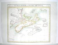
1827M2906Bruxelles 1827. Excellent. Size : 470x530 mm 18.5x20.875 Inches Coloring: Original Outline Coloring Category: ; Maps Canada East Nova Scotia; Maps Canada East Prince Edward Island; Maps Canada East New Brunswick; Maps Canada East Newfoundland unknown
1827M2907Bruxelles 1827. Excellent. Size : 482x565 mm 19x22.25 Inches Coloring: Original Outline Coloring Category: Maps Polar Arctic Regions Alaska Greenland Iceland; unknown
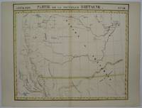
1825M3339Bruxelles 1825. Excellent;. Notes: The first atlas of the world on a uniform scale. If assembled as a globe gores forms a very large globe.<br><br>The map shows British Columbia and extends as far north and the Straits of Queen Charlotte. The map also notes the location of different Native tribes of the area. Finally this map shows the route that MacKenzie took to the Pacific from the Frasier River. Size : 472x561 mm 18.625x22.125 Inches Coloring: Original Hand Coloring Category: Maps Canada West British Columbia; unknown
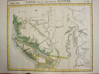
1825M3340Bruxelles 1825. Very Good. Notes: An uncommon map of South Alberta. The map clearly shows the location of Fort Edmonton and other major establishment. From the first atlas of the World on an uniform scale. If assembled as a globe gores forms a very large globe. Size : 470x563 mm 18.5x22.125 Inches Coloring: Hand Colored Category: Maps Canada West Alberta unknown
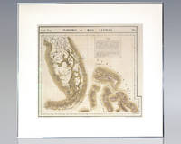
1825137108Brussels: Lithographed by H. Ode 1825. Rare hand-colored lithograph map of South Florida the Keys and the Bahamas from renowned 19th century Belgian cartographer Philippe Vandermaelen's Atlas Universel. One page the map displays South Florida and the Bahamas including major cities as of 1825 with numerous Native American trails and roads recorded and an inset text regarding the flora and fauna of the Everglades. Matted and framed. The entire piece measures 29 inches by 27 inches. Published in 1827 and consisting of approximately 380 conically projected sheets of maps in six volumes Belgian geographer's Vandermaelen's Atlas Universel was the first atlas produced using the method of lithography and the first to use the same large uniform scale for all of the maps included in its pages. Regarded as one of the most important and remarkable innovations in the private enterprise of cartography the maps were uniquely designed to be joined into a three-dimensional terrestrial globe with a diameter of approximately 25 feet. Lithographed by H. Ode unknown
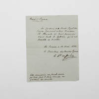
1833028210UK 1833. First Edition . Paper. Good. 48mo - over 3 - 4" tall. An Original Letter Handwritten and Signed by French Artist Louis Nicolas Philippe Auguste Comte de Forbin. Dated March 1833. A letter in French from the Louvre. Louis Nicolas Philippe Auguste Comte de Forbin 1777-1841 was the French painter and antiquary who succeeded Vivant Denon as curator of the Musée du Louvre and the other museums of France. Size is 132m x 105mm. Condition is good. Light folding creasing. More images can be taken upon request. Ref18068 <br/> <br/> unknown