Vandermaelen, PhilippeBiblio.com
949 résultats
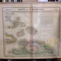
182736243Brussels Belgium: Lithographed By H. Ode. Very Good. 1827. Map. Map # 68 A Very Good primitive and early map of the Bahama Islands and the Island of Haiti or Santo Domingo also shows the eastern tip of Cuba. Latitude of the map is 18 degrees to 24 degrees and longitude is 70 degrees to 78 degrees. Of course almost all localities shown are French or Indian names. The atlas from which this is extracted is extremely rare and originally composed 6 volumes this map being from the North America volume. Lithographer Ode and Cartographer Vandermaelen produced the first lithographed atlas ever done. Condition is overall Very Good. Browning to the centerfold crease caused by glue used in attaching the tab to the original volume the two page spread measures 21" x 26 1/2" when opened out. Topigraphical features are accentuated see image. Shipping will require extra care and cost due to insurance. Photo available upon request. ; 21" x 26 1/2"; 1 pages . Lithographed By H. Ode unknown
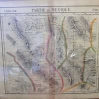
182736238Brussels Belgium: Lithographed By H. Ode. Very Good. 1827. Map. Map # 59 A Very Good primitive and early map of northwest Mexico and southwest Texas includes Chihuahua ans the southern tip of the Baja Peninsula. Latitude of the map is 24 degrees to 30 degrees and longitude is 102 degrees to 110 degrees. Of course almost all localities shown are French or Indian names. The atlas from which this is extracted is extremely rare and originally composed 6 volumes this map being from the North America volume. Lithographer Ode and Cartographer Vandermaelen produced the first lithographed atlas ever done. Condition is overall Very Good. Browning to the centerfold crease caused by glue used in attaching the tab to the original volume the two page spread measures 21" x 26 1/2" when opened out. Topigraphical features are accentuated see image. Shipping will require extra care and cost due to insurance. Photo available upon request. ; 21" x 26 1/2"; 1 pages . Lithographed By H. Ode unknown
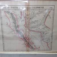
182736242Brussels Belgium: Lithographed By H. Ode. Very Good. 1827. Map. Map # 58 A Very Good primitive and early map of the Baja Peninsula and the western coast of Mexico showing the province of Sonora. Latitude of the map is 24 degrees to 30 degrees and longitude is 110 degrees to 118 degrees. Of course almost all localities shown are French or Indian names. The atlas from which this is extracted is extremely rare and originally composed 6 volumes this map being from the North America volume. Lithographer Ode and Cartographer Vandermaelen produced the first lithographed atlas ever done. Condition is overall Very Good. Browning to the centerfold crease caused by glue used in attaching the tab to the original volume the two page spread measures 21" x 26 1/2" when opened out. Topigraphical features are accentuated see image. Shipping will require extra care and cost due to insurance. Photo available upon request. ; 21" x 26 1/2"; 1 pages . Lithographed By H. Ode unknown
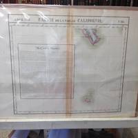
182736241Brussels Belgium: Lithographed By H. Ode. Very Good. 1827. Map. Map # 63 A Very Good primitive and early map of the southernmost tip of the Baja Peninsula and the Iles Revillagigedo showing Cabo San Lucas. Latitude of the map is 18 degrees to 24 degrees and longitude is 110 degrees to 118 degrees. There is a large inset note in French about Mexico. Of course almost all localities shown are French or Indian names. The atlas from which this is extracted is extremely rare and originally composed 6 volumes this map being from the North America volume. Lithographer Ode and Cartographer Vandermaelen produced the first lithographed atlas ever done. Condition is overall Very Good. Browning to the centerfold crease caused by glue used in attaching the tab to the original volume the two page spread measures 21" x 26 1/2" when opened out. Topigraphical features are accentuated see image. Shipping will require extra care and cost due to insurance. Photo available upon request. ; 21" x 26 1/2"; 1 pages . Lithographed By H. Ode unknown
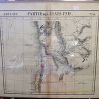
182736239Brussels Belgium: Lithographed By H. Ode. Very Good. 1827. Map. Map # 38 A Very Good primitive and early map of western and southern Oregon territory including southern Washington state. It especially emphasizes the coast. Latitude of the map is 42 degrees to 48 degrees and longitude is 120 degrees to 130 degrees. Of course almost all localities shown are French or Indian names. The atlas from which this is extracted is extremely rare and originally composed 6 volumes this map being from the North America volume. Lithographer Ode and Cartographer Vandermaelen produced the first lithographed atlas ever done. Condition is overall Very Good. Browning to the centerfold crease caused by glue used in attaching the tab to the original volume the two page spread measures 21" x 26 1/2" when opened out. Topigraphical features are accentuated see image. Shipping will require extra care and cost due to insurance. Photo available upon request. ; 21" x 26 1/2"; 1 pages . Lithographed By H. Ode unknown
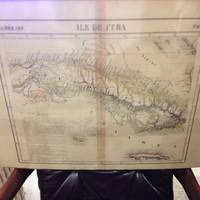
182736244Brussels Belgium: Lithographed By H. Ode. Very Good. 1827. Map. Map # 67 A Very Good primitive and early map of the Island of Cuba also shows Jamaica and Grande Cayman. There is an inset in French with the history of Cuba. Latitude of the map is 18 degrees to 24 degrees and longitude is 78 degrees to 86 degrees. Of course almost all localities shown are French or Indian names. The atlas from which this is extracted is extremely rare and originally composed 6 volumes this map being from the North America volume. Lithographer Ode and Cartographer Vandermaelen produced the first lithographed atlas ever done. Condition is overall Very Good. Browning to the centerfold crease caused by glue used in attaching the tab to the original volume the two page spread measures 21" x 26 1/2" when opened out. Topigraphical features are accentuated see image. Shipping will require extra care and cost due to insurance. Photo available upon request. ; 21" x 26 1/2"; 1 pages . Lithographed By H. Ode unknown
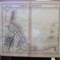
182736240Brussels Belgium: Lithographed By H. Ode. Very Good. 1827. Map. Map # 65 A Very Good primitive and early map of the southeastern Mexican coast along the Gulf of Mexico showing Vera Cruz and approaching the Yucatan. Latitude of the map is 18 degrees to 24 degrees and longitude is 92 degrees to 104 degrees. Very nice color. Of course almost all localities shown are French or Indian names. The atlas from which this is extracted is extremely rare and originally composed 6 volumes this map being from the North America volume. Lithographer Ode and Cartographer Vandermaelen produced the first lithographed atlas ever done. Condition is overall Very Good. Browning to the centerfold crease caused by glue used in attaching the tab to the original volume the two page spread measures 21" x 26 1/2" when opened out. Topigraphical features are accentuated see image. Shipping will require extra care and cost due to insurance. Photo available upon request. ; 21" x 26 1/2"; 1 pages . Lithographed By H. Ode unknown
182736246Brussels Belgium: Lithographed By H. Ode. Very Good. 1827. Map. Map # 57 A Very Good primitive and early map showing the Jamestown Virginia and Washington D. C. Area also includes Summer's island in the Bermudas. There is an inset in French with facts about the early United States. Latitude of the map is 34 degrees to 36 degrees and longitude is 77 degrees to 80degrees. Of course almost all localities shown are French or Indian names. The atlas from which this is extracted is extremely rare and originally composed 6 volumes this map being from the North America volume. Lithographer Ode and Cartographer Vandermaelen produced the first lithographed atlas ever done. Condition is overall Very Good. Browning to the centerfold crease caused by glue used in attaching the tab to the original volume the two page spread measures 21" x 26 1/2" when opened out. Topigraphical features are accentuated see image. Shipping will require extra care and cost due to insurance. Photo available upon request. ; 21" x 26 1/2"; 1 pages . Lithographed By H. Ode unknown
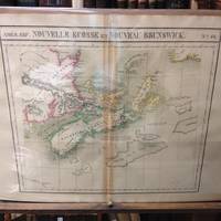
182736247Brussels Belgium: Lithographed By H. Ode. Very Good. 1827. Map. Map # 44 A Very Good primitive and early map showing Nova Scotia and New Brunswick in Canada. Map has wonderful color and many small text descriptions of the coast lines. Latitude of the map is 42 degrees to 48 degrees and longitude is 60 degrees to 70 degrees. Of course almost all localities shown are French or Indian names. The atlas from which this is extracted is extremely rare and originally composed 6 volumes this map being from the North America volume. Lithographer Ode and Cartographer Vandermaelen produced the first lithographed atlas ever done. Condition is overall Very Good. Browning to the centerfold crease caused by glue used in attaching the tab to the original volume the two page spread measures 21" x 26 1/2" when opened out. Topigraphical features are accentuated see image. Shipping will require extra care and cost due to insurance. Photo available upon request. ; 21" x 26 1/2"; 1 pages . Lithographed By H. Ode unknown
182736258Brussels Belgium: Lithographed By H. Ode. Very Good. 1827. Map. Map # 51 A Very Good primitive and early map showing Vancouver British Columbia and Vancouver Island in Canada. Includes some of extreme NW Washington state adjacent to but not including Seattle also includes the city of Victoria. Very nice multi-color depiction of the larger British Columbia coastline. Latitude of the map is 48 degrees to 54 degrees and longitude is 119 degrees to 131 degrees. Of course almost all localities shown are French or Indian names. The atlas from which this is extracted is extremely rare and originally composed 6 volumes this map being from the North America volume. Lithographer Ode and Cartographer Vandermaelen produced the first lithographed atlas ever done. Condition is overall Very Good. Browning to the centerfold crease caused by glue used in attaching the tab to the original volume the two page spread measures 21" x 26 1/2" when opened out. Topigraphical features are accentuated see image. Shipping will require extra care and cost due to insurance. Photo available upon request. ; 21" x 26 1/2"; 1 pages . Lithographed By H. Ode unknown
182736262Brussels Belgium: Lithographed By H. Ode. Very Good. 1827. Map. Map # 37 A Very Good primitive and early map showing Newfoundland present day and eastern part includes the city of Bonavista. Nice color depiction of the coastline. Latitude of the map is 48 degrees to 54 degrees and longitude is 47 degrees to 59 degrees. Of course almost all localities shown are French or Indian names. The atlas from which this is extracted is extremely rare and originally composed 6 volumes this map being from the North America volume. Lithographer Ode and Cartographer Vandermaelen produced the first lithographed atlas ever done. Condition is overall Very Good. Browning to the centerfold crease caused by glue used in attaching the tab to the original volume the two page spread measures 21" x 26 1/2" when opened out. Topigraphical features are accentuated see image. Shipping will require extra care and cost due to insurance. Photo available upon request. ; 21" x 26 1/2"; 1 pages . Lithographed By H. Ode unknown
182736259Brussels Belgium: Lithographed By H. Ode. Very Good. 1827. Map. Map # 70 A Very Good primitive and early map showing the southwest Mexico coastline with portions of Guerrrero Province. Includes Acapulco. Has nice multi-color contrasts also includes a large geological diagramatic illustration. Map is based on the excursion of nautralist Alexander Humboldt in 1802. Latitude of the map is 15 degrees to 18 degrees and longitude is 100 degrees to 108 degrees. Of course almost all localities shown are French or Indian names. The atlas from which this is extracted is extremely rare and originally composed 6 volumes this map being from the North America volume. Lithographer Ode and Cartographer Vandermaelen produced the first lithographed atlas ever done. Condition is overall Very Good. Browning to the centerfold crease caused by glue used in attaching the tab to the original volume the two page spread measures 21" x 26 1/2" when opened out. Topigraphical features are accentuated see image. Shipping will require extra care and cost due to insurance. Photo available upon request. ; 21" x 26 1/2"; 1 pages . Lithographed By H. Ode unknown
182736261Brussels Belgium: Lithographed By H. Ode. Very Good. 1827. Map. Map # 17 A Very Good primitive and early map showing the North Hampton Bay area. Includes the Welcome Strait. Latitude of the map is 60 degrees to 66degrees and longitude is 82 degrees to 98 degrees. Of course almost all localities shown are French or Indian names. The atlas from which this is extracted is extremely rare and originally composed 6 volumes this map being from the North America volume. Lithographer Ode and Cartographer Vandermaelen produced the first lithographed atlas ever done. Condition is overall Very Good. Browning to the centerfold crease caused by glue used in attaching the tab to the original volume the two page spread measures 21" x 26 1/2" when opened out. Topigraphical features are accentuated see image. Shipping will require extra care and cost due to insurance. Photo available upon request. ; 21" x 26 1/2"; 1 pages . Lithographed By H. Ode unknown
182736263Brussels Belgium: Lithographed By H. Ode. Very Good. 1827. Map. Map # 15 A Very Good primitive and early map showing the southern Yukon Territory and the southwestern part of the Northwest Territory. Includes the Great Slave lake depicted in black white and gray shades. Latitude of the map is 60 degrees to 65 degrees and longitude is 114 degrees to 130 degrees. Of course almost all localities shown are French or Indian names. The atlas from which this is extracted is extremely rare and originally composed 6 volumes this map being from the North America volume. Lithographer Ode and Cartographer Vandermaelen produced the first lithographed atlas ever done. Condition is overall Very Good. Browning to the centerfold crease caused by glue used in attaching the tab to the original volume the two page spread measures 21" x 26 1/2" when opened out. Topigraphical features are accentuated see image. Shipping will require extra care and cost due to insurance. Photo available upon request. ; 21" x 26 1/2"; 1 pages . Lithographed By H. Ode unknown
182736260Brussels Belgium: Lithographed By H. Ode. Very Good. 1827. Map. Map # 66 A Very Good primitive and early map showing the Yucatan Penninsula coastline. Includes present day provinces of Yucatan Ouintara Roo Compecha and Tobasco. Also includes a small portion of Northern Belize. Cities include Merida Compeche Chetumal and Cuido del Carmen eastern tip of Cuba is shown. Latitude of the map is 18 degrees to 24 degrees and longitude is 86 degrees to 94 degrees. Of course almost all localities shown are French or Indian names. The atlas from which this is extracted is extremely rare and originally composed 6 volumes this map being from the North America volume. Lithographer Ode and Cartographer Vandermaelen produced the first lithographed atlas ever done. Condition is overall Very Good. Browning to the centerfold crease caused by glue used in attaching the tab to the original volume the two page spread measures 21" x 26 1/2" when opened out. Topigraphical features are accentuated see image. Shipping will require extra care and cost due to insurance. Photo available upon request. ; 21" x 26 1/2"; 1 pages . Lithographed By H. Ode unknown
182736264Brussels Belgium: Lithographed By H. Ode. Very Good. 1827. Map. Map # 75 A Very Good primitive and early map showing the lesser Antilles shows St. Croix on the north and Grenada on the south. Includes the island of St. Croix St. Bartholome St Christophe-Nevis Antigue Barbude Guadeloupe Dominica Martinque St. Lucia Grenade Barbados and others. Very nice color contrasts. Latitude of the map is 12 degrees to 18 degrees and longitude is 60 degrees to 68 degrees. Of course almost all localities shown are French or Indian names. The atlas from which this is extracted is extremely rare and originally composed 6 volumes this map being from the North America volume. Lithographer Ode and Cartographer Vandermaelen produced the first lithographed atlas ever done. Condition is overall Very Good. Browning to the centerfold crease caused by glue used in attaching the tab to the original volume the two page spread measures 21" x 26 1/2" when opened out. Topigraphical features are accentuated see image. Shipping will require extra care and cost due to insurance. Photo available upon request. ; 21" x 26 1/2"; 1 pages . Lithographed By H. Ode unknown
182736277Brussels Belgium: Lithographed By H. Ode. Very Good. 1827. Map. Map # 46 A Very Good primitive and early map showing the northern California coast with San Francisco and Monterey. Map has wonderful color and many small text descriptions of the coast lines. Latitude of the map is 36 degrees to 42 degrees and longitude is 120 degrees to 150 degrees. Of course almost all localities shown are French or Indian names. The atlas from which this is extracted is extremely rare and originally composed 6 volumes this map being from the North America volume. Lithographer Ode and Cartographer Vandermaelen produced the first lithographed atlas ever done. Condition is overall Very Good. Browning to the centerfold crease caused by glue used in attaching the tab to the original volume the two page spread measures 21" x 26 1/2" when opened out. Topigraphical features are accentuated see image. Shipping will require extra care and cost due to insurance. Photo available upon request. ; 21" x 26 1/2"; 1 pages . Lithographed By H. Ode unknown
182736276Brussels Belgium: Lithographed By H. Ode. Very Good. 1827. Map. Map # 52 A Very Good primitive and early map showing the central California coast with Santa Barbara and others. Map has wonderful color and many small text descriptions of the coast lines. Latitude of the map is 30 degrees to 36 degrees and longitude is 120 degrees to 128 degrees. Of course almost all localities shown are French or Indian names. The atlas from which this is extracted is extremely rare and originally composed 6 volumes this map being from the North America volume. Lithographer Ode and Cartographer Vandermaelen produced the first lithographed atlas ever done. Condition is overall Very Good. Browning to the centerfold crease caused by glue used in attaching the tab to the original volume the two page spread measures 21" x 26 1/2" when opened out. Topigraphical features are accentuated see image. Shipping will require extra care and cost due to insurance. Photo available upon request. ; 21" x 26 1/2"; 1 pages . Lithographed By H. Ode unknown
182736275Brussels Belgium: Lithographed By H. Ode. Very Good. 1827. Map. Map # 53 A Very Good primitive and early map showing the southern California coast with San Diego and others. Map has wonderful color and many small text descriptions of the coast lines. Latitude of the map is 30 degrees to 36 degrees and longitude is 112 degrees to 120 degrees. Of course almost all localities shown are French or Indian names. The atlas from which this is extracted is extremely rare and originally composed 6 volumes this map being from the North America volume. Lithographer Ode and Cartographer Vandermaelen produced the first lithographed atlas ever done. Condition is overall Very Good. Browning to the centerfold crease caused by glue used in attaching the tab to the original volume the two page spread measures 21" x 26 1/2" when opened out. Topigraphical features are accentuated see image. Shipping will require extra care and cost due to insurance. Photo available upon request. ; 21" x 26 1/2"; 1 pages . Lithographed By H. Ode unknown
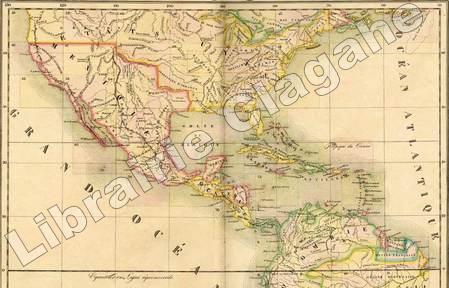
18279452Bruxelles, PMG Vandermaelen éditeur, 1827 ; cinq tomes (Europe, Asie, Afrique, Amérique Septentrionale, Amérique Méridionale), in-folio atlantique (52,5 x 36 cm) ; demi-veau havane à petits coins verts, dos à faux-nerfs dorés, palette décorative dorée en tête et en pied, titre doré, tranches marbrées (reliure uniforme de l'époque) ; 1- Europe : (4), 43 pp., (1) p., tableau comparatif des principales hauteurs du globe (illustré en couleurs), carte d'assemblage de l'Europe et 29 cartes doubles. 2- Asie : (6) pp., carte d'assemblage de l'Asie et 111 cartes doubles. 3- Afrique : (4) pp., tableau d'assemblage de l'Afrique et 60 cartes doubles. 4- Amérique Septentrionale : (4), tableau d'assemblage et tableau provisoire d'assemblage d'une partie de l'Amérique Seple et d'une partie de l'Amérique Méridionale et 77 cartes doubles. 5- Amérique Méridionale : (4), carte d'assemblage d'Amérique Méridionale et 44 cartes doubles. Toutes les cartes sont en couleurs à quelques rares exceptions près et montées sur onglets.
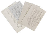
1837ABC_47451France 1837. Folded. 1 17.7 x 12 cm; 2 17.7 x 12 cm; 3 15.6 x 10 cm; 4 20.4 x 13.2 cm. All four letters written in French in an early 19th century cursive in brown ink. With the blind-stamped initials "H.B" in the top right corner of each letter. Including:1 Autograph letter from Hyacinthe de Bougainville to Gaspar baron Gourgaud.France Saturday 26 September 1835.2 Autograph letter from Hyacinthe de Bougainville to Madame Delpeche.France 25 March 1837.3 Autograph letter from Hyacinthe de Bougainville to a "Cher Ami".France 13 April 1838.4 Autograph letter from Hyacinthe de Bougainville to a "Cher Ami" and his best "Comrade".France 16 December 1845. Hyacinthe Bougainville 1781-1846 was a French naval officer son of the famous French Admiral and explorer Louis-Antoine Comte de Bougainville 1729-1811 who had circumnavigated the world in 1766-1779. Hyacinthe sailed around the world from 1824-1826 on board of the Thétis and the Espérance sent by the Minister of the Navy and the Colonies the Duc de Clermont-Tonnerre. It was virtually a diplomatic mission to Réunion Cochin-China Pondicherry in the Indian Ocean Manila and Macao. Hyacinthe returned across the Pacific and after anchoring at Port Jackson for three months he returned to France via Rio de Janeiro. Hyacinthe de Bougainville became Rear-Admiral in 1838.Ad 1: Autograph letter signed by Hyacinthe de Bougainville to Gaspar baron Gourgaud. Hyacinthe complained that he had heard nothing from him since their last "réunion gastronomique" 16 days earlier.Ad 2: Autograph letter signed by Hyacinthe de Bougainville to Madame Delpeche. She was the widow of François Delpeche an engraver who made a portrait of Hyacinthe's father Louis-Antoine de Bougainville in 1837.Ad 3: Autograph letter signed by Hyacinthe de Bougainville to a "Cher ami". He wrote that he had been presented by the Minister with some others that he didn't know to the King as an option for being made a contre admiral = Rear Admiral. "I am at the head of the list and if I stick to my titles I will be without worry ". He invokes his deeds since 1830 and says that he wants to retire "if I am not done justice; the name I bear does not allow me to serve any longer as a stepping stone for others". Three days before he was told that "le travail" was presented to the King and indeed his appointment followed the same year.Ad 4: Autograph letter signed by Hyacinthe de Bougainville to a "Cher ami" and his best "comrade". De Bougainville asks him a favour regarding the son-in-law of his "second" on the Thétis during his voyage around the globe in 1824-1826.All four letters with faint folding lines and pencil annotations; ads 2 and 4 with glue residue on the last leaf ad 2 with the remnants of a seal and a slight defect to the top corner of the last leaf where the letter was sealed and reopened. Overall in very good condition.l Howgego Encyclopaedia of Exploration 1800 to 1850 vol 2 B50. unknown
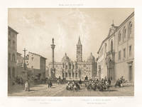
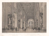
187023531870. Tinted lithograph. 245mm by 360mm image 345mm by 500mm sheet. Founded in the 4th century the Basilica di Santa Maria Maggiore Basilica of Saint Mary Major is one of the five great ancient basilicas of Rome. From a French series titled 'Rome dans Sa Grandeur' circa 1870. Benoist was one of France's most gifted topographical artists of the 19th century he was both a master lithographer and painter. He began his career in Paris and by 1836 he was exhibiting his views at the Paris Salons and continued to do so until 1879. As an original lithographic artist Philippe Benoist specialized in exterior and interior views of many famous European buildings. CONDITION : Some light soiling in margins and on the reverse of the sheet. unknown
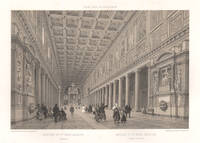
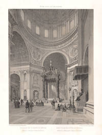
187028111870. Tinted lithograph. 250mm by 360mm image 345mm by 500mm sheet. Felix Benoist was a French painter and lithographer. Phillippe Benoist was one of France's most gifted topographical artists of the 19th century he was both a master lithographer and painter. He began his career in Paris and by 1836 he was exhibiting his views at the Paris Salons and continued to do so until 1879. As an original lithographic artist Philippe Benoist specialized in exterior and interior views of many famous European buildings. From 'Rome dans Sa Grandeur'. unknown
187028081870. Tinted lithograph. 250mm by 360mm image 345mm by 500mm sheet. From 'Rome dans Sa Grandeur'. Phillippe Benoist was one of France's most gifted topographical artists of the 19th century he was both a master lithographer and painter. He began his career in Paris and by 1836 he was exhibiting his views at the Paris Salons and continued to do so until 1879. As an original lithographic artist Philippe Benoist specialized in exterior and interior views of many famous European buildings. Soiling and light foxing in margins. Foxing on reverse of the sheet. unknown
187028061870. Tinted lithograph. 250mm by 360mm image 345mm by 500mm sheet. From 'Rome dans Sa Grandeur'. Phillippe Benoist was one of France's most gifted topographical artists of the 19th century he was both a master lithographer and painter. He began his career in Paris and by 1836 he was exhibiting his views at the Paris Salons and continued to do so until 1879. As an original lithographic artist Philippe Benoist specialized in exterior and interior views of many famous European buildings. Light foxing in margins. Foxing on reverse of the sheet. unknown