BENOIST (Philippe).Livre Rare Book
943 résultats
1861LBW-5511Paris, Henri Charpentier, [1861]. 278 x 358 mm.
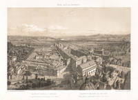
187023581870. Tinted lithograph. 250mm by 360mm image 345mm by 500mm sheet. Depicts a view of Rome taken from the top of St Peter's. From a French series titled 'Rome dans Sa Grandeur' circa 1870. Benoist was one of France's most gifted topographical artists of the 19th century he was both a master lithographer and painter. He began his career in Paris and by 1836 he was exhibiting his views at the Paris Salons and continued to do so until 1879. As an original lithographic artist Philippe Benoist specialized in exterior and interior views of many famous European buildings. CONDITION : Some light soiling to edges of the sheet. unknown
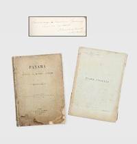
1892185348Paris: G. Masson 1892. An infrastructural and political revolution First and sole edition presentation copy signed on the dedication page "Hommage à Monsieur Gournay curé de Vertou. P. Bunau-Varilla 12 Septembre 1893". This comprehensive study was written by one of the driving forces behind the Panama Canal alongside de Lesseps. Most institutions list the text volume alone lacking the elaborate prospectus volume. Bunau-Varilla 1859-1940 was first sent to Panama in 1884 by the Compagnie Universelle du Canal Interocéanique where he rose to the position of chief engineer of the new canal. The attempt failed in 1889 and the company was dissolved after which he wrote a number of books to document and build support for the project's resumption. In this volume he both describes the work completed so far and his plan to complete the canal with locks. He "distributed copies of his book to the French Parliamentaries. However it did not meet any audience. as the Champer of Deputies' members did no want to be involved again in the burning subject of the Panama Canal" Loizillon p. 333 Bunau-Varilla tried again in 1894 and soon became a prominent figure in US-Panama relations. In particular when Colombia refused to ratify a treaty granting the United States rights to build the canal he encouraged the Panamanians to declare independence and his wife designed their new flag. He later signed the Hay-Bunau-Varilla Treaty giving the US control over the canal despite local protests. The canal would continue to occupy a central position in both the infrastructural and political development of Central America. This work contains a large number of photographic illustrations showing the construction as well as colour diagrams describing the geology of the area. The identity of Monsieur Gournay is unclear and there are no records linking Bunau-Varilla to the commune of Vertou. 2 vols quarto. With 45 half-tone photographic plates 5 folding colour folding map 5 colour diagrams 4 folding tables in text; text in French. Original buff paper wrappers spines and front wrappers lettered in black rear wrapper of text vol. decorated with publisher's device. Worn and soiled spines split sometime repaired with tape in gutters map loose in annex volume contents bright with a little toning at edges: a good copy. Gabriel J. Loizillon The Bunau-Varilla Brothers and the Panama Canal 2012. unknown
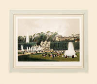
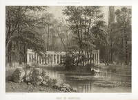
186164186Paris. 1861. Wonderful view of the Park of St Cloud on the outskirst of Paris published in 'Paris Dans Sa Splendeur' by Henri Charpentier Size: 250 x 360 mm. Original lithograph. Hand coloured. Mounted size: 490 x 570 mm. Fine condition. unknown
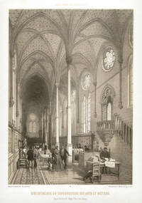
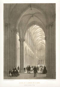
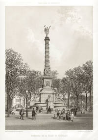
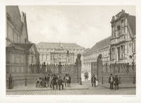
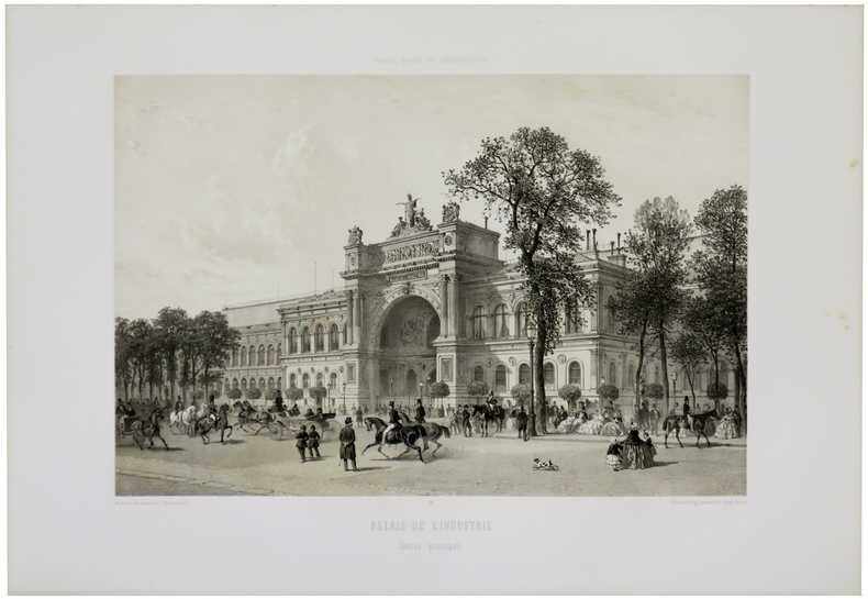
186122291861. Tinted lithograph. 490mm by 330mm sheet. From a series of lithographs depicting the famous buildings of Paris - 'Paris dans sa Splendeur' published in Nantes and Paris by Henri Charpentier in 1861.<br /> Phillippe Benoist Geneva 1813 - Paris 1881was one of France's most gifted topographical artists of the 19th century he was both a master lithographer and painter. He began his career in Paris and by 1836 he was exhibiting his views at the Paris Salons and continued to do so until 1879. As an original lithographic artist Philippe Benoist specialized in exterior and interior views of many famous European buildings. Light crease in left hand margin not affecting the image. unknown
186122311861. Tinted lithograph. 490mm by 330mm sheet. From a series of lithographs depicting the famous buildings of Paris - 'Paris dans sa Splendeur' published in Nantes and Paris by Henri Charpentier in 1861.<br /> Phillippe Benoist Geneva 1813 - Paris 1881was one of France's most gifted topographical artists of the 19th century he was both a master lithographer and painter. He began his career in Paris and by 1836 he was exhibiting his views at the Paris Salons and continued to do so until 1879. As an original lithographic artist Philippe Benoist specialized in exterior and interior views of many famous European buildings. unknown
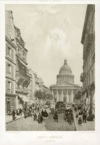
186123221861. Tinted lithograph. 355mm by 250mm image 495mm by 340mm sheet. Louis XV recovered from illness in 1744 and was so grateful he built this Neo-Classical church. Work began in 1764 and was completed in 1790.<br /> From a series of lithographs depicting the famous buildings of Paris - 'Paris dans sa Splendeur' published in Nantes and Paris by Henri Charpentier in 1861.Phillippe Benoist was one of France's most gifted topographical artists of the 19th century he was both a master lithographer and painter. He began his career in Paris and by 1836 he was exhibiting his views at the Paris Salons and continued to do so until 1879. As an original lithographic artist Philippe Benoist specialized in exterior and interior views of many famous European buildings. unknown
186122281861. Tinted lithograph. 490mm by 330mm sheet. From a series of lithographs depicting the famous buildings of Paris - 'Paris dans sa Splendeur' published in Nantes and Paris by Henri Charpentier in 1861.<br /> Phillippe Benoist Geneva 1813 - Paris 1881was one of France's most gifted topographical artists of the 19th century he was both a master lithographer and painter. He began his career in Paris and by 1836 he was exhibiting his views at the Paris Salons and continued to do so until 1879. As an original lithographic artist Philippe Benoist specialized in exterior and interior views of many famous European buildings. Creasing to lower right corner only visible in margins and title area. unknown
186122321861. Tinted lithograph. 325mm by 490mm sheet. From a series of lithographs depicting the famous buildings of Paris - 'Paris dans sa Splendeur' published in Nantes and Paris by Henri Charpentier in 1861.<br /> Phillippe Benoist Geneva 1813 - Paris 1881was one of France's most gifted topographical artists of the 19th century he was both a master lithographer and painter. He began his career in Paris and by 1836 he was exhibiting his views at the Paris Salons and continued to do so until 1879. As an original lithographic artist Philippe Benoist specialized in exterior and interior views of many famous European buildings. Faint foxing in title area. unknown
186123211861. Tinted lithograph. 245mm by 355mm image 340mm by 485mm sheet. The Palais des Beaux Arts<br /> From a series of lithographs depicting the famous buildings of Paris - 'Paris dans sa Splendeur' published in Nantes and Paris by Henri Charpentier in 1861.Phillippe Benoist was one of France's most gifted topographical artists of the 19th century he was both a master lithographer and painter. He began his career in Paris and by 1836 he was exhibiting his views at the Paris Salons and continued to do so until 1879. As an original lithographic artist Philippe Benoist specialized in exterior and interior views of many famous European buildings. One small spot in the sky. unknown
186121098Nantes Charpentier 1861 -in-folio demi-chagrin 3 volumes, reliure d'époque demi-chagrin marron foncé in-folio Editeur (binding half shagreen in-folio Editor)(49 x 33,5 cm), dos à nerfs (spine with raised bands) décoré or (gilt decoration), titre et tomaison frappés "or", filet et roulette chainette "or" de part et d'autre des nerfs, roulette chainette "or" en tête et en pied, entre-nerfs décorés de fers à froid, plats de percale noire muets, toutes tranches lisses, illustré de 100 lithographies sur fond teinté, certaines rehaussées de détails en couleurs, d'après BENOIST, CHAPUY, ISABEY, etc. et 38 bois gravés in-texte, légères mouillures au coin supérieur gauche de la page de titre du 3ème Volume , [(4)-XII-88-(2)-122] + [(6)-76-(2)-44-(2)-24-(2)-22-(2)-36-(2)-26] + [(8)-76-(2)-80-(2)-34] pages, 1861 Nantes: Imprimerie de Charpentier père, Fils et Cie Editeur,
186120316Nantes Charpentier 1861 -in-folio demi-chagrin 3 volumes, reliure d'époque demi-chagrin havane in-folio Editeur (binding half shagreen in-folio Editor)(49 x 33,5 cm), RELIURE EDITEUR D'EPOQUE (pour l'Edition de Luxe), dos à nerfs (spine with raised bands) décoré or (gilt decoration), plat orné d'un décor romantique en encadrement avec, au centre du premier plat, le blason de Paris, le Louvre médiéval et la devise de la capitale soutenus par deux personnages, toutes tranches dorées, illustré de 100 lithographies sur fond teinté, certaines rehaussées de détails en couleurs, d'après BENOIST, CHAPUY, ISABEY, etc. et 38 bois gravés in-texte, légères mouillures claires (sur moins de 3 cm2) au coin inférieur droit des 17 premiers feuillets du 1er volume et des 2 premiers feuillets du 3ème volume, [(4)-XII-88-(2)-122] + [(6)-76-(2)-44-(2)-24-(2)-22-(2)-36-(2)-26] + [(8)-76-(2)-80-(2)-34] pages, 1861 Nantes Paris : Imprimerie de Charpentier père, Fils et Cie Editeurs,
1893RO10029178Bureau de la revue. 3 septembre 1893. In-12. Broché. Bon état, Couv. convenable, Dos satisfaisant, Intérieur frais. 16 pages illustrées d'une gravure portrait en première page.. . . . Classification Dewey : 920-Biographie générale et généalogie
1827798Brussels: Vandermaelen Philippe 1827. 18 1/2 x 20 1/2 inches. Very good. An antique map of epic proportions for the Texas collector. This map shows Arkansas and portions of eastern Texas in 1827. It has place names and locations of Native American tribes. Multiple rivers are shown and details of topography well labeled. Overall this is a fine cartographic presentation in the for of a rare map. Vandermaelen, Philippe unknown
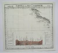
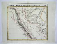
1827801Brussels: Vandermaelen Phillipe 1827. 19 3/4 x 18 1/2 inches. Very good condition. Vandermaelens map sheet on California and the coast. It shows the Westcoast line of Southern California A very nice map and the earliest us of lithography in a cartographic enterprise. Senefelder published his volume on lithography in 1819 in French. Vandermaelen, Phillipe unknown
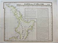
1827M9228Brussels: Philippe Vandermaelen c. 1827. Very Good. Notes: A scarce set of maps one showing the north island and the other the south island of New Zealand from the early 19th century. This is considered to be one of the first maps to show New Zealand as the core focus. They do an excellent job of showing detail by having the names of various places showing geographical features and by keeping that same detail in their portrayal of the numerous smaller islands around New Zealand. To further add to the detailed nature of the map there are extensive notes. <br><br>Measurement for No. 60 is 495x545mm<br><br> Size : 483x595 mm 19.02x23.43 Inches Coloring: Original Hand Coloring Reference: Phillips 749; Koeman Vdm 1; National Maritime Museum 179; Wellens-De Donder L. Philippe Vandermaelen 1795-1869 4-5. Category: Maps Pacific; Philippe Vandermaelen unknown
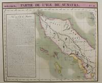
1815M9661Brussels c.1815. Very Good. Notes: Map of the northern half of Sumatra from the early 19th century. The map shows topographical features and has a short history of the island . <br>Philippe Vandermaelen 1795-1869 was an eminent Belgian geographer and cartographer famous for having founded the geographical establishment of Brussels. Size : 480x570 mm 18.90x22.44 Inches Coloring: Hand Colored Category: Maps Asia South East Indonesia & Papua New Guinea; unknown
1827802Brussels: Vandermaelen Phillipe 1827. 20 1/2 x 18 1/2 inches. Very good condition. This map shows the West Coast inward into the Tonto Apache territories. Also shown is the land of the Papagos which also includes western Arizona and southern Arizona. Located on the east side of the map is Tumacacori site of a cluster of mission buildings indicating the long arm of religious colonialism. On the west coast is Cape Loma and San Diego. Above this is San Juan Capistrano located in present day Orange County California. This antique map rare map is an original artifact of a period oof little direct knowledge of the area. Vandermaelen, Phillipe unknown
1825M4512Brussels 1825. Very Good minor worming on upper and lower portion of the map along the central fold proficiently repaired. Notes: The first atlas of the world on a uniform scale. If assembled as a globe gores forms a very large globe. Size : 460x500 mm 18.125x19.625 Inches Coloring: Original Outline Coloring Category: ; Maps United States West California unknown
1825M4513Brussels 1825. Very Good minor worming on upper and lower portion of the map along the central fold proficiently repaired. Notes: The first atlas of the world on a uniform scale. If assembled as a globe gores forms a very large globe. Size : 464x515 mm 18.25x20.25 Inches Coloring: Original Outline Coloring Category: ; Maps United States West California unknown
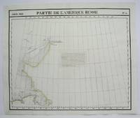
1825M4493Brussels 1825. Excellent. Notes: The first atlas of the world on a uniform scale. If assembled as a globe gores forms a very large globe. Size : 483x579 mm 19x22.75 Inches Coloring: Original Outline Coloring Category: Maps Polar Arctic Regions Alaska Greenland Iceland; unknown
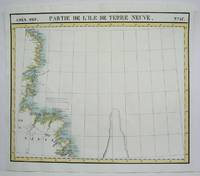
1825M4479Brussels 1825. Excellent. Notes: The first atlas of the world on a uniform scale. If assembled as a globe gores forms a very large globe. Size : 475x570 mm 18.75x22.375 Inches Coloring: Original Outline Coloring Category: Maps Canada East Newfoundland unknown
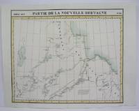
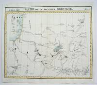
1825M4524Brusseld 1825. Very Good minor worming on upper portion of the map along the central fold proficiently repaired. Notes: The first atlas of the world on a uniform scale. If assembled as a globe gores forms a very large globe.<br><br>This map shows the western shore of Hudson Bay. Nothern Ontario Size : Coloring: Original Outline Coloring Category: Maps Canada Ontario North unknown
1825M4478Brussels 1825. Excellent. Notes: The first atlas of the world on a uniform scale. If assembled as a globe gores forms a very large globe.<br><br>This map shows the area from Hudson Bay to Lake Abbitibbe and notes the location of various Native tribes and trade houses. Size : 470x565 mm 18.5x22.25 Inches Coloring: Original Outline Coloring Category: Maps Canada East Quebec unknown
1825M4473Brussels 1825. Excellent. Notes: The first atlas of the world on a uniform scale. If assembled as a globe gores forms a very large globe. Size : 475x552 mm 18.75x21.75 Inches Coloring: Original Hand Coloring Category: Maps Polar Arctic Regions Alaska Greenland Iceland; unknown