ANONYMEBiblio.com
785 résultats
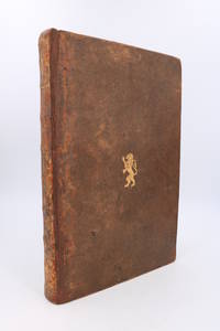
175090724n. l.: s. n. 1750. Fine. s. n. n. l. s. d. 1750 20.5 x 31 cm Relié Eighteenth-century manuscript second half comprising 258 foliated pages. Contemporary binding expertly restored in full tan calf with a smooth spine adorned with gilt compartments and decorative gilt tooling some now faded; signs of rubbing; title label missing; gilt rampant lion at the centre of both boards; handmade paper endpapers and pastedowns; gilt double fillets on board edges; corners slightly worn. Notable manuscript featuring extracts and summaries of orders and dispatches issued by the Ministry of the Navy during the Regency and the first year of Louis XVs reign. Collated from original documents carefully dated and with folio references these extracts are written in a highly legible hand. Topics covered include: general armament; the War of the Quadruple Alliance 1718 1719 1720; Barbary States; Guinea Coast; colonies; trade Spain Portugal Guinea Compagnie dAfrique Compagnie des Indes; justice police and discipline; munitions; goods and timber; fishing; ports and roadsteads; prizes and more. The manuscript is in excellent condition preserved in its original binding. Contemporary pencil note on the front endpaper: ""Aux armes du Maréchal Duc de Duras de lAcadémie française"" 17151789. s. n. hardcover
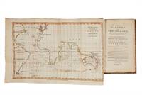
17875001050London: John Stockdale 1787. Octavo with two folding maps hand coloured in outline; a very good copy edges uncut in contemporary calf gilt spine neatly repaired. <p><p>An important book and a sometimes neglected precursor to the Australian First Fleet: this was one of the earliest descriptions of Australia published to coincide with the departure from England of the First Fleet. "It is an extremely interesting work and an essential inclusion in all comprehensive collections" Davidson. In discussing the fleet's imminent departure the anonymous compiler lists numbers and equipment as well as the principal officers and there is also material in both preface and text about transportation as well as an "Introductory Discourse" on the subject by William Eden which has often led to the misattribution of the whole book to him.</p> <p>This is an example of the important second edition published the same year as the first and after parliamentary approval of the Botany Bay plans and with a very significant new section: an additional ten prefatory pages appear for the first time in this edition discussing in detail the hopes for the new settlement. The anonymous writer reports that many of the convicts awaiting transportation have embraced the idea with excitement: "strange to tell! there have not been wanting voluntary candidates for banishment to that remote shore.".</p> <p>The "Eden" as it is often called was written "to present at one view a connected description of the whole country of New Holland". The book is clearly aimed at a public eager for information on the new colonial venture and for details of Botany Bay itself which is here described at length. This is the form in which many of the participants in the First Fleet must have absorbed what little information existed about conditions in Australia. The maps show the continent Botany Bay and most interestingly the "passage from England to Botany Bay in New Holland 1787" highlighting the route that the fleet must take.</p> <p>The book is of some importance too for its Cook material: as Cook's bibliographer Holmes points out "the greater part of the book is devoted to Cook's discoveries.". His charting of the east coast of Australia is here put into context in a form anticipating the actual settlement of the new coastline.</p> </p> . John Stockdale unknown
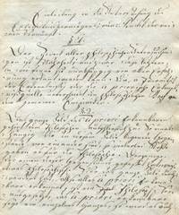
1790846<p>n/a: n/a 1790. First Edition. Cardboard covers. Very good. Early Manuscript Defense of the Critique of Pure Reason <br /><br />Original one-of-a-kind handwritten manuscript defense of Kants Epistemology. 196-page manuscript in clear German cursive with some deletions and corrections ink on clean paper. 1790 Quarto. <br /><br />An extensive presentation and defense of Kant's theory of knowledge probably written as the basis for a lecture or series of lectures. There are five main sections: <br /><br />Einleitung 34 paragraphs <br />Theorie des Vorstellungsvermögens überhaupt 30 paragraphs <br />Theorie der Sinnlichkeit 35 paragraphs <br />Theorie des Verstandes 64 paragraphs <br />Kritik der bisherigen Methaphisick 21 paragraphs <br /><br />Many of the paragraphs contain numbered Anmerkungen" further reflections. In these the author shows himself to be a stout defender of Kant's controversial new theories: "Vor Kant ist es keinem eingefallen die Gemüthsvermögen zu untersuchen die Erkenntniße aus dem Erkennbaren zu schöpfen und die Philosophie nicht von den so genannten Objeckten zu erbetteln. Man begehet keine tolle Freiheit wenn man behauptet daß es vor Kant wohl resonierende Köpfe und philosophische Versuche aber eigentlich keine Philosophie und Philosophen gegeben habe. <br /><br />The identity of the author remains unknown. Interestingly the final sentence announces a sequel: "Näher darüber in unseren zukünftigen moralischen Untersuchungen wo wir für das Ens Entium einen begreiflicheren Gott wieder finden werden. <br /><br />CONDITION: Very good or better in contemporary plain boards with minimal spotting edges untrimmed. <br /><br /><br />PHOTOS AVAILABLE UPON REQUEST</p> n/a
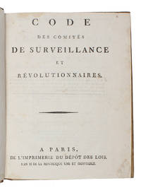
179360748Paris Impremerie du depot des lois An II 1793. 4to. In contemporary half calf with gilt lettering and ornamentation to spine. Wear to extremities. Upper part of back hinge split with minor loss of letters. Small dampstain to upper inner margin otherwise a nice copy. 2 VII 2-116 100 8 pp. <br/><br/><em>Exceedingly rare first edition of this highly interesting document being the Code of the Committees of Surveillance containing 106 regulations and guidelines for the functioning of these committees during the French Revolution. The Committees of Surveillance were established during the Reign of Terror September 5 1793 - July 27 1794 as part of the revolutionary government's efforts to identify and suppress counter-revolutionary activities. These committees were tasked with monitoring individuals' behavior enforcing revolutionary laws and ensuring loyalty to the revolutionary government. The document outlines the powers duties and procedures of these committees as well as the penalties for those found to be opposing the revolution providing a unique and fascinating insight into the legal and administrative framework of revolutionary France – arguable one of the most profound and radical moments in modern European history. The Committee of Surveillance in France during 1793 was established as a part of the radical phase of the French Revolution. Its function was to oversee and monitor the activities of suspected counter-revolutionaries and enemies of the Revolution as well as to enforce laws related to internal security and revolutionary principles. The committee was tasked with identifying individuals or groups deemed to be a threat to the revolutionary government often leading to arrests interrogations and in some cases executions by the Revolutionary Tribunal. It played a significant role in the Reign of Terror a period marked by extreme political violence and repression in France. The present work is of the utmost scarcity. We have not been able to trace a single copy at auction and OCLC only lists one copy in Paris. Nadaillac Catalogue d’une Collection Importante Sur la Revolution Francaise 724 </em> unknown
171086508Edinburgh: Various. Very Good; Compilation Bound Together of 12 Books/Pamphlets Etc From . Early 1700's About Religious Persecution in Eng. & Scotland. 1710-1717. Leather. PROFESSIONALLY REBOUND IN FINE LEATHER WITH RAISED BANDS GILT LETTERING AND NEW MARBLED BOARDS AND ENDPAPERS. GORGEOUS!! VERY VERY SCARCE!! The title continues: "More particularly her approving of and going into the legal establishment of the Prelatic constitutions of England. The generality of ministers swearing in the Oath of Abjuration to maintain Erastianism Prelacy and English Popish Ceremonies. Non-Jurants joining with Jurants judicially approving that practice to be free of scandal. The Church's establishing tyranny in government against all who will not join in communion with her and approve her practices without redress of grievances. Wherein these and several other causes of withdrawing are proven to be justly chargeable on the Church demonstrated to be contrary to the Word of God and Reformed principles of this Church and just grounds of withdrawing and setting up judicatures distinct from her; and the objections of Jurants and others fully answered."This is a classic detailed statement of the old covenanted principles and the biblical attainments of the second Reformation like the Solemn League and Covenantthe Westminster standards etc. It is also an excellent defense against the modern malignants who counsel Christ's children to remain in the backsliding and covenant breaking denominations that abound in our day. This constitutes 264 pages. The next largest ones bound in this book is: SHIELDS ALEXANDER. A true and faithful relation of the sufferings of the Reverend and learned Mr. Alexander Shields minister of the Gospel.; 772 pages . Various hardcover
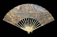
17802221Spain c1780. Folding paper fan with a fine large hand-coloured engraved view of the Siege of Gibraltar with Spanish ships and troops in the foreground the verso with engraved key in Spanish decorated with weapons of war on either side mounted on ivory sticks the ivory sticks decorated in silver and gilt with a fort ship and flag the gaurdsticks carved and pierced and with silver and gilt depicting a ship and drums. The unsuccessful siege of Gibraltar began in 1779 and lasted until February 1783 when the siege was lifted. This fan which it has been suggested belonged to the Earl of Minto is not in the Schreiber Collection. unknown
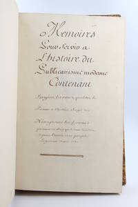
175078168s. l. 1750. Fine. s. l. 1750 23 x 38 cm 2 manuscrits reliés en un volume Manuscript entitled Mémoires pour servir à l'histoire du publicanisme moderne contenant l'origine les noms qualités le portrait et l'histoire abrégée de nosseigneurs les fermiers généraux du Roy qui se sont succédés depuis l'année 1720 jusqu'à la présente année 1750 with Mémoires pour servir à l'histoire du publicanisme ou l'Origine des receveurs généraux des finances du royaume 1750 folio 23 x 38 cm 330 pp 4 p. bl. 8 p. 4 p. bl. 83 pp. contemporary full calf Important and long manuscript composed of two parts written by two different hands retracing in total 160 biographies of the Fermiers Généraux active between 1720 and 1750 lavish and unpopular collectors of indirect taxes in the Ancien Régime. Each of the parts also contains a very useful index. The entries with the exception of 19 of them are all decorated with a coat of arms drawn in pencil painted by hand in colour and sometimes enhanced with gold or silver. Some modern notes some juicy in pencil in the margin of certain leaves. These memoirs have never been the object of a publication and we know of only a few handwritten copies with varying texts. The other examples that we have been able to find including the one digitised by the French National Library contain fewer biographies that ours and are not illustrated. Contemporary binding in full blond marbled calf title pieces in black and red morocco. Joints top of the first board and spine head repaired joints of the first board split but solid scratches on the boards corners damaged. A very beautiful manuscript richly painted retracing the history of the most despised institution of the Ancien Régime. Provenance: library of Count Chandon de Briailles descendent of the founders of the famous house of Champagne then of the Michel de Bry library with its motto Pro captu lectoris with their ex-libris glued to the first endpapers. hardcover
180018412c1800. 470mm in diameter. Instruments""Planispherum Lunare A unique manuscript lunar astrolabe Ink and polychromy on paper over pine. The instrument comprises a circular base plate and three rotatable cardboard volvelles and a brass radius pointer attached to each other in the centre. A brass ring is attached to the base plate for suspending. All four paper covered discs are finely inscribed in manuscript with various scales and symbols. Content 1. The smallest volvelle bears a scale covering 12 hours on its outer ring. It also shows the ecliptical motion of the Sun the Moon's orbit the line of nodes and the arguments of latitude in other words the distances from the nodes. 2. On the second volvelle a scale covers the years from 1801 to 1825. each year is subdivided in twelve months with the abbreviated name written for each month. 3. The following volvelle carries a series of scales showing a monthly calendar a zodiac calendar with skilfully drawn pictures and the symbols of the signs. Below the zodiac is a scale for the declination of the sun throughout the year set in four sequences of three. 4. On the outside rim of the volvelle is another calendar scale in which the months are unevenly distributed. This scale presumably was to be used in conjunction with the outer scale on the circular base plate. In addition the volvelle holds two brass studs that most probably helped the user turn the disc to the desired position. This latter scale gives the days subdivided in hours. The days are numbered I to XXXI with the number I coinciding with XXVII and 8 hours the sidereal period of the Moon which results in a double numbering from XXVIII to XXXI. Below this scale for days there is a series of dates all confined to the period 1801 to 1825 presumably for solar eclipses. The brass rule or pointer holds a horizontal scale from 5 to 0 LA-southern declination and from 0 to 5 LB-northern declination indicating the latitude of the moon with respect to the ecliptic. The closer to 0 at new moon or full moon the likelier an eclipse is to occur. The rule is engraved with """"Locus Lunae"""". The circular scales serve to set the moon's position and node relative to the sun from which the user can then infer the lunar phase and whether an eclipse will occur at new moon or full moon. Manuscript instruments of this type are rare especially in such good condition as no other exact copy is recorded to date. Similar instruments were produced at the end of the sixteenth century mostly in brass. Sir Robert Dudley 1573-1649 see item 17 had a lunar calculator made by Charles Whitwell c. 1568-1611 a brass disc of 72 cm diameter overall which was the most complex instrument made during the sixteenth century. Inscribed 'Sir Robert Dudley was the inventor of this instrument' its purpose was to calculate the place of the moon over a period of thirty years. It is now in the Museo di Storia della Scienza in Florence Italy. Another similar paper device was printed with detailed instructions in 1786 in Vlissingen Flushing in the Netherlands advertised as a """"Starkundige Maan-Wyzer en Almanach"""" Astronomical Moon Pointer and Almanac by Henricus Schortinghuis. Oxford Dictionary of National Biography; Webster Roderick and Marjorie 'Western Astrolabes' Adler Planetarium & Astronomy Museum 1998; Museo di Storia della Scienza Florence Italy unknown
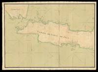
173317524Probably Paris: Dépôt des cartes et plans de la Marine c1733-1739. 530 by 1500mm. 20.75 by 59 inches overall. Manuscript chart pen and black ink and colour wash on two separate sheets of paper watermarked with Strasburg Lily within a shield initials "VDL" beneath and countermark "IV" closest to Churchill 405 dated to 1733 from the mill of Pieter van der Ley son of Gerrit Pieters van der Ley who worked De Wever - the Weaver - and De Bonsem - the Polecat - mills at Koog aan de Zaan Holland from 1674 onwards. The conquest of Jakarta by the Dutch who immediately renamed the port Batavia in 1619 gave the VOC its Asian headquarters from which it commanded a vast trading empire eventually extending from southern Africa to Japan that lasted for nearly two hundred years. By the end of the 1730s the British and French had begun to flex their seafaring muscles in the area and were publishing their own maps. This large-scale and detailed French chart of Java is clear evidence of a hostile interest that is directed at the very the heart of the Dutch empire. It is very similar to Francois Valentyn's large chart 'Nieuwe en zeer naaukeurige kaart van t Eyland Java Major of Groot Java' published in his 'Oud en Nieuw Oost-Indien vervattende een Naaukeurige en Uitvoerige Verhandelinge van Nederlands Mogentheyd in die Gewesten' 1724-1726 based on his own research correspondence and from previously unpublished material secured from the VOC officials. Some of this information must also have been available to the Chatelain family who published their 'Carte de l'Ile de Java: Partie Occidentale Partie Orientale.' 1719 which included details of inland topography not found on this manuscript chart nor on Valentyn's. The Chatelain map is avowedly based on Hadriaan Reland's work which was not published by the Dutch until Johannes van Keulen issued it as 'Insulae Iavae pars Occidentalis edente Hadriano Relando' in 1728. Interestingly this manuscript chart includes soundings that are not expressed on the Chatelains' chart implying some more recent knowledge of the coastline. However it does not reflect VOC knowledge of the southern coastline of Java dating from 1739 when Paulus Paulsz. in the sloop de Valk went on a surveying expedition there. His report and much more detailed chart which "remained the best sea chart of this area until the end of the VOC rule" Schilder page 173 survive. In 1513 Francisco Rodrigues sailed with the "Portuguese expedition from Malacca to find the unknown source of the rich trade in nutmeg mace and other spices. They sailed along the north coast of Java a trip from which Rodrigues prepared the first European map of Java's basic outline only of the north coast from direct observation. The Dutch who followed the Portuguese also ignored the interior in their mapping. In 1619 when the VOC established Batavia present-day Jakarta as a trading entrepot the south coast remained relatively unknown: it did not lie on the route to the valuable Molucca Spice Islands. The interior lands away from Batavia were ignored as long as the Javanese kingdoms remained quiescent; the VOC was intent only on ensuring a profitable return for its investors. Pursuit of these immediate economic goals restricted the exploration and associated topographic cartography of Java for nearly a century. A trivial cartographic misunderstanding reveals much about the stagnant state of mapping in Java at that time. The VOC sent Cornelius Coops by ship in 1698 to update the charts of the south coast; until this time charting was largely restricted to the northern coast where the Dutch ports and trading centres were located. Several schematic manuscript maps of the whole island appeared in Isaak de Graaf's 'Atlas Amsterdam' compiled by the VOC at the end of the seventeenth century but not published until the 1980s chiefly showing unnamed rivers and several VOC strongholds in the island's interior. At the beginning of the eighteenth century further mapping of the interior was conducted in a spasmodic and uncoordinated manner. The maps mostly by anonymous cartographers are in manuscript form and are held by the Netherlands National Archives The Hague. They were prepared internally by the VOC as administrative planning and strategic documents for circulation and use by VOC officials. VOC maps were closely guarded trade secrets; however commercial maps of the whole of Java and the neighbouring island of Madura were becoming readily available in Europe by the second decade of the eighteenth century" Simpson. This anonymous manuscript chart was probably prepared by the Dépôt de la Marine known more formally as the Dépôt des cartes et plans de la Marine the central charting institution of France. The centralization of hydrography in France began in earnest when Jean-Baptiste Colbert became First Minister of France in 1661. Under his watch the first Royal School of Hydrography began operating as did the first survey of France's coasts 1670-1689. The Dépôt itself began as the central deposit of charts for the French Navy. In 1720 the Navy consolidated its collection with those government materials covering the colonies creating a single large repository of navigation. By 1737 the Dépôt was creating its own original charts and from 1750 they participated in scientific expeditions to determine the accurate calculation of longitude. In 1773 the Dépôt received a monopoly over the composition production and distribution of navigational materials solidifying their place as the main producer of geographic knowledge in France. Dépôt-approved charts were distributed to official warehouses in port cities and sold by authorized merchants. The charts were of the highest quality as many of France's premier mapmakers worked at the Dépôt in the eighteenth century including Philippe Bauche Jacques-Nicolas Bellin Rigobert Bonne Jean Nicolas Buache and Charles-François Beautemps-Beaupré. The Dépôt continued to operate until 1886 when it became the Naval Hydrographic Service. In 1971 it changed names again this time to the Naval and Oceanographic Service SHOM. Although its name has changed its purpose is largely the same to provide high quality cartographic and scientific information to the France's Navy and merchant marine. Simpson 'Java Emerging Unfolding Cartographic Views' The National Library Magazine December 2010. Dépôt des cartes et plans de la Marine,