[ANONYMOUS].Biblio.com
237 569 résultats
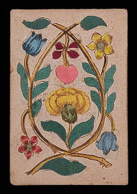
168021834Germany c1680. 93 by 65mm. 3.75 by 2.5 inches. A luxury silk and brocade deck 36 playing cards coloured silk and brocade laid between paper. The Maker There is no information on the present deck of cards about its maker but the nature of the materials used demonstrate that he or she must have been working for some extremely wealthy clients. The Cards The present cards are uniquely luxurious each one being comprised of layers of coloured silk and brocade laid between two sheets of paper. The different layers of fabric give the images added depth which reinforces the sense of meticulous craftsmanship. The janiform eagle which had been a symbol of the German emperors since the fifteenth century points towards a German origin for these cards. Indeed Hargrave records another deck of silk trappola cards from the seventeenth century which appear to have been made in Germany. It has been tentatively suggested that hearts represent France with Louis XIV as King; spades Russia with Peter the Great as Tsar - the jack bears the double headed-eagle of the Russian Empire; clubs the Holy Roman Empire with Leopold I as Emperor - he holds a shield bearing the imperial eagle; and diamonds the Ottoman Empire with - possibly - Mehmed IV as Sultan; the jack holds a falcon: falconry was one of the most popular pastimes in the Ottoman court. unknown
TM 466ELEGANT MANUSCRIPT CONTAINING TWO WORKS OF SPIRITUAL AND MORAL EDIFICATION IN FRENCH TRANSLATION. Illuminated manuscript on parchment in French France after 1482 c. 1490. Dimensions 274 x 175 mm. 70 folios written in a Gothic <i>bâtarde</i> bookhand 18 large initials parti-colored in red and/or blue inserted leaf in first quire with FULL-PAGE HERALDIC COMPOSITION IN GOLD SILVER RED BLUE AND BLACK. BINDING: Bound in modern nineteenth-century blue velvet over wooden boards pink paper pastedowns and endleaves edges gilt. TEXT: Manuscript contains two works that reflect the spirituality of fifteenth-century Carthusians and their quest for the contemplative life. The first text <i>Sept fruits de la tribulation</i> is known in only five extant manuscript and is still unedited. A free French version probably dating from the fifteenth century of either the longer <i>Latin Tractatus de tribulacione</i> or an abridged adaptation of the French <i>Livre de tribulacion</i>. The second text<i> Miroir d'or de l'ame pecheresse</i> is a work of spiritual edification which consists of seven sections: on human misery sin especially lechery penance rejection of the world the vanity of human wishes death and hell and heaven. There is neither a modern critical edition of the second text nor a complete census of the existing manuscripts; the copy here was apparently made from an incunable edition of c. 1490. This manuscript begins with a remarkable added full-page illuminated frontispiece with the coat of arms and motto of Louis de Grolée fl. late fifteenth-early sixteenth century the abbot of Bonnevaux and Saint-Pierre de Vienne. PROVENANCE: Copied in France perhaps northeastern based on script and linguistic characteristics as well as internal evidence. It belonged to Louis de Grolée fl. late fifteenth-early sixteenth century. It then belonged Charles Chardin bibliophile. It was later a part of the collection of Sir Thomas Phillipps 1792-1872 who has been described as the greatest private manuscript collector of all time. CONDITION: Gold slightly rubbed some off-setting from heraldic painted composition to opening text page slight staining in upper margin and into three lines of text ff. 68-69. Overall good condition. Full description and pictures available. TM 466
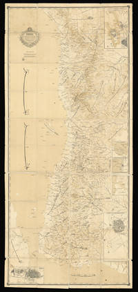
188615648Arabia 1886. 2435 by 1085mm. 95.75 by 42.75 inches. Lithograph dissected and mounted on linen in black and brown sea in sepia wash minor spotting or staining occasional wear to edges. A rare Arabic map of the Red Sea and Hejaz region. Despite the key role that the Arabian Peninsula and waters had played in Mediterranean trade for centuries European cartographers historically paid surprisingly little attention to the area. The lack of rivers and waterways made Arabia particularly difficult to chart but the exploration of the sixteenth and seventeenth centuries did see a number of new maps being produced. These however were generally littered with errors which were then compounded as later mapmakers drew on the inaccurate work of their predecessors. The eighteenth and nineteenth centuries however saw the rapid expansion of European empires giving rise to a renewed interest in foreign cultures and religions a trend that came to be known as 'Orientalism'. As a result explorers and cartographers began to venture further into the Arabian Peninsula undertaking expeditions to trace the deep-rooted incense trails and pilgrimage routes to the holy cities of Mecca and Medina. Maps began to appear showing the Hajj routes across the peninsula. After annexing Arabia during the sixteenth century the Ottoman Empire exerted various levels of influence; the emergence of Al Saud in the eighteenth century however introduced a rival power. In 1744 the founder of the dynasty Muhammad bin Saud had joined forces with the Wahhabi religious movement and their alliance soon lead to the rapid expansion of their territories and power. Although the first Saudi state was overcome by Mohammed Ali Pasha the Ottoman viceroy of Egypt in 1818 a second state continued to exist in the eastern region of Nejd. Al Saud rule over the Emirate of Nejd was contested throughout the nineteenth century by the Al Rashid dynasty. This map shows the southern portion of the Red Sea bordered on the east by the Arabian peninsula. The majority of the map is taken up by Hejaz the western region of Arabia where the two Holy Cities of Medina and Mecca are located. From 1845 Hejaz was under the direct control of the Ottomans governed by an appointed official known as the Sharif of Mecca. Ottoman influence persisted in the region until the early twentieth century when a popular revolt ousted them from power. In 1825 it was conquered by Ibn Saud who combined the kingdoms of Hejaz and Nejd in 1932 to form Saudi Arabia. Al Saud now controlled almost the entire Arabian peninsula with the exception of Yemen; Ibn Saud's attempts to claim Yemeni land sparked the war of 1934. Interestingly on the present map there is no national boundary drawn between Hejaz and Yemen probably because they were both subsumed under Ottoman control as part of the Egyptian Eyalet. The inset maps offer more detailed views of important cities and ports with two of the urban views depicting specific buildings and walls. Further inland where there were fewer significant settlements general areas are identified while towards the coast numerous towns rivers islands and harbours are labelled. At the bottom of the map the Horn of Africa is partially visible separated from Yemen by the Bab-el-Mandeb strait. We have been unable to trace any other examples of this map in institutions or at auction. unknown
1834000044<p>First volume of two 710 p. in later hard cover binding. the most rare and complete edition edited by Abdurrahman al Safti al Sharqawi. vol.1 contains 536 stories. 26.5 x 18 cm. printed in Bulak 1251 1834-1835.</p> Bulak hardcover
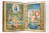
156957498s. l. Grenade Granada: S. n. 1569. Fine. S. n. s. l. Grenade Granada 1569 21.50 x 30.50 cm relié ILLUMINATED MANUSCRIPT ANONYMOUS Regla y Constitutiones de la Cofradia del Sanctissimo Sacramento de la Yglesia de San Christoval de Granada Autograph manuscript with three miniatures no publisher Granada 1569 folio 21.5 x 30.5 cm upper margin: 35 mm bottom margin: 50 mm interior margin: 30 mm exterior margin: 40 mm 31 ff. 16th-century full calf gilt Manuscript on vellum comprising 31 leaves: 50 pages of text ruled and lined and 3 full-page miniatures in colours heightened in gold. The four final leaves were numbered and partly ruled but left empty. Contemporary manuscript ex-libris on front endpaper. In Spanish throughout written in Caroline minuscule on 24 lines the text is very readable and very regular. The manuscript begins with a three-page summary covering the 24 chapters that comprise the Regla y constitutiones de la cofradia del Sanctissimo sacramento de la yglesia de San Christoval de Granada. One illuminated capital in red and blue indents and pagination in red small sketch in black ink to the inner margin. The verso of the final page of the summary has been ruled and lined in red but left blank. There follow the three full-page miniatures. The first shows a Communion scene on the recto of one leaf the second the Tree of Jesse verso of the same leaf and the third Saint Christopher bearing the baby Jesus recto of the following leaf. The verso of the miniature bears a short manuscript text explaining that these rules are those of the confraternity and brotherhood of the Holy Sacrament established in the Church of Saint Christopher of Granada on the 1st of May 1568. This is followed by the prohemio a prologue of two and a half pages in which the confraternity takes an oath; this starts with an imposing illuminated capital in red and blue. The chapters then follow on directly each with a tidy initial. The important terms are heightened in red allowing for quick navigation in the text. A long manuscript annotation to the outer margin of leaf 24. The aforementioned rules take up 23 ruled leaves ruled and lined in red. Leaf 27 bears two manuscript privileges. We have not been able to read the signature on the first dated May 1569 though quite elaborate. The second later one May 1596 is signed by Justino Antolinez de Burgos 1557-1637 at the time the Chaplain Royal charged with the inspection of ecclesiastical lodges. Long contemporary manuscript note to reverse of leaf 24. Contemporary light-brown calf spine in five compartments with gilt fillets and fleurons gilt fillet frame to boards small gilt fleurons to corner and a larger gilt fleuron to centre of covers. One clasp preserved. A few very skilful repairs and regilding practically invisible. This manuscript has three spectacular full-page miniatures in gouache heightened in gold. The first shows the Holy Communion with Christ himself establishing the Eucharist with the words This is my body this is my blood. The Apostles and Jesus with a halo blessing them are seated around a table set with bread and fish. This motif became a major theme of Christian art in the Renaissance as this miniature also shows. The second miniature shows the Tree of Jesse which symbolises the genealogy of Christ traced from Jesse Xese shown as an old man reclining. In keeping with the iconographic tradition a tree protrudes from his side the main branches of which bear some of Jesus's ancestors. Here they are: Zachary Jeremiah David an unidentified king and at the pinnacle Mary holding the Christ child within a mandorla. The third miniature presents a scene with Saint Christopher the patron of the Church in Granada to which the Confraternity of the Holy Sacrament was attached with a child on his shoulders as he was commonly represented. The iconography derives from a passage in the Golden Legend in which St Christopher helps a small b S. n. hardcover
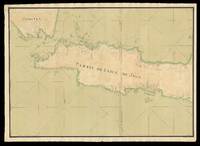
173317524Probably Paris: Dépôt des cartes et plans de la Marine c1733-1739. 530 by 1500mm. 20.75 by 59 inches overall. Manuscript chart pen and black ink and colour wash on two separate sheets of paper watermarked with Strasburg Lily within a shield initials "VDL" beneath and countermark "IV" closest to Churchill 405 dated to 1733 from the mill of Pieter van der Ley son of Gerrit Pieters van der Ley who worked De Wever - the Weaver - and De Bonsem - the Polecat - mills at Koog aan de Zaan Holland from 1674 onwards. The conquest of Jakarta by the Dutch who immediately renamed the port Batavia in 1619 gave the VOC its Asian headquarters from which it commanded a vast trading empire eventually extending from southern Africa to Japan that lasted for nearly two hundred years. By the end of the 1730s the British and French had begun to flex their seafaring muscles in the area and were publishing their own maps. This large-scale and detailed French chart of Java is clear evidence of a hostile interest that is directed at the very the heart of the Dutch empire. It is very similar to Francois Valentyn's large chart 'Nieuwe en zeer naaukeurige kaart van t Eyland Java Major of Groot Java' published in his 'Oud en Nieuw Oost-Indien vervattende een Naaukeurige en Uitvoerige Verhandelinge van Nederlands Mogentheyd in die Gewesten' 1724-1726 based on his own research correspondence and from previously unpublished material secured from the VOC officials. Some of this information must also have been available to the Chatelain family who published their 'Carte de l'Ile de Java: Partie Occidentale Partie Orientale.' 1719 which included details of inland topography not found on this manuscript chart nor on Valentyn's. The Chatelain map is avowedly based on Hadriaan Reland's work which was not published by the Dutch until Johannes van Keulen issued it as 'Insulae Iavae pars Occidentalis edente Hadriano Relando' in 1728. Interestingly this manuscript chart includes soundings that are not expressed on the Chatelains' chart implying some more recent knowledge of the coastline. However it does not reflect VOC knowledge of the southern coastline of Java dating from 1739 when Paulus Paulsz. in the sloop de Valk went on a surveying expedition there. His report and much more detailed chart which "remained the best sea chart of this area until the end of the VOC rule" Schilder page 173 survive. In 1513 Francisco Rodrigues sailed with the "Portuguese expedition from Malacca to find the unknown source of the rich trade in nutmeg mace and other spices. They sailed along the north coast of Java a trip from which Rodrigues prepared the first European map of Java's basic outline only of the north coast from direct observation. The Dutch who followed the Portuguese also ignored the interior in their mapping. In 1619 when the VOC established Batavia present-day Jakarta as a trading entrepot the south coast remained relatively unknown: it did not lie on the route to the valuable Molucca Spice Islands. The interior lands away from Batavia were ignored as long as the Javanese kingdoms remained quiescent; the VOC was intent only on ensuring a profitable return for its investors. Pursuit of these immediate economic goals restricted the exploration and associated topographic cartography of Java for nearly a century. A trivial cartographic misunderstanding reveals much about the stagnant state of mapping in Java at that time. The VOC sent Cornelius Coops by ship in 1698 to update the charts of the south coast; until this time charting was largely restricted to the northern coast where the Dutch ports and trading centres were located. Several schematic manuscript maps of the whole island appeared in Isaak de Graaf's 'Atlas Amsterdam' compiled by the VOC at the end of the seventeenth century but not published until the 1980s chiefly showing unnamed rivers and several VOC strongholds in the island's interior. At the beginning of the eighteenth century further mapping of the interior was conducted in a spasmodic and uncoordinated manner. The maps mostly by anonymous cartographers are in manuscript form and are held by the Netherlands National Archives The Hague. They were prepared internally by the VOC as administrative planning and strategic documents for circulation and use by VOC officials. VOC maps were closely guarded trade secrets; however commercial maps of the whole of Java and the neighbouring island of Madura were becoming readily available in Europe by the second decade of the eighteenth century" Simpson. This anonymous manuscript chart was probably prepared by the Dépôt de la Marine known more formally as the Dépôt des cartes et plans de la Marine the central charting institution of France. The centralization of hydrography in France began in earnest when Jean-Baptiste Colbert became First Minister of France in 1661. Under his watch the first Royal School of Hydrography began operating as did the first survey of France's coasts 1670-1689. The Dépôt itself began as the central deposit of charts for the French Navy. In 1720 the Navy consolidated its collection with those government materials covering the colonies creating a single large repository of navigation. By 1737 the Dépôt was creating its own original charts and from 1750 they participated in scientific expeditions to determine the accurate calculation of longitude. In 1773 the Dépôt received a monopoly over the composition production and distribution of navigational materials solidifying their place as the main producer of geographic knowledge in France. Dépôt-approved charts were distributed to official warehouses in port cities and sold by authorized merchants. The charts were of the highest quality as many of France's premier mapmakers worked at the Dépôt in the eighteenth century including Philippe Bauche Jacques-Nicolas Bellin Rigobert Bonne Jean Nicolas Buache and Charles-François Beautemps-Beaupré. The Dépôt continued to operate until 1886 when it became the Naval Hydrographic Service. In 1971 it changed names again this time to the Naval and Oceanographic Service SHOM. Although its name has changed its purpose is largely the same to provide high quality cartographic and scientific information to the France's Navy and merchant marine. Simpson 'Java Emerging Unfolding Cartographic Views' The National Library Magazine December 2010. Dépôt des cartes et plans de la Marine,
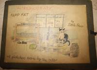
19430072801943. Hardcover. Cloth Box. Very Good. Inimitable and disarming tales that represent the pinnacle of outsider art and folk art with the naive drawings richly full of life as they speak of the daily routine at a British army camp during the Second World War from the point-of-view of a camp mascot cat who excels at mangling English in its creative attempts at phonetic spelling. Folios are oblong 41 by 30 cm each. The first folio contains "The Alterbyografy" a 56 pages long unpaginated with 54 illustrations including the folio cover 28 of which are full page 24 of which are half page. The second folio is entitled "Kamp Karacters" . This is 51 leaves with 92 illustrations including the cover 51 of which are full page 40 a third page generally with the area above entirely blank. Illustrations are rendered with colored pencil and crayon. The first manuscript is a continuous narrative of army life its humdrum rhythms and routines its various inanities its social life sports and other activities etc. while the second part is more character sketches. The second folio is even more visually driven than the autobiography. Another distinction between the two is that the autobiography is done with the leaves oblong while the character studies are applied with the leaves vertical. While one part isn't exactly a sequel to the other the two parts are truly complementary. The two folios are of a rough burlap material with a large title sheet mounted on their front cover. The folios have three flap folds to hold the loose sheets in plus ribbon ties on their right sides. hardcover
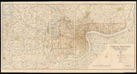
193215013Shanghai: Shanghai Municipal Council 27th October 1932. 860 by 1744mm. 33.75 by 68.75 inches. Coloured lithograph map dissected and laid on linen early ownership stamp of "John Pook & Co." in blank area folding into original cloth portfolio lettered in gilt 'General Map of Shanghai 1933' on spine. Acknowledgement is made of information obtained from the French Municipal Council the Shanghai City Government and the Whangpoo Conservancy Board. The map depicts Shanghai city in 1933 however the date printed on the bottom right corner is 27th October 1932. The round shape of the Old city is still clearly visible as in the Plan of Shanghai printed in 1928 it is labelled the "Chinese City" Similarly immediately to the north east and west is the French Concession and further to the north is the International Settlement. It is printed with a legend which includes: villages and developed property; creek; motor road; path and roads; and important buildings. Compared with the Plan of Shanghai printed in 1928 this map has much more information added most notably is that more villages and developed property are marked and identified using the relevant legend. We are only able to trace one other example of this map that in the British Library Map Collection. BL: Cartographic Items Maps X.3743. Shanghai Municipal Council, hardcover
180018412c1800. 470mm in diameter. Instruments""Planispherum Lunare A unique manuscript lunar astrolabe Ink and polychromy on paper over pine. The instrument comprises a circular base plate and three rotatable cardboard volvelles and a brass radius pointer attached to each other in the centre. A brass ring is attached to the base plate for suspending. All four paper covered discs are finely inscribed in manuscript with various scales and symbols. Content 1. The smallest volvelle bears a scale covering 12 hours on its outer ring. It also shows the ecliptical motion of the Sun the Moon's orbit the line of nodes and the arguments of latitude in other words the distances from the nodes. 2. On the second volvelle a scale covers the years from 1801 to 1825. each year is subdivided in twelve months with the abbreviated name written for each month. 3. The following volvelle carries a series of scales showing a monthly calendar a zodiac calendar with skilfully drawn pictures and the symbols of the signs. Below the zodiac is a scale for the declination of the sun throughout the year set in four sequences of three. 4. On the outside rim of the volvelle is another calendar scale in which the months are unevenly distributed. This scale presumably was to be used in conjunction with the outer scale on the circular base plate. In addition the volvelle holds two brass studs that most probably helped the user turn the disc to the desired position. This latter scale gives the days subdivided in hours. The days are numbered I to XXXI with the number I coinciding with XXVII and 8 hours the sidereal period of the Moon which results in a double numbering from XXVIII to XXXI. Below this scale for days there is a series of dates all confined to the period 1801 to 1825 presumably for solar eclipses. The brass rule or pointer holds a horizontal scale from 5 to 0 LA-southern declination and from 0 to 5 LB-northern declination indicating the latitude of the moon with respect to the ecliptic. The closer to 0 at new moon or full moon the likelier an eclipse is to occur. The rule is engraved with """"Locus Lunae"""". The circular scales serve to set the moon's position and node relative to the sun from which the user can then infer the lunar phase and whether an eclipse will occur at new moon or full moon. Manuscript instruments of this type are rare especially in such good condition as no other exact copy is recorded to date. Similar instruments were produced at the end of the sixteenth century mostly in brass. Sir Robert Dudley 1573-1649 see item 17 had a lunar calculator made by Charles Whitwell c. 1568-1611 a brass disc of 72 cm diameter overall which was the most complex instrument made during the sixteenth century. Inscribed 'Sir Robert Dudley was the inventor of this instrument' its purpose was to calculate the place of the moon over a period of thirty years. It is now in the Museo di Storia della Scienza in Florence Italy. Another similar paper device was printed with detailed instructions in 1786 in Vlissingen Flushing in the Netherlands advertised as a """"Starkundige Maan-Wyzer en Almanach"""" Astronomical Moon Pointer and Almanac by Henricus Schortinghuis. Oxford Dictionary of National Biography; Webster Roderick and Marjorie 'Western Astrolabes' Adler Planetarium & Astronomy Museum 1998; Museo di Storia della Scienza Florence Italy unknown
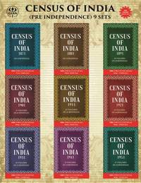
2024Gyan-9788121258883Gyan Publishing House 2024. In 384 Bindings. Hardcover. New. 22.59 x 28.94 x 1524.27. English Gyan Publishing House hardcover
2024Gyan-9788121258883Gyan Publishing House 2024. In 384 Bindings. Hardcover. New. 22.59 x 28.94 x 1524.27. English Gyan Publishing House hardcover
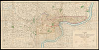
191315014Shanghai: North-China Daily News & Herald Limited 1st June 1913. 735 by 1510mm. 29 by 59.5 inches. A large English map of Shanghai dissected in 40 4 by 10 sections and mounted on linen folding map. Oriented with north towards the upper right. Top left includes an inset of "plan shewing the rubicon road system". Signed by Engineer and Surveyor. The North-China Daily News was an English-language newspaper in Shanghai China the most influential foreign newspaper of its time. The paper was founded as the weekly North-China Herald and was first published on 3 August 1850. Its founder British auctioneer Henry Shearman died in 1856. North-China Daily News & Herald Limited, unknown
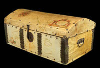
16902196Spain c1690. 320 by 740mm. 12.5 by 29.25 inches. Wooden chest clad in vellum manuscript maps with wrought iron handles rivets lock and clasp. A very unusual piece of cartographic history. It was common for seafarers to have sturdy wooden chests for storage whilst on a voyage but the owner of this chest chose to have it covered it with manuscript maps drawn on vellum possibly by their own hand with the decorative ironwork fitted on top. The lid is covered with a map of North and Central America with the Darien Isthmus labelled to the south and decorated with an elaborate compass rose and title cartouche supported by figures of Native Americans. The map on the front is decorated with a title cartouche showing a sea god. The sides are covered with maps of the East and West Indies decorated with ships. It is remarkable that the maps have survived given the treatment they would have encountered at sea. hardcover
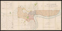
192815011London: Standford's Geog.l Establishment London 21st April 1928. 880 by 1660mm. 34.75 by 65.25 inches. A large coloured lithographed map showing the plan of Shanghai made in 1928. Signed by Commissioner of public works 44 4 by 11 sheets mounted on linen. The map depicts Shanghai city in 1928 with the French Settlements and Shanghai International Settlements hand-coloured in outline in brown and pink. Two lines noted below the title: 1. The Pootung shore is taken from surveys by the Whangpoo Conservancy Board. 2. The French settlement is taken from surveys by the French Municipal Council. The famous Whangpoo Huangpu river in Shanghai is prominently shown from the midpoint of the bottom edge sinuating upwards to the top right corner which divides the settlements to the left and Pootung Pudong to the right. Between the bank of the river and the French settlement are the 'Chinese city' and a district labeled 'Nan Tao' Nan Dao. The "Chinese city" is now called the "Old City" the traditional urban core of Shanghai. Its boundary was formerly defined by a defensive wall. The Old City was the county seat for the old county of Shanghai with the advent of foreign concessions in Shanghai it became just one part of Shanghai's urban core but continued for decades to be the seat of the Chinese authority in Shanghai. It was essentially coterminous with the old Nanshi District - Nan Dao which is now part of Huangpu District. In 1927 in a bid to establish a tangible Chinese authority in Shanghai the Republic of China government established the Special Municipality of Shanghai. The municipal government was moved out of the Old City to near Xujiahui. In 1928 Shanghai City the Old City was reduced to district status under the Special Municipality. In 1930 Shanghai County became a separate parallel administrative unit to the Special Municipality and the county government was moved out to Minhang. This was the end of the Old City's role as the seat of government of Shanghai. From 1928 the Old City was Hunan District; 'Hunan' literally meant 'southern Shanghai'. An exact copy of the map dated to the same day 21st April 1928 was published in Shanghai North-China Daily News and Herald Limited. by permission of the Municipal. It is signed by the same commissioner of public works. We are only aware of a single surviving example that in the Library of Congress Geography and Map Division Washington D.C. Publisher Edward Stanford 1827-1904 rose to prominence during the height of the Victorian age a period defined by technological innovation social upheaval literary excellence and world exploration. In 1853 Stanford became sole proprietor and expanded his shop to 7 and 8 Charing Cross whilst acquiring premises on Trinity Place for a printing works. This solidified Stanford's as the largest and only map maker and seller in London at a time when British colonialism the rise of the railways and the continuing popularity of the Grand Tour. Edward Stanford II took over in 1882 when Stanford's had become the sole agents for Ordnance Survey Maps in England and Wales and in 1887 published Stanford's London Atlas Of Universal Geography dedicated to Queen Victoria on the occasion of her Royal Jubilee and he received his royal warrant as Cartographer to the Queen in 1893. Edward Stanford II died in 1917 and his son Edward Fraser Stanford assumed control of the business in 1917. This map was made in the succeeding period between the wars which saw the company continue to innovate and encourage exploration. Standford's Geog.l Establishment, London, unknown
2024BIBHB0334000512024. Hardcover. New. Due to the very old age and scarcity of this book some pages are missing and may be hard to read due to the blurring of the original text. The Title 'Census of India 1871-1951 written/authored/edited by Anonymous' published in the year 2024. The ISBN 9788121258883 is assigned to the Hardcover version of this title. This book has total of pp. 152427 Pages. The publisher of this title is Gyan Publishing House. This Book is in English. The subject of this book is History Census India. Size of the book is 22.59 x 28.94 cms Vol: Volume In 384 Bindings hardcover
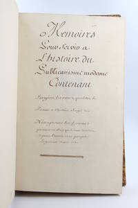
175078168s. l. 1750. Fine. s. l. 1750 23 x 38 cm 2 manuscrits reliés en un volume Manuscript entitled Mémoires pour servir à l'histoire du publicanisme moderne contenant l'origine les noms qualités le portrait et l'histoire abrégée de nosseigneurs les fermiers généraux du Roy qui se sont succédés depuis l'année 1720 jusqu'à la présente année 1750 with Mémoires pour servir à l'histoire du publicanisme ou l'Origine des receveurs généraux des finances du royaume 1750 folio 23 x 38 cm 330 pp 4 p. bl. 8 p. 4 p. bl. 83 pp. contemporary full calf Important and long manuscript composed of two parts written by two different hands retracing in total 160 biographies of the Fermiers Généraux active between 1720 and 1750 lavish and unpopular collectors of indirect taxes in the Ancien Régime. Each of the parts also contains a very useful index. The entries with the exception of 19 of them are all decorated with a coat of arms drawn in pencil painted by hand in colour and sometimes enhanced with gold or silver. Some modern notes some juicy in pencil in the margin of certain leaves. These memoirs have never been the object of a publication and we know of only a few handwritten copies with varying texts. The other examples that we have been able to find including the one digitised by the French National Library contain fewer biographies that ours and are not illustrated. Contemporary binding in full blond marbled calf title pieces in black and red morocco. Joints top of the first board and spine head repaired joints of the first board split but solid scratches on the boards corners damaged. A very beautiful manuscript richly painted retracing the history of the most despised institution of the Ancien Régime. Provenance: library of Count Chandon de Briailles descendent of the founders of the famous house of Champagne then of the Michel de Bry library with its motto Pro captu lectoris with their ex-libris glued to the first endpapers. hardcover
2024Gyan-9788121258876Gyan Publishing House 2024. In 384 Bindings. Paperback. New. 21.59 x 27.94 x 1066.989. English Gyan Publishing House paperback
2024Gyan-9788121258876Gyan Publishing House 2024. In 384 Bindings. Paperback. New. 21.59 x 27.94 x 1066.989. English Gyan Publishing House paperback
2024Gyan-9788121256711Gyan Publishing House 2024. In 245 Bindings. Hardcover. New. 22.59 x 28.94 x 828.17. English Gyan Publishing House hardcover
2024Gyan-9788121256711Gyan Publishing House 2024. In 245 Bindings. Hardcover. New. 22.59 x 28.94 x 828.17. English Gyan Publishing House hardcover
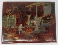
1880127847ca. 1880s-90s. Good. Forty 20.5 x 27 cm albumen hand-coloured photographs pasted into 28 x 35 cm laquer album. Each photo has number and short descriptive caption. Front board of album damaged where ivory was pried off. Board coming loose. Front free endpaper detached and chipped. Tissue guards between plates some detached and folded or chipped. Last three photos detached. Accompanied by one 11.5 cm photograph of woman Bernard & Co. mounted on 19 cm card as well as twenty-one 9 x 13.5 cm photos six with inscriptions on rear. Photos in very fine condition. <br/><br/>These tremendous photographs illustrate Japan during the Meiji Period 1868-1912. During this time period Japan abandoned its centuries-old isolationism and began a period of industrial growth and Westernization. Prince Meiji Mutsuhito encouraged his people to work or study abroad and also invited Westerners to tour his country. During this era Japanese photography began to blossom. A Greek photographer named Felice Beato went to Japan and started documenting the country's landscapes villages and people. When he started to delicately hand colour his black and white albumen prints the Japanese themselves began to take an interest in his work. Soon there were numerous practitioners of the art of handcolouring albumen prints for tourists. These prints are now eminently collectable. The scenes in this album show tea houses restaurants temples fishermen rice growers stores a lantern maker toy shop basket seller farm workers and domestic scenes. The richly decorated album once including ivory in its design was meant for tourists to fill with various personally chosen commercial photos available for purchase. unknown
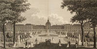
18161435761816. PARIS. Graphic Illustrations of the Most Prominent Features of the French Capital; with Characteristic Figures in the Foregrounds comprised in Twelve Stroke Engravings From Accurate Designs Taken in Paris during the Imperial Reign of Buonaparte. With Descriptive Notices and Interesting Anecdotes. 26 pp. illustrated with 12 double-page engravings. Folio 430 x 380 mm. bound in contemporary French three-quarter black morocco over marbled boards gilt title and floral vignettes on spine paper label with ms. number "20" on front cover and spine. London: Harper and Co. 1816. A fine copy of this extremely rare collection of views of Paris consisting of twelve artistically conceived views of Paris engraved by English artists. The large double-page engravings incorporate local Parisians participating in daily routines within the setting of each view. Panoramic views include: the Military School and the Church of the Invalides; View of Paris from the South Boulevard; View of Paris from Montmartre; South View of the Old and New Louvre; The Mint and The Façade of the Louvre; View of La Place de la Concorde; The Garden of the West Front of the Tuileries; Palace of the Tuileries Facing La Place du Carrousel; Garden of the Tuileries; The Luxembourg or Palais du Senat with the Gardens; The Elysian Fields Distant Gardens of the Tuileries; Entrance to Les Champs Élysées and La Place de la Concorde. Each plate is followed by two pages of text giving historical details and anecdotes about the site illustrated. Minor wear to outer edges of binding plates and text clean. Rare: OCLC lists 6 copies worldwide of which only one is held in America Bowdoin College. hardcover
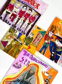
40620n.p.: n.p. 1990. Very good plus. Stunning and extensive collection of original artwork album covers and two lengthy reference books - all describing a vast imaginary world of 20th century rock-and-roll that never existed. Introducing the auto-fanfictive outsider art of The Indoor Kid - a Henry Darger of Greil Marcuses Syd Barrett of Daisy Ashfords Robert Christgau of Richard Dadds - who fell through the pages of ten thousand music magazines into a wonderland of his own making. The anonymous creator hereafter The Artist fashioned an entirely fictitious musical universe. From dozens of albums drawn and collaged over actual LPs as well as what might perhaps best be described as concept art for those albums to extensive accompanying commentaries whose tone owes a great deal both to zines of old and the once-popular Encyclopedias of Rock the impression is one of carpeted suburban bedrooms and children longing to escape both backwards into lost decades and forwards into the autonomy and sexuality of imagined adulthood. The Artist's mock-authoritative assertions of judgment and offhand omniscience speak of a child raised by a stacks of ROLLING STONE and CREAM in lieu of the foundling's traditional pack of wolves. His major fascinations - psychedelia the particular flavor of British whimsy that preceded it and hippie-tinged heavy metal of the Zeppelin-Black Sabbath era- are all in line with this lineage and with the character of the solitary late-'80s adolescent.<br /> <br /> THE DREAM OF FAME BEATS FAME ITSELF:<br /> <br /> The Artist's record collection most immediately calls to mind the work of Mingering Mike the D.C.-based self-made recording artist who constructed scores of fake albums by "unheard artists such as Joseph War the Big 'D' and Rambling Ralph on labels such as Fake Records Inc. Decision Sex and Mother Goose" Hadar. Discovered at a flea market in the early 2000s Mike's work found instant cult and early online fame. The present collection however can be dated with a great deal of confidence to the mid-late 1980s through perhaps the very early 1990s from the issue dates of the original repurposed albums as well as triangulating particular contemporary references coupled with certain early laser-print fonts. Thus while it is almost certainly impossible that the one could have influenced the other the similarities of technique imagination and single-minded dedication in their respective oeuvres are striking. <br /> <br /> Their art styles however are highly individuated. Though both may be placed under the broad umbrella of outsider art our Artist abhors a vacuum; he does not have Mike's appreciation of negative space. Lacking any formal skills or apparent training and with a representational style much younger than his assumed years he works in blasts of color in layers of collage and pen and children's marker in puns and allusions and call-backs both verbal and visual. And whereas Mingering Mike's invented record labels and bands lent verisimilitude to his own fantasied career in which he was the star The Artist is self-effacing to a fault. His dream is pure and strange. Not so much the protagonist of this created world but its chronicler publicist. In short that most reviled and necessary of creatures: the rock journalist. <br /> <br /> "OPIUM: ONE OF THE MOST POTENT DRUGS. NOW THE NAME OF A NEW ROCK AND ROLL BAND."<br /> <br /> Clearly a deep reader if only of music journalism the artist scatters little gems in the corners. Little clusters of mini-trends pop up in band names: the exquisitely named Sand Witch Witch-ita Falls Witching Hour and Witches Comettee sic; Mezzanine Anecdote and The Syntax Man; Tar-O and the O-CULT Band. Elsewhere there's a knowing nod to the Bonzo Dog Doo Dah Band clearly a source of inspiration; a song called "Austin Osmanspare" described as a "creepy tale of a black magic practitioner"; a reference to vocals vocals! like H.P. Lovecraft. Well-versed in the style of Bangsian word-omelettes "a sound full of ponderous organ pounding plodding rhythms screaming operatic vocals fast blitzkrieg-Bach-inspired guitar runs" some of the song titles are undoubtedly jokes on purpose: "Who When And Where Is Our Love Machine" "Soldier Sentry Squabbie Cockleshell Army" "666 All in the Name of Satan" Death Banquet's "Let Me Bludgeon You" followed by "No No No Don't Break The China" and the magisterial "Surrender Your Arms Sexual Metaphor." <br /> <br /> Meanwhile the real world does exist but is kept resolutely peripheral: nods to Timothy Leary praise from George Harrison glowing comparisons to Ozzy Osbourne and sneering ones to Michael Bolton creep in. Occasionally a deep-cut cover appears like "Magic Handkerchief" Bown/Bannister always scrupulously attributed. In a stroke of crossover genius one of the two encyclopedic notebooks explains that the imaginary band Iron Maiden had to change its name when the other real Iron Maiden got too famous. Poets too feature not only in certain liner notes "The group are heavily into Shelly sic Byron Keats William Blake and Sigfried Sasoon sic" but also most intriguingly in one unique piece of album art: "Strange Games" by "WILLIAM BLAKE." Unlike all the others however this album incorporates actual photographs of a teenage boy sulking theatrically for the camera in a red-collared black cape heavy bangs and incipient wispy mustache. We suspect the subject of being the artist and if we are correct his choice of pseudonym is impeccable.<br /> <br /> ENTRANCE TO THE SOLAR MINE<br /> <br /> What became of the creator is unknown and likely unknowable. Perhaps like Mingering Mike he decided that "the dream of fame beats fame itself" Washington City Paper. Perhaps he put away childish things and went on to be a sober and square maker of spreadsheets and never reminisced about a single song no one else had ever heard. Or perhaps he struggled when abruptly deposited in an adult world more real but less beloved than his own - a sadly more likely scenario as this collection was rescued from a storage locker auction.<br /> <br /> What is known for certain however is that the most compelling of pasts is the dream-past just before one's own birth well-remembered by parents and better-known to cool older siblings but eternally opaque to oneself. It is tragically the strangest history of all farthest away yet tantalizingly close. One cannot remember it so one invents. Wasn't Satanic Brittanica's "Moanin' Alone If You Leave Me Girl" a banger And that the song "Bastard" by Dallas sure rocks. Tune the FM dial of the aimless drives of youth. You remember. Collection includes the following 101 items: 52 original hand-colored and collaged record album sleeves. Two handwritten clamp-bound journals. Six color xerox reproductions and 41 original color marker-and-collage artworks for a subtotal of 47 different images; the color xeroxes do not reproduce any of the original works present and though some band names and iconographic motifs recur no images repeat from the album covers. Collaged materials include one piece with several original photographs of a young man tentatively identified as the anonymous artist. All materials show minor wear with occasional glue separation of artwork from original album cover; on the whole spectacularly well preserved. A complete inventory is available as well as a document with further sample quotes. n.p. unknown
2024BIBHB0334000832024. Hardcover. New. Due to the very old age and scarcity of this book some pages are missing and may be hard to read due to the blurring of the original text. The Title 'District Gazetteers of India In 245 Bindings written/authored/edited by Anonymous' published in the year 2024. The ISBN 9788121256711 is assigned to the Hardcover version of this title. This book has total of pp. 82817 Pages. The publisher of this title is Gyan Publishing House. This Book is in English. The subject of this book is History. Size of the book is 22.59 x 28.94 cms Vol: Volume In 245 Bindings hardcover
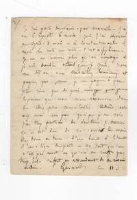
184475148Paris 1844. Fine. Paris 11 février 1844 10.40 x 13.60 cm quatre pages sur deux feuillets Three autograph letters signed by Gérard de Nerval 2 pages signed «Gérard» Théophile Gautier 1 page and a third unsigned letter 1 page penned by a certain «Robert» cf. Nerval's letter Louis Desessart Théophile Gautier's appointed publisher co-published Nervals play Léo Burckart with Barba in 1839. Following financial difficulties he was forced to take refuge «in that sad and charming city of Brussels». The three friends wrote this letter from Paris where they had reunited following Nervals long journey to the East: «I spent six months in Egypt; then three months in Syria four months in Constantinople and the rest en route. Its quite beautiful. I only enjoy myself while traveling and try to live twice as much as I can.» This journey deeply impressed Théophile Gautier who would only travel to Turkey and Egypt years later: «I am in Paris and wish I were in Cairo from where Gérard is returning.» The exoticism of distant lands starkly contrasts with the melancholy and severity of Europe: «How sad Paris is when one returns from sunlit countries.» Nerval And in Paris far from dreams of escape life means toil and melancholy: «We are like sick people who are never comfortable anywhere. I think the good times are gone and the golden hours of the past when we spoke such wise follies will never return. Whats the point of living if we must work and cannot see our friends or write to them or do anything we would like» Gautier The two writers express great compassion for their friends Belgian exile with Brussels appearing as the capital of spleen: «What! Youre still in that sad and charming city of Brussels! . Brussels is even darker poor fellow!» Nerval This joint letter was in fact initiated by «Robert»: «Isnt it true my dear friend that Im quite skilled at making you forget my faults . as a way of making it up to you Im sending you the autographs of two of your . comrades your fondest memories two men of fame who despite all their affection and friendship for you would never have written a word had I not trimmed their quills and handed them paper like sulky children and told them: write at once at once to the exile you love most.» unknown