[Anonymous]Biblio.com

237 569 résultats
193217484The Platt & Munk Co. Inc. . 1932. Softcover. Very Good-. Boards with light rubbing to extremities; Front cover bears "No. 3100-B" marking on the bottom. A nice early edition of a book that reminds us of different times ; 16mo 6" - 7" tall; 10 pages . The Platt & Munk Co. , Inc. paperback
182515982New Haven: S. Babcock n.d. circa 1825. First edition. RARE. 7 engravings “for the mind and the eye†and decorative borders on each page 12mo in original paper with blue wrappers very nicely designed border on upper and lower covers illustrations on upper cover and inside lower cover; advertisement on lower cover. 16 pp. A very good copy with attractive designs on covers and pages. This children’s book is called a chapbook a more modern term that derives from the chapmen. Chapmen were pedlars who hawked their goods in towns and villages and at country fairs. In 1553 Edward VI proclaimed that champmen must be licensed and Chettle in Kind Hart’s Dreame 1592 wrote that “‘Chapmen are able to spred more pamphlets.then all the booksellers in town.’†Although they sold other wares too they always had cheap booklets sometimes ballad sheets which eventually assumed the familiar form af a miniature booklet with a paper cover that usually had a picture. Even Shakespeare in Henry IV mentioned the chapmen as did Urquhart’s Rabelais in 1653. With the growth of small printers miniature editions of old favourites could be printed. While chapbooks were ostensibly designed to help children learn how to read they often broached adult subjects and were the source of entertainment in families and villages. <br> This book is one of the series of “moral instructive and entertaining toy books†put out by Babcock’s. S. Babcock unknown
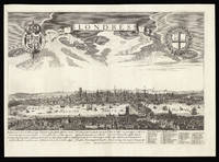
168712426Italy c1687-1730. Image: 395 by 510mm 15.5 by 20 inches. Sheet: 430 by 555mm 17 by 21.75 inches. Copper engraving. A Latin version of Pierre Aveline's view of London. Although the title cartouche has been changed the engraver has not changed the tower of St Paul's Cathedral to its post-Fire state. Although it is intended to represent contemporary eighteenth century London it still shows the Elizabethan theatres in Bankside. Scouloudi records this as a variant of the view published by Antoine Aveline 1691-1743 in the early eighteenth century but she does not record the copy published by his father Pierre Aveline. The present example could therefore be a variant on either the father's or the son's. Scouloudi pp.59-60. unknown
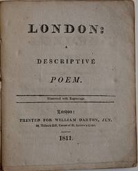
14014London: Printed for William Darton Jun. 58 Holborn Hill Corner of St. Andrew’s Court 1811. . 28 4pp. 16mo. Eight engraved plates seven of them captioned "Published Feby 16 1811 by W. Darton Junr." with a four-page publisher’s catalogue at end; some offsetting from the plates. Original stiff buff wrappers a large Darton woodcut on both covers; wrappers faded and a bit worn. Contemporary ownership inscription on upper wrapper "A Keepsake of Charles Wood." First edition a rather sophisticated poem for children but clearly intended for them as the wrappers demonstrate. The Dartons H9871 noting that a subsequent edition gave the author as "A Well Known Cockney." London: Printed for William Darton, Jun., 58, Holborn Hill, Corner of St. Andrew’s Court, 1811. unknown
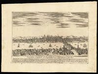
169012422Italy c. 1690. Image: 212 by 316mm 8.25 by 12.5 inches. Sheet: 288 by 391mm 11.25 by 15.5 inches. Copper engraving. An Italian view of the River Thames and the London skyline from a viewpoint above Southwark. The image is one of a number of derivatives of Pierre Aveline's prospect. The text underneath gives the reader information about London and England in general. The English have beautiful women "le donne sono bellissime" and the aristocracy is interested in science "inclinata alle Scienze" but the lower classes are insolent and volatile "insolenti e volubili" and the country is full of heretical sects. unknown
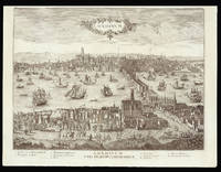
12363Paris: chez Jean Savué demeurant à la rue St. Jaques proche St. Yves à la libert. 385 by 540mm. 15.25 by 21.25 inches. Copper engraving. A French variant on De Jonghe's view of London with the verses underneath in a different type and the name of the Thames translated into French from Latin. Jean Sauvé 1635-1692 was an engraver and publisher active in Paris and known for re-engraving the works of others including de Jonghe as here Merian Tavernier and Jollain. chez Jean Savué demeurant à la rue St. Jaques proche St. Yves à la libert, unknown
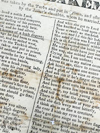
359n.p. n.d. Good with significant staining a few holes from folding and tears to the edges. A broadside mystery which does not feature any imprint or other readily identifying marks and we cannot locate further information on the same thus leaving a researcher or collector the ability to make the first discovery. unknown
19154227France Belgium England 1915. Good. Oblong 8vo. Small "Walker's Service Notebook" 154 x 94 mm lined 26 pages filled with neat entries in pencil and pen final page of diary loose the remaining portion of the notebook i.e. about 2/3 blank. Original limp cloth covers worn. § Extraordinary manuscript diary of an anonymous British soldier beginning April 12th 1915 and ENDING ABRUPTLY IN THE TRENCHES AFTER A GAS ATTACK. The final entry was dated December 19th 1915 which was THE FIRST DAY PHOSGENE GAS WAS USED AGAINST BRITISH SOLDIERS. The short diary is rich in detail of life at the front. The anonymous soldier belonged to the 49th West Riding Division which had a large number of gas casualties when soldiers in reserve lines did not receive a warning in time to put on their helmets. A study by British medical authorities arrived at a figure of 1069 gas casualties 120 of which were fatal. It is very possible that the present manuscript was written by one of those men. It seems probable that with access to the right regimental records the identity and fate of the soldier could be learned and his story told in full; however even as an anonymous diary the interest and poignancy of this personal record is clear.<br /> <br /> The events recorded span just nine months. On April 12th the soldier leaves Edenthorpe near Doncaster and crosses the channel to Le Havre that evening "packed like herrings" and accompanying horses and wagons. Over the next few months he records laying lines opening signal offices handling horses towns and villages visited billets and meals injuries regiments encountered names of comrades and O.C.s shelling rain and mud. He sees the Northumberland Hussars the Indian Corps and Royal Horse Artillery. On May 9th he records the Battle of Aubers Ridge: "Off duty at 7am. Attack began at 5am by Artillery. Signal thro' during day showed heavy losses in E. Lancs Lincolns. 13th London and other Batts. Had coffee in Fleurbaix and then to bed in barn. Off duty 3pm. Attack still proceeding without much impression on our line. French said to be doing well. At night we have the two windows in our Signal Office made up with corrugated iron & sandbags."<br /> <br /> For the entry dated May 12th our author notes that the name of the Division has been "altered to the 49th" thereby confirming the identity of his Division. On May 24th: "The Allamands dropped about 6 shrapnel in our vicinity."<br /> <br /> From a period of steady work and periodic pleasures "had tea & cakes at a patisserie & and then back after buying some books" "glorious day" the situation deteriorates with the weather "torrential rain dugouts leaking & 18" water on my floor".<br /> <br /> They move to Chateau de Trois Tours and on July 13th there is "rather an exciting night" with a bombardment from 7.30 to 10.30. On the 14th "The whole place is being encircled by barbed wire & trenches & the furniture is being moved out of the chateau." On the 15th "At 12.45pm about 12 shells fell round the chateau made a dive for the Signal Office Billy Edwards & Gus Harris wounded in thigh and ankle." They were shelled again on the 16th.<br /> <br /> On December 1st he travels back to Sheffield on leave returning on December 8th. The company are now holed up near Ypres at Hospital Farm the name given to a farm building used as a dressing station. The final entry reads "Dec 19th 'S.O.S.' Gas attack 5.30 am things lively until 8.30am. 146 & 148 des. 148 soon repaired from chateau". The cemetery at Hospital Farm contains 115 Commonwealth burials of the First World War.<br /> <br /> On the significance of the 19 Dec. 1915 battle at Wieltje Belgium northeast of Ypres see the long Wikipedia entry "German Phosgene Attack of 19 December 1915." <br /> <br /> The diary contains many clues that could help identify our writer in military records. It is not certain that he was one of the first British casualties to Phosgene gas but it seems tragically likely. As it stands the final entry in the diary marks an important milestone in the war: phosgene gas would eventually be responsible for about 85% of the 90000 deaths caused by chemical weapons during World War I. unknown
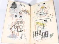
2548<p>Modern covers they have been replaced with no indication. <br />Traditional Japanese binding posterior covers.</p><p>Unlike kabuki there are no complex props sets and rotating platforms used during a No performance. Instead the No theater favors a type of modest accessory called tsukurimono literally "crafted objects". Handmade from materials such as bamboo tsukurimono often have one simple frame and are more symbolic than realistic. They often depict structures such as boats tombs houses and wells.</p> No publisher (original manuscript)
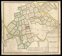
14549mid-18th century. 285 by 315mm 11.25 by 12.5 inches. Pen and ink and wash colour on vellum. A manuscript map of Golders Green extending from Cricklewood to Hampstead Heath now Golders Hill Park. This remarkable map shows the division Golders Green and the surrounding area during the mid to late eighteenth century. The area was divided into three farms: Cowhouse Farm green; Hodford Farm orange; and Golders Green Farm yellow. Each of the farms fields are meticulously laid out with their name and area in acres roods and perches marked. The largest landowners at the time were the Dean of Westminster and the Trustees of Eton College. To the lower right is a table of the total holdings of each farm Golders Green being by far the largest; with the total land of all three farms amounting to just over 470 acres. Common land is marked with a 'X' and amounts to just over six acres. Several buildings are marked on the plan including the Cowhouse Farm and The Cock and Hoop Ale House. In 1896 the authorities closed the Cock and Hoop when it was discovered that the named licensee Mr Robinson had been dead for four years! Eighteenth century manuscript plans of London boroughs are very rare especially on such a large scale. Scale: 10 chains to one inch or 1/8th a mile to one inch. Colloms W & M Kilburn and West Hampstead Past; Howkins F. The Story of Golders Green and its remarkable development London 1923. hardcover
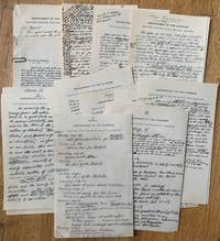
19240289701924. Manuscript. Good. octavo 51 pages written on letterhead of the Department of the Interior United States Geological Survey rectos only neatly inscribed in pencil and ink very good. This account appears to have been a draft and may have been intended for publication there are numerous corrections changes and emendations throughout the work. The unidentified author traveled by rail from Yellowstone to Seattle and from there to Alaska by steamer. The author visited Ketchikan Seward Anchorage Fairbanks where time was spent with the Mayor Valdez Juneau Prince William Sound Cordova Columbia Glacier etc. The author comments upon the events of the trip and gives interesting information on accommodations for tourists describes the scenery and topography a twelve page description of Columbia Glacier and also describes the towns and cities visited. "Valdez represents the tragedy of mining towns. It is really a dead mining town & it is a real tragedy to walk through and see the great number of vacant houses. Really it is hard to understand the lure of such a place." "Anchorage was created as an operating base for the construction of the railroad and has large permanent railroad yards & shops. It is the youngest and most up to date town in Alaska. For the tourist however it has little of interest." "Fairbanks a town almost exclusively of log cabins. the city is isolated because of its great distance from anywhere and people of the States do not care to spend so much time in traveling to reach the place." <br />
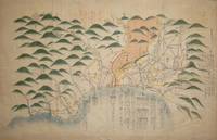
6624The focus of the map is Toyama a significant sea-port in what was once Etchu province on Honshu. The medium is ink on laid paper. A mid nineteenth century date has been suggested on stylistic grounds and the script is pre-Meji era. Toyama and the surrounding towns are shown in the yellow circles linked by red roads and regions are also named. It is unsigned on the back of the map is written 'Etchu Map'. Most of the text concerns distances a form of mileage table. There is a note top right which appears to indicate that the information in red is less certain than the information in black. Various other things are shown on the map: shrines and temples hot springs and a gate where travellers would have to show passports. Map unknown
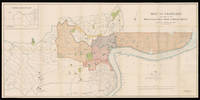
191315014Shanghai: North-China Daily News & Herald Limited 1st June 1913. 735 by 1510mm. 29 by 59.5 inches. A large English map of Shanghai dissected in 40 4 by 10 sections and mounted on linen folding map. Oriented with north towards the upper right. Top left includes an inset of "plan shewing the rubicon road system". Signed by Engineer and Surveyor. The North-China Daily News was an English-language newspaper in Shanghai China the most influential foreign newspaper of its time. The paper was founded as the weekly North-China Herald and was first published on 3 August 1850. Its founder British auctioneer Henry Shearman died in 1856. North-China Daily News & Herald Limited, unknown
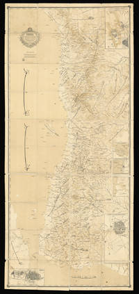
188615648Arabia 1886. 2435 by 1085mm. 95.75 by 42.75 inches. Lithograph dissected and mounted on linen in black and brown sea in sepia wash minor spotting or staining occasional wear to edges. A rare Arabic map of the Red Sea and Hejaz region. Despite the key role that the Arabian Peninsula and waters had played in Mediterranean trade for centuries European cartographers historically paid surprisingly little attention to the area. The lack of rivers and waterways made Arabia particularly difficult to chart but the exploration of the sixteenth and seventeenth centuries did see a number of new maps being produced. These however were generally littered with errors which were then compounded as later mapmakers drew on the inaccurate work of their predecessors. The eighteenth and nineteenth centuries however saw the rapid expansion of European empires giving rise to a renewed interest in foreign cultures and religions a trend that came to be known as 'Orientalism'. As a result explorers and cartographers began to venture further into the Arabian Peninsula undertaking expeditions to trace the deep-rooted incense trails and pilgrimage routes to the holy cities of Mecca and Medina. Maps began to appear showing the Hajj routes across the peninsula. After annexing Arabia during the sixteenth century the Ottoman Empire exerted various levels of influence; the emergence of Al Saud in the eighteenth century however introduced a rival power. In 1744 the founder of the dynasty Muhammad bin Saud had joined forces with the Wahhabi religious movement and their alliance soon lead to the rapid expansion of their territories and power. Although the first Saudi state was overcome by Mohammed Ali Pasha the Ottoman viceroy of Egypt in 1818 a second state continued to exist in the eastern region of Nejd. Al Saud rule over the Emirate of Nejd was contested throughout the nineteenth century by the Al Rashid dynasty. This map shows the southern portion of the Red Sea bordered on the east by the Arabian peninsula. The majority of the map is taken up by Hejaz the western region of Arabia where the two Holy Cities of Medina and Mecca are located. From 1845 Hejaz was under the direct control of the Ottomans governed by an appointed official known as the Sharif of Mecca. Ottoman influence persisted in the region until the early twentieth century when a popular revolt ousted them from power. In 1825 it was conquered by Ibn Saud who combined the kingdoms of Hejaz and Nejd in 1932 to form Saudi Arabia. Al Saud now controlled almost the entire Arabian peninsula with the exception of Yemen; Ibn Saud's attempts to claim Yemeni land sparked the war of 1934. Interestingly on the present map there is no national boundary drawn between Hejaz and Yemen probably because they were both subsumed under Ottoman control as part of the Egyptian Eyalet. The inset maps offer more detailed views of important cities and ports with two of the urban views depicting specific buildings and walls. Further inland where there were fewer significant settlements general areas are identified while towards the coast numerous towns rivers islands and harbours are labelled. At the bottom of the map the Horn of Africa is partially visible separated from Yemen by the Bab-el-Mandeb strait. We have been unable to trace any other examples of this map in institutions or at auction. unknown
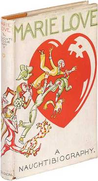
1925372309London: Robert Holden and Co 1925. Hardcover. Near Fine/Near Fine. First edition. Illustrated. Some modest foxing and slight cocking else near fine in a nice near fine dustwrapper with wraparound jacket art illustrated by "Benjamin" with a few short tears on the rear panel and a tiny chip. Fictionalized satire of English society. OCLC locates three copies with only one in the U.S. Robert Holden and Co hardcover
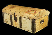
16902196Spain c1690. 320 by 740mm. 12.5 by 29.25 inches. Wooden chest clad in vellum manuscript maps with wrought iron handles rivets lock and clasp. A very unusual piece of cartographic history. It was common for seafarers to have sturdy wooden chests for storage whilst on a voyage but the owner of this chest chose to have it covered it with manuscript maps drawn on vellum possibly by their own hand with the decorative ironwork fitted on top. The lid is covered with a map of North and Central America with the Darien Isthmus labelled to the south and decorated with an elaborate compass rose and title cartouche supported by figures of Native Americans. The map on the front is decorated with a title cartouche showing a sea god. The sides are covered with maps of the East and West Indies decorated with ships. It is remarkable that the maps have survived given the treatment they would have encountered at sea. hardcover
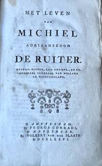
BB110081Hardcover marble cardboard binding with damages. Full title: Het leven van Michiel Adriaanszoon De Ruiter hertog ridder enz enz. en Lt. Admiraal Generaal van Holland en WestFriesland Amsterdam by Petrus Coradite Harlingen by Volkert van der Plaats 1776. Interior in good condition.Michiel de Ruyter 1607-1676 aka Michiel de Ruiter is a Dutch famous admiral. hardcover
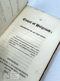
1822329Edinburgh: Macredie Skelly & Co 1822. First Edition. A good plus copy uncut in the publisher's original orange marbled boards with a printed paper spine label the spine worn and chipped with loss and hinges weak. Relatively scarce in the 21st century though an apparently popular work at the time which saw a second edition in the same year and a third edition in 1825. First edition of a scarce historical romance about Mary Queen of Scots published to coincide with the visit of George IV to Scotland in 1822 the first by a reigning monarch since that of Charles II in 1651.<br /> <br /> A work clearly brimming with Scottish nationalist sentiment the preface by the "authors" states the novel was "sketched some years ago" but was written "when a rumour arose that an unknown author of great power Sir Walter Scott in publishing The Abbott in 1820 was about to bring back to our ken the days and fortunes of Queen Mary."<br /> <br /> However disappointed that Scott only featured Mary while imprisoned rather than covering her reign this novel was published to show that a historical romance "could be used to serve the purposes of contemporary Scottish patriotism" offering "Mary as a sexily vulnerable icon around whom a brotherhood of modern national subjects are confidently expected to rally." Dobson Lost Mother LRB Vol. 22 No. 4 17 February 2000. <br /> <br /> 8vo. 2 v 1 9-194pp.; with the half-title. Garside 1822:4. Macredie, Skelly, & Co unknown
1949055016Kütahya 1949. Soft cover. Very Good. Original b/w photograph. 12x8 cm. Manuscript descriptive text in Ottoman Turkish on verso. Dated 1949. "Kütahya'da Gaybî Baba'nin dedesi Kalburcu Çiftligi'nde medfûn Pîr Ahmed Besir. Kabri nakl olunurken. 1949.". Original photograph shows the transfer of Pir Ahmed Besir A saint of Halwatiyya order's tomb and his bones in Kütahya city. He was the father of Müftî Dervish the grandfather of Gaybî Baba. He was born in Kütahya. He is a member of the Çavdarogullari family who settled in the Kalburcu village of Kütahya during the Germiyanoghuls period. He served for a long time a sufi named Cem Seyyah in Karaman and received an 'ijazat' from Sünbül Sinan Efendi the master of the Sünbüliyye branch of Halvetiyye sect in Istanbul. An interesting photograph showing his bones in his open tomb. <br/> <br/> paperback
18851776Cincinnati O.: Peter G. Thomson 1885. Cloth. Fine. Copyrighted 1885 by Peter G. Thomson. 24mo 5 ½" x 4 1/8"; 8pp; glazed cloth wrapper chromolithographed portrait vignette of a young girl set inside decorative borders on the front rear wrapper has a vignette of a young girl with a cat; two staple binding; an alphabet and the numbers one through zero are lithographed on the verso of the front wrapper; the alphabet is printed in black with three letters to each page excepting the last which is the recto of the rear wrapper; fine. This small ABC book with a bright and charming wrapper is decorated in the aesthetic style with large flowers at the corners and a stylized branching flower on the rear wrapper. Each letter is illustrated with a word from A Anchor through Z Zedu. Peter G. Thomson unknown
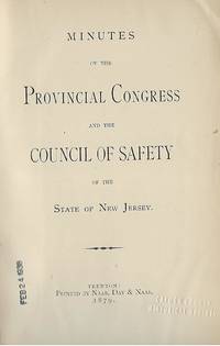
187958143Trenton: Naar Day & Naar; 1879. First Edition. 8vo. embossed black cloth spine stamped in gilt 618 pages. Very Good some wear cover with gilt bright; front hinge lightly cracked; small paper label base of spine; contents clean & tight. Naar, Day & Naar; unknown
17350227<p><strong><u>Attempted 'fake-news' to influence British opinion during the War of Polish Succession</u></strong><br /><br />viii pages numbered 9-62</p><p>Title-page and rear free end-paper a little darkened. Title-page with a small bookseller's notation in pencil. Slight fraying to rear lower edge of original cover. Very good condition.</p><p>ESTC: T041409. The Gentleman's Magazine: or Monthly Intelligencer vol. 5 for the year 1735 gives the date of publication as January 1735.</p><p>Dedicated to Lord Harrington then Secretary of State for the Northern Department later the Foreign Office under Prime Minister Robert Walpole this is purportedly a partial translation of a Spanish work entitled "<em>Meditaciones Morales sobre las Reynas Ministros y Confessores del Rey nuestro Sennor desde su veneda hasta estos Tiempos ; puestas en luz para la mayor Instruction y Edificacion de todos Hombres de Intendimento en nuestra querida aunque pobre y affligida Ispagna</em>." No date or author for this work is given and an extensive search of online databases has failed to find any reference to confirm the existence of such a work.</p><p>This supposed partial translation comes from an anonymous writer in "<em>want of Employment in a retreat I seldom stir from</em>" who accordingly "<em>bestow'd some time in learning Spanish</em>" from "<em>such Books as I might the easier understand</em>". Having said this the quality of the translation if that is what it is would have to be classed as of very good quality i.e. not that of an auto-didact.</p><p>The bulk of the text concerns Giulio Alberoni 1664– 1752 Italian cardinal and statesman in the service of Philip V of Spain and his influence upon Spanish diplomacy and domestic policy "<em>who it seems exceeded all others as well in Power as in the Abuse of it</em>."</p><p>The introductory dedication points out to Harrington that he had been a spectator to "<em>most of the Facts my author in this Extract relates or hints at</em>". Indeed as plain William Stanhope he acquired the Harrington title in 1730 he had served as a diplomat in Spain. Given that Alberoni had fallen from grace and was ordered to leave Spain in 1719 it might be wondered why anyone should feel the need to produce a short publication about him in 1735 Apart from vilification of Alberoni and tangentially his protegee the Duke of Ripperda the short-lived Prime Minister of Spain there may be a clue in the request to Harrington in the dedication that "<em>should You find them</em> i.e. the account of Spanish diplomacy and policy <em>to be true and worthy the Attention of THEIR MAJESTIES</em> i.e. King George II and Queen Caroline <em>You are likewise in a Station to make them cast a favourable Eye upon them which is the Height of my Ambition</em>." That this publication was produced in the midst of the War of Polish Succession 1733-1735 which ranged Spain and France against the Austrian Habsburgs likely provides the relevant context to the intentions of the 'translator' and likely author of the so-called extract.</p><p>British diplomatic policy during this period was beset by division between those who wanted to stay out of the conflict and bellicose pro-Austrians willing to intervene amongst whom were King George II and initially Harington. That Britain had remined neutral was in large part due to the stance of Prime Minister Walpole. The role that Britain should play if not as a combatant then as an arbiter was open to political jockeying for position. In February 1734 the British and Dutch had already offered to mediate peace talks between the various combatants. Publishing a text highlighting the weaknesses and past corruption of Spanish polity would at this time most likely be designed to give sustenance to the cause of promoting sympathy for the plight of Austria.</p><p><strong>As this is a high value item the actual shipping cost will be greater than that quoted for a standard shipment. Please contact me for details of actual shipping cost with signed for delivery.</strong></p> Printed for J. Purser, in Shoe-Lane, near Holbourn hardcover
19262327<p>New York: Gallia Laboratories Inc. 1926. <br /><br />Promotional pamphlet for Kola Astier a product possessing "remarkable curative and stimulative properties quite unknown to any other preparation." According to the manufacturer Gallia Laboratories Kola Astier builds muscular strength fights fatigue relieves depression and "melancholia" stimulates the heart and helps in combatting bronchitis pneumonia and "senile debility." It also acts we're told as a "remarkable regenerator" for "tired overworked men and women." <br /><br />Where did this cure for every ailment come from According to the company Dr. P. Astier recognized the amazing properties of the kola nut. "Long before the white man traversed the midnight jungles and the wild plains of mysterious Africa the natives were using the fruit of the Kola Tree to increase their physical stamina and powers of endurance. Finally when the first white explorers forced their way into the heart of the Dark Continent they too soon recognized the value of this gift of the Gods." <br /><br />This text is accompanied by an illustration of spear-wielding African warriors. Other illustrations depict runners an apparently sick office worker and an exhausted home maker. <br /><br />Unfortunately for the company the U.S. Agriculture Department determined that Kola Astier contained no ingredients capable of producing any therapeutic or curative effects claimed by the company. <br /><br />In March 1933 the U.S. Attorney for New Jersey sought the seizure of 199 bottles of Kola Astier Granulated charging misbranding in violation of federal rules. Analysis by the U.S. Agriculture Department showed that the product consisted essentially of sugar 97.3% and small proportions of plant material including kola. A federal district court ordered that the 199 bottles be destroyed. <br /><br />That judgment didn't stop Gallia Laboratories from promoting its miracle cure. In June 1943 the Federal Trade Commission charged the company with making false misleading and deceptive statements about its products. It ordered the company to stop claiming that Kola Astier had any therapeutic value in the treatment of any disorder. <br /><br />This pamphlet is rare. OCLC shows no institutional holdings. None in commerce.</p><p>PHYSICAL DETAILS: 24mo 5 1/2 x 4 1/4 inches; 138 x 107 mm 8 pages in stapled wrappers. <br /><br />CONDITION: Some staining soiling and a few small nicks to wrappers as well as rusting to staples. But the pages are clean bright and unmarked. A Very Good copy.</p> Gallia Laboratories, Inc.
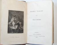
11941London: John Harris 1831. . iv 159 1pp. 18mo. Engraved frontispiece of "The Deserter" this dated Dec. 1830. A few tiny marks and spots but an unusually nice copy in the original red roan-backed marbled boards spine gilt-titled. First edition perhaps a sequel to Idle Hours Employed which Harris published in 1828 and reprinted this same year 1831. Among the stories here are in addition to "The Deserter" "Female Friends" "The East Indian" and "The Fairy’s Gift Revoked." Moon John Harris 558. London: John Harris, 1831. hardcover
186131860New York: Robert Carter & Brothers 1861. First Edition. Hardcover. One of the Carter's Fireside Library. 120pp. Blue decorated cloth stamped in blind on the sides and lettered and decorated in gold on the spine. Pale yellow endpapers. Frontispiece and five inserted plates with illustrations engraved by Felter and Williams. A few stains to cloth contemporary inscription on the front free endpaper. A solid very good copy. ; 24mo. Robert Carter & Brothers hardcover