[ANONYMOUS]Biblio.com
237 569 résultats
2113Maine. 24mo oblong 5 1/2" x 7"; 16 leaves. Thirty untitled b&w photos of various sizes in a small purchased construction paper-style album titled "Photographs" on the front and a label on the inside rear wrapper reads: "Ward's Souvenir Album. Made in LIght Gray and Dark Gray Leaves. This Book is No. 111." Photos are both mounted and laid in. The photos are of houses and farmland 3 contain farm animals in one a woman holds a baby 3 feature small boats in the water in one a woman is reading under a tree 3 feature horse and carriages including one with two young girls in a decorated cart and 7 show logging operations and log driving down a river. unknown
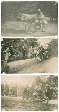
55639No place UK no date 1950s. A selection of Motorcycle trials and speedway event photographs being mostly postcard size black and white images examples detailing a meeting or meetings held in the 1950 s. One image has competition details to the rear 'J.B. HUNT N v S North versus South Oct 17th 1954' and another for competitor T.E. Cheshire riding 400cc machines. Photos remain in good condition. 18 images. Foremerly sold through C and T Auctioneers Tunbridge Wells. No place (UK), no date (1950s) unknown
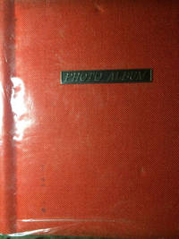
196143829N. P.: Privately photographed n. d. ca 1961. 1961. AUTOMOBILE. 12" x 10" red linen binder with title PHOTO ALBUM on a plaque and raised on front cover. A collection of 110 black and white photographs 3 1/2" x 3 1/2" glued to 20 thick cardboard sheets. Someone took the time to seek out and photograph vintage American-made automobiles where they were found. There are Fords Chevrolets Pontiacs Packards Studebakers Mercurys Plymouths La Salles Buicks Oldsmobiles etc. The photographs were taken in the 1960s through the early 1980s and are photographs of cars manufactured in the 1910 through 1940 time period. Some of the photographs have faded a bit but most are clear and easy to read. Overall a very good group. Spotting to several photos. Privately photographed, n. d. (ca 1961). unknown
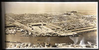
193845414N.P.: ca 1938-39. 1938-39. CALIFORNIA. Nineteen 9 1/8" x 18 3/4" sepia toned photographs of San Francisco housed in 10 3/4" x 20 1/2" black leather pebbled boards. Photographs are glued to thick black stock paper. 47 pp. though only 16 pages used. From various views one can see the San Francisco-Oakland Bay Bridge the San Mateo Bridge the High Street Bridge Alcatraz Yerba Buena Island the National Ice & Cold Storage Company and of course the Golden Gate Bridge. All photographs are clean and bright. Page edges with light wear. Cover boards with light dust and light rubbing to edges. Very good plus. ca 1938-39. hardcover
195045431N.P.: 1950 - 1953. 1950 - 1953. Photograph album containing 236 pictures glued to thick stock paper and housed in 8 1/2" x 10" red leather boards with gilt border and raised title Photographs. 114 pp. Contents. Photographs are mostly black and white or sepia toned and range in size from 2" x 3" to 5" x 4 1/2" with most being 3 1/2" x 5." First 15 photos are of the Canvey flood. When floods devastated large parts of the East Coast on January 31st and February 1st 1953 Canvey Island in Essex was one of the places that bore the brunt. Fifty-nine people died and 13000 were evacuated from their homes after floodwater engulfed the island. This group of photos is followed by 13 pictures of the lights on Southend Pier in Essex. Southend Pier is a major landmark in Southend-on-Sea. Extending 1.34 miles into the Thames Estuary it is the longest pleasure pier in the world. Additional pictures include Deal Dungeness the Goodwin sands Kingdown St. Margarets-at-Cliffe St. Margaret's Bay Dover Folkestone Hythe Romney Marsh Rye Tenby Pembroke Caldey Island Swanage Isle of Wight Port of Southampton etc. Photos include street scenes masts of ships lost on the Goodwin Sands castles rural scenes churches fishermen railroads and trains homes villages harbor scenes cliffs villagers etc. plus 11 port scenes showing the American liner "United States" pictures aboard the ship tugs leading the ship etc. Final photograph is of the ship "America" arriving in Southampton. Several of the photographs include people going about their lives. Captions neatly written in black ink throughout. All photos are clear and bright with minor edgewear to pages. Boards are lightly soiled and rubbed along with rubbing to board edges. Very good plus. A beautiful collection of nicely annotated photographs. 1950 - 1953. hardcover
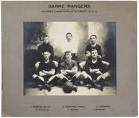
54436Barre VT. 1913. Mounted Photographs EARLY AMERICAN SOCCER TEAM winners of the Vermont League and the 5-A-Side Champions of Vermont in 1913. Four mounted black and white photographs. Three photographs of the fourteen team members as well as trainer secretary and mascot each in different attire. One photo of the five-a-side team with trainer. Two large photographs 43cm; 64cm with mount one medium 31cm 46cm with mount and one small 31cm 39cm with mount. The three larger photographs have titles printed to the mounts; two list the names of the team members. The smaller mount has glue stains to edges and reverse. Contained within the boards of a nineteenth century folio-sized atlas. All mounts bumped and rubbed to edges. Atlas boards heavily battered. A few small marks and blooming to photographs. Good. A rare collection of photographs documenting the winning team of the Vermont soccer league in 1913 the same year of the formation of the United States Football Association now U.S. Soccer and its entry into FIFA. The first president of USFA was G. Randolph Manning an Anglo-German migrant to the USA who was also influential in the popularisation of Association Football in Germany. The winning Vermont team here pictured was reportedly made up largely from Aberdonians who had migrated to Barre from Scotland to work in the granite quarries. [Barre, VT]. 1913 unknown
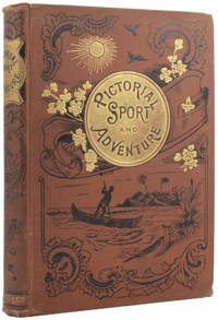
54714London: Frederick Warne and Co. no date 1898. True Adventure and Hunting EARLY EDITION. Large octavo 25 x 18cm pp.viii; 312. With a colour frontispiece and decorated title page and numerous engravings through the text. Publisher's brown cloth with gilt titles and black decoration to spine and upper board. Cracked-earth pattern to endpapers. Spotting and browning to preliminaries. Light rubbing and bumping to boards with some marks to lower. Spine toned and lightly pulled to head. Very good. London: Frederick Warne and Co., no date [1898] unknown
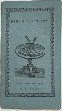
18382043Northampton Massachusetts: John Metcalf 1838. JUVENILE RELIGIOUS CHAPBOOK ILLUSTRATED. Front wrapper title: Bible History Northampton: J.H. Butler <br /> 24mo 5 ¼" x 2 7/8"; 24pp; blue wrapper vignette of a table with quill pens and two books on the front and printer's ornament border number "3" in upper right corner; engraved vignette of a man child holding a book and dog on the rear wrapper; publisher's string binding; fp and wood-engraved vignette on title page; alphabet and numbers 1-0 on verso title page; head-piece 18 small engraved illustrations; light foxing throughout; very good plus. First printed around 1828 by John Metcalf then located in Wendell Massachusetts this copy was after he moved to Northampton around 1833. Published with Johnathan Hunt Butler. A nice imprint of the alphabet and numbers precedes the introduction to the Bible stories. Eighteen nicely illustrated stories with Biblical chapter references follow: Death of Abel; The Flood; Abraham offers up Isaac; Pharaoh and his host drowned in the Red Sea; Samson slayeth the Lion; Samson carrieth away the gates of the city; Absalom slain; Solomon's Judgement; Elijah fed by Ravens; Elijah taken up to heaven Haman hanged; Shadrach Meshach and Abednego in the fiery Furnace; Simeon's Blessing; Joseph flies to Egypt; Woman of Samaria; Ship in a Storm; Judas betrays Christ; and Crucifixion. The final page is unillustrated and titled Christ's Resurrection. John Metcalf unknown
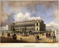
183528786München: Sauer 1835-40. Other. Altkoloriertes Albumblatt allseitig knapp auf die Einfassungslinie bzw. Bildlinie beschnitten. Gut erhalten und in dekorativem Altkolorit. 153 by 188mm 6 by 7 inches. Hand-Colored Original Lithograph by Anonymous depicting Pinakothek. Published München Sauer 1835. Sheet: 153 by 188mm 6 by 7 inches. A fine and original hand-colored example of Anonymous's celebrated cartographic work documenting this region of Germany with the precision and decorative artistry characteristic of the 18300s. Anonymous was a cartographer active in the 1800s working in the tradition of European copper-engraved cartography. Their maps are valued by collectors for their historical accuracy and decorative quality.This original lithograph with original hand coloring depicts the region of Pinakothek published in München Sauer 1835-40. The map records the political and geographic boundaries of the region as understood in 1835-40 offering a fascinating window into the history of German territorial organization. Sheet measures 153 by 188mm 6 by 7 inches. In good condition showing expected signs of age. Ready to frame. Sauer unknown
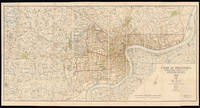
192815011London: Standford's Geog.l Establishment London 21st April 1928. 880 by 1660mm. 34.75 by 65.25 inches. A large coloured lithographed map showing the plan of Shanghai made in 1928. Signed by Commissioner of public works 44 4 by 11 sheets mounted on linen. The map depicts Shanghai city in 1928 with the French Settlements and Shanghai International Settlements hand-coloured in outline in brown and pink. Two lines noted below the title: 1. The Pootung shore is taken from surveys by the Whangpoo Conservancy Board. 2. The French settlement is taken from surveys by the French Municipal Council. The famous Whangpoo Huangpu river in Shanghai is prominently shown from the midpoint of the bottom edge sinuating upwards to the top right corner which divides the settlements to the left and Pootung Pudong to the right. Between the bank of the river and the French settlement are the 'Chinese city' and a district labeled 'Nan Tao' Nan Dao. The "Chinese city" is now called the "Old City" the traditional urban core of Shanghai. Its boundary was formerly defined by a defensive wall. The Old City was the county seat for the old county of Shanghai with the advent of foreign concessions in Shanghai it became just one part of Shanghai's urban core but continued for decades to be the seat of the Chinese authority in Shanghai. It was essentially coterminous with the old Nanshi District - Nan Dao which is now part of Huangpu District. In 1927 in a bid to establish a tangible Chinese authority in Shanghai the Republic of China government established the Special Municipality of Shanghai. The municipal government was moved out of the Old City to near Xujiahui. In 1928 Shanghai City the Old City was reduced to district status under the Special Municipality. In 1930 Shanghai County became a separate parallel administrative unit to the Special Municipality and the county government was moved out to Minhang. This was the end of the Old City's role as the seat of government of Shanghai. From 1928 the Old City was Hunan District; 'Hunan' literally meant 'southern Shanghai'. An exact copy of the map dated to the same day 21st April 1928 was published in Shanghai North-China Daily News and Herald Limited. by permission of the Municipal. It is signed by the same commissioner of public works. We are only aware of a single surviving example that in the Library of Congress Geography and Map Division Washington D.C. Publisher Edward Stanford 1827-1904 rose to prominence during the height of the Victorian age a period defined by technological innovation social upheaval literary excellence and world exploration. In 1853 Stanford became sole proprietor and expanded his shop to 7 and 8 Charing Cross whilst acquiring premises on Trinity Place for a printing works. This solidified Stanford's as the largest and only map maker and seller in London at a time when British colonialism the rise of the railways and the continuing popularity of the Grand Tour. Edward Stanford II took over in 1882 when Stanford's had become the sole agents for Ordnance Survey Maps in England and Wales and in 1887 published Stanford's London Atlas Of Universal Geography dedicated to Queen Victoria on the occasion of her Royal Jubilee and he received his royal warrant as Cartographer to the Queen in 1893. Edward Stanford II died in 1917 and his son Edward Fraser Stanford assumed control of the business in 1917. This map was made in the succeeding period between the wars which saw the company continue to innovate and encourage exploration. Standford's Geog.l Establishment, London, unknown
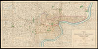
193215013Shanghai: Shanghai Municipal Council 27th October 1932. 860 by 1744mm. 33.75 by 68.75 inches. Coloured lithograph map dissected and laid on linen early ownership stamp of "John Pook & Co." in blank area folding into original cloth portfolio lettered in gilt 'General Map of Shanghai 1933' on spine. Acknowledgement is made of information obtained from the French Municipal Council the Shanghai City Government and the Whangpoo Conservancy Board. The map depicts Shanghai city in 1933 however the date printed on the bottom right corner is 27th October 1932. The round shape of the Old city is still clearly visible as in the Plan of Shanghai printed in 1928 it is labelled the "Chinese City" Similarly immediately to the north east and west is the French Concession and further to the north is the International Settlement. It is printed with a legend which includes: villages and developed property; creek; motor road; path and roads; and important buildings. Compared with the Plan of Shanghai printed in 1928 this map has much more information added most notably is that more villages and developed property are marked and identified using the relevant legend. We are only able to trace one other example of this map that in the British Library Map Collection. BL: Cartographic Items Maps X.3743. Shanghai Municipal Council, hardcover
0951043714.Ghardcover. Good. Access codes and supplements are not guaranteed with used items. May be an ex-library book. hardcover
1933B6955Baltimore: Increased Sales Inc. 1933. Light shelfwear. . Binding: Illustrated paper wraps staple-bound. Notes: A very good example of this book of magic tricks using coins. Each trick with accompanying illustration. With foreword anonymous. Size: 12mo.175 x 125 mm Pages: 24 pp. unnumbered. Category: Book Pastimes Games & Amusements; Increased Sales Inc. paperback
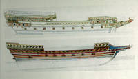
19350001301935. Textured Boards. Near Fine. Folio - over 12" - 15" tall. Various. Place unknown no publisher. Portfolio of ship illustrations circa 1935. Presumed private aggregation. Portfolio containing 7 matted ship illustrations. 14.5" x 11" portfolio and mats; plates vary but are generally 9.75" x 7.5" including margins. Textured brown boards with beige ribbon fasteners off-white mats color plates. Plates were probably excised from unknown nautical works of larger than octavo size in early to mid 1900's. 7 Illustrations of older ships and ship parts close-up of figureheads etc. Condition: Light sunning to portfolio spine tiny white paint speck to front board a few rubbed spots ribbon fasteners are crinkled some toning to edges of mats; near fine plates in better than very good portfolio. LBB-D <br/> <br/> hardcover
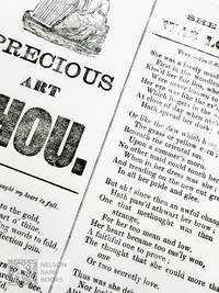
360n.p. n.d. Very good on thin wove. Scarce slip song ballads sheet. Not located in OCLC as of March 2024. Broadside Ballads Online Bod22943. unknown
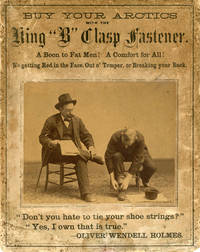
188048377n.p.: Privately printed n.d. ca 1880-1890. ca 1880-1890. 10" x 8" thick cardstock with 6" x 4 3/4" albumen photograph affixed. Advertisement for a shoe clasp which reads: "Buy Your Arctics with the King 'B' Clasp Fastener. A Boon to Fat Men! A Comfort for All! No getting Red in the Face Out o' Temper or Breaking your Back. 'Don't you hate to tie your shoe strings Yes I own that is true.' - Oliver Wendell Holmes." The photograph shows two men one pointing to the clasp on his boot and the other in the midst of using the shoe clasp. Heavy toning foxing and soiling and with chipping to edges. Photograph has moderate yellowing but still presents a crisp image. Good. A great advertisement for the Velcro of the 19th century. Privately printed, n.d. (ca 1880-1890). unknown
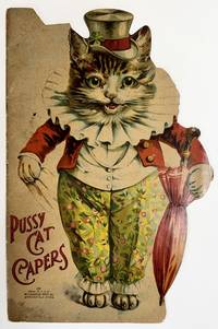
19202282Springfield Mass: McLoughlin Bros 1920. E. NISTER W. FOSTER Louis WAIN. JUVENILE SHAPE BOOK ILLUSTRATED RHYMING VERSE. Folio die-cut in the shape of a cat 13 3/8" x 8 7/8"; 8pp; glazed chromolithographed stiff die-cut wrapper in the shape of a cat with a top hat and umbrella on the front title in red "270"; rear wrapper has pictorial scene of a rock in water with trees; three staple binding; black line illustrations with orange accents illustrate some of the verse; 4 pages of chromolithographic illustrations with verse; old internal repair of folded spine bottom staple has let go of the gathering; spotting on front and rear wrapper; very good. OCLC locates 5 copies 4 in the U.S. and one in Canada. Dating of the book based on the OCLC cataloging and the purchase of McLoughlin Bros. publishing by the Milton Bradley Company of Springfield Mass. One of the black line illustrations is signed "E. Nister" for Ernest Nister the other is signed "W. Foster." The line drawings and the color pictorials are in the style of Louis Wain but are not signed. Common in this time for companies to "borrow" the illustrations without permission or credit. McLoughlin Bros unknown
19001427London: Ernest Nister 1900. Boards. Very good. POETRY. New York: E.P. Dutton & Co. Printed in Bavaria. 12mo square; 12pp; glazed color pictorial front board; tan shelf-back; textured paper stock; 4 full page chromolithograph illustrations b&w illustrations in text; light wear to boards age-toning to paper old repairs to 3 staple binding but holding; very good minus. Located in one OCLC library. Scarce. Delightful illustrations of cats and kittens with seven stories told in verse. Ernest Nister unknown
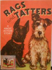
19362Racine Wisconsin: Whitman Publishing Co 1936. 1st Edition. Stiff boards. Near fine. 4to; 18pp; color pictorial wrappers on stiff board; 3 staple binding; 3 color illustrated pop-up; light ink bleed through from some illustrations small scuff to white dog face light age toning of paper; near fine. Only 3 located in WorldCat libraries. Charming story of two mischievous dogs with three color pop-ups. Whitman Publishing Co unknown
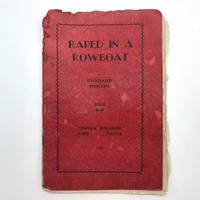
1935015873Paris France: Contiour Publishing 1935. Soft cover. Fair. Stapled in red thin-card wrapper with title printed n the front cover. A well-worn copy of a scarce title. A few leaves are loose. Soft frayed edges all around. 32 pages. Six photographs including frontispiece and ten illustrations. 21 x 13.5 cm. The explicitly erotic adventures of a young woman 'Flora' which begins with accounts of sexual trysts with her cousin including a narrative on advantages of the various positions they enjoyed. In conversation with her companion Aldabella she discusses contraception marital aids and how a jilted john took exception and arranged for her to be abducted flagellated and raped by twenty-five men. Contiour Publishing paperback
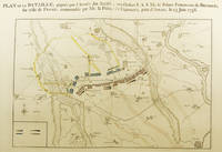
49511Amsterdam: J. G. Treuttel 1789. Seven Years War DUKE OF GRAFTON'S COPY. Folio 42 x 27cm pp.4 followed by 19 plates. Contemporary marbled boards paper covered spine designed to look like speckled calf printed paper label to spine. Introductory text in French text to plates in either English or French. A collection of plates pertaining to the Seven Years War. The Plates are as follows: I. Hand-coloured folding plan of the Battle of Lowostiz 1st October 1756. II. Hand -coloured folding plan of the Siege of Pirna 1756. III. Hand-coloured folding plan of the Battle of Reichenberg 21st April 1757. IV. Hand-coloured folding plan of the Battle of Prague 6th May 1757. V. Hand-coloured folding plan of the Siege of Prague 7th May to 19th June 1757. VI. Hand-coloured folding plan of the Battle of Chotzemitz 18th June 1757. VII. Hand-coloured folding plan of the Battle of Jaegerndorf 30th August 1757. VIII. Hand-coloured folding plan of the Battle of Rosbach 5th November 1757. IX. Hand-coloured folding plan of the Siege of Schweidnitz 1757. X. Hand-coloured folding plan of the Battle of Breslau 22nd November 1757. XI. Hand-coloured folding plan of the Battle of Leuthen 5th December 1757. XII. Hand-coloured folding plan of the Battle of Krefeld 23rd June 1758. XIII. Hand-coloured folding plan of the Battle of Minden 1st August 1759. XIV. Hand-coloured folding plan of the Battle of Hastenbeck 26th July 1757. XV. Hand-coloured folding plan of the Battle of Bergen 13th April 1759. XVI. Plan of Stralsund. XVII. Plan of Erfurt. XVIII. Plan of Dresden. XIX. Hand-coloured list of the troops of the King of Prussia. Some spotting to prelims bookplate of Wakefield Lodge to front pastedown Binding has some light wear to extremities with some loss of the paper to the upper board and spine. Very good. A nice provenance with the bookplate of Wakefield Lodge the Northamptonshire seat of the 3rd Duke of Grafton Augustus FitzRoy who served as Prime Minister between 1768-1770 but was forced out of office due with growing challenges to British global dominance after victory in the Seven Years War in particular the failure to intervene of the French annexation of Corsica in 1769. Amsterdam: J. G. Treuttel, 1789 unknown
1874JC17699New York: Press of Bible and Publication Society 1874. Paperback. Fair. Original wraps. 19 pp. Briefly and anonymously inscribed by the author at the top. Last leaf detached. SOLD AS IS. <br/><br/> Press of Bible and Publication Society paperback
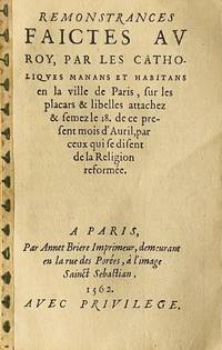
15622555A Paris: Par Annet Briere Imprimeur demeurant en la rue des Porées à l’image Sainct Sebastian 1562. First edition. Papered spine. In fine condition. First edition. Papered spine. ff. 4. <p><p><br /> First edition of this scarce Catholic attack on the Huguenots an important document of the French Wars of Religion.<br /> <p><p><br /> An anonymously published Catholic attack on the Huguenots who distribute placards and libels against orthodoxy. The prohibition of such defamatory publications was one of the main provisions of the 1562 Edict of January.<br /> <p><br /> Scarce USTC and FB French Vernacular Books list only one copy under the exact title which contains “manans et habitans en la ville†however it seems that the other title 6 copies lacking the aforementioned words in the bibliographies is in fact the same.<br /> USTC 27669 and 74708; FB 40754 and 40753. Par Annet Briere Imprimeur, demeurant en la rue des Porées, à l’image Sainct Sebastian unknown
19008184<p>London 1900. A handmade photograph album in a book meant for charcoal sketching highlights women's studies at the Royal College of Art. The photographs inside give a candid glimpse into the co- educational student life at the Royal College of Art in the early 20th century. It also reveals that there were a few students of colour at the School during this period. Originally founded in 1837 as the National School of Design the College was established to train art teachers as well as provide instruction on fine and decorative art to students.</p><p>The album includes many photographic portraits of people in historical costume most of whom are women as well as formal and informal group photographs. Few of the photographs in the album have labels. However it is clear that artist and occultist Austin Osman Spare who attended the Royal College of Art between 1904 and 1906 is in several of the group photographs including one showing the Royal College of Art football team 1909-1910. Most of the individual photographs are of women presumably students at the school. One as yet unidentified woman in particular appears in multiple photographs including a recreation of the one of 18th century French artist Elisabeth Vigee Le Brun's famous self portraits.</p><p>During the period covered in the album there were a large number of women students attending the School who would later become noted sculptors artists and illustrators. These include: Margaret Winser Jess M. Lawson Margaret Jameson Helen Margaret Mackenzie Anne Crawford Acheson Dorothy Stanton Wise Louise E. Jacobs Amy K. Browning Maggie Richardson and Sylvia Pankhurst. Pankhurst studied at the RCA at the same time as Austin Osman Spare and in 1911 reported on the dire finances of RCA scholarship students.</p><p>Winsor & Newton Sketch Book Series 40 brown paper boards. 48 pages in a sewn binding. 86 photographs some loose others secured in celluloid corner mounts. 30.5 x 24cm. Tape repair to cover. Cover separated along the spine sewn binding holding sketchbook pages intact.</p><p>A fascinating insight into student life at the RCA during one of its most luminous periods and a valuable resource for those seeking traces of this lost generation of artists.</p> hardcover
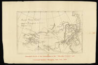
188015229Shanghai 1880. 400 by 530mm. 15.75 by 20.75 inches. The Chinese-Russian frontiers Three lithograph maps. The growing number of expatriates servicemen and foreign workers based in China during the late-nineteenth century prompted numerous publishers to set up foreign-language periodicals to cater to the international community. Several English newspapers appeared including the 'Evening Gazette' the 'Shanghai Courier' the 'China Gazette' the 'Mercury' and 'The Celestial Empire'. These publications documented an important period in Chinese history as incursions from Japanese Russian British and Ottoman forces each took their toll. During the mid-nineteenth century the Chinese and Russian empires expanded into what is now Kazakhstan and Western Xinjiang. Upon meeting the powers both signed the Treaty of Kulka in 1851 which legalised trade between both countries in the region. During the Second Opium War however Russia took advantage of China's weakened position and annexed the north back of the Amur River and the coast down to the Korean border while also gaining control of Sakhalin Island alongside Japan. Tensions remained high throughout the 1860s and 1870s. In 1868 Russia launched its first attempt to expel the Chinese from the territory resulting in the Manza War in which they were ultimately unsuccessful. The Chinese General Zuo Zongtang called for war against Russia and in 1878 began to amass troops causing his opponents to retreat from the city of Kuldja which they were besieging and demonstrating that the Chinese had built up a modernised arsenal of weaponry since their last conflict. In fact in 1880 huge quantities of military equipment were shipped to China from Europe. It is this period of tension shown on the present maps which were included with editions of 'The Celestial Empire' and the 'Shanghai Courier' in 1880 as noted in red beneath the images. The first is a map of the Chinese-Russian frontiers with Mongolia and Manchuria clearly identified in the centre and many other important cities rivers mountains and roads represented. The second shows the Kuldja Triangle in modern-day Kazakhstan which was the centre of the conflict in which Chinese troops forced out the occupying Russians. The contemporary frontier according to Russia sources is contrasted against the frontier of ten years earlier. The final map focuses on "The Russian Province of Fergana and the Pamir Plateau showing the adjacent Chinese Territory and Indian Frontier according to Russian Surveys in 1878 and 1879". Mountains cities rivers roads and lakes are represented with elevation given in feet. unknown