12 324 résultats
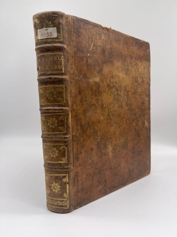
017376[Jansénisme] Nouvelles ecclésiastiques ou mémoires pour servir à l'histoire de la Constitution Unigenitus pour l'année M.DCC.XLIX., M.DCC.L et M.DCC.LI Paris, s.n., 1749-1751. In-4, 208-208-204p. Trois années de cet important journal, la dernière étant incomplète (elle devrait avoir 208p). A la fin se trouvent des numéros éparses dont les pages 1 à 32 et 81 à 84 de 1752, 145 à 148 de 1732, 169 à 172 et 177 à 180 de 1753, 141 à 148, 153 à 160, 85 à 88, 61 à 68, 137 à 140, 181 à 184, 193 à196 de 1756. Plein veau, dos à nerfs orné, pièce de titre tranches rouges. Mors supérieur fendu en tête, manque à une coupe, quelques manques marginaux, quelques déchirures dans les numéros supplémentaires.
Very Good Turkish Original wrappers. Roy. 8vo. (23 x 15,5 cm). In Turkish. 117 p. Uncommon enlarged second edition of this account of the Russo-Japanese War in 1905 describing rising Japanese nationalism at the beginning of the 20th century, by Demirhan (1871-1964), sent with reference of Goltz Pasha (Colmar von der Goltz, 1843-1916) to Manchuria to observe the war in the ranks of the Japanese army as a Turkish colonel. He stayed for two months in Japan and more than a year in Manchuria. In addition to writing down his observations in the field of war in detail, he also took on the duty of ambassador due to the Ottoman Empire's lack of diplomatic relations with Japan and contributed to the development of relations between the two countries. He received a medal from the Japanese Emperor Meiji and returned home with the gifts that Emperor Meiji presented to Sultan Abdulhamid. His account was published first in 1937 in book form. Sait Pertev Demirhan, (1871-1964), was a Turkish soldier and politician. He is a graduate of Erkân-i Harbiye. He was an author, intellectual, Erkân-i Harbiye School teacher, 6. Army chief of staff, Harbiye Undersecretariat, 3rd Army Chief of Staff, 1st Corps, and 4. Corps Commands, Military Schools Inspector, Member of History and Geography Councils, Member of Military Appeals Court, a deputy of Erzurum. He was the son of Yanyali Mustafa Pasha. He graduated from Harbiye as a staff captain (1892). In 1894 he was sent to Germany to advance his military education. After being a colonel, he was appointed to the Staff School as a teacher (1904). He was sent to the Russo-Japanese War as an observer. He returned to Istanbul in 1906 and was promoted to "Pasha", and was appointed as the 6th Army Chief of Staff. He participated in the Balkan Wars (1912-1913) and was in the Caucasian Theater during the First World War. He was sent to Vienna as a military diplomat. Upon his return, he moved to Anatolia to participate in the Greco-Turkish War (1919-1922). Only three copies are located in OCLC, two copies are in Turkish libraries, and one is in a German library; not in the US libraries. OCLC 60522483.
Very Good German Original color lithograph maps in 7 special cloth cases. Cases large 8vo., only seventh one is smaller which is covered by European marbling. Bookseller and bibliothek stamps on some maps, plans and sketches; and cases interior. A fine map collection. Contents: V.1: Includes 1 map, 2 plans and 5 skecthes, 1 uebersichtskarte. Uebersichtskarte für die Geschichte des Iten und IIten schlesisschen Krieges von 1740-1745. Kriege Friedrichs des Grossen. 1/740000. 73x81 cm.; Plan zur Erstürmung von Glogam am 9 Marz 1741 (Entworfen nach alten Planen). 1/6250 / 1/100000. 48x52 cm; Plan der Schlach bei Mollwitz am 10 April 1741. 1/25000. 43x59 cm.; (Skizze) Stellung der preussischen und oesterreichischen Truppenam, 3 Januar 1741. 1/740000. 30x30 cm.; Skizze zum Scharmützel bei Ellguth und zum Gefecht bei Ottomachall am 9. Januar 1741. 1/67500. 34x26 cm.; Skizze zu den Winterquartieren des preussen mit Stellung der Truppen am 20 Februar 1741. 1/740000. 46x52 cm.; Skizze zum Ueberfall bei Baumgarten am 27 Feb. 1741. 1/50000. 29x34 cm.; Marsch der oesterreichischen Armee unter F. M. Neipperg und der preussischen Truppen unter dem Könige von der Schlacht bei Mollwitz. 1/1480000. 36x42 cm.; [.] Standorte des preussischen Heeres bei Ausbruch des Krieges 1740. 1/2400000. 34x55 cm.; V.2: 12 pieces: 3 uebersichtskarten, 2 planen, 7 skizzen. ... von Europa im Jahre 1756. 1/18000000. 33x46 cm.; ... des südöstlichen Kriegsschauplatzes. 1/740000. 65x95 cm.; Standorte des preussischen uns sachsischen Heeres und Stellung des oestreichischen Truppen in Böhmen, Mahren, oestrç Schlesen und Erzth. oesterreich var Beginn des siebenjahrigen Krieges. 1/2200000. 56x72 cm.; Plan der Schlacht bei Lobositz am 1. Oktober 1756. Verlauf des Schlact bis etwa 12 Uhr Mittags. 1/25000. 47x60cm (Also includes Plan der 2ten Attacke des preussischen Kavallerie and Skizze des beiderseitigen Vormarsches am 30ten September 1756).; ... Weiterer Verlaufdes Schlact bis etwa 3 Uhr Nachtmittags. 1/25000. 47x60 cm.; Skizzen: 1. Vormarssch 28. 8 bis 10.9.56. 2.-3. Pirna 1.10.56. 4. Bewegungen Schwerins 56. 5. Pirna 10.10.56. 6. Pirna 12.10.56. 7. Pirna 13.10.56. V.3: 5 skizzen (No: 8-12) und 3 plannen (No: 3, 4-A, 4-B). Plan 4-A-4-B: Prag, 6.5.1757.; Plan 3: Reichenberg, 21.4.57. Skizze 8: Postrungen und Winterquartiere Dezember 56 (Huge size).; Versammlung der Heere, Marz und April 57.; Einmarsch bis 30.4.57.; Stellungen am 1.5.57.; Stellungen am 5.5.57. V.4: Karten 1,2,3,5 (4 is missing); skies 31,32; uebersichtskarte 5; Plan 12-B. ... des nordöstlischen Kriegsschauplatzes (Huge size).; Skizze 31: Heeresbewegungen vom 11.11.57 bs zum Einrücken in die Winterquartiere, Winter 1757-58.; (World War 1): Karte 1: Belgien und nordost-frankreich. Ostpreussen, polen, kurland, Weissrussland.; Galizien und Wolkynien.; Kleinasien , Schweizes Meer, Kaukasien, Kurdistan, Armenien, Aserbeidschan, Arabier, Mittellandisches Meer: Vordasien map. V.5: Sizzen 20-24 - Planen 6-A, 6-B - 9. Planen: Gr. Jagersdorf, 30.8.57.; Jager b. Goerlitz, 31.8.-9.9.57. Moys, 7.9.57.; Breslau, 22.11.57.; Schweidnitz, 24.10-12.11.57.; Skizze 20: Feldzung in ostpreussen Vormarsch des russischen Heeres bis 6.7.57.; 21: Heeresbewegungen vom 6.7.57 bis zur Schlact bei Gr. Jagersdorf. 22: ... nach der Schlact bei Gr.-Jagersdorf bis zum Schluss.; 23: Bewegungen i. d. Lausitz u. i. Schleisen, 20.8.-30.11.57.; 24: Lager bei Liegnitz, 19.-27.9.57. V.6: Plan 5-A, 5-B - Skizzen no: 13-19. Plans: Kolin, 18.6.57.; Kolin, 18.6.57.; Skizzen 13: Beiderseitige Stellungen 8.5.57.; 14: Operationen Beverns u. d. Königs gegen Daun 10.5.-17.6.57.; Bewegungen vom 20.6.-1.7.57. Stellungen vom 1.7.57.; Rechten Elbufer in der ersten Halfte des Juli 1757.; ... vor Zittau, 12.-20.8.57. V.7: 4 plans in cloth covered with European marbling. These last 4 plans from "Suworow und Polens untergang. Nach archivalischen Quellen dargestellt" von Friedrich von Smitt, 1858 First Edition. Pl. 1: Der Schlact am Rymnik den 11/22 Septeember 1789. Pl. 2: ... der
Very Good Turkish, Ottoman (1500-1928) Original manuscript book of the registers of the conjurations sessions by the first Turkish spiritualist group. 20x15 cm. In Ottoman script (Turkish with Arabic letters). [154] p., several hand-drawn ills. Group has Bedri Ruhselman, (1898-1960), Albert Braun, (Violinist and Ruhselman's violin teacher of German origin), Hans Ianma (Violin teacher), Hasan Saadeddin Bey, (Turkish spiritualist), and Doctor Zühdü Riza Bey, (Turkish musician, Kemençe teacher, a friend of Sadeddin Arel). Dr. Bedri Ruhselman (1898-1960), the founder of NeoSpiritism and "the Experimental New Spiritism". Ruhselman's point of view and a new perspective to the concepts such as creation, spirit, afterlife, birth incarnation, and rebirth-reincarnation are pioneers in the Early Turkish Republican period. Ruhselman's empirical perspective on "afterlife", one of the most important and primary subjects of theology, has made important contributions to spiritism, out of the classical standpoint. (Source: Ruhselman and his metaphysical vision, Kestel). Albert Braun was Ruhselman's violin teacher and his friend. It's said this early spiritualist group is the pioneer and elitist of Neo-Spiritualism in Turkey. He is considered a Mission Medium, a very rare category within spiritual mediumship. By definition, every medium has a varying degree of ability to tune in to spiritual "frequencies". But not all "reception" (coming from those frequencies) convey a meaningful message (sometimes if any). While mediumship is a gift (meaning that; one either has it or not); very few mediums are actually knowledgeable in spiritual matters. They simply transfer what they capture from their sensitive channels. And once in a while, mainstream media picks on certain mediums, especially when he/she delivers sensational predictions (i.e. Edgar Cayce). Bedri Ruhselman's both interest and gift was manifested since his early childhood. He was conducting spiritual sessions when he was only 12 years old. While continuing his musical education in the Prague Conservatory, in the 1920s, he studied the pioneers of classic spiritualism like Allen Kardec, Gustave Geley, Charles Richet, Leon Denis, William Crooks and become experienced in hypnotism and spiritual sessions. He also completed his medical education and graduated as a medical doctor. In 1950 by establishing Metapsychic Investigations and Scientific Research Society, he gifted an institutional identity to Neo-Spiritualism. His true duty started in 1958 by means of spiritual sessions with a guide being from higher spiritual plans which identified itself as "The Master". Ruhselman and his carefully selected mediums received a vast amount of knowledge via these sessions during a few months. That body of knowledge has been compiled as a book, which Ruhselman never claimed any ownership (stating that it's purely a gift from the higher spiritual plan). The plan has instructed that; the book was only to be released in the future - to be identified by a certain sign. That point alone commends recognition for pure selfless devotion towards undertaken duty. If the ego was in play; one would usually do anything for fame or at least to cash on the subject. But Ruhselman completes his true duty and hands over the book for safekeeping without ever mentioning one word about the content. He passes away a few months after (1960). (Source: Indication23). This manuscript includes their registers of the conjurations sessions with some illustrations which have "table order" of the sessions at a house in Sisli, Istanbul. In the illustrations, given the locations of the goods in the room like piano, wardrobe, chair, etc. Registers including the sessions between the years of 1935-1936. Scripts were written by M. Zühdü Pektas mostly, by various fountain pens with blue and black inks. Some registers are taken by a pencil. An extremely rare stylish manuscript. Unpublished.
Very Good Turkish, Ottoman (1500-1928) Original color map. Atlas folio. (65 x 44 cm). In Ottoman script. Scale: 1/400.000. [MAP] Kars, Kutayisi, Tiflis, Batum. [Kars, Kutaisi, Tbilis, Batoum]. Extremely rare. Not in TBMM Library Map collection.
Very Good Turkish, Ottoman (1500-1928) Original map. Oblong elephant folio. (50 x 60 cm). In Ottoman script. Scale: 1/200.000. [MAP of Ankara city]. Ankara. Gerede, Keskin, Sivrihisar. A rare Ottoman map printed in last period shows Ankara city with detailed place names. This is one the serie of the Bonn projection maps which are the first map series in modern techniques in Turkey and the Ottoman Empire. In order to produce these maps covering Turkish territory, Reconnaissance Branch was incorporated into The Mapping Commission. The maps were produced in the datum based on the latitude and longitude of Ayasofya Mosque in equal area Bonn Projection. The field works for the 123 sheets covering the country were conducted by 76 staff. The production was completed in 18 years starting from east west. Field works continued without stopping except in years 1914 and 1920. This map series called also reconnaissance maps contributed a lot to producing 1:25.000 scale maps.
Very Good Turkish, Ottoman (1500-1928) Original color map. Atlas folio. (65 x 45 cm). In Ottoman script. [MAP of CAUCASIA: GEORGIA - ARMENIA] Tiflis, Erivan, Kutayisi. [Tbilisi, Yerevan, Kutaisi]. Not in TBMM Library Map Collection. Extremely rare.
Very Good Turkish, Ottoman (1500-1928) Original color map. Atlas folio. (56 x 46 cm). In Ottoman script. [MAP of CAUCASIA] Bepagliya, Batum, Yeysk. [Pelapaglia, Batoum, Yeysk]. Not in TBMM Library Map Collection. Extremely rare.
Very Good Turkish, Ottoman (1500-1928) Original color map. Atlas folio. (55 x 46 cm). In Ottoman script. Scale: 1/400.000. [OTTOMAN MAP of CAUCASIA] Yekaterinodar - Yeysk - Maykob - Anapa. Shows Krasnodar, Maikop, Yeysk, Anapa and shores of Black Sea. At northeast, map shows Kuban river (Kuban nehri) and its basin in Circassia (Republic of Adygea). Maykop is the capital city of the Republic of Adygea in Russia, located on the right bank of the Belaya River (a tributary of the Kuban River). Yekaterinodar (Krasnodar) at north of map, near to Maykop. From northwest to south east, map shows Black Sea shores of the extensive area with interesting details in Ottoman Turkish script. Also shown Belaya, Chokhrak and Dakh Rivers in addition all south land of Krasnodar Krai of the Northwestern Caucasus until southern Georgian borders and Georgia. Almost all toponyms are in Ottoman Turkish.
Very Good Turkish, Ottoman (1500-1928) Original color map. Atlas folio. (66 x 46 cm). In Ottoman script. Scale: 1/400.000. [MAP of GEORGIA - SHORES of BLACK SEA] Batum, Keskim, Kutayisi. [Batoum, Kutaisi, Keskim]. Shows all toponym of shores of Black Sea of Georgia including Ottoman fortresses, villages etc. Not in TBMM Library Map Collection. Extremely rare.
Very Good Turkish, Ottoman (1500-1928) Original map. Oblong elephant folio. (50 x 60 cm). In Ottoman script. Scale: 1/200.000. [MAP of Kharpout]. Harput. Dersim, Palu, Malatya, Siverek. Rare Ottoman map shows Elaziz (Elazig), Dersim, ancient Harput et environment. This is one the serie of the Bonn projection maps which are the first map series in modern techniques in Turkey and the Ottoman Empire. This is one the serie of the Bonn projection maps which are the first map series in modern techniques in Turkey and the Ottoman Empire. In order to produce these maps covering Turkish territory, Reconnaissance Branch was incorporated into The Mapping Commission. The maps were produced in the datum based on the latitude and longitude of Ayasofya Mosque in equal area Bonn Projection. The field works for the 123 sheets covering the country were conducted by 76 staff. The production was completed in 18 years starting from east west. Field works continued without stopping except in years 1914 and 1920. This map series called also reconnaissance maps contributed a lot to producing 1:25.000 scale maps.
Very Good Turkish, Ottoman (1500-1928) Original color map. Elephant folio. (60 x 50 cm). In Ottoman script. Scale: 1/300.000. [MAP of KRASNODAR - YEYSK] Yeysk. Bedlapaglia, Yekaterinodar, Anapa. Shows Yeysk, a port and a resort town in Krasnodar Krai, Russia, situated on the shore of the Taganrog Gulf of the Sea of Azov in north, Yekaterinodar (Krasnodar) in south, Anapa (Bigurkal) etc.
Very Good Turkish, Ottoman (1500-1928) Original color map. Elephant folio. (60 x 50 cm). In Ottoman script. Scale: 1/300.000. [MAP of KRASNODAR - YEYSK] Yeysk. Bedlapaglia, Yekaterinodar, Anapa. Shows Yeysk, a port and a resort town in Krasnodar Krai, Russia, situated on the shore of the Taganrog Gulf of the Sea of Azov in north, Yekaterinodar (Krasnodar) in south, Anapa (Bigurkal) etc.
Very Good Turkish, Ottoman (1500-1928) Original color map. Atlas folio. (77 x 100 cm). In Ottoman script. Scale: 1/840.000. [MAP] Mufassal Büyük Sark Vilâyeti, Dogu Karadeniz kiyilari, Van Gölü, Gürcistan, Ermenistan [General map of East Province of Ottoman Empire, Eastern Black Sea coasts, Georgia, Armenia, Eastern borders, Van Lake]. Detailed place names. Extremely rare.
Good Good English Paperback. Pbo. Dust wrapper. Roy. 8vo. (23 x 16 cm). In French. 10 volumes: ([iv], 436 p.; [viii], 390, [1] p.; [x], 387 p.; [viii], 421, [1] p.; [12], [iv], 509, [1] p.; [x], 462, [1] p.; [viii], [iv], 498, [1] p.; [viii], 563, [3] p.; [4], [iv], 382, [1] p.; [viii], 389, [1] p.). French Edition of Churchill's 'Second World War': [Memoires sur la] Le Deuxieme Guerre mondiale. 10 volumes. [Second World War]. Vol. I: L'orage approche. D'une Guerre a l'autre, 1919-1939. Vol. II: La 'drôle de Guerre'. Vol. III: L'heure tragique. Mai-Decembre 1940, La chute de la France. Vol. IV: Seuls. Vol. V: Le grande alliance. La Russie envahie, 1er Janvier - 22 Juin 1941. Vol. VI: L'Amerique en guerre. 23 Juin 1941 - 17 Janvier 1942. Vol. VII: Le tournant du destin. La ruee Japonaise, 18 Janvier - 3 Juillet 1942. Vol. VIII: L'Afrique sauvee. 4 Juillet 1942 - 5 Juin 1943. Vol. IX: L'Etau se referme. L'Italie capitule. 6 Juin - 12 Novembre 1943. Vol. X: De Teheran a Rome. 13 Novembre 1943 - 5 Juin 1944.
Very Good Armenian Paperback. Cr. 8vo. (19 x 13 cm). In Armenian. 5 volumes set: (1035 p.). Cr. 8vo. (19 x 13 cm). Signed and dedicated by the author Rober Haddeler to Armenian female painter Kristin Saleri. Rober Haddeciyan also known as Rober Haddeler, is an Armenian writer, playwright, and since 1967 editor-in-chief of Marmara, an Armenian-language daily newspaper. Marmara (also known as Nor Marmara) is published six times a week (daily except Sundays). Circulation is reported at 2,200 per issue. Rober Haddeciyan was born in 1926 in the district of Bakirköy in Istanbul, Turkey, to Avedis Haddeciyan and Siranush. He graduated from the Pangalti Armenian Mkhitarist High School in 1944 and is an Istanbul University Faculty of Letters Department of Philosophy graduate. Haddeciyan, who was already working for Marmara as a journalist, became the editor-in-chief of the newspaper in 1967. His columns in Nor Marmara are translated into Turkish by his daughter-in-law Karolin Haddeler and published in the weekly Turkish supplement. He has published 50 to 60 books so far. One of his most famous books is his novel Arasdagh (i.e. Ceiling), which has also been published in Turkish under the title "Tavan". In 2011, on the occasion of the 20th anniversary of the Republic of Armenia's Independence, President Serzh Sargsyan awarded Haddeciyan the Mesrob Mashdots Medal for his contributions to Armenian literature, theater, and journalism. Kristin Saleri, (1915-2006), was a prominent 20th century Turkish artist of Armenian descent, recognized as a child prodigy at an early age. She received her initial art training from Prof. DeMille and Feyhaman Duran Studio at the Istanbul Academy of Fine Arts and later under the tutelage of artist André Lhote in Paris. (In this rare archival footage from 1953, we get a glimpse of André Lhote's studio. A prolific artist, she has produced over 3,000 (the exact number being unknown) pieces of art during her long career in Istanbul. Oil paintings made up her predominant art medium while ceramics, glass, and charcoal providing alternative, albeit equally creative channels of artistic expression. She held 40 plus private shows (first in 1956, last in 1997 both in Istanbul) and contributed to 600 group exhibitions around the globe including Ankara, London, Paris, Brussels, Athens, Frankfurt and Washington D.C. Her works have been acquired by Istanbul Painting and Sculpture Museum, Ankara State Museum, Paris Centre Pompidou: Musée National d'Art Moderne, Calouste Gulbenkian Foundation Lisbon, and numerous private collectors worldwide. She was apolitical, yet, undeterred by the huge hurdles of being a female minority artist in a period of social and ethnic strain in post World War II Turkey. Saleri became a leading force in the Turkish art community- co-founder of International Turkish Female Artists Association (1965), co-chair of Turkish Painters Association and used her art to convey a message of modern feminism. Kristin Saleri's art represented an inexplicably harmonious blend of Eastern mysticism with Western impressionism fused through a variety of themes-music, whirling dervishes, folklore, trees of love, Anatolian women, children -- which in her words "...were nothing but metaphors for life in different shapes.". (Source: Kristin Saleri: Official website of painter, Biography).
1970615611970 Genève, Edito-Service (Cercle du bibliophile), sans date (vers 1970), 12 volumes in 8° reliés plein cuir bleu orné de l'éditeur, têtes dorées, médaillon de Churchill doré en relief sur les plats supérieurs ; plus de 500 illustrations photographiques hors-texte ; infimes frottis.
Very Good Turkish, Ottoman (1500-1928) Original illustrated wrappers. Cr. 8vo. (20 x 13 cm). In Ottoman script (Old Turkish with Arabic letters). 220, [2] p., 41 unnumbered plates (incl. 68 b/w photos), and 3 maps. Pages are partly untrimmed and uncut. Slight stains on cover and wear at spine. Overall a good copy. Roumi: 1326 = Hegira: 1327 = Gregorian: 1910. First and only edition of this extremely rare book, including a historically significant eyewitness account of Cami Baykurt, who was an Ottoman officer during the Tripoli War (1911-1912), describing the flora, and the fauna in the Sahara desert and around Libya; the Bedouins and their customs with their social life, their culinary culture and their special drinks in his book during his travels to the south of Libya, to the Fezzan region, to participate in the Ottoman military operations at the fortress of Ghat, serving as a commander and governor. This book was prepared to present Tripoli, located in the Libyan lands today, Fezzan in the south, and the desert roads in between to the Ottoman court as well as the intelligentsia. Baykurt was a Turkish politician and soldier who served as deputy of the first period of the Turkish Republican Parliament. He was the first minister of Turkish foreign affairs in the Republican period. He had participated as an officer in the Battle of Tripoli back in the day. The provinces of Tripoli and Fezzan were accepted as destinations of exile in the last period of the Ottoman Empire. The province of Tripoli, the last center of a few Ottoman sanjaks, had been the granary of ancient Rome in the past with its large villages. Özege 21177.; Kursun p. 294.; Not in ATYB I (Askeri Tarih Yayinlari Bibliyografyasi).; OCLC 165148162 (with some misread and misspelled words; Kursun mentioned in his bibliography those misread words, especially 'Kazan mebusu -deputy of Kazan- instead of a deputy of Fizan about his title in some catalogs like OCLC. Kursun has a short but useful biography of Câmî).
Very Good Turkish, Ottoman (1500-1928) Modern full morocco in Ottoman traditional style. Roy. 8vo. (25 x 17 cm). In Ottoman script (Old Turkish with Arabic letters). 119 p., 15 unnumbered b/w plates, and 1 color double-paged map of Northwest Africa and the Sahara Desert. First and only edition of this exceedingly rare book of Sahara and other territories of North Africa, written by Sadik El-Müeyyed, including his surviving report and travel account written to be presented to the Ottoman Sultan Abdulhamid II. It's a reference text that specifies the military and the political measures of the Sahara exploration, gives extensive information about the Benghazi region of Tripoli and about Muhammad al-Senusi, the leader of the Senûsî (Senussi) movement there, and his followers. With the impressive and enthusiastic expression of Sadik el-Müeyyed's descriptions, this work reveals not only the affairs of the Ottoman government but also the mysteries of the journeys that have taken months in the Sahara desert, uncovers the living standards of the desert peoples, and sheds light on an unknown aspect of the North African history. Özege 132.; Not in Kursun.
Very Good Turkish, Ottoman (1500-1928) Original color map. Elephant folio. (67 x 45 cm). In Ottoman script. Scale: 1/400.000. [OTTOMAN MAP of CAUCASIA] Shores of Black Sea / Batum - Poti. Shows Black Sea shores of Batum and Poti of Georgia. Mostly shown Black Sea in the map, but from southeast to northwest, a coastline reaches from Batum city to Adler (?). Some toponyms are in Turkish, but mostly Russian and Georgian in Arabic (Ottoman) script. A handsome and calligraphic Ottoman map.
Very Good Turkish, Ottoman (1500-1928) Original color map. Atlas folio. (55 x 46 cm). In Ottoman script. Scale: 1/400.000. [OTTOMAN MAP of CAUCASIA] Yekaterinodar - Yeysk - Maykob - Anapa. Shows Krasnodar, Maikop, Yeysk, Anapa and shores of Black Sea. At northeast, map shows Kuban river (Kuban nehri) and its basin in Circassia (Republic of Adygea). Maykop is the capital city of the Republic of Adygea in Russia, located on the right bank of the Belaya River (a tributary of the Kuban River). Yekaterinodar (Krasnodar) at north of map, near to Maykop. From northwest to south east, map shows Black Sea shores of the extensive area with interesting details in Ottoman Turkish script. Also shown Belaya, Chokhrak and Dakh Rivers in addition all south land of Krasnodar Krai of the Northwestern Caucasus until southern Georgian borders and Georgia. Almost all toponyms are in Ottoman Turkish.
Very Good Turkish, Ottoman (1500-1928) Original lithograph map partly colored in brown tones. 82x56 cm. (Map print size: 50x46 cm). This map including four different map blocks on the paper. Three small ones include completely Asia, Baycal Lake, and North Russia. The big one includes a very detailed view of Japan, the Sea of Japan, Korea Strait, Korean Peninsula, Korean Bay, Yellow Sea, Shangai, Mongolia, Manchuria, and East Russian lands. No info about the cartographer. "The Cartographer Plotting School was opened to train the cartographers, especially when they were needed on military issues in the Ottoman State. Since there are differences between land maps and sea maps (in terms of measurements), the institution of surveyors emerged. When surveyors were needed also in the Navy, students at the Naval School were trained on this issue, and the gap for surveyors was covered in this way." (SCHOOL OF MAP DRAWING IN THE OTTOMAN STATE, Derya Geçili). Minor splits on foldings. Map in good condition generally.
Very Good Turkish, Ottoman (1500-1928) Original b/w portrait photograph of Cemal Karabekir. (24x22 cm). With card-board. Autograph signed and inscribed by Karabekir as 'Sekizinci Kolordu Askerî Mintika Kumandani' in May, 30, 1941. Inscribed as '... aziz ve muhterem arkadasim, kardesim Enver Nâci Bey' takdîm kilinmisdir; Sekizinci Kolordu Askerî Mintika Kumandani Cemal Karabekir."'. Karabekir, also was author of his memoirs 'Maçka Silahhanesi hatiralari' (Memoirs from Maçka Arsenal). During the Turkish War of Independence, he was manager of Arsenal (or; Armory / Armoury) in Maçka, Besiktas and he supplied and sent armament to Anatolia, especially in the course of Occupation period of Istanbul.
114727Série de cinq volumes in-12 de 90 x 150 mm environ comportant 40 textes. Demi-chagrin bleu, dos à quatre nerfs portant titres et tomaisons dorés, gardes marbrées. Intérieur frais et ensemble en bon état malgré les défauts à signaler : un dos insolé, de discrets frottements sur les coins et les coiffes.
110343Lugduni (Lyon), Sumptibus Auctoris : & venundanur. Apud Batholomaeum Vincentium (Vincent, Barthélemy), Cum Privilegio Caesareo & Galliarum Regis, 1618, 4 texte reliés en 1 volume in-16 de 145x85x35 mm environ, 1f.blanc-12 ff.-(titre en rouge et noir avec vignette, armoirie au dos, épîtres, extrait du Privilege, avec 3 planches d'armoiries)-120 pages-12ff. (titre, epitre, epigramma,extrait du privilege)-102 pages (avec 8 planches gravées comprises dans la pagination)-48 pages-216 pages (la p. 216 numérotée par erreur 220)-1f.blanc. Parchemin crème souple, titres manuscrits sur le dos. Des rousseurs mouillures et pages brunies, tranche supérieure tachée, fréquentes erreurs de pagination sans manque, petites et fines galeries de ver dans les marges, texte souligné à l'encre ancienne par endroits, plis sur le parchemin du dernier plat.