Mitchell S. WeirABAA

1 372 résultats
1900184738New York: The Century Co 1900. Hardcover. G ex-library. Spine is faded has labels. Bookplate blind stamp pocket inside. Pages are clean and tight. Black boards gilt lettering cover/spine. v pages 1 leaf 47 pages. Nice reference or reading title. The Century Co hardcover books
1871D17731Philadelphia: J.B. Lippincott & Co. 1871. Hardcover. Good. 8vo. 59 pp. Original brown cloth lettered in gilt. Dampstaining to boards chips to spine internally very good. <br/><br/> J.B. Lippincott & Co. hardcover books
1861106100<p>Unbound colored engraved map decorative boarder 14"x 11". Slight toning and aging a few margin chips on margin edge; overall bright and clear and in very good shape. Maps are wrapped with acid free board or in rigid sleeves. The Mitchell family started to produce atlases in 1846 and continued into the early 1890s. Around 1860 S. Augustus Mitchell Jr. took over and the atlas would be called Mitchell's New General Atlas. This is a colorful map of several South American countries including Peru Venezuela and Argentina from the 1861 installment of that atlas. The map is colorful and has a fair amount of detail. Ristow 311-313.</p> books
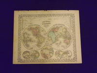
1869106105<p>Unbound colored engraved map decorative boarder 14" x 11". Slight toning darkening and aging bottom margin narrow upper margin with a few edge chips and a little rough; still fairly bright and clean and in very good condition. Maps are wrapped with acid free board or in rigid sleeves. The Mitchell family started to produce atlases in 1846 and continued into the early 1890s. Around 1860 S. Augustus Mitchell Jr. took over and the atlas would be called Mitchell's New General Atlas. This is an attractive hemispheric map of the world from the 1869 installment of that atlas. Ristow 311-313.</p> books
1870106106<p>Unbound colored engraved map decorative boarder 14" x 11". Slight toning darkening and aging top and bottom margina little narrow but still ample; otherwise fairly bright and clean and in very good condition. Maps are wrapped with acid free board or in rigid sleeves. The Mitchell family started to produce atlases in 1846 and continued into the early 1890s. Around 1860 S. Augustus Mitchell Jr. took over and the atlas would be called Mitchell's New General Atlas. This is an attractive hemispheric map of the world from the 1870 installment of that atlas. Ristow 311-313.</p> books
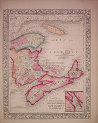
1863204026Philadelphia: Mitchell Samuel Augustus Jr. 1863. unbound. very good. Map. Engraving with original hand coloring. Image measures 13" x 10.5".<br/><br/> Includes inset of Halifax Harbor and city. S. Augustus Mitchell Jr. continued his father's successful mapmaking and publishing business and was one of the most prolific and renowned 19th century American publishers.<br/><br/> Mitchell, Samuel Augustus Jr. unknown books
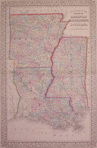
1867203103Philadelphia: Mitchell Samuel Augustus Jr. 1867. unbound. very good. Gamble W.H. Map. Engraving with original hand coloring. Image measures 21.25" x 13.5".<br/><br/> Classic double page map of Louisiana Arkansas and Mississippi divided into counties. Shows towns major routes waterways and geographical features. In excellent condition. S. Augustus Mitchell Jr. continued his father's successful mapmaking and publishing business and was one of the most prolific and renowned 19th century American publishers.<br/><br/> Mitchell, Samuel Augustus Jr. unknown books
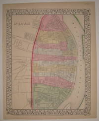
1867227682Philadelphia: Mitchell Samuel Augustus Jr. 1867. unbound. very good. Map. Engraving with original hand coloring. Image measures 13.75" x 11".<br/><br/> Nice map of St. Louis colored according to wards. Shows streets railroads and public parks. In very good condition with a small tear and chi to bottom edge. S. Augustus Mitchell Jr. continued his father's successful mapmaking and publishing business and was one of the most prolific and renowned 19th century American publishers.<br/><br/> Mitchell, Samuel Augustus Jr. unknown books
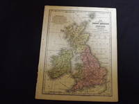
1840106603<p>Engraved colored map 9" x11 1/2" Box like cartouche with map information. Some soiling perhaps a little margin foxing small holes in left margin where map was bound not affecting image some aging and browning otherwise very good. Attractive little map with plenty of detail and some decent color. From a school and family geography. </p> S. Augustus Mitchell, books
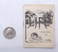
1883339316New York: Life Co 1883. First edition. 12 pp. iv. 85. cm. x 5.5 cm. 64mo. Staple-bound illustrated wrappers light toning soiled and worn area on verso over ads else a very good copy. First edition. 12 pp. iv. 85. cm. x 5.5 cm. 64mo. This miniature edition was a promotional facsimile to encourage people to buy the full size magazine. A Little Life. <br/><br/> Life Co unknown
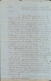
1863022385New York. 1863. Manuscript. 12 1 /4 x 8 inch lined blue paper with light chipping at edges mild toning at bottom and previous folds. Manuscript writing on both sides of paper signed in manuscript Wm. Mitchell Referee N. Y. May 19th 1863. Document from a court case involving the American Guano Company V. United States Guano Company and the rights to mine guano on two remote Pacific Ocean Islands. From a May 1865 New York Times article: "This was an action brought to test the title to a guano island in the Pacific Ocean and to forbid the defendants from procuring any of the guano on the island." A second Island Baker Island was also litigated. The dispute dated to 1856 based upon an Act of Congress Unites States Guano Islands Act which authorized the President of the United States: 1. To assert the Jurisdiction of the United States over any guano island which might have been or should thereafter be discovered by any of its citizens; and 2. To confer upon the discoverer or his assigns the exclusive right to the guano upon such islands. In January 1859 the United States Guano Company made contracts to mine and sell Guano deposits on the two islands only to find men from the American Guano Company already occupying the islands. According to a Wiki page on Jarvis Island the American Guano Company ultimately mined guano for 20 years shipping the product to the Unites States for fertilizer. Names included in this document include Alfred Benson the President of the American Guano Company plus the surnames Lucas Baker Taylor Turner Russell and Roberts. Alfred Benson's son also played a role. The United States Guano Islands Act is still on the books just in case you sail upon an unknown island piled high in guano--you can legally seize the island as a United States Possession. ; 2 pp . unknown
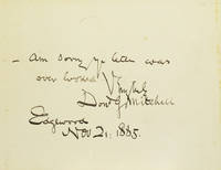
189816951Edgewood 1898. One page. 1 vols. 8vo. Recipient unknown. Writing "I think the 'Critical Excerpta' you speak of- if judiciously made-would have great value." Accompanied by a card with the note "Am sorry your letter was over looked" signed by Mitchell and dated 2 November 1885. Some light offsetting from bookplate on letter else good. One page. 1 vols. 8vo. <br/><br/> unknown
189745797Glasgow: James MacLehose and Sons. Good with no dust jacket; Outer joints cracked some loss at spine . endpapers foxed. 1897. First Edition. Hardcover. Marbled paper-covered boards with printed paper spine label. vii 141pp. Inscribed on the front free endpaper J. H. Benton Jr. Esq. with the authors kind regards Nov 28 1902. A manuscript letter from the author of the same date on light blue stationery embossed with 7 Huntly Gardens Glasgow describes his regret upon hearing from a relative that Benton had not received acknowledgement of a gift of a book of family history. He expounds a bit about other family history tidbits. The volume itself describes various aspects of Burns life Scottish culture and his historical era with plentiful quotes. ; 8vo 8" - 9" tall . James MacLehose and Sons hardcover
1892399732New York: The Century Co 1892. Hardcover. Very Good. First edition. Decorative gray-blue cloth stamped in dark blue and gilt top edge gilt. Contemporary owner's gift inscription inked on front fly extremities a bit worn with spine slightly cocked else a very good copy. A scarce medical tale. The Century Co hardcover
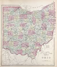
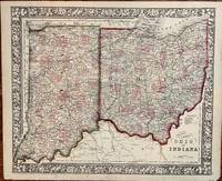
188645717Philadelphia: W.M. Bradley & Bro. 1886. Very good faint toning. Hand colored map. 11.5 x 13.5 inches. Plate 67: County & Township Map of the State of Ohio. Copyright by S. Augustus Mitchell 1884. <br /> <br /> From: Mitchell's New General Atlas Containing Maps Of The Various Countries Of The World Plans Of Cities Etc. Embraced In Ninety-Three Quarto Maps Forming A Series Of One Hundred and Forty-seven Maps and Plans Together With Valuable Statistical Tables. Also A List Of Post-Offices Of The United States And Territories And Also Census Of 1880 For States Territories And Counties Also Of Cities Of Over 10000 Inhabitants. Philadelphia: Published By Wm. M. Bradley & Bro. No. 1026 Arch Street. 1886. [W.M. Bradley & Bro.] unknown
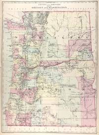
188645707Philadelphia: W.M. Bradley & Bro. 1886. Very good faint toning. Hand colored map. 20 x 14.5 inches. Plate 93: County and township map of Oregon and Washington. Copyright by Wm. M. Bradley & Bro. 1884.<br /> <br /> From: Mitchell's New General Atlas Containing Maps Of The Various Countries Of The World Plans Of Cities Etc. Embraced In Ninety-Three Quarto Maps Forming A Series Of One Hundred and Forty-seven Maps and Plans Together With Valuable Statistical Tables. Also A List Of Post-Offices Of The United States And Territories And Also Census Of 1880 For States Territories And Counties Also Of Cities Of Over 10000 Inhabitants. Philadelphia: Published By Wm. M. Bradley & Bro. No. 1026 Arch Street. 1886. [W.M. Bradley & Bro.] unknown
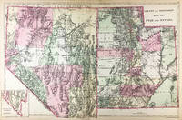
188645724Philadelphia: W.M. Bradley & Bro. 1886. Very good light soiling. Hand colored map. 22 x 14 inches. Plate 91: County and township map of Utah and Nevada. Inset: Southern portion of Nevada. Copyright by Wm. M. Bradley & Bro. 1884. <br /> <br /> From: Mitchell's New General Atlas Containing Maps Of The Various Countries Of The World Plans Of Cities Etc. Embraced In Ninety-Three Quarto Maps Forming A Series Of One Hundred and Forty-seven Maps and Plans Together With Valuable Statistical Tables. Also A List Of Post-Offices Of The United States And Territories And Also Census Of 1880 For States Territories And Counties Also Of Cities Of Over 10000 Inhabitants. Philadelphia: Published By Wm. M. Bradley & Bro. No. 1026 Arch Street. 1886. [W.M. Bradley & Bro.] unknown
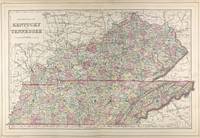
188645712Philadelphia: W.M. Bradley & Bro. 1886. Very good faint soiling and toning minor tears on the outer edges not affecting the image. Hand colored map. 22 x 14 inches. Plates 50 & 51: County Map of Kentucky and Tennessee drawn & engraved by W.H. Gamble Philadelphia. Copyright by S. Augustus Mitchell 1884. <br /> <br /> From: Mitchell's New General Atlas Containing Maps Of The Various Countries Of The World Plans Of Cities Etc. Embraced In Ninety-Three Quarto Maps Forming A Series Of One Hundred and Forty-seven Maps and Plans Together With Valuable Statistical Tables. Also A List Of Post-Offices Of The United States And Territories And Also Census Of 1880 For States Territories And Counties Also Of Cities Of Over 10000 Inhabitants. Philadelphia: Published By Wm. M. Bradley & Bro. No. 1026 Arch Street. 1886. [W.M. Bradley & Bro.] unknown
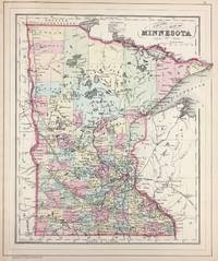
188645720Philadelphia: W.M. Bradley & Bro. 1886. Very good faint toning. Hand colored map. 11.5 x 13.75 inches. Plate 81: County Map of Minnesota. Copyright by S. Augustus Mitchell 1884. <br /> <br /> From: Mitchell's New General Atlas Containing Maps Of The Various Countries Of The World Plans Of Cities Etc. Embraced In Ninety-Three Quarto Maps Forming A Series Of One Hundred and Forty-seven Maps and Plans Together With Valuable Statistical Tables. Also A List Of Post-Offices Of The United States And Territories And Also Census Of 1880 For States Territories And Counties Also Of Cities Of Over 10000 Inhabitants. Philadelphia: Published By Wm. M. Bradley & Bro. No. 1026 Arch Street. 1886. [W.M. Bradley & Bro.] unknown
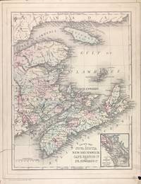
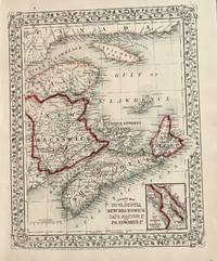
188645708Philadelphia: W.M. Bradley & Bro. 1886. Very good soiling and toning tears on the outer edges one just into image cropped closely. Hand colored map. Plate 7: County Map of Nova Scotia New Brunswick Cape Breton Island and Prince Edward's Island with inset map of City and Harbor of Halifax. Copyright by S. Augustus Mitchell 1884. 10.5 x 13.5 inches.<br /> <br /> On verso Plate 8: Map of Ontario in Counties with inset map of Manitoba Dominion of Canada. Copyright by S. Augustus Mitchell 1884. 13.5 x 10.75 inches.<br /> <br /> From: Mitchell's New General Atlas Containing Maps Of The Various Countries Of The World Plans Of Cities Etc. Embraced In Ninety-Three Quarto Maps Forming A Series Of One Hundred and Forty-seven Maps and Plans Together With Valuable Statistical Tables. Also A List Of Post-Offices Of The United States And Territories And Also Census Of 1880 For States Territories And Counties Also Of Cities Of Over 10000 Inhabitants. Philadelphia: Published By Wm. M. Bradley & Bro. No. 1026 Arch Street. 1886. [W.M. Bradley & Bro.] unknown
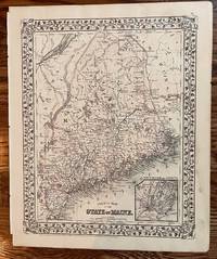
1872198Philadelphia: S. Augustus Mitchell 1872. 13 3/4 x 10 3/4 inches. Very good. Well copied rendering of the State of Maine with an inset of Portland Harbor and Vicinity. Lightly colored counties backdrop a most interesting picture of a maritime state with vast areas of native forests. Several railroads are in place giving a feeling for the local transportation picture at 1872. S. Augustus Mitchell unknown
1872177Philadelphia: S. Augustus Mitchell 1872. 1872. 14 1/4 x 11 1/2 inches. Very good. W. H. Gamble. Two states Indiana and Ohio are set into this well executed cartographic presentation using a grapevine motif for the external decorative borders. Railroads ar most prominent along with the individually colored counties. The Ohio River forms the lower border of the colored area. The riverine commerce of the day was highly complemented by the railroads. By this time the riverine commerce had lost its high value low bulk items to the ubiquitous capacities of the railroads. This made it much easier to export grains and produce to New York by feeding the Erie Canal of the railroads connecting to New York City and its port.For the Ohio it brought qlarge quantities of sugar and cotton to the northern states. S. Augustus Mitchell unknown
186720Philadelphia: Mitchell S. Augustus 1867. 1867 edition. 13 1/2 x 10 3/4 inches. Very good. Beautifully hand-colored map with the Gulf of St. Lawrence with associated provinces is shown. The provinces adjacent were colored when the map was made just two years after the end of the Civil War. Mitchell, S. Augustus unknown
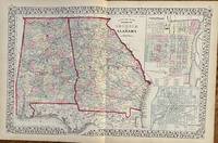
1872106Philadelphia: Mitchell S. Augustus 1872. 21 1/2 x 13 7/8 inches. Very good. An original antique map of the states of Georgia and Alabama published just seven years after the cessation of the Civil War. These states were most battle active in the years 1864 and 1865. Of particular interest are the railroads that emerged after the War. The rail systems of the South were decimated by overuse and under supply of spare rails and equipment. Large two page presentation. Mitchell, S. Augustus unknown
187063025Philadelphia:: S. Augustus Mitchell 1870. disbound removed from atlas; horizontal crease. Fine. Approx. 21 x 14 inches. Colored map. S. Augustus Mitchell, unknown