Mitchell, Samuel AugustusBiblio.com
1 372 résultats
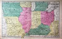
18527174Philadelphia:: Thomas Cowperthwait & Co. 1852. First printing. Near Fine. An original hand-colored lithograph. Folio 11.5 x 18.5 inches. Matted in Ivory Rag board with gilt French line decoration; sized to 18.25 x 24 inches. Near Fine condition. Minor staining. A finely colored map from early american educator turned atlas producer Samuel Augustus Mitchell Connecticut 1792-1868. Drawn and engraved by W. Williams. Single sheet matted in rag board Thomas, Cowperthwait & Co., unknown
18527180Philadelphia:: Thomas Cowperthwaite & Co. 1852. First printing. Near Fine. An original hand-colored lithograph. Folio 11.5 x 18.5 inches. Matted in Ivory Rag board with gilt French line decoration; sized to 18.25 x 24 inches. Near Fine condition. Minor staining. A finely colored map from early american educator turned atlas producer Samuel Augustus Mitchell Connecticut 1792-1868. Drawn and engraved by W. Williams. Single sheet matted in rag board Thomas, Cowperthwaite & Co. , unknown
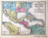
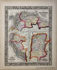
18527176Philadelphia:: Thomas Cowperthwaite & Co. 1852. First printing. Fine . Near Fine condition. Original hand-colored lithograph. Folio 11.5" x 9.5". Light staining. A finely colored map from early american educator turned atlas producer Samuel Augustus Mitchell Connecticut 1792-1868. Drawn and engraved by J. H Young. Includes inset of the Isthmus of Nicaragua showing Proposed Routes from the Caribbean Sea to the Pacific Ocean and inset of The Isthmus of Tehuantepec showing the Proposed Route from the Gulf of Mexico to the Pacific Ocean. Matted in ivory rag with french line decoration sized to 18" x 16". Thomas, Cowperthwaite & Co. , unknown
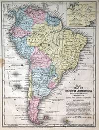
18527178Philadelphia:: Thomas Cowperthwaite & Co. 1852. First printing. Near fine. Near Fine condition. Original hand-colored lithograph. Folio 11.5" x 9.5". Matted in Ivory Rag board with gilt French line decoration; sized to 16 x 18 inches. A finely colored map from early american educator turned atlas producer Samuel Augustus Mitchell Connecticut 1792-1868. Drawn and engraved by J. H Young. Single sheet matted in rag board Thomas, Cowperthwaite & Co. , unknown
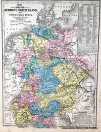
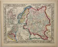
18527177Philadelphia:: Thomas Cowperthwaite & Co. 1852. First printing. Fine . Fine condition. Original hand-colored lithograph. Folio 11.5" x 9.5". Matted in Ivory Rag board with gilt French line decoration; sized to 16 x 18 inches. A finely colored map from early american educator turned atlas producer Samuel Augustus Mitchell Connecticut 1792-1868. Drawn and engraved by J. H Young. Includes an inset listing the German States. Single sheet matted in rag board Thomas, Cowperthwaite & Co. , unknown
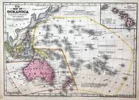
18527175Philadelphia:: Thomas Cowperthwaite & Co. 1852. First printing. Fine . Fine condition. An original hand-colored lithograph. Folio 11.5" x 9.5". A subtly colored map from early american educator turned atlas producer Samuel Augustus Mitchell Connecticut 1792-1868. Drawn and engraved by J. H Young. Includes map inset of The Sandwich or Hawaiian Islands; with population census of 1849. Matted in ivory rag with french line decoration sized to 18" x 16". Thomas, Cowperthwaite & Co. , unknown
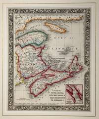
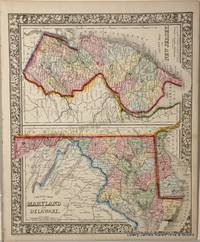
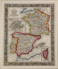
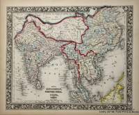
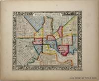
18606984Philadelphia:: S. Augustus Mitchell Jr 1860. First edition. Fine . Fine original hand-colored lithograph. Folio 15.5 x 12.75 inches. A fine and decorative pre-Civil War Map from one of America's most prolific atlas publishing firms of the nineteenth century; Samuel Augustus Mitchell Connecticut 1792-1868 and his son S. Augustus Mitchell Jr. Drawn and engraved by W. Williams this map is from the first edition of the popular New Universal Atlas which characterized by the fine topographical detail of the charted territory here heightened with rich watercolor all surrounded by an embellished floral border. Single Sheet S. Augustus Mitchell, Jr, unknown
18606977Philadelphia:: S. Augustus Mitchell 1860. First printing. Fine . Fine original hand-colored lithograph. Folio 15.5 x 12.75 inches. A fine and decorative pre-Civil War Map from one of America's most prolific atlas publishing firms of the nineteenth century; Samuel Augustus Mitchell Connecticut 1792-1868 and his son S. Augustus Mitchell Jr. Drawn and engraved by W. Williams this map is from the first edition of the popular New Universal Atlas which characterized by the fine topographical detail of the charted territory here heightened with rich watercolor all surrounded by an embellished floral border. Single Sheet S. Augustus Mitchell, unknown
18606983Philadelphia:: S. Augustus Mitchell Jr 1860. First edition. Fine . Fine original hand-colored lithograph. Folio 15.5 x 12.75 inches. A fine and decorative pre-Civil War Map from one of America's most prolific atlas publishing firms of the nineteenth century; Samuel Augustus Mitchell Connecticut 1792-1868 and his son S. Augustus Mitchell Jr. Drawn and engraved by W. Williams this map is from the first edition of the popular New Universal Atlas which characterized by the fine topographical detail of the charted territory here heightened with rich watercolor all surrounded by an embellished floral border. Single Sheet S. Augustus Mitchell, Jr, unknown
18606976Philadelphia:: S. Augustus Mitchell Jr. 1860. First edition. Fine . Fine original hand-colored lithograph. Folio 15.5 x 12.75 inches. A fine and decorative pre-Civil War Map from one of America's most prolific atlas publishing firms of the nineteenth century; Samuel Augustus Mitchell Connecticut 1792-1868 and his son S. Augustus Mitchell Jr. Drawn and engraved by W. Williams this map is from the first edition of the popular New Universal Atlas which characterized by the fine topographical detail of the charted territory here heightened with rich watercolor all surrounded by an embellished floral border. Single Sheet S. Augustus Mitchell, Jr., unknown
18606980Philadelphia:: S. Augustus Mitchell Jr 1860. First edition. Fine . Fine original hand-colored lithograph. Folio 15.5 x 12.75 inches. A fine and decorative pre-Civil War Map from one of America's most prolific atlas publishing firms of the nineteenth century; Samuel Augustus Mitchell Connecticut 1792-1868 and his son S. Augustus Mitchell Jr. Drawn and engraved by W. Williams this map is from the first edition of the popular New Universal Atlas which characterized by the fine topographical detail of the charted territory here heightened with rich watercolor all surrounded by an embellished floral border. Single Sheet S. Augustus Mitchell, Jr, unknown
18606978Philadelphia:: S. Augustus Mitchell 1860. First edition. Fine . Fine original hand-colored lithograph. Folio 15.5 x 12.75 inches. A fine and decorative pre-Civil War Map from one of America's most prolific atlas publishing firms of the nineteenth century; Samuel Augustus Mitchell Connecticut 1792-1868 and his son S. Augustus Mitchell Jr. Drawn and engraved by W. Williams this map is from the first edition of the popular New Universal Atlas which characterized by the fine topographical detail of the charted territory here heightened with rich watercolor all surrounded by an embellished floral border. Single Sheet S. Augustus Mitchell, unknown
18606979Philadelphia:: S. Augustus Mitchell 1860. First edition. Fine . Fine original hand-colored lithograph. Folio 15.5 x 12.75 inches. A fine and decorative pre-Civil War Map from one of America's most prolific atlas publishing firms of the nineteenth century; Samuel Augustus Mitchell Connecticut 1792-1868 and his son S. Augustus Mitchell Jr. Drawn and engraved by W. Williams this map is from the first edition of the popular New Universal Atlas which characterized by the fine topographical detail of the charted territory here heightened with rich watercolor all surrounded by an embellished floral border. Single Sheet S. Augustus Mitchell, unknown
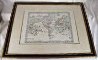
18712312280010S. Augustus Mitchell Philadelphia 1871. First Edition. Maps. Very Good. Large Lithographed Map of the World Wooden gilt frame. Framed dimensions: 32" x 25" inches. 82 x 64 cm. Sheet Measures c. 12 1/2"H x 15 1/4" W. Engraved Area Measures c. 10 1/2" H x 13 1/2" W. This version has the tracks of the explorers Capt. Cook in 1774-80 and the tracks of the U.S. Exploration Expedition under Wilkes. <br> Refs: Reps American Maps and Mapmakers p. 313. Tooley's Dictionary of Mapmakers vol. 4 pp. 260. S. Augustus Mitchell, Philadelphia unknown
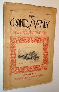
1899845G0887USA: The Granite Monthly Company 1899. Magazine. Fair. Paperback. First Edition. 4to - over 9¾" - 12" tall. Pages 256-320. Printed on glossy stock. Numerous black and white photos. Features: Nice Prescott Pianos ad inside front cover; Seen through New Hampshire Eyes - a letter from San Francisco - article with many nice photos of Chinese people; The exit of the Royal Governor; Songs of Norwich University; The Federal Supreme Court; Arbutus poem; New Hampshire's young poet - Adelbert Clark; The month of May poem; The house that Jack built; New Hampshire Necrology. Some moisture staining. Pencil markings to front cover and page 305. Peripheral chipping. Contents in quality condition. A worthy vintage copy. The Granite Monthly Company Paperback
189511343Washington DC: Smithsonian Institution 1895. First Edition First printing. Hard Cover. OVERALL VERY GOOD TO NEAR-FINE. ORIGINAL GREEN CLOTH BOARDS WITH GILT LETTERING HAVE VERY MINOR WEAR WITH A LITTLE RUBBING ON SPINE. INTERIOR FINE. A NICE COPY. Smithsonian Institution unknown
18670356New York: Charles Scribner & Co 1867. First Edition. Hard Cover. Near Fine. Octavo. First issue with "iv" on the final page of the preface. x 295 pages 3 pages of ads at rear; brown endpapers original green cloth.Mitchell was also known as IK. Marvel. The present volume is well illustrated showing country architecture landscape gardening and farm building. Small blemish on FEP a fine copy. BAL 13944. <br/><br/> Charles Scribner & Co hardcover books
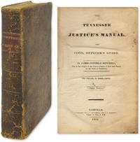
1834WRCAM53665Nashville 1834. vii534pp. plus errata. Full contemporary calf leather label. Calf rubbed and stained. Some internal staining and spotting scattered foxing old ownership signatures else very good and sound. Written for the use of the layman and official alike. "The work contains a greater portion of the common and statute laws in force in Tennessee than any other work now extant. In fine it is the PEOPLE'S LAW BOOK" Advertisement. ALLEN 1152. ALLEN MORE RARITIES 507. AII TENNESSEE 542. hardcover books
1834601121834. Scarce 1834 Tennessee JP Manual Mitchell James Coffield. The Tennessee Justice's Manual and Civil Officer's Guide. Nashville: Published by J.C. Mitchell and C.C. Norvell 1834. 534 pp. Octavo 8-1/4" x 5". Contemporary sheep lettering piece and gilt fillets to boards. Moderate rubbing to extremities corners bumped partial crack between front endleaf and title page rear hinge partially cracked a few signatures loose. Light browning to text internally clean. $200. Only edition. Along with Haywood's Justice this was one of the two manuals of its kind published in Tennessee before the Civil War. It is divided into three parts: Civil Division Criminal Division Miscellaneous Division. Mitchell was a judge of the Tennessee Circuit Courts of Law and Equity. Cohen Bibliography of Early American Law 8471. unknown books
1878D17718Philadelphia: J. B. Lippincott Company 1878. Hardcover. Very Good. 8vo. 109 pp 10 page publisher's catalog at back. Original brown limp cloth stamped in gilt dark green endpapers. Some rubbing to extremities very good. Provenance: Egerton L. Crispin noted American physician bookplate and ownership signature. <br/><br/>Second edition revised of a work much admired and positively reviewed by Freud who was significantly influenced by Mitchell's ideas and who himself undertook Mitchell's rest cure. J. B. Lippincott Company hardcover books
189791473New York: The Century 1897. First Edition. hardcover. near fine. Two frontispieces by Howard Pyle. 2 vols. gray cloth stamped in red. N.Y.: The Century 1897. First Edition. First issue.<br/><br/> The Century unknown books
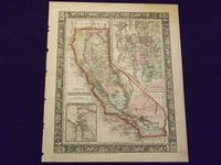
1865101010<p>Philadelphia 1865. Unbound colored engraved map decorative boarder 14"x 11". Slight toning and aging a few small chips at the edges; overall very bright and clean. Maps are wrapped with acid free board or in rigid sleeves. The Mitchell family started to produce atlases in 1846 and continued into the early 1890s. Around 1860 S. Augustus Mitchell Jr. took over and the atlas would be called Mitchell's New General Atlas. This is an extremely attractive map of California from the 1865 installment of that atlas. The city of San Francisco is shown in an inset. Ristow 311-313</p> books
1870101012<p>Philadelphia 1870. Unbound colored engraved map decorative boarder 14"x 11". Slight aging and toning; overall bright and clean. Maps are wrapped with acid free board or in rigid sleeves. The Mitchell family started to produce atlases in 1846 and continued into the early 1890s. Around 1860 S. Augustus Mitchell Jr. took over and the atlas would be called Mitchell's New General Atlas. This is an attractive double page map of California from the 1870 installment of that atlas. The city of San Francisco is shown in an inset. Ristow 311-313</p> books
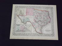
1869101081Philadelphia 1869. Unbound colored engraved map decorative boarder 22 1/2"x 14 1/2". Slight toning a little staining in margins slight darkening in bottom part of crease at center fold; overall bright and clear and in very good shape. Maps are wrapped with acid free board or in rigid sleeves. The Mitchell family started to produce atlases in 1846 and continued into the early 1890s. Around 1860 S. Augustus Mitchell Jr. took over and the atlas would be called Mitchell's New General Atlas. This is one of the more colorful and attractive maps of Texas from the 1869 installment of that atlas. The city of Galveston is highlighted in an inset. Ristow 311-313 books
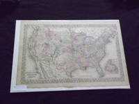
1882101086<p>Philadelphia: Bradley 1882. Unbound colored engraved map decorative boarder 22 1/2"x 14 1/2". Slight toning and aging; overall bright and clear and in very good shape. Maps are wrapped with acid free board or in rigid sleeves. The Mitchell family started to produce atlases in 1846 and continued into the early 1890s. Around 1860 S. Augustus Mitchell Jr. took over and the atlas would be called Mitchell's New General Atlas. This is an attractive double page map of the United States from the 1882 installment. The Indian Territory is highlighted and the Island of Newfoundland is illustrated in a small inset. May require extra postage. Ristow 311-313 Phillips 907</p> Bradley books