3 880 résultats
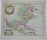
166925695Paris: Chez Pierre Mariette 1669. Copper-engraved map period hand colouring in outline. The most important French map of North America of its generation produced by the country's most esteemed family of cartographers.<br/> <br/>This very influential map was the official successor to Nicolas Sanson's 1650 map of North America. When Nicolas Sanson regarded as the father of the renaissance of cartography under Louis XIV died in July 1667 he left his flourishing business in the care of his eldest son Guillaume. The younger Sanson continued his father's partnership with the Mariette family who were prominent Parisian printers. Guillame was determined to publish a new updated edition of his father's Cartes Generales de toutes parties du Monde the first French general atlas originally published in 1657. The map of North America that appeared in the atlas although masterful was now considered to be geographically outdated. The present map which appeared in the second edition of the atlas featured updated toponymy and is geographically based on Nicolas Sanson's wall map of 1666 of which only two copies survive. While California is shown to be an island in line with popular perception unlike the map from 1650 it no longer attempts to build a geographical mythology in the place of the Pacific Northwest which was then totally unknown. Appropriately the magnificent baroque title cartouche which features swags and ribbons held aloft by putti has been placed to fill this enigmatic space. Cartographically the map appears to be based on Sanson's maps of "Le Canada ou Nouvelle France" and "Le Nouveau Mexique et La Floride." Lake Erie is shown in a recognizable form and the entire Great Lakes network is shown in greater detail than his father's map although the western lakes are still open-ended. On the East coast Long Island is shown and the shape of the Outer Banks is improved. Several Indian tribes are identified in New Mexico where the R. del Norte Rio Grande mistakenly flows from an interior lake and empties into the Mar Vermeio ou Mer Rouge Gulf of California. Iceland now appears in the Atlantic as well as a bit of Britain. The map proved to be highly successful and was sourced on numerous occasions by other mapmakers. The present copy is an example of Burden's first state of the map; a second state would be issued in 1690.<br/> <br/>Burden The Mapping of North America I 404; first state McCorkle New England in Early Printed Maps 669.4; McLaughlin California as an Island 45; Wagner Cartography of the Northwest Coast of America 399; Tooley "California as an Island" 8 in TooleyThe Mapping of America. Chez Pierre Mariette unknown books
1680024707London: William Berry 1680. .Kingdoms and States which are found there at present/Described by Sanson/Corrected and amended By William Berry =Kopftitel; Text der figürlich reich verzierten Kartusche oben rechts: Asia Divided into its Principall Regions in which may be seen the extent of the Empires Monarchies Kingdoms and States which at present divide Asia/To the Most serene and Most Sacred Majesty of Charles II./By the Grace of God King of Great Britain France and Ireland/This Map of Asia is humbly Dedicated and Presented By Your Majesties Loyal Subject and Servand William Berry; Text der reich verzierten Kartusche links oben: Scale es folgen Maßstäbe verschiedener Länder/London/Sold by William Berry at the Sign of the Globe between Charing-Cross and White-Hall/1680; SW-Kupferstich-Landkarte nach Nicolas Sanson d'Abbeville gestochen von William Berry; ca. 51 x 39 cm; Falzspuren einige Tintenflecken hauptsächlich ausserhalb des Druckbildes mässige Lichtverfärbung; professionell hinter Glas gerahmt in schwarzem Holzrahmen; äußerst selten; for description in other languages of this extremely rare map please don't hesitate to contact me. . Gut. Landkarte. William Berry unknown
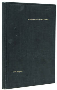
1913238650New York: Privately printed 1913. First edition no. 96 of 200 copies initialed and numbered on the half-title. With frontispiece 19 plates including 2 group portraits double map of Lake George around Bolton Landing at back. 65 pp. 1 vols. 8vo. Original green cloth titled in gilt on upper board. Bixby bookplate of Mohican Point house on front pastedown. Fine. First edition no. 96 of 200 copies initialed and numbered on the half-title. With frontispiece 19 plates including 2 group portraits double map of Lake George around Bolton Landing at back. 65 pp. 1 vols. 8vo. Inscribed on flyleaf "Mr. & Mrs. A. B. P- names partly effaced with sincere regards of Mr. & Mrs. W.K. Bixby St. L. 5/18/14"<br /> "Includes 12 pages of text on fishing for smallmouth bass lake trout and land-locked salmon. one of the few early books to contain as much material on fishing in Lake George" Heller.<br /> An important and rare book. Plum Adirondack Bibliography 568; Bruns S27; Heller 1:716 Privately printed unknown
1913238650New York: Privately printed 1913. First edition #96 of 200 copies initialed and numbered on the half-title. With frontispiece 19 plates including 2 group portraits double map of Lake George around Bolton Landing at back. 65 pp. 1 vols. 8vo. Original green cloth titled in gilt on upper board. Bixby bookplate of Mohican Point house on front pastedown. Fine. First edition #96 of 200 copies initialed and numbered on the half-title. With frontispiece 19 plates including 2 group portraits double map of Lake George around Bolton Landing at back. 65 pp. 1 vols. 8vo. Inscribed on flyleaf "Mr. & Mrs. A.B. Payne names partly effaced with sincere regards of Mr. & Mrs. W.K. Bixby St. L. 5/18/14"<br/>"Includes 12 pages of text on fishing for smallmouth bass lake trout and land-locked salmon. one of the few early books to contain as much material on fishing in Lake George" Heller.<br/>An important and rare book. Plum Adirondack Bibliography 568; Bruns S27; Heller 1:716 Privately printed unknown books
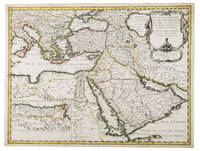
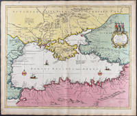
1654G1ADV7RKD7B6Paris 1654. Engraved map 42 x 56 cm coloured in outline. Map of the Turkish Empire showing Ottoman possessions in the Balkans Eastern Mediterranean Egypt and Arabia - marking topography and settlements.l Al Ankary 59; Al-Qasimi 60; Tibbetts 99. unknown
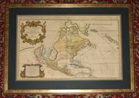
89167Amsterdam Hubert Jaillot Chez Pierre Mortimer et Company. 1692. Copper-engraved map. Engraved surface 34 x 22 inches. Framed with glass and double dark-green and blue mounts. Overall 44 x 33 inches. In very good condition. Stunning large early map of America. Beautifully coloured states and islands with both cartouches and border also coloured. With vertical centre fold/crease. The map lines up in the middle but is slightly offset at top and bottom. A couple of very light minor spots around the main cartouche else map surface is lovely and bright and clean. No offsetting or darkening. A stunning map. With two decorative cartouches with scale. With later hand-colouring. Jaillot's oversized map of North America notable for the large island of California poised off the West Coast first published in 1674. Tooley notes rather critically: “Jaillot who succeeded to Sanson's business makes a rehash of his maps. California is copied from Sanson's map of 1656. The remainder of the map is based on that of 1669. Jaillot retains the 5 lakes with two open at their western ends. He shows New Sweden and New Amsterdam. Curiously he omits Montreal but does insert a few French Missions round the Great Lakes. Large handsome titlepiece with arms of the Dauphin natives and indigenous fauna.” The map was reissued many times and its “long life was to in part to the expense of production for it continued in use long after its geographical information became out of date.” Tooley 37 Plate 44; McLaughlin 55. Amsterdam, Hubert Jaillot, Chez Pierre Mortimer et Company. 1692 unknown
169025648Paris: Chez Pierre Mariette 1690. Copper-engraved map period hand colouring in outline. Among the most important French maps of North America of the second half of the 17th century produced by the country's most esteemed family of cartographers.<br/> <br/>This very influential map was the official successor to Nicolas Sanson's 1650 map of North America. When Nicolas Sanson regarded as the father of the renaissance of cartography under Louis XIV died in July 1667 he left his flourishing business under the charge of his eldest son Guillaume. The younger Sanson continued his father's partnership with the Mariette family who were prominent Parisian printers. Guillame was determined to publish a new updated edition of his father's Cartes Generales de toutes parties du Monde the first French general atlas originally published in 1657. The map of North America that appeared in the atlas although masterful was now considered to be geographically outdated. The present map which appeared in the second edition of the atlas featured updated toponymy and is geographically based on Nicolas Sanson's wall map of 1666 of which only two copies survive. While California is shown to be an island in line with popular perception unlike the map from 1650 it no longer attempts to build a geographical mythology in the place of the Pacific Northwest which was then totally unknown. Appropriately the magnificent baroque title cartouche which features swags and ribbons held aloft by putti has been placed to fill this enigmatic space. Cartographically the map appears to be based on Sanson's maps of "Le Canada ou Nouvelle France" and "Le Nouveau Mexique et La Floride." Lake Erie is shown in a recognizable form and the entire Great Lakes network is shown in greater detail than his father's map although the western lakes are still open-ended. On the East coast Long Island is shown and the shape of the Outer Banks is improved. Several Indian tribes are identified in New Mexico where the R. del Norte Rio Grande mistakenly flows from an interior lake and empties into the Mar Vermeio ou Mer Rouge Gulf of California. Iceland now appears in the Atlantic as well as a bit of Britain. The map proved to be highly successful and was sourced on numerous occasions by other mapmakers. The present copy is an example of Burden's second state of the map with the date changed to 1690 in the cartouche and with additional place names and other changes: ".with minor alterations Terre de Jesso and Conibas inserted but without a coastline. Detroit d'Anian placed immediately above California and a few changes in spelling . New Albion is inserted in the north of the island and New York replaces New Amsterdam" Tooley.<br/> <br/>Burden The Mapping of North America 404 second state; McCorkle New England in Early Printed Maps 669.4; cf. McLaughlin California as an Island 45; cf. Wagner Cartography of the Northwest Coast of America 399; Tooley "California as an Island" 9 in TooleyThe Mapping of America. Chez Pierre Mariette unknown books
1792M4892Amsterdam 1792. Excellent. Notes: North America revised from the Sanson/Jaillot maps. California is shown as a peninsula but named "isle de California" to the northwest is "Mer de Iesso" and beyond that a small stretch of coastline "Terre de Iesso ou Ieco." The Great Lakes are defined if not with great accuracy a number of settlements in Nouveau Mexico are identified and a R. del Norte flows southwest from a large lake near Taosii to the Gulf of California. Size : 480x580 mm 18.875x22.875 Inches Coloring: Original Hand Coloring Category: Maps North America; Maps Central America; Maps West Indies General unknown
169616269Paris: Alexis Hubert Jaillot 1696. Copper-engraved map with full original colour and gold embellishment in excellent condition. A stunning map of Normandy by Alexis Jaillot an exceptional example with gilt embellishments.<br/> <br/>One of the most important figures in French cartography Nicolas Sanson initiated the great school of French geographers. Born in Abbeville in 1600 Sanson established his first printing house in Paris in 1638. He soon became geographer to the king establishing himself as one of the most influential cartographers on the Continent. He was succeeded by his sons Adrien and Guillaume and by his son-in-law Pierre Duval who continued to publish a wealth of maps using Sanson's name. At the close of the seventeenth century Sanson's plates were purchased by the influential cartographer Alexis Hubert Jaillot who continued to publish his maps and atlases under Sanson's title. This stunning map of Normandy is based on Sanson's map published in 1650 but was redrawn and enlarged by Jaillot. It shows the provinces of Normandy as well as the northern tip of Brittany and part of the English Channel. Both Jersey and Guernsey are included as is Mont St. Michel off the coast of St. Malo. In keeping with all of Sanson's and Jaillot's superb maps forests rivers and towns are meticulously identified and named. The map includes an ornate cartouche in the upper section as well as a scale and key.<br/> <br/>Tooley Maps & Map-Makers pp. 40-41. Alexis Hubert Jaillot unknown books
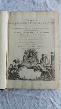
007346Paris Book. Good. Full-Leather. Elephant Folio - over 15 - 23" tall. 106 geographical tables. This copy has tables from various editions with printing dates from 1663 to 1741. The majority of tables date from 1663-1698. Most are in French but many also in Latin. The plates show different versions of the geographical tables. Please inquire for more details. The majority of tables are 20 inches some tables are 16 inches and are pasted on blank pages. The leather binding is worn at the top and bottom of spine and on corners and edges. Hardcover
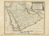
62978Paris Chez Pierre Mariette 1654. Original copper-engraved map of the Arabian Peninsula 43.5 x 59 cm with contemporary outline colour refreshed and adorned with a large columnar style title cartouche. A dark impression. Paper has been washed and strengthened due to foxing. Rare map of the Arabian Peninsula first published in 1654 and one of the first large maps focused specifically on the Arabian Peninsula. Sanson's map of the Arabian Peninsula continued to influence maps of the region throughout the latter part of the 17th century. Here Arabia is divided into three regions: Arabia Petraea the northwestern area encompassing the Sinai Peninsula and Jordan Arabia Deserta the northernmost area just south of the Tigris and Euphrates rivers and Arabia Felix by far the largest territory covering most of the peninsula and extending from the holy cities of Mecca and Medina in the northwest to the coasts of the Arabian Sea and the Gulf of Oman. There is great detail of mountains and rivers although there are clear geographical errors such as the exaggerated extent of the mountain ranges. Numerous villages are depicted including stopping places on the pilgrimage to Mecca Iathreb Badrahenen Gioffa and Cadaid among others as well as towns that appeared for the first time on a map of Arabia Hagair Hadrama Salamia and Iamama. Bahrain is demarcated along the northwestern shore of the Arabian Gulf. Nicolas Sanson was to bring about the rise of French cartography although the fierce competition of the Dutch would last until the end of the century. His success was partly owing to the partnership with the publisher Pierre Mariette. In 1644 the latter had purchased the business of Melchior Tavernier and helped Sanson with financial support in producing the maps. In 1657 Pierre Marriette died however his son also named Pierre co-published Les Cartes Générales de toutes les parties du Monde the following year. It was the first folio French produced world atlas. Tibbetts 98; Ankary p.98 Paris, Chez Pierre Mariette, 1654. unknown
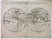
1652010748twParis: Sanson. Very Good. 1652. A very rare map from Nicolas Sanson. Imprint bears the date of 1652 although it is possible that this copy came from an atlas in the later 1600s. Light toning and edgewear with one corner slightly chipped. Light soil on lower margin. Hand-colored boundaries. Map borders measure 14" x 20 3/4". California is shown as an island and Terre Australe is a vague line encircling the Antarctic. Terre de Iesso is the name given to the land mass northwest of North America. Sanson 1600-1667 published many map versions of the world and is known as "the father of French cartography." ; 16 1/2" x 22 1/4" . Sanson unknown books
1691M1345Paris 1691. Very Good. Size : 590x885 mm 23.25x34.875 Inches Coloring: Hand Colored in Outline Category: ; Maps South America Continent unknown
1652010748twParis: Sanson. Very Good. 1652. A very rare map from Nicolas Sanson. Imprint bears the date of 1652 although it is possible that this copy came from an atlas in the later 1600s. Light toning and edgewear with one corner slightly chipped. Light soil on lower margin. Hand-colored boundaries. Map borders measure 14" x 20 3/4". California is shown as an island and Terre Australe is a vague line encircling the Antarctic. Terre de Iesso is the name given to the land mass northwest of North America. Sanson 1600-1667 published many map versions of the world and is known as "the father of French cartography." ; 16 1/2" x 22 1/4" . Sanson unknown
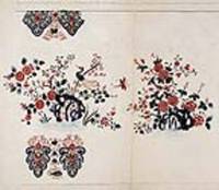
18458623Paris 1845. Pen ink and watercolour. Very good condition apart from some overall light soiling. A rare example of an original watercolour design for porcelain by the Samson factory of Paris.<br/> <br/> This finished design was intended as a reference source from which the porcelain painters could work using the design as a guide for the colours and image to be transformed from paper into fine porcelain. The French porcelain manufactory of Samson & Cie. was established by "Edmé Samson b. Paris 1810; d. Paris 1891 at 7 Rue Vendôme later Rue Béranger in Paris. The intention of the firm was to reproduce ceramics from museums and private collections and it claimed that all such reproductions would be distinctly marked to avoid confusion with the originals. In 1864 the factory was moved to Montreuil by Samson's son Emile Samson 1837-1913. The range of wares included copies of 18th-century porcelain from such factories as Sèvres Chelsea Meissen and Derby Chinese export-wares especially armorial wares decorated with famille rose colours and mugs decorated with the Fitzhugh pattern Delftware Iznikware maiolica and faience." Grove Dictionary of Art. unknown
18458623Paris 1845. Pen ink and watercolour. Very good condition apart from some overall light soiling. A rare example of an original watercolour design for porcelain by the Samson factory of Paris.<br/> <br/>This finished design was intended as a reference source from which the porcelain painters could work using the design as a guide for the colours and image to be transformed from paper into fine porcelain. The French porcelain manufactory of Samson & Cie. was established by "Edmé Samson b. Paris 1810; d. Paris 1891 at 7 Rue Vendôme later Rue Béranger in Paris. The intention of the firm was to reproduce ceramics from museums and private collections and it claimed that all such reproductions would be distinctly marked to avoid confusion with the originals. In 1864 the factory was moved to Montreuil by Samson's son Emile Samson 1837-1913. The range of wares included copies of 18th-century porcelain from such factories as Sèvres Chelsea Meissen and Derby Chinese export-wares especially armorial wares decorated with famille rose colours and mugs decorated with the Fitzhugh pattern Delftware Iznikware maiolica and faience." Grove Dictionary of Art. unknown books
1650LBW-8846Paris, Pierre Mariette, [circa 1650]. 313 x 427 mm.
1720M8856Amsterdam: Pierre Mortier 1720. Very Good. Notes: A fine large scale map of Mediterranean Sea Italy Greece Eastern Europe Turkey. The map depicts the Ottoman Empire in the mid to late seventeenth century. Size : 530x864 mm 20.87x34.02 Inches Coloring: Original Hand Coloring Category: Maps Europe Balkans; Maps Mediterranean Sea; Maps Europe Italy; Maps Europe Greece Macedonia; Maps Asia Near East Turkey; Pierre Mortier unknown
16969749<p>Scarce original hand-colored engraving by Sanson published in Pierre Mortier's <em>Atlas Nouveau</em> or <em>Atlas Novum ad usum serenissimi</em>.</p><p>Image size is approximately 23 x 18.75 in 58.5 x 47.5 cm; page size is 24.75 x 21 in 63 x 53.5 cm.</p><p>Some minor staining and toning to edges not affecting the image.</p>
95This book is in Very Good condition. The book is the Lettered edition one of only 26 copies signed by Warren C. Carberg Jr. Dave Christensen Grady Hendrix and Wendell Minor. This copy is letter "P." This book contains a number of tipped in Black and White illustrations. The original slipcase is present and in very good condition. A rare find of a truely unique work. Suntup hardcover
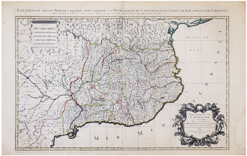
1696LBW-6394Paris, H. Jaillot, 1696. En deux feuilles jointes formant une carte de 565 x 868 mm.
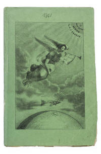
184193KAS1RPK7OLParis 1841. 8vo. De Boulé et Comp. for Ledoyen Original green wrappers in a protective plastic wrapper with a large lithographed plate on the front showing a dirigible flying over the globe underneath a floating angel who is blowing a trumpet with the motto "Conquête de l'aire". With a large folding lithographed plate 40 x 235 cm of the dirigible and a smaller woodcut of the same dirigible on p. 5. 31 1 blank pp. First edition of this very rare early and remarkable brochure on navigation in the air and the dirigible manoeuvrable balloon. The brochure introduces a new project to build a dirigible in the shape of a fish. The cost was estimated at 30.000 francs and was to be financed by the issue of 300 shares of 100 francs. The work explains the expected profits and the workings of the dirigible in order to entice patrons. It is an early example of such a project as the first powered and steerable airship that was able to take flight was invented in 1852 eleven years after the publication of the present work. This curious brochure therefore offers a fascinating insight into the history of aviation.The fish dirigible is shown in detail on the large folding plate. It was proposed to ascend the balloon being in equilibrium by means of wings to obtain propulsion by four small paddle-wheels and to steer by means of a large triangular rudder. It was approximately 25 meters long and 12 meters high and operated from a basket hanging underneath like in a hot air balloon. It was invented by bookseller and author Alexandre-Jacques Sanson 1789-1862 and his father. The dirigible was never built but the Sansons nevertheless published a number of other works elaborating on the same subject in the following years: Navigation atmosphérique. Explications complémentaires sur le système 1845; Explication du système de navigation aérienne 1848 and Solution du problème de la navigation aérienne principes preuves et moyens 1850. The present work ends with a letter by the aeronaut Jules-François Dupuis-Delcourt 1802-1864 giving permission to use some of his data in the brochure and offering his blessing to the project.The wrappers are somewhat creased with tears at the head and foot of the spine. The folding plate has browned. Otherwise in good condition.l Tissandier p. 34; WorldCat 457418223 907812680 1141280150 13 copies. unknown
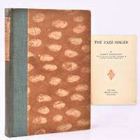
1925326925New York: Brentano's 1925. 153pp. 8vo. Blue cloth paper label & patterned boards. Very Good. 153pp. 8vo. Signed by the author on the ffep. This movie is considered the first talkie. Brentano's unknown
184514073Paris 1845. Pen ink and watercolour. Very good condition apart from some overall light soiling and minor foxing. A rare example of an original watercolour design for porcelain by the Samson factory of Paris.<br/> <br/>This finished design was intended as a reference source from which the porcelain painters could work using the design as a guide for the colours and image to be transformed from paper into fine porcelain. The French porcelain manufactory of Samson & Cie. was established by "Edmé Samson b. Paris 1810; d. Paris 1891 at 7 Rue Vendôme later Rue Béranger in Paris. The intention of the firm was to reproduce ceramics from museums and private collections and it claimed that all such reproductions would be distinctly marked to avoid confusion with the originals. In 1864 the factory was moved to Montreuil by Samson's son Emile Samson 1837-1913. The range of wares included copies of 18th-century porcelain from such factories as Sèvres Chelsea Meissen and Derby Chinese export-wares especially armorial wares decorated with famille rose colours and mugs decorated with the Fitzhugh pattern Delftware Iznikware maiolica and faience." Grove Dictionary of Art. unknown books
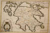
1692M7546Paris: H. Jaillot c. 1692. Very Good;. Notes: The title cartouche in the lower left corner is encased in a floral wreath at the bottom of which sits a winged lion wielding a sword and standing at a pulpit. At the top of the wreath sits a coat of arms held by two winged putti. Encircling the wreath are little diagrams of various fortifications around Greece. Size : 565x845 mm 22.24x33.27 Inches Coloring: Original Outline Coloring Category: Maps Europe Greece Macedonia; H. Jaillot unknown