192 résultats
48819Large atlas of Versailles and the surrounding towns with twelve maps total including one map depicting the overall area covered in the atlas and eleven more detailed maps covering the towns and immediate surroundings of Mantes Poissy St. Denis Crépieres Versailles Paris Montfor l'Amaury Chevreuse Sceaux Rambouillet Arpajon and Corbeil. Very minor scattered soiling or toning very fine condition. Elephant folio sheet size 32 x 22 inches. Original full calf binding with handwritten label affixed to front cover. Some minor scattered soiling and abrasions minor wear consistent with age. Paris Dépôt de la Guerre n.d. circa 1807. This suite of maps was commissioned by Louis XV to represent his hunting territories around Versailles and stemmed from his obsession with hunting coupled with a decision to copy an old map of the Duchy of Rambouillet. The maps are the result of three surveys of the land conducted between 1764 and 1773. The first nine maps including the overview were completed in the late 18th century under the reign of Louis XVI but the work was put on hold at the time of the Revolution when the credits allocated for completing the work were taken away by the National Convention. The last four maps were not completed until 1807 after Napoléon became Emperor. These maps are notable for their precision and the multitude of details represented including roads land use features such as plowing meadows vegetable crops barns and parks and hydrography. For his work on these maps Berthier was granted nobility status. A spectacular and scarce volume of beautiful maps; as of January 2018 WorldCat locates only two holdings in North America. unknown books
169648399Amsterdam: Pierre Mortier 1696. Engraved broadside map 19 x 23 5/8 inches plate mark dimensions with extensive pink and green wash. Some light browning but an attractive copy. Matted glazed and framed. One of two issues of this map this one being a bit larger based on the Thornton-Morden map of circa 1685. Pictures the colony from the Santee River to the South Edisto River and well inland up the Cooper River. Physical features and names of plantation and land owners are given in English "Nouveau Londre" on the Edistow sic River being exceptions; soundings are given at river mouths in Charleston Harbor and in the ocean along some beaches. Cumming Southeast in Early Maps 121. Kendall Early Maps of Carolina 17c: "This map has a wealth of names of owners of land in Carolina." <br/><br/> Pierre Mortier unknown books
165124777Paris: N. Sanson & P. Mariette 1651. Copper-engraved map with original outline colour. The rare second state of this highly important map of North America by the founder of the French School of cartography.<br/> <br/>This very rare map is the most geographically progressive portrayal of the continent made at its time and was not superseded until Vincenzo Maria Coronelli's map of 1688. Importantly it is the first map to depict the Great Lakes in a recognizable form and the first to name Lake Ontario and Lake Superior. In his rendering of the region Sanson benefited from having received a copy of The Jesuit Relations published in Paris in 1649 a detailed account by French missionaries who had traveled in the region. Most notably this included Father Paul Ragueneau's account of his visit to Niagara Falls and Jean Nicollet's discovery of Lake Michigan "Lac des Puans" in 1634. Down the St. Lawrence River from the lakes Montréal is named the settlement having been founded by the Sieur de Maisonneuve in 1642. Elsewhere to the north a mysterious strait weaves over "New South Wales" on Hudson's Bay terminating in the interior of the continent a blank space labeled as "Mer Glaciale". This alludes to the existence of a much hoped-for Northwest Passage. On the eastern seaboard the map notes "Nouvelle Amsterdam" in the place of present day New York and is the first printed map to label "Nouvelle Suede" referring to the Swedish colony centered on Fort Christina founded on the site of present-day Wilmington Delaware in 1638. To the far southwest Sanson based his depiction on the Father Alonso Benavides Memorial a travel account of New Mexico published in Madrid in 1630. It is the first printed map to label "Santa Fe" which is incorrectly shown to be on the banks of the Rio Grande and the domains of various native tribes such as the "Apache" "Navajo" and the "Taosij" Taos. To the west California is shown as a large island and features some of the same nomenclature as found on Johannes de Laet's map of 1630. A striking aspect of the map is the sinusoidal projection employed by Sanson that essentially places the globe on an elliptical graticule creating a very pleasing aesthetic. The composition is finished by an extremely elegant Baroque title cartouche featuring swags of fruit and vegetation. Nicholas Sanson was born in the town of Abbeville in Picardy. Something of a child prodigy by the age of eighteen he could already be found in Paris drafting his own maps. There he quickly rose to become Royal Geographer to Louis XIII in 1630. He maintained the position upon the ascension of the "Sun King" Louis XIV in 1643 and later served as tutor to the ambitious young monarch. In 1644 he formed a lucrative partnership with Paris publisher Pierre Mariette with the objective of producing a great atlas that could rival those of the Amsterdam houses such as Blaeu and Jansson. The present map was devised as one of the most important maps in the atlas. The first state of the map was printed in 1650 and the present second state appeared a year later. The atlas itself entitled Les Cartes Générales de toutes les parties du Monde was not finally assembled until 1658. It was however a landmark moment in the history of French cartography being the first folio atlas produced in that country. The extremely high quality of Sanson's work motivated other French mapmakers to improve the standard of their production. Sanson also greatly influenced Louis XIV's chief minister Jean-Baptisite Colbert to heavily fund cartographic projects. This gave rise to a great French School of cartography that was to eventually wrest dominance of the mapmaking market from the Dutch by the 1680s. After Sanson's death in 1667 his work was continued by his sons Guillaume d.1703 and Adrian d.1708. The first state of this map is extremely rare with Burden citing but two copies in private American collections. This second state is also quite rare and can be recognized by addition of a coastline north west of California but with Lake Ontario unshaded and with the appearance of a river system. "With his 1650 Map of North America Sanson had introduced a great deal of information concerning the nomenclature of American Indians with words such as Apache and Navajo appearing on printed maps for the first time. He was also the first cartographer to show Santa Fe as the capital of New Mexico . an extraordinary document of the cultural and geographical resources known in the centers of learning in Europe" Martin & Martin.<br/> <br/>Burden The Mapping of North America I 294 state 3; Leighly California as an Island p.33 pl.7; McLaughlin The Mapping of California as an Island 12; Pastoreau Les Atlas Français XVIe-XVIIe Siècles p.387-9; Wagner The Cartography of the Northwest Coast of America to the Year 1800 360 pp.130-2; Wheat Mapping of the Transmississippi West I p.39; cf. Martin & Martin Maps of Texas and the Southwest p. 83 plate 10. N. Sanson & P. Mariette unknown books
165924778Paris: N. Sanson & P. Mariette 1659. Copper-engraved map with original outline colour. The third state of this highly important map of North America by the founder of the French School of cartography.<br/> <br/>This very rare map is the most geographically progressive portrayal of the continent made during its generation and was not superseded until Vincenzo Maria Coronelli's map of 1688. Importantly it is the first map to depict the Great Lakes in a recognizable form and the first to name Lake Ontario and Lake Superior. In his rendering of the region Sanson benefited from having received a copy of The Jesuit Relations published in Paris in 1649 a detailed account by French missionaries who had traveled in the region. Most notably this included Father Paul Ragueneau's account of his visit to Niagara Falls and Jean Nicollet's discovery of Lake Michigan "Lac des Puans" in 1634. Down the St. Lawrence River from the lakes Montréal is named the settlement having been founded by the Sieur de Maisonneuve in 1642. Elsewhere to the north a mysterious strait weaves over "New South Wales" on Hudson's Bay terminating in the interior of the continent a blank space labeled as "Mer Glaciale". This alludes to the existence of a much hoped-for Northwest Passage. On the eastern seaboard the map notes "Nouvelle Amsterdam" in the place of present day New York and is the first printed map to label "Nouvelle Suede" referring to the Swedish colony centered on Fort Christina founded on the site of present-day Wilmington Delaware in 1638. To the far southwest Sanson based his depiction on the Father Alonso Benavides Memorial a travel account of New Mexico published in Madrid in 1630. It is the first printed map to label "Santa Fe" which is incorrectly shown to be on the banks of the Rio Grande and the domains of various native tribes such as the "Apache" "Navajo" and the "Taosij" Taos. To the west California is shown as a large island and features some of the same nomenclature as found on Johannes de Laet's map of 1630. To the north an entirely unknown realm is named "Conibas" a mythical land that lay between North America and Asia. A striking aspect of the map is the sinusoidal projection employed by Sanson that essentially places the globe on an elliptical graticule creating a very pleasing aesthetic. The composition is finished by an extremely elegant Baroque title cartouche featuring swags of fruit and vegetation. Nicholas Sanson was born in the town of Abbeville in Picardy. Something of a child prodigy by the age of eighteen he could already be found in Paris drafting his own maps. There he quickly rose to become Royal Geographer to Louis XIII in 1630. He maintained the position upon the ascension of the "Sun King" Louis XIV in 1643 and later served as tutor to the ambitious young monarch. In 1644 he formed a lucrative partnership with Paris publisher Pierre Mariette with the objective of producing a great atlas that could rival those of the Amsterdam houses such as Blaeu and Jansson. The present map was devised as one of the most important maps in the atlas. The first state of the map was printed in 1650 a second state appeared a year later and the third state in 1659. The atlas itself entitled Les Cartes Générales de toutes les parties du Monde was not finally assembled until 1658. It was however a landmark moment in the history of French cartography being the first folio atlas produced in that country. The extremely high quality of Sanson's work motivated other French mapmakers to improve the standard of their production. Sanson also greatly influenced Louis XIV's chief minister Jean-Baptisite Colbert to heavily fund cartographic projects. This gave rise to a great 'French School' of cartography that was to eventually wrest dominance of the mapmaking market from the Dutch by the 1680s. After Sanson's death in 1667 his work was continued by his sons Guillaume d.1703 and Adrian d.1708. The first state of this map is extremely rare with Philip Burden citing only two copies in private American collections; this third state can be recognized by the addition of hachuring around Lake Ontario.<br/> <br/>Burden The Mapping of North America I 294; Leighly California as an Island p.33 pl.7; McLaughlin The Mapping of California as an Island 12; Pastoreau Les Atlas Français XVIe-XVIIe Siècles p.387-9; Wagner The Cartography of the Northwest Coast of America to the Year 1800 360 pp.130-2; Wheat Mapping of the Transmississippi West I p.39. N. Sanson & P. Mariette unknown books
1656006682Paris: Chez l'Autheur 1656. First Edition . Full Calf. Very Good. 4to. 23.5 by 17.5 cm. Unpaginated 100 pages of text plus 2 pp. of ads. With 18 copper engraved maps all two page plates each with hand-colored of boundaries. Maps include one of the entire continent then of its various regions as then known plus the islands off the continent. Also a map of Malta. Bound in contemporary calf. Condition: calf dry and rubbed on spine and joints and edges rubbed. Light to moderate soiling in the margins of the pages. Two bookplates -- one of the Marquis of Lothian the other the Newbattle Abbey Library. <br /><br /> Chez l'Autheur books
1652006683Paris: Chez l'Autheur 1652. First Edition . Full Calf. Very Good. 4to. 23.5 by 17.5 cm. Unpaginated 102 pages of text plus 2 pp. of ads 1 Royal privilege page. With 17 copper engraved maps all two page plates each with hand-colored of boundaries. Maps include one of the entire continent then of its various regions as then known plus island groups. Separate maps for China and Japan. Bound in contemporary calf. Condition: Rebacked with joints making this obvious. Calf dry and rubbed on spine and joints and edges rubbed. Light to moderate soiling in the margins of the pages. Edge of a few leaves with short stretch slightly chewed-looking. Two bookplates -- one of the Marquis of Lothian the other the Newbattle Abbey Library. <br /><br /> Chez l'Autheur books
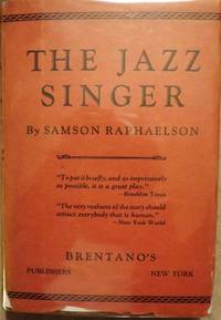
30548RAPHAELSON Samson. THE JAZZ SINGER. NY: Brentano's 1925. Small 8vo. cloth & patterned boards in dust jacket. First Edition. Signed by Raphaelson on the front endpaper and dated Christmas 1925. Basis for the hit play starring George Jessel and Sam Jaffe. The play was later adapted to the famous film starring Al Jolson and Warner Oland. The film generally considered the first "talkie" is certainly one of the milestones in cinematic history. Very Good; some edgewear & shallow chipping number of tears with professional interior repairs d/j. Enclosed in a custom-designed leather and cloth clam-shell box with Al Jolson in black face depicted on the spine and front cover. $4000.00. <br/><br/> hardcover books
166925695Paris: Chez Pierre Mariette 1669. Copper-engraved map period hand colouring in outline. The most important French map of North America of its generation produced by the country's most esteemed family of cartographers.<br/> <br/>This very influential map was the official successor to Nicolas Sanson's 1650 map of North America. When Nicolas Sanson regarded as the father of the renaissance of cartography under Louis XIV died in July 1667 he left his flourishing business in the care of his eldest son Guillaume. The younger Sanson continued his father's partnership with the Mariette family who were prominent Parisian printers. Guillame was determined to publish a new updated edition of his father's Cartes Generales de toutes parties du Monde the first French general atlas originally published in 1657. The map of North America that appeared in the atlas although masterful was now considered to be geographically outdated. The present map which appeared in the second edition of the atlas featured updated toponymy and is geographically based on Nicolas Sanson's wall map of 1666 of which only two copies survive. While California is shown to be an island in line with popular perception unlike the map from 1650 it no longer attempts to build a geographical mythology in the place of the Pacific Northwest which was then totally unknown. Appropriately the magnificent baroque title cartouche which features swags and ribbons held aloft by putti has been placed to fill this enigmatic space. Cartographically the map appears to be based on Sanson's maps of "Le Canada ou Nouvelle France" and "Le Nouveau Mexique et La Floride." Lake Erie is shown in a recognizable form and the entire Great Lakes network is shown in greater detail than his father's map although the western lakes are still open-ended. On the East coast Long Island is shown and the shape of the Outer Banks is improved. Several Indian tribes are identified in New Mexico where the R. del Norte Rio Grande mistakenly flows from an interior lake and empties into the Mar Vermeio ou Mer Rouge Gulf of California. Iceland now appears in the Atlantic as well as a bit of Britain. The map proved to be highly successful and was sourced on numerous occasions by other mapmakers. The present copy is an example of Burden's first state of the map; a second state would be issued in 1690.<br/> <br/>Burden The Mapping of North America I 404; first state McCorkle New England in Early Printed Maps 669.4; McLaughlin California as an Island 45; Wagner Cartography of the Northwest Coast of America 399; Tooley "California as an Island" 8 in TooleyThe Mapping of America. Chez Pierre Mariette unknown books
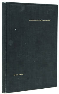
1913238650New York: Privately printed 1913. First edition #96 of 200 copies initialed and numbered on the half-title. With frontispiece 19 plates including 2 group portraits double map of Lake George around Bolton Landing at back. 65 pp. 1 vols. 8vo. Original green cloth titled in gilt on upper board. Bixby bookplate of Mohican Point house on front pastedown. Fine. First edition #96 of 200 copies initialed and numbered on the half-title. With frontispiece 19 plates including 2 group portraits double map of Lake George around Bolton Landing at back. 65 pp. 1 vols. 8vo. Inscribed on flyleaf "Mr. & Mrs. A.B. Payne names partly effaced with sincere regards of Mr. & Mrs. W.K. Bixby St. L. 5/18/14"<br/>"Includes 12 pages of text on fishing for smallmouth bass lake trout and land-locked salmon. one of the few early books to contain as much material on fishing in Lake George" Heller.<br/>An important and rare book. Plum Adirondack Bibliography 568; Bruns S27; Heller 1:716 Privately printed unknown books
169025648Paris: Chez Pierre Mariette 1690. Copper-engraved map period hand colouring in outline. Among the most important French maps of North America of the second half of the 17th century produced by the country's most esteemed family of cartographers.<br/> <br/>This very influential map was the official successor to Nicolas Sanson's 1650 map of North America. When Nicolas Sanson regarded as the father of the renaissance of cartography under Louis XIV died in July 1667 he left his flourishing business under the charge of his eldest son Guillaume. The younger Sanson continued his father's partnership with the Mariette family who were prominent Parisian printers. Guillame was determined to publish a new updated edition of his father's Cartes Generales de toutes parties du Monde the first French general atlas originally published in 1657. The map of North America that appeared in the atlas although masterful was now considered to be geographically outdated. The present map which appeared in the second edition of the atlas featured updated toponymy and is geographically based on Nicolas Sanson's wall map of 1666 of which only two copies survive. While California is shown to be an island in line with popular perception unlike the map from 1650 it no longer attempts to build a geographical mythology in the place of the Pacific Northwest which was then totally unknown. Appropriately the magnificent baroque title cartouche which features swags and ribbons held aloft by putti has been placed to fill this enigmatic space. Cartographically the map appears to be based on Sanson's maps of "Le Canada ou Nouvelle France" and "Le Nouveau Mexique et La Floride." Lake Erie is shown in a recognizable form and the entire Great Lakes network is shown in greater detail than his father's map although the western lakes are still open-ended. On the East coast Long Island is shown and the shape of the Outer Banks is improved. Several Indian tribes are identified in New Mexico where the R. del Norte Rio Grande mistakenly flows from an interior lake and empties into the Mar Vermeio ou Mer Rouge Gulf of California. Iceland now appears in the Atlantic as well as a bit of Britain. The map proved to be highly successful and was sourced on numerous occasions by other mapmakers. The present copy is an example of Burden's second state of the map with the date changed to 1690 in the cartouche and with additional place names and other changes: ".with minor alterations Terre de Jesso and Conibas inserted but without a coastline. Detroit d'Anian placed immediately above California and a few changes in spelling . New Albion is inserted in the north of the island and New York replaces New Amsterdam" Tooley.<br/> <br/>Burden The Mapping of North America 404 second state; McCorkle New England in Early Printed Maps 669.4; cf. McLaughlin California as an Island 45; cf. Wagner Cartography of the Northwest Coast of America 399; Tooley "California as an Island" 9 in TooleyThe Mapping of America. Chez Pierre Mariette unknown books
169616269Paris: Alexis Hubert Jaillot 1696. Copper-engraved map with full original colour and gold embellishment in excellent condition. A stunning map of Normandy by Alexis Jaillot an exceptional example with gilt embellishments.<br/> <br/>One of the most important figures in French cartography Nicolas Sanson initiated the great school of French geographers. Born in Abbeville in 1600 Sanson established his first printing house in Paris in 1638. He soon became geographer to the king establishing himself as one of the most influential cartographers on the Continent. He was succeeded by his sons Adrien and Guillaume and by his son-in-law Pierre Duval who continued to publish a wealth of maps using Sanson's name. At the close of the seventeenth century Sanson's plates were purchased by the influential cartographer Alexis Hubert Jaillot who continued to publish his maps and atlases under Sanson's title. This stunning map of Normandy is based on Sanson's map published in 1650 but was redrawn and enlarged by Jaillot. It shows the provinces of Normandy as well as the northern tip of Brittany and part of the English Channel. Both Jersey and Guernsey are included as is Mont St. Michel off the coast of St. Malo. In keeping with all of Sanson's and Jaillot's superb maps forests rivers and towns are meticulously identified and named. The map includes an ornate cartouche in the upper section as well as a scale and key.<br/> <br/>Tooley Maps & Map-Makers pp. 40-41. Alexis Hubert Jaillot unknown books
1652010748twParis: Sanson. Very Good. 1652. A very rare map from Nicolas Sanson. Imprint bears the date of 1652 although it is possible that this copy came from an atlas in the later 1600s. Light toning and edgewear with one corner slightly chipped. Light soil on lower margin. Hand-colored boundaries. Map borders measure 14" x 20 3/4". California is shown as an island and Terre Australe is a vague line encircling the Antarctic. Terre de Iesso is the name given to the land mass northwest of North America. Sanson 1600-1667 published many map versions of the world and is known as "the father of French cartography." ; 16 1/2" x 22 1/4" . Sanson unknown books
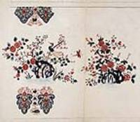
18458623Paris 1845. Pen ink and watercolour. Very good condition apart from some overall light soiling. A rare example of an original watercolour design for porcelain by the Samson factory of Paris.<br/> <br/>This finished design was intended as a reference source from which the porcelain painters could work using the design as a guide for the colours and image to be transformed from paper into fine porcelain. The French porcelain manufactory of Samson & Cie. was established by "Edmé Samson b. Paris 1810; d. Paris 1891 at 7 Rue Vendôme later Rue Béranger in Paris. The intention of the firm was to reproduce ceramics from museums and private collections and it claimed that all such reproductions would be distinctly marked to avoid confusion with the originals. In 1864 the factory was moved to Montreuil by Samson's son Emile Samson 1837-1913. The range of wares included copies of 18th-century porcelain from such factories as Sèvres Chelsea Meissen and Derby Chinese export-wares especially armorial wares decorated with famille rose colours and mugs decorated with the Fitzhugh pattern Delftware Iznikware maiolica and faience." Grove Dictionary of Art. unknown books
184514073Paris 1845. Pen ink and watercolour. Very good condition apart from some overall light soiling and minor foxing. A rare example of an original watercolour design for porcelain by the Samson factory of Paris.<br/> <br/>This finished design was intended as a reference source from which the porcelain painters could work using the design as a guide for the colours and image to be transformed from paper into fine porcelain. The French porcelain manufactory of Samson & Cie. was established by "Edmé Samson b. Paris 1810; d. Paris 1891 at 7 Rue Vendôme later Rue Béranger in Paris. The intention of the firm was to reproduce ceramics from museums and private collections and it claimed that all such reproductions would be distinctly marked to avoid confusion with the originals. In 1864 the factory was moved to Montreuil by Samson's son Emile Samson 1837-1913. The range of wares included copies of 18th-century porcelain from such factories as Sèvres Chelsea Meissen and Derby Chinese export-wares especially armorial wares decorated with famille rose colours and mugs decorated with the Fitzhugh pattern Delftware Iznikware maiolica and faience." Grove Dictionary of Art. unknown books
1652287521Abbeville: Nicolas Sanson 1652. unbound. Map. Engraving with original outline hand coloring. Image measures 15 1/2" x 20 1/2". Shows light foxing and some mat burn.<br/><br/> A beautiful and unususual double hemisphere hydrological world map from the mid 17th century. Shows and highlights all bodies of water including oceans gulfs lakes straits and rivers. Wonderful light hachure marks hint of a land mass in Terre Australe. Nicolas Sanson 1600-1667 is considered the founder of the French school of cartography. In reaction to the prevailing trend of Dutch baroque design Sanson favored minimal details focusing rather on accurate cartography than ornament. Shirley R.W. World 394<br/><br/> Nicolas Sanson unknown books
18458619Paris 1845. Pen ink and watercolour. Very good condition apart from some overall light soiling. A rare example of an original watercolour design for porcelain by the Samson factory of Paris.<br/> <br/>This finished design was intended as a reference source from which the porcelain painters could work using the design as a guide for the colours and image to be transformed from paper into fine porcelain. The French porcelain manufactory of Samson & Cie. was established by "Edmé Samson b. Paris 1810; d. Paris 1891 at 7 Rue Vendôme later Rue Béranger in Paris. The intention of the firm was to reproduce ceramics from museums and private collections and it claimed that all such reproductions would be distinctly marked to avoid confusion with the originals. In 1864 the factory was moved to Montreuil by Samson's son Emile Samson 1837-1913. The range of wares included copies of 18th-century porcelain from such factories as Sèvres Chelsea Meissen and Derby Chinese export-wares especially armorial wares decorated with famille rose colours and mugs decorated with the Fitzhugh pattern Delftware Iznikware maiolica and faience." Grove Dictionary of Art. unknown books
184514400Paris 1845. Pen ink and watercolour. Very good condition apart from some overall light soiling and minor foxing. A rare example of an original watercolour design for porcelain by the Samson factory of Paris.<br/> <br/>This finished design was intended as a reference source from which the porcelain painters could work using the design as a guide for the colours and image to be transformed from paper into fine porcelain. The French porcelain manufactory of Samson & Cie. was established by "Edmé Samson b. Paris 1810; d. Paris 1891 at 7 Rue Vendôme later Rue Béranger in Paris. The intention of the firm was to reproduce ceramics from museums and private collections and it claimed that all such reproductions would be distinctly marked to avoid confusion with the originals. In 1864 the factory was moved to Montreuil by Samson's son Emile Samson 1837-1913. The range of wares included copies of 18th-century porcelain from such factories as Sèvres Chelsea Meissen and Derby Chinese export-wares especially armorial wares decorated with famille rose colours and mugs decorated with the Fitzhugh pattern Delftware Iznikware maiolica and faience." Grove Dictionary of Art. unknown books
18458622Paris 1845. Pen ink and watercolour. Good condition apart from some minor foxing overall light soiling and writing that reads: "Potiche pans god. 3 B.B. semis 13 to 8 de P" A rare example of an original watercolour design for porcelain by the Samson factory of Paris.<br/> <br/>This finished design was intended as a reference source from which the porcelain painters could work using the design as a guide for the colours and image to be transformed from paper into fine porcelain. The French porcelain manufactory of Samson & Cie. was established by "Edmé Samson b. Paris 1810; d. Paris 1891 at 7 Rue Vendôme later Rue Béranger in Paris. The intention of the firm was to reproduce ceramics from museums and private collections and it claimed that all such reproductions would be distinctly marked to avoid confusion with the originals. In 1864 the factory was moved to Montreuil by Samson's son Emile Samson 1837-1913. The range of wares included copies of 18th-century porcelain from such factories as Sèvres Chelsea Meissen and Derby Chinese export-wares especially armorial wares decorated with famille rose colours and mugs decorated with the Fitzhugh pattern Delftware Iznikware maiolica and faience." Grove Dictionary of Art. unknown books
18458624Paris 1845. Pen ink and watercolour. Good condition apart from two small waterstains and a slight crease. A rare example of an original watercolour design for porcelain by the Samson factory of Paris.<br/> <br/>This finished design was intended as a reference source from which the porcelain painters could work using the design as a guide for the colours to be used and the image to be transformed from paper into fine porcelain. The French porcelain manufactory of Samson & Cie. was established by "Edmé Samson b Paris 1810; d Paris 1891 at 7 Rue Vendôme later Rue Béranger in Paris. The intention of the firm was to reproduce ceramics from museums and private collections and it claimed that all such reproductions would be distinctly marked to avoid confusion with the originals. In 1864 the factory was moved to Montreuil by Samson's son Emile Samson 1837-1913. The range of wares included copies of 18th-century porcelain from such factories as Sèvres Chelsea Meissen and Derby Chinese export-wares especially armorial wares decorated with famille rose colours and mugs decorated with the Fitzhugh pattern Delftware Iznikware maiolica and faience." Grove Dictionary of Art. unknown books
184518737Paris 1845. Watercolor. Very good condition apart from very mild soiling and a vertical crease where the sheet was once folded. This finished design was intended as a reference source from which the porcelain painters could work using the design as a guide for the colours and image to be transformed from paper into fine porcelain. The French porcelain manufactory of Samson & Cie. was established by "Edmé Samson b. Paris 1810; d. Paris 1891 at 7 Rue Vendôme later Rue Béranger in Paris. The intention of the firm was to reproduce ceramics from museums and private collections and it claimed that all such reproductions would be distinctly marked to avoid confusion with the originals. In 1864 the factory was moved to Montreuil by Samson's son Emile Samson 1837-1913. The range of wares included copies of 18th-century porcelain from such factories as Sèvres Chelsea Meissen and Derby Chinese export-wares especially armorial wares decorated with famille rose colours and mugs decorated with the Fitzhugh pattern Delftware Iznikware maiolica and faience." Grove Dictionary of Art. unknown books
184515379Paris 1845. Pen ink and watercolour. Very good condition apart from some overall light soiling and foxing overall light creasing and a vertical crease in the center. A rare example of an original watercolour design for porcelain by the Samson factory of Paris.<br/> <br/>This finished design was intended as a reference source from which the porcelain painters could work using the design as a guide for the colours and image to be transformed from paper into fine porcelain. The French porcelain manufactory of Samson & Cie. was established by "Edmé Samson b. Paris 1810; d. Paris 1891 at 7 Rue Vendôme later Rue Béranger in Paris. The intention of the firm was to reproduce ceramics from museums and private collections and it claimed that all such reproductions would be distinctly marked to avoid confusion with the originals. In 1864 the factory was moved to Montreuil by Samson's son Emile Samson 1837-1913. The range of wares included copies of 18th-century porcelain from such factories as Sèvres Chelsea Meissen and Derby Chinese export-wares especially armorial wares decorated with famille rose colours and mugs decorated with the Fitzhugh pattern Delftware Iznikware maiolica and faience." Grove Dictionary of Art. unknown books
184510167Paris 1845. Pen ink and watercolour. Good condition apart from some overall light foxing and mild creasing. A rare example of an original watercolour design for porcelain by the Samson factory of Paris.<br/> <br/>This finished design was intended as a reference source from which the porcelain painters could work using the design as a guide for the colours and image to be transformed from paper into fine porcelain. The French porcelain manufactory of Samson & Cie. was established by "Edmé Samson b. Paris 1810; d. Paris 1891 at 7 Rue Vendôme later Rue Béranger in Paris. The intention of the firm was to reproduce ceramics from museums and private collections and it claimed that all such reproductions would be distinctly marked to avoid confusion with the originals. In 1864 the factory was moved to Montreuil by Samson's son Emile Samson 1837-1913. The range of wares included copies of 18th-century porcelain from such factories as Sèvres Chelsea Meissen and Derby Chinese export-wares especially armorial wares decorated with famille rose colours and mugs decorated with the Fitzhugh pattern Delftware Iznikware maiolica and faience." Grove Dictionary of Art. unknown books
184513983Paris 1845. Pen ink and watercolour. Very good condition apart from some light soiling and a few small tears at the edge of the bottom margin. A rare example of an original watercolour design for porcelain by the Samson factory of Paris.<br/> <br/>This finished design was intended as a reference source from which the porcelain painters could work using the design as a guide for the colours and image to be transformed from paper into fine porcelain. The French porcelain manufactory of Samson & Cie. was established by "Edmé Samson b. Paris 1810; d. Paris 1891 at 7 Rue Vendôme later Rue Béranger in Paris. The intention of the firm was to reproduce ceramics from museums and private collections and it claimed that all such reproductions would be distinctly marked to avoid confusion with the originals. In 1864 the factory was moved to Montreuil by Samson's son Emile Samson 1837-1913. The range of wares included copies of 18th-century porcelain from such factories as Sèvres Chelsea Meissen and Derby Chinese export-wares especially armorial wares decorated with famille rose colours and mugs decorated with the Fitzhugh pattern Delftware Iznikware maiolica and faience." Grove Dictionary of Art. unknown books
184514120Paris 1845. Pen ink and watercolour. Good condition apart from some overall light soiling and minor foxing. A rare example of an original watercolour design for porcelain by the Samson factory of Paris.<br/> <br/>This finished design was intended as a reference source from which the porcelain painters could work using the design as a guide for the colours and image to be transformed from paper into fine porcelain. The French porcelain manufactory of Samson & Cie. was established by "Edmé Samson b. Paris 1810; d. Paris 1891 at 7 Rue Vendôme later Rue Béranger in Paris. The intention of the firm was to reproduce ceramics from museums and private collections and it claimed that all such reproductions would be distinctly marked to avoid confusion with the originals. In 1864 the factory was moved to Montreuil by Samson's son Emile Samson 1837-1913. The range of wares included copies of 18th-century porcelain from such factories as Sèvres Chelsea Meissen and Derby Chinese export-wares especially armorial wares decorated with famille rose colours and mugs decorated with the Fitzhugh pattern Delftware Iznikware maiolica and faience." Grove Dictionary of Art. unknown books
184514074Paris 1845. Pen ink and watercolour. Very good condition apart from a 7/8" tear along the right edge of the bottom crease some overall light soiling and minor foxing and a few skillfully repaired small tears in the right margin one of which slightly extends into the right part of the image. A rare example of an original watercolour design for porcelain by the Samson factory of Paris.<br/> <br/>This finished design was intended as a reference source from which the porcelain painters could work using the design as a guide for the colours and image to be transformed from paper into fine porcelain. The French porcelain manufactory of Samson & Cie. was established by "Edmé Samson b. Paris 1810; d. Paris 1891 at 7 Rue Vendôme later Rue Béranger in Paris. The intention of the firm was to reproduce ceramics from museums and private collections and it claimed that all such reproductions would be distinctly marked to avoid confusion with the originals. In 1864 the factory was moved to Montreuil by Samson's son Emile Samson 1837-1913. The range of wares included copies of 18th-century porcelain from such factories as Sèvres Chelsea Meissen and Derby Chinese export-wares especially armorial wares decorated with famille rose colours and mugs decorated with the Fitzhugh pattern Delftware Iznikware maiolica and faience." Grove Dictionary of Art. unknown books