2 781 résultats
2013x-1489935819Springer 2013. Paperback. New. 488 pages. 9.30x6.20x1.10 inches. Springer paperback
000122241Shimshon Blokh haLevi. Shvilei Olam. Zholkva 1822. Publisher: Meir Zeev Hoffer. In Hebrew. The listing price is for a single volume of this title. The copy is in fair condition without binding. Some imperfections are among the following common defects: holes damaged pages tears water stains foxing worm holes or tracers age spots frayed margins handwritten notes inscriptions censorship stamps. Please contact us for more details on the condition of the book. SKU000122241 unknown
2006x-1441939415Springer US 2006. Paperback. New. 392 pages. 9.25x6.10x0.87 inches. Springer US paperback
2010x-3642128521Springer Verlag 2010. Hardcover. New. 1st edition. 214 pages. 9.25x6.00x0.50 inches. Springer Verlag hardcover
2010x-3642123619Springer Pub Co 2010. Hardcover. New. 197 pages. 9.50x6.50x1.00 inches. Springer Pub Co hardcover
2013x-3642264204Springer Verlag 2013. Paperback. New. 2010 edition. 228 pages. 9.25x6.10x0.54 inches. Springer Verlag paperback
2012x-3642263526Springer Verlag 2012. Paperback. New. 2010 edition. 232 pages. 9.20x6.10x0.48 inches. Springer Verlag paperback
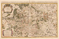
169233439Paris: H. Jaillot 1692. In ausgezeichnetem Zustand. . 570 by 850mm 22 by 33 inches. Hand-Colored Original Copperplate Engraving by Charles Hubert Alexis Jaillot & Nicolaus Sanson depicting Le Cercle de Franconie subdivise entous les Estats qui le composent. Dressè sur les Memotres les plus Nouveaux Parle Sr. Sanson Geographe Ordinaire du Roy. A Paris Chez H. Iaillot joignant les grands Augustins aux dewe Globes. Avec Privilege du Roypour Vingt Ans. 1692. Published Paris H. Jaillot 1692. Sheet: 570 by 850mm 22 by 33 inches. A fine and original hand-colored example of Jaillot's celebrated cartographic work documenting this region of Germany with the precision and decorative artistry characteristic of the 16900s. Alexis-Hubert Jaillot c.1632-1712 was one of the foremost French cartographers of the late 17th and early 18th centuries. Working in Paris he produced magnificent large-format maps of European territories often in collaboration with Nicolas Sanson -- considered the father of French cartography. Jaillot's maps are known for their striking decorative cartouches generous size and fine hand coloring representing the pinnacle of French Baroque cartography.This original copperplate engraving with original hand coloring depicts the region of Le Cercle de Franconie subdivise entous les Estats qui le composent. Dressè sur les Memotres les plus Nouveaux Parle Sr. Sanson Geographe Ordinaire du Roy. A Paris Chez H. Iaillot joignant les grands Augustins aux dewe Globes. Avec Privilege du Roypour Vingt Ans. 1692. published in Paris H. Jaillot 1692. The map features a decorative Baroque cartouche containing the title inscription. A distance scale is incorporated within the cartouche or alongside it. The map records the political and geographic boundaries of the region as understood in 1692 offering a fascinating window into the history of German territorial organization. Sheet measures 570 by 850mm 22 by 33 inches. In good condition overall with minor signs of age appropriate for a 17th-century engraving. Ready to frame. H. Jaillot unknown
2021x-0198754957Oxford Univ Pr 2021. Hardcover. New. 656 pages. 9.50x6.50x1.75 inches. Oxford Univ Pr hardcover
20112-1611226562Nova Science Pub Inc 2011. Hardcover. New. 384 pages. 10.00x7.25x1.00 inches. Nova Science Pub Inc hardcover
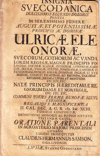
107610Leipzig Stanno Georgiano 1693. Folio. 28 s. HÃ¥rt skuren titelbladet med delförlust av bokstäver. Arket med â€Ad orationem parentalum†löst. Tagen ur band. Delvis bortskuren namnteckning pÃ¥ titelbladet. VD17 1:033780V. Warmholtz 6601 som anger 1694 som tryckÃ¥r. Med tryckt dedikation till änklingen Karl XI. Claudius Hermann Samson 1670-1737 var son till borgmästaren i Riga Hermann Samson. Han studerade i Leipzig och blev 1697 assessor och slutligen hovrättsassessor i Riga. Hans litterära produktion bestÃ¥r av dels denna parentation vid Ulrika Eleonoras begravning och dels av tvÃ¥ hyllningar vid hennes död en pÃ¥ tyska och en pÃ¥ tyska samt parentationer till tvÃ¥ andra personer. Ulrika Eleonora d.ä. 1656-93 frÃ¥n Danmark var gift med Karl XI och var svensk drottning frÃ¥n 1680 till sin död. Hon dog pÃ¥ Karlberg 26 juli 1693. unknown
16546571Paris 1654. Copper engraving 37 x 48 cms modern hand-colour blank verso. Nicolas Sanson 1600-1667 founder of the Sanson dynasty of map-makers is considered by many to be the father of the French school of cartography. He was a prolific and original map-maker admired for the clarity and scientific accuracy of his maps. Map unknown
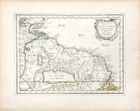
165766689Paris. c.1657. A very attractive and finely engraved map of the north eastern South American country of Guiana. The map is highlighted by numerous rivers tributaries mountains villages inlets bays and a very large inland equatorial lake that was thought to exist. Published in "Cartes Generales de toutes les parties du monde." Size: 285 x 360 mm. Copperplate engraving with original outline colouring. Fine condition. unknown
165756721Histoire et Geographie de l'Amerique. 1657. Attractive map of Paraguay. Title cartouche at top right. Maps by Sanson in original colour are rare. Nicolas Sanson was founder of the French school of mapmakers at a time when the leadership in European cartography passed from the Low Countries to France. Copper engraving. Fine condition; very light offsetting. Original outline colour. Size: 28.5 x 21.5 cm. 11 x 8½ inches unknown
2023__110853922XCambridge University Press 2023. 2 Hardback books. New. 1st edition. 1600 pages. 9.29x6.54x3.58 inches. Cambridge University Press hardcover
REIS0742Wien Holzhausen 1901. Front.-Portr. IX 1611 Seiten mit zahlreichen Abbildungen nach Zeichnungen im Text 9 Tafeln mit 11 photogr. Abb. 1 Farbradierung von Fischer nach Hildebrandt. Grüner Original-Leinenband mit Einbandgoldpräg. u. Kopfgoldschnitt Lesebändchen. Frisch u. fleckenfrei sehr gut erhalten. Exlibris. Cordier Bibl. Indosinica 910. - Mit einem Vorwort von Carl Ritter von Gsiller sowie einer biographischen Skizze über den Verfasser. (Wien, Holzhausen) 1901. unknown
926869like new. unknown
2012x-1780761198I B Tauris & Co Ltd 2012. Hardcover. New. 320 pages. 8.60x5.60x1.20 inches. I B Tauris & Co Ltd hardcover
6515702Longman Group pp. 335 2nd Edition . Hardback. New. Longman Group hardcover
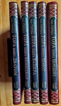
19934876<p>Jerusalem: Shvut Ami 1993. Hardcover Set. AsNew condition. 9.6"x6.8". be42. Contact the seller about the price of shipping.</p> Shvut Ami hardcover
2023x-946265509XT.M.C. Asser Instituut 2023. Paperback. New. 771 pages. 9.25x6.10x1.54 inches. T.M.C. Asser Instituut paperback
2019DBS-9781682857274Willford 2019. 1st. Hardcover. New. Willford hardcover
2019DBS-9781682857274Willford 2019. 1st. Hardcover. New. Willford hardcover
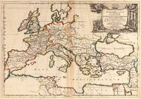
166725060Paris: P. Mariette 1667. Other. The centre fold minor spotting else in excellent condition. 395 by 565mm 15 by 22 inches. Rare and decorative large-format historical map of Europe showing the locations of Church Councils and Synods in original outline color. By Guillaume Sanson 16331703 Géographe du Roy published by Pierre Mariette Paris 1667. Image: 395 x 565 mm 15.5 x 22 inches. Decorated with a superb allegorical title cartouche depicting a Catholic council in session a unique historical and cartographic document. Guillaume Sanson 16331703 was a leading French cartographer who inherited the celebrated family firm from his father Nicolas Sanson 16001667 known as the 'Father of French Cartography' and official Géographe du Roy to Louis XIV. Like his father Guillaume held the title of Géographe Ordinaire du Roy. Much of his work after 1671 was published in collaboration with Alexis-Hubert Jaillot and together the Sanson dynasty dominated French cartography throughout the 17th century. Their maps are held in the Bibliothèque nationale de France the British Library and major research collections worldwide.This large and striking map plots the locations of ecumenical councils national synods provincial councils and diocesan synods across Europe a unique cartographic subject of combined religious and historical significance. The coverage extends from the British Isles and Iberian Peninsula across to the eastern Mediterranean including Cyprus and Syria with North Africa also shown. Political borders are rendered in hand-applied outline color. The splendid allegorical title cartouche depicts a Catholic council in session and was engraved to the highest standard of the Parisian workshop. The Geographia Synodica is among the most unusual and collectible maps ever published of Europe: a historic document of scholarship faith and cartographic craft. In excellent condition. Original outline color fresh and vivid. The centrefold shows minor spotting as expected for a 17th-century map of this size; all else excellent. No tears or significant foxing. 395 x 565 mm. P. Mariette unknown