SAMSON & CO (designers)Biblio.com

2 781 résultats
184514123Paris 1845. Pen ink and watercolour. Good condition apart from some overall light soiling and minor foxing mild creasing and a few light brownish stains in the image and top margin. A skillfully repaired 5 7/8" tear traveling from the top margin into the top of the image. The design instructions on the print read: "Jardiniere cabossée" A rare example of an original watercolour design for porcelain by the Samson factory of Paris.<br/> <br/> This finished design was intended as a reference source from which the porcelain painters could work using the design as a guide for the colours and image to be transformed from paper into fine porcelain. The French porcelain manufactory of Samson & Cie. was established by "Edmé Samson b. Paris 1810; d. Paris 1891 at 7 Rue Vendôme later Rue Béranger in Paris. The intention of the firm was to reproduce ceramics from museums and private collections and it claimed that all such reproductions would be distinctly marked to avoid confusion with the originals. In 1864 the factory was moved to Montreuil by Samson's son Emile Samson 1837-1913. The range of wares included copies of 18th-century porcelain from such factories as Sèvres Chelsea Meissen and Derby Chinese export-wares especially armorial wares decorated with famille rose colours and mugs decorated with the Fitzhugh pattern Delftware Iznikware maiolica and faience." Grove Dictionary of Art. unknown
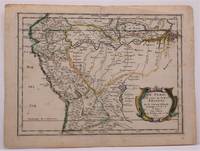
1657W2347Paris: Chez Sanson 1657. Image is 8 1/8 inches by 11 inches on a folded sheet measuring 9 inches by 12 13/16 inches. Original hand-colored copper-engraved map from Sanson's atlas of maps of the Americas: L'Amerique en Plusieurs Cartes. It is a map of the Viceroyalty of Peru that displays the Amazon River and its many tributaries. Nicolas Sanson 1600-1667 was the official geographer for the king of France. His map of Peru and the Amazon became the standard that was copied by almost all geographers/cartographers--even reproduced by Bion for his 1700 treatise on globes. Cintra and Oliveira argue that Sanson's map was a scientific one that holds up well even when compared to 21st century maps of the region. The map is in about very good condition: clean with bright original outline color; minimal foxing ; some edgewear and soiling in the margins. . First Edition. Single Sheet. Very Good-. 8 1/8 inches by 11 Inches. Map. Chez Sanson
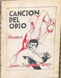
193965714México: Ediciones de la Sociedade de Amigos de España; Talleres Gráficos de la Editorial El Mundo 1939. illus. wrps. The poetry of Jesús Flores Sansón which reflect his strong support of the workers and communist movements in Mexico and the world and his solidarity with the anti-fascists in the Spanish Civil War. 2 color cover by Alberto Beltrán. Only one copy in OCLC USA. Ediciones de la Sociedade de Amigos de España; Talleres Gráficos de la Editorial El Mundo unknown
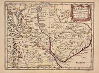
1657326341Paris 1657. unbound. Map. Original outline coloring. Sheet measures 8 3/4" x 12 1/8". Image measures 8" x 10 5/8". Paris: Nicolas Sanson 1657.<br/> <br/> This rare 17th century map by Nicolas Sanson with original color depicts the region showing present day Paraguay Uruguay with parts of Brazil and Argentina. Mountains are rendered pictorially and cities rivers and notations describing indigenous populations are labeled. In very good condition.<br> <br> Nicolas Sanson 1600-1667 is considered the founder of the French school of cartography. In reaction to the prevailing trend of Dutch lavishness Sanson favored minimal details focusing rather on accurate cartography than ornament.<br/> <br/> unknown
1700104160<p>Copper engraved map double page 24" x 20" hand colored and large uncolored title cartouches. Some minor soiling a little wear along centerfold with old verso repair normal aging; very good. Samson 1600-1667 is often referred to as the father of French cartography. Louis XIII was impressed with his work and appointed him "Geographe Ordinaire du Roi". During his career Sanson would produce about 300 maps and his major atlas "Cartes Generales de Toutes les Parties du Monde" would represent an important part of his body of work. While two of his sons continued publication of his maps after his death Pieter Schenk 1655-1718 an important publisher and engraver in his own right published this map. The map is attractively colored and gives a detailed view of the provinces of France. The map is also decorated with a large title cartouche. Bagrow p. 185. map hist website.</p>
1683297468Paris 1683. unbound. Map. Copper engraving with hand coloring. Image measures 7 5/8 x 11 1/4 inches.<br/> <br/> This map published in Paris in Afrique en plusieurs cartes is one of Sanson's small atlas maps of depicting various African regions. This map offers extensive detail on the cities of North Africa as well as topographical and geographical features with mountains beautifully rendered in profile. Nicolas Sanson 1600-1667 is considered the founder of the French school of cartography. In reaction to the prevailing trend of Dutch lavishness Sanson favored minimal details focusing rather on accurate cartography than ornament. This map is a fine example of his work.<br/> <br/> unknown
000115915Chaim ben Moshe Shimshon of Viermaiza. Chut haShani. Sudilkov 1833. Publisher: Yitzhak Madfis. In Hebrew. The listing price is for a single volume of this title. The copy is in fair condition without binding. Some imperfections are among the following common defects: holes damaged pages tears water stains foxing worm holes or tracers age spots frayed margins handwritten notes inscriptions censorship stamps. Please contact us for more details on the condition of the book. SKU000115915 unknown
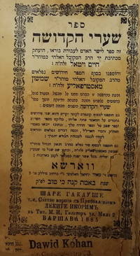
000130821Chaim Vital Shimshon of Osropolie. Shaarei haKdusha. Warsaw 1885. Publisher: Meir Yechiel Halter. In Hebrew. The listing price is for a single volume of this title. The copy is in fair condition without binding. Some imperfections are among the following common defects: holes damaged pages tears water stains foxing worm holes or tracers age spots frayed margins handwritten notes inscriptions censorship stamps. Please contact us for more details on the condition of the book. SKU000130821 unknown
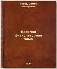
9279965Short description: In Russian. Glazer Samson Volfovich. The merry winter of sport. Moscow: Physical culture and tourism 1934: 16 type of trust Polygraphbook. Please feel free to contact us for a detailed description of the copies available. SKU9279965 unknown
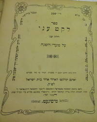
000118472Moshe ben Yakov Shimshon Hager meKosov. Leket Oni. Sighet 1910. Publisher: Yerachmiel Roizenthal. In Hebrew. The listing price is for a single volume of this title. The copy is in fair condition without binding. Some imperfections are among the following common defects: holes damaged pages tears water stains foxing worm holes or tracers age spots frayed margins handwritten notes inscriptions censorship stamps. Please contact us for more details on the condition of the book. SKU000118472 unknown
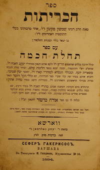
000180944Shimshon. Sefer haKritot. Warsaw 1884. Publisher: Yitzhak Goldman. In Hebrew. The listing price is for a single volume of this title. The copy is in fair condition without binding. Some imperfections are among the following common defects: holes damaged pages tears water stains foxing worm holes or tracers age spots frayed margins handwritten notes inscriptions censorship stamps. Please contact us for more details on the condition of the book. SKU000180944 unknown
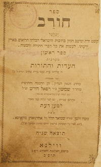
000127001Shimshon bemn Rafael Hirsh of Frankfurt-Main. Sefer Chorev. Vilna 1901. Publisher: Widow and brothers Romm. In Hebrew. The listing price is for a single volume of this title. The copy is in fair condition without binding. Some imperfections are among the following common defects: holes damaged pages tears water stains foxing worm holes or tracers age spots frayed margins handwritten notes inscriptions censorship stamps. Please contact us for more details on the condition of the book. SKU000127001 unknown
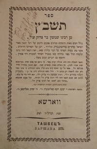
000176326Shimshon Bar Tsedek. Tashbats. Warsaw 1875. Publisher: Yakov Yosef Kaliberg Yitzhak Goldman. In Hebrew. The listing price is for a single volume of this title. The copy is in fair condition without binding. Some imperfections are among the following common defects: holes damaged pages tears water stains foxing worm holes or tracers age spots frayed margins handwritten notes inscriptions censorship stamps. Please contact us for more details on the condition of the book. SKU000176326 unknown
000115921Yair Chaim ben Moshe Shimshon Vermeysha. Chavat Yair. Sudilkov 1834. Publisher: Yitzhak ben Eliezer. In Hebrew. The listing price is for a single volume of this title. The copy is in fair condition without binding. Some imperfections are among the following common defects: holes damaged pages tears water stains foxing worm holes or tracers age spots frayed margins handwritten notes inscriptions censorship stamps. Please contact us for more details on the condition of the book. SKU000115921 unknown
1978biblio2529<p>Feldheim Publishers; New Corrected Edition 1978. Fine Hardcover RedBrown Leather or Leatherlike binding Gilt Stamping and lettering no dj. Colorless personal stamp of rabbi Daniel L. Schwartz. Three words inscription inside front cover. Otherwise The Book looks as New. 7.9"x5.5"x1.3". be26502.</p> Feldheim Publishers hardcover
170054035Amsterdam: 1700. Map of Germany divided into regions which at the time extended over much of the Low Countries. Maps by Sanson in original colour are rare. Nicolas Sanson was founder of the French school of mapmakers at a time when the leadership in European cartography passed from the Low Countries to France. This map was published in Brion's treatise on globes. Nicolas Brion was a famous French mathematical and scientific instrument maker. L'Usage des Globes. Copper engraving. Fine condition. Original colour. Size: 23.5 x 18.5 cm. unknown
3244Americas: Amsterdam Francois Halma 1705. Copper engraved map of Guatemala by N. Sanson from Halma's Algemeene Werelde Beschryving Vol. 3 Black and white; title in Dutch; verso blank; strapwork title cartouche. This map appeared in Algemeene Weereld-Beschryving nae de Rechte Verdeeling der Landschappen Plaetsen Zeeën Rivieren &c. Geographisch Politisch Historisch Chronologisch en Genealogisch a Dutch edition of A. Phérotée de la Croix's Nouvelle Methode Pour Apprendre Facilement la Geographie Universelle which first appeared in 1690. Dark impression. Nicolas Sanson d'Abbeville.1600-67 ' father of the French cartography' and founder of the Sanson firm. Atlas ' Cartes générales de toutes les parties du Monde' 1658-70 and a pocket atlas in 4 parts 1652-1705. Sanson's small maps from A. Phérotée de la Croix's Nouvelle Methode Pour Apprendre Facilement la Geographie Universelle. first published in 1652 and engraved by A. Peyrounin were copied several times by various map publishers. Johann David Zunners made copies of Sanson's maps for his German translation of Die Gantze Erd-Kugel in 1679. Johannes Ribbius and Simon de Vries published copies in 1682 and 1683 with new maps engraved by Antoine d'Winter. The plates were later sold to Francois Halma who used them in 1699 and then again in 1705 with the titles re-engraved in Dutch. François Halma 1653 - 1722 Dutch publisher/printer; dealer/auction house. Cartographer and publisher of maps active in Utrecht Amsterdam Franeker and Leeuwarden. Published 'Description de l'Univers' 1700; 'Algemene Wereldtbescrijving' 1705; 'Corpus Inscriptionum' 1707 and 'Lexicon Philosophicum' 1713. Keoman: Hal 1; Phillips 528; B Americas Central America Guatemala Amsterdam Francois Halma 1705 unknown
3243Americas: Amsterdam Francois Halma 1705. Copper engraved map of Mexico by N. Sanson from Halma's Algemeene Werelde Beschryving Vol. 3 Black and white; title in Dutch; verso blank; strapwork title cartouche. The map shows Mexico including the Yucatan peninsula part of present-day Guatemala and Honduras. This map appeared in Algemeene Weereld-Beschryving nae de Rechte Verdeeling der Landschappen Plaetsen Zeeën Rivieren &c. Geographisch Politisch Historisch Chronologisch en Genealogisch a Dutch edition of A. Phérotée de la Croix's Nouvelle Methode Pour Apprendre Facilement la Geographie Universelle which first appeared in 1690. Dark impression. Nicolas Sanson d'Abbeville.1600-67 ' father of the French cartography' and founder of the Sanson firm. Atlas ' Cartes générales de toutes les parties du Monde' 1658-70 and a pocket atlas in 4 parts 1652-1705. Sanson's small maps from A. Phérotée de la Croix's Nouvelle Methode Pour Apprendre Facilement la Geographie Universelle. first published in 1652 and engraved by A. Peyrounin were copied several times by various map publishers. Johann David Zunners made copies of Sanson's maps for his German translation of Die Gantze Erd-Kugel in 1679. Johannes Ribbius and Simon de Vries published copies in 1682 and 1683 with new maps engraved by Antoine d'Winter. The plates were later sold to Francois Halma who used them in 1699 and then again in 1705 with the titles re-engraved in Dutch. François Halma 1653 - 1722 Dutch publisher/printer; dealer/auction house. Cartographer and publisher of maps active in Utrecht Amsterdam Franeker and Leeuwarden. Published 'Description de l'Univers' 1700; 'Algemene Wereldtbescrijving' 1705; 'Corpus Inscriptionum' 1707 and 'Lexicon Philosophicum' 1713. Keoman: Hal 1; Phillips 528; B Americas Mexico Yucatan Guatemala Honduras Amsterdam Francois Halma 1705 unknown
H32ca. 1750. 30 mal 21 cm. Gefalt. Karte. unknown
2018__3319843656Springer 2018. Paperback. New. reprint edition. 380 pages. 9.25x6.10x0.86 inches. Springer paperback
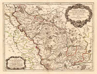
170024651Paris: H. Jaillot. 1700. Other. In excellent condition. 428 by 570mm 16 by 22 inches. 428 by 570mm 16 by 22 inches. Hand-Colored Original Copperplate Engraving by Alexis-Hubert Jaillot & N. Sanson depicting Le Duché de Berg le Comté de Homberg les Seigneuries de Hardenberg et de Wildenborg. Dressé surles Memoires les plus recents. Parle Sr. Sanson Geographe ordinaire du Roy. A Paris. Chez H. Iaillot joignant les grands Augustins aux deux Globes Aure Privilege du Roy. 1700. Published Paris H. Jaillot. 1700. Sheet: 428 by 570mm 16 by 22 inches. A fine and original hand-colored example of Jaillot's celebrated cartographic work documenting this region of Germany with the precision and decorative artistry characteristic of the 17000s. Alexis-Hubert Jaillot c.1632-1712 was one of the foremost French cartographers of the late 17th and early 18th centuries. Working in Paris he produced magnificent large-format maps of European territories often in collaboration with Nicolas Sanson -- considered the father of French cartography. Jaillot's maps are known for their striking decorative cartouches generous size and fine hand coloring representing the pinnacle of French Baroque cartography.This original copperplate engraving with original hand coloring depicts the region of Le Duché de Berg le Comté de Homberg les Seigneuries de Hardenberg et de Wildenborg. Dressé surles Memoires les plus recents. Parle Sr. Sanson Geographe ordinaire du Roy. A Paris. Chez H. Iaillot joignant les grands Augustins aux deux Globes Aure Privilege du Roy. 1700. published in Paris H. Jaillot. 1700. The map records the political and geographic boundaries of the region as understood in 1700 offering a fascinating window into the history of German territorial organization. Sheet measures 428 by 570mm 16 by 22 inches. In good condition overall with minor signs of age appropriate for a 18th-century engraving. Ready to frame. H. Jaillot. unknown
167638217Paris: Sanson 1676. AN ATTRACTIVE MAP OF SPAIN AND PORTUGAL. 18 x 25 cm plate 23.5 x 32 cm sheet. FULLY COLORED by a later hand. Printed on fine laid paper. Reverse blank. A fine impression. A PRISTINE EXAMPLE with the paper FINE AND BRIGHT. Very scarce in such fine condition. <br/><br/> Sanson unknown
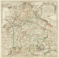
170332775Paris 1703. Tadelloses Exemplar. 420 by 420mm 16½ by 16½ inches. Original antiker Kupferstich in zeitgenössischem Grenzkolrit. Dargestellt wird der bayrische Kreis um 1650 im Norden von Eger bis nach dem benachbarten Insbruck im Süden. Im Westen noch mit Ulm a.d. Donau und im Osten bis Linz. Die einzelnen Bezirksämter u. Bistümer deutlich durch das schöne Grenzkolorit herausgearbeitet. Zeigt Ober- u. Niederbayern sowie die Oberpfalz. Rechts oben große dekorative Rollwerkstitelkartusche links oben kleiner Meilenzeiger. Gestochen von R. Cordier. Nicolas Sanson der Ältere 20. Dezember 1600 in Abbeville Frankreich; 7. Juli 1667 in Paris war ein französischer Kartograph. Seine Vorfahren stammten aus Schottland. In den Jahren 1618 bis 1667 schuf Sanson etwa 300 einzelne Karten sowie Atlanten und illustrierte Texte. Seine Arbeit wurde von seinen Söhnen Nicolas Sanson 1626 Schottland; 27. August 1648 in Paris Adrien Sanson 1708 und Guillaume Sanson 1703 seinem Neffen Pierre Duval 1619; 1683 seinem Enkel Pierre Moulard Sanson 1730 und Gilles Robert de Vaugondy 1688; 1766 fortgeführt. Wikipedia Speculum Orbis/Loeb San.VA53 unknown
16511111150111Paris 1651. Map. Very Good. Paris: Sanson Marriette 1651. 55.3 x 39.2 cm. Black-and-white copper plate engraved chart of primarily Eastern Europe with Turkey in the lower right panel. Modern hand-coloring applied to political boundaries. Title cartouche in upper right corner. Numbered 299 in upper right corner. Otherwise clean unmarked sheet with slight toning to edges. Vertical crease down center from atlas extraction. Minor chipping to edges. Colors are bright and vivid. Lines remain crisp and clear.<br><br>Nicolas Sanson was a Jesuit-trained French cartographer who attracted attention with a detailed accurate map of Gaul which he constructed when only 18. Active from 1627 Sanson issued his first map of importance the Postes de France which was published by Melchior Tavernier in 1632. After publishing several general atlases himself he became the associate of Pierre Mariette a publisher of prints.<br><br>The following map is one of the many prints Sanson collaborated with Mariette on. Unlike Jaillots future reproductions the original plates maintain a more modest decorative style with understated cartouches and less flourish or embellishment. Please feel free to view our photographs of this piece. Paris unknown
2008x-1855661683Tamesis Books Ltd 2008. Hardcover. New. 384 pages. 9.50x6.50x1.00 inches. Tamesis Books Ltd hardcover