2 781 résultats
2022x-0198855907Oxford Univ Pr 2022. Hardcover. New. 1st edition. 598 pages. 9.75x7.00x1.50 inches. Oxford Univ Pr hardcover
2017x-3319629611Springer 2017. Hardcover. New. 435 pages. 9.50x6.50x1.25 inches. Springer hardcover
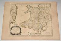
90477PARIS Chez l’Auteur 1658. Title cartouche to lower left corner. Blank on verso. In good condition. Some light tanning on edges with a few faint foxing marks. With original outline hand colouring. Engraved Size 17.5 x 23 inches Nicolas Sanson 1600-1667 sometimes called Nicolas Sanson d'Abbeville or Sanson d'Abbeville was the most important French cartographer of the 17th century. Tooley called Sanson "the founder of the French school of cartography." He began making maps in the late 1620s and in the 1630s he was working with Melchior Tavernier. Later Sanson worked in concert with the print publisher Pierre Mariette with whom he published his great atlas: Cartes générales de toutes les parties du monde 1658. After Sanson's death in 1667 his son Guillaume carried on the business in partnership with Alexis Hubert Jaillot. Guillaume established himself as a very important French mapmaker in his own right. PARIS Chez l’Auteur 1658 unknown
2026x-3032118697Springer 2026. Hardcover. New. 313 pages. 6.30x0.87x9.49 inches. Springer hardcover
2002__0521590175Cambridge Univ Pr 2002. Hardcover. New. 772 pages. 9.25x5.75x1.75 inches. Cambridge Univ Pr hardcover
1999DADAX0631201890Wiley-Blackwell 1999-10-25. 1. hardcover. New. 6.90x1.30x10.00. Buy with confidence. Excellent Customer Service & Return policy. Wiley-Blackwell hardcover
2011x-0197264832Oxford Univ Pr 2011. Hardcover. New. 1st edition. 420 pages. 8.75x5.25x0.25 inches. Oxford Univ Pr hardcover
2022x-1032424494Routledge 2022. Hardcover. New. 216 pages. 8.50x5.43x0.71 inches. Routledge hardcover
2026x-9819532671Springer Nature 2026. Hardcover. New. 200 pages. 9.25x6.10x9.49 inches. Springer Nature hardcover
2012G1894037588I5N00Arbeiter Ring Publishing 2012. Paperback. Acceptable. Readable copy. Pages may have considerable notes/highlighting. ~ ThriftBooks: Read More Spend Less.Dust jacket quality is not guaranteed. Arbeiter Ring Publishing paperback
182811433MADRID: Imprenta de Verges 1828. Primera edición.- 4º.- Plena pasta española doble tejuelo y dorados en el lomo.- 5 tomos.- I: VIII.- 479 páginas.- II: 392 páginas.- 1 hoja de Advertencia.- III: 402 páginas.- 1 hoja Erratas.- IV: 372 páginas.- V: 396 páginas.- 2 hojas Erratas. . Palau 271872 Imprenta de Verges hardcover
6133606411MacMillan pp. 476 . Hardback. New. MacMillan hardcover
2012SONG3642264204Springer 2012-10-13. 2010. paperback. Used: Good. 6.10x0.54x9.25. Buy with confidence. Excellent Customer Service & Return policy. Springer paperback
2012SONG3642263526Springer 2012-06-28. 2010. paperback. Used: Good. 6.10x0.50x9.25. Buy with confidence. Excellent Customer Service & Return policy. Springer paperback
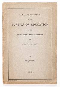
191247568New York: Bureau of Education of the Jewish Community of New York City 1912. First edition. Softcover. g to vg. Large octavo. 41pp. 1. Beige printed wrappers with black lettering on the front cover. This publication serves a report on the status of Jewish education in New York City as of the year 1912 by the overseeing bureau which had been established in two years prior. As stated on the front cover this was the fifth publication by the bureau. Written and compiled by the bureau's director and founder Samson Benderly 1876–1944 this report covers many topics including the gathering of data the state of existing schools curriculum methods of teaching women's educatio text books the organization and workings of the bureau and its departments and finally conclusions for the future. Table of contents at the front. The back cover lists the previous four publications of the bureau.<br /> <br /> Wrappers with some light age toning along the bottom and left edges of the front cover. Rubbing and some tears to the head and tail of the spine. Interior with some light creases to the bottom edges of pages. Wrappers in good interior in very good condition overall. Scarce. Protected by modern mylar. Samson Benderly 1876–1944 was a Jewish pedagogue and influential reformer in the history of modern Jewish education on the United States. In 1910 he established the Bureau of Education of the Jewish Community of New York City and was the instigator of the teaching of modern Hebrew in Hebrew for American students. Bureau of Education of the Jewish Community of New York City unknown
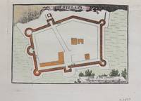
1690M9479Paris c.1690. Very Good. Notes: Map of Chielafa Greece during the late 17th century. Size : 105x152 mm 4.13x5.98 Inches Coloring: Hand Colored Category: Maps Europe Greece Macedonia; unknown
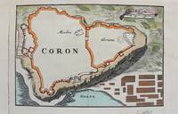
1690M9480Paris c.1690. Very Good. Notes: Map of Coron Greece during the late 17th century. Size : 103x153 mm 4.06x6.02 Inches Coloring: Hand Colored Category: Maps Europe Greece Macedonia; unknown
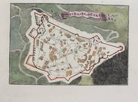
1690M9473Paris c.1690. Very Good. Notes: A charming map of Fort D'Asso Greece during the late 17th century. Size : 104x153 mm 4.09x6.02 Inches Coloring: Hand Colored Category: Maps Europe Greece Macedonia; unknown
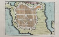
1690M9475Paris c.1690. Very Good. Notes: A charming map of Forteresse de Zante Greece during the late 17th century. Size : 104x154 mm 4.09x6.06 Inches Coloring: Hand Colored Category: Maps Europe Greece Macedonia; unknown
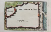
1690M9474Paris c.1690. Very Good. Notes: A charming map of Forteresse de Volo Greece during the late 17th century. Size : 104x153 mm 4.09x6.02 Inches Coloring: Hand Colored Category: Maps Europe Greece Macedonia; unknown
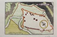
1690M9481Paris c.1690. Very Good. Notes: Map of Passava Greece during the late 17th century. Size : 104x153 mm 4.09x6.02 Inches Coloring: Hand Colored Category: Maps Europe Greece Macedonia; unknown
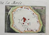
1690M9483Paris c.1690. Very Good. Notes: A charming map of Zarnata Greece during the late 17th century. Size : 103x152 mm 4.06x5.98 Inches Coloring: Hand Colored Category: Maps Europe Greece Macedonia; unknown
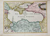
1656M10647Paris c.1656. Very Good. Size : 182x246 mm 7.17x9.69 Inches Coloring: Hand Colored Category: Maps Russia; Maps Asia Near East Turkey; Maps Europe Ukraine; unknown
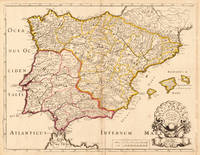
170419604Paris: N. Sanson 1704. Other. In very good condition a slightly creasing in the lower part of the centrefold with minor tiny spots. 410 by 525mm 16¼ by 20¾ inches. 410 by 525mm 16¼ by 20¾ inches. Copper engraving hand colored in outline when published. Interesting and detailed map of ‘Antique SpainÂ’ with Portugal and the Balearic Islands by the French cartographer Nicolaus Sanson d´Abbeville. The map provides us a lot of information of the various place names of cities and small towns the rivers mountains and also engraved borders of the various Spanish provinces. The map impresses with the geographic exactness which is typical for the French cartographer Nicolaus Sanson. In the decorative cartouche which is in shape of a seashell we find the altered date ‘1704Â’ which is a relatively late edition for maps by N. Sanson. The map is probably published in a French composit atlas around this date. N. Sanson unknown
20241870081L'Erma di Bretschneider 2024. paperback. New. 0x0x0. L'Erma di Bretschneider paperback