Jim SamsonBiblio.com
3 880 résultats
20034352like new. unknown
1999x-0631201890Blackwell Pub 1999. Hardcover. New. 377 pages. 10.25x7.25x1.25 inches. Blackwell Pub hardcover
2021x-3030739198Springer 2021. Hardcover. New. 254 pages. 9.25x6.10x0.83 inches. Springer hardcover
2015x-140946573XAshgate Pub Co 2015. Hardcover. New. new edition edition. 220 pages. 9.29x6.50x0.79 inches. Ashgate Pub Co hardcover
2022x-1032186410Routledge 2022. Hardcover. New. 184 pages. 9.19x6.13x0.64 inches. Routledge hardcover
2025x-1032800399Routledge 2025. Hardcover. New. 256 pages. 9.18x6.12x9.45 inches. Routledge hardcover
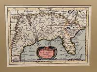
173422619Utrecht 1734. Full-title: La Floride. Par N. Sanson d' Abbeville Geogr. Ordre du Roy. Copper engraved double-page hand colored map. Neat pencil writing on verso "Henri Du Sauzet 1734". Image size 7" x 9 7/8". Tipped in double-mat. Fold line down center else a fine copy. The map covers southern states and coastline from Secotan in Virginia to Planuco in Mexico. Showing political and administrative boundaries major cities towns villages rivers mountains drainage etc. <br /> <br /> Nicolas Sanson 1600 – 1667 was a French cartographer who served under two kings in matters of geography. He has been called the "father of French cartography." <br /> <br /> Henri Du Sauzet 1686/87 - 1754 was a bookseller/publisher in Amsterdam during the early to mid-eighteenth century. unknown
2022x-3030739228Springer 2022. Paperback. New. 254 pages. 9.25x6.10x0.71 inches. Springer paperback
1986SONG0306422220Springer 1986-02-01. 1986. hardcover. Used: Good. 6.14x1.06x9.21. Buy with confidence. Excellent Customer Service & Return policy. Springer hardcover
44410481-nnew. unknown
DADAX1585740756Brand: Lyons Press 0000-00-00. First Edition. hardcover. New. 4.25x0.75x6.50. Buy with confidence. Excellent Customer Service & Return policy. Brand: Lyons Press hardcover
44410481like new. unknown
5530Paris, L'Édition d'Art H. Piazza, 1933 - 1935. 3 volumes 205 x 155 mm, 158-(8) pp., (2)ff. blancs, 12 illustrations couleurs in-texte, 4 planches couleurs de Louis Willaume, vol. 2 : 160-(6) pp., (2) ff. blancs, 12 ill. couleurs in-texte et 4 pl. couleurs de André de Doba, 12 ill. couleurs in-texte, 4 pl. ill. couleurs par Charles Samson. Reliure demi-chagrin à coins d'époque, dos à faux nerfs, orné des armes de Paris et de fleurons dorés, toutes couvertures et dos conservés, tranches sup. dorée, les premières de couverture sont illustrées, dos passés, légers frottements, vol. 3 : première de couverture un peu brunie, mors et coins très légèrement frottés, très bel état. Très bel exemplaire.
2018x-1516543696Cognella Academic Publishing 2018. Paperback. New. 486 pages. 11.02x8.50x0.98 inches. Cognella Academic Publishing paperback
2023x-1316510409Cambridge Univ Pr 2023. Hardcover. New. 800 pages. 9.21x6.46x1.97 inches. Cambridge Univ Pr hardcover
2011x-041588165XRoutledge 2011. Hardcover. New. 1st edition. 256 pages. 9.00x6.00x0.80 inches. Routledge hardcover
2004SONG0841238308American Chemical Society 2004-09-16. 1. hardcover. Used: Good. 9.10x1.10x6.30. Buy with confidence. Excellent Customer Service & Return policy. American Chemical Society hardcover
165024869London 1650. 1 vols. 13" x 8 3/4. Contemporary. hand-coloring. Fine condition. 1 vols. 13" x 8 3/4 ". unknown
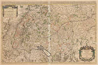
167533301Paris: Hubert Jaillot 1675. Blatt gebräunt Mittelfalz mit nicht säurebeständigem Tape hinterlegt heller Streifen. . 803 by 560mm 31 by 22 inches. Hand-Colored Original Copperplate Engraving by Alexis-Hubert Jaillot & N. Sanson depicting Le Cercle de Souabe subdivisé en tous les Estats qui le Composent Tire ´sur les Memoires les plus noueaux Par le S. Sanson Geographe Ordinaire du Roy. A Paris Ches H. Laillot joingnant les Augustins aux deux Globes Auec Priuilege du Roy pour Vingt Ans. Published Paris Hubert Jaillot 1675. Sheet: 803 by 560mm 31 by 22 inches. A fine and original hand-colored example of Jaillot's celebrated cartographic work documenting this region of Germany with the precision and decorative artistry characteristic of the 16700s. Alexis-Hubert Jaillot c.1632-1712 was one of the foremost French cartographers of the late 17th and early 18th centuries. Working in Paris he produced magnificent large-format maps of European territories often in collaboration with Nicolas Sanson -- considered the father of French cartography. Jaillot's maps are known for their striking decorative cartouches generous size and fine hand coloring representing the pinnacle of French Baroque cartography.This original copperplate engraving with original hand coloring depicts the region of Le Cercle de Souabe subdivisé en tous les Estats qui le Composent Tire ´sur les Memoires les plus noueaux Par le S. Sanson Geographe Ordinaire du Roy. A Paris Ches H. Laillot joingnant les Augustins aux deux Globes Auec Priuilege du Roy pour Vingt Ans. published in Paris Hubert Jaillot 1675. The map records the political and geographic boundaries of the region as understood in 1675 offering a fascinating window into the history of German territorial organization. Sheet measures 803 by 560mm 31 by 22 inches. In good condition overall with minor signs of age appropriate for a 17th-century engraving. Ready to frame. Hubert Jaillot unknown
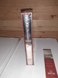
20219615<p>sealed signed by artist</p> Suntup hardcover
184514123Paris 1845. Pen ink and watercolour. Good condition apart from some overall light soiling and minor foxing mild creasing and a few light brownish stains in the image and top margin. A skillfully repaired 5 7/8" tear traveling from the top margin into the top of the image. The design instructions on the print read: "Jardiniere cabossée" A rare example of an original watercolour design for porcelain by the Samson factory of Paris.<br/> <br/> This finished design was intended as a reference source from which the porcelain painters could work using the design as a guide for the colours and image to be transformed from paper into fine porcelain. The French porcelain manufactory of Samson & Cie. was established by "Edmé Samson b. Paris 1810; d. Paris 1891 at 7 Rue Vendôme later Rue Béranger in Paris. The intention of the firm was to reproduce ceramics from museums and private collections and it claimed that all such reproductions would be distinctly marked to avoid confusion with the originals. In 1864 the factory was moved to Montreuil by Samson's son Emile Samson 1837-1913. The range of wares included copies of 18th-century porcelain from such factories as Sèvres Chelsea Meissen and Derby Chinese export-wares especially armorial wares decorated with famille rose colours and mugs decorated with the Fitzhugh pattern Delftware Iznikware maiolica and faience." Grove Dictionary of Art. unknown
1683297468Paris 1683. unbound. Map. Copper engraving with hand coloring. Image measures 7 5/8 x 11 1/4 inches.<br/><br/> This map published in Paris in Afrique en plusieurs cartes is one of Sanson's small atlas maps of depicting various African regions. This map offers extensive detail on the cities of North Africa as well as topographical and geographical features with mountains beautifully rendered in profile. Nicolas Sanson 1600-1667 is considered the founder of the French school of cartography. In reaction to the prevailing trend of Dutch lavishness Sanson favored minimal details focusing rather on accurate cartography than ornament. This map is a fine example of his work.<br/><br/> unknown books
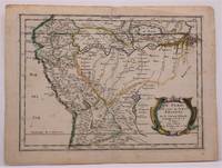
1657W2347Paris: Chez Sanson 1657. Image is 8 1/8 inches by 11 inches on a folded sheet measuring 9 inches by 12 13/16 inches. Original hand-colored copper-engraved map from Sanson's atlas of maps of the Americas: L'Amerique en Plusieurs Cartes. It is a map of the Viceroyalty of Peru that displays the Amazon River and its many tributaries. Nicolas Sanson 1600-1667 was the official geographer for the king of France. His map of Peru and the Amazon became the standard that was copied by almost all geographers/cartographers--even reproduced by Bion for his 1700 treatise on globes. Cintra and Oliveira argue that Sanson's map was a scientific one that holds up well even when compared to 21st century maps of the region. The map is in about very good condition: clean with bright original outline color; minimal foxing ; some edgewear and soiling in the margins. . First Edition. Single Sheet. Very Good-. 8 1/8 inches by 11 Inches. Map. Chez Sanson
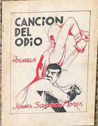
193965714México: Ediciones de la Sociedade de Amigos de España; Talleres Gráficos de la Editorial El Mundo 1939. illus. wrps. The poetry of Jesús Flores Sansón which reflect his strong support of the workers and communist movements in Mexico and the world and his solidarity with the anti-fascists in the Spanish Civil War. 2 color cover by Alberto Beltrán. Only one copy in OCLC USA. Ediciones de la Sociedade de Amigos de España; Talleres Gráficos de la Editorial El Mundo unknown
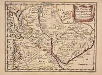
1657326341Paris 1657. unbound. Map. Original outline coloring. Sheet measures 8 3/4" x 12 1/8". Image measures 8" x 10 5/8". Paris: Nicolas Sanson 1657.<br/> <br/> This rare 17th century map by Nicolas Sanson with original color depicts the region showing present day Paraguay Uruguay with parts of Brazil and Argentina. Mountains are rendered pictorially and cities rivers and notations describing indigenous populations are labeled. In very good condition.<br> <br> Nicolas Sanson 1600-1667 is considered the founder of the French school of cartography. In reaction to the prevailing trend of Dutch lavishness Sanson favored minimal details focusing rather on accurate cartography than ornament.<br/> <br/> unknown