Samson JuliaABAA

192 résultats
1997031917London: Rubicon Press 1997. Revised Edition Reprinted. xvii 150p. b/w illus. original stiff wrappers. Rubicon Press unknown books
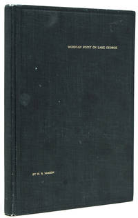
1913238650New York: Privately printed 1913. First edition #96 of 200 copies initialed and numbered on the half-title. With frontispiece 19 plates including 2 group portraits double map of Lake George around Bolton Landing at back. 65 pp. 1 vols. 8vo. Original green cloth titled in gilt on upper board. Bixby bookplate of Mohican Point house on front pastedown. Fine. First edition #96 of 200 copies initialed and numbered on the half-title. With frontispiece 19 plates including 2 group portraits double map of Lake George around Bolton Landing at back. 65 pp. 1 vols. 8vo. Inscribed on flyleaf "Mr. & Mrs. A.B. Payne names partly effaced with sincere regards of Mr. & Mrs. W.K. Bixby St. L. 5/18/14"<br/>"Includes 12 pages of text on fishing for smallmouth bass lake trout and land-locked salmon. one of the few early books to contain as much material on fishing in Lake George" Heller.<br/>An important and rare book. Plum Adirondack Bibliography 568; Bruns S27; Heller 1:716 Privately printed unknown books
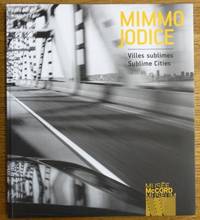
2012163079McCord Museum 2012. Softcover. VG. Inscribed on title page to previous owner. BW pictorial wraps French flaps 148 pp. many BW illus. Text is in French and English. Issued in conjunction with a 2012-2013 exhibition of photographs rendered by Italian photographer Mimmo Jodice b. 1934. With essays by Dany Laferriere and Helene Samson. Includes an exhibitions history selected bibliography and many BW illustrations. McCord Museum paperback books
2012153438McCord Museum 2012. Softcover. VG. BW pictorial wraps French flaps 148 pp. many BW illus. Text is in French and English. Issued in conjunction with a 2012-2013 exhibition of photographs rendered by Italian photographer Mimmo Jodice b. 1934. With essays by Dany Laferriere and Helene Samson. Includes an exhibitions history selected bibliography and many BW illustrations. McCord Museum paperback books
165024869London 1650. 1 vols. 13" x 8 3/4. Contemporary. hand-coloring. Fine condition. 1 vols. 13" x 8 3/4 ". unknown books
201029856Paris: Somogy 2010. First edition. Paperback. Fine. Thick paperbound volume in photo-illustrated glossy wrappers with French flaps. 103 pp. Illustrated with numerous illustrations and color photographs. Text in French by Pierre Berge and others. A fine copy. Book describes and analyzes the life and career of author and artist Jean Cocteau in his home in France. Somogy paperback books
20149027776Tubingen: Mohr Siebeck 2014. 1st . Paperback. fine. Wissenschaftliche Untersuchungen zum Nuen Testament 2. Reihe 366. Text in English <br/><br/> Mohr Siebeck paperback books
19691619Garden City: Doubleday. Near Fine in Near Fine dust jacket. 1969. Hardcover. B0006BYM66 . Illustrated by the author. First edition. Near fine in a near fine minor edge wear dust jacket. . Doubleday hardcover books
119346hardcover. illus. 4to cloth d.w. N.Y.: Winchester 1973. vg<br/><br/> unknown books
18528000Paris: Chez L'un des Auteurs et Chez Ledoyen Libraire 1852. 1st. Very Good. 1st edition. Pamphlet in original wraps bound in limp paper covered boards. A beautiful copy. <br/><br/> Chez L'un des Auteurs et Chez Ledoyen Libraire hardcover books
1648251162Paris 1648. unbound. Map. Engraving with hand outline color. Image measures 14.5 x 21.5 inches.<br/><br/> This map of Switzerland centers on Lucerne covering approximately the area from Lake Constance south to Lake Como in Italy. Published in 1648 the map dates to the period of the Old Swiss Confederacy. Furthermore it predates by only a few years the Swiss Peasant War of 1653 a siege of Lucerne and Bern that demonstrated the significance of the rural population to the confederacy%u2019s stability. Hand-colored outlines on the map indicate the various independent states that made up the confederacy. A title cartouche with elaborate scrollwork adorns the lower right corner of the map. The map is in good condition with full margins and no chips or tears. Wear to lower margin. Nicolas Sanson 1600-1667 is considered the founder of the French school of cartography. In reaction to the prevailing trend of Dutch lavishness Sanson favored minimal details focusing rather on accurate cartography than ornament. This map demonstrates the skill that made him such a valuable asset to the French monarchy.<br/><br/> unknown books
193838911Paris 1938. First Edition. 12mo. Staple-bound pamphlet; printed thick paper wrappers; 64pp. Covers slightly browned and foxed; internally clean and unmarked text unopened; Very Good. Late single issue of this notable anarchist-literary journal which ran from 1917 to 1939 under the single-handed control of Maurice Wullens a Flemish-born schoolteacher anarchist and later accidental collaborationist with national socialism. Uncommon. unknown books
1700104160<p>Copper engraved map double page 24" x 20" hand colored and large uncolored title cartouches. Some minor soiling a little wear along centerfold with old verso repair normal aging; very good. Samson 1600-1667 is often referred to as the father of French cartography. Louis XIII was impressed with his work and appointed him "Geographe Ordinaire du Roi". During his career Sanson would produce about 300 maps and his major atlas "Cartes Generales de Toutes les Parties du Monde" would represent an important part of his body of work. While two of his sons continued publication of his maps after his death Pieter Schenk 1655-1718 an important publisher and engraver in his own right published this map. The map is attractively colored and gives a detailed view of the provinces of France. The map is also decorated with a large title cartouche. Bagrow p. 185. map hist website.</p> books
1652251161Paris 1652. unbound. Map. Engraving with hand outline color. Image measures 14 x 16.5%u201D.<br/><br/> This map of southeastern France includes the erstwhile provinces of Dauphiné corresponding roughly to the present departments of Isère Drôme and Hautes-Alpes as well as parts of Savoye and Bresse. At the time of the map%u2019s publication in 1652 Dauphiné was under the absolutist rule of King Louis XIV. The cartographer Nicolas Sanson as Royal Geographer to Louis XIV as well as Louis III likely understood the importance of this region to French interests of the time. The map thusly provides ample detail about the area including cities rivers mountains and significant forts. Hand-colored outlines indicate political boundaries. An elegant cartouche in the upper right corner of the map displays the title amidst scrollwork topped with the crown of the French monarchy. The map is in very good condition with full margins and no chips or tears. Nicolas Sanson 1600-1667 is considered the founder of the French school of cartography. In reaction to the prevailing trend of Dutch lavishness Sanson favored minimal details focusing rather on accurate cartography than ornament. This map points to his significant role within the French monarchy.<br/><br/> unknown books
166710027Paris 1667. No Binding. Near Fine. 12 ½ x 17 inches. Original outline color; excellent. Earliest map of Martinique listed in Phillips featuring attractive original color and an elegant cartouche. This map depicts the situation on the island before 1660 when it was still largely inhabited by natives and only about half of it had been claimed by colonists for sugar cane farming. The map goes so far as to mark with a printed line the partition dividing the "demeure des François" and the "demeure des savages." However by 1660 the entirety of the native population was either dead expelled or in slavery and Martinique was a full-fledged sugar cane-farming European colony. Phillips Maps P. 389. unknown books
1652287521Abbeville: Nicolas Sanson 1652. unbound. Map. Engraving with original outline hand coloring. Image measures 15 1/2" x 20 1/2". Shows light foxing and some mat burn.<br/><br/> A beautiful and unususual double hemisphere hydrological world map from the mid 17th century. Shows and highlights all bodies of water including oceans gulfs lakes straits and rivers. Wonderful light hachure marks hint of a land mass in Terre Australe. Nicolas Sanson 1600-1667 is considered the founder of the French school of cartography. In reaction to the prevailing trend of Dutch baroque design Sanson favored minimal details focusing rather on accurate cartography than ornament. Shirley R.W. World 394<br/><br/> Nicolas Sanson unknown books
1652010748twParis: Sanson. Very Good. 1652. A very rare map from Nicolas Sanson. Imprint bears the date of 1652 although it is possible that this copy came from an atlas in the later 1600s. Light toning and edgewear with one corner slightly chipped. Light soil on lower margin. Hand-colored boundaries. Map borders measure 14" x 20 3/4". California is shown as an island and Terre Australe is a vague line encircling the Antarctic. Terre de Iesso is the name given to the land mass northwest of North America. Sanson 1600-1667 published many map versions of the world and is known as "the father of French cartography." ; 16 1/2" x 22 1/4" . Sanson unknown books
1696206066Amsterdam: Alexis-Hubert Jaillot 1696. unbound. very good. Map. Engraving with hand outline. Image measures 23" x 35".<br/><br/> Stunning map showing the vast extent of the German Empire including parts of Poland Bohemia Hungary Austria Croatia Italy France and the Netherlands. Exquisite and subtle coloring beautifully detailed. Based on a plate by Nicolas Sanson reworked and published in "Atlas Nouveau" by Jaillot. Severe toning due to early acid backing chipping to edges and corners and some tears. Priced as is. Alexis-Hubert Jaillot 1632--1712 was a French sculptor engraver publisher and cartographer. He served as official geographer to King Louis XIV and worked with other prominent mapmakers of the period such as Nicolas Sanson He is best known for his Atlas Nouveau of 1674.<br/><br/> Alexis-Hubert Jaillot unknown books
1652006683Paris: Chez l'Autheur 1652. First Edition . Full Calf. Very Good. 4to. 23.5 by 17.5 cm. Unpaginated 102 pages of text plus 2 pp. of ads 1 Royal privilege page. With 17 copper engraved maps all two page plates each with hand-colored of boundaries. Maps include one of the entire continent then of its various regions as then known plus island groups. Separate maps for China and Japan. Bound in contemporary calf. Condition: Rebacked with joints making this obvious. Calf dry and rubbed on spine and joints and edges rubbed. Light to moderate soiling in the margins of the pages. Edge of a few leaves with short stretch slightly chewed-looking. Two bookplates -- one of the Marquis of Lothian the other the Newbattle Abbey Library. <br /><br /> Chez l'Autheur books
1656006682Paris: Chez l'Autheur 1656. First Edition . Full Calf. Very Good. 4to. 23.5 by 17.5 cm. Unpaginated 100 pages of text plus 2 pp. of ads. With 18 copper engraved maps all two page plates each with hand-colored of boundaries. Maps include one of the entire continent then of its various regions as then known plus the islands off the continent. Also a map of Malta. Bound in contemporary calf. Condition: calf dry and rubbed on spine and joints and edges rubbed. Light to moderate soiling in the margins of the pages. Two bookplates -- one of the Marquis of Lothian the other the Newbattle Abbey Library. <br /><br /> Chez l'Autheur books
194224364New York: Dramatists Play Service. Very Good. c.1942. Acting Edition. Softcover. slight discoloration to covers short diagonal bend at lower right corner of front cover also affecting first couple of pages tiny tear in bottom edge of front cover; one-time owner's signature on ffep. frontispiece photo of stage setting Comedy about a snooty drama critic who is brought down to earth and taught the facts of life by a free-spirited playwright somewhat modeled after William Saroyan at least in the opinion of Brooks Atkinson in the NY Times. The original 1942 Broadway production starred Alexander Knox and Nicholas Conte who changed his name to Richard Conte when he became a full-time movie actor after World War II and ran for a respectable 125 performances. . Dramatists Play Service paperback books
19425691New York Random House 1942. 1942. First edition so stated. 8vo. Dust jacket unclipped. Very good. No signatures or bookplates. F. Hardcover. New York, Random House [1942]. hardcover books
194224195NY: Random House 1942. First printing. 8vo pp. 172. Author's presentation on flyleaf. Vg in some chipped and torn dj. A play. Random House unknown books
1663283501Paris 1663. unbound. very good. Map. Hand-colored engraving. 15" x 23".<br/><br/> This map of Sicily from the 17th century shows the entire island as well as the southwesternmost tip of the Italian peninsula. The names of the surrounding bodies of water are named in Latin and rivers mountains lakes and towns are noted on the map. Nicolas Sanson 1600-1667 is considered the founder of the French school of cartography. In reaction to the prevailing trend of Dutch lavishness Sanson favored minimal details focusing rather on accurate cartography than ornament. This map is a fine example of his work.<br/><br/> unknown books
1680264415Paris 1680. unbound. Map. Uncolored copper plate engraving. Image measures 7.5" x 10". 1680.<br/><br/> This map of southeast Asia and the East Indies is essentially two maps on a single sheet. The map on the left depicts the northern portion of the India Ganges region representing Burma Myanmar Thailand Cambodia Vietnam and Laos while the map of the right depicts the southern portion and includes the Malay Peninsula Singapore Sumatra. The most interesting feature is the Lacus Chimay Chimay Lake the mythical lake located in northern Burma which was believed to be the source of the river system in Southeast Asia. Important towns and cities are identified with beautifully rendered topography depicted in profile. Map is in very good condition with some toning along original centerfold which shows repairs on verso. Minimal foxing. <br><br>Nicolas Sanson 1600-1667 is considered the founder of the French school of cartography. In reaction to the prevailing trend of Dutch lavishness Sanson favored minimal details focusing rather on accurate cartography than ornament. This map is a fine example of his work.<br/><br/> unknown books