Salten, FelixMareMagnum

187 résultats
A clean, unmarked book with a tight binding. Slight fading to full red/brown cloth boards with silver and black design. Tears and small pieces missing from dust jacket edges. 228 pages. 5 5/8"w x 8 1/4"h. Illustrated by Ludwig Heinrich Jungickel. A book about Perri and Porro, two forest squirrels, by the author of Bambi.
Frontespizio del Theatrvm statvvm regiæ celsitvdinis Sabavdiæ dvcis, Pedemontii principis, Cypri regis pubblicato per la prima volta ad Amsterdam Amstelodami, apud. hæredes Ioannis Blaev, 1682. L’opera venne successivamente ristampata da Pierre Mortier. Acquaforte, in ottimo stato di conservazione. Title page of Theatrvm statvvm regiæ celsitvdinis Sabavdiæ dvcis, Pedemontii principis, Cypri regis first published in Amstelodami, apud. hæredes Ioannis Blaev, 1682. The work was later reprinted by Pierre Mortier. Etching, in excellent condition.
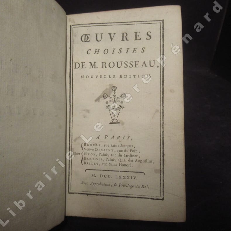
17841136421784 Nouvelle édition. A Paris, chez Brocas, Veuve Desaint, Nyon, Barrois, Bailly. Avec approbation & privilège du Roi - De l'imprimerie de la Veuve Herissant - 1784 - Petit in-12, plein veau marron, pièce de titre au dos avec fleurons dorés - 316 pages + tables et approbation royale
- EDIZIONE ORIGINALE, COLORITURA COEVA -Frontespizio del terzo volume del "Nuovo Atlante Geografico Universale delineato sulle ultime osservazioni", edito a Roma dal 1792 fino al 1801, opera che la Calcografia Camerale commissionò al Cassini al fine di sostituire l’ormai obsoleto "Mercurio Geografico".Giovanni Maria Cassini, Chierico Regolare Somasco fu geografo e cartografo, ma anche intagliatore di architetture e prospettive - uno dei migliori discepoli di Giovanni Battista Piranesi - Cassini fu uno degli ultimi sferografi italiani del Settecento ed i suoi globi ebbero una notevole diffusione, come pure questo "Nuovo Atlante Geografico".Incisione in rame, coloritura coeva dei contorni, leggere bruniture, per il resto in ottimo stato di conservazione. L'Atlante del Cassini fu ristampato dalla Calcografia Camerale nel primo quarto del XIX secolo, prima del 1839. Solo gli esemplari di prima edizione come questo sono stampati su carta vergata coeva e sono colorati a mano in epoca. Le tirature del XIX secolo sono già su carta meccanica, priva di vergelle, e generalmente in bianco e nero. - FIRST EDITION, CONTEMPORARY OUTLINE COLOUR -Title page of the third book of Nuovo atlante geografico universale delineato sulle ultime osservazioni. Roma, Calcografia camerale, 1792-1801.Cassini was geographer and cartographer but he was also good at engraving architectural items and perspectives – he was one of the best disciples Giovanni Battista Piranesi had. Moreover, Cassini was one of the last artists to engrave spheres in the XVIII century and his globes were quite famous and widespread, and realized the most important Italian Atlas of the XVIII century; his maps always bear a cartouche, extremely rich in colours and details. Copperplate with fine original hand colour, some foxing, otherwise in very good condition.The Cassini's Atlas was reprinted by the Calcografia Camerale in the first quarter of XIXth century (before 1839). Only the first edition of the atlas is printed on contemporary laid paper, while the late issue are on XIXth century paper and often without colour.
- EDIZIONE ORIGINALE, COLORITURA COEVA -Frontespizio del secondo volume del "Nuovo Atlante Geografico Universale delineato sulle ultime osservazioni", edito a Roma dal 1792 fino al 1801, opera che la Calcografia Camerale commissionò al Cassini al fine di sostituire l’ormai obsoleto "Mercurio Geografico".Giovanni Maria Cassini, Chierico Regolare Somasco fu geografo e cartografo, ma anche intagliatore di architetture e prospettive - uno dei migliori discepoli di Giovanni Battista Piranesi - Cassini fu uno degli ultimi sferografi italiani del Settecento ed i suoi globi ebbero una notevole diffusione, come pure questo "Nuovo Atlante Geografico".Incisione in rame, coloritura coeva dei contorni, leggere bruniture, per il resto in ottimo stato di conservazione. L'Atlante del Cassini fu ristampato dalla Calcografia Camerale nel primo quarto del XIX secolo, prima del 1839. Solo gli esemplari di prima edizione come questo sono stampati su carta vergata coeva e sono colorati a mano in epoca. Le tirature del XIX secolo sono già su carta meccanica, priva di vergelle, e generalmente in bianco e nero. - FIRST EDITION, CONTEMPORARY OUTLINE COLOUR -Title page of the second book of Nuovo atlante geografico universale delineato sulle ultime osservazioni. Roma, Calcografia camerale, 1792-1801.Cassini was geographer and cartographer but he was also good at engraving architectural items and perspectives – he was one of the best disciples Giovanni Battista Piranesi had. Moreover, Cassini was one of the last artists to engrave spheres in the XVIII century and his globes were quite famous and widespread, and realized the most important Italian Atlas of the XVIII century; his maps always bear a cartouche, extremely rich in colours and details. Copperplate with fine original hand colour, some foxing, otherwise in very good condition.The Cassini's Atlas was reprinted by the Calcografia Camerale in the first quarter of XIXth century (before 1839). Only the first edition of the atlas is printed on contemporary laid paper, while the late issue are on XIXth century paper and often without colour.
- EDIZIONE ORIGINALE, COLORITURA COEVA -Frontespizio del primo volume del "Nuovo Atlante Geografico Universale delineato sulle ultime osservazioni", edito a Roma dal 1792 fino al 1801, opera che la Calcografia Camerale commissionò al Cassini al fine di sostituire l’ormai obsoleto "Mercurio Geografico".Giovanni Maria Cassini, Chierico Regolare Somasco fu geografo e cartografo, ma anche intagliatore di architetture e prospettive - uno dei migliori discepoli di Giovanni Battista Piranesi - Cassini fu uno degli ultimi sferografi italiani del Settecento ed i suoi globi ebbero una notevole diffusione, come pure questo "Nuovo Atlante Geografico".Incisione in rame, coloritura coeva dei contorni, leggere bruniture, per il resto in ottimo stato di conservazione. L'Atlante del Cassini fu ristampato dalla Calcografia Camerale nel primo quarto del XIX secolo, prima del 1839. Solo gli esemplari di prima edizione come questo sono stampati su carta vergata coeva e sono colorati a mano in epoca. Le tirature del XIX secolo sono già su carta meccanica, priva di vergelle, e generalmente in bianco e nero. - FIRST EDITION, CONTEMPORARY OUTLINE COLOUR -Title page of the first book of Nuovo atlante geografico universale delineato sulle ultime osservazioni. Roma, Calcografia camerale, 1792-1801.Cassini was geographer and cartographer but he was also good at engraving architectural items and perspectives – he was one of the best disciples Giovanni Battista Piranesi had. Moreover, Cassini was one of the last artists to engrave spheres in the XVIII century and his globes were quite famous and widespread, and realized the most important Italian Atlas of the XVIII century; his maps always bear a cartouche, extremely rich in colours and details. Copperplate with fine original hand colour, some foxing, otherwise in very good condition.The Cassini's Atlas was reprinted by the Calcografia Camerale in the first quarter of XIXth century (before 1839). Only the first edition of the atlas is printed on contemporary laid paper, while the late issue are on XIXth century paper and often without colour.
<p>23 cm, in 4°, rilegatura coeva in pergamena morbida a tre nervi, titolo manoscritto al dorso ed al taglio inferiore, p. (1),(48), 648,(1). Antiporta con grande marca tipografica, grande ritratto dell'autore a tutta pagina. Oltre trecento illusrtazioni xilografiche nel testo, sempre addornate da cornice tipografica. Restauro professionale al bordo bianco esterno delle prime 9 carte, alcuni aloni marginali, più evidenti nella parte finale del volume. Piccoli antichi tratti di inchiostro al frontespizio. Titolo esteso: Nova iconologia di Cesare Ripa perugino caualier de ss. Mauritio, & Lazzaro. Nella quale si descriuono diuerse imagini di virtu, vitij, affetti, passioni humane, arti, discipline, humori, elementi, corpi celesti, prouincie d'Italia, fiumi, tutte le parti del mondo, ed' altre infinite materie. Opera vtile ad oratori, predicatori, poeti, pittori, scultori, disegnatori, e ad'ogni studioso per inuentar concetti, emblemi, ed imprese, Per diuisare qualsiuoglia apparrato Nuttiale, Funerale, Trionfale. Per rappresentar Poemi Drammatici, e per figurare co`suoi propij simboli ciò, che può cadere in pensiero humano. Ampliata vltimamente dallo stesso auttore di trecento imagini, e arricchita di molti discorsi pieni di varia eruditione; con nuoui intagli, e con molti indici copiosi. Straordinario apparato iconografico nell'ultima edizione curata dal Ripa. Esemplare in eccellenti condizioni corredato dalle freschissime llustrazioni.</p>
Frontespizio del Nova et accurata Italiae hodiernae descriptio in qua omnium eius regionum, vrbium, pagorum, dominiorum, castellorum, montium, fluviorum, fontium, lacuum, et portuum, historia exhibetur. Geographicis tabulis et vrbium praecipuarum iconibus illustrata a Iudoco Hondio addita est Siciliae, Sardiniae, Corsicae, et itinerariorum per Italiam brevis delineatio, stampato a Leida dalla tipografia Elzevir nel 1627. Si tratta di un atlante geografico unito ad una raccolta di cartografia urbana, esclusivamente dedicato alla penisola. L’opera consta di 31 carte geografiche e 67 vedute o piante di città. Le carte derivano dall’Atlas Minor del Mercator, mentre la cartografia urbana è basata sui modelli introdotti a Venezia da Francesco Valegio e da quelli del Civitates Orbis Terrarum di G.Braun e F. Hogenberg. L’opera è relativa al periodo in cui Jodocus Hondius II si era appena diviso dal fratello Hendrick. Secondo la letteratura esisterebbe una prima edizione della raccolta, stampata ad Amsterdam nel 1626. Incisione in rame, finemente colorata a mano, in ottimo stato di conservazione. Bibliografia Cremonini, pp. 23/25, n. 18; Fossati Bellani; n. 320; Willems; n. 279. Title page taken from Nova et accurata Italiae hodiernae descriptio in qua omnium eius regionum, vrbium, pagorum, dominiorum, castellorum, montium, fluviorum, fontium, lacuum, et portuum, historia exhibetur. Geographicis tabulis et vrbium praecipuarum iconibus illustrata a Iudoco Hondio addita est Siciliae, Sardiniae, Corsicae, et itinerariorum per Italiam brevis delineatio, printed in Leiden by the printing house Elzevir in 1627. This is a geographical atlas combined with a town book, exclusively dedicated to Italy. The work consists of 31 maps and 67 views or plans of cities. The maps derive from Mercator's Atlas Minor, while the plans are based on the models introduced in Venice by Francesco Valegio and those of Civitates Orbis Terrarum by G. Braun and F. Hogenberg. The work is related to the period in which Jodocus Hondius II had just separated from his brother Hendrick. According to the literature there is a first edition of the collection, printed in Amsterdam in 1626. Copper engraving, finely hand-colored, in excellent condition. Literature Cremonini, pp. 23/25, n. 18; Fossati Bellani; n. 320. Willems; n. 279.
Torino, 1932, 6 novembre, copertina illustrata a colori in fascicolo originale completo di pp. 20 de “Illustrazione del popolo”.
326762Contentum Ltd. Loose sheet. New. High-quality art print based on an original work from the Met. Created in the 16th century 1537. Professionally printed on premium fine-art paper Museum Etching museum quality in size A3. The artwork is printed with a white border museum-style presentation. Contentum Ltd. unknown
326763Contentum Ltd. Loose sheet. New. High-quality art print based on an original work from the Met. Created in the 16th century 1537. Professionally printed on premium fine-art paper Photo Rag 308 in size A2. The artwork is printed with a white border museum-style presentation. Contentum Ltd. unknown
326765Contentum Ltd. Loose sheet. New. High-quality art print based on an original work from the Met. Created in the 16th century 1537. Professionally printed on premium fine-art paper Museum Etching museum quality in size A2. The artwork is printed with a white border museum-style presentation. Contentum Ltd. unknown
326764Contentum Ltd. Loose sheet. New. High-quality art print based on an original work from the Met. Created in the 16th century 1537. Professionally printed on premium fine-art paper Photo Rag Bright White premium quality in size A2. The artwork is printed with a white border museum-style presentation. Contentum Ltd. unknown
Decorativa allegoria pubblicata nell'opera di Heinrich Scherer Atlas Novus exhibens orbem terraguem per naturae opera, historiae navae acveterus monumenta, artistique geographicae leges et praecepta edita in 8 parti, stampate tra il 1702 e il 1710 a Monaco di Baviera. Heinrich Scherer, professore di matematica a Monaco di Baviera, era un gesuita devoto la cui opera sottolineava la gerarchia cattolica e la diffusione delle missioni gesuite in tutto il mondo. Il suo Atlas Novus contiene mappe di tutte le altre parti che mostravano la diffusione del cattolicesimo e delle missioni gesuite. Le 180 mappe incluse in questo lavoro sono state preparate tra il 1699 e il 1700 e sono state incise da Leonard Hecknaeur, Joseph Montelegre e Matthus Wolfgang; ogni volume è introdotto da splendidi frontespizi allegorici dagli stessi incisori. Incisione su rame, in ottimo stato di conservazione. Decorative allegoric title page by Heinrich Scherer for his Atlas Novus exhibens orbem terraguem per naturae opera, historiae navae acveterus monumenta, artistique geographicae leges et praecepta...published in eight volumes from 1702-1710 in Munich. Scherer, a devout Jesuit, produced this geographical compendium to depict the Catholic hierarchy and the spread of Jesuit missions throughout the world. The 180 maps included in this work were prepared between 1699 and 1700 and were engraved by Leonard Hecknaeur, Joseph Montelegre or Matthus Wolfgang with each volume introduced by fine allegorical frontispieces by the same engravers. Copper engraving, in very good condition.
19841192917Frankfurt am Main : Fischer-Taschenbuch-Verlag, 1984. 92 S. : 52 Ill., 1 graph. Darst. ; 19 cm. kart.
Ritratto di Giovanni Antonio Magini.La didascalia in basso recita: All'Ill.mo Sig.re Padrone mio Collendiss.mo il Signor Ferdinando Riario Senatore di Bologna, Nobile Venetiano, Marchese di Castiglione di Valle d'Orcia, e Cameriero della Chiave d'Oro della Maestà Cesarea Ferdinando Secondo Imperatore. Giovanni Antonio Magini's portrait.In the caption on the bottom: All'Ill.mo Sig.re Padrone mio Collendiss.mo il Signor Ferdinando Riario Senatore di Bologna, Nobile Venetiano, Marchese di Castiglione di Valle d'Orcia, e Cameriero della Chiave d'Oro della Maestà Cesarea Ferdinando Secondo Imperatore.
0809-Bo.J. Kupferstich, von Julius Theater (1804-1870), auf aufgewalztem China. 22:22,7 cm. Sehr guter Abdruck mit vollem Rand an drei Seiten, oben auf die Plattenkante geschnitten (es handelt sich um die untere Hälfte einer Seite, auf der sich zwei Kupferstiche befanden). Das Gemälde von L. Seidler war 1831 vom Sächsischen Kunstverein angekauft worden (vgl. Boetticher Bd. II, Tl. II (Seidler), I, 13).
Mm 245x290 Volume in copertina rigida con sovraccoperta, custodia originale muta, 370 pagine profusamente illustrate a colori. Copia prossima al nuovo, spedizione in 24 ore dalla conferma dell'ordine.
Frontespizio della serie Les stations de Rome. “Les stations de Rome, suite de 10 pièces numérotées, non compris le titre. Les inscriptions de cette suite sont en français (caractères italiques) et en latin (caractères romains). Le titre de chaque pièce qui sépare l'inscription latine de l'inscription française est en italien et en gros caractères. On n'a mis ici que le titre italien et l'inscription française. Ces pièces sont de la plus belle manière de Silvestre” (cfr. Faucheux, Catalogue raisonné de toutes les estampes qui forment l'oeuvre d'Israel Silvestre). Il Silvestre, incisore e disegnatore, nasce a Nancy nel 1621. Come era consuetudine all'epoca, fece diversi viaggi in Italia per copiare i vecchi maestri e per migliorare le sue abilità con i più grandi maestri. Faucheux fissa le date di questi viaggi, il primo prima del 1640 (Israel non aveva ancora 20 anni), il secondo dal 1643 al 1644 e l'ultimo intorno al 1653. Israel portò con sé molte vedute dell'Italia, quasi tutte incise. Fino al 1659, fece altri viaggi in Francia e in Lorena, da cui trasse molti disegni e incisioni. Il suo stile fu, all'inizio, piuttosto sciolto, ma dal 1643 in poi divenne più raffinato e delicato, acquisendo accuratezza e precisione senza essere asciutto, risultando a volte simile a quello di Jacques Callot o di Stefano della Bella, con i quali ebbe rapporti di amicizia attraverso il suo zio materno e mentore, l’editore Israël Henriet. Accanto alle testimonianze per la Roma antica mostrò ben presto un grandissimo interesse per la città "moderna", divenendo uno dei precursori del vedutismo - non solo nel campo incisorio - anticipando artisti come Lievin Cruyl e Gaspar van Wittel. È praticamente impossibile fare un inventario completo delle opere di Israël Silvestre, tanto era prolifico l'artista. Ha lasciato numerosi disegni e più di mille incisioni. Tra le sue opere più belle, possiamo tuttavia menzionare le numerose e complesse “piccole” suite (composte da poche tavole) sulle piazze, le chiese e le antichità di Roma. Acquaforte, in ottimo stato di conservazione. Bibliografia L. E. Faucheux, Catalogue raisonné de toutes les estampes qui forment l'oeuvre d'Israel Silvestre: précédé d'une notice sur sa vie (1857), n. 2.0; F. Baré, Israël Silvestre et sa famille, suivi du catalogue de son oeuvre (1885), n. 806. Title page from the series Les stations de Rome. Les stations de Rome, suite of 10 numbered pieces, not including the title. The inscriptions of this suite are in French (italic characters) and in Latin (Roman characters). The title of each piece which separates the Latin inscription from the French inscription is in Italian and in large characters. Silvestre, engraver and draftsman, was born in Nancy in 1621. As was customary at the time, he made several trips to Italy to copy the old masters and to improve his skills with the greatest masters. Faucheux fixes the dates of these trips, the first before 1640 (Israel was not yet 20 years old), the second from 1643 to 1644 and the last around 1653. Israel brought with him many views of Italy, almost all of them engraved. Until 1659, he made other trips to France and Lorraine, from which he took many drawings and engravings. His style was, at the beginning, rather loose, but from 1643 onwards became more refined and delicate, acquiring accuracy and precision without being dry, resulting sometimes similar to that of Jacques Callot or Stefano della Bella, with whom he had friendly relations through his maternal uncle and mentor, the publisher Israël Henriet. Alongside the testimonies to ancient Rome, he soon showed great interest in the "modern" city, becoming one of the precursors of vedutism - not only in the field of engraving - anticipating artists such as Lievin Cruyl and Gaspar van Wittel. It is quite impossible here to make a complete inventory of Israël Silvestre's works, so prolific was the artist. He left numerous drawings and more than a thousand engravings. However, among his most beautiful works, we can mention the many complex "small" suites (composed of a few plates) on the squares, churches and antiquities of Rome. Etching, in excellent condition. Bibliografia L. E. Faucheux, Catalogue raisonné de toutes les estampes qui forment l'oeuvre d'Israel Silvestre: précédé d'une notice sur sa vie (1857), n. 2.0; F. Baré, Israël Silvestre et sa famille, suivi du catalogue de son oeuvre (1885), n. 806.
1961100148529Robert Laffont 1961 in12. 1961. Broché. Le roman "Les chiens" de Francis-Joachim Roy publié en 1961 décrit l'invasion de Port-au-Prince par des chiens errants qui créent le chaos et la panique. Cette arrivée massive sert d'allégorie pour représenter les masses exclues et misérables d'Haïti sur fond de régime dictatorial de corruption et de répression. L'œuvre aborde les thèmes éternels d'Haïti dans un esprit tragi-comique
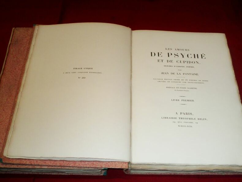
111298A Paris, Librairie Théophile Belin, 1899, 2 volumes in-4 de 310 x 220 mm environ, 2 ff. blancs, 2 ff. (faux-titre, titre), xxiv pages (Avant-propos, Epitre, Préface), 96 pages, 2ff. - 2 ff. blancs, 2 ff. ( faux-titre, titre), 144 pages, 2 ff. blancs. Cartonnages roses, dos bruns lisses portant titres dorés sur pièces de cuir bordeaux.Tirage unique à deux-cent-cinquante exemplaires, celui-ci porte le numéro 210. Complet des 26 figures sous serpente, en 3 états (avant la lettre, en noir, en couleurs), en sus chaque volume comprend in-fine une décomposition couleurs en 4 planches d'une figure reproduite dans l'ouvrage. Cartonnages solides mais peu esthétiques (dos griffés et salis, mors apparents), tranches et gardes brunies ainsi que des rousseurs sur les feuillets liminaires et en fin de volume, en revanche corps de texte en bon état et planches d'une grande fraîcheur.
0448-Bo.J. Kupferstich, auf Bütten. 21,4:16,1 cm. Literatur: Schuster 131 a. - Guter Abdruck, auf die Plattenkante geschnitten.
Frontespizio dell'edizione francese dell'Atlas Novus di Blaeu. Willem Janszoon Blaeu, avviò nel 1599 la sua attività di costruttore di globi e strumenti astronomici ad Amsterdam. Nel 1630, dopo aver comprato alcune lastre dell’atlante del Mercator da Jodocus Hondius II, fu in grado di pubblicare un volume di 60 mappe con il titolo di Atlantis Appendix. Cinque anni dopo, pubblicò i primi due volumi del suo atlante Atlas Novus o Theatrum Orbis Terrarum, in sei libri. Dopo la sua morte, Joan (Johannes) continuò l’opera paterna, completando l’intera serie di sei volume dell’Atlas Novus intorno al 1655. Fu inoltre autore di un Atlas Maior sive Cosmographia Blaviana, in 12 volumi pubblicati nel 1662 -72. Incisione in rame, bella coloritura coeva, in ottimo stato di conservazione. Title page of the French edition of Blaeu's Atlas Novus. Willem Janszoon Blaeu, started in 1599 his business as a builder of globes and astronomical instruments in Amsterdam. In 1630, after buying some plates of the Mercator atlas from Jodocus Hondius II, he was able to publish a volume of 60 maps under the title Atlantis Appendix. Five years later, he published the first two volumes of his atlas Atlas Novus or Theatrum Orbis Terrarum, in six books. After his death, Joan (Johannes) continued his father's work, completing the entire six-volume Atlas Novus series around 1655. He was also the author of an Atlas Maior sive Cosmographia Blaviana, in 12 volumes published in 1662 -72. Copperplate with fine original hand colour, very good condition.
H. Champion 1974, In-8 broché, 150 pages. Parfait état. Collection Nouvelle Bibliothéque du Moyen Age.
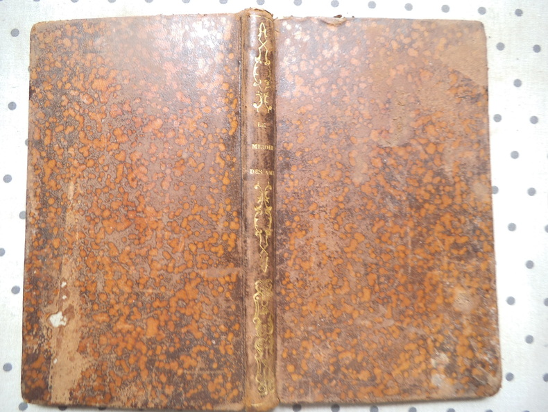
14809le miroir des âmes ou exposition des différens états des âmes par rapport à Dieu.Conformément à la réalité ou aux idées allégoriques de la foi;A l'usage de tous ceux qui désirent entièrement leur salut ou qui veulent contribuer à celui des autres.Edition revue et augmentée.In 12 plein cuir fauve raciné moucheté,titre et fers en long,filets dorés au dos roulette dorée sur coupes.Faux-titre,frontispice gravé (état malheureux d'une âme tomée dans le pêché mortel) titre,164 pages,16 planches gravées,hors texte,y compris le frontispice.Librairie catholique de Périsse frères Lyon-Paris 1843.(tache brune en marge extérieure de la page 40 à la page 109 en s'agrandissant puis en diminuant.En l 'état