Civil War TintypeBiblio.com
11 490 résultats
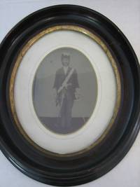
11351A large Civil War 3/4 plate tintype measures 5" x 7" of a Navy chaplain in full uniform with his sword pulled out of his rapier and in his hand. He has his dress uniform chapeaux with feathers on his head and a white sash with a chaplain medal in the center. There are crosses on his cuffs sash and belt buckle. A clean image with some minor cracking to the emulation barely noticeable. In an oval matte and original oval wood frame. unknown
194396067Washington: War Department 1943. 1st edition. Very Good. octavo. card covers 505pp. b/w plates text ills. diags. index Technical Manual No. 9-808. Ownership details & well-used & many greasy fingerprints but still a usable reference copy War Department unknown
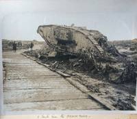
RGW22310Hardcover. with typed or pencilled captions card leaves on guards. Large folio two-tone cloth 'The Great War 1914-1919' in gilt on front cover rubbed and scuffed Some of the aerial photographs were taken when the ground was under snow. There is little clue as to the identity of the compiler but by the notes about the aerial photographs he was obviously someone with first hand knowledge of how they were taken and how they were used. One of the photographs has a map below showing the area covered in the photograph and how the maps were updated with the information taken from the photographs. hardcover
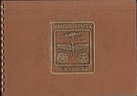
36038Philippines: n.p. n.d. Photograph Album. Very good. Oblong plastic bound photograph album. 10.5 x 7.5". 52 photographs measuring approximately 3.75" x 2.5". These pictures are possibly prints. "United States Air Forces" embossed on the front cover. Inside the front cover is written "31st Div USMC New Britain Philippines." Album is clean and in very good condition. <br /> <br /> Photographs depict soldiers in camp in the jungle riding ox's picture of a downed planes pictures of jeeps and equipment tents and a couple of photographs of natives. No dates or names found inside. Unclear where the photographs were taken. The 31st Division was in the Philippines and New Guinea during World War Two. n.p. unknown
1919023654Lakeside Press: 1919. 92 pages illustrated with 92 pages of photographs and illustrations by Private Dudley J. Nelson. "This book is but a modest effort to preserve for you a few pictures that will become more precious as the years go by." VERY GOOD HARDCOVER. Hard Cover. Very Good/No Dust Jacket Present. 4to - over 9¾" - 12" tall. Lakeside Press: Hardcover
Eckhoff, Audun, edNot in perfect condition. unknown
194062545Washington DC: United States Government Printing Office 1940. Wraps. Good. No dust jacket as issued. Cover has some wear and soiling. Stamp on front cover blacked over. iii 160 p. Includes: illustrations diagrams index. The matter contained herein together with that in FM 23-95 supersedes sections I to IV inclusive TR 420-75 June 15 1926 including C 1 January 2 1929; TR 1300-37A April 15 1933 including C1 January 2 1936; the relevant parts of TR 1320-B April 2 1927; TR 1350-37A August 1 1932; chapters one and two parttwo Basic Field Manual volume III May 2 1932 including C1 January 3 1938; and sections XIV to XVII inclusive chapter one Cavalry Field Manual volume I January 3 1938. . United States Government Printing Office paperback
37090Elephant folio printed broadsheet completed in neat ink manuscript and signed by Captain Charles N. Hunt and Captain George Nelson. Old folds several fold splits repaired minor loss. Else Very Good.<br /> <br /> The 39th Regiment Massachusetts Infantry was organized at Camp Stanton in Lynnfield Massachusetts August 13 through September 2 1862 and mustered for a three-year enlistment under the command of Colonel Phineas Stearns Davis. Originally assigned to the defense of Washington the Regiment later saw action with the Army of the Potomac at the major battles in Virginia. This carefully detailed muster roll was written soon after the Battle at Weldon Railroad in late August 1864. It reflects the consequences of that battle noting soldiers wounded ill and taken as prisoners of war. unknown
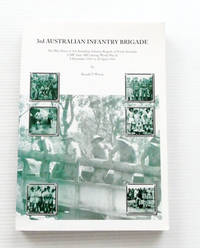
2000053355Canberra: The Author 2000. 265pp appendices bibliography bw ills maps some folding. Pictorial card. Near new. The 3rd Australian Infantry Brigade was part of Australia's northern defences during WWII both in Darwin and Townsville. First Edition. Soft Cover. Fine. 4to. The Author Paperback
2000BIB330168Canberra: Published by Author. 2000. Quarto Size approx 21x29cm. Fine Condition. As new. Illustrated with b/w photos & maps including 5 fold-out maps. Signed by the author. Only 100 copies if this book have been printed. 265pages. Based on the actual war diaries of the Brigade with commentary. Robust professional packaging and tracking provided for all parcels. . Fine. 1st Edition. Softcover. Published by Author paperback
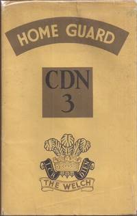
89<p>Lampeter UK: J. D. Lewis & Sons 1947 1st ed. 62pp. illus. tan cloth 8vo: Good in a Good dj in Brodart poly cover tan cover cloth has some white faded spots near extremities front & back; else a clean complete & tight copy; dj = torn @ spine ends & corners; few other edge tears; else G A unit history of the 3rd Cardiganshire Battalion Home Guard of South Wales illustrated with photos and an appendix listing officers. Endpaper maps depict the Battalion Area in Wales. The Cardiganshire Battalion had responsibility for a portion of the west Wales coastline that faced Ireland a potential threat had the Germans occupied that country.</p> Lampeter, UK: J. D. Lewis & Sons hardcover
23456Howick 25 June 1857. Six pages 12mo good condition. He finds it difficult to give advice because of his "being so imperfectly informed as to the present state of the question of immigration into Guiana. - It is obvious that the course which ought to be taken must depend upon whether the Colonists have or have not reason to complain of the conduct of the Government.- If they have & if any facilities for obtaining labour which might be granted to them have been with-held then a discussion would seem to be desirable & in the present word obscured of the session & if parties in the House of Commons I do not see how you could ruin a discussion except by asking a question & making a statement in explanation of it going into Committee of Supply. But if the Govt as I think it most likely sincerely desire to do all that can properly be done to encourage immigartion & only refuse to consent to measures to which there is a just objectn it would seem to me doubtful whether there would be any advantage in bringing on a discussion or whether it would be quite right to do so. - For this reason if I had remained in town & had had words deleted to present the petition to the House of Lords I would in the first instance have called upon the gentlemen connected with the colony in this country for a clear explanation of what they want & of the grounds on which they think the government ought to do more for them & I w-ould have endeavoured to satisfy myself whether they are right or wrong in order that in presenting the petition I might express the opinion I had formed which you know is allowed in the House of Lords. .". Howick, 25 June 1857 unknown
1980KOS01200136Kamakura Bunko 1980. Soft Cover. Fine. KOS01200136 Kamakura Bunko paperback
194663630Baton Rouge LA; Germany: 42nd “Rainbow†Infantry Division Army & Navy Publishing Co. 666th Engr. Topographic Company 7th Army 1946. Four pieces. 1st -- 4to. 9.25 x 12.25 in. 188 pp. Colour maps and photo illustrations throughout some full page. Embossed blue publisher’s calf Divisional insignia and lettering in red & gold & green minor bumping to corners slightly shaken still VG copy; 2nd -- Oblong atlas folio. 1 colour pictorial map sized 25 x 19.5 in. printed in 4 colours depicting the route of the 42nd across Europe minor creasing thumbing edgewear couple minor holes still a G copy now shrink--wrapped on archival foam core; 3rd - Oblong folio. 19 x 12.75 in. Double-page broadside sheet music score shrink-wrapped on foam core minor creasing edgewear; 4th - 9 x 11 in. 1 broadside sheet music score shrink-wrapped on foam core minor creasing still a VG set. First editions of four uncommon souvenir pieces for the famed 42nd Infantry Division during World War II who is best remembered as one of the three liberating divisions for the Dachau Concentration Camp on April 29 1945. Reactivated in July 1943 the original nickname “Rainbow Division†was coined by Douglas MacArthur as it was drawn from National Guards of 26 States and the District of Columbia in 1917 and in December 1944 they landed in the French port of Marseille. By mid-December the 42nd had advanced North into Alsace and fought the German Army ear Strasbourg. In march 1945 they crossed the Siegfried Line in the Hardt Mountains where there was hard fighting at Hatten. During the fighting against the last major German offensive a 242nd Infantry Congressional Medal of Honor winner repulsed several attacks. This Divisional History includes a number of graphic photos of their entry into Dachau and together with the 45th Infantry and the 20th Armored Division they helped liberate over 30000 prisoners from the Camp as well as those trapped on trains after being sent from Buchenwald and other concentration camps. The map created by MacKechnie 1923-2012 was produced only for his fellow soldiers not for publication and fought with the 42nd Infantry during the Rainbow Division campaigns including a number of humorous figures for his “Cartograph†although SS Skull & Crossbones for Dachau. Jane Douglass was a WAC officer during World War II music educator and songwriter who wrote many songs during World War II to promote the WAC’s and other Army Divisions. Captain Douglass commanded the first all-woman Special Service company. Worldcat locates 3 copies of the pictorial map NYPL TX A&M WI Vet. Mus. Res. Ctr; No copies located of either of the Jane Douglass songs. 42nd “Rainbow†Infantry Division, [Army & Navy Publishing Co.], 666th Engr. Topographic Company, 7th Army, unknown
1940120354No Place stated pub: no publisher stated.us u.s. army map service. Very Good. ud 1940s. Original ed. paperback. 23x21" folded to 3x3". VERY GOOD Condition. CORENERS SOME ROLL PAPERBACK; AERONAUTICAL CHART.printed in fine detail on both sides of nice SILK CLOTH.Similar to items used in World War TWo as part of rescue & trade item for flliers first aid kits. cloth is 23x21" neatly folded down to 3x3". PORTA TO MADRID BOTTOM ONE SIDE.BILBOA to BEZIERS other side top.No date to LEGEND CHART .Map is on bright white silk cloth with 1" wide tan border all around. NOT TORN NOT FREYED NOT MARKED UP.NOT STAINED.BUT OBVIOUSLY WORLD WAR TOW ERA ITEM. ; 1 LARGE SHEET pages; VERY LAGE COLORFUL MAP SHOWING MUCH EUROPE SOUTH OF FRANCE.This a nice item since it covers the European theater. Quite nice no tears no marks. CLEAN . no publisher stated..(us u.s. army map service?) paperback
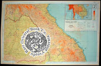
38011701London 1944 Geographical Section General Staff. Silk cloth 62 x 97 cm.very clean bright copy 2 tiny holes else solid folds to 9 x 13.5 cm. color printed 2 side2 maps in all. Issued by MI 9 FIRST & ONLY RARE EDITION . . . . . . ORIGINAL WORLD WAR 2 ROYAL AIR FORCE RAF 1944 . . . "E & E" "ESCAPE & EVASION" SILK SURVIVAL MAP . . . BURMA SIAM & FRENCH-INDO CHINA VIETNAM . . . YUNNAN SOUTH CHINA & THE TIP OF INDIA. . . . WITH INSET OF ADJACENT AREA MAPS: 44 ABCDJ & K: . . . OF BURMA SIAM CAMBODIA LAOS S.VIETNAM & INDIA . . MAP 44 A: Shows Arrang & Sibsagar at the north down to Minbu Magwe & Tayetmyo in the south. From west to east: Chittagong Hill Tracts to Maymyo Mandalay et al. . MAP 44 B: Showing from the north southward: Hkamti Long Nung & Lihsaw and Weishi. Utmost south: Mong Rai Kaarenni Aiam & French Indo China. From west to east: Kodaung Hill Tracts Tawngpeng to Meikia Mengli Muong Sing & Rabang. . An important World War 2 British Intelligence MI-9 "E & E" Escape & Evasion" map. Created and designed for RAF Royal Air Force & shared with U.S.A.A.F. U.S. Army Air Force pilots & flight crews fighting against the common Japanese enemy. . This map and others of the adjacent areas were carried by allied flyers in the "C.B.I." "CHINA-INDIA-BURMA theaters of war. Used also by "A.V.G." "AMERICAN VOLUNTEER GROUP" later known as the famous "FLYING TIGERS" of the United States FOURTEENTH & TWENTY-THIRD ARMY AIR FORCES AAF in Burma and throughout China. . British RAF and American AAF pilots cooperated in 1941-1942 fighting the onslaught of Japanese invading South China: Hong Kong Kwangtung Guangzhou Kuangsi Guangxi French Indo-China Hanoi & S. Vietnam Thailand Siam Singapore and Burma. . The allies shared resources and targets in the early years of this beginning campaign against Japanese ground air force and targets of opportunity. . Allied pilots and air crew carried this silk area map as well as other related A.A.F. cloth maps to provide 'hope' for down airmen. The map assisted airman finding friendly lines and make their way back to safe havens. . This kind of map printed on thick silk was commonly worn as a flyer's neck scarf during combat flight missions. Some also wore a "Survival Vest" loaded with other valuable emergency use rations pistol & equipment designed to help airmen's "E & E" Escape & Evasion using these kinds of silk maps to return to friendly lines. . CONDITION: This map is fairly clean with a very small 'tone' area in upper right corner of sheet B it may just be some of the usual 'transfer' of pale color from the upper folded part on this as it is a similar tone. The two old mended small splits appear to be firm and solid. The edges are a bit frayed as usual by and large an excellent example of a vintage and exceptionally RARE World War 2 silk map. . Color photos are posted to our website. . REFERENCES: . BALDWIN R.E. et al.: LAST HOPE THE BLOOD CHIT STORY. DOLL John G.: CLOTH MAPS CHARTS AND BLOOD CHITS OF WORLD WAR 2. search: escape-maps.history_of_wwii.___Asiatic_Series . . unknown
38005002London 1944 Geographical Section General Staff. Silk cloth opens to ca. 97.5 x 63.7 cm.folds down ca. 9 x 8 cm. color-printed on two sides "NEW" unused an exceptionally very pristine example. FIRST & ONLY RARE EDITION . . . . IN COLLECTOR'S SUPERB CONDITION . . . ORIGINAL WW2 1944 R.A.F. "ESCAPE & EVASION" SILK MAP . . . COVERING CENTRAL FRENCH-INDO CHINA: . . . SIAM EAST & PART OF LAOS CAMBODIA & VIETNAM . . . WITH INSET OF ADJACENT AREA MAPS: 44C & D: . . . BURMA SIAM/THAILAND CAMBODIA LAOS SOUTH VIETNAM . . . SOUTH END OF HAINAN ISLAND CHINA . An important WW2 British Intelligence MI-9 "E & E" Escape & Evasion" map. Created and designed for RAF Royal Air Force & shared with U.S.A.A.F. U.S. Army Air Force pilots & flight crews fighting against the common Japanese enemy. . This map and others of the adjacent areas were carried by allied flyers in the "C.B.I." "CHINA-INDIA-BURMA theaters of war. Used also by "A.V.G." "AMERICAN VOLUNTEER GROUP" later known as the famous "FLYING TIGERS" and the FOURTEENTH AIR FORCE in Burma and China. . British RAF and American pilots cooperated in 1941-1942 fighting the onslaught of Japanese invading South China: Hong Kong Kwangtung Guangzhou Kuangsi Guangxi French Indo-China Hanoi & S. Vietnam Thailand Siam Singapore and Burma. . The allies shared resources and targets in the early years of this beginning campaign against Japanese ground air force and targets of opportunity. . Allied pilots and air crew carried this silk area map as well as other related A.A.F. cloth maps to provide 'hope' for down airmen. The map assisted airman finding friendly lines and make their way back to safe havens. . This kind of map printed on thick silk was commonly worn as a flyer's neck scarf during combat flight missions. Some also wore a "Survival Vest" loaded with other valuable emergency use rations pistol & equipment designed to help airmen's "E & E" Escape & Evasion using the maps to return to friendly lines. . Color photos are posted to our website. . REFERENCES: . BALDWIN R.E. et al.: LAST HOPE THE BLOOD CHIT STORY. DOLL John G.: CLOTH MAPS CHARTS AND BLOOD CHITS OF WORLD WAR 2. see escape maps:.Asiatic_Series See pearl plymouth uk . . unknown
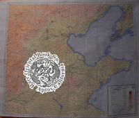
38008901London 1944 Geographical Section General Staff.A silk map color printed 2 sides 2 maps in all 84 x 104 cm. a "NEW" unused copy exceptionally clean & bright no flaws rarely found in pristine condition. RARE FIRST EDITION . . . . . . ORIGINAL WORLD WAR 2 1944 ROYAL AIR FORCE . . . "E. & E" "ESCAPE & EVASION" SILK SURVIVAL MAPS . . . COVERING: HOPEH SHANTUNG N. HONAN N. KIANGSU . . . E. SHANSI & CHOSEN JAPANESE OCCUPIED KOREA . . This map was produced under supervision of British Intelligence MI9 for downed R.A.F. ROYAL AIR FORCE and American A.A.F. ARMY AIR FORCE pilots and air crew during World War 2. . The maps are exceptionally and colorfully executed in much detail issued in a Deluxe grand size. This is perhaps the largest of all British issued survival maps during World War 2. . THE MAPS: . SHEET 44 R: Grand coverage of of North East coastal China encompassing HOPEH SHANTUNG N. HONAN N. KIANGSU E. SHANSI & CHOSEN JAPANESE OCCUPIED KOREA. Continuing from the left middle west to east & southwards: Wu Tai mountain Ch'ing Yuan Hsu Shui Tien-Ching Tientsin. Po Hai Wan mouth of the Huang Ho Yangtze River Shan Tung Chiao & Yung Ch'eng Wan bay. . From the lower section from west to south & easterly An-Yang Tung-Ping Hu lake Li-ch'eng Tsinan the Yellow river I-tu Singchow Chi-mo Tsimo & Chiao Chou Wan bay . From extreme west bottom portion easterly: Huaiching Tsinyang K'ai-Feng Shang-Ch'iu Kweiteh Tung-P'ing lake Hsauchang & T'ung-Shan Suchow. . SHEET 44 S: Grand coverage of CHOSEN KOREA AN-TUNG SHENG AN-TUNG NORTHERN CHOSEN TO THE SEA OF JAPAN THE EIGHT PROVINCES OF CHOSEN P'YONGAN -NAMDO HEIAN-NANDO HWANGHAE-DO KOKAI DO KANGWON-DO KOGEN DO KYONGGI-DO KEIKI DO KANGWON-DO KOGEN DO CH'UNGCHONG-PUKTO CHUSEI HOKUDO CH'UNGCH'ONG NAM-DO CHUSEI NAN-DO KYONGSAN-PUK TO KEISHO-HOKUDO CHOLLA-PUK-TO EZENRA HO KU-DO YONGSANG NAM DO KEISHONAN-DO CHOLLANAM-DO ZENRA-NAN-DO. ISLANDS: TSUSHIMA SAISHU TO SOUTH-WESTERN JAPAN: HONSHU ISLANDS SASEBO KAGOSHIA GOTO RETTO FUKUE-SHIA ISLANDS &c. . This grand view covers An-Tung east through most of N. Korea to the Sea of Japan; Sojoson Man West Korean Bay major cities Pyongyang Seoul most all of the coast lines islands in much detail. . A map with great detail from the top west Siuyan-Shansi borders going east Pei-Ping Beijingto the Gulfs of Chili and Liao-tung Pechili Strait to the Kwangtung Leased Territory Japanese helf Liaoning and the Ch'ang Shan Lieh Tao islands Dairen Ryojun Port Arthur and the Yellow Sea. . Prepared under the direction of R.A.A.F. H/Q. Compiled by the R.A.A.F. D.S.D. Cartographic Section September 1944. . KEY: The key shows 'references' to the symbols usd on th map provinces cities towns roads railroads telegrpahs rivers internatinoal boundaries steamer routes lighthouses wireless stations telegraph offices sand reef and river depths. . There is a tint guide to altitude of mountains in meters. The map scale is 1L1000000 with kilometers nautical miles and English miles. The map is folded as issued five times. . An important WW2 British Intelligence MI-9 "E & E" "Escape & Evasion" map. Created and designed for RAF Royal Air Force & shared with U.S.A.A.F. U.S. Army Air Force pilots & flight crews fighting against the common Japanese enemy. . This map and others of the adjacent areas were carried by allied flyers in the "C.B.I." "CHINA-INDIA-BURMA theaters of war. Used also by "A.V.G." "AMERICAN VOLUNTEER GROUP" later known as the famous "FLYING TIGERS" and the FOURTEENTH AIR FORCE in Burma and China. . British RAF and American pilots cooperated in 1941-1942 fighting the onslaught of Japanese invading South China: Hong Kong Kwangtung Guangzhou Kuangsi Guangxi French Indo-China Hanoi & S. Vietnam Thailand Siam Singapore and Burma. . The allies shared resources and targets in the early years of this beginning campaign against Japanese ground air force and targets of opportunity. . Allied pilots and air crew carried this silk area map as well as other related A.A.F. cloth maps to provide 'hope' for down airmen. The map assisted airman finding friendly lines and make their way back to safe havens. . This kind of map printed on thick silk was commonly worn as a flyer's neck scarf during combat flight missions. Some also wore a "Survival Vest" loaded with other valuable emergency use rations pistol & equiptment designed to help airmen's "E & E" Escape & Evasion using the maps to return to friendly lines. . CONDITION: This map is excellent in "NEW" superb condition un-used as issued clean pristine with vivid colors no fading. The edges are clean with a few stray threads otherwise equisite example. Seldom found in such stunning"collector's" RARE condition. . Color photos are posted to our website. . REFERENCES: . BALDWIN R.E. et al.:LAST HOPE THE BLOOD CHIT STORY. DOLL John G.: CLOTH MAPS CHARTS AND BLOOD CHITS OF WORLD WAR 2. see also : escape-maps.Asiatic_Series Barbara Bond article: MI0'S ESCAPE AND EVASION MAPPING PROGRAMME 1939-1945: pearl dot plymouth.ac.uk Both the above have copious bibliogrphies on the subject. RAF WW2 E & E MAPS: see escape-maps. . . unknown
19792111902160201306Ryudo shuppan 1979. Soft Cover. Fine. Number of books: 5 books Ryudo shuppan paperback
20032111902154607820Gamagori Kanazawa Kaichi Study Group 2003. Soft Cover. Fine. The book is in fine condition. Gamagori Kanazawa Kaichi Study Group paperback
2111902158402855Gamagori Kanazawa Kaichi Study Group N.A. Soft Cover. Fine. The book is in fine condition. Gamagori Kanazawa Kaichi Study Group paperback
1995208300211580406550 years after the war now for peace editorial committee 1995. Soft Cover. Fine. Volume: 1 50 years after the war, now for peace editorial committee paperback
19952081502112304206Fukuoka Prefecture 1995. Soft Cover. Fine. Number of pages: 518p Size: 31cm Fukuoka Prefecture paperback
19952080202103000310Okinawa 1995. Soft Cover. Fine. Number of books: 1 book Okinawa paperback
199425551Grenz-Echo Verlag. Very Good in Very Good dust jacket; Jacket lightly scuffed. 1994. Hardcover. 9054330414 . A photoessay on the tank memorials and other military remains of the Battle of the Bulge along the Luxembourg-Belgium border. Many color photos. ; Folio 13" - 23" tall; 160 pages . Grenz-Echo Verlag hardcover