Claudius, PtolemyBiblio.com
335 résultats
1991I5845New York: White Lotus 1991. Paperback. Good/no dj. 1.00. Claudius Ptolemy. Geography The White Lotus paperback
0243512473.Gpaperback. Good. Access codes and supplements are not guaranteed with used items. May be an ex-library book. paperback
0656926945.Ghardcover. Good. Access codes and supplements are not guaranteed with used items. May be an ex-library book. hardcover
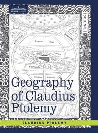
ria9781605204390_inpHardcover. New. New Book; Fast Shipping from UK; Not signed; Not First Edition; Geography of Claudius Ptolemy originally titled Geographia and written in the second century is a depiction of the geography of the Roman Empire at the time. Though inaccurate due to Ptolemy's varying methods of measurement and use of hardcover
ria9798985923780_inpPaperback. New. New Book; Fast Shipping from UK; Not signed; Not First Edition; N/A paperback
B9798985923780Paperback / softback. New. paperback
19731602050041West of England Press 1973. Hardcover. Like New. Facsimile of the 1520 edition. Burgundy cloth with crimson spine label. 46 cm. Hardcover. No dust jacket. Good binding and cover. Spine cocked. Includes maps and original Latin text as well as essays on the history of the work. Clean unmarked pages. This is an over sized or heavy book that requires additional postage for international delivery outside the US. West of England Press hardcover
0366555499.Ghardcover. Good. Access codes and supplements are not guaranteed with used items. May be an ex-library book. hardcover
2005Q-1933303123Astrology Classics 2005-03-23. Paperback. New. In shrink wrap. Looks like an interesting title! Astrology Classics paperback
Y06M-00219Dover Publications. Used - Good. Good condition. A copy that has been read but remains intact. May contain markings such as bookplates stamps limited notes and highlighting or a few light stains. Dover Publications unknown
1991P-09206Dover Publications 1991. Paperback. Fine. Translated by Edward Luther Stevenson with an introduction for this edition by Prof. Joseph Fischer. An unabridged republication of the work first published in an edition limited to 250 copies by the New York Public Library with the title GEOGRAPHY OF PTLOEMY. Clean unmarked and tight: a pristine copy. Dover Publications paperback
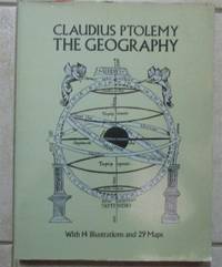
1991Ancient World cptg<p>Ancient World cptg Claudius Ptolemy active 2nd century. <strong>The Geography.</strong> Translated and edited by Edward Luther Stevenson; with an introduction by Joseph Fischer. Mineola N.Y.: Dover; Toronto: General Pub. Company; London: Constable 1991 1 atlas xvi 167 ca. 121 p.: ill. maps; This The Dover reprint came from the library of a bibliophile who had a wonderful collection of printed books on the history of maps. The original paperback volume was rebound in a handsome blue library buckram with wrappers bound in gilt lettering on spine. Measures 9 ½" x 12 ½". Fine copy. <strong>$50.00 Box 5678</strong></p><p><u>Notes</u></p><p>Translation of the <em>Geographia</em> and dedication of the 1460 ms. ed. <em>Codex Ebnerianus</em> prepared by Donnus Nicholas Nicolaus Germanus.</p><p>"Translation based upon . Latin and Greek texts" and later editions--P. xiii.</p><p>At head of title: Claudius Ptolemy.</p><p>Unabridged republication in reduced dimensions of the limited ed.: Geography of Claudius Ptolemy. New York: New York Public Library 1932.</p><p>Includes reproductions of maps and some text from the <em>Codex</em> <em>Ebnerianus</em> and reproductions of two maps from 16th cent. printed eds. of the <em>Geographia</em>: the Ruysch world map from the 1508 ed. and the Lorenz Fries world map from the 1522 ed.</p><p><u>Subjects</u></p><p>Ptolemy active 2nd century. <em>Geographia</em></p><p>Manuscripts Latin -- Facsimiles</p><p>Early maps -- Facsimiles</p><p>Atlases -- Early works to 1800</p><p>Geography Ancient</p><p>Geography Ancient -- Maps</p><p>Author / Creator</p><p>Nicolaus Germanus active 15th century. </p><p>Stevenson Edward Luther 1858-1944. </p><p>Fischer Joseph 1858-1944 </p><p>New York Public Library </p><p>Other title</p><p><em>Claudius Ptolemy the Geography.</em></p><p>Other title</p><p><em>Codex Ebnerianus</em> New York Public Library </p><p>ISBN : 0486268969 pbk. :</p> Dover; General Pub. Company; Constable hardcover
1621B6798Padova: Paolo & Francesco Galignani. 1621. . Some toning interior otherwise clean and crisp. Edition: Second Italian edition. Binding: Recent full calf boards. Matching upper and lower with double blind panels gilt floral devices at corners of inner panel. Spine with 4 raised bands abbreviated title in gilt on maroon label in 2 remaining compartments with gilt devices and blind rules. Notes: Translated from Latin into Italian by Leonardo Cernoti Vinitiano.<br>Text in Italian. <br>A fine example of this monumental atlas and treatise on cartography considered to be the most influential cartographic and geographical account of the ancient world originally written by Ptolemy in Greek around 150 AD. <br><br>Claudius Ptolemy c.100 – c.170 AD was a mathematician astronomer astrologer and geographer living in the city of Alexandria then the Roman province of Egypt under Roman rule who wrote a number of scientific treatises that greatly influenced Byzantine Islamic and Western European science. His Geografia written around 150 AD is a thorough discussion on maps and the geographic knowledge of the Greco-Roman world and also serves as a handbook on how to draw maps using geographic coordinates for parts of the Roman world known at the time. Geografia draws from an earlier work by Marinus of Tyre now lost to us as well as various Roman and Persian gazetteers.<br>Geografia is divided into 8 books: book I is a treatise on cartography describing the methods used to assemble and arrange Ptolemy's data; from Book II through the beginning of Book VII a gazetteer provides longitude and latitude values for the world known to the ancient Romans; the rest of book VII provides details on three projections to be used for the construction of a map of the world varying in complexity and fidelity; book VIII constitutes an atlas of regional maps. The maps include a recapitulation of some of the values given earlier in the work which were intended to be used as captions to clarify the map's contents and maintain their accuracy during copying.<br>Geografia was translated into Arabic in the 9th century and Latin around 1406 and was a highly influential resource on the cartographic traditions of the medieval Caliphate and Renaissance Europe.<br><br> Size: Small Folio 301x 206 mm Illustration: Complete with 64 engraved maps 27 Ptolemaic 37 modern including the rare double-page world map “Orbis Terrae Compendiosa Descriptio†engraved by Girolamo Porro in addition to 14 in-text illustrations plus title vignette and chapter headpieces. Folio pagination. La Seconda Parte Della Geografia di Cl. Tolomeo…: title dated 1620; period marginalia in margins of 126v; 154 mispag. 174. Pg. 13 of Commentarii et Annotationi… unnumbered. Volume: 2 parts in 1 volume. References: Sabin 66506; Phillips Atlases 405; Adams M-118; Shirley 193-96 Pages: Blank 2. Title. 1597 dedication to Marco Cornaro from Gio. Battista & Giorgio Galignani. 1621 dedication to Marco Cornaro from Paolo & Francesco Galignani. Blank. Della Geografia di Claudio Tolomeo: p. 1-62. Commentarii et Annotationi dell’Eccell. Sig. Gio. Antonio Magini Padouano…: p. 1-21. Blank 2. Table of contents. Index 27. La Seconda Parte Della Geografia di Cl. Tolomeo…: p. 2-212. Blank. Index 59. Blank 3. Category: Book Atlas & Cartography; Paolo, & Francesco Galignani. hardcover
200181701Planeta–De Agostini 2001. Planeta–De Agostini unknown
1974028470Paris 1974 E. P. Denoël Hardcover Very Good 1st Edition
1024156877.Ghardcover. Good. Access codes and supplements are not guaranteed with used items. May be an ex-library book. hardcover
101720411X.Ghardcover. Good. Access codes and supplements are not guaranteed with used items. May be an ex-library book. hardcover
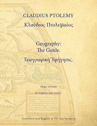
Frisches und sauberes Hardcover-Exemplar in gutem Zustand mit Original-Schutzumschlag. - Englisch. - Claudius Ptolemäus (altgriechisch Klaúdios Ptolemaíos, lateinisch Claudius Ptolomaeus; * um 100, möglicherweise in Ptolemais Hermeiou, Ägypten; † nach 160, vermutlich in Alexandria) war ein griechischer Mathematiker, Geograph, Astronom, Astrologe, Musiktheoretiker und Philosoph. Er lebte in Alexandria in der römischen Provinz Ägypten. Insbesondere seine drei Werke zur Astronomie, Geografie und Astrologie galten in Europa bis zur frühen Neuzeit als wissenschaftliche Standardwerke und wichtige Datensammlungen. Das geographische Werk hatte 561/62 noch Cassiodor in der Hand, doch erst mit der lateinischen Übersetzung einer Abschrift aus Konstantinopel, die in Florenz ab 1397 erfolgte, wurde die Geographike Hyphegesis wieder rezipiert. Ptolemäus verfasste die mathematiké sýntaxis ("mathematische Zusammenstellung"), später megíste sýntaxis ("größte Zusammenstellung"), heute Almagest genannte Abhandlung zur Mathematik und Astronomie in 13 Büchern. Dieses Werk blieb bis zum Ende des Mittelalters das Standardwerk der Astronomie im europäischen Raum. Es enthielt neben einem ausführlichen Sternenkatalog eine detaillierte Ausarbeitung des geozentrischen Weltbilds, die später nach ihm ptolemäisches Weltbild genannt wurde. … (wiki) // INHALT : List of Illustrations - Preface - Note on Citations of Classical Authors - Introduction - What Ptolemy Expected His Reader to Know - The Place of the Geography in Ptolemy's Work - Ptolemy's Evolving Conception of the World - Marinos and Other Sources - Ptolemy's Map Projections and Coordinate Lists - The Manuscripts of the Geography - The Maps in the Manuscripts - Early Readers and Translators - Modern Editions and Translations of the Geography - Our Translation - Ptolemy, Guide to Drawing a Map of the World - Book 1 - Book 2 - Book 7 - Book 8 - Plates and Maps - Notes on the Plates and Maps - Plates 1-7 following p. 128 - Maps 1-8 - Appendices - Appendix A: The Journeys of Flaccus and Maternus to the Aithiopians - Appendix B: Marinos' Calculation of the Latitude of Cape Prason - Appendix C: The Trade Route across Central Asia - Appendix D: The Breadth of the Mediterranean According to Marinos and Ptolemy - Appendix E: The Sail to Kattigara - Appendix F: The Miscellaneous Criticisms of Marinos' Data - Appendix G: Textual Notes - Appendix H: Geographical Index - Bibliography - Index. ISBN 9780691010427
9293Paris, Librairie Académique Perrin, 1977 14 x 21, 429 pp., illustrations N/B, cartonnage éditeur + jaquette, bon état
157418848Venetia Venice Giordano Ziletti 1574-73. 4to. Hcalf from ab 1820. Gilt back. Slight rubbing to spine. 78350 pp. and 65 double-page engraved maps with text on verso of plates 130 pp5665 pp. 6 textlvs. at end with brownspots in right margin sometimes a little browning to pages few brownspots and a few textlvs. with minor wormtracts. Complete with all 65 maps called for each measuring ab. 19 x 26 cm. A great part of the maps have some background shadowing from the printers ink mainly due to the fact that this is the third Ruscelli-edition where the plates have been used before. 3 printer's wood-cut devices and 20 smaller and larger woodcuts in the text. 2 woodcuts with Ptolemy shown observing. <br/><br/><em>Third edition of Ruscelli's translation from Venice 1561. The maps are printed from the same plates with the exception of Ptolemy's map of the world for which Malomba had returned to the original conical projection of Ptolemy. Moreover one map is added: the map of "Territorio di Roma". In general the maps are enlarged copies of Gastaldi's maps from the edition of 1548 which came out in 8vo. The Ruscelli translation contains an important innovation namely the division of the world map into two parts one for the Old World and one for the New as seen on the plate "Tavola Universal" depicting the 2 hemispheres. The atlas contains 27 ptolemaic maps and 38 new. 1 World 1 Hemisphere 10 Europe 4 Africa 12 Asia and 38 others. 10 of the maps relate to America.Philipps I:380. Sabin 66505. Nordenskiöld Nr. 34 p.27. </em> unknown
11791in 16 demi-chagrin rouge à nerfs et à coins, titre, caissons, filets, date en pied, dorés, filets dorés sur les plats. Faux-titre, titre, 119 pages, texte encadré d’un frise décorative, non rogné, tête dorée, gravures en couleurs de MEAULLE. Notices par A. PONS Paris A. QUANTIN imprimeur éditeur 1879. Très bon état
c4899Paris, Imprimerie Nationale, 1951; plaquette in-4° brochée, couverture jaune pale imprimée en noir;7pp.
2015R200130790Guy Trédaniel. 2015. In-8. Broché. Etat d'usage, Couv. légèrement pliée, Dos satisfaisant, Papier jauni. 184 pages, marque-page inclus - coins frottés.. . . . Classification Dewey : 130-Phénomènes paranormaux. Pseudo-sciences
31328, brepols, 2011 Hardback. 470 pages ., 3 b/w ill. 16 colour ill., 210 x 270 mm, Languages: English, Terraum orbis 8 ISBN 9782503523781.
195948400Madrid, Victoriano Suarez, 1959. 4°. Mit zahlr. meist ganzs. Abbildungen. 281 S., 2 Bll., Lwd. d. Zt. m. goldgepr. Rückentitel u. dem eingeb. OUmschlag.