610 résultats
Very Good German Original color map on cloth. Chipped on folded places. Otherwise a clean copy. Oblong atlas folio. (46 x 52 cm). Scale: 1/300.000. Toponyms in German. Shows Saraybosna (Sarajevo), and its around, Travnik, Kladanj, G. Yakuf, Konjiva, Gorazda, Mostar et alli. A sheet of the collection of 'The general map of Central Europe'. appeared in the years between 1873-1876 with the work of Joseph Ritter von Scheda, (1815-1888) who was a general, geographer and cartographer.
Very Good German Original color map on cloth. Chipped on folded places. It needs repair. Oblong atlas folio. (46 x 52 cm). Toponyms in German. Shows Durach (Durazzo) and its around, Musakija at south, western shores of Albania, Elbasan, and three bays (Drin Golf etc). A sheet of the collection of 'The general map of Central Europe'. appeared in the years between 1873-1876 with the work of Joseph Ritter von Scheda, (1815-1888) who was a general, geographer and cartographer.
Very Good German Original color map on cloth. Chipped on folded places. Otherwise a clean copy. Oblong atlas folio. (46 x 52 cm). Toponyms in German. Shows Brood area and its around, Djakovo, Tuzla etc. A sheet of the collection of 'The general map of Central Europe'. appeared in the years between 1873-1876 with the work of Joseph Ritter von Scheda, (1815-1888) who was a general, geographer and cartographer.
Very Good German Original color map on cloth. Chipped on folded places. Otherwise a clean copy. Oblong atlas folio. (46 x 52 cm). Toponyms in German. Shows Krusevac and its around in Serbia. A sheet of the collection of 'The general map of Central Europe'. appeared in the years between 1873-1876 with the work of Joseph Ritter von Scheda, (1815-1888) who was a general, geographer and cartographer.
Very Good German Original color map on cloth. Chipped on folded places. Oblong atlas folio. (46 x 52 cm). Toponyms in German. [MAP of WEST WALLACHIA - CRAIOVA] N.10. Kraiova. A sheet of the collection of 'The general map of Central Europe'. appeared in the years between 1873-1876 with the work of Joseph Ritter von Scheda, (1815-1888) who was a general, geographer and cartographer.
Very Good German Original color map on cloth. Chipped on folded places. It needs repair. Oblong atlas folio. (46 x 52 cm). Toponyms in German. Shows Kastoria area in Greece. A sheet of the collection of 'The general map of Central Europe'. appeared in the years between 1873-1876 with the work of Joseph Ritter von Scheda, (1815-1888) who was a general, geographer and cartographer.
Very Good German Original color map on cloth. Chipped on folded places. Oblong atlas folio. (46 x 52 cm). Toponyms in German. A sheet of the collection of 'The general map of Central Europe'. appeared in the years between 1873-1876 with the work of Joseph Ritter von Scheda, (1815-1888) who was a general, geographer and cartographer.
2001__3486252607De Gruyter Oldenbourg 2001. Hardcover. New. reprint edition. 299 pages. Italian language. 9.05x6.10x0.87 inches. De Gruyter Oldenbourg hardcover
Features/Photos: The Queen and her baby son; Uncovering a 7th Millennium Settlement in Macedonia, Nea Nikomedeia - Part I, Site and Pottery; The cutting up of Abu Simbel; Death of General Douglas MacArthur; and more. Moderate wear. Clean and unmarked. Quality copy. Magazine
191813831918 Paris, Éditions Parisiana, sans date [1918]. 20 cartes postales protégées par une serpente. Format 14 x 8,5 cm, dont 15 ont pour sujet la prostitution. Une carte se détache sinon bon exemplaire. Légendes bilingues français-anglais.
Very Good Turkish, Ottoman (1500-1928) Original autograph letter handwritten signed by Mehmed Semseddin Pasha addressed to 'Kütahya Evkâf-i Humâyûn' [i.e. Kütahya Imperial Foundations]. It starts with 'Huve' traditionally. (29x21 cm). In Ottomsn script. Letterhead 'Nezâret-i Evkâf-i Humâyûn' [i.e. Ministry of foundations]. 1 p. including eight lines with additional annotation. Mehmed Semseddin was an Ottoman / Turkish statesman with Circassin (Adige - Shapsig) origin, descended from Tletseruk (or Tleseruk) family. Mehmed Semseddin Pasha was the son of Hacizade Osman Bey who was a Circassian chieftain. In 1864, his family emigrated to Samsun and then to Istanbul in the Great Immigration of Circassians. He was graduated from Galatasaray High School. He was also groom of Egypt Extraordinary Commissioner Circassian Rauf Pasha, a member of the Society Circassian Charity (Çerkes Teavun -Yardim- Cemiyeti), the manager and author of Guaze newspaper published in Turkey which was first published journal in Latin letters in Turkey.
Very Good Turkish, Ottoman (1500-1928) Original color map on cloth. Oblong eephant folio. (64 x 573 cm). Toponyms in Ottoman script. [MAP of BALKANS] Filibe [Plovdiv]. A very detailed map. Shows Plovdiv and mountains, rivers around it. Extremely rare.
New English Original bdg. Roy. 8vo. (24 x 17 cm). In English, Turkish; and Macedonian, Albanian, Serbian. 2 volumes set: (752 p. 730 p.). Proceedings of the Fourth International Congress on Islamic Civilisation in the Balkans, 12-17 October 2010. Skopje, Macedonia.= Balkanlar'da Islâm Medeniyeti Dördüncü Milletlerarasi Kongre Tebligleri, 13-17 Ekim 2010. Üsküp, Makedonya. This is a collection of the papers that were presented during the international congress on "Islamic Civilisation in the Balkans" held in the Macedonian capital Skopje in October 2010. The congress, organized in cooperation with the Macedonian Academy of Sciences and Arts (MANU), was fourth in IRCICA's congress series that focus on the history and cultures of the Balkan region. The Skopje congress was accorded high patronage and opened by H.E. Gjorge Ivanov, President of the Republic Macedonia. President Ivanov also participated in the congress in his capacity as an academician and presented a paper. This State support and scholarly contribution extended to the congress underscored the importance attached to its objectives. The first volume contains the papers that were presented in English or Turkish (39 papers) and the second volume, those presented in Macedonian, Albanian or Serbian (44 papers). Located at crossroads between Europe and Western Asia, the Balkan peoples have been in contact with the Muslim world since at least the 8th century. Various phenomena, including the long experience in trade between the two regions, helped fasten the expansion process, and enhance the notable cultural role, of Islam in the Balkans. The relationship between the Muslim world and the Balkans has not only been one of encounters and exchanges but also one of coexistence. Research papers contributed to the congress addressed a wide range of topics highlighting the multicultural relations specific to the Balkan region. IRCICA's engagement in studies on the region in connection with the history of Islamic civilisation draws from the above aspects of the theme and also takes into account that two Balkan countries are members of the OIC and IRCICA: Albania is a full Member State and Bosnia and Herzegovina is an Observer State. Previously, three congresses were held on the same theme, in Sofia (2000), Tirana (2003) and Bucharest (2006) respectively. A fifth congress was held in May 2015. This program devoted to the history of Islamic civilization in the Balkans has succeeded in drawing interest and participation from around the world in addition to the Balkan countries themselves and generated a fascinating range of studies, as the contents of this publication reflect.

Scholar's name to ffep (E. Badian). Light bumping to one corner. DJ is somewhat tattered with tears and chipping. DJ has rubbing. ; Philopoemen's political activity in the Achaean league spanned the period of its transition from being a Macedonian satellite to becoming a Roman client. Deals with Philopoemen's political career through this vital period of change. ; 328 pages
Very minor shelfwear to book. DJ has very minor rubbing and light browning to DJ spine. ; Philopoemen's political activity in the Achaean league spanned the period of its transition from being a Macedonian satellite to becoming a Roman client. Deals with Philopoemen's political career through this vital period of change. ; 328 pages
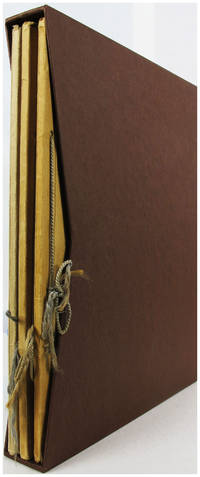
6904Macedonia 1933. Soft cover. Very Good. Reisen und Wandern - Album I II und III. Macedonia21301/2/3/4 1933 Reisen und Wandern - durch Deutschlands Gau Herz Album I. Complete with all 150 bilder and in very good condition. Reisen und Wandern - durch Deutschlands Gau Rheinland Album II. Complete with all 150 bilder and in very good condition. Reisen und Wandern - durch Deutschlands Gau Spreewald und Oberlausitz Album III. Complete with all 150 bilder and in very good condition. Three Albums in a Collectors Slipcase. A31.2474 Nr.6904 <br/> <br/> Macedonia 1933 paperback
8062PARIS, chez Pichard & J.J. Blaise - 1807 - In-8 - couverture muette - 13 volumes sur 15, manque I& III - T. XI taché, sinon bons exemplaires
PARIS, chez Pichard & J.J. Blaise - 1807 - In-8 - couverture muette - 13 volumes sur 15, manque I & III - T. XI taché, sinon bons exemplaires E.O. de la première édition complète des Oeuvres de ROLLIN, tirée au nombre de 500 exemplaires sur papier ordinaire, et de 25 su papier velin
2020BN102043Brandstätter Verlag 2020. 2020. 2020. Beweg dich! Und dein Gehirn sagt Danke - Wie wir schlauer werden besser denken und uns vor Demenz schützen <br/><br/>Beweg dich! Und dein Gehirn sagt Danke - Wie wir schlauer werden besser denken und uns vor Demenz schützen Brandstätter Verlag unknown
1863259951863 Paris, Durand, 1863. Un volume In-8 (235x145 mm), de XII, 454, (1) pages et une grande carte dépliante. Reliure recente demi maroquin tabac à coins. Dos a nerfs, muet,sans pièce de titre . Intérieur parfait sans presque de rousseurs - envoi autographe auteur, Illustré d'une grande carte dépliante (72,5x48 cm pour le sujet). Rare.
1915A111-114Wien, Kaiserlich-K?nigliches Milit?r-Geographisches Institut, 1915. Hochformat, ca. 42 x 55 cm, Ausgabe: mehrf?rbig; Zustand: gut +
Very Good Turkish, Ottoman (1500-1928) Original color map. Folded. Atlas folio. (82 x 57 cm). In Ottoman script. Scale: 1/400000. A clean copy. Including Azerbaijan, Dagestan, Mahaçkala, Tbilisi, Yerevan, Darband, et alli. A fine map of Caucasus and shores of Caspian Sea. Extremely rare.
2 vols., 8vo., Third Impression, with 32 plates and endpaper maps (front endpaper maps in red and black); green buckram, gilt backs, green tops (mildly faded), a very good, bright, crisp copy in unclipped dustwrapper, the wrappers sunned at backstrips. Bright set of Dame Rebecca West's account of her journey through the Balkan states, one of the outstanding travel books of the twentieth century. Published four months after the first edition. NCBEL IV, p.770 (recording the first US and UK editions).
BN303645Wellness für das Gehirn <br/><br/>Wellness für das Gehirn Manuela Macedonia unknown