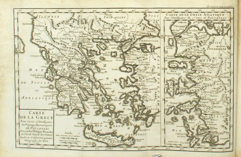
610 résultats
Very Good Turkish, Ottoman (1500-1928) Original b/w map on cloth. Very good. Folded. Oblong atlas folio. (54 x 71 cm). In Ottoman script. Scale: 1/2.000.000. [MILITARY MAP of OTTOMAN CAUCASUS] Kafkasya Darü'l-Harekâti. (Fasil: 3 - Numero: 3). Tiflis ve civari, Bahr-i Siyah, Don Kazaklari, Kalmuk, Kirgiz, Bahr-i Hazer-i Kuzgun Denizi (Derya-i Hazar), Kuban Kazaklari, Çerkezistan, Nogay, Termerek Kazalari etc. Military map of Ottoman Caucasus. Shows Tbilisi and around, Khazar Sea, Kuban Cosacks, Don Cosacks, Kalmuks, Kyrgyzstan, Circassia, Nogai, Termerek Cosacks, Maveraünnehir, etc.
14852Amsterdam, Paris, Desaint & Saillant, Durand, Vincent, Duchesne, 1758 - Edition originale in-12 - Complet en 2 volumes, seuls édités - Reliure plein veau de l'époque (coiffes et coins frottés) - Dos à nerfs orné de caissons fleuronnés - Pièce de titre havane - titre doré - Ecoinçons dorés aux 1 & 4 plats - Gardes marbrées - Toutes tranches rouges - signet - LVIII-[2]-317 & 448 pp - Bon exemplaire, très propre - Envoi rapide et soigné
Amsterdam, Paris, Desaint & Saillant, Durand, Vincent, Duchesne, 1758 - Edition originale in-12 - Complet en 2 volumes, seuls édités - Reliure plein veau de l'époque (coiffes et coins frottés) - Dos à nerfs orné de caissons fleuronnés - Pièce de titre havane - titre doré - Ecoinçons dorés aux 1 & 4 plats - Gardes marbrées - Toutes tranches rouges - signet - LVIII-[2]-317 & 448 pp - Bon exemplaire, très propre - Envoi rapide et soigné Philippe-Auguste, Comte de SAINTE-FOIX, dit le chevalier d'Arc ou d'Arcq (1721-1795) était l'un des fils naturels de Louis-Alexandre de Bourbon, comte de Toulouse, un des légitimés de Louis XIV. Il fit une carrière militaire assez brillante dans la cavalerie, et quitta le service en 1748, lors de son anoblissement, pour se consacrer aux lettres
Pages 353-440, plus 16 pages of nostalgic ads. Features: Flying in Central Africa - part 2 - tales from the log book of an R.A.F. officer during the campaign in German East Africa - article with interesting photos; Torn by Starving Jackals in Macedonia - Private James McDade of the 6th Royal Inniskilling Fusiliers recounts his experience - with photo of McDade; Death-Struggle with An Alligator - what happened to Van Campen Heilner when he was photographing an alligator in a Florida swamp - photo-illustrated article; The Thrills of Parachuting - early and marvelously photo-illustrated article on this topic; Photo of tourist party in Solomon's Quarry, the world's most ancient quarry; My South African Adventures - part 1 of Jack West's incredible recollections, including photo of him aged 17; Ship Built By One Man - Liberian missionary, the Rev. James E. Lewis - photo-illustrated article of him, his wife and "The Coloured Missionary Yacht"; John A. Jordan and his African Leopard-Hunting Adventures; Our Trip to Catch Murderers - the rough and ready methods of achieving justice in Bolivia; An Exciting Night Drive - 35 miles in a South African Cape Cart; Relief Workers' Adventures - part 2 of this superb photo-illustrated article on thrilling experiences among the War Victims of Armenia, Syria and Persia; With a Caravan in Corsica - photo illustrated article which relates the primitive life of the people; A Mountain of Gold - photo-illustrated article about the discovery made by the Fisk Expedition - Captain James L. Fisk and Dr. William Denton Dibb; In the Wilds of Siberia - part 2 - fascinating article with great photos document the explorations of Harry Somerset-Lister; The Adventures of a Newspaper-Man - part 4 - Exploring New York - article with nice photos and fascinating observations of the people; A Butterfly Farm in France - French Entomologist M. Andre's farm near Macon - article with photos; Fascinating photo of flume in British Columbia, by which logs are carried to the sawmills; Photo of amber mine on the coast of Samland in the eastern Prussian peninsula. Somewhat above-average external wear. Openings and loss at each end of backstrip. Unmarked. A worthy vintage copy of this marvelous issue. Book
"Comprised in twenty-six maps showing the various divisions of the world as known to the ancients composed from the most authentic sources with an index of the ancient and modern names." - from title page. Includes the following maps: Orbis Veteribus Notus; Roma; Italia Meridionalis; Athenae; Peloponnesus et Attica; Graecia Septentrionalis; Insuleae Maris Aeg Aei; Macedonia, Thracia, Illyria, Moesia, et Dacia; Britannia; Insuleae Britannicae; Gallia; Germania; Vindelicia, Noricum, Rhaetia, Pannonia, et Illyricum; Hispania; Africa Septentrionalis; Aegyptus; Asia Minor; Palaestina; Syria; Armenia, Mesopotamia, Assyria, et Babylonia; Arabia; Imperium Persicum; Indiae. Fold-out map entitled 'Central Italy with the Adjacent Countries from the Peutingerian Tables, constructed about A.D. 393'. Extensive 44-page index of place names. Hand done colour outlines to most maps. Average external wear. 1.5" opening to upper corner of front free endpaper. Toning to endpapers. Gilt titling clearly legible upon backstrip. Binding sound. A quality copy of this wonderful reference. Book
Carta geografica del territorio greco, macedone ed albanese, in bella e particolare coloritura coeva. Inserita in "Mercurio geografico overo Guida Geografica in tutte le parti del Mondo conforme le Tavole Geografiche del Sansone Baudran de Cantelli Data in luce con direttione, e cura di Gio. Giacomo de Rossi nella sua stamperia in Roma alla Pace all'insegna di Parigi con Priu: del S. Pont" edita a Roma alla fine del '600
1731PHO-1807Paris, F. G. Quillau, 1731. 2 volumes grand in-4 de [2]-VIII-XXIV-478-[4] et [2]-VI-524 pages, pleine basane brune, dos à nerfs, épidermures, manque aux coiffes, mouillure, rousseurs et brunissures, illustrée d'un frontispice de A. Humblot, 3 cartes gravées dressées par Buache sur les observations de Deslile et de 4 planches dépliantes gravées par Rigaud.
9389Vers 1917. Album 19 x 25 cm avec environ 120 tirages photographiques.
VO601Tome I. Contenant la description de la Natolie, de la Caramanie, & de la Macedoine. – Tome II. Contenant la description de Jerusalem, de l’Egypte, & du Fioume: avec un Memoire pour servir à l’Histoire de Tunis, depuis l’année 1684]. Paris, Nicolas Simart, 1712. PREMIERE EDITION. 2 vol., in-12o (159 x 89 mm.), ΠΡΩΤΗ ΕΚΔΟΣΗ. 2 τόμοι, 12o (159 x 89 mm.), 410 et 417 p. Avec 2 cartes depliantes -dechirure a la cote inter. a l'une- un tableau depliant et 16 images sur cuivre, vignettes. Reliure d'epoque, petite usure, dos dore, tranches rouges. Brunet, III, 1204, Atabey 732, Weber, II, 465.
Very Good French Original decorated map. Hand-coloured. Oblong elephant folio. (54 x 76 cm). In French. Shows Greece, Archipelago, Isle de Candie, Asia Minor (Western side), and East Mediterranean. Delisle od de l'Isle was a French cartographer known for his popular and accurate maps of Europe and the newly explored Americas. At 27, Delisle was admitted into the French Académie Royale des Sciences, an institution financed by the French state. After that date, he signed his maps with the title of "Géographe de l'Académie". Five years later, he moved to the Quai de l'Horloge in Paris, a true publishing hub where his business prospered. Delisle's progress culminated in 1718 when he received the title of Premier Géographe du Roi. He was appointed to teach geography to the Dauphin, King Louis XIV's son, a task for which he received a salary. Again, his father's reputation as a man of science probably helped the younger Delisle. Historian Mary Sponberg Pedley says, 'once authority was established, a geographer's name might retain enough value to support two or three generations of mapmakers'. Delisle's case, it could be said that his accomplishments surpassed his father's. Up to that point, he had drawn maps not only of European countries, such as Italy, Spain, Germany, Great Britain, Poland, and regions such as the Duchy of Burgundy, but he had also contributed to the empire's claims to recently explored continents of Africa and the Americas. Like many cartographers of his day, Delisle did not travel with the explorers. He drew maps mostly in his office, relying on a variety of data. The quality of his maps depended on a solid network to provide him first-hand information. Given his family's and his own reputation, Delisle had access to fairly recent accounts of travellers who were returning from the New World, which gave him an advantage over his competitors. Being a member of the Académie, he also kept current with recent discoveries, especially in astronomy and measurement. When he could not confirm the accuracy of a source, he would indicate it clearly on his maps. For instance, his Carte de la Louisiane shows a river that the baron of Lahontan claimed he discovered. As no one else could validate it, Delisle noted a warning to the viewer that it might not exist. (Source: Wikipedia). Tooley, p.43.
Very Good Turkish, Ottoman (1500-1928) Original color map on cloth. A little foxing on cloth. Very good. Folded. Oblong atlas folio. (66 x 72 cm). In Ottoman script. Scale: 1/210.000. Ottoman sanjaks in Albania and Greece. A rare Ottoman map of Balkans with Turkish place names for the period of pre-Balkan Wars, (1912-1913). Very important for onomastics and historical geography. Written 'Paris -French meridian- was accepted as the 0 meridian'. The Paris meridian is a meridian line running through the Paris Observatory in Paris, France-now longitude 2°20'14.03" east. It was a long-standing rival to the Greenwich meridian as the prime meridian of the world. Personal stamp of Muhiddin Pasha on cloth, under the printed descriptive texts. It's from the collection of him. Hasan Muhiddin Pasha [Çanga], (1866-1944), who was a lieutenant in Hedjaz Army of the Ottoman Empire in 1887. After he suppressed the rebellion in Yemen, 1891, his rank was promoted to the 'major'. After the Imam Yahya rebellion in Yemen, 1904, he prepared a report for the Ottoman government. He also took part in Ethiopia, Sudan, Yemen, Arabian Peninsula for various military duties. After promotion to division command, he was provincial president of CHP (Republican People's Party). He was a very important politic and diplomatic figure for the last period of Ottoman and early Republican Turkey. Not in Tooley. Extremely rare.
Very Good Turkish, Ottoman (1500-1928) Original color map on cloth. A little foxing on cloth. Very good. Folded. Oblong atlas folio. (66 x 72 cm). In Ottoman script. Scale: 1/210.000. Ottoman cities in Bulgaria. A rare Ottoman map of Balkans with Turkish place names for the period of pre-Balkan Wars, (1912-1913). Very important for onomastics and historical geography. Written 'Paris -French meridian- was accepted as the 0 meridian'. The Paris meridian is a meridian line running through the Paris Observatory in Paris, France-now longitude 2°20'14.03" east. It was a long-standing rival to the Greenwich meridian as the prime meridian of the world. Personal stamp of Muhiddin Pasha on cloth, under the printed descriptive texts. It's from the collection of him. Hasan Muhiddin Pasha [Çanga], (1866-1944), who was a lieutenant in Hedjaz Army of the Ottoman Empire in 1887. After he suppressed the rebellion in Yemen, 1891, his rank was promoted to the 'major'. After the Imam Yahya rebellion in Yemen, 1904, he prepared a report for the Ottoman government. He also took part in Ethiopia, Sudan, Yemen, Arabian Peninsula for various military duties. After promotion to division command, he was provincial president of CHP (Republican People's Party). He was a very important politic and diplomatic figure for the last period of Ottoman and early Republican Turkey. Not in Tooley. Extremely rare.
Very Good Turkish, Ottoman (1500-1928) Original color map on cloth. A little foxing on cloth. Very good. Folded. Oblong atlas folio. (66 x 72 cm). In Ottoman script. Scale: 1/210.000. Ottoman sanjaks in Greece, mostly in Greek Macedonia. A rare Ottoman map of Balkans with Turkish place names for the period of pre-Balkan Wars, (1912-1913). Very important for onomastics and historical geography. Written 'Paris -French meridian- was accepted as the 0 meridian'. The Paris meridian is a meridian line running through the Paris Observatory in Paris, France-now longitude 2°20'14.03" east. It was a long-standing rival to the Greenwich meridian as the prime meridian of the world. Personal stamp of Muhiddin Pasha on cloth, under the printed descriptive texts. It's from the collection of him. Hasan Muhiddin Pasha [Çanga], (1866-1944), who was a lieutenant in Hedjaz Army of the Ottoman Empire in 1887. After he suppressed the rebellion in Yemen, 1891, his rank was promoted to the 'major'. After the Imam Yahya rebellion in Yemen, 1904, he prepared a report for the Ottoman government. He also took part in Ethiopia, Sudan, Yemen, Arabian Peninsula for various military duties. After promotion to division command, he was provincial president of CHP (Republican People's Party). He was a very important politic and diplomatic figure for the last period of Ottoman and early Republican Turkey. Not in Tooley. Extremely rare.
Very Good Turkish, Ottoman (1500-1928) Original color map on cloth. A little foxing on cloth. Very good. Folded. Oblong atlas folio. (66 x 72 cm). In Ottoman script. Scale: 1/210.000. Ottoman sanjaks in Greece, mostly in Thessaly. A rare Ottoman map of Balkans with Turkish place names for the period of pre-Balkan Wars, (1912-1913). Very important for onomastics and historical geography. Written 'Paris -French meridian- was accepted as the 0 meridian'. The Paris meridian is a meridian line running through the Paris Observatory in Paris, France-now longitude 2°20'14.03" east. It was a long-standing rival to the Greenwich meridian as the prime meridian of the world. Personal stamp of Muhiddin Pasha on cloth, under the printed descriptive texts. It's from the collection of him. Hasan Muhiddin Pasha [Çanga], (1866-1944), who was a lieutenant in Hedjaz Army of the Ottoman Empire in 1887. After he suppressed the rebellion in Yemen, 1891, his rank was promoted to the 'major'. After the Imam Yahya rebellion in Yemen, 1904, he prepared a report for the Ottoman government. He also took part in Ethiopia, Sudan, Yemen, Arabian Peninsula for various military duties. After promotion to division command, he was provincial president of CHP (Republican People's Party). He was a very important politic and diplomatic figure for the last period of Ottoman and early Republican Turkey. Not in Tooley. Extremely rare.
Very Good Turkish, Ottoman (1500-1928) Original color map on cloth. A little foxing on cloth. Very good. Folded. Oblong atlas folio. (66 x 72 cm). In Ottoman script. Scale: 1/210.000. Ottoman sanjaks in Greece. A rare Ottoman map of Balkans with Turkish place names for the period of pre-Balkan Wars, (1912-1913). Very important for onomastics and historical geography. Written 'Paris -French meridian- was accepted as the 0 meridian'. The Paris meridian is a meridian line running through the Paris Observatory in Paris, France-now longitude 2°20'14.03" east. It was a long-standing rival to the Greenwich meridian as the prime meridian of the world. Personal stamp of Muhiddin Pasha on cloth, under the printed descriptive texts. It's from the collection of him. Hasan Muhiddin Pasha [Çanga], (1866-1944), who was a lieutenant in Hedjaz Army of the Ottoman Empire in 1887. After he suppressed the rebellion in Yemen, 1891, his rank was promoted to the 'major'. After the Imam Yahya rebellion in Yemen, 1904, he prepared a report for the Ottoman government. He also took part in Ethiopia, Sudan, Yemen, Arabian Peninsula for various military duties. After promotion to division command, he was provincial president of CHP (Republican People's Party). He was a very important politic and diplomatic figure for the last period of Ottoman and early Republican Turkey. Not in Tooley. Extremely rare.
Very Good Turkish, Ottoman (1500-1928) Original color map on cloth. A little foxing on cloth. Very good. Folded. Oblong atlas folio. (66 x 72 cm). In Ottoman script. Scale: 1/210.000. Ottoman sanjaks in Greece, mostly in Thessaly and Macedonian Greece. A rare Ottoman map of Balkans with Turkish place names for the period of pre-Balkan Wars, (1912-1913). Very important for onomastics and historical geography. Written 'Paris -French meridian- was accepted as the 0 meridian'. The Paris meridian is a meridian line running through the Paris Observatory in Paris, France-now longitude 2°20'14.03" east. It was a long-standing rival to the Greenwich meridian as the prime meridian of the world. Personal stamp of Muhiddin Pasha on cloth, under the printed descriptive texts. It's from the collection of him. Hasan Muhiddin Pasha [Çanga], (1866-1944), who was a lieutenant in Hedjaz Army of the Ottoman Empire in 1887. After he suppressed the rebellion in Yemen, 1891, his rank was promoted to the 'major'. After the Imam Yahya rebellion in Yemen, 1904, he prepared a report for the Ottoman government. He also took part in Ethiopia, Sudan, Yemen, Arabian Peninsula for various military duties. After promotion to division command, he was provincial president of CHP (Republican People's Party). He was a very important politic and diplomatic figure for the last period of Ottoman and early Republican Turkey. Not in Tooley. Extremely rare.
Very Good Turkish, Ottoman (1500-1928) Original color map on cloth. A little foxing on cloth. Very good. Folded. Oblong atlas folio. (66 x 72 cm). In Ottoman script. Scale: 1/210.000. Ottoman sanjaks in Balkans. A rare Ottoman map of Balkans with Turkish place names for the period of pre-Balkan Wars, (1912-1913). Very important for onomastics and historical geography. Written 'Paris -French meridian- was accepted as the 0 meridian'. The Paris meridian is a meridian line running through the Paris Observatory in Paris, France-now longitude 2°20'14.03" east. It was a long-standing rival to the Greenwich meridian as the prime meridian of the world. Personal stamp of Muhiddin Pasha on cloth, under the printed descriptive texts. It's from the collection of him. Hasan Muhiddin Pasha [Çanga], (1866-1944), who was a lieutenant in Hedjaz Army of the Ottoman Empire in 1887. After he suppressed the rebellion in Yemen, 1891, his rank was promoted to the 'major'. After the Imam Yahya rebellion in Yemen, 1904, he prepared a report for the Ottoman government. He also took part in Ethiopia, Sudan, Yemen, Arabian Peninsula for various military duties. After promotion to division command, he was provincial president of CHP (Republican People's Party). He was a very important politic and diplomatic figure for the last period of Ottoman and early Republican Turkey. Not in Tooley. Extremely rare.
Very Good Turkish, Ottoman (1500-1928) Original color map on cloth. A little foxing on cloth. Very good. Folded. Oblong atlas folio. (66 x 72 cm). In Ottoman script. Scale: 1/210.000. Ottoman sanjaks in Albania, Macedonia, Greece and Serbia. A rare Ottoman map of Balkans with Turkish place names for the period of pre-Balkan Wars, (1912-1913). Very important for onomastics and historical geography. Written 'Paris -French meridian- was accepted as the 0 meridian'. The Paris meridian is a meridian line running through the Paris Observatory in Paris, France-now longitude 2°20'14.03" east. It was a long-standing rival to the Greenwich meridian as the prime meridian of the world. Personal stamp of Muhiddin Pasha on cloth, under the printed descriptive texts. It's from the collection of him. Hasan Muhiddin Pasha [Çanga], (1866-1944), who was a lieutenant in Hedjaz Army of the Ottoman Empire in 1887. After he suppressed the rebellion in Yemen, 1891, his rank was promoted to the 'major'. After the Imam Yahya rebellion in Yemen, 1904, he prepared a report for the Ottoman government. He also took part in Ethiopia, Sudan, Yemen, Arabian Peninsula for various military duties. After promotion to division command, he was provincial president of CHP (Republican People's Party). He was a very important politic and diplomatic figure for the last period of Ottoman and early Republican Turkey. Not in Tooley. Extremely rare.
Very Good Turkish, Ottoman (1500-1928) Original autograph letter handwritten signed by Mahmud Sevket. (33x21 cm). In Ottoman script. 1 p. Case and its response by Mahmud Sevket when he was the governor of Kosovo. Document has 17 lines including the case of 'comitadjis' in Gjilan region of Kosovo. Report says that several comitadjis have been arrested and for them the court was expected to issue a death sentence. In his response, Mahmud Sevket Pasha has ordered that the death penalty should be converted to life rowing (hard labour). Mahmud Sevket's text: "Mabeyn-i Humayun Cenâb-i mülûkâne-i bas kitâbet celilesinden (?) celileden teblîg buyurulan telgrafane-i âlîsi sureti bilâde nakl-i (?) müebbeden kürek cezasi ile mahkûm edilerek idamlari cihetine gidilmemenin azâ-yi muhakemeye ettirilmeyeek ve muamelât-i muhakeme-i te'dib etmekte olan memuriye mucibiince dahi anlasilamayacak surette muhakeme-i fevkalâde re'isine bizzat sifâhen teblîg buyurulmus ve isbu muharebenin nezd-i âlîsinde hifz-i (?) müsarinileyhin emriyle müstesnâdir. Yevm-i muhakeme gayr-i mâlûm ise de bunun yarisinin bile icrâ olunmasi mahtumun bulunduguna göre teblîgâtin ihtiyâten teblîgi (?) baskaca beyân olunur efendim. Kosova Vâlisi Birinci Ferik Mahmud Sevket.".
Features: The "Hold-Up" at Fenelon; Avalances; A Tramp in Spain - VI; Hunting the Giant Tortoise; A Desert Tragedy; The Land of the Shrimp-God; How "Buffalo Bill" Won his Name; The Looting of the "Bang Yee"; On the March in the Bahr-El-Ghazal - III; Francisca Machalek, the female burglar; The Wilson Life Insurance Fraud; "Monkey"; The Happenings of a Night; A West African Mutiny; Paris to New York Overland - IV; A Chapter of Mishaps; My Experiences at Kano - I; Besieged in a Tree; The Man-Stealers; In the Grip of the Quagmire; The Monks' Republic; The Strange Case of the "Ferret"; The Calculut Affair; Some Japanese Signboards; A Tramp in Spain - VII; Hoist By His Own Petard; The Island of Captive Kings; The March of "Coxey's Army"; Sport and Adventure in Gallaland - I; In the Land of the "Never-Never"; The Range War; A Thousand Miles in a Refrigerator; Sport and Adventure in Gallaland - II; How the Treasure was Saved; A Tardy Vindication; Rambles in Macedonia; Attacked by Wolves in the Desert; A Tramp in Spain - VIII; My Experiences at Kano - II; Defective in the Barrel; The Last of the Bushrangers; Prisons of Many Lands; The Solving of a Mystery; "Meistertrunk" at Rothenburg; The Shrine by the Nujha Bridge; Among the Buriats; Adrift on a Raft; A Night of Horrors; The Narcissus Festival at Montreux; A Mountain of Salt; After the "Mad Mullah"; A Unique Summer Residence; The Wandering Jew; With the British to Sokoto; John Glover of Texas; A Baby Parade; How the Gipsy Queen found her lover; A Cargo of Cats; A Tramp in Spain; When the Water Came Down; A Mystery of the Bush; The Story of My Chinese God; A Battle with a Rhino; After the "Mad Mullah" - II; The Pursuit of Captain Victor - II; The Cave-Dwellers of Mexoco; Calamity Jane; With the British to Sokoto - II; Arrested as Spies; When Niagara Ran Dry; The Flying Dutchman; Among the South Sea Cannibals - I; Across Sumatra in a Motor-Car; A Tramp in Spain - X; Our Attempt to Reach Mecca; A Puma Hunt in Surrey; Entombed in a Capsized Ship; With the British to Sokoto - II; The Apotheosis of Simpson; Our Quiet Little Shooting Trip; My Adventure with a Lunatic; A Tramp in Spain - XI; Sacred Town of Mandhata; Mystery of Silver Bow Valley; Among the South Sea Cannibals - II; A Night in a God-House; The Tragedy of the "Maria" and My Part in it; The Red Pig of Poora; Two-Thousand Miles in a Trawler; The Most Inaccessible Place in China; What Happened at Morelia; The Blumencorso at Hamburg. Heavily worn. Backstrip almost detached. Binding open after second blank leaf. A worthy reading copy. Book
Very Good Turkish, Ottoman (1500-1928) Original color map. Folded. Oblong atlas folio. (50 x 60 cm). In Ottoman script. Shows Rhodes and Tilos Islands. Scale: 1/200.000. Hegira: 1332 = Gregorian: 1916. Not description on map-maker. This is one of the series of the Bonn projection maps which are the first map series in modern techniques in Turkey and the Ottoman Empire. This is one of the series of the Bonn projection maps which are the first map series in modern techniques in Turkey and the Ottoman Empire. In order to produce these maps covering Turkish territory, Reconnaissance Branch was incorporated into The Mapping Commission. The maps were produced in the datum based on the latitude and longitude of Ayasofya Mosque in an equal area Bonn Projection. The field works for the 123 sheets covering the country were conducted by 76 staff. The production was completed in 18 years starting from east-west. Fieldworks continued without stopping except in the years 1914 and 1920. This map series called also reconnaissance maps contributed a lot to producing 1:25.000 scale maps. A very detailed and attractive map of Rhodes Island showing its harbors and Ottoman place names.
19209490Genève et Paris, Editions d'Art Fred Boissonnas et Librairie Jean Budry, 1920-1921. 3 ouvrages en un volume in-4 de [6]-133-[10]; [8]-118-[4]; [8]-122-[4] pages, demi-toile bleue à coins, titre doré au dos, chacun des trois volumes comportant les couvertures rempliées, illustrées en 2 tons, conservées.