628 résultats
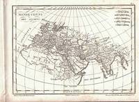
182215951Paris: Ambroise Tardieu. 1822. Non-Book. Very Good in No Dust Jacket dust jacket. This map is in VG condition full borders as published plate marks defined uncolored as published folded at centre as published measures 21" x 17". A very scarce map of which images are available.; 8vo . Ambroise Tardieu unknown
1821264880Paris : Alexis Eymery 1821. First Edition. Softcover. Poor set in the original stiff-card wrappers; wear and tear as with age. Text remains in fine condition and without blemish. Physical description; 6 volumes only: 1 2 4 6 7 and 10 ; 21 cm. Contents; t.1. Histoire d'Egypte d'Asie et de Perse -- t.2. Histoire de la Grèce -- t. 4 and 6. Histoire Romaine -- t.7. Includes one volume from histoire moderne: tome 10. Histoire du Bas-Empire. Subjects; History Ancient. Paris : Alexis Eymery paperback
1821D7867Paris: Chez Masson et fils 1821. Hardcover. Very Good. 8vo 210 x 125mm. 660pp. 11 plates on various subjects; 1 principles of the head and symmetry of the face; 2 principles of the human body and anatomy; 3 orders of columns and architecture; 4 architecture for military naval or marine; 5 cosmography folding; 6 the mappe-monde in two hemispheres 400 x 230mm folding; 7 physics; 8 Seven Wonders of the World folding; 9 portraits of Greek mythology; 10 personifications of the sun and muses; 11 portraits of divine muses; and one in-text illustration of signs of the zodiac on p. 54. Contemporary calf marbled endpapers; intermittent browning and foxing plates are bright and clean. Good. Large oval engraved bookplate of Biblioteca Francisci Riccardi De Verna and royal armorial book label; stamp of Bibl. Gust. Galletti Florence to title. <br/><br/>French childrens encyclopedia from 1821 with folding mappe-monde plate by Tardieu in excellent shape. Stated fourth edition of Massons encyclopedia for children; the first was published in 1804. Massons encyclopedia is arranged as a series of questions and answers on an encyclopedic range of topics suitable for the schools of deux sexes. The folding mappemonde map is an exquisite addition to the encyclopedia and looks like it was harldy ever unfolded. All the wonderful and expertly executed plates are on a richer and sturdier paper that has resisted age well. The well-known Parisian engraver Pierre François Tardieu executed the map as well as the plate on cosmography. Chez Masson et fils hardcover
1872261228Paris: Bailliere 1872. hardcover. very good. xxii 610pp. 8vo half leather over marbled boards; some wear to spine and hinges. Paris: J.-B. Bailliere et Fils 1872. Internally clean and bright a very good copy.<br/> <br/> Bailliere unknown
18491356839Boston: Ticknor Reed and Fields 1849. First American Edition. Hardcover. Octavo xi 286 pp. Good; bound in contemporary brown embossed cloth with spine edges torn and slight wear to corners; binding tight; text block age-toned; minor foxing and age-toning to pages; inscribed on ffep in ink "J. M. Warren M.D. with the regards of Wm. W. Morland;" ex-library copy with usual markings including institutional stamps to several pages and call numbers written in pencil and ink; MF consignment. Jonathan Mason Warren 1811-1867 received his medical degree from Harvard in 1832 and studied in Europe before returning to practice in Boston in 1835. In 1846 he was appointed visiting surgeon at Massachusetts General Hospital. <br /> <br /> William Wallace Morland 1818-1876 graduated from Dartmouth College in 1838 and received the degree of M. D. from the Harvard Medical School in 1841. After continuing his studies for a time in Europe he settled in Boston where he practiced his profession with considerable success. At the foundation of the Boston City Hospital in 1864 Dr. Morland was appointed visiting physician and held this post until 1870. 1356839. Special Collections. Ticknor, Reed, and Fields hardcover
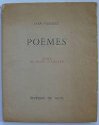
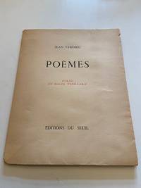
1944873Paris: Éditions du Seuil 1944. First edition. Original Wraps. Near Fine. First edition. 57 pp. Original printed wraps with glassine dust jacket. Glassine rubbed at fore-edges and head and foot of spine evidence of bookplate removal from inside front cover and some browning to endpapers. Mostly unopened. Original etching by master printmaker Roger Vieillard who studied with Stanley William Hayter at Atelier 17 in the 1930s. One of 200 numbered copies of a total edition of 210 on Lana. Tardieu 1903-1995 was a poet known for his collaborations with Surrealists his work as a dramatist and his association with French radio following World War II. Éditions du Seuil unknown
197423516Paris: Études Augustiniennes 1974. Softcover. Near fine. 10" x 6.25" 387 pp in original printed wrappers. Light shelf wear internals fine. Études Augustiniennes unknown
186843704Paris Baillière et fils 1868. In 8° bross. pp. 280 8168 le ultime pag. di pubb. editoriale. Qualche giallitura non particolarmente pesante ma buona copia. Terza edizione rivista e aumentata Paris, Baillière et fils unknown
181053137Precis de la Geographie Universelle by Malte Brun. 1810. Clear and detailed engraving of Scandinavia with inset maps of Iceland and the Faroe Islands. Illustrated cartouche at lower right showing title on a rock in a forest. Two scales below Copper engraving. Fine condition Later colour. Size: 30 x 21 cm. 12 x 8½ inches unknown
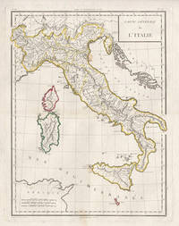
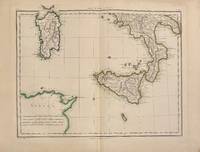
17985441798. Copper-line engraving with later hand-colouring. 450mm by 350mm platemark. French copper-line engraved map of Italy and Sicily with later outline hand-colouring. Published in Paris 1798.<br /> Central horizontal fold as issued. A couple of small stains.Scarce map from Mentelle & Chanlaire's Atlas Universel. etc. The engraving detail is very well executed in the style of other Tardieu maps. unknown
18201103020030Grave par P.F. Tardieu 1820. Map. Very Good. 5-1/4 x 18-1/2 inches. Copperplate engraving of Constantinople including labeled geographic features and key in top-right corner listing them. Pierre Francois Tardieu 1711-1774 was a prominent French cartographer and engraver working in the mid 18th century. This print provides a fine example of his cartographic work and attention to detail. Two small pinholes on middle left side of image border. Smudge marks on top-right corner of border. Image itself remains clear and detailed. Ink lines are crisp and clean. A superior chart in excellent condition. Grave par P.F. Tardieu unknown
187027929Paris:: Bailliere et Fils 1870. contemporary quarter green morocco. Institutional bookplate and withdrawn stamp and stamps on title page; light rubbing to the binding; otherwise clean and crisp. 8vo. 14 plates 1 in color. Bailliere et Fils, unknown
179324813France 1793. Very good condition. Handsome copper engraved portrait bust of the great French Pacific explorer whose last known stop on his circumnavigational voyage was at Botany Bay the newly founded colony of New South Wales. After he departed Botany Bay and explored the coast of Australia he went on to New Caledonia the expedition vanished. <br /> <br /> La Perouse 1741 - 1788 was commissioned in 1785 to head a scientific expedition the Pacific for fur and whaling resources and to claim new territory in Australia for the French crown. He explored widely from Chile and Hawaii to Alaska and California where he was the first foreign visitor since its founding in 1769 making a detailed description of the country.<br /> <br /> Showing the head and shoulders of la Perouse in braid-trimmed naval coat within an oval frame. Printed below the image "Grave d'apres une Miniature par Alex.r Tardieu 1793". <br /> 9 1/4 x 11 1/2". Wide margins with 2 of the impression lines visible on thick gauge paper. Trove 9635425. unknown
1802331189Paris: Edme Mentelle 1802. Map. Engraving with hand coloring. Image measures 14" x 17"<br/> <br/> This 1802 map by Tardieu depicts southern Italy the islands of Sicily and Sardinia and the northern coast of present-day Tunisia. The highly detailed map identifies towns cities roads and rivers. Mountains are depicted pictorially. The map is in very good condition with minor toning to edges. <br> <Br> Pierre Francois Tardieu 1711-1771 came from a family of engravers and map makers based in Paris.<br/> <br/> Edme Mentelle unknown
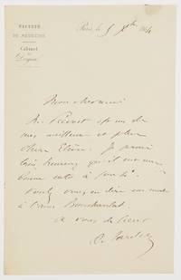
1864603961864. Paris 5.XII.1864. 1 Seite gr.-8°. Mit Siegelspur und Adresse. Gestochener Briefkopf "Faculté de Médecine / Cabinet du Doyen". Ambroise Auguste Tardieu 1818-1879 französischer Rechtsmediziner; das Battered-Child-Syndrome ist auch als Tardieu-Syndrom bekannt. - An Professor Regnauld mit der Bitte um Empfehlung eines Schülers. ". Mr. Prévost est un de mes meilleurs et plus chers elèves. Je serais très heureux qu'il eut une bonne note à sortie. Voulez-vous en dire un mot à l'ami Boucharelat ." unknown
1870389131870. Paris J.-B. Baillière et Fils 1870 8° XII 352 pp. mit 13 gaznseitigen Abbildungen 1 farblith. Tafel feiner Pappband mit aufkaschierte orignal. Broschur. Cet ouvrage est divisé en trois parties: la pendaison première édition 2 la strangulation première parution en 1855 édition complétée 3 la suffocation première parution en 1860 édition complétée. unknown
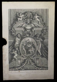
1752261801752. S.l. s.ÂŽ. s.d. 1752. Dimensions : 562 x 367 mm. Eau-forte signÂŽ dans la plaque Charles Le Brun et Nicolas-Henri Tardieu. Lequel fut ''un des plus beaux graveurs du XVIIIÂme siÂcle. Il grava plusieurs planches pour le Cabinet Crozat et La Galerie de Versailles''. in BÂŽnÂŽzit. La peinture originale figure dans le Galerie des glaces du ch‰teau de Versailles. BÂŽnÂŽzit X Dictionnaire des peintres p. 77. Deux dÂŽchirures en marge. Manque marginal sans atteinte ˆ la composition. Quelques rousseurs marginales. Du reste belle condition. b42961 unknown
183578717Paris: Chez de Pelafol libraire c 1835. Oblong folio 26x34 cm. Original printed publishers wrappers with vignette soiled some small stains and a few loss of paper. - Missing: endpapers title the 2 large flding maps and 1 folding map "Ile de Bourbon". But still a nice collection of all the 86 engraved departemental maps & "Paris" & "Environs de Paris" coloured by hand in vivid colors and the folding maps: "Alger" and 5 of 6 of the colonial maps "Guyane" "Sénéal" "Martinique etc" Guadaloupe" and "Les Possessions Françaises Orientales" also coloured by hand. - Together 94 maps. Chez de Pelafol, libraire unknown
32273Couverture rigide. Bon/1944. in-8. Paris Editions du Seuil 1944 in-8 57pp broché Très bel exemplaire de l'édition originale numérotée sur papier Vélin de Lana n° 128/200 tirage total: 210ex. Superbe burin en frontispice pleine page de Roger Vieillard! unknown
KART0161Paris um 1800. Portugal - Plattengröße:45x34 cm Blattgröße: 568x434 cm; verstärkter Mittelfalz No. 108 im linken Plattenrand in der Mitte im unt. Plattenrand: Longitude du Meridien de Paris; sauberes dekoratives Blatt. Paris, um 1800. unknown
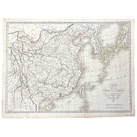
1821364072Paris 1821. Very good. An engraved map of China and the countries to the east by Ambrose Tardieu with period outline color. The text is in French.<br /> <br /> 22 by 16 inches on a larger sheet. Dated 1821 in the plate and published in Atlas pour servir a l'Intelligence de l'Histoire Générale des Voyages de Laharpe. Very good. Folded as issued. Page margin chipped in place not affecting the image. A short tear at the fold has been repaired with tissue. unknown
35622204-nnew. unknown
35622204like new. unknown
16-4237Paris : Alexis Eymery 1827. Oblong 8vo. Oriiginal qtr roan and blue percaline shaken. 195 x 258mm. Light foxing. OCLC Number: 491642538 Paris : Alexis Eymery, 1827. unknown
1867012994Paris: J. B. Bailliere 1867. Contemporary quarter morocco marbled boards. Paper label removed from spine bottom; ink stamps on half-title and title page. Two plates at page 440 and 827. First Edition. Hard Cover. Very Good/No Jacket. J. B. Bailliere Hardcover