628 résultats
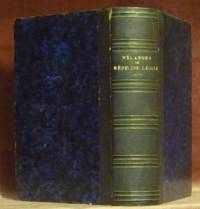
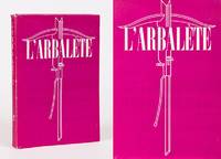
194760564AB1947. Lyon Chez Marc Barbezat 1947. 19.5 cm x 28 cm. 184 pages. Original Softcover. Stiff card covers with illustrated paper dust jacket. Deckled edges. Very good condition with only minor signs of external wear. Some foxing to rear endpaper and inside cover only. Includes two loose sheets broadsides of advertising for further publications from the publishing house Jean Genet's Poems and Miracle de la Rose sizeable praise from Jean-Paul Sartre included and errata-leaf loosely inserted. Several pages untrimmed / unopened. L'Arbalète No. 12. Includes the following contributions: Le Rite du Peyotl Chez les Tarahumaras / Les Bonnes / Portraits de Famille / Boris Vian - Les Poissons Morts / Qui est là / L'Arve et L'aume. paperback
183652355Paris. 1836. Splendid route map of Switzerland showing all routes in detail and the cantons in outline colour. A key to the map at top right is in English German and French. Title at top left engraved in steel. Scales at lower right. La Suisse Pittoresque. Souverain Paris. Copper engraving. The whole map has been laid down on newer paper. Minor marks mainly towards margins but otherwise clean and crisp. Very good condition. Later colour. Size: 68 x 48 cm. unknown
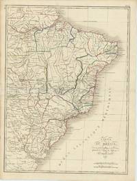
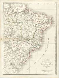
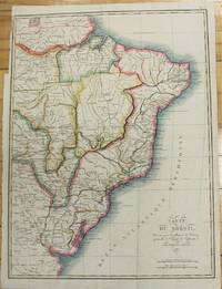
61292Paris: par Ambroise Tardieu 1821. Original double page engraved map of Brazil 52.5 x 40 x overall sheet size 58 x 4 cm with outline hand colouring. Centrefold crease as issued. Minor wear along outer edge of left margin not affecting map. Generally an excellent example. Paris: par Ambroise Tardieu, 1821. unknown
61285Paris: par Ambroise Tardieu 1821. Double page engraved map of Brazil 52.5 x 40 cm overall sheet size 58 x 44 cm. With outline hand colouring. Centrefold crease as issued. Small ink stain to upper right of map. Generally very good. Paris: par Ambroise Tardieu, 1821. unknown
185941170Paris : J.-B. BailliÂre et Fils 1868 1863 1859 1860. 210x140mm. VIII - 95 186Êpages demi-percaline. VIII - prÂŽface 337 95 186 140 pages. Titre et faux nerfs dorÂŽs au dos. Bel exemplaire. 1000 J.-B. BailliÂre et Fils unknown
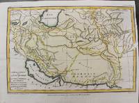
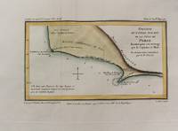
1797M10803Paris 1797. Very Good. Size : 195x288 mm 7.68x11.34 Inches Coloring: Hand Colored Category: Maps Asia Middle East Iran Iraq; unknown
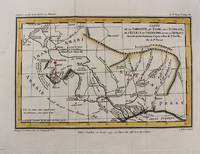
1797M10802Paris 1797. Very Good. Notes: Map of Northern side of the Persian gulf Iran. Size : 98x176 mm 3.86x6.93 Inches Coloring: Hand Colored Category: Maps Asia Middle East Iran Iraq; unknown
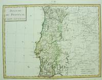
1750M6691Paris c. 1750. Very Good;. Notes: Engraved by Pierre Francois Tardieu. Size : 346x462 mm 13.62x18.19 Inches Coloring: Original Hand Coloring Category: Maps Europe Portugal; unknown
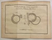
1801301145Paris: Maradan 1801. Print. Uncolored engraving. Plate measures 6" x 8 1/2"<br/> <br/> This map and diagram published in "Voyage dans la Haute Pensylvanie et dans l'etat de New-York" by Michel Crevecoeur depicts ancient circular fortifications built by Native Americans along the Huron River. The Huron River is also referred to as the Bald Eagle River named after a large nest found at the mouth of the river in the 18th century. The engraving reads "This sketch was sent to George Washington by A. Steiner on May 28 1789." Pierre Francois Tardieu 1711-1771 came from a family of engravers and map makers based in Paris. Rare.<br/> <br/> Maradan unknown
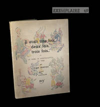
1947210501947. Paris Librairie Gallimard 1947. Un vol. au format in-4 333 x 257 mm non paginÂŽ en feuilles sous couverture illustrÂŽe ˆ rabats rempliÂŽs. Edition originale. Tirage unique ˆ 50 exemplaires numÂŽrotÂŽs sur papier pur-fil de Lana seul papier 15 exemplaires hors-commerce. Celui-ci le numÂŽro 59. Il s'agrÂŽmente - ici en premier tirage - de dÂŽlicieuses compositions en couleurs d'Elie Lascaux. ''Natif de Limoges depuis qu'il expose au Salon d'Automne cet artiste bien particulier fut vite remarquÂŽ des amateurs. Ses compositions dÂŽbordent de trouvailles que l'on est tentÂŽ paradoxalement de qualifier de savantes. Ses oeuvres figurent souvent dans les galeries les plus avancÂŽes d'esprit. Scrupuleusement descriptif il ÂŽnumÂre les feuilles les arbres les fenÂtres des maisons ses paysages ne sont pas d'ici ; transfigurant le rÂŽel ils projettent le spectateur dans l'imaginaire dÂŽcor de thŽ‰tre ou dÂŽcor d'un rÂve selon le degrÂŽ d'illusions. .''. in BÂŽnÂŽzit. BÂŽnÂŽzit VI Dictionnaire des peintres p. 461. Petite coupe en tÂte du dos. Plats prÂŽsentant un ÂŽclat lÂŽgÂrement altÂŽrÂŽ ainsi qu'une tra”nÂŽe brune au second. Marge supÂŽrieure d'un des feuillets lÂŽgÂrement solarisÂŽe. Un autre prÂŽsente quant ˆ lui de discrÂtes altÂŽrations. Du reste belle condition. Exemplaire non coupÂŽ. b42961 unknown
1840111136Firenze Batelli e Compagni 1840. In 8° mezza pelle coeva con titoli oro e nervi al dorso. Pp. 304 le dette tavole incise a raffigurare il bassorilievo della colonna ed alcuni particolari della costruzione della stessa. Rarissime e pallide gialliture ma buon esemplare Firenze, Batelli e Compagni unknown
18684079EB1868. Erlangen Verl. Ferdinand Enke 1868. 27 xylographische Abb. XIII 598 S. Original-Halblederband geringfügig berieben/bestoßen. Titelblatt unauffaellig gestempelt. Seiten teilw. geringfügig fleckig eine Seite mit Anmerkungen von alter Hand. Sonst in sehr gutem Zustand. unknown
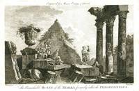
17781612London: Alexander Hogg 1778. Etching with engraving on lightweight wove paper 7 1/2 x 11 1/4 inches 190 x 285 mm; sheet 8 3/4 x 13 1/4 inches 222 x 336 mm unevenly trimmed wide margins. Condition is consistent with age including some light toning handling wear and some scattered light spots of discoloration. An image from Moore's Voyages & Travels. Alexander Hogg unknown
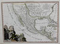
1819M8213Paris. c. 1819. Very Good. Notes: Rare first edition of this important map of Mexico and the South & Western US. This map is based on the works of Humboldt Pike and Lewis & Clark. <br><br> Size : 222x298 mm 8.75x11.75 Inches Coloring: Hand Colored in Outline Category: Maps Central America Mexico; unknown
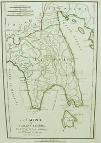
1786M6642Paris 1786. Very Good;. Size : 326x215 mm 12.83x8.46 Inches Coloring: Original Outline Coloring Category: Maps Europe Greece Macedonia; unknown
59-0182Paris de l'Imprimerie Royal Cabinet Crozat 1729. Engraving by Nicolas Tardieu after the painting by André Luigi d'AssiseImage size: 443 x 326 mmSheet size: 540 x 406 mm Water stains in lower margin.Plate number 74From "Recueil d'Estampes d'après les plus beaux Tableaux et d'après les plus beaux Desseins qui sont en France dans le Cabinet du Roy dans celuy de Monseigneur le Duc d'Orleans & dans d'autres Cabinets Tome Premier. Cabinet Crozat Volume 1 Paris, de l'Imprimerie Royal [Cabinet Crozat], 1729. unknown
1836014368Paris: Furne & Fruger et Brunet 1836. Hardcover. Very Good/No Jacket. 12mo - over 6¾ - 7¾" tall. Half morocco marbled paper boards gilt spine decoration. Marbled endpapers. Twenty double-page map spreads designed and engraved by Ambroise Tardieu featuring plans of the cities of Athens Sparta ruins Carthage Jerusalem Syracuse Rome and Constantinople. Spine sunned light rubbing to extremities. Inner hinge cracked at flyleaf. Bookplates to flyleaves. Furne & Fruger et Brunet hardcover
186819750Paris: Bailliere 1868. With 2 full-page and 1 folding stipple engraved plates 2 completed in fine contemporary hand-color. Contemporary half gilt green sheep over marbled boards old manuscript shelf labels bookbinder ticket affixed to the front pastedown stamps of the Royal College of Surgeons of England. In good condition. First edition of this forensic analysis of infanticide. The text describes ways of determining if a newborn was born alive different forms of infanticide suffocation head injury strangulation drowning discarding in trash fire and the criminal pathology of mothers who kill their babies. It includes instructions for performing autopsies. The final section is comprised of case studies. The plates at the end of the volume show the organs and bones of babies who were both stillborn and killed after birth. Bailliere unknown
183078711Paris: Pelasol c. 1830. Oblong folio 25x33 cm. Contemporary half cloth covers marbled paper spine partly damaged; marbled paper rubbed and loss of paper at the borders; first endpapaers renewed. Calligraphed title with on verso "Table. composant l'Atlas"and explications of "Signes conventionnels pour les Departemens". And 97 engraved maps 'sous la direction de P. Tardieu' with explanatory texts printed in the margins in a very small type. A bit loose in binding small lightbrown spots in places. 97 maps complete: 2 large folding maps 'France' & 'Douanes'. - 86 'Departements'. 2 second copy of 'Seine' & 'environs de Paris' only these 2 handcoloured. - 1 'Alger' folding map - 6 'Colonies' folding maps. - Binding used; small waterstain in lower margins but on the whole an acceptable copy Pelasol hardcover
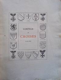
2103PA169<p>A Clermont-Ferrand 19 mai 1895. Avec une liste générale des famillles existantes en France qui ont été aux Croisades. Par. Créateur-Organisateur de ce Cortège Historiographe de l"Auvergne. Officier et Chevalier de divers ordres Membre de l"Institut archéologique d"Allemagne de l"Académie royale d"histoire de Madrid et de la Société archéologique impérale de Saint-Petersbourg des Académies de Toulouse Rouen Nancy Marseille Hippone Clermont-Ferrand. Macon Protat Frères Imprimeurs. Clermont-Ferrand. 1895.</p>_x000d_<p>De 31x24 cm. Com ii 164 págs. Brochado pronto a ser encadernado.</p>_x000d_<p>Ilustrado no texto com uma fotografia em sépia belas gravuras cabeções decorados iniciais com emotivos vegetalistas e florões de remate e em extratexto com uma gravura a preto e branco do autor. </p>_x000d_<p>Exemplar com folha de guarda anterior decorada com uma gravura de uma figura feminina alada a segurar um escudo em forma de coração estilizado. No verso da folha de guarda uma informação emoldurada por flores de lis "Cette ouvrage n'a pas été mis dans le commerce" Esta obra não foi comercializada. Na folha de guarda posterior uma vinheta com um anjo numa moldura decorada com motivos vegetalistas e o mote ' L"amour du beau est un don céleste O amor pelo belo é um dom divino. Capa anterior danificada com perda de papel. </p>_x000d_<p>Obra que se debruça sobre as famílias existentes em França cujos membros estiveram nas Cruzadas.</p> I-191-F-14 unknown
2019x-1138584614Taylor & Francis 2019. Hardcover. New. 312 pages. 9.00x6.00x0.75 inches. Taylor & Francis hardcover
1810357352Paris.: Henri Tardieu. 1810. 1st Edition. Hardcover. Old half plain parchment over mottled boards. Good covers worn lower half of spine missing contents very good with light toning to maps. 21.8x16x1.5 cm. Rare first edition of this popular atlas intended for the instruction of children. North American map shows little detail in the Pacific Northwest but does show the “River of the West†flowing westward from “Pikes Lakeâ€. weight: 0.6 lb. 21 double page maps with outline color. Henri Tardieu. hardcover
1797M10801Paris 1797. Very Good. Notes: Important early map of present day southern Iraq. Size : 132x208 mm 5.20x8.19 Inches Coloring: Hand Colored Category: Maps Asia Middle East Iran Iraq; unknown
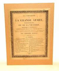
1822953523Paris: Tardieu 1822 / 1823. hardcover. Gut. 75 Seiten 38 Kupfertafeln. Lose Lagen und Tafeln in einer modernen Leinenkassette mit aufmontiertem Titelblatt. 315 x 235 x 4 cm Die Kasette ganz frisch Lagen und Tafeln unbeschnitten minimal braunfleckig an den Rändern leicht angestaubt im Ganzen gut erhalten. Mit vollständigem Text und allen Tafeln. Von den drei Titelblättern der Lieferungen wurde eines auf den Deckel der Kassette aufgezogen die Rückseite mit der Verlagswerbung auf den Innendeckel; ein weiterer Titel wurde auf Karton aufgezogen und der dritte liegt unbehandelt in der Kassette dieser stark gebräunt und mit Einrissen und Fehlstellen. "Die Säule der Großen Armee und ihres Sieges bei Austerlitz ein aus Bronze errichtetes Triumphdenkmal auf dem Place Vendôme in Paris. Beschreibung mit 38 Tafeln die die Gesamtansicht die Medaillen Podeste Basreliefs und die Statue aus denen sich das Denkmal zusammensetzt darstellen." "Die Schlacht bei Austerlitz französisch Bataille d'Austerlitz tschechisch Bitva u Slavkova auch die Drei-Kaiser-Schlacht genannt obwohl der österreichische Kaiser Franz I. auf dem Schlachtfeld nicht anwesend war fand am Montag dem 2. Dezember 1805 statt exakt ein Jahr nach der Kaiserkrönung Napoleons I. in Paris. Sie ist eine der bekanntesten Schlachten der Napoleonischen Kriege. Am Pratzeberg zwischen Brünn Brno und Austerlitz Slavkov u Brna in Mähren besiegte Kaiser Napoleon I. von Frankreich eine Allianz aus österreichischen und russischen Truppen - letztere unter Kaiser bzw. 'Zar' Alexander I. . Die Bronze der eroberten Kanonen wurde zum Guss der Vendôme-Säule auf dem Pariser Place Vendôme verwendet." Wikipedia. - Weitere Bilder auf Anfrage oder auf unserer Homepage. Wegen Urlaub kann Ihre Bestellung / Anfrage erst nach dem 21.06.2026 bearbeitet werden. - Because of holidays your order / question can be handled only after 06/21/2026. Tardieu hardcover
1821M2689Paris 1821. Very good. Size : 407x545 mm 16x21.5 Inches Coloring: Original Hand Coloring Category: Maps South America Countries; unknown