TARDIEU, AmbroiseBiblio.com
628 résultats
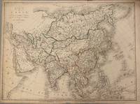
1821331698Paris: Ambroise Tardieu 1821. unbound. Map. Original outline color. Image measures 21 1/2" x 16"<br/> <br/> Simple and elegant map of Asia. Highly detailed the map shows rivers population centers and topography. Relief is depicted pictorially. In good condition with some closed tears to margins and edge toning.<br> <Br> Ambroise Tardieu 1788-1841 was a French engraver mapmaker and publisher. From a family of engravers he was trained by his uncle Pierre Alexandre Tardieu and became celebrated for his portraits. He also published a number of atlases. He and his uncle are not to be confused with Jean Baptiste Pierre Tardieu an unrelated French cartographer and engraver.<br/> <br/> Ambroise Tardieu unknown
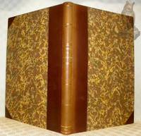
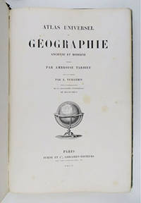
1853117582Paris : Furne 1853. 425x280mm. 2 ff. 30 doubles planches avec frontiÂres coloriÂŽes demi-chagrin ˆ coins titre et filets dorÂŽs au dos plats papier marbrÂŽ reliure moderne. 2156 Furne unknown
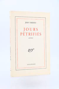
195489913Paris: Gallimard 1954. Fine. Gallimard Paris 1954 14.2 x 19.5 cm Broché First edition one of 50 copies numbered on pure wove paper the only deluxe issue.A fine copy. Gallimard unknown
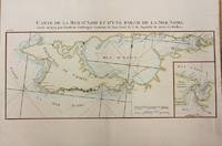
1783M2768Paris: Le Clerc Nicolas Gabriel 1783. Excellent. Size : 238x480 mm 9.375x18.875 Inches Coloring: Hand Colored Category: ; Maps Europe Ukraine Le Clerc, Nicolas Gabriel unknown
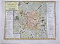
1792M4250Paris 1792. A tear on the right margin beyond the plate mark has been repaired upper margin shaved closely otherwise very good. Notes: A detailed and decorative city plan of Madrid and vicinity with a list of major edifices in two panels on the left and right hand sides. Size : 330x435 mm 13x17.125 Inches Coloring: Hand Colored Category: Maps City Maps; Maps Europe Spain unknown
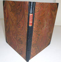
51-4449Paris: Chez Bernard 1804. 4to . 23 x 25 cm . Modern half Sakora goat and marbled boards by the artisan binder Sasha Mosalov. Without the title page. 15 handcolored double page maps each 25 x 41cm. . Includes a world map and maps of North and south America. .OCLC Number: 879716030; 45848528. Paris: Chez Bernard, 1804. hardcover
BN104984GALLIMARD. Softcover. Comme ceci comme cela <br/><br/>Comme ceci comme cela GALLIMARD paperback
1990NN2548Peeters 1990. No ownership marks. Scarce. Robust packaging. Tracking can be added to overseas orders on request. Used books are exempt from USA tariffs. 1st edition. Paperback. Paperback. Near Fine/Fine. 209 i pp. illus. Peeters Paperback
16192942Paris 1916-1917. Hardcover. Very Good . Each volume approx. 300 p. 5 x 7 1/4 in. Half morocco binding with marbled boards gilt lettering on spines 5 raised bands top edge of text block gilt colored end papers. Condition of each volume is VERY GOOD: very light wear to covers and spines marbled boards very lightly worn a few lightly worn corners and spine edges light discoloration to some leather surfaces. Spine faded edges of text block very lightly darkened small book plate of David B. Ogden on inside of front cover pages very clean bindings very tight. LF LC- light soiling to end papers. Gaspard- small old worm hole at edge of text block. La France.- light soiling to end papers front hinge starting to crack this text alone from 1910 all others are from 1916-1917. NOTE- 10 volumes all in French all war memoirs pertaining to WW I all bound uniformly color variations in leather marbled boards end papers by Brentano's NY stamped on endpaper. hardcover
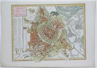
1792M4116Paris 1792. Excellent. Notes: A detailed and decorative city plan of Vienna and vicinity with a list of major edifices on the left hand side. Size : 345x440 mm 13.625x17.25 Inches Coloring: Hand Colored Category: Maps City Maps; Maps Europe Austria unknown
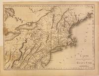
1801301221Paris: Maradan 1801. Map. Uncolored engraving. Image measures 14 1/4" x 19 3/4". Stains and foxing but otherwise in good condition.<br/> <br/> Important early map of the United States published in "Voyage dans la Haute Pensylvanie et dans l'etat de New-York" by Michel Guillame de Crevecoeur. One of the most highly detailed and comprehensive maps published post-Revolution it depicts the northeast US extending from Maine to northern Virginia and westward to the Ohio River. In the Finger Lakes region surveyed bounty land known as the Central New York Military Tract or New Military Tract is indicated. Following the Revolutionary War New York soldiers were guaranteed 500 acres as compensation for their service. Nearly two million acres were reserved for this purpose. Other interesting features of the map include the Connecticut Western Reserve in present day Ohio and lack of a northern border in Maine. Cities counties rivers and roadways are labeled. Some stains along left margin. Minor spotting. <br> <br> Pierre Francois Tardieu 1711-1771 came from a family of engravers and map makers based in Paris.<br/> <br/> Maradan unknown
23881Paris Boulland 1825. 8vo 16.7 x 9.8 cm. viii 528 pp.; three engraved portraits of Haüy frontispiece Thénard opposite p. 177 and Biot opposite p. 337 12 folded engraved plates several tables. Contemporary full calf. Boards with gilt ornamented borders and dentelles front board with the large gilt vignette of the College Royal de Louis le Grand spine rich gilt and with green morocco label with gilt title. Marbled endpapers edges marbled. = This well-illustrated work introduces the mineralogical system of Haüy to a broader public. The author Ambroise Tardieu 1788-1841 was a French mineralogist cartographer and engraver. His son Auguste Ambroise Tardieu 1818-1879 was also an artist and a pioneering forensic medical scholar. This work has been written in the form of a dialogue between 'Mme de Beaumont' 'Gustave' and 'Caroline' and treats all kinds of minerals in 16 chapters. This Mme de Beaumont may well be based on an actual person but not the wife of the famous geologist Jean-Baptiste Armand Louis Léonce Élie de Beaumont 1798-1874 as he was single until in 1859 he married the poet Thérèse Marie Augusta Quélen 1806-1866. The title page states that there are 23 plates but that is an error. The 12th plate says: "Pl. XII et dernière". The plates mainly show crystal forms two plates include tools and one shows minerals. An extraordinary copy with additional portraits. The two "extra" portraits are in exactly the same style and on the same paper as Hauy's. However they are not recorded in any other copy. In fact several copies on the internet do not only lack these two portraits but lack the Hauy-portrait too. The extra portraits show the French chemist Baron Louis Jacques Thénard 1777-1857 and the French chemist physicist and astronomer Jean-Baptiste Biot 1774-1862. Top hinges starting otherwise a very good attractively bound copy. Not in Ward and Carozzi. hardcover
16-3711France: late 19th Century. 8vo. 13 x 20 Qtr. roan and Original boards. 28 double page handcolored maps most with one wormhole in the margins and waterstain. 28 world and country maps; Also bound in are 19th Century maps of Napolionic battles.Atlas. Recueil composite :-- 4 planches doubles couleurs sphère armilllaire lune mappemonde etc.- 23 cartes fin XVIIIe s. rehaussées sur double page mappemonde Europe pays d'Europe Asie Afrique Egypte Amérique etc.- 1 carte d'Océanie sur double page par Avril 1841. 10 plans de A.M. PERROT gravés par Tardieu sur les batailles napoléoniennes.In-8 ½ basane verte ép. dos lisse. Coiffes et coins usés. Galeries de vers et mouillures claires. France: late 19th Century hardcover
51-5739Paris: Gregoire Dupuis 1719. 4to. 19 x 25cm. Contemporary calf with gilt spine.100 half-page etchings.xlii 358 6pp.OCLC Number :177708811:Splendid engraved frontispiece of the dedicatee the nine-year-old Louis XV sitting on Athena's knee as the figure of Fable points out a seductively naked Truth to the lad by Coypel and Tardieu. Engraved title vignette by Vleughels and Simoneau. .in-4 de XLII-358pp.-3ff. Plein veau époque dos orné pièce de titre de maroquin rouge Ce charmant ouvrage contient 100 fables d'Antoine Houdar de La Motte 1672-1731 imitées sur les fables de Jean de La Fontaine et d'Esope. Bien complet des 100 gravures sur cuivre à mi-page par Coypel Cochin Picart… « Très belle édition rare et recherchée. . Les vignettes sont jolies et spirituelles surtout celles gravées par Gillot" Cohen 594 "Jolie édition" Brunet III 801. Dacier considère cet ouvrage comme le "Premier Livre illustré au XVIIIe siècle ».Très belle édition rare et recherchée les vignettes sont jolies et spirituelles surtout celles gravées par Gillot. Cohen-594 Coiffe supérieure arrachée rousseurs mouillure marginale en fin. Paris: Gregoire Dupuis, 1719 unknown
194891074Paris: Gallimard 1948. Fine. Gallimard Paris 1948 12 x 18.8 cm Broché First collected edition one of 13 numbered copies on pur fil paper our copy being one of 3 hors commerce the only copies on deluxe paper.A fine copy. Gallimard unknown
17998682Paris F. Buisson 1799-1804. Two copper engraved maps each 65 x 47 cm engraved by Jean-Baptiste Pierre Tardieu lainé of 385 Rue de Sorbonne; black and white a couple of closed tears old fold lines blank verso. Maps 38 and 39 from the atlas volume of Voyage dans l'intérieur de la Chine et en Tartarie fait dans les années 17921793 et 1794 par Lord Macartney Ambassadeur du Roi d'Angleterre auprès de l'Empereur de Chine the French translation of Sir George Stauntons account of the first British diplomatic mission to China headed by Lord Macartney. The maps cover the route between Guangzhou Canton and Beijing Peking. Map unknown
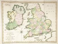
51474A Paris: de l'Imprimerie de Crapelet An VI 1797/1798. 4to. 27 x 21cm. pp.43. Original pink boards with white printed label. Large folding map overall: 48 x 63cm image: 42 x 55cm in full original hand colour titled 'Carte des Descentes faites en Angleterre et en Irlande depuis Guillaume le Conquerant jusqu'a nos jours. An VI' showing the locations of the attempted invasions of Britain since William the Conqueror in 1066. Boards rubbed map very clean and attractive. A history of the invasions of Britain. A Paris: de l'Imprimerie de Crapelet An VI [1797/1798]. hardcover
194765561Paris: Gallimard 1947. Fine. Gallimard Paris 1947 25.50 x 33.50 cm broché First illustrated edition with 92 original colour compositions by Elie Lascaux one of 65 numbered copies on pure Lana wove paper deluxe issue. Endpapers slightly shaded minor tears to the spine without loss a pleasant copy. Gallimard unknown
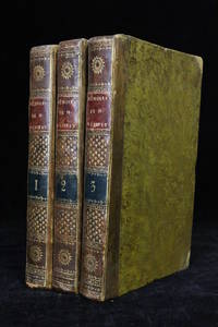
181849877à Paris: Chez Brunet 1818. Fine. Chez Brunet à Paris 1818 13 x 20 cm 3 volumes reliés First edition. There would be three editions the same year. Contemporary half brown sheep bindings with corners. Smooth spines decorated with gilt compartments and fleurons as well as red and blue morocco title and volume labels. Joints slightly cracked and showing some rubbing. Some dampstaining. ""Woman writer salonnière and friend of philosophers and famous writers in the 18th century Louise d'Épinay is the author of Memoirs whose originality is situated on two levels: from the point of view of content first because it is a history of her family and the literary events of the century a history however 'self-reflective' and filled with her own feelings and reflections; then from the point of view of form since it involves a singular combination of letters memories and first-person diary pages and short third-person narratives."" Sanda Nemeth-Badescu Dalhousie French Studies 2005. The famous muse of the late 18th century was indeed a friend of Rousseau Grimm Diderot Voltaire etc and her memoirs interspersed with correspondence best illustrate the world of letters of this late 18th century. Chez Brunet unknown
16-4498Paris Bernard 1804. 4to. 21 x 25.5 cm. With 19 of handcloored double-page maps Lacks the 20th of France but the 2 of America are present.Contemporary qtr. roan somewhat worn.in-4 relié demi-basane frottée. Illustrées de 6 tableaux dépliants montés sur onglet et de 19 cartes ou plans sur 20 manque la dernière. Quelques restaurations dans les marges blanches de quelques cartes Paris, Bernard, 1804, unknown
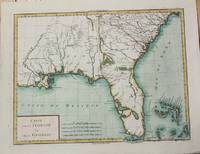
1799M5632Paris c. 1799. Very Good. Notes: The map depicts Florida during its time under Spanish control. Numerous Indian villages are located and roads are shown connecting early settlements. There are no engraved political divisions indicating the mapmaker's bias toward either the territorial claims of Spain or the United States. The map provides an excellent view of the Gulf Coast with a dramatically over-sized Tampa Bay. Numerous Indian villages are located and roads are shown connecting early settlements. The Bahamas are also well delineated.<br> Size : 335x440 mm 13.125x17.25 Inches Coloring: Hand Colored Category: Maps United States South Florida; Maps United States South States; unknown
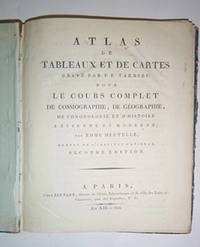
16-6261Paris: Furne et Cie libraires-éditeurs 1855. In-folio 27.5 41.5cm; demi-toile verte étiquette de titre sur le plat reliure de l'époque. Reliure usagée mors int. cassé. 30 cartes sur double page en couleurs. Qqs petites rousseurs bon état des cartes. Bookblock partially loose from spine.OCLC Number / Unique Identifier:794503958:4 pages 60 leaves : 30 hand colored maps ; 42 cm; "Pour l'intelligence de la Géographie universelle de Malte-Brun.""J. Claye imprimeur-libraire"--Half t.p. verso"Imp. Delamain 8 rue Git--le-Cœur Paris"--Most maps.Some maps engraved by S. Jacobs; some maps with script engraved by A. BlanchardRelief shown by hachures and shadingMaps hand colored in outlin Paris: Furne et Cie, libraires-éditeurs, 1855 unknown
1817027703Paris: Ambrose Tardieu 1817. First Edition. `. Quarto. 32 pages with 28 plates including frontispiece some folding 25 are hand colored. Very scarce copies at the Houghton Harvard library Brown University and two libraries in France. The richness of the colors as well as the details of the uniforms made this an early classic that is still essential for those who need exactitude on military uniforms. contents: pt. 1. Les Ordonnances Réglemens et Instructions sur les dits Uniforms -- pt. 2. Une légende détaillée des Planches -- pt. 3. 28 Planches gravées et coloriées des Uniformes et de leurs détails dessinées d'après les modèles déposés au Comité des Gardes nationales -- pt. 4. Les tarifs des prix de tous les objets d' équipment des Gardes à pied et à cheval avec les soumissions et les adresses des Fournisseurs.pt. 1. The Orders Regulations and Instructions on the said Uniforms - pt. 2. A detailed legend of the Boards - pt. 3. 28 Engraved and colored plates of the Uniforms and their details drawn according to the models deposited with the National Guard Committee - pt. 4. The price lists of all the objects of equipment of the Guards on foot and on horseback with the quotes and the addresses of the Suppliers. Bound in a modern dark green morocco boards double ruled in gilt with blind stamped role raised bands lettered and decorated in gilt top edge gilt. Ambrose Tardieu unknown
199574075Limoges: Editions Adélie 1995. Fine. Editions Adélie Limoges 1995 22 x 28 cm une feuille dépliante sous chemise et étui cartonnés Rare first edition one of 40 numbered copies on Arches wove paper the only printing. This first edition is printed on the right half of each page in an unbroken single column with the top and bottom margins omitted. The left half from the first to the last page is occupied by the contribution of the painter and graphic artist Jean Cortot in lithography. The work is presented in the publishers board binding each cover made of three laminated layers of corrugated cardboard with the upper cover and spine printed; the slipcase is of the same type. At the end of the volume a small Limoges ceramic in colour composed by Jean Cortot is embedded in the board and protected by a small glass window. A rare and appealing copy. Inscribed dated and signed by Jean Cortot to Nicolas Bocquet. Editions Adélie unknown
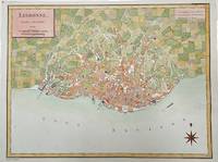
1792M4211Paris 1792. Very Good upper margin has been extended. Notes: Map of Lisbon capital of Portugal published in late 18th century.<br>Antoine-François Tardieu 1757-1822 was a French geographical engraver and publisher active in Paris during the late 18th and early 19th centuries. Size : 340x447 mm 13.375x17.625 Inches Coloring: Hand Colored Category: Maps City Maps; Maps Europe Portugal unknown