M Lapie; Pierre TardieuBiblio.com
628 résultats
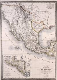
1842M7906Paris: P. Lehuby c. 1842. Very Good;. Notes: A rare and important version of Lapie's Mexico map circa 1842 which depicts Texas as an independent Republic. With an inset map in the lower left of Guatemala. Size : 550x395 mm 21.65x15.55 Inches Coloring: Original Outline Coloring Category: Maps United States South;Maps United States South Texas;Maps Central America Mexico; P. Lehuby unknown
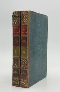
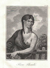
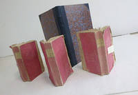
182089082Paris: Madame Veuve Courcier 1820. Fine. One of the earliest explorations of Senegal Madame Veuve Courcier Paris 1820 13.2 x 21.1 cm Relié First edition illustrated with 4 engraved plates by Ambroise Tardieu portrait of Diai-Boukari in marabout attire from Foutatoro view of the Foutatoro army on the march view of the sources of the Rio Grande and the Gambia view of Timbo; and a large folding map at the end of the first volume copy signed by the author on the verso of the title page of vol. I. Contemporary half calf bindings spines decorated with gilt roll tooling in place of raised bands title and volume labels in red calf paper covered boards speckled blue edges small wormhole to the lower hinge of the first volume. Shortly after the Treaty of Paris returned Senegal to France Molliena mere naval clerk and survivor of the Medusa shipwreckwas sent to Africa by the French government on a geographical and political mission Sent to explore the sources of the Senegal and Gambia rivers Mollien was also tasked with countering British expansion in the region. At the end of volume 2 are found an itinerary and glossaries of the Iolof Wolof Poule Peul and Serer languages along with geographical observations on Mollien's discoveries by Eyries. Madame Veuve Courcier hardcover
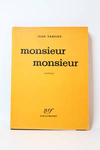
195173758Paris: Gallimard 1951. Fine. Gallimard Paris 1951 14.50 x 19 cm broché First edition one of 8 numbered copies on Holland paper ours being one of 3 hors commerce deluxe issue. A pleasant copy. Gallimard unknown
16-3606Paris Chez F. Buisson Imprimeur-Libraire an X 1802. 4to. Contemporary qtr. roan and marbled boards and eps. Table of plates and 15 engraved plates including a map "Carte de Détroit qui sépare l'Asie de l'Amérique."Map 44.5 x 63 cm. by Tardieu. Map with loss lower right center 8.5 x 1 cm. The first edition in French of the atlas volume only. Sauer’s work documents the Russian Northeast Expedition led by Captain Billings. He served as secretary on the voyage and Lada-Mocarski notes that he was "critical of Billings and sorely disappointed when Billings decided to abandon the idea of going back to the American coast south of Cook's River." Arctic Bib. 37229 text vols only not mentioning atlas; Howes-S 117; cf. Lada-Mocarski 58; Sabin 77153; Tourville 3974; Wickersham 6135.Alaska Description and travelAleutian Islands AlaskaSiberia Russia Description and travelVoyages 18e siècle Russie nordIn-4° demi-veau dos à nerfs orné d’un décor doré et à froid reliure de l’époque.ÉDITION ORIGINALE.Quinze planches gravées sur cuivre dont une carte repliée.Planches seules de cet ouvrage qui comprend deux volumes in-8° de texte.Dos légèrement passé ; petite fente à un pli de la carte. Paris, Chez F. Buisson, Imprimeur-Libraire, an X (1802). hardcover
51-5756Paris: Etienne Ledoux 1821. Folio. 30 x 45cm. Fifteen mainly double-page maps colored in outline. Original qtr. calf. and boards.OCLC Number Identifier:558050636.Very good. Paris: Etienne Ledoux, 1821. hardcover
51-4364Paris: Circa mid-18th Century. Plate volume with 189 engraved plates. 4to. 29 x 22 cm. Contemporary marbled calf. restored. Graveur à l'eau-forte et au burin. - Élève de Lepautre puis de Gérard et Bernard'Audran.Figures de la Bible et de l'histoire sainte.Paris Tardieu milieu du XVIII°siècle.In-4 veau marbré dos lisse orné reliure de l'époque.Suite de 189 planches gravées par Tardieu d'après des tableaux illustrant l'ancien testament 22 le nouveau testament 144 et l'histoire sainte 23.Bon état intérieur. Coiffes et coins usagés.Expertise by Christian GASCHExpertise Livres Anciens et Modernes58004 NEVERS Cédex Paris: Circa mid-18th Century unknown
286753Pierre-Francois Tardieu. unbound. Map. Engraving with modern hand coloring. Image measures 12.5 x 16.75 inches. Sheet measures 17 x 22 inches. In very good condition.<br/> <br/> Beautiful early map of Florida and Georgia western Louisiana southern parts of the Carolinas and the Bahamas circa 1798. The interior of Florida was not yet mapped with distortions to Baie du St. Espirit. Pierre Francois Tardieu 1711-1771 came from a family of engravers and map makers based in Paris. This map was engraved by Jean Emmanuel Jerome Vallet. Hard to find.<br/> <br/> Pierre-Francois Tardieu unknown
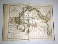
183756150<p>lithograph double-page sheet. EXTREMELY RARE map from "Atlas Journal de la Navigation Autour du Globe de la Frégate la Thétis et de la Corvette l'Esperance pendant les années 1824 1825 et 1826"; pl. 52; REFERENCE: Borba de Moraes I p. 115; Sabin 6874; cf. Ferguson 2236; Ferguson 1204; cf. Hill p. 31; Numa Broc Oceanie 89; cf. Nissen ZBI 483; Howgego B50.</p> Arthus Bertrand, Paris.
195165467Paris: Gallimard 1951. Fine. Gallimard Paris 1951 14 x 19.50 cm broché First edition one of 13 numbered copies on Hollande paper the tirage de tête. A nice copy. Gallimard unknown
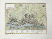
1785M10371Paris c.1785. Excellent wide margins. Notes: A fine early plan of Warsaw is based upon the 4-sheet plan of Warsaw by Pierre Ricaud de Tirregaille entitled Plan de la ville de Varsovie first published in 1762 and Antonio Rizzi-Zannoni's single sheet version of the map published in 1772.<br>Pierre Ricaud de Tirregaille a French Architect and Engineer worked in Warsaw as a surveyor and as an army engineer. Crown Marchal Bielinski commissioned Tirregaille to prepare a detailed plan of the city of Warsaw which resulted in the first map of Warsaw based upon a scientific survey.<br>Rizzi-Zannoni's plan published in 1772 of which we have an example coincided with the efforts of Polish Nobles to enlist the assistance of French "democracy" experts in Paris including Rosseau and Malby to help restructure the Polish "Republic" on the eve of the first partition.<br> Size : 345x455 mm 13.58x17.91 Inches Coloring: Hand Colored Category: Maps City Maps; Maps Europe Poland Lithuania; unknown
51-3516Paris:Buisson An VII de la République 1798 or 1799 . Large 4to. 19th Century 1/4 calf with marbled boards. 30 x 22 cm. Atlas only with all the plates. 44 plates some folding. Very good. Expertise by Dominique Courvoisier Paris.Brunet V p. 527OCLC Number: 68847877French translation of "Narrative of a five years' expedition against the revolted negroes of Surinam : in Guiana on the wild coast of South America ; from the year 1772 to 1777: elucidating the history of that country and describing its productions . with an account of the Indians of Guiana & Negroes of Guinea."Paris Buisson An VII de la République. In-4 demi-veau vert olive dos lisse orné pièces de titre rouges Reliure pastiche moderne.Atlas seul complet des 44 très jolies planches gravées en taille-douce par Tardieu l'aîné certaines se dépliant: carte du Surinam plan de Paramaribo portrait de l'auteur scènes d'esclavage animaux plantes vues de plantation etc.Quelques légères rousseurs dos passé. Paris,:Buisson, An VII de la République [1798 or 1799 )] hardcover
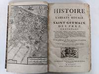
51-5721Paris:Grégoire Du Puis1724. . Folio. 24.5 cx 38 cm. Qtr. contemporary roan and marbled boards. 20 326 clxxxviii 30 pp. From page 323 onwards with clipped bottom corner. Numerous hors texte and folding plates. OCLC Number / Unique Identifier 1177089803. . Préface Sommaire des livres Catalogue des Abbez de Saint Germain-328-clxxxviij Recueil des pièces justificatives pour l’histoire de l’Abbaye Royale de Saint Germain des prez.bandeaux. 24 planches : Un plan du faubourg Saint Germain en frontispice Un plan général Planche double de l’Abbaye de Saint Germain des Prez comme est présentement 1723 Vuë septentrionale de l’Abbaye de St.Germain des Prez telle qu’elle est presentement Chaufourier Tombeau de la Reine Frédegonde Chaufourier Vue orientale de l’Abbaye de St.Germain des Prez telle qu’elle étoit en 1368 Chaufourier Chasse de S.Germain Evêque de Paris Chaufourier Retable du grand autel de St.Germain des Prez Chafourier Vuë méridionale de l’Abbaye de St.Germain des Prez en 1440 et du Louvre Tel quil étoit depuis Philippe Auguste jusques à François I Chaufourier Planche double Vuë ocidentale de l’Abbaye de S.Germain des Prez telle qu’elle étoit avant 1640 Chaufourier Planche double Tombeau de Guillaume Douglas prince d’Ecosse Chaufourier Tombeau de Jean Casimir Roi de Pologne Chaufourier Chapelle de Sainte Marguerite Tombeau de MM.de Castellan Chaufourier Tombeau de Saint Germain rétabli en 1690 ChaufourierTombeau du cardinal de Fustemberg et du comte Ferdinand son nepveu Chaufourier Plan ancien et moderne de l’église de St.Germain des Prez Chaufourier Grand portail de l’église de S.Germain des Prez Chaufourier Grand autel de St.Germain des Prez Chaufourier Reliques Chaufourier Reliques Chaufourier Reliques Chaufourier Reliques Chaufourier Tombeau de Jacques Douglas prince d’Ecosse Chaufourier Habits des religieux de S.Germain des Prez Dessignez sur leurs tombes Chaufourier. Paris:Grégoire Du Puis,1724. hardcover
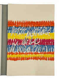
11371Paris: Maeght Editeur 1991. No. 111 of 120 copies signed by Jean Tardieu and Jean Cortot on the colophon. With a presentation inscription by the author “A Catherine Jajolet a une amie de longue date en la felicitant de son talent exceptionnel et en la remerciant pour ses merveilleuses photographies en affectueux hommage Paris 21 janier 92â€. 18 colour lithographs and silk-screen prints including one which is printed across both wrappers. 33 x 50.5 cms. Large folio loose as issued in the original wrappers housed in a silver cloth chemise with lettering in black on the cover and spine with a matching silver cloth slipcase.Four poems by Jean Tardieu 1903-95 are printed elegantly by l’Imprimerie Arte and dramatically illustrated with lithographs combined with silk screen printing by the artist Jean Cortot 1925-2018 who was an important French graphic artist painter and illustrator. Strikingly illustrated by Cortot Maeght Editeur hardcover
51-6926Paris: Dentu An X 1802. 3 text volumes in original pink wrappers. 14 x 21cm. Atlas: folio. 27.5 x 36cm. Half goatskin and marbled boards by the artisan binder Sasha Mosalov. Original pink boards saved separately. . A few plates with marginal waterstains.OCLC Numbers465192568 and 1501424368.3 vol. ; in-8 XVIII-303 332 315-1 p. Atlas with 14 pages 43 leaves of plates 4 folded : 37 illustrations.The atlas includes plates of Corfu Zante Ithaca and Athens in addition to 5 views of the plain of Troy which have been re-engraved from the aquatints in Morritt's Vindication. Le Chevalier's survey of the Troad marks the beginning of modern archaeological exploration in that area despite the fact that his theory as to the location of Troy proved to be incorrect. Le Chevalier worked with Choiseul Gouffier and Louis Francois Cassas. Paris: Dentu, An X (1802) hardcover
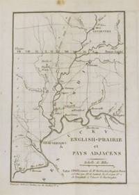
51-6057Paris: L'Huillier & Delaunay 1819. In-8 12 x 20cm. Tan boards leather label red title page speckled edges modern binding.4 xvi 156pp. Complete with the folding mapFirst French edition of Letters from Illinois published in Philadelphia in 1818 and illustrated with a folding engraved map.Born into a family of Quakers the author emigrated with his family to the United States in 1817 founding an agricultural colony in the state of Illinois. This collection of letters includes his correspondence during his first year with friends and future settlers. It contains a wealth of practical information about his life and the conditions of his settlement.A good copy. Some spotting at the beginning of the volume.OCLC Number / Unique Identifier:457072930. Paris: L'Huillier & Delaunay, 1819. hardcover
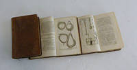
51-6669Paris: Desaint; & Boubers Bruxelles. 1782. 8vo. 3 vols. 12 x 20 cm. Contemporary calf. Leather peeled from corner and edge of one volume but solid. 176 plates.Duhamel was a passionate advocate of fruit "Je n'ai garde cependant de conseiller tout le monde indistinctement de manger de toutes sortes de fruits" he dismisses contemporary opinion that fruit could adversely affect health and presents the work as a practical manual intended to aid the spread of both the cultivation and consumption of fruit. His earlier interest in pears is demonstrated by the subjects of the plates: 58 of pears; 32 of peaches; 20 of plums; 16 of cherries; 14 of apples. Other fruits include almonds apricots and strawberries. References: OCLC Number / Unique Identifier:6743922; Dunthorne 109; Great Flower Books p.55; Nissen BBI 550; ; Stafleu and Cowan 1546.3 vol. in-8 veau raciné doslisses ornés p. de titre et de tom. brun et vert reliure del'époque. Fortes épidermures et manques de cuir.176 planches 29 84 63 gravées concernant les arbresfruitiers fruits feuilles graines et bourgeons dessinées parMagd. Basseporte et Le Berriays et gravées par Benoist Maison-Neuve Mesnil Tardieu etc. Les bibliographes indiquent 180 voire181 planches en tout mais en réalité le nombre de planches varieselon les exemplaires et n'est pas fixe.Duhamel du Monceau est l'un des plus grands botanistes du XVIIIesiècle. Originaire de la petite noblesse la richesse de sa famille luipermit de poursuivre ses recherches en agronomie botaniquechimie et technologie navale bien que l'on retienne avant tout delui ses travaux sur les arbres fruitiers. Nissen IV 550. Paris: Desaint; & Boubers, Bruxelles. 1782. hardcover
1798005808Paris: Dezauche et Tardieu 1798. First edition. NA. Very Good. Spectacular topographical map printed in the sixth year of the Revolutionary French Republic -- the Directoire. The oversized copper engraved map assembled from six separate folding parts all linen backed. The map features a very beautiful and large allegorical title cartouche in one corner and a highly decorative key Explication des Signes contained in a large pastoral illustration and set in a pyramid monument. The individual pieces are 49 by 75 cm and the map in its entirety measures about 147 by 148 cm we are not counting overlapped margins. Slipcase which we believe is the original measures 19 by 13 by 5.5 cm. Fairly scarce with just five institutional holdings showing on OCLC First Search and all these national libraries: the British Library the BNF the Bayerishces Staatsbibliothek the Sachsiches Landesbibliothek the Biblioteca Nacional de Espana. Labels with handwritten details on the linen side of the maps exposed when the maps are folded and on the box. Lightest of scattered soiling on the map. The slipcase likewise. Dezauche et Tardieu unknown
51-3482Paris: Maradan 1793. . Folio. Unbound. 26.5 x 35cm. Plate vol. VI only. Frontispiece and title page to Vol. VI with 121 of 123 plates many double page to accompany the text vols. I-V. The atlas contains the maps by P. F. Tardieu and the views by N. Thomas.This is a larger paper copy than the normal 4to format.Chadenat 4792. Nissen ZBI 3076OCLC Number: 1051486954 plates and 490197769 text and platesIn folio : 2f. titre et 121/123 planches tome 1 : 28/29 planches manque la planche 1 ; tome 2 : 15/16 planches manque la planche 1 ; tome 3 : 22 planches ; tome 4 : 35 planches dont de nombreuses en double ; tome V : 21 planches dont quelques unes en doubles gravées par Tardieu d'après Thomas botanique fourneaux moulins monuments idoles costumes animaux et histoire naturelle. Grandes marges.En feuilles grandes marges en attente de reliure.Édition originale française. La première édition de ce voyage effectué par Pallas de 1768 à 1774 et paru à Saint-Petersbourg de 1771 à 1776 en 3 vol. in-4. Envoyé en mission par l'académie de Saint-Petersbourg pour observer le passage de Vénus devant le soleil Pallas 1741-1811 restera finalement six ans à explorer les contrées russes de la mer caspienne jusqu'à la frontière chinoise. Une des plus grandes expéditions commanditées par Catherine II. Paris: Maradan, 1793. unknown
190451117Bruxelles Belgium: Imprimerie Scientifique. As New. 1904. Paperback. FREE UPGRADE to Courier/Priority Shipping Upon Request IN STOCK AND IMMEDIATELY AVAILABLE FOR SHIPMENT - Text block pristine - text in French. The catalogue is divided into 3 parts. Part 1 consists of essays by various experts and men of letters on 18th Century French tapestries art & music women in the pictures of Watteau and Fragonard the 18th Centry French woman and dramatic art and literature in 18th Century France. Part 2 catalogues the 108 paintings works on paper & engravings the 23 sculptures and 23 tapestries included in the exposition with a number of these items illustrated in black and white. Part 3 catalogues the books at glass musical instruments furnishings and other items in the expositions and also includes a number of illustrations. Among the artists represented: Greuze DuPlessis Boucher Tournieres A. Watteau and others. -- with a bonus offer-- . Imprimerie Scientifique paperback
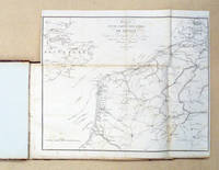
877931820 22 24. 27 x 40 cm HLdr. d. Zt. m. marmoriertem Papier Rücken angebrochen Frontdeckel fast loseStempel a. Vors. Karten etwas stockfleckig einige mit kleinen Randeinrissen. Folgende Karten sind eingebunden:- Campagnes de 1803-1804: Carte d’une partie des côtes de France; Plan du Camp de Dunkerque; Plan d’Ostende et de ses environs ou sont placés le quartier général de L’Empereur; Plan du Camp d’Ampleteuse; Carte du Camp d’Utrecht commandé par le Général en chief Marmont; carte pour l’intelligence de l’invasion de l’électorat d’Hanovre; Plan de la ville du port et des camps de Boulogne;- Campagnes de 1805: Plan de la ville et des la Citadelle d’Anvers; Carte des bouches de L’Escaut; Carte des Antilles; Plan de la ville et de la citadelle d’Alexandrie; Plan général du port de Boulogne; Plans d’arrimage des bâtimens de transport de la flotille d’ecuries. Vue et plan du cirque formé par les troupes des camps de Boulogne; Carte d’une partie de l’Allemagne pour l’intelligence des premières opérations de lal campagne de 1805; Plan des environs d‘Elchingen et d’Albeck; Paln des environs d’Ulm; Théatre de la campagne d’Italie; Plan du cahamp de bataille de Caldiero; Plan du Brulot anglais. Elévation intérieure de la machine qui devait faoire partjit le brulot; Carte pour l‘intelligence de bataille de Castel-Franco; Plan du combat naval de Trafalgar; Plan des Retranchemens de Scharnitz; Carte pour l’intelligence de l’affaire de Maria-Zell; Carte pour l’intelligence de l’affaire de Diernstein; Combat de Diernstein; Plan de öla ville et des environs de Vienne; Carte pour l’intelligence de combat d’Hollabrunn; Carte de la Moravie; Plan du champ de bataille d’Austerlitz.- Campagnes de 1806 et 1807. Cartes du Royaume de Naples; Carte du golf de St. Euphömie et du champ de bataille de Maida. Carte des environs de Gaete; Plan du siége de Gaete; Carte des bouches de Cattaro; Schleitz et ses environs; Plan du champ de bataille de Saalfeld; Carte du théatre de la guerre en Saxe en Prusse et en Polgne pendant les campagnes de 1806 et 1807; Plan général des champs de bataille d‘Iena et d’Auerstedt; Champ de bataille d’Iena; Plan du champ de bataille d’Auerstaedt; Halle et ses environs; Plan de Lubeck et de ses environs; Ambroise Tardieu 1788-1841 französischer Kupferstecher. Er arbeitete als Kartograf und Illustrator. Eines seiner Hauptwerke war die «Iconographie universelle ancienne et moderne14:20:22 in der er zwischen 1820 und 1828 die Porträts von etwa 800 berühmten Personen veröffentlichte. Weiterhin seine Interpretation des Aufmarsches der Napoleonischen Armee zur Schlacht bei Austerlitz mit dem Titel: «La colonne de la Grande Armée d'Austerlitz». Ein Band mit 36 Kupferstichen. Er illustrierte auch Bücher wie den Roman Voyage du jeune Anacharsis en Grèce von Jean-Jacques Barthélemy. -- Die Karten zeigen die militärische Entwicklung des dritten und vierten Kollationskrieges die Napoleon gegen seine europäischen Gegenspieler führte. 010 1820, 22, 24 unknown
193991760Algiers: Rivages Edmond Charlot 1939. Fine. Rivages Edmond Charlot Algiers 1939 15.2 x 20.5 cm Broché ENGLISH DESCRIPTION ON DEMAND Deuxième numéro de la revue Rivages revue de culture méditerranéenne qui ne comptera que deux numéros publiés en décembre 1938 et février-mars 1939. Poèmes d'Eugenio Montale en langue originale accompagnés de leur traduction par Filippo Donini poèmes de Jean Tardieu extrait de De toutes mes forces de Claude de Fréminville essai d'Emmanuel Roblès sur les Curanderos d'Andalousie. Quelques infimes déchirures marginales petit manque sans gravité sur le dos. Contributions dAlbert Camus Jules Supervielle Emmanuel Roblès Jean Tardieu Gabriel Audisio Federico Garcia Lorca Antonio Machado Eugenio Montale. Rare exemplaire du deuxième numéro de cette éphémère revue créée par Camus avec Gabriel Audisio et Jacques Heurgon qui sera interrompue par la censure. Le jeune écrivain y publie pour la première fois""L'été à Alger"" qui fera partie de Noces. Lorsque Camus lance Rivages sous légide de son éditeur et ancien camarade Edmond Charlot le jeune écrivain avait déjà terminé ses études supérieures fondé le Théâtre du Travail puis celui de lÉquipe milité pour le projet Blum-Viollette afin détendre le droit de vote en Algérie contribué à lAlger Républicain et même dirigé la Maison de la culture dAlger. Avec cette nouvelle revue il appelle au développement dune littérature de la méditerranée dans la splendeur de son unité mais surtout de ses contrastes : « Cest ce scintillement plein de vie que lon retrouve dans des uvres telles que LEnvers et lEndroit ou Noces et même dans certains passages de LÉtranger. » Hélène Rufat À travers et par la Méditerranée : regards sur Albert Camus. Rivages est imprimée assez artisanalement sur les presses de son ami Claude de Fréminville également contributeur de la revue qui venait de créer une imprimerie rue Barbès à Alger. Camus fonde avec lui les éditions CA-FRE Camus-Fréminville et publiera Jean Hytier Léo-Louis Barbès Christian de Gastyne et Blanche Balain. Ce second numéro de Rivages contient en édition pré-originale le célèbre essai camusien ""Lété à Alger"" dédié à Jacques Heurgon qui paraîtra en volume dans Noces également publié chez Charlot. Le troisième et dernier numéro de Rivages consacré à Garcia Lorca ne paraîtra jamais. Les morasses seront saisies et détruites par les autorités qui exerçaient un contrôle des imprimés dès avant la déclaration de guerre. Après la définitive interruption de Rivages Camus étendra son engagement méditerranéen à lEurope tout entière victime des totalitarismes en prenant la tête du journal Combat. Rare exemplaire de ce numéro de revue contenant une des toutes premières productions littéraires de Camus. Rivages [Edmond Charlot] unknown
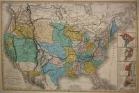
1848M7518Paris: A. Bes & F. Dubreuil Fils c. 1848. Very Good. Folding map flattened and backed acid-free tissue paper for long-term preservation. Two marginal tears repaired expertly. Notes: A scarce large-scale map of the Mexican-American War era and of the entire West. <br><br>To the very north the boundaries of the United States extend well into future British Columbia and within the current states of Washington and Oregon is carved the District of Columbia which was owned by the British. California Arizona and Nevada are together and California's central valley is highlighted for its gold deposits.<br><br>The map is based upon the Eustache Herisson map of the United States 1799 and its major cities. As various publications were made 1826 1834 the map started to take shape. Various projections of the Rocky Mountains were used based off of the Humboldt and Pike projections. Much of the Northwest is based off of the Lewis and Clark expedition. <br><br>This particular map is a scarce and important example as it focuses on the changes brought about by the Mexican-American War. The major differences in this regard are a small inset map of Central America and the delineation of the Mexican-American border; as this map shows all the territory that the United States had captured since the onset of the war. <br><br>Five inset maps depict Mexico and the cities of Washington Boston Philadelphia and New York. Size : 509x662 mm 20.04x26.06 Inches Coloring: Original Hand Coloring Category: Maps United States; A. Bes & F. Dubreuil Fils unknown
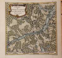
1762M9032Paris 1762. Very Good backed on acid free tissue paper for long term preservation left margin is extended. Notes: Fine and scarce French 18th century map of St. Lawrence River and Quebec. The course of the river to the East is from Montreal and passing through the Quebec City and it extends to Tadoussac. Size : 220x215 mm 8.66x8.46 Inches Coloring: Hand Colored Reference: Kershaw vol.II #659. Category: Maps Canada East Quebec; Maps Canada East Quebec St. Lawrence River; unknown
185719015Paris: J.-B. Baillière et fils 1857. SECOND AND FIRST EDITIONS. Later sheep-backed boards spine gilt. Somewhat foxed but otherwise very good. Typographic tables in the text. Two foundational texts in the forensic history of sex crimes. The first offered here in its second edition explores the medical and legal natures of flashing rape sexual assault pederasty and sodomy. The study defines the terms of sex crime vocabulary to establish consistency in related cases with lengthy entries for deflowering debauchery and penetration and it sets the range for what should be considered underage. Tardieu attempts to prove a typology of the sex criminal: hyper masculine mentally unstable and violent often with a misshapen penis. In the final part of the text he notes the transmission of STIs as a result of rape as a legal addendum and gives 21 case studies of criminal sex acts. The second title here in its first edition is the first French legal study on abortion. Abortion was an unmitigated crime in France at the time but as Tardieu explains the high rate of stillbirths made it difficult to determine which were purposefully inflicted. Here he describes eight different methods of abortion and supplies several case studies of each including chemical descriptions of abortive medications. He stresses the culpability of “wise women†who provide the necessary supplies and instructions for abortions and implores that they be strictly watched by law enforcement. This text was the medico-legal authority in France for the next 60 years. <br /> <br /> Both titles are rare: OCLC records 4 institutional copies of Étude médico-légale sur les attentats aux moeurs in the U.S. Penn NY Academy of Medicine Chicago and Michigan and only one copy of Étude médico-légale sur l’avortement Penn.<br /> <br /> Donaldson Homosexuality and medicine 176; Hirsch V: 516; Le Naour and Valenti Histoire de l’avortement passim. J.-B. Baillière et fils unknown
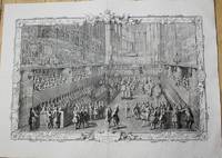
1722P5187Paris 1722-31. Very Good. Notes: A pair of superb early 18th century French copper engraving showing the day of the coronation of Louis XV from Lever du Roi to the Royal Feast. The plates and frames are designed and engraved by Pierre Dulin Perrot Cochin Larmessin Duchange Tardieu Beauvais Desplaces Dupuis Edelinck Chereau Audrand Petit Haussard Jaurat Devret Simonneau Berey Bailleul and Putheau. The Coronation of Louis XV King of France and Navarre in the Church of Reims Sunday October XXV MDCCXXII. Image Size : Platemark Size : 543x794 mm 21.38x31.26 Inches Paper Size : 628x870 mm 24.72x34.25 Inches Coloring: Black & White Medium: Copper Engraving Categories: Portraits Royalty; Views Europe France Others; unknown